

2.1 McCrae
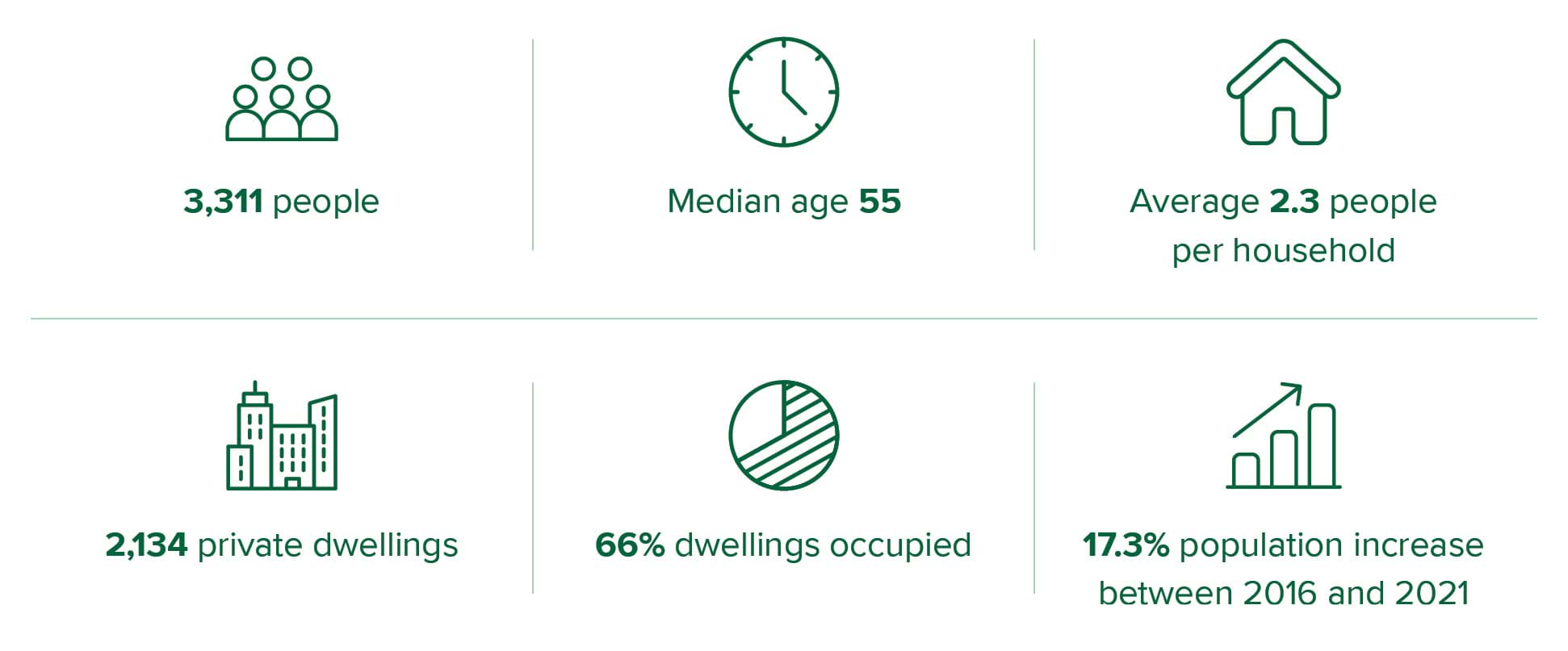
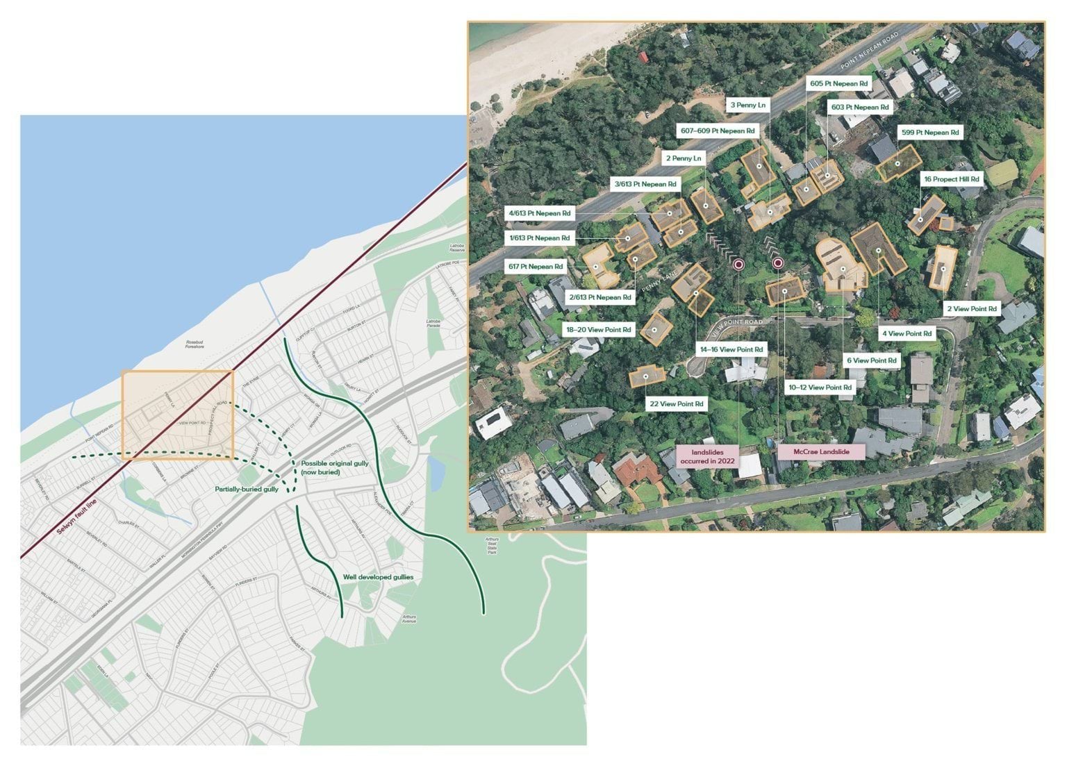
- The small seaside town of McCrae sits along the Mornington Peninsula in Victoria. It is known for its steep escarpment rising high above Point Nepean Road, which winds along the picturesque coastline of Port Phillip Bay (McCrae escarpment). Many homes sit on the plateau across the top of the escarpment and some homes sit at the foot, on Point Nepean Road.
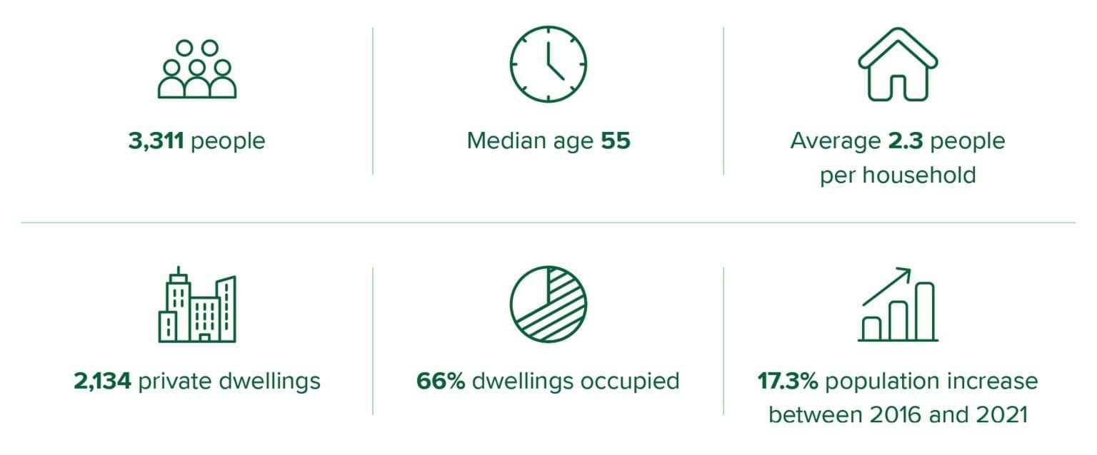
- Most of McCrae is zoned as a General Residential Zone, encouraging moderate housing growth. The pace of development has grown significantly in the last two decades with private dwellings increasing by 11% from 2011 to 2016,1 and a further 5% from 2016 to 2021.2
- Between August 2024 and July 2025, the median house price in McCrae was $1.23 million, with the median rent being $690 per week.3 Similar to other parts of the Mornington Peninsula, McCrae experiences seasonal tourism booms with only 66% of private dwellings being permanently occupied as compared with 89% in the rest of Victoria.4
- Critical infrastructure has been built over the last 20 years, which has significantly shaped the landscape. The dual carriage freeway known as the Peninsula Link (M11) opened in January 2013.5 The freeway crosses several waterways, with waterflow managed via drainage systems and bridges.
- Greater density and infrastructure development has impacted levels of vegetation coverage, types of soil fill and natural watercourses. These are all known preparatory factors for landslides.6
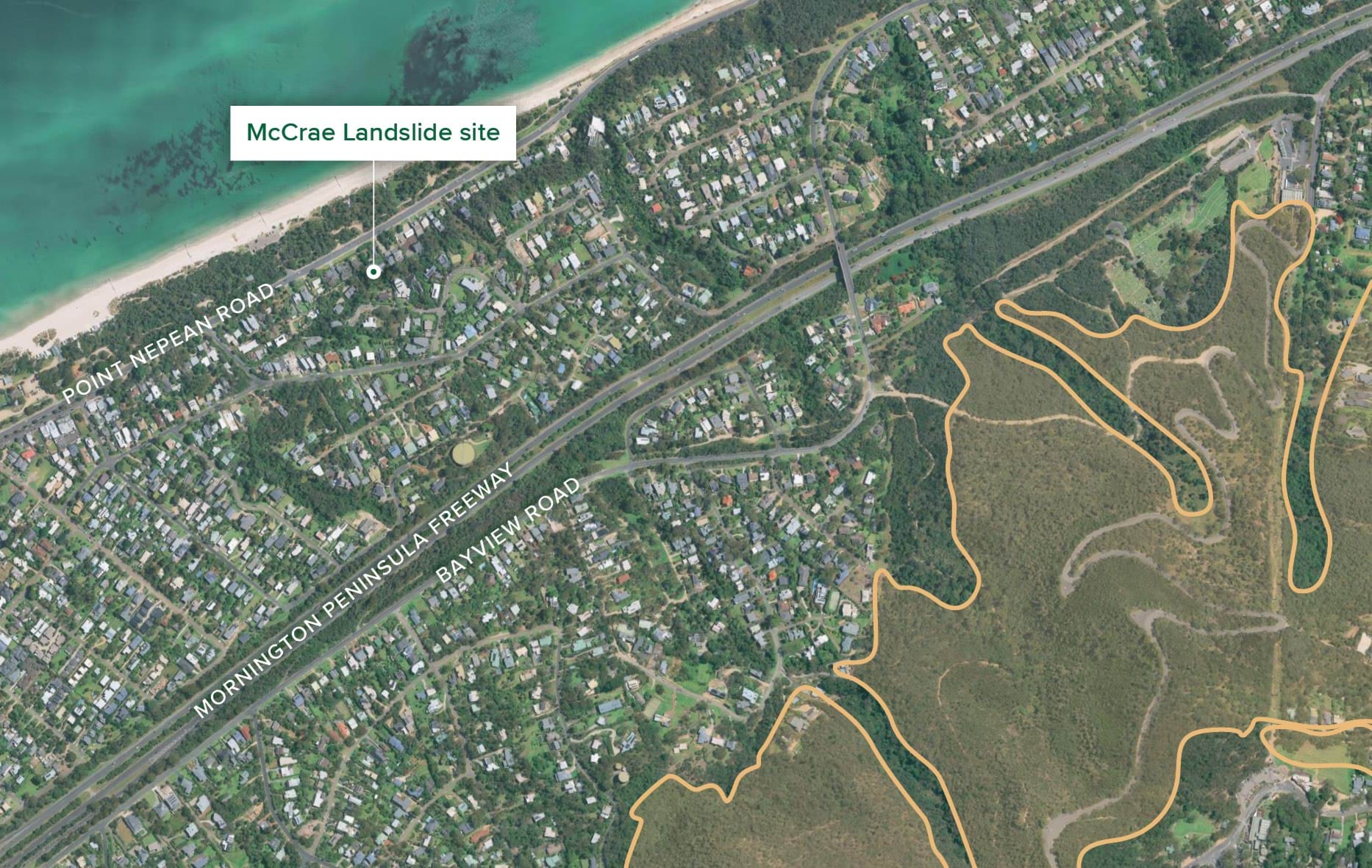
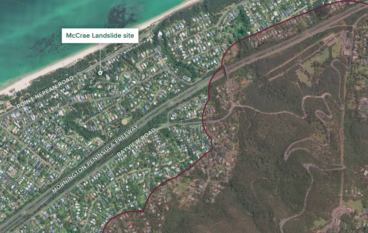
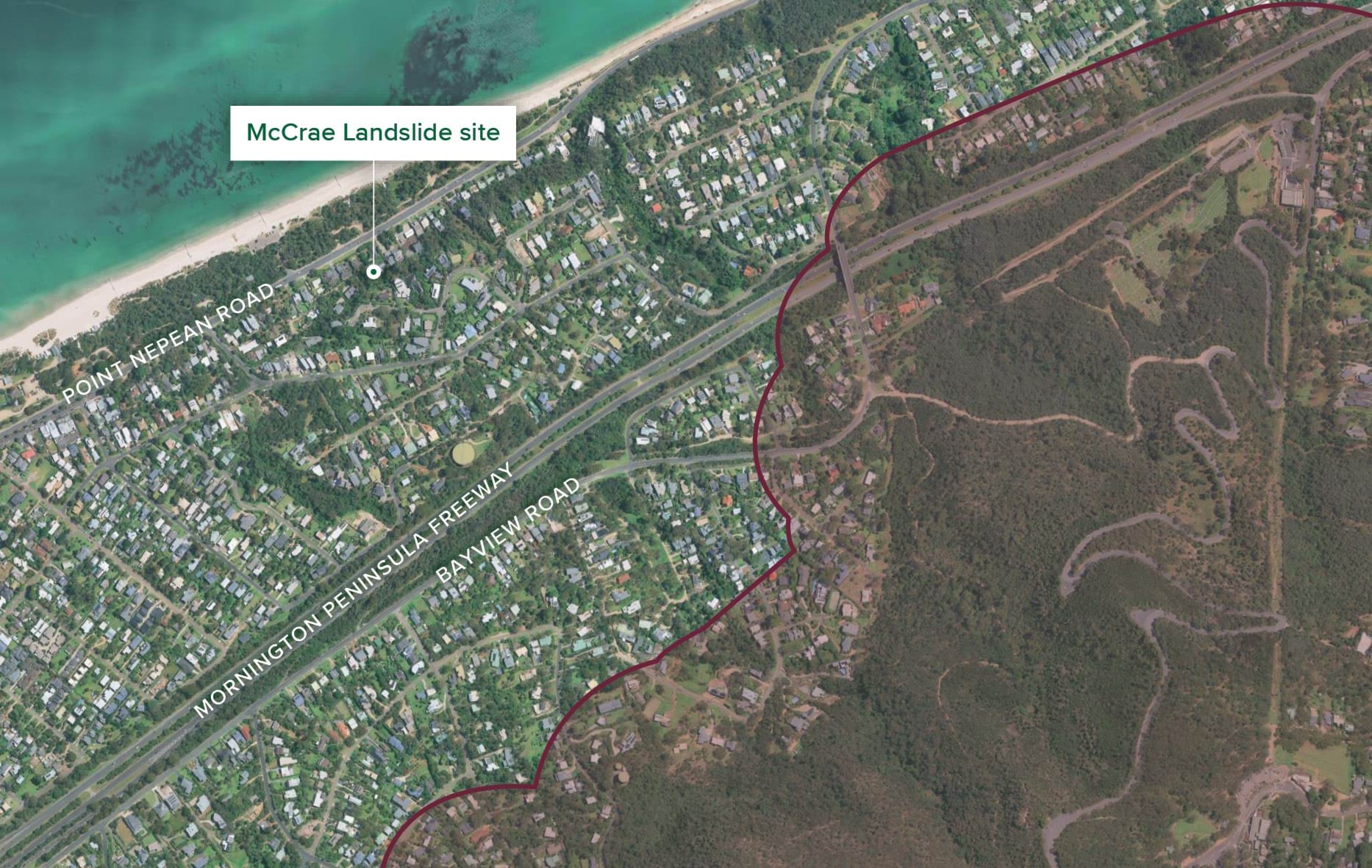
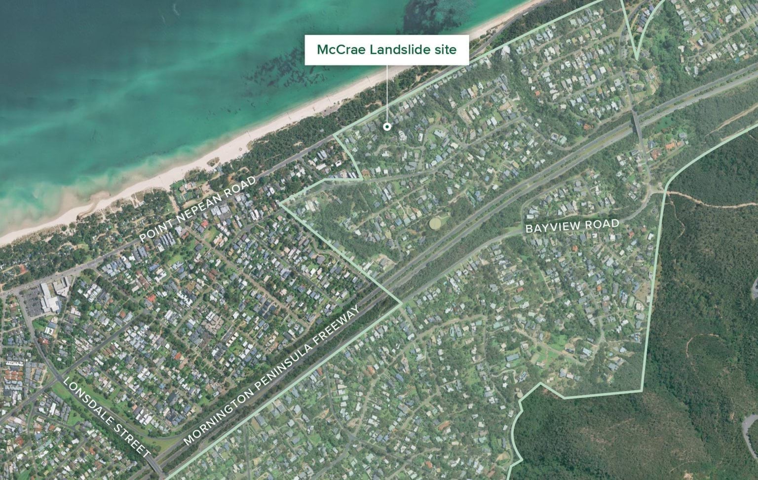
- The map at Figure 2.1 provides an overview of McCrae. The inset map identifies the properties where the landslides in 2022 and 2025 occurred as well as surrounding properties. It is intended to be a visual aid for subsequent chapters of this Report which discuss those properties.
Demographic overview of McCrae
FIGURE 2.1: AN OVERVIEW OF MCCRAE INCLUDING THE SELWYN FAULT LINE AND WATER COURSES. INSET MAP SHOWS THE LANDSLIDE-AFFECTED AREA AT VIEW POINT ROAD AND PENNY LANE.7
FIGURE 2.1
2.2 Geology, topography and climate
- McCrae’s coastal escarpment rises 32 metres above the low coastal plains and sand dunes along Point Nepean Road.8 The slope has developed over many years as a result of tectonic activity along the Selwyn Fault,9 which runs through the Mornington Peninsula and continues north of Frankston.10 The fault remains active with the most notable recent activity being a 2.4 magnitude earthquake on 6 June 2023.11
- Over the last 100 years, ground conditions in the area have also been modified by natural marine and fluvial erosion, and human activity.12 At the base of the escarpment, where dwellings are located, the area is composed of quaternary raised coastal deposits, comprising siliceous and calcareous sand, shell beds, and guano (mud islands).13 The area is also home to many waterways and gullies cascading down the escarpment, some of which have been buried over time with urban development, as shown at Figure 2.1.
- The Mornington Peninsula area experiences lower average temperatures and above average rainfall compared to the broader Southern Metropolitan Region. The area has significant seasonal variability ranging from 127.9 millimetres mean rainfall in spring, to 914.3 millimetres in autumn.14 The annual mean rain days ( > 5 millimetres) is 52.2, slightly above the regional average.15
- The Bureau of Meteorology expects that in the future, climate change will lead to fewer days with rain, but higher intensity rain events.16 Short-duration extreme rainfall events, often associated with flash flooding and landslides, pose heightened risks to communities. Hourly extreme rainfall is expected to increase by approximately 15% per degree of warming.17 While such projected climate change is not unique to McCrae, it raises complex challenges for future planning and preparedness in a landslide-prone area such as McCrae.
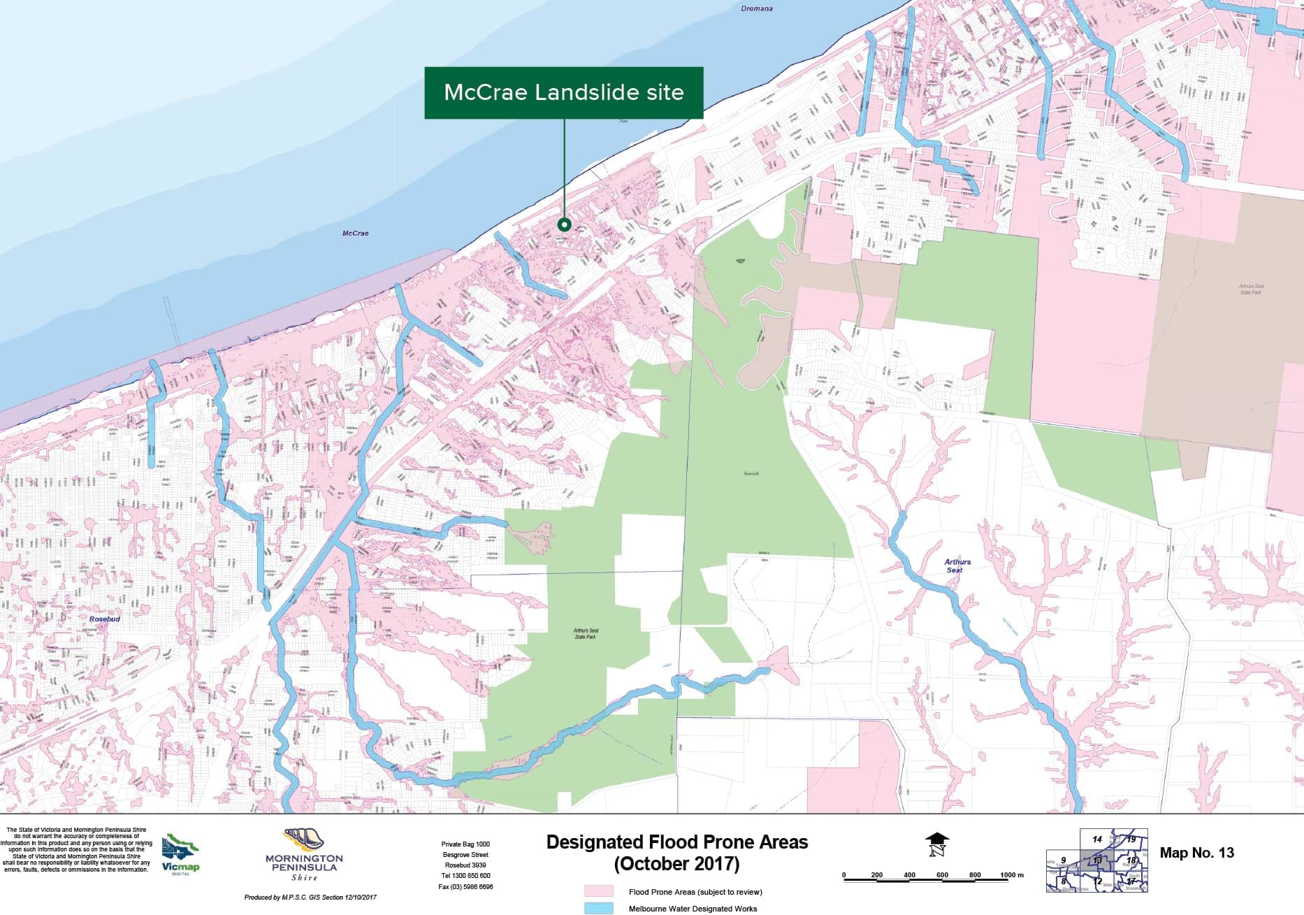
2.3 Land use planning and hazard risk
- The geography of McCrae and the Mornington Peninsula brings exposure to a range of natural and man-made hazards, varying from floods and bushfires to disruption to essential services. Development has, and continues to be, subject to a range of planning controls to minimise risk exposure as well as avoiding the creation of new risks through development. Many of these planning controls are also used as data points to inform broader decisions around service provision and emergency preparedness.
- In addition to planning zones, there are a range of zoning overlays across the area, developed to address hazard risks to residents and the built environment. These overlays will be referred to throughout this Report. Whilst not exhaustive, the following overlays are the most relevant for the purposes of the Board of Inquiry: erosion management, bushfire management, and vegetation protection. Flood risk is managed through the designation of land liable to flooding.18
FIGURE 2.2: PLANNING OVERLAYS,19 AND DESIGNATED RISK AREAS IN MCCRAE.20
Erosion Management Overlay

Bushfire Management Overlay
Vegetation Protection Overlay
Designated Flood Prone Areas

Chapter 2 Endnotes
- 1 Australian Bureau of Statistics, McCrae 2021 Census All persons QuickStats (Web Page, 2021) <https://abs.gov.au/census/find-census-data/quickstats/2011/SSC20857>; Australian Bureau of Statistics, McCrae 2016 Census All persons Quickstats (Web Page, 2016) <https://abs.gov.au/census/find-census-data/quickstats/2016/SSC21614>.
- 2 Australian Bureau of Statistics, McCrae 2011 Census All persons QuickStats (Web Page, 2011) <https://abs.gov.au/census/find-census-data/quickstats/2011/SSC20857McCrae>; Australian Bureau of Statistics, McCrae 2016 Census All persons Quickstats (Web Page, 2016) <https://abs.gov.au/census/find-census-data/quickstats/2016/SSC21614>; Australian Bureau of Statistics, McCrae 2021 Census All persons QuickStats (Web Page, 2021) <https://abs.gov.au/census/find-census-data/quickstats/2021/SAL21625>.
- 3 PropTrack by REA Group, McCrae House Price Guide (Web Page, 2024-2025) <https://www.realestate.com.au/vic/mccrae-3938/>.
- 4 Australian Bureau of Statistics, McCrae 2021 Census All persons QuickStats (Web Page, 2021) <https://abs.gov.au/census/find-census-data/quickstats/2021/SAL21625>.
- 5 Mike Hast, ‘Peninsula Link finally up and running’, Mornington Peninsula News (online, 22 January 2013) <https://www.mpnews.com.au/2013/01/22/peninsula-link-finally-up-and-running/>.
- 6 Public Hearing Transcript, Darren Paul, 7 May 2025, 42–44.
- 7 Exhibit CA-67, McCrae Landslide Causation Report prepared by WSP, 21 July 2025, [DPA.0004.0001.0001 at _0032, _0037].
- 8 Exhibit CA-72, Landslide Risk Assessment for Evacuation Area prepared by PSM, 22 May 2025, [MSC.5047.0001.0001 at .0008].
- 9 Public Hearing Transcript, Darren Paul, 7 May 2025, 39.
- 10 Exhibit CA-13, Second Witness Statement of David Simon, 17 April 2025, Exhibit CA-13(110) [MSC.5012.0001.4440 at .4459].
- 11 Paul Somerville, ‘Perspective on the Melbourne Earthquakes of Late May and Early June 2023’, Risk Frontiers: Insights (Briefing Note, 7 June 2023) <https://riskfrontiers.com/insights/perspective-melbourne-earthquakes-la…;.
- 12 Exhibit CA-77, Revised McCrae Landslide Risk Assessment for Evacuation Area prepared by PSM, 28 May 2025, [MSC.5056.0001.0003 at .0010].
- 13 Exhibit CA-1(1), Opening Presentation of Senior Counsel Assisting, 7 May 2025, [INQ.0005.0001.0001 at _0004].
- 14 These averages draw on 30-year averages from 1961 to 1990. See Department of Justice and Community Safety: Victorian Government, Environmental Scan Report – Southern Metro Region (Report, 14 September 2020) 11.
- 15 Department of Justice and Community Safety: Victorian Government, Environmental Scan Report – Southern Metro Region (Report, 14 September 2020) 16.
- 16 Bureau of Meteorology, State of the Climate 2024: Australia’s changing climate (Web Page, 2024) <http://www.bom.gov.au/state-of-the-climate/australias-changing-climate.shtml>.
- 17 Bureau of Meteorology, State of the Climate 2024: Australia’s changing climate (Web Page, 2024) <http://www.bom.gov.au/state-of-the-climate/australias-changing-climate.shtml>.
- 18 Building Regulations 2018 (Vic) reg 153.
- 19 Department of Transport and Planning: Victorian Government, VicPlan (Web Page, 2025) <https://mapshare.vic.gov.au/vicplan/>.
- 20 Mornington Peninsula Shire Council, Designated Flood Prone Areas (October 2017) (Web Page, 12 October 2017) <https://www.mornpen.vic.gov.au/files/assets/public/v/3/new-website-documents/building-amp-planning/building/docs/a2-building-flood-prone_13.pdf>.
Updated