

Chapter 1
The Process of the Board of Inquiry
1.1 Work of the Board of Inquiry
We need to get to the bottom of what has happened here because too many people have been let down and too many questions remain unanswered.
The Hon Jacinta Allan MP, Premier.1
An independent inquiry will ensure local residents’ voices are heard and help us do everything we can to ensure it doesn’t happen again.
The Hon Nick Staikos MP, Minister for Local Government.2
- On 4 February 2025, the Premier of Victoria, the Hon Jacinta Allan MP and the Minister for Local Government, the Hon Nick Staikos MP, announced that a Board of Inquiry would be established to investigate the McCrae Landslide.
- On 18 March 2025, I was appointed Chairperson of the Board of Inquiry by the Governor in Council, on the recommendation of the Premier, pursuant to s 53(1) of the Inquiries Act 2014 (Vic) (Inquiries Act).
- On 3 April 2025, I issued a Practice Direction informing interested parties of the process for making applications for leave to appear at public hearings.3 I issued a further five Practice Directions addressing other procedural matters.4 The Practice Directions were made available on the Board of Inquiry’s website.
- On 9 April 2025, I visited McCrae to see the site of the 2022 and 2025 landslides and to meet the community. A community session was held that day at the Dromana Community Hall. The session was well attended. Later in the day, I attended an information session with the McCrae Evacuees Response Group (MERG) at the McCrae Yacht Club. I returned to McCrae on 4 July 2025, to again meet with MERG to provide a broad update about the process of the Board of Inquiry and to answer questions.
- The first public hearing was held on 7 May 2025. At the beginning of the hearing, I emphasised the need for findings to be made as quickly as possible given the number of landslides that had occurred in the area and the ongoing impact on residents. I said that while speed was important, the work of the Board of Inquiry also needed to be undertaken with care.
- Senior Counsel Assisting the Board of Inquiry outlined the work that had been undertaken up to the first hearing and provided an overview of the events being examined. He also identified a number of lines of inquiry in relation to the cause of the McCrae Landslide.
- The Shire and SEW and the State of Victoria were represented by Counsel at the hearing (and at subsequent hearings) after having been granted leave to appear.
- Further information about the public hearings held between 7 May 2025 and 18 August 2025 is contained in Appendix D.
- Those assisting the Board of Inquiry undertook a broad range of activities, including:
- visiting the site of the 2022 and 2025 landslides;
- liaising with the McCrae community;
- interviewing potential witnesses and preparing witness statements;
- engaging independent experts;
- reviewing thousands of documents;
- preparing correspondence and a public notice informing residents and the wider community of the opportunity to make a written submission; and
- identifying specific organisations and individuals to be invited to make a written submission.
- Information about the public submissions received by the Board of Inquiry is contained in Appendix G.
- The Board of Inquiry issued 102 Notices to Produce under the Inquiries Act requiring the production of documents or information. These notices were issued to a range of bodies, including the Shire, SEW, Melbourne Water, Southern Rural Water, Detection Services Pty Ltd, Downer Utilities Australia Pty Ltd, the Building Appeals Board, and the Victorian Government (including its departments). In response, the Board of Inquiry received in excess of 25,000 documents. The Board of Inquiry received 51 witness statements.
- The Board of Inquiry's processes and procedures were informed by considerations of procedural fairness. The Shire and SEW were given an opportunity to respond in writing to adverse findings being considered. They did so. The Shire and SEW were also given an opportunity to provide reports from experts on the cause of the McCrae Landslide, as well as the landslides that occurred in November 2022 and on 5 January 2025, and the works required to mitigate the risk of further landslides. The Shire provided reports on both issues. SEW chose to provide reports on the issue of causation only. The experts engaged by the Board of Inquiry provided reports on both issues.
- A structured process was put in place for the preparation, exchange, and appraisal of the expert evidence, which involved:
- the experts having access to each other’s testing results during the preparation of their reports;
- the experts providing their reports to the Board of Inquiry by a set date so that they could properly consider each other’s reports before attending a conclave;
- the experts attending private conclaves to discuss and debate the content of their reports;
- the experts preparing joint reports identifying both agreed matters and matters remaining in dispute;
- the experts giving evidence concurrently at the public hearings;
- all parties with leave being permitted to cross-examine the experts;
- all parties with leave providing written submissions; and
- SEW providing further written submissions in reply to the submissions provided by the Shire and the owners of 10–12 View Point Road, McCrae.
- Further detail about this process is contained in Appendix E.
1.2 Acknowledgements
- I wish to acknowledge and thank the many people who provided invaluable support to the work of the Board of Inquiry.
- I acknowledge the work of Counsel Assisting the Board of Inquiry. Particular mention should be made of the significant, broad ranging and invaluable assistance provided by Angela Kittikhoun of Counsel.
- Thank you to the team of solicitors at Wotton Kearney who worked tirelessly throughout the Board of Inquiry. The whole team brought excellence, commitment and energy to their role. Particular mention should be made of Wotton Kearney Partner, Georgie Austin, who ably led the team. I also acknowledge the significant and invaluable work undertaken throughout the Board of Inquiry by Samantha Saad, Rhyse Collins, Zoe Burchill and Matthew Kenna.
- The dedication and excellence of Chief Executive Officer, Andrew Campbell, the Policy and Research team, and the Operational team should be acknowledged. Thank you for your skills, expertise and commitment.
I acknowledge collectively the assistance of the following additional solicitors, staff and service providers:
Wotton Kearney
Richard Leder Zoe Jones Michelle Rich Deniz Coskundag Jessica Bennett Isabelle Ferrali Policy and Research
John Aliferis Georgina Glanfield Kelly Butler Media and Communications
Linda McSweeny Amber Brodecky Aoife O'Connell Operations
Hannah Moore Dianna Bergen Service providers
Epiq WOO Agency
- There are two final acknowledgements of a different type to be made.
- I acknowledge the significant work undertaken by Darren Paul, Technical Director - Engineering Geology, together with Stephen Makin, Hydrogeologist, and Hong Phuc Vu, Geochemist/Geochemical Modeller, of WSP. They were asked by the Board of Inquiry to assist by providing independent expert opinions, and they did so by submitting multiple expert reports, attending private conclaves and attending hearings to give evidence concurrently with experts engaged by the Shire and SEW.
- Finally, I extend my gratitude to MERG and the broader McCrae community. Thank you for your knowledge, time and dedication to providing information throughout the Board of Inquiry. Whether you were involved in meeting with the Solicitors Assisting, attending hearings as a witness or observer, preparing witness statements, drafting submissions, or providing video and photographic evidence — you have been of tremendous assistance to the work of the Board of Inquiry. I hope this Report results in quick and honest action so that those residents still displaced may return to their homes and other residents may feel safe.
Chapter 1 Endnotes
- 1 Hon Jacinta Allan MP, Victoria State Government, ‘Inquiry into McCrae Landslide to give answers to residents’ (Media Release, 4 February 2025).
- 2 Hon Jacinta Allan MP, Victoria State Government, ‘Inquiry into McCrae Landslide to give answers to residents’ (Media Release, 4 February 2025).
- 3 Practice Direction No. 1 General Information.
- 4 Practice Direction No. 2 Leave to Appear; Practice Direction No. 3 Hearings; Practice Direction No. 4 Production of Documents; Annexure A to Practice Direction No. 4: Document Management Protocol; Practice Direction No. 5 Media Guidelines; Practice Direction No. 6 Witnesses Expenses Policy.
Chapter 2
Overview of McCrae
2.1 McCrae
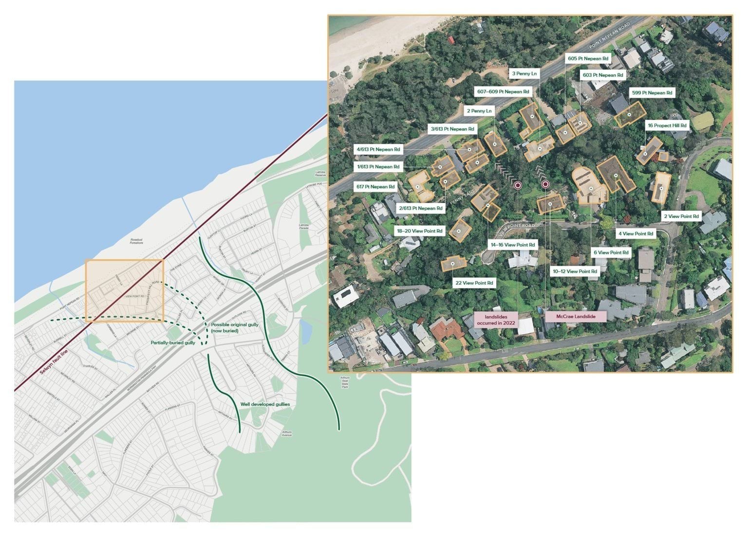
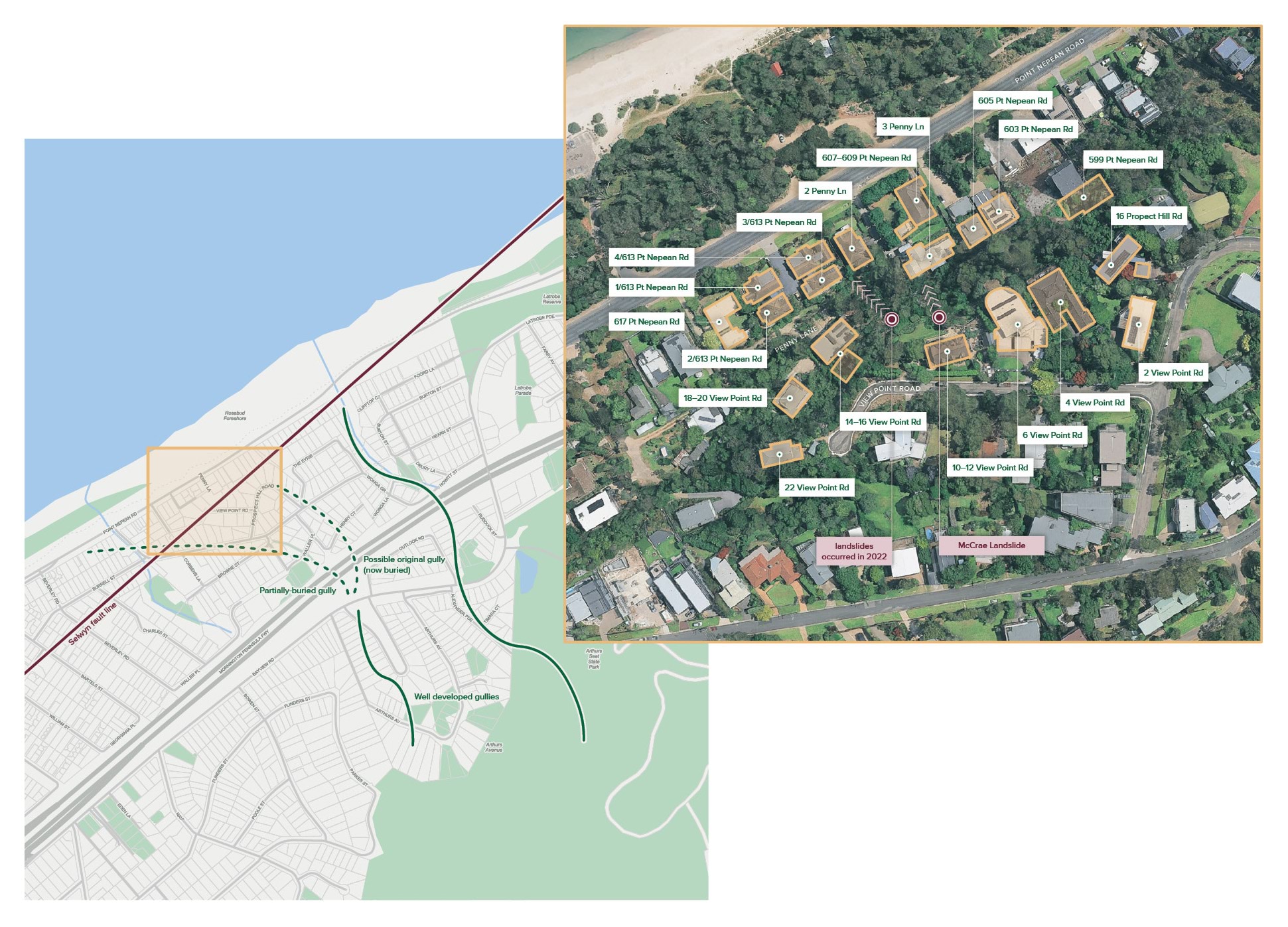
- The small seaside town of McCrae sits along the Mornington Peninsula in Victoria. It is known for its steep escarpment rising high above Point Nepean Road, which winds along the picturesque coastline of Port Phillip Bay (McCrae escarpment). Many homes sit on the plateau across the top of the escarpment and some homes sit at the foot, on Point Nepean Road.
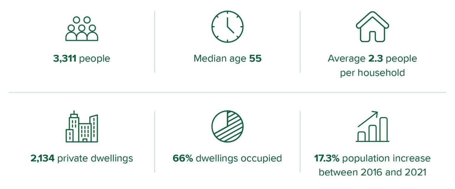
- Most of McCrae is zoned as a General Residential Zone, encouraging moderate housing growth. The pace of development has grown significantly in the last two decades with private dwellings increasing by 11% from 2011 to 2016,1 and a further 5% from 2016 to 2021.2
- Between August 2024 and July 2025, the median house price in McCrae was $1.23 million, with the median rent being $690 per week.3 Similar to other parts of the Mornington Peninsula, McCrae experiences seasonal tourism booms with only 66% of private dwellings being permanently occupied as compared with 89% in the rest of Victoria.4
- Critical infrastructure has been built over the last 20 years, which has significantly shaped the landscape. The dual carriage freeway known as the Peninsula Link (M11) opened in January 2013.5 The freeway crosses several waterways, with waterflow managed via drainage systems and bridges.
- Greater density and infrastructure development has impacted levels of vegetation coverage, types of soil fill and natural watercourses. These are all known preparatory factors for landslides.6
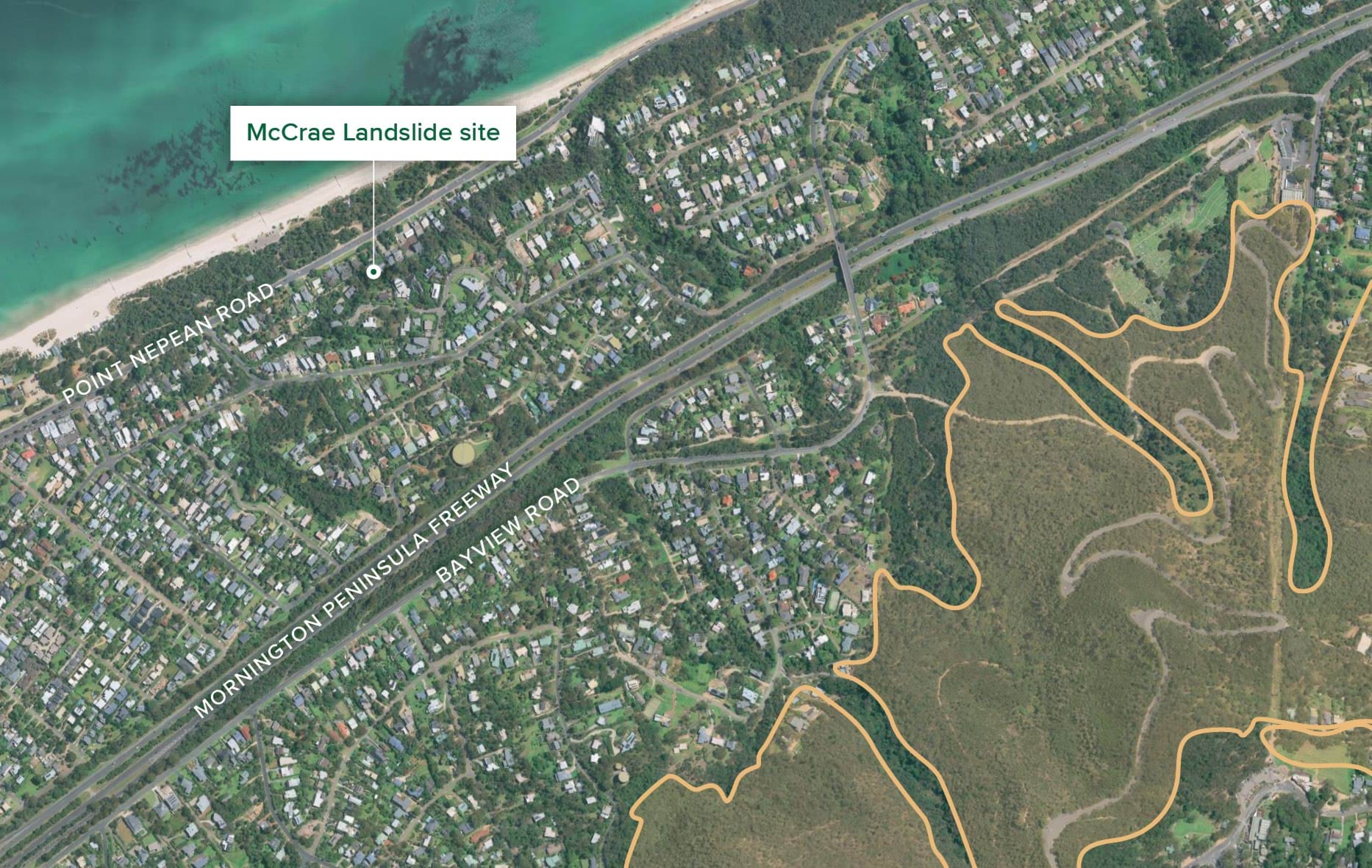
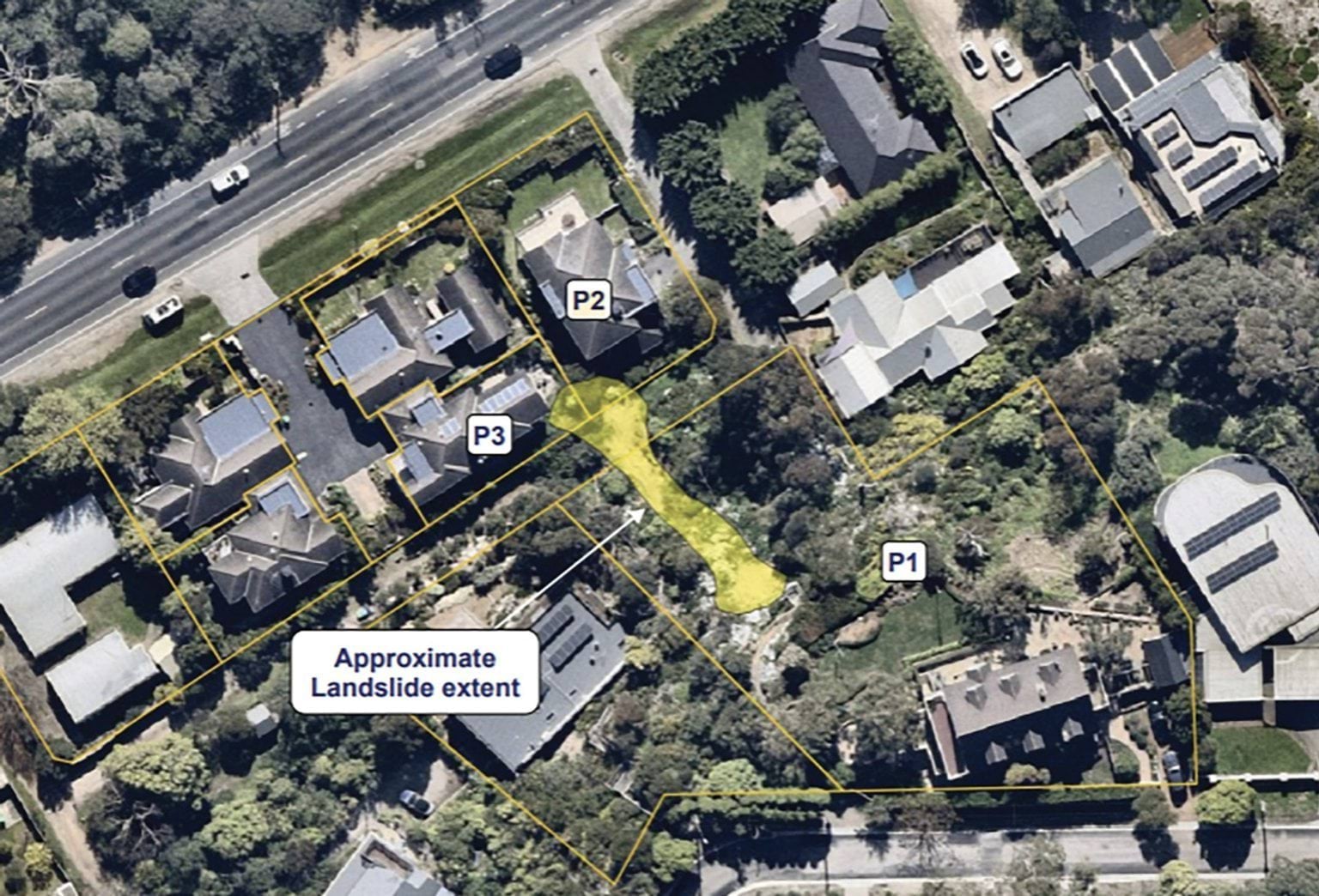
- The map at Figure 2.1 provides an overview of McCrae. The inset map identifies the properties where the landslides in 2022 and 2025 occurred as well as surrounding properties. It is intended to be a visual aid for subsequent chapters of this Report which discuss those properties.
Demographic overview of McCrae
FIGURE 2.1: AN OVERVIEW OF MCCRAE INCLUDING THE SELWYN FAULT LINE AND WATER COURSES. INSET MAP SHOWS THE LANDSLIDE-AFFECTED AREA AT VIEW POINT ROAD AND PENNY LANE.7
FIGURE 2.1
2.2 Geology, topography and climate
- McCrae’s coastal escarpment rises 32 metres above the low coastal plains and sand dunes along Point Nepean Road.8 The slope has developed over many years as a result of tectonic activity along the Selwyn Fault,9 which runs through the Mornington Peninsula and continues north of Frankston.10 The fault remains active with the most notable recent activity being a 2.4 magnitude earthquake on 6 June 2023.11
- Over the last 100 years, ground conditions in the area have also been modified by natural marine and fluvial erosion, and human activity.12 At the base of the escarpment, where dwellings are located, the area is composed of quaternary raised coastal deposits, comprising siliceous and calcareous sand, shell beds, and guano (mud islands).13 The area is also home to many waterways and gullies cascading down the escarpment, some of which have been buried over time with urban development, as shown at Figure 2.1.
- The Mornington Peninsula area experiences lower average temperatures and above average rainfall compared to the broader Southern Metropolitan Region. The area has significant seasonal variability ranging from 127.9 millimetres mean rainfall in spring, to 914.3 millimetres in autumn.14 The annual mean rain days ( > 5 millimetres) is 52.2, slightly above the regional average.15
- The Bureau of Meteorology expects that in the future, climate change will lead to fewer days with rain, but higher intensity rain events.16 Short-duration extreme rainfall events, often associated with flash flooding and landslides, pose heightened risks to communities. Hourly extreme rainfall is expected to increase by approximately 15% per degree of warming.17 While such projected climate change is not unique to McCrae, it raises complex challenges for future planning and preparedness in a landslide-prone area such as McCrae.
2.3 Land use planning and hazard risk
- The geography of McCrae and the Mornington Peninsula brings exposure to a range of natural and man-made hazards, varying from floods and bushfires to disruption to essential services. Development has, and continues to be, subject to a range of planning controls to minimise risk exposure as well as avoiding the creation of new risks through development. Many of these planning controls are also used as data points to inform broader decisions around service provision and emergency preparedness.
- In addition to planning zones, there are a range of zoning overlays across the area, developed to address hazard risks to residents and the built environment. These overlays will be referred to throughout this Report. Whilst not exhaustive, the following overlays are the most relevant for the purposes of the Board of Inquiry: erosion management, bushfire management, and vegetation protection. Flood risk is managed through the designation of land liable to flooding.18
FIGURE 2.2: PLANNING OVERLAYS,19 AND DESIGNATED RISK AREAS IN MCCRAE.20
Erosion Management Overlay

Bushfire Management Overlay
Vegetation Protection Overlay
Designated Flood Prone Areas

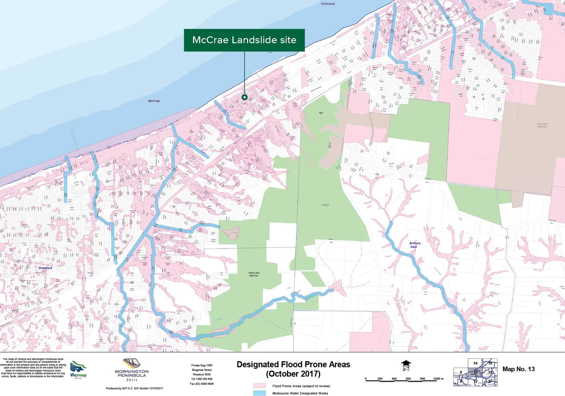
Chapter 2 Endnotes
- 1 Australian Bureau of Statistics, McCrae 2021 Census All persons QuickStats (Web Page, 2021) <https://abs.gov.au/census/find-census-data/quickstats/2011/SSC20857>; Australian Bureau of Statistics, McCrae 2016 Census All persons Quickstats (Web Page, 2016) <https://abs.gov.au/census/find-census-data/quickstats/2016/SSC21614>.
- 2 Australian Bureau of Statistics, McCrae 2011 Census All persons QuickStats (Web Page, 2011) <https://abs.gov.au/census/find-census-data/quickstats/2011/SSC20857McCrae>; Australian Bureau of Statistics, McCrae 2016 Census All persons Quickstats (Web Page, 2016) <https://abs.gov.au/census/find-census-data/quickstats/2016/SSC21614>; Australian Bureau of Statistics, McCrae 2021 Census All persons QuickStats (Web Page, 2021) <https://abs.gov.au/census/find-census-data/quickstats/2021/SAL21625>.
- 3 PropTrack by REA Group, McCrae House Price Guide (Web Page, 2024-2025) <https://www.realestate.com.au/vic/mccrae-3938/>.
- 4 Australian Bureau of Statistics, McCrae 2021 Census All persons QuickStats (Web Page, 2021) <https://abs.gov.au/census/find-census-data/quickstats/2021/SAL21625>.
- 5 Mike Hast, ‘Peninsula Link finally up and running’, Mornington Peninsula News (online, 22 January 2013) <https://www.mpnews.com.au/2013/01/22/peninsula-link-finally-up-and-running/>.
- 6 Public Hearing Transcript, Darren Paul, 7 May 2025, 42–44.
- 7 Exhibit CA-67, McCrae Landslide Causation Report prepared by WSP, 21 July 2025, [DPA.0004.0001.0001 at _0032, _0037].
- 8 Exhibit CA-72, Landslide Risk Assessment for Evacuation Area prepared by PSM, 22 May 2025, [MSC.5047.0001.0001 at .0008].
- 9 Public Hearing Transcript, Darren Paul, 7 May 2025, 39.
- 10 Exhibit CA-13, Second Witness Statement of David Simon, 17 April 2025, Exhibit CA-13(110) [MSC.5012.0001.4440 at .4459].
- 11 Paul Somerville, ‘Perspective on the Melbourne Earthquakes of Late May and Early June 2023’, Risk Frontiers: Insights (Briefing Note, 7 June 2023) <https://riskfrontiers.com/insights/perspective-melbourne-earthquakes-la…;.
- 12 Exhibit CA-77, Revised McCrae Landslide Risk Assessment for Evacuation Area prepared by PSM, 28 May 2025, [MSC.5056.0001.0003 at .0010].
- 13 Exhibit CA-1(1), Opening Presentation of Senior Counsel Assisting, 7 May 2025, [INQ.0005.0001.0001 at _0004].
- 14 These averages draw on 30-year averages from 1961 to 1990. See Department of Justice and Community Safety: Victorian Government, Environmental Scan Report – Southern Metro Region (Report, 14 September 2020) 11.
- 15 Department of Justice and Community Safety: Victorian Government, Environmental Scan Report – Southern Metro Region (Report, 14 September 2020) 16.
- 16 Bureau of Meteorology, State of the Climate 2024: Australia’s changing climate (Web Page, 2024) <http://www.bom.gov.au/state-of-the-climate/australias-changing-climate.shtml>.
- 17 Bureau of Meteorology, State of the Climate 2024: Australia’s changing climate (Web Page, 2024) <http://www.bom.gov.au/state-of-the-climate/australias-changing-climate.shtml>.
- 18 Building Regulations 2018 (Vic) reg 153.
- 19 Department of Transport and Planning: Victorian Government, VicPlan (Web Page, 2025) <https://mapshare.vic.gov.au/vicplan/>.
- 20 Mornington Peninsula Shire Council, Designated Flood Prone Areas (October 2017) (Web Page, 12 October 2017) <https://www.mornpen.vic.gov.au/files/assets/public/v/3/new-website-documents/building-amp-planning/building/docs/a2-building-flood-prone_13.pdf>.
Chapter 3
What happened in McCrae?
3.1 Previous landslide events in McCrae
- The McCrae Landslide is not the first time that a landslide in McCrae has destroyed a home.
- More than several decades earlier, a significant landslide on the McCrae escarpment near Anthony’s Nose impacted multiple homes. However, since then and up to the landslides in November 2022, the escarpment has experienced only relatively minor landslides and like events.
- This history is explored below.
The 1952 landslide near Anthony’s Nose, Point Nepean Road
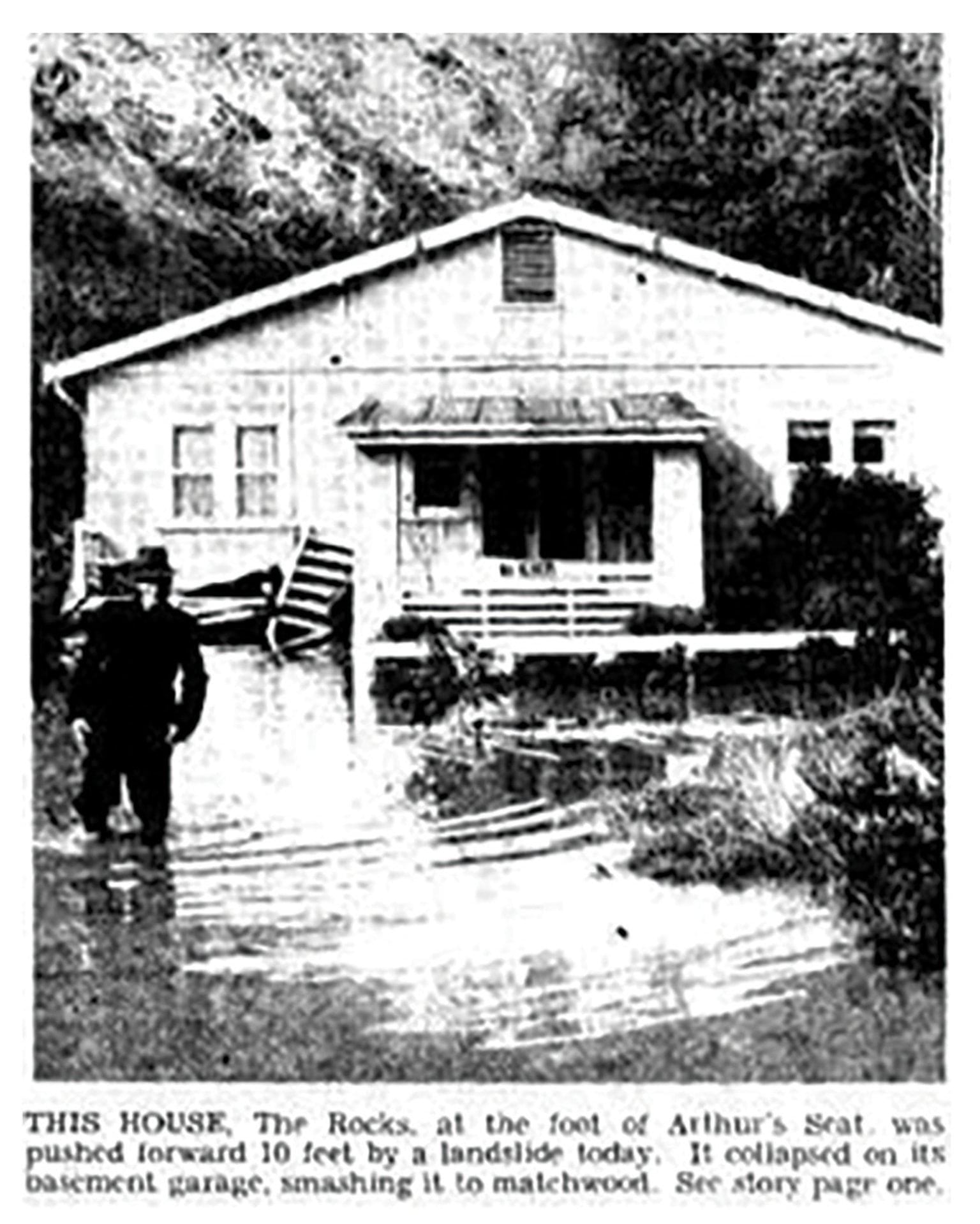
- The first known significant landslide to have occurred along the McCrae escarpment was near Anthony’s Nose in 1952. Anthony’s Nose is a rocky area between McCrae and Dromana, where the granite hill of Arthurs Seat meets Port Phillip Bay. It is not far from the site of the McCrae Landslide.
- The landslide occurred on 14 July 1952 and reportedly destroyed many homes and a milk bar, swept away three bridges and blocked streets. A local resident and owner of an antique shop, Bill Caldwell, described “terrifying rumblings” prior to the landslide and then “the whole cliff-face” suddenly giving way.1 Mr Caldwell described the incident as “the most horrifying experience of [his] life”.2
- The landslide coincided with a significant rainfall event of between 113 millimetres and 160 millimetres over 13 and 14 July 1952.3 One report of the landslide also described Coburn Avenue, which sits at the top of the McCrae escarpment above Anthony’s Nose, being “covered to a depth of 10ft by flood waters and a burst water main”.4
- The following photographs capture the magnitude of the landslide and some of the damage it caused:
FIGURE 3.1: VIEW LOOKING WEST AT 565 POINT NEPEAN ROAD SHOWING DAMAGE TO DWELLINGS FROM LANDSLIDE DEBRIS.5
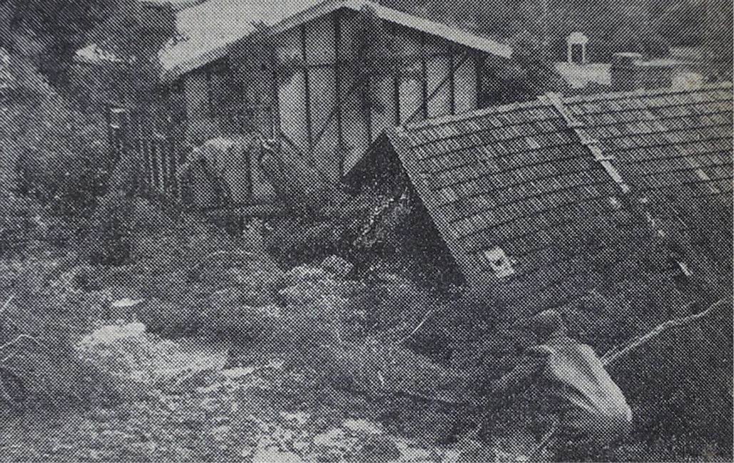
FIGURE 3.2: VIEW LOOKING SOUTHEAST AT 563 POINT NEPEAN ROAD WITH THE LANDSLIDE HEADSCARP ON THE SLOPE TO THE REAR.6
FIGURE 3.2
FIGURE 3.3: CLEAN-UP OF A CUTTING FAILURE ON POINT NEPEAN ROAD NEAR ANTHONY’S NOSE.7
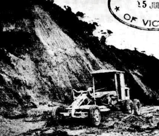
- In the decades that followed the July 1952 landslide, several smaller landslide events reportedly occurred along or in the vicinity of the McCrae escarpment. These included:
- a landslide that occurred at “The Rocks, near McCrae” on 27 November 1952. The Age reported that this landslide occurred during a significant storm event which saw more than four inches of rain falling within three hours. The landslide “partly blocked the highway” until the debris was cleared;8
- two landslides that occurred in the mid-1990s. One occurred on the McCrae escarpment to the east of 611–613 Point Nepean Road and prompted the evacuation of the property directly below the landslide site.9 The other occurred at Anthony’s Nose in 1996, around 500 metres from the location of the landslide to the east of 611–613 Point Nepean Road;10
- a further landslide that reportedly occurred at or around the location of the July 1952 landslide, on 8 October 2020, following heavy rain. It left rocks and soil on Point Nepean Road;11 and
- a minor landslide that occurred along the McCrae escarpment directly above 599–601 Point Nepean Road, in 2021, following earthworks for the construction of the dwelling on that site.12
- In addition to the above:
- it is thought that a minor landslide may have occurred at 10–12 View Point Road at some point between 1975 and 1977. This is based on aerial photographs showing a change in vegetation cover at that site between those years;13
- the Board of Inquiry was informed about retaining walls that had failed or tilted on View Point Road and neighbouring streets from the 1990s onwards, as a result of the downslope movement of fill and saturated soils;14 and
- as recently as February 2017, the owner of 4 View Point Road is said to have observed several tonnes of surficial soils being transported down slope by flood waters during heavy rainfall.15
- The record of incidents above tells a clear but also unsurprising story: the McCrae escarpment is a steep slope vulnerable to landslide.
3.2 Lead up to the November 2022 landslides
The 2000s
- During the 2000s, the Shire became increasingly aware of the McCrae escarpment’s vulnerability to landslides.
The development of 611–613 Point Nepean Road
- In 2003, concerns about the vulnerability of the escarpment above Point Nepean Road came into focus. A development was proposed at 611–613 Point Nepean Road, involving the construction of seven dwellings. Accordingly, planning permit and planning amendment applications were made.16
- The Shire placed those applications on public exhibition and received 24 submissions raising a range of different issues.17 Of the submissions received, 16 people opposed the planning permit and planning amendment applications.18 Many of the submissions questioned the suitability of the land for the proposed development. Several people stated that the escarpment above the site was unstable and prone to landslides.19 Len Wharfe, a local resident, pointed to several landslides in the general area and emphatically submitted:
Increasing housing density below a steep, unstable cliff face which is already at some risk of slippage is not cautious, it is careless.20 (emphasis in original)
- Jenny Wharfe told the Shire, in a submission made on behalf of the Mornington Peninsula Ratepayers’ & Residents’ Association, that she was aware of extensive land slippage on a property just above and to the east of 611–613 Point Nepean Road in the mid-1990s which impacted the dwelling below, causing it to be evacuated.21
- A local resident, Eunice Cain, stated in her submission to the Shire that the topographic features of the site imposed “real physical constraints to land capacity and safe habitation in the area”.22
- The Shire did not request any information (such as an expert opinion) in relation to the landslide risk raised in the submissions by residents. The Shire also did not obtain its own opinion.
- The Shire resolved to refer the planning permit and planning amendment applications to Planning Panels Victoria.23
- The Shire’s submission to the Planning Panel indicated that, while it supported the aims of the amendment application, the Shire was seeking advice on the best statutory mechanism to achieve the desired outcome.24
- At the hearing before the Planning Panel, the issue of landslide risk was raised in the context of consideration of the suitability of the site for the proposed development. The owner of the land told the Planning Panel that he had no knowledge of any landslides in the immediate area.25 His legal representative submitted that a landslide at Anthony’s Nose was not relevant (due to its nature) and that there was no evidence in relation to the risk of a landslide on the cliff above the site.26 The owner’s planning consultant told the Planning Panel that land slippage was not an issue because the site was almost flat and Penny Lane provided an appropriate separation from the base of the escarpment. He said that no site works were required at or around the base.27
- The residents who had raised landslide risk in their written submissions, attended the hearing. John d’Helin, a local resident, told the Planning Panel at the hearing that he was aware of a landslide on the property immediately behind the building at 611 Point Nepean Road.28
- Anthony Matthews, who appeared on behalf of the Shire, told the Planning Panel that he would seek the advice of the Shire’s engineering department concerning their knowledge of landslide risk in the area.29 Following the hearing, Mr Matthews sent a letter to the Planning Panel stating that “a preliminary search of the Council’s records had not revealed any relevant information [about landslide risk] and a further search was being undertaken”.30 The Planning Panel was not notified of the results from this search following Mr Matthews’ email.31
- In the absence of any Shire records or other documentation recording instability in the area, or of any expert testimony concerning the matter, the Planning Panel concluded that it was not in a position to make any finding on landslide risk to the site.32 However, the Planning Panel noted that:
[E]ffective management of stormwater drainage and other infiltration on the properties above the site would be likely to reduce any hazard that may exist and … such management is desirable regardless of the type or density of development that may occur on the subject land.33
- After considering the many different issues raised, the Planning Panel concluded that the land at 611–613 Point Nepean Road was suitable for development for medium density housing.34 However, the Planning Panel concluded that the proposed amendment to the Mornington Peninsula Planning Scheme would not necessarily result in development on the site of the type the Shire was seeking to facilitate. The Planning Panel therefore recommended that the Shire prepare and adopt a specific Development Plan Overlay for the site.35 The Planning Panel also concluded that the development proposed in the planning application should not be approved without modification.36 The Planning Panel provided recommendations in relation to the modifications and the content of a Development Plan Overlay.37
- Around 18 months after the Planning Panel provided its report, the Shire issued a planning permit for the subdivision of 611–613 Point Nepean Road (P05/0607).38 The permit required the applicant to “substantially complete the construction of the dwellings in general accordance with the development plan endorsed as part of permit P04/1497 to the satisfaction of the Shire”.39
- Planning Permit P04/1497 had been issued earlier, on 3 September 2004, and permitted the development of five dwellings in accordance with the endorsed plans.40
- Despite the residents’ concerns and the Planning Panel’s inability to determine the landslide risk for the site, there is no evidence that, before issuing the planning permits, the Shire requested or obtained from the developer an assessment of the landslide risk for the site. There is also no evidence that the Shire undertook or commissioned its own assessment.
- Further, there is no evidence of the Shire taking any steps to manage stormwater drainage or other water infiltration on the properties above the development site in connection with the issuing of the planning permits.
- Between 15 April 2005 and 3 February 2006, the properties at 2 Penny Lane and 3/613 Point Nepean Road were constructed on the lots resulting from the subdivision.41
- Those properties are no longer occupied due to the landslides that occurred on the escarpment above them (at 10–12 View Point Road) on 14 and 15 November 2022, following water infiltration. Both properties remain subject to Emergency Orders due to the ongoing risk. They were also impacted by the McCrae Landslide.
Lane Piper investigation in 2007
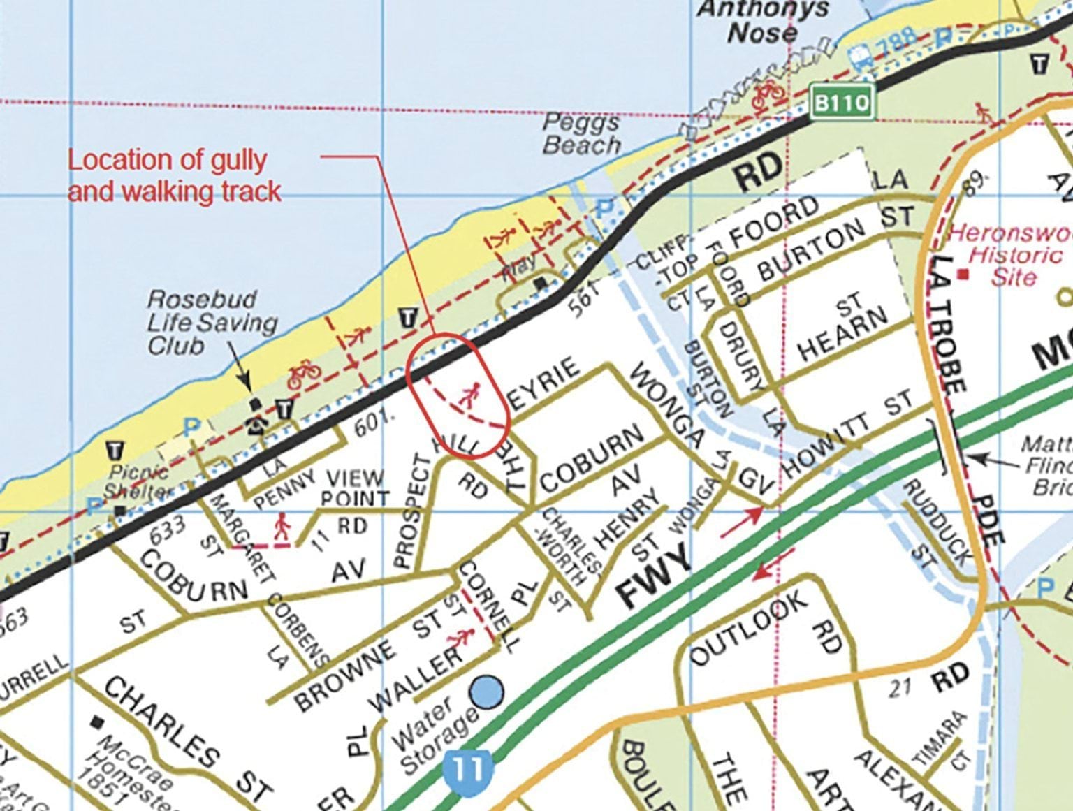
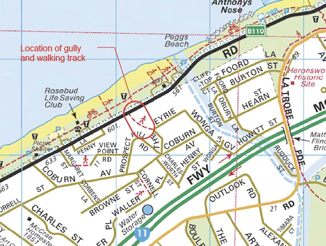
- In 2007, the Shire commissioned Lane Piper Pty Ltd (Lane Piper) to undertake a geotechnical investigation into the stability of the gully located between The Eyrie and Point Nepean Road (see Figure 3.4 below).42 The gully is located approximately 150 metres away from the site of the McCrae Landslide.
- The investigation was prompted by signs of destabilisation of the gully banks. It was thought that increased runoff in recent years had resulted in erosion of the gully bed. The Shire was concerned to stabilise the gully.43
FIGURE 3.4: ANNOTATED MAP DEPICTING THE LOCATION OF THE GULLY SUBJECT TO LANE PIPER’S INVESTIGATIONS.44
FIGURE 3.4
- In September 2007, after conducting geotechnical investigations and fieldwork, Lane Piper observed that the deepening of the valley and increased erosion of the escarpment were driven by two key factors:
- first, the increased urbanisation of the area around the gully. Namely, through the construction of houses, roads and paving and the removal of vegetation in the vicinity of the gully; and
- second, the sandy terrain of the area which was easily erodible.45
- Lane Piper concluded that most of the slopes of the gully examined were only marginally stable.46
- To address this, Lane Piper made several recommendations to the Shire to stabilise the gully.47 The principal recommendation was to “partially pipe the gully to resist further erosion combined with the placement of fill around and above the pipeline to improve the stability of the gully banks”.48 The associated recommendations included using “sandy clay or impermeable backfill” and concrete cut-off collars to prevent high velocity water flow through the backfill.49
- The report made it abundantly clear that the Shire needed to take measures to prevent further erosion, including through the effective management of water runoff. The stabilisation works were not completed until 2014,50 some seven years after the Shire received the report.
The 2010s
2012 Cardno Lane Piper Landslide Susceptibility Assessment and the Shire’s response
- On or around 1 February 2012, Cardno Lane Piper Pty Ltd (Cardno) provided a draft report to the Shire entitled Draft for Comment Landslide Susceptibility Assessment, Stage 2.51
- The report was the culmination of a study the Shire had commissioned over a decade earlier, in 2000. Cardno had been tasked with assessing “landslide hazards” across the entire Mornington Peninsula Shire area.52 The assessment was prompted by several landslides in the Mornington Peninsula in the 1980s and 1990s, which had resulted “in considerable damage to dwellings, in some cases resulting in their demolition”.53 There was a demonstrable need to understand landslide susceptibility across the Mornington Peninsula.
- Over several years, Cardno used various techniques to map the contours and characteristics of the entire Mornington Peninsula to build a slope stability model.54 By applying the resultant model, the report, in effect, classified areas of the Mornington Peninsula into subjective zones of “high”, “medium” and “low” landslide susceptibility. The zones were explained as follows:
FIGURE 3.5: LANDSLIDE SUSCEPTIBILITY ZONATION FRAMEWORK.55
| Landslide Susceptibility | Explanation | Implication for Development |
|---|---|---|
| High | Evidence of active or past landslips or rock or soil failure; extensive instability may occur. Evidence of significant soil creep or minor slips or rock face instability; significant instability may occur during and after extreme climatic conditions. | Strict development restrictions and/or geotechnical works required. Extensive geotechnical investigation necessary. Risk after development may be higher than usually accepted. |
| Medium | Evidence of possible soil creep or a steep soil covered slope; significant instability can be expected if the development does not have due regard to the site conditions. | Some development restrictions required. Moderate level of geotechnical investigation necessary. Risk after development normally acceptable. |
| Low | No evidence of instability observed; instability not expected unless major site changes occur. | Good engineering practices suitable for hillside construction required. Risk after development normally acceptable. Typical site classification required. |
- Cardno stressed that the classification of the Mornington Peninsula into these three zones was not intended to represent the likelihood of landslides occurring nor the severity of such landslides. Rather, the zones were intended to identify and rank the relative susceptibility of areas within the Mornington Peninsula to landslides.56
- In undertaking the zoning, Cardno considered multiple factors including the existing EMOs in place within the Mornington Peninsula and the geology of the area. Each of these factors warrants explanation, especially as they relate to the McCrae escarpment.
- To establish a baseline understanding of landslide susceptibility in the Mornington Peninsula, Cardno began by examining the Shire’s EMO schedules.
- An EMO is a planning tool. Its purpose is to protect areas prone to erosion, landslip and other land degradation or coastal processes by minimising land disturbance and inappropriate development.57 If an EMO applies to land, it may trigger the need for a planning permit for building and works, including for types of developments that are ordinarily exempt from planning permits under statewide planning controls.58
- At the time of the 2012 Cardno Report, five EMO schedules were in place in the Mornington Peninsula:
- EMO1 – Erosion Prone Slopes;
- EMO2 – Unstable Slopes;
- EMO3 – Ballar Creek;
- EMO4 – Medium Landslide Susceptibility for Flinders and Tanti Creek; and
- EMO5 – High Landslip Susceptibility for Flinders and Tanti Creek.
- EMO1 and EMO2 were developed and introduced in the 1970s.59 To Cardno’s knowledge, these EMOs had not been used by the Shire in recent decades.60 The limited utility of these EMOs was accepted by the Shire’s current Acting Director Planning and Environment, David Simon. He told the Board of Inquiry:
EMO1 and 2 basically don’t contain any guidance or any additional information requirements whatsoever. So to that extent I would say they’re probably not a great tool for a planner or an engineer or whoever’s considering the [planning] application[.]61
- EMO3 was introduced in December 2000 as a result of “[l]and degradation problems along Ballar Creek includ[ing] clearly visible erosion of the banks and bed and less visible landslips of much larger areas”.62
- EMO4 and EMO5 were introduced in January 2011 to land in the vicinity of Tanti Creek and the Flinders township.63 Those overlays reflected several geotechnical studies concerning those locations, including a Geotechnical Investigation of Stability of Creek Banks, Tanti Creek by Piper and Associates in 2006 and a Geotechnical Assessment for Landslip Risk, Flinders Foreshore by Piper and Associates in 2007.64 Notably, EMO4 and EMO5 required (and still require) any planning permit applications to be accompanied by a “site specific geotechnical hazard and risk assessment report prepared by a suitably qualified geotechnical engineer or engineering geologist with experience in landslide risk assessment”.65
- None of the EMOs applied to the McCrae escarpment at the time the 2012 Cardno report was prepared.
- After reviewing the existing EMOs, Cardno turned its attention to the geology of the Mornington Peninsula. It noted that the relationship between the Mornington Peninsula’s geology and slope stability is complex.66 Several distinct geological materials were identified across the region, each exhibiting varying levels of susceptibility to slope failure.67
- Cardno observed that Dromana Granite – a hard medium-grained rock – extends from the McCrae coastline and rises steeply towards Arthurs Seat.68 Critically, Cardno stated in its report:
The area covered by the Dromana Granite is commonly steep and the cover of residual soils and highly weathered rock can be expected to be of very variable thickness. A concurrence of steep slope – either natural or through recent erosion – water saturation and a thick weathered profile could lead to slope failure.69 (emphasis added)
- The report went on to say that “[t]he cliffs at McCrae have been shown to be unstable in the past due to both natural and man-made causes”.70
- In the final analysis, Cardno zoned the escarpment on which the McCrae Landslide (and the earlier landslides on 5 January 2025 and 14 and 15 November 2022) occurred as having high susceptibility to landslides, as depicted in the red shading below.
FIGURE 3.6: ZONING OF THE MCCRAE ESCARPMENT IN 2012 CARDNO REPORT.71
FIGURE 3.7: ZONING OF MCCRAE AREA GENERALLY AND THE SITE OF THE NOVEMBER 2022 LANDSLIDES AND THE JANUARY 2025 LANDSLIDES AT 10–12 VIEW POINT ROAD.72
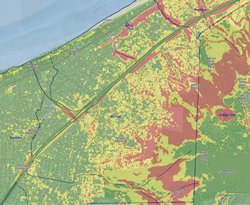
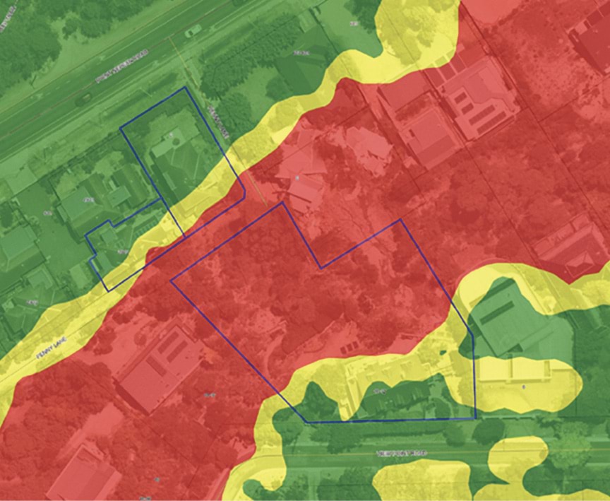
- The Shire used the mapping generated by Cardno to implement a geographical information system (GIS), which overlaid low (in green), medium (in yellow) and high (in red) landslide susceptibility areas over all land in the Mornington Peninsula.73
- In the concluding remarks of its report, Cardno made two relevant recommendations. First, for areas identified as having “high landslide susceptibility”, it recommended that “a landslip risk assessment is essential to consider risk to property and life [to any] proposed development and also [to] consider the impacts on nearby properties”.74 Second, it advised that the Shire update the data, the subject of the study, every five to 10 years to incorporate new geotechnical studies or literature, and that the GIS be re-run to include that updated information.75
- Neither of those recommendations were properly implemented by the Shire. Specifically, the Shire did not update its EMOs to cover all land that fell within the red zone of high landslide susceptibility. It also did not update its landslide susceptibility data and modelling.76
- Instead, at some point after receiving Cardno’s report but prior to 2019, the Shire adopted a process whereby:
additional planning requirements [were imposed] on all properties that are mapped as falling within the areas coloured in red (i.e., high susceptibility), including in the McCrae area, so as to prevent and manage the risk of landslides and landslips.77
- Those additional requirements were, and are currently, as follows:
- first, any planning permit applications in respect of land clearly in high landslide susceptibility (red) areas must be accompanied by a peer-reviewed geotechnical report which complies with the Australian Geomechanics Society’s Practice Note Guidelines for Landslide Risk Management 2007 (AGS Guidelines 2007);78
- second, prior to the commencement of any works for a development, a Form B Structural/Civil/Geotechnical Engineering Declaration must be completed in compliance with the AGS Guidelines 2007 by both a registered structural or civil engineer (endorsed by the Victorian Business Licencing Authority) and a specialist geotechnical engineer or a specialist engineering geologist as defined by the AGS;79 and
- finally, upon completion of any works, but prior to occupation of a site, a Final Geotechnical Certificate must be completed by a specialist geotechnical engineer or a specialist engineering geologist as defined by the AGS.80
- The Board of Inquiry was told that these requirements are not prescribed by any legislation. The Shire chose to adopt these requirements “as [a] matter of practice as an additional precautionary measure”.81 It was said that planners within the Shire knew, and know of, this practice through internal documents and systems, as well as through training by more experienced planners.82
- The Shire accepted, however, that it could not be entirely confident that the process was applied across all planning permit applications relating to high landslide susceptibility areas.83 Still, the Shire took no formal steps to mandate geotechnical hazard and risk assessments in respect of those areas.
Mornington Peninsula Planning Scheme Review No. 4
- In 2018, pursuant to s 12B of the Planning and Environment Act 1987 (Vic) (Planning and Environment Act), the Shire reviewed the provisions of the Mornington Peninsula Planning Scheme.84 The review, amongst other things, considered the (then) five EMOs.
- The Shire acknowledged the landslide susceptibility modelling undertaken by Cardno but noted that there was “significant work still required to translate the outcomes into [EMO] mapping”.85 Two relevant recommendations emerged from the review:
- Recommendation 210: Merge the application requirements of EMO3 into EMO1, delete the schedules for EMO2 and EMO3, and renumber mapping of EMO2 and EMO3 to EMO1; and
- Recommendation 211: Complete the comprehensive review and update of the Shire’s landslip susceptibility data and modelling and update the ordinance and mapping of the Shire’s EMOs.86
- The Shire anticipated that such strategic work would be completed within two to three years of the review.87 As it turned out, neither of those recommendations were ever implemented.88
- The McCrae escarpment, despite being in an area of high landslide susceptibility, remained outside of the Shire’s EMOs. This meant that strict planning controls were not automatically triggered for building works on the escarpment, including for works at 10–12 View Point Road.
2020 to November 2022
Works conducted at 10–12 View Point Road
- In December 2020, after living in the United States for approximately two decades, Gerrard (Gerry) and Bronwyn Borghesi began permanently residing at 10–12 View Point Road. Upon their return to Australia, the Borghesis undertook general maintenance of the gardens on the property. Before describing those works, it is convenient at this stage to refer to some earlier works completed on the property.
- Prior to moving in, and while the Borghesis were residing overseas, they arranged for works to be carried out on the property between 2015 and 2017. Such works included:
- Those works were undertaken in accordance with a planning permit issued by the Shire in April 2015.92
- In early 2018, the Borghesis carried out further works, including the erection of fencing and construction of retaining walls.93 These works were undertaken in accordance with a planning permit issued by the Shire on 15 December 2015.94
- Upon the Borghesis’ permanent return to Australia in December 2020, they then undertook further works which included:
- the removal of dead vegetation and invasive weeds on the hillside;
- the trimming of large trees at the request of their immediate neighbours;
- the planting of 20–30 native plants and shrubs along the hillside as well as installing a new water tap and hose to water those plants;
- the installation of a one-metre-high retaining wall directly upslope of the site of the McCrae Landslide, to create a level area for a vegetable patch; and
- the installation of six garden beds.95
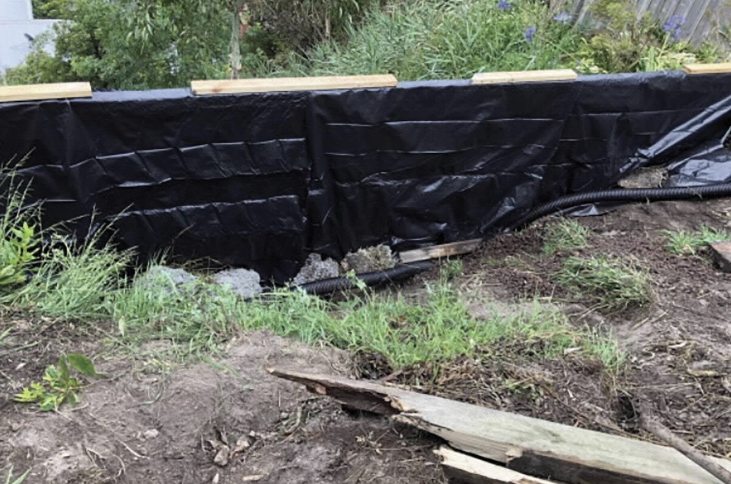
FIGURE 3.8: CONSTRUCTION OF ORIGINAL RETAINING WALL INSTALLED BY THE BORGHESIS.96
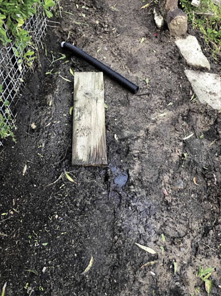
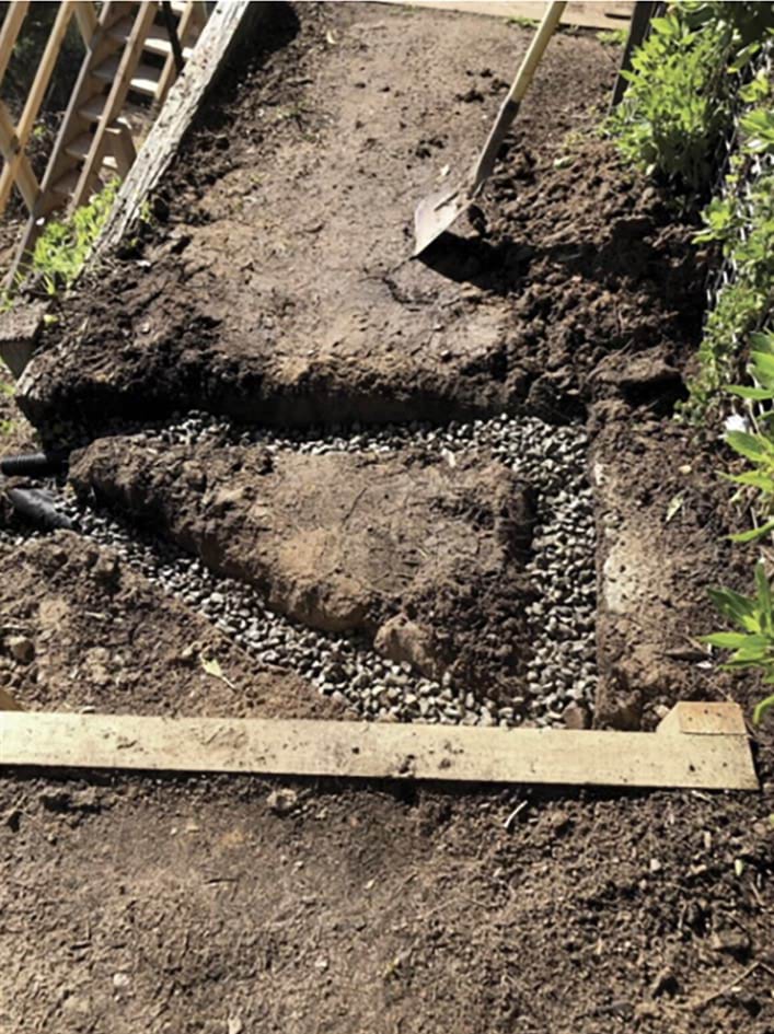
- In addition to the above works, Mr Borghesi told the Board of Inquiry that, due to increased saturation of the hillside towards the western boundary of the property,97 he installed agricultural (agi) drains in July 2021 in an effort “to control erosion and make the pathway down to Penny Lane trafficable”.98
FIGURE 3.9: COMPARISON BETWEEN THE HILLSIDE PATH PRE AND POST INSTALLATION OF THE AGRICULTURAL DRAINS.99
The constant presence of water in the vicinity of the McCrae Landslide site
- The Borghesis were not alone in their observations of water on the hillside. Several local residents observed water in the vicinity of the McCrae Landslide site in the years prior to the landslides in November 2022.
- A local resident told the Board of Inquiry that, between 2016 and 2022, they had noticed the kerbs:
along the entirety of View Point Road would always be brim full of water, with overflow always slowly running all along the road edge gutters and across the bitumen road bends at the street’s lower end. This flow was constant always, not being caused by any rainfall.100
- Two residents of View Point Road made similar observations. The first resident, whose family has lived on that street for over 20 years, reported observing “a significant and persistent water flow down View Point Road” throughout that time. They told the Board of Inquiry that despite raising the issue with the Shire and SEW on multiple occasions, no action was taken.101
- The second resident observed multiple water issues with the stormwater infrastructure along View Point Road and Prospect Hill Road, particularly following significant rain events in 2017 and on 12 July 2022. In particular, they observed the stormwater pits along Prospect Hill Road becoming overwhelmed with water, which led to flooding.102
FIGURE 3.10: FLOODING IN FRONT OF 11 PROSPECT HILL ROAD.103
- The resident also reported an increase in water along the kerbs near 5 and 7 Prospect Hill Road during the construction of both dwellings in 2020 and 2021.104 This observation was also made by a longtime resident of McCrae, whose family has owned a property on Prospect Hill Road for over 50 years.105 The resident added that the “lower ... northern end, of [7 Prospect Hill Road], including the nature strip, resembled a sodden marsh up until ... [the] new house was built replacing the old one”.106
FIGURE 3.11: PHOTOS OF THE KERBS DURING THE DEVELOPMENT OF 7 PROSPECT HILL ROAD BETWEEN 5 MAY 2021 AND 11 NOVEMBER 2021.107
- The issue of excess water on Prospect Hill Road was only to be made worse by the bursting of a water main on 14 November 2022.
2022 burst water main at Coburn Avenue
- At about 5.40am on 14 November 2022, a water main at the corner of Prospect Hill Road and Coburn Avenue failed,108 suffering two circumferential breaks along the length of the asbestos cement pipe.109
- The Shire received multiple complaints concerning water issues at the site of the burst, namely:
- at 10.18am, a resident at 23 Coburn Avenue reported that a large sinkhole had appeared in the nature strip between Coburn Avenue and Prospect Hill Road. The resident was concerned that the hole could be related to flooding at a neighbouring property;110
- at 10.46am, a resident at 22 Prospect Hill Road (next door to 23 Coburn Avenue) reported that the street stormwater pit was blocked, and that water was overflowing and flooding their house;111 and
- at 11.46am, a resident at 17 Burton Street reported “[w]ater spurting out of Coburn Ave just near Prospect Hill Road intersection”, and that the road surface was “broken and the road [was] in danger of washing away”.112
- After receiving these complaints, at some stage in the morning of 14 November 2022, employees of the Shire’s contractor, DM Roads, attended the area near 23 Coburn Avenue. The contractor determined that the issue was due to SEW’s assets.113 The contractor took a photo of the road surface (Figure 3.12 below) and made the site safe.114 The photo was subsequently emailed to Michelle Twaites, Customer Service Officer at DM Roads, at 11.58am.115
- SEW was first notified of the burst at 1.41pm, when Ms Twaites reported it via email.116 Ms Twaites attached a copy of the photograph that she received earlier that day:
FIGURE 3.12: PHOTO OF DEFECT IN TARMAC AND WATER FLOW ON COBURN AVENUE.117
- Minutes later, SEW created a job in its Montage system and allocated it to Service Stream Ltd (Service Stream).118 Service Stream was and remains contracted by SEW to provide water and sewer repair and maintenance services.119
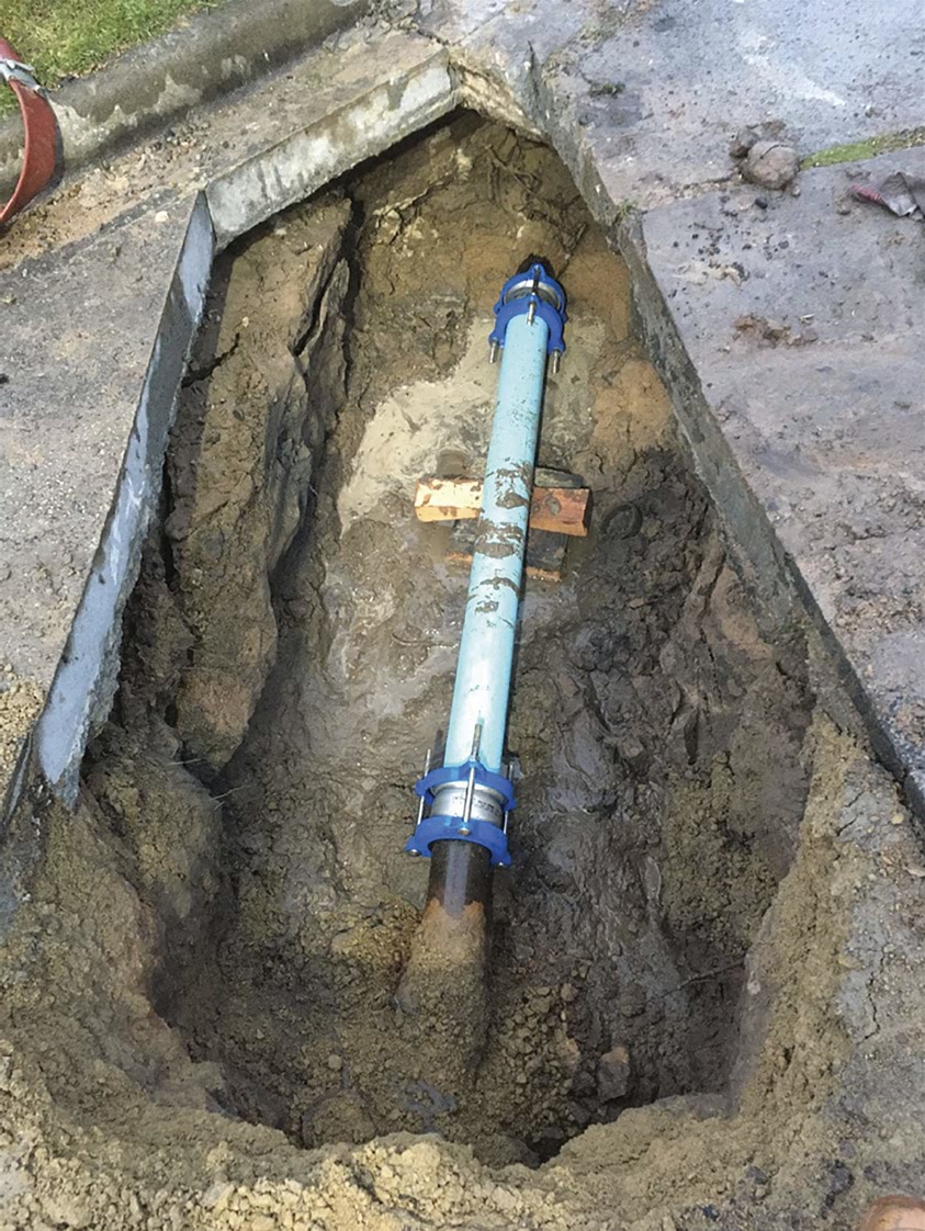
- Service Stream attended the site at around 3.20pm.120 They remained there for several hours, until around 8.05pm.121 During that timeframe, extensive works were undertaken to repair the pipe.122 Those works involved drilling several holes to locate the burst, cutting and removing concrete to expose the water main, shutting off the supply of water, removing and replacing the broken pipe, filling the area around the pipe with sand/rock embedding material and repairing areas of the road that had been undermined by the water.123
FIGURE 3.13: IMAGES OF THE CUT TO THE ROAD SURFACE AT COBURN AVENUE.124
FIGURE 3.14: IMAGES OF THE BREAKS ALONG THE PIPE.125
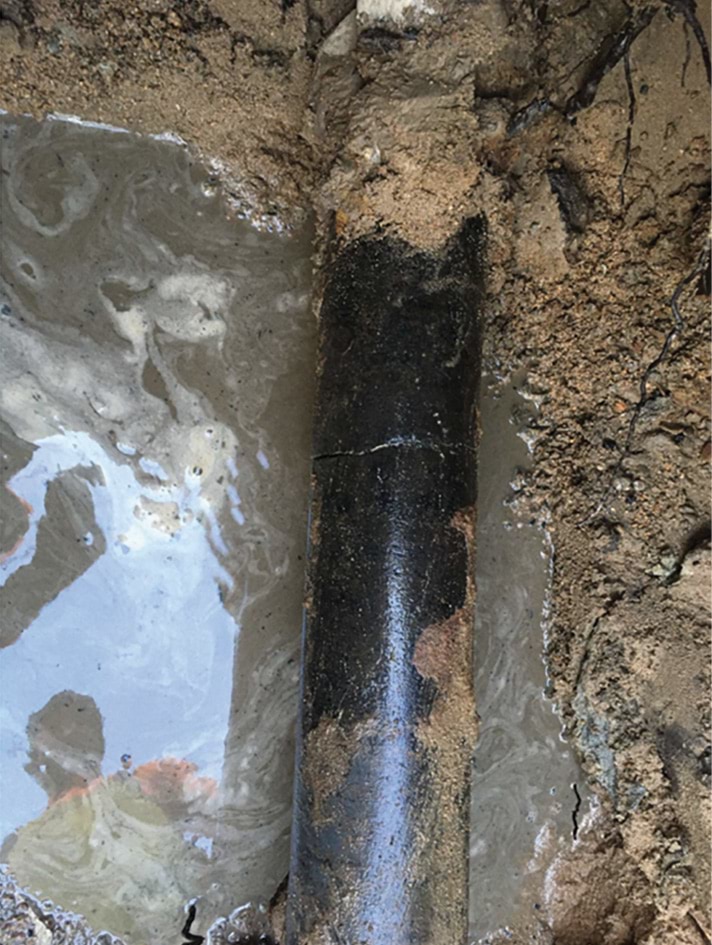
FIGURE 3.15: PHOTO OF THE PIPE POST REPLACEMENT.126
- As is evident from the photographs, the burst was not small. SEW estimates that approximately 900,000 litres of water escaped from the burst pipe, with a peak flow rate of approximately 2.3 megalitres per day just prior to the main being turned off at 6.50pm.127
3.3 The November 2022 landslides
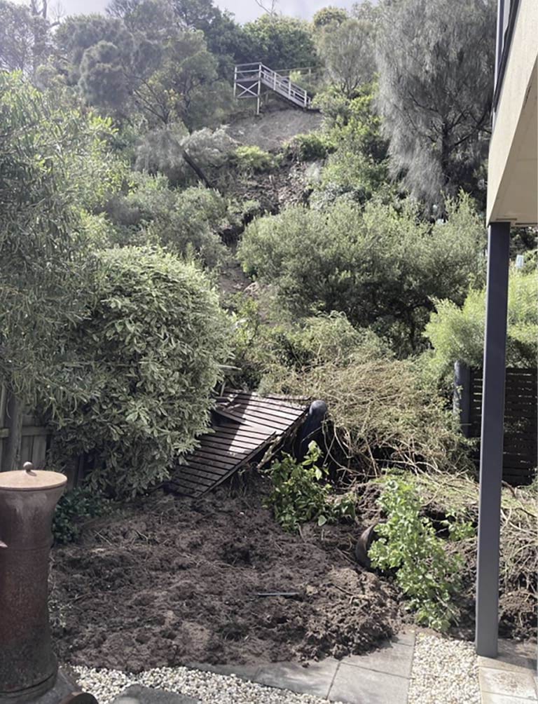
- The same day as the burst water main on 14 November 2022, a landslide occurred on the escarpment at the north-west end of 10–12 View Point Road.128 The impact of this landslide was small, but a more destructive landslide was coming.
- Paul and Denise Willigenburg, who lived at the bottom of the escarpment at 3/613 Point Nepean Road, were home on the morning of 14 November 2022. They were packing for a 10-day holiday to Tasmania when they heard a loud cracking noise coming from the rear of their property.129 In Mr Willigenburg’s words: “[i]t sounded like a tree, [like] a large branch from a tree had snapped off”.130
- The Willigenburgs went downstairs and out to their back garden to locate the source of the noise but could not see anything unusual.131 They resumed packing and departed for Tasmania later that morning.132
- The following morning, on 15 November 2022, a destructive landslide occurred in the same location on the escarpment.
- At around 11.00am, the Willigenburgs’ son, Christopher, telephoned Mr Willigenburg in Tasmania to tell him that a major landslide had occurred earlier that morning.133 Soil and debris had smashed through the back fence of the home.134
- Mr Willigenburg was shocked and confused. He gave evidence to the Board of Inquiry that Christopher told him:
[T]here was a lot of mud, debris, a lot of water flowing down the slope. The fence – the back fence was basically destroyed. A lot of vegetation had come down into the property next door and also into our property.135
- Christopher sent his father a video recording of the steady flow of water coming down the slope, and photographs of the soil, debris and damage at the rear of their home.136
FIGURE 3.16: THE IMPACT OF THE 15 NOVEMBER 2022 LANDSLIDE ON 3/613 POINT NEPEAN ROAD.137
- The Willigenburgs’ property was not the only property damaged by the landslide on 15 November 2022.
- Damage was also caused to the property at 2 Penny Lane.138 Soil and debris from the landslide similarly crashed through the rear fence of 2 Penny Lane, stopping just short of the back door.139 One side of the property was left covered in mud and debris which had flowed off the escarpment.
FIGURE 3.17: THE IMPACT OF THE 15 NOVEMBER 2022 LANDSLIDE ON 2 PENNY LANE.140
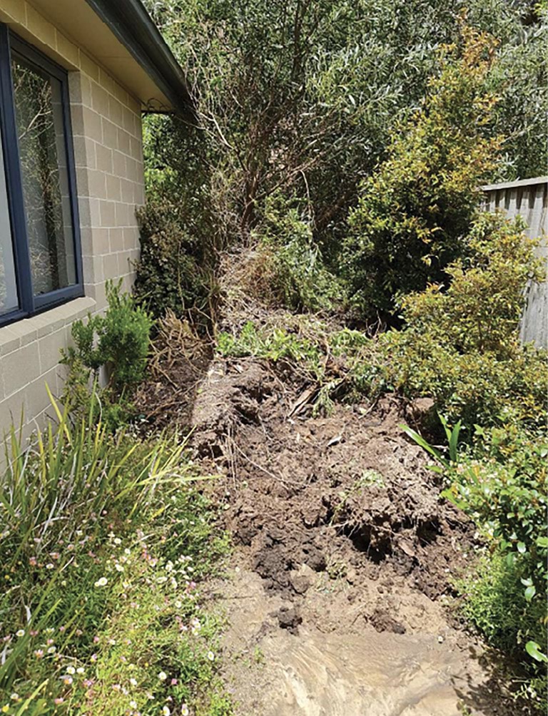
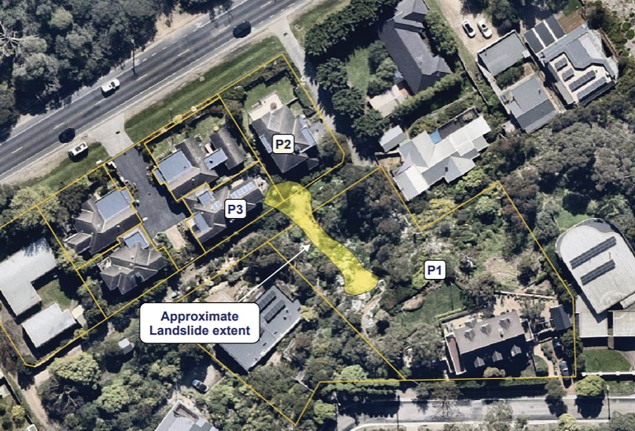
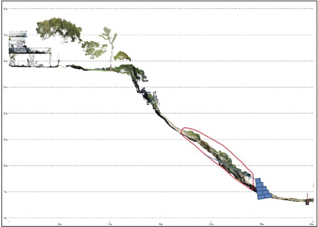
FIGURE 3.18: AERIAL IMAGE DEPICTING THE LOCATION OF THE 15 NOVEMBER 2022 LANDSLIDE RELATIVE TO 10–12 VIEW POINT ROAD (P1), 3/613 POINT NEPEAN ROAD (P2) AND 2 PENNY LANE (P3).141
FIGURE 3.18
- The landslide on 15 November 2022 involved at least 20 tonnes of soil and debris flowing to the bottom of the escarpment.142
- Water was observed seeping out of several locations on the escarpment throughout the landslide area,143 including from a displaced irrigation system at 10–12 View Point Road.144
- In response to water being observed flowing down the site of the landslide, SEW was contacted by a local resident, Ben Wells. Mr Wells, who was the owner of 3 Penny Lane at the time, placed a call to SEW at around 6.40am.145 Mr Wells was distraught and reported that “the mountain [in] front of his house [meaning the escarpment above his home] was shifting due to a lot of water running” and he was “not sure if it [was] rain/stormwater or [the] burst main further up”.146
- In responding to Mr Wells’ call, SEW itself recognised that there may have been a connection between the water running down the site of the landslide and the burst. SEW’s records state: “[the water] may be associated with job in Coburn just up the hill”.147
- Soon after the landslide, officers from the VicSES attended the site.148 They arrived at 6.47am.149 VicSES officers were in contact with the Shire, and engineers engaged by the Shire, who were on-site at 7.20am. They liaised regarding the evacuation of residents.150 VicSES officers advised Christopher Willigenburg to evacuate his parents’ home as soon as possible.151
- Victoria Police also attended.152
- At around 7.28am, a contractor from Service Stream (on behalf of SEW) attended 10–12 View Point Road and observed “water cascading down the hill”.153 He sounded the water meter at the property and discovered a “good noise”.154 He also observed the water meter was “spinning”,155 which he thought indicated a water leak. The contractor then attempted to shut off the water at the property but found that the stop tap was letting water through.156 He replaced the defective stop tap and then shut off the water.157
- At 10.29am, the contractor made an entry into SEW’s Montage system stating that the VicSES had informed him that the water had stopped flowing down the escarpment. He then issued a Red Notice to the owners of 10–12 View Point Road, which stated that there was a leak in an internal service pipe and that “water has been turned off because of a burst pipe on [the] property causing landslip”.158
- Significant rain had fallen on McCrae immediately prior to the landslide on 15 November 2022. Around 80 millimetres of rainfall was recorded in nearby Rosebud the day prior, on 14 November 2022. This far exceeded the historical November monthly average (dating back to 1927) of 60.5 millimetres.159 The rainfall event was the highest daily rainfall event of 2022, and the highest daily rainfall event recorded in Rosebud for the previous 17 years.160 The monthly precipitation for November 2022 was recorded at almost three times the historical average.161
- Later in the morning, Benjamin Essing, a delegate of the Shire’s Municipal Building Surveyor (MBS), issued Christopher Willigenburg with an Emergency Order pursuant to s 102 of the Building Act 1993 (Vic) (Building Act), prohibiting occupation of his parents’ home.162 The Emergency Order also stated that evidence of soil stabilisation on the land was to be provided to the satisfaction of the MBS.163 When Mr Willigenburg was told about the Emergency Order, he was confused by that aspect of it. He told the Board of Inquiry that he was not aware of any unstable soil on his land (his property was at the bottom of the escarpment and was struck by landslide debris from above) and that he had “no idea” whether he was required to take any action.164
- Emergency Orders requiring evacuation were also issued in respect of the following properties:
- 10–12 View Point Road;
- 14–16 View Point Road;
- 2 Penny Lane;
- 3 Penny Lane;
- 1/613 Point Nepean Road;
- 2/613 Point Nepean Road; and
- 4/613 Point Nepean Road.165
- At 1.38pm on 15 November 2022, Davin Slade, a geotechnical engineer from Stantec Australia Pty Ltd (Stantec) (formerly Cardno) arrived to inspect the landslide site.166 Mr Slade was engaged by the Shire. The purpose of the inspection was to identify the extent of the landslide and the zone of influence around the landslide that might be impacted by further ground movement.167 Mr Slade walked around the perimeter of the landslide and observed the characteristics of the upper slope, noting water seepage and tension cracks on the eastern side of the landslide area.168 His observations of the lower slope included the build-up of the upper slope’s vegetation and soil debris and additional water seepage on the eastern side of the landslide area. Mr Slade was concerned that the tension cracks, water seepage and accumulation of debris had the potential to cause a further landslide.169
- At 4.45pm, VicSES and Shire personnel attended a meeting during which the Shire informed the VicSES that it had determined it was safe for some residents to return home.170 It appears that the Shire relied on geotechnical advice from Stantec to make this determination. It is, however, unclear from the records whether Mr Slade or another representative from Stantec was at this meeting.
- At around 5.45pm, the VicSES handed the site over to the Shire, seemingly for recovery coordination.171
- At 6.20pm, a Shire staff member emailed Mr Slade confirming that, following his site investigation, the Shire proposed to change the Emergency Orders issued by the MBS to allow residents from the following properties to return to their homes immediately and without restriction:
- 14–16 View Point Road;
- 1/613 Point Nepean Road; and
- 2/613 Point Nepean Road.172
- The Shire sought confirmation of Mr Slade’s agreement with the proposed changes.
- At 8.08pm, Mr Slade advised the Shire that, based on the site inspection, he agreed with the proposed changes. He noted that the area around the remaining houses, which had been evacuated, should be inspected the next morning and afternoon to assess the status of those properties.173
- At the time of the landslide, Mr and Mrs Borghesi were in Melbourne for a short overnight trip for medical reasons.174 The Borghesis returned to McCrae the following morning,175 but were not permitted to enter their property pursuant to the Emergency Order issued by the MBS. That Emergency Order was cancelled three days later.176
- The Willigenburgs spent their Tasmanian holiday trying to arrange alternative accommodation in McCrae.177 At that time they did not know, and could not have known, that they would be displaced from their home for at least another two and a half years.
3.4 The intervening period – what happened between 2022 and 2025?
Immediate aftermath
- In the days following the 15 November 2022 landslide, the Shire and residents came together to discuss the next steps.
- On 16 November 2022, the Shire held a meeting in the driveway of 2 Penny Lane for residents affected by the landslide.178 Andrew Joseph, Resilience and Recovery Coordinator, attended on behalf of the Shire. Representatives from the VicSES and Victoria Police were also present and updated residents.179 During the meeting, the Shire told residents that it had engaged geotechnical specialists to determine the works that would be required to ensure the safety of the landslide site and the affected properties.180 No explanation was provided as to the cause of the landslide.
- The significant amount of rainfall in the area in the days preceding 15 November 2022 was raised during the meeting.181 There was also discussion regarding the smaller landslide that had occurred on 14 November 2022. That smaller landslide was understood to have displaced an irrigation system located underneath a set of stairs at the rear of 10–12 View Point Road, causing water to flow into the escarpment for approximately 24 hours before it was stopped by SEW.182 It was thought that this may have contributed to the larger landslide the following day.183
- Some residents also voiced concerns at the meeting about drainage issues at the top of the escarpment on Prospect Hill Road and on View Point Road.184
- On the same day, Mr Slade inspected the landslide site for the second time in two days. He subsequently advised that 2 Penny Lane and 3/613 Point Nepean Road, the Willigenburgs’ property, were the only properties that remained at risk of being affected by a further landslide.185 This was detailed in an email from Mr Slade dated 17 November 2022, which stated that:
Based on my review of the site yesterday which identified that any current movement is limited to the cliff face up slope of 2 Penny Lane and 3/613 Point Nepean [Road] and does not extend significantly up slope of the crest of the cliff it is appropriate for the remaining houses to return to their properties.186
- The properties referred to in Mr Slade’s email, that he considered were no longer at risk, were:
- 10–12 View Point Road;
- 14–16 View Point Road;
- 3 Penny Lane;
- 1/613 Point Nepean Road;
- 2/613 Point Nepean Road; and
- 4/613 Point Nepean Road.187
- On 17 November 2022, Mr Joseph emailed the residents who had attended the driveway meeting the previous day, identifying himself as the point of contact at the Shire.188 Mr Joseph stressed the importance of returning residents being “vigilant in monitoring their surrounding environment” and noted the Shire would circulate information for residents to consider “from a monitoring perspective”.189 Mr Joseph also noted the drainage issues and condition of View Point Road, which had been raised at the meeting, and requested that residents send through any historical correspondence with the Shire so that it could investigate the issue.190
- The following day, on 18 November 2022, Mr Essing and Claudio Flores, Senior Building Surveyor at the Shire, had an online meeting with Mr Slade to discuss his advice. Mr Flores told the Board of Inquiry that during this meeting, Mr Slade recommended the area near and around the landslide be avoided, and that 2 Penny Lane and the Willigenburgs’ property remain evacuated.191
- Mr Flores gave evidence that he and Mr Essing considered Mr Slade’s advice and decided, with Mr Slade, that there was a danger to the life and safety of the occupants of 2 Penny Lane and to the Willigenburgs if they remained in their properties.192 Consequently, they decided that the Emergency Orders to vacate should remain in place.193 They also decided there was a danger to the life and safety of the occupants of 14–16 View Point Road and to the Borghesis near the area of the landslide and that orders should be issued “restricting access to areas within 3m of areas deemed a possible risk”.194
- That same day, Mr Flores attended the landslide site.195 Following the inspection, Mr Essing issued a series of notices cancelling the Emergency Orders pursuant to s 105B of the Building Act, including with respect to 3 Penny Lane, 10–12 View Point Road and 14–16 View Point Road.196 In the notices, the owners were directed to follow hillside practices and to continue monitoring for changing site conditions in accordance with advice from a suitably qualified geotechnical engineer.197
- Later in the day, Mr Flores then issued a new Emergency Order pursuant to s 102 of the Building Act to the Borghesis prohibiting “entry and use of the land within 3m of the embankment”.198
- No further Emergency Order was issued to 14–16 View Point Road despite the discussions between Mr Flores, Mr Essing and Mr Slade that there was a danger to the life and safety of the occupants of that property.199 Mr Flores gave evidence to the Board of Inquiry that he did not recall why no further Emergency Order was issued, however, he “believe[d] it may have been because [he] formed the view that there were accessibility issues near the landslide from 14–16 View Point Road”.200
- On 21 November 2022, the Willigenburgs returned home from Tasmania and moved into their rental property at 607–609 Point Nepean Road, McCrae.201
- On 28 November 2022, the Borghesis received a further Emergency Order pursuant to s 102 of the Building Act requiring them to engage a suitably qualified geotechnical engineer to “undertake an assessment of the site” and “provide a report containing recommendations and work methodology for the undertaking of make safe work to stabilise the land that has been impacted by the landslip” by 5 December 2022.202 The Emergency Order also stipulated that, following approval of the work methodology by the Shire’s MBS, the Borghesis were required to engage a suitably qualified and professional engineer to undertake the make safe works by 19 December 2022.203
- The Borghesis promptly engaged CivilTest Pty Ltd (CivilTest), a consultancy specialising in geotechnical engineering, to “determine the nature and extent of the landslide, and the residual risk associated with the moved earth” in order to “provide recommendations for immediate make-safe measures”.204 CivilTest attended the property on 29 November 2022 and 2 December 2022, including to conduct a drone topographical survey of the landslide area.205
December 2022 – the CivilTest and Stantec reports
- Throughout November and December 2022, Mr Willigenburg liaised with Mr Essing and Mr Flores, who had since been appointed as the Shire’s Acting MBS, in relation to the timing of the Stantec and CivilTest reports and recommendations arising from them.206 Mr Willigenburg told the Board of Inquiry that he wanted to understand “what the next steps were going to be, what was going to happen, [and] when it was going to happen”.207 Mr Willigenburg understood consideration was being given to “some sort of temporary measure that might allow us to return back to our property”.208
5 December 2022 CivilTest report
- Mr Borghesi received a report from CivilTest on 5 December 2022 and provided it to the Shire shortly thereafter.
- The report concluded that the main cause of the 15 November 2022 landslide was the excessive amount of precipitation on 14 November 2022.209 It explained that the excessive precipitation on that single day, and in November 2022 generally, added weight to the soil on the escarpment, which led to a “higher driving force and lower resisting force”.210
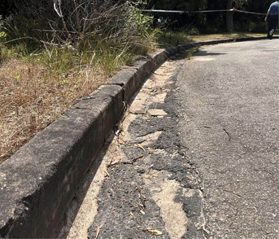
- It also noted that, on 29 October 2022 and 2 November 2022, both of which were sunny days, water was continuously flowing along the kerb drain on View Point Road.211 The point of discharge was located at the end of View Point Road, not far from the subject landslide area.212 CivilTest observed “[t]here were signs of cracks and bitumen patching along the kerb [of] View Point Road” and that “[a] hump was built to divert water from one side of the kerb on View Point Road to the other side”.213 CivilTest concluded that if there was water seeping into the nature strip of View Point Road and the surrounding areas towards the north, this could have contributed to the landslide as “the road drain collects surface runoff from a much larger catchment area, and the continuous flow would have some influence if there was any leaking along the kerb drain”.214
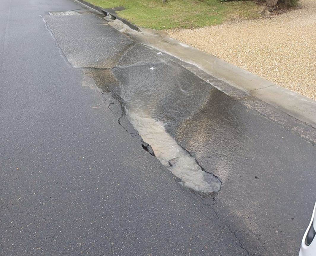
FIGURE 3.19: WATER RUNNING ALONG THE KERB ON VIEW POINT ROAD.215
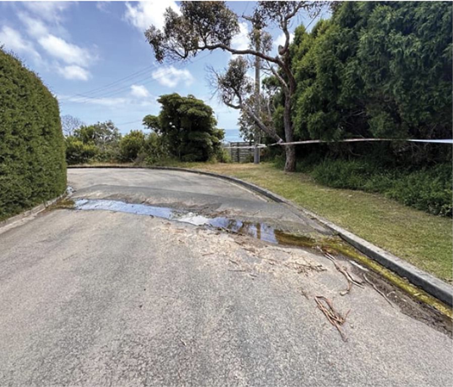
FIGURE 3.20: CRACKS AND PATCHING ALONG THE KERB OF VIEW POINT ROAD.216
- With respect to the displaced irrigation system at 10–12 View Point Road, CivilTest noted that there had been no report of leakage prior to the landslide, and so it was:
highly likely that the Earth FLOW [that preceded the 15 November 2022 landslide] has moved the pipe downslope, breaking any connections to taps, if applicable, and causing the leakage.217
- The report concluded that “a leakage of this type is highly unlikely to trigger a landslide of this magnitude”.218
- CivilTest recommended the following measures be implemented “immediately” to make the area in the vicinity of the landslide site safe:
Clear Penny Lane in the area affected by the landslide to expose undisturbed natural soil, and install an 8m long gabion wall along the northern boundary of the subject property bordering on Penny Lane as illustrated in Figure 9 [reproduced at Figure 3.21 below]. The gabion wall should be up to 2.5m to 3m high (depending on the amount of disturbed soil cleared), with the base keyed a minimum 500mm into the undisturbed natural soil.
The disturbed soil hanging over the middle to lower portion of the slope (highlighted in red in Figure 9) should be removed gradually from top to bottom with a large excavator with a long reach. This should be conducted after the gabion wall has been constructed, as the gabion wall will provide protection if the loose earth further slides down the hill.
After removing the disturbed material upslope of the proposed gabion wall, the batter behind the gabion wall should be backfilled with engineered crushed ROCK FILL (with an internal frictional angle of at least 40 degrees) to not steeper than 25 degrees to the horizontal against the natural slope.
An additional 1.5m high sleeper wall/fence should be considered located 6 to 8 metres away from the gabion wall as illustrated in Figure 9, along the boundary of the property further downslope. This would stop possible residual Earth FLOW hitting the property downslope and reduce the residual risk to LOW. The sleeper wall should be designed as a retaining wall to retain active earth pressure of up to 1.5m of sandy soil.219
FIGURE 3.21: RECOMMENDATIONS FOR MAKING SAFE.220
- CivilTest also stated that the affected “Penny Lane reserve area” should remain closed until it was stabilised, and that the area should be monitored for any signs of movement, including “tension cracks, fallen trees, and water seepage from the uncovered scarp, etc”.221
- With respect to long term stability, CivilTest recommended, amongst other things, that:
7 December 2022 Stantec report
- The Shire obtained a report from Stantec on 7 December 2022.224 Stantec identified the existence of a series of “tension cracks” on the upper slope and “water seeps” on the lower slope of the escarpment.225 It also identified a number of landslide hazards for the site, including the risk of further translational landslides on the upper and lower slope and new debris flow similar to that which occurred on 15 November 2022.226
- Stantec did not make recommendations for make safe works. Rather, it specifically stated that it was “limited to a discussion of the immediate risk to the properties in the vicinity of the landslides”.227 It concluded:
- the risk to life for 3 Penny Lane and 14–16 View Point Road was “Tolerable” and the occupiers of those properties should be allowed access to their properties;
- the risk to life for the Borghesis’ property was “Not Tolerable” but this only applied to the “steep section of the site and the area within 5m of the crest of the slope”. Provided that area was barricaded off and the occupiers of the property did not enter the barricaded area, the risk to life would be reduced to “Tolerable” and its occupants could return; and
- the risk to life for the Willigenburgs’ property and 2 Penny Lane was “Not Tolerable” and barricading off those properties from the landslide site was not considered sufficient to allow the occupiers of those properties to return. It was recommended that the occupants not be allowed to return to their homes until “appropriate rectification works are undertaken”.228
- Notably, Stantec also stated that the properties along the McCrae escarpment on the southern side of Point Nepean Road fell within an area of “known landslide susceptibility” and that it was important for residents to be aware of the risks associated with living in “the vicinity of steep slopes”, including the need for appropriate hillside practices.229 Stantec recommended that the occupiers of the affected properties be provided with a copy of the AGS’s Australian Geoguides for Slope Management and Maintenance (2007e) for further reference.230
- On 7 December 2022, Mr Essing advised Mr Willigenburg that the Shire had received both the Stantec and CivilTest reports. He told Mr Willigenburg that the reports could not be released to the residents at that time because they were being peer reviewed. Mr Essing assured Mr Willigenburg that he would update him as to when the reports could be provided to residents.231
Maw Civil methodology and 16 December 2022 CivilTest report
- Following the landslides, Mr Borghesi engaged Maw Civil Marine Pty Ltd (Maw Civil), a civil construction and earthmoving company, to prepare a work methodology for the safe restoration and stabilisation of the impacted land, as directed by the Emergency Order issued to him on 28 November 2022.
- On 15 December 2022, Mr Borghesi received a work methodology from Maw Civil for “[p]re-Xmas site works”. It proposed the removal of approximately “60+m3 of [slip] material” located at the base of the slip and the construction of a temporary barrier made of “4Tonne granite rocks”.232 Mr Borghesi provided the Maw Civil work methodology to the Shire that same day.233
- On 16 December 2022, following an on-site meeting between CivilTest and Maw Civil to discuss the work methodology, site preparation and make safe measures, Mr Borghesi received a further report from CivilTest in respect of the proposed work methodology.234
- That report summarised the proposed remediation works in the following three stages (3-Stage Plan):
Stage 1 – Site Preparation and Make Safe for the Christmas and New Year Break: Removal of necessary/minor vegetation along Penny Lane to allow construction machinery access; Partial [r]emoval of debris on Penny Lane to allow the installation of a 4 tonne of rock berm within the 10–12 View Point Road property boundary. The rock berm will be installed immediately following any necessary removal of existing debris.
Stage 2 – Gabion Wall Installation in Early 2023, Subject to Planning Approval: Removal of any remaining debris at the toe of the slope. Install an engineered gabion wall; Then remove the disturbed material on the slope surface with a long-reach excavator and re-profile the base section of the slope with engineered fill to a 25-degree slope to the horizontal.
Stage 3 – Installation of Long-Term Stabilisation Measures in Quarter 1 2023, Subject to Planning Approval: Installation of additional engineered retaining structures on the headscarp, restoration of walkway, backfilling any tension cracks, and revegetation.
All of the above-mentioned works should only be conducted under dry conditions and under the supervision of a qualified Geotechnical Engineer.235
- The report also provided a risk analysis for two scenarios:
- if no works were undertaken between 16 December and Christmas 2022, and prolonged wet conditions occurred during the Christmas and New Year period, a further residual earth flow was possible, such that a “Medium” consequence and a “Moderate” risk rating would be applied to the two properties downslope, being the Willigenburgs’ property and 2 Penny Lane;236 and
- if the proposed Stage 1 works were implemented before Christmas, this would reduce the consequence of a further residual earth flow to “Medium to Minor”, however the risk rating would remain “Moderate”.237 CivilTest noted “[t]he AGS guidelines suggest areas with a moderate risk level ‘may be tolerated in certain circumstances…’ but require investigation, planning and implementation of treatment options to reduce the risk to Low”.238
- That same day, on 16 December 2022, Mr Flores informed Mr Borghesi that the 3-Stage Plan would need to form part of a review process, including a review by Stantec and Shire engineers.239 Mr Flores noted that “given the time of year, this will not be able to take place until early in the new year” and that he had “spoken to the affected neighbours” and advised them of the peer review and expected timeframes.240
- This is contrary to evidence given by Mr Willigenburg, who told the Board of Inquiry that, as at 20 December 2022, he had not received copies of any reports, nor any updates from the Shire as to any proposed works or the timing of those works.241 In fact, on 20 December 2022, Mr Willigenburg wrote to Mr Essing seeking an update.242 Mr Essing responded on the same date, stating that “the Shire’s review remains pending in the context of stage 1 works to Penny Lane in the first instance and further feedback to the other two stages proposed”.243
- On 21 December 2022, Mr Wells forwarded to Mr Willigenburg an email that he had received from Mr Essing setting out the 3-Stage Plan.244
- On 22 December 2022, Mr Willigenburg sent a further email to Mr Essing stating, “No plans; no detail; no timings; just some proposals”.245 Mr Essing told Mr Willigenburg the following day that the Shire was doing everything it could to enable residents to return to their properties.246
- Two and a half years on, the works proposed in the 3-Stage Plan have not been undertaken, nor have any other works been undertaken.247 The Willigenburgs are still displaced from their home.
January to June 2023
Communications with the Shire
- By late January 2023, Mr Willigenburg had not received any further communication from the Shire as to whether the 3-Stage Plan had been approved or not, and no works had commenced in the area. On 27 January 2023, Mr Willigenburg sent an email to Mr Essing stating:
10 weeks locked out of our house; whilst we expect the process to take some time at least we could have the plan approved by now.248
- Mr Essing did not respond to that email, nor did Mr Willigenburg receive any other contact from Shire representatives in January 2023.249
- In early to mid-February 2023, Mr Willigenburg noticed a large wet patch forming underneath a platform located around 75% of the way up the escarpment toward 10–12 View Point Road. The remaining area had started to dry out after the landslides, but that particular patch of land remained very wet. He was concerned it was related to the drainage issues other residents had identified in late 2022.250 On 13 February 2023, he sent photographs of the wet patch to Mr Flores by email and told Mr Flores the wet patch had “been there for a while now”.251
FIGURE 3.22: WET PATCH UNDER STAIRCASE ON 10–12 VIEW POINT ROAD.252
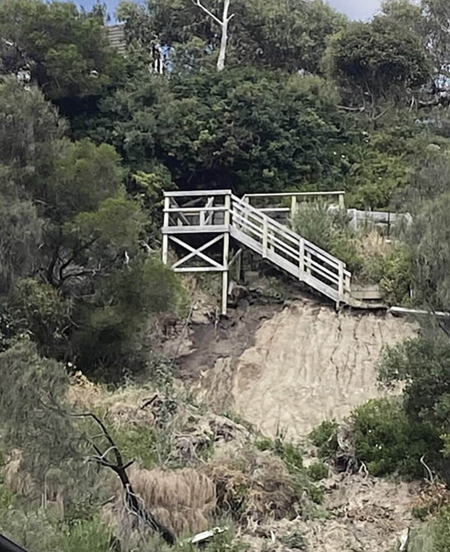
- Mr Flores responded to Mr Willigenburg’s email the following day, stating that he would make enquiries about the wet patch and have the area inspected.253 Mr Borghesi separately gave evidence to the Board of Inquiry that, in the months following the landslides, he attended several on-site meetings with Mr Flores, during which he pointed out to Mr Flores the location of the water emanating from the hillside, specifically the water seepage on either side of the timber staircase.254
- Mr Flores otherwise confirmed in his email to Mr Willigenburg that the peer review of the CivilTest recommendations had been completed and the 3-Stage Plan was considered appropriate.255 Mr Flores confirmed that the next step was for Mr and Mrs Borghesi to commence design documentation, which would also be peer reviewed by the Shire, and that they were “working hard to get the relevant documentation as soon as possible”.256
- Several days later, on 17 February 2023, Mr Wells sent an email to Mr Essing and Mr Flores stating that there was a “considerable” amount of water travelling from View Point Road onto Penny Lane and being collected in the drainage system at the rear of 3 Penny Lane. He noted the water had been running continuously since November 2022, and there were signs it was running underneath the soil in the area where the landslides had occurred. He asked if it would be possible for the Shire to review the drainage system and make any necessary improvements to it.257
- Mr Borghesi similarly told the Board of Inquiry that from the time he purchased his property in May 2014, and particularly in the period between December 2020 and May 2023, he observed a flow of water that appeared to emanate from two properties located at 1 and 5 Prospect Hill Road, directly uphill from his property.258 That flow of water was intercepted and diverted down a stormwater drain on Prospect Hill Road and into a culvert at the top of View Point Road. The culvert was constantly overflowing, causing water to flow down the fractured and cracked kerb on View Point Road.259 Mr Borghesi told the Board of Inquiry that he “never saw it dry” and that the flow of water was such that it caused moss and algae to build up from time to time.260
FIGURE 3.23: MOSS AND ALGAE ON VIEW POINT ROAD.261
3.23
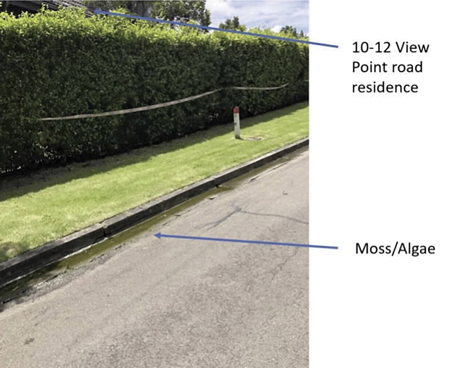
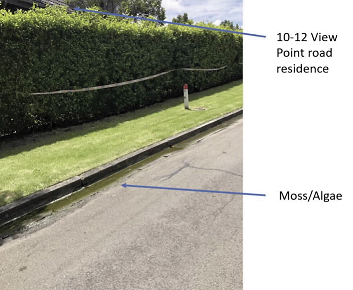
- On 21 February 2023, having not received a response from the Shire to his concerns about water flow, Mr Wells lodged a complaint with the Shire online.262
- That same day, Kendrick Koa, Senior Loss Adjuster at CHU Insurance (CHU), the insurer for the Body Corporate of 611–615 Point Nepean Road, provided the Shire with a report from Logocon.263 Logocon, a structural engineering company, had been engaged by CHU in the aftermath of the landslides to determine the cause of the slope failure and conduct an assessment of the “claimed building distress” for 611–615 Point Nepean Road.264
- Logocon’s report concluded that the slope failure had been caused by a reduction in the shear strength of the sand soils, resulting in slope instability and subsequent failure of a wedge, due to the following factors:
An increase in soil moisture due to an anomalously high volume of rainfall in the day preceding the slope failure.
An increase in soil moisture due to a potential mains water leak at the top of the slope in the days preceding the slope failure.
Removal of vegetation and trees on the failed section of the slope which has reduced the stability of the slope making it more susceptible to failure.265
- Logocon’s report noted, however, that had the slope been “constructed at a safe and compliant angle, failure would not have occurred under the imposed conditions”.266 Logocon therefore concluded that:
preliminary slope stability analysis indicates that the proximate cause of the slope failure is inadequate construction of the slope at an excessively steep angle beyond the safe slope angle making the slope unstable and susceptible to failure.267
- On 1 March 2023, Mr Wells received an email from Brandon Treblico, Civil Engineer - Drainage at the Shire, stating that “drainage works, including installation of new pits and pipes and renewal of the kerb” would commence very shortly and that “[t]he landslip issue is definitely a complicated one but the drainage works should definitely help resolve some of the overland flow issues off the infrastructure”.268 Mr Wells forwarded the email to Mr Willigenburg stating “I have a sense from reading below that [the Shire] feel it has certainly contributed to the slide and hence the immediate response”.269
Purchase of 3 Penny Lane by Kellie and Nick Moran
- It was around this same time that 3 Penny Lane went on the market.
- The history of 3 Penny Lane can be shortly stated. From 1978 to the mid-1990s, the house that stood on that land was occupied by the Radcliffe family. Whilst living there, the Radcliffes observed, towards the lower left room of the house, “a stream [of water] running down the hill underneath the extension which ran between the stumps and drained into a pond on the flat”.270 The water course was damp with a green slime.271 Decades later, consistent with the Radcliffes’ and Mr Wells’ observations, signs of water erosion were seen beneath the house at 3 Penny Lane in the days following the 5 January 2025 landslide (as explained later in the Report).
- On 3 March 2023, Kellie and Nick Moran attended an inspection of 3 Penny Lane.272 During the inspection, when Mr and Mrs Moran stepped out onto the balcony of the second floor of the property, Mrs Moran noticed temporary fencing opposite the driveway to the garage.
- Mrs Moran asked the real estate agent, who was showing them through the property, why there was temporary fencing near the garage. The agent told Mrs Moran that one of the neighbours was conducting works on the property. Mrs Moran had some concerns.273
- While Mr and Mrs Moran travelled back to Melbourne, Mrs Moran entered “Penny Lane, McCrae” into Google and found several articles that referred to the 15 November 2022 landslide. Mrs Moran’s understanding of these articles was that there had been a period of significant rain which had caused a landslide. Mrs Moran relayed this information to Mr Moran, who told her he would contact the real estate agency to find out more.274
- Shortly after, Mr Moran contacted the agency seeking information about whether 3 Penny Lane had been impacted by the landslide. He was told that they would speak to the vendor, Mr Wells, to find out what impact (if any) it had had on the property. Mr Moran said that he and Mrs Moran would not purchase the property unless they received information that gave them confidence that any issues with the property had been rectified.275
- On 5 March 2023, Mr Moran received an email from an agent forwarding an email from Mr Wells. Mr Wells’ details and the date and time of the email were not included in the copy provided to Mr Moran.276 The email stated that:
- the landslide in 2022 had occurred at 10–12 View Point Road, following heavy rainfall;
- investigations indicated that it had most likely been caused by a combination of problems with the Shire’s drainage on View Point Road and a burst water pipe on the property at 10–12 View Point Road; and
- the burst water pipe had been repaired, and Mr Wells’ understanding was that the Shire was to commence works on the drainage system shortly.277
- Mr Wells stated in his email:
We have been advised that plans for the repair of the slip and reinstatement of the laneway have been approved and will commence shortly.
There has been no impact on our property and we haven’t been affected in any way.
Overall, it seems like it was an unfortunate one-off and [it] is not expected to happen again.278
- Mr Wells had also forwarded to the agent a copy of the email he had received from Mr Treblico on 1 March 2023 about the planned drainage works.279
- The Morans then decided to move forward with the purchase of 3 Penny Lane in May 2023.280
10–12 View Point Road remediation works
- On 28 March 2023, following correspondence between Mr Borghesi and the Shire regarding the ongoing appropriateness of the Emergency Order issued on 28 November 2022,281 the Shire issued Mr Borghesi with a Building Order for Minor Works pursuant to s 113 of the Building Act.282 The Shire informed Mr Borghesi that the Building Order was to replace the Emergency Order.283
- The Building Order directed them to “[e]ngage a suitably qualified and insured professional to construct suitable retaining walls or other site stabilisation walls in accordance with an approved design and work methodology and remove the landslip debris from Penny Lane McCrae” by 27 May 2023.284 It also directed them, prior to undertaking any work, to submit documentation to the Shire for peer review and approval including design documentation.285
- On 28 April 2023, Mr Borghesi provided the Shire with a land stability assessment conducted by CivilTest.286 Mr Borghesi had engaged CivilTest to assess the proposed installation of a retaining wall to remediate the landslide site and to “address the potential for further land instability on the site and to determine the depth and specification required for the retention system to protect the site”.287
- CivilTest concluded that “sleeper retaining walls with deep foundations” were a suitable remediation option.288 It noted that a gabion wall could be used at the toe of the slope and recommended that “deep piling [be] used there for long-term permanent stability”.289 It did note, however, that the remediation of the local slope failure would “not help stabilise the surrounding areas”.290
- CivilTest recommended that:
an inclinometer could be installed to confirm if there is any movement that will have an impact at the top of the slope. The inclinometer would be monitored every six months for a minimum period of three years.291
- Melissa Burrage, Manager - Climate Change and Sustainability at the Shire, was seemingly unaware of this recommendation in CivilTest’s report. She gave evidence to the Board of Inquiry that the Shire was not provided with any expert opinion that either the Shire or individual property owners should install inclinometers in the vicinity of the November 2022 landslides.292
- In his covering email to the Shire, Mr Borghesi noted that soil borings undertaken by CivilTest had “identified a pre-existing risk with regard to slope stability due to the underlying Aeolian sand beneath the more stable Colluvium sand”.293 Mr Borghesi queried why properties below his property were granted permits “when the hillside stability risk already existed, and was not identified by the building permitting due diligence?” (error in original).294
- Mr Borghesi also sought “guidance from Council regarding what is necessary to stabli[s]e the hillside to an acceptable level” in circumstances where the required Factor of Safety rating yields “an extremely complex and expensive solution”.295
- On 9 May 2023, Mr Flores responded to Mr Borghesi confirming the Shire had held a meeting on 5 May 2023, with officers from the Shire’s Planning, Infrastructure and Engineering sections in attendance.296 Mr Flores confirmed that “a Factor of Safety of at least 1.5 is [C]ouncil’s standard practice, and what is required to be achieved in this situation”.297
Stormwater drainage works on View Point Road
- By May 2023, the drainage works foreshadowed in the email from Mr Treblico to Mr Wells on 1 March 2023 had commenced. Mr Borghesi gave evidence to the Board of Inquiry that the works took about 14 weeks and included the installation of an underground stormwater drain about 300 millimetres in diameter, along with new kerbs in View Point Road.298
FIGURE 3.24: SHIRE’S STORM WATER UPGRADE ON VIEW POINT ROAD.299
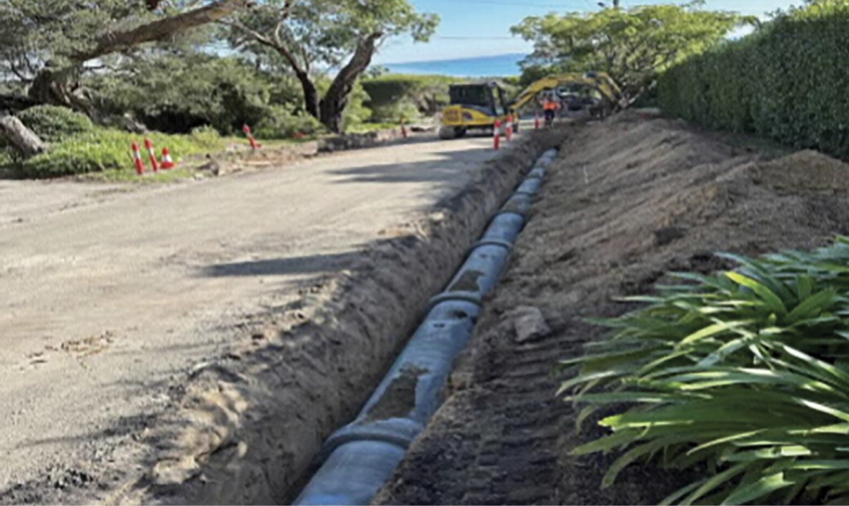
- Mr Borghesi told the Board of Inquiry that, during the excavation process for the installation of the stormwater drain, a void was discovered directly above the location of the November 2022 landslides.300
FIGURE 3.25: VOID LOCATED DURING THE SHIRE’S STORMWATER UPGRADE ON VIEW POINT ROAD.301
3.25

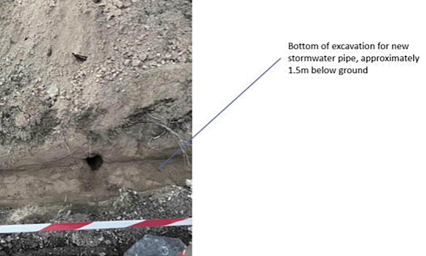
- On 11 May 2023, Mr Borghesi emailed Mr Flores alerting the Shire to the existence of the void.302 Mr Borghesi expressed and sought the Shire’s response to the following:
It is now clear the cracked kerb and channel coupled with the continuous flow of water has been a key contributor to the landslip of November 2022.
As I pay rates for drainage, I believe the lack of maintenance and response to the issue of continuous water running down View Point [Road] over cracked kerb and channel changes the liability for hillside restitution to the Council.303
- Mr Borghesi told the Board of Inquiry that once the drainage works were completed, the continuous flow of water down the northern kerb of View Point Road appeared to stop, with water successfully captured and diverted into the new stormwater drain. As a result, the area of the escarpment where the landslides had occurred began to dry out progressively.304
June to December 2023
- Between June and August 2023, Mr Borghesi continued to correspond with the Shire about the expert reports, including about a further land stability assessment by CivilTest obtained in June 2023.305 The June report largely mirrored CivilTest’s earlier report save for the inclusion of an updated analysis regarding the slope stabilisation system, including specifications for the piles required to support the proposed retaining walls.306 The June report reiterated that Mr Borghesi had “nominated the proposed remediation area” and that “the slopes outside this area would remain susceptible to slide in the future and this may undermine the anchors and piles installed on the subject site”.307
- Mr Borghesi also provided the Shire with structural drawings prepared by Rexicon Consulting Engineers (Rexicon) outlining the proposed land stability design for his property and 14–16 View Point Road.308
- During this same period, Mr Willigenburg instructed solicitors, McGuinness Legal, to send correspondence to the Shire requesting, amongst other things, copies of the geotechnical reports the Shire had obtained in respect of the affected area. The letters noted that as impacted parties, it was appropriate for the Willigenburgs to have access to the information they were seeking.309 Letters were also sent to Mr and Mrs Borghesi and their insurer seeking copies of the geotechnical reports they had obtained.310
- Around the same time, the Willigenburgs also decided to engage a geotechnical engineering firm, A.S.James Pty Ltd (AS James), to prepare a report on the impact of the landslide on their property and works that would be required to make the area safe enough for them to move back home.311
- The Shire refused to provide the information sought and suggested that the Willigenburgs seek the information via freedom of information processes.312
- Nine months after the landslides, on 21 August 2023, following the peer review of CivilTest’s June report by Stantec,313 and an updated land stability assessment by CivilTest addressing the substance of the peer review,314 the Shire finally confirmed with Mr Borghesi that he could proceed with finalising the retaining wall design.315 On 24 August 2023, the Shire’s Legal team also sent an email to the Willigenburgs’ solicitors, stating:
To provide you [with] an update, the rectification works, which will ensure the safety of all impacted parties, are expected to commence in middle to late September.316
- Those works did not commence in September 2023.
- In respect of that period, Mr Willigenburg had the following exchange with Counsel Assisting the Board of Inquiry:
Q. So at that point had you been provided any expert analysis or expert report by either the council or any other party?
A. No.
Q. And I assume you were quite fed up with the state of affairs?
A. Yes. Yes, you could say that.
Q. So what is it that you decided to do?
A. Through McGuinness Legal they had a view that what we probably should do was to challenge the validity of the emergency order that had been raised in November and to seek the services of a lawyer who would specialise in the Building Act, and that’s basically what we decided to do.317
- On 7 September 2023, after having received no further correspondence from the Shire in response to requests for information, McGuinness Legal sent a letter to the Shire stating that the Willigenburgs were moving back into their home.318
- Mr and Mrs Willigenburg then returned to their home on 17 October 2023. Mr Willigenburg told the Board of Inquiry it was only then that they “finally got some traction”.319 That is, the Shire agreed to attend a meeting with them.320 Counsel Assisting asked Mr Willigenburg:
Q. So about a year after, a bit under a year after the landslide you had your first face-to- face meeting with the council; is that right?
A. That’s right.321
- On 13 September 2023, Mr Borghesi sent an email to the Shire confirming that all documentation for the proposed remediation works had been completed, including independent certification of the design.322 Mr Borghesi reiterated that he considered the Shire were responsible for the landslides “due to the inadequate maintenance of the View Point Road drainage and the cracked kerb”, and requested the Shire accept responsibility for the proposed remediation works.323 Mr Borghesi noted in his email:
I have invested 8 months of my time, and substantial expense, as a qualified civil/structural engineer, to find the lowest cost, feasible solution to the restitution that meets Council’s requirements … The project cost is at ~$1.1m as quoted by Maw Civil. Notably, the earlier solutions proposed would have cost upwards of $3m.324
- On 18 October 2023, Mr Borghesi sent an email to Maw Civil seeking a quote for the construction of a “[v]eggie patch retaining wall”, including the cost of bored piers, steel columns and concrete sleepers required for the job.325 Mr Borghesi noted that he was hosting a wedding at his house in March 2024 and “[i]f Council has not accepted responsibility soon, we’d like to get that job done, on our nickel, pretty soon!”.326
- On 1 November 2023, Mr Willigenburg attended a meeting with representatives from the Shire including Mr Flores, Mathew Hopwood-Glover (Glover), who had taken over from Mr Flores as the Shire’s MBS, and various legal representatives. The Shire’s representatives raised concerns about the Willigenburgs re-occupying their home and told Mr Willigenburg they were continuing to work to develop a plan for the affected area.327
- Mr Willigenburg left the meeting with the understanding that the Shire was still working towards implementing the 3-Stage Plan.328 He told the Board of Inquiry:
The period between 5 May 2023 and November 2023 caused me a considerable amount of stress, worry and frustration. However, by December 2023, I was residing in my [p]roperty again and I was feeling more optimistic that rectification works were still going to be undertaken to ensure the safety of the area, and would be commenced as soon as possible.329
- On 3 November 2023, Harwood Andrews, the Shire’s legal representatives, received a report from Dane Pope of PSM, Geotechnical & Engineering Services (PSM), providing a risk assessment for 10–12 View Point Road. The report concluded that there continued to be an “unacceptable” risk to life for the Willigenburgs at 3/613 Point Nepean Road and 2 Penny Lane and to pedestrians on and below the escarpment slope on 10–12 View Point Road and the Willigenburgs’ property.330
- On 15 December 2023, Mr Borghesi provided Maw Civil with a design for the vegetable patch retaining wall.331 Mr Borghesi noted in his email to Maw Civil that:
We will have (yet another) set of reports from underground radar scans and new Geotechnical inspections which clearly implicate Council’s responsibility for saturating the hillside. If Council concedes quickly, we expect they will approve the major works you have already quoted on, and we would like to have all of the work executed under one contract.332
- On 21 December 2023, Mr Borghesi received a further technical report from CivilTest.333
- This latest report, amongst other things, confirmed that CivilTest had engaged Safety Scan Pty Ltd to conduct a ground penetrating radar (GPR) scan of the landslide site to check for the existence of voids. This occurred on 12 December 2023, and the report provided the following summary of the scan results:
Scanning was conducted along the road surface, nature strip and front of [the] property. GPR scan results indicated the presence of potential voids within the nature strip area. The location of the indicated voids commenced behind the kerb between trees. Due to the number of services located within the nature strip disturbing natural soil layers, a probe was utilised to physically confirm the GPR findings. The probe confirmed a void was present. When removed the probe was dry and the bottom of the void was solid. The void was approximately 550mm below ground surface and 450mm deep (1.0m below ground surface). The identified void travels from the kerb line to the sewer line on the property line along View Point Road. The sewer pipe has an invert level of 1.37m entering the sewer pit, the downstream pipe exits the pit at 3.01m invert. The full extent of the void network was unable to be mapped. It is typical of water to follow the easiest route downhill. Any further voids toward the North West would be expected at a depth exceeding the 1.5m effective range of the GPR equipment within the soil conditions.334
- The report concluded that:
The obvious shift in moisture conditions at the headscarp, both prior to (characterised by continuous seepage and abnormal wetness) and after (resulting in a drier headscarp) the road drainage improvement works strongly suggests the presence of a subsurface water pathway. This subsurface water pathway originates near the hump that has since been removed, where surface flow patterns change, and this is also near where voids were discovered during the drainage improvement works, and confirmed through subsequent GRP scanning. This pathway directs water toward the current headscarp area.
The heavy rainfall event in November 2022, particularly on the day preceding the landslide, resulted in a substantial buildup of surface runoff throughout the general View Point Road and Arthurs Seat catchment area. It is concluded that the landslide was triggered by the accumulation of subsurface water pressure, which had built up due to the presence of a cracked road kerb and the flow of water into the voids, all directed towards the affected (landslide) area downslope.335
2024
Reinforcement wall at 10–12 View Point Road
- Mr Borghesi gave evidence to the Board of Inquiry that in January 2024, he arranged for the installation of a “geotechnical and structurally engineered wall” at his property, located at the top of the headscarp, 30 centimetres in front of the existing retaining wall and almost directly upslope of 3 Penny Lane.336 He said that the purpose of the reinforcement wall was to strengthen the old retaining wall that had shown signs of settlement.337 Mr Borghesi decided to expedite the construction of the reinforcement wall due to the wedding taking place at his home in March 2024.338
- The construction of the reinforcement wall was undertaken by Maw Civil in January 2024.339
FIGURE 3.26: CONSTRUCTION OF THE REINFORCEMENT WALL AT 10–12 VIEW POINT ROAD.340
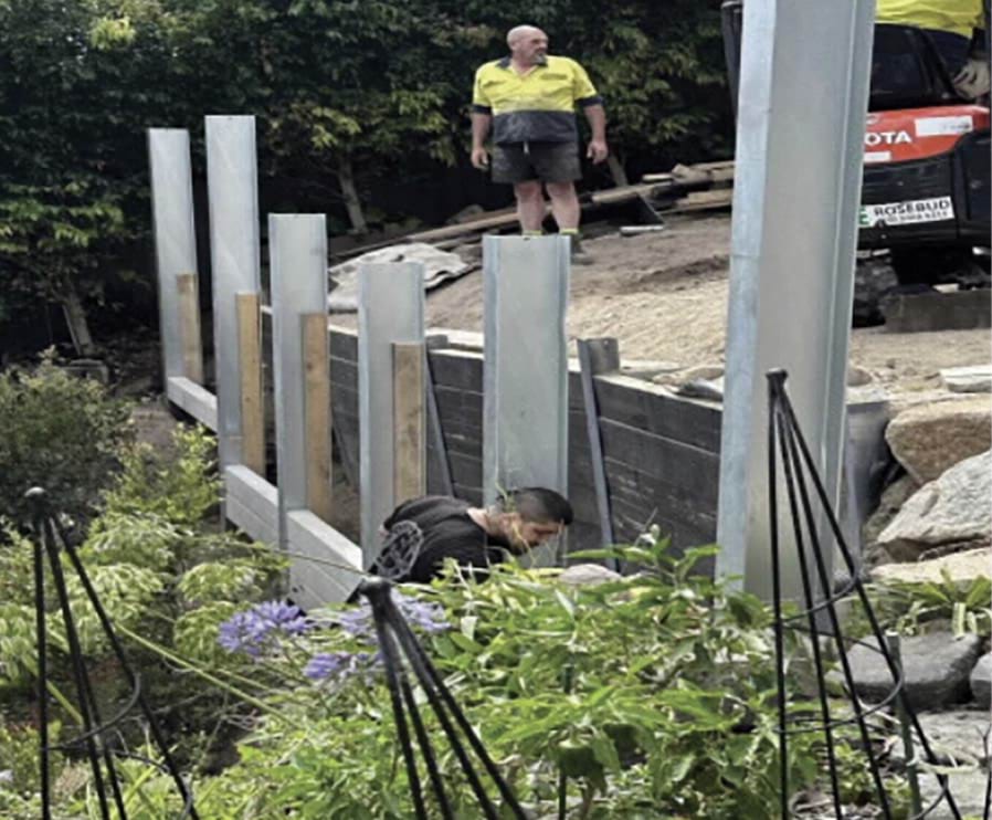
FIGURE 3.27: COMPLETED REINFORCEMENT WALL AT 10–12 VIEW POINT ROAD.341
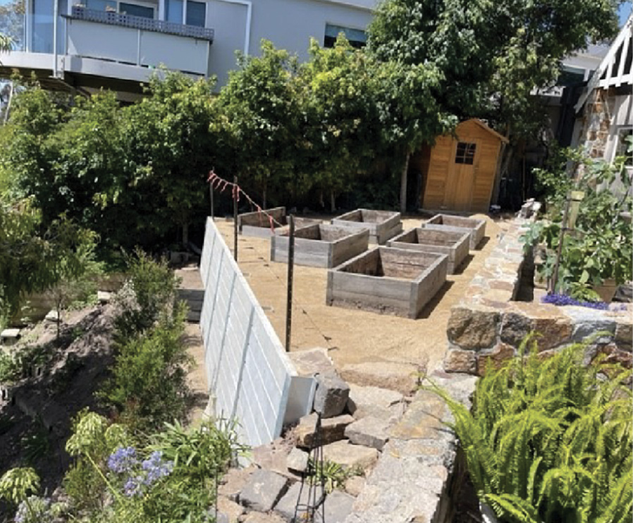
- Mr Borghesi described the reinforcement wall as being just under two metres at its highest point if measured from the base to the top.342 He did not seek a building permit to construct the reinforcement wall.343 Consequently, the Shire was not made aware of its proposed construction.344
Further Emergency and Building Orders issued to the Willigenburgs and Borghesis
- On 30 January 2024, the Borghesis’ solicitors, Rotman & Morris Solicitors, provided a copy of CivilTest’s December report to the Shire’s solicitors.345 Rotman & Morris emphasised the report’s conclusions regarding the “inadequate management of the drainage on View Point Road” and the “presence of a cracked road kerb and the flow of water into the voids” as causal factors of the landslides, which by this stage had occurred more than 12 months earlier.346 The letter also stated that, by reason of s 16 of the Water Act 1989 (Vic) (Water Act), the Shire was strictly liable to compensate the Borghesis for the loss and damage suffered as a result.347
- The letter sought, amongst other things, compensation from the Shire for the approximate cost of the 3-Stage Plan, being in the amount of $1.25 million.348
- The Borghesis did not receive a response to that letter.
- On 1 February 2024, Mr Flores, having returned to his role as Senior Building Surveyor at the Shire, gave Mr Willigenburg a letter requesting an inspection of his property.349 The letter stated:
As your property has been impacted by the landslip, I am following up on the Council issued Emergency Order EO-147/22 that directed you to cease occupation of the dwelling.
Council undertook a recent site visit of the property which has raised concerns that the dwelling is being occupied in contravention of Emergency Order EO-147/22.350
- Mr Willigenburg was not aware of any site visit having taken place at his property.351
- In any case, Mr Willigenburg consented to Mr Flores inspecting the property, and an inspection took place on 6 February 2024.352 Following the inspection, Mr Flores issued Mr Willigenburg with a further Emergency Order pursuant to s 102 of the Building Act, requiring the Willigenburgs to vacate the property on the basis of “immediate safety concerns”.353
- Between 6 February and 12 March 2024, the Shire issued a further six Emergency Orders (pursuant to s 102 of the Building Act) to the Willigenburgs.354 As a result, the Willigenburgs left their home again and moved back into the rental property at 607–609 Point Nepean Road on 23 February 2024.355
- On 7 February 2024, Mr Flores issued a Building Notice pursuant to s 106 of the Building Act to the Borghesis.356 The notice required them to show cause as to why they should not be required to carry out “stabilisation work to the landslide affected land in accordance with the geotechnical recommendations and structurally engineered design after obtaining the relevant building and planning permit approvals”.357
- On 12 March 2024, the Borghesis’ solicitors responded to Mr Flores stating that the Building Notice was invalid on jurisdictional grounds.358 They stated that, even if the Building Notice was valid, it was “inequitable” for the Shire to require them to undertake the work at their own cost in circumstances where legal responsibility for the landslides lay with the Shire.359
- On 14 March 2024, Mr Flores issued a Building Order pursuant to s 111 of the Building Act, prohibiting occupation of the Willigenburgs’ property at 3/613 Point Nepean Road until such time as 10–12 View Point Road had been made safe to the satisfaction of the MBS.360
- On 4 April 2024, Mr Flores issued a Building Order pursuant to s 111 of the Building Act to the Borghesis.361 The Building Order largely mirrored the earlier Building Notice and required the Borghesis to undertake stabilisation works to the landslide affected land in accordance with geotechnical recommendations and a structurally engineered design.362
- The next day, on 5 April 2024, the Shire informed the Borghesis’ solicitors that the MBS did not intend to withdraw the Building Notice or the Emergency Order issued on 18 November 2022.363
Building Appeals Board proceedings
- In April 2024, the Willigenburgs commenced proceedings in the Building Appeals Board to appeal the Building Order served on them.364
- By that time, the Willigenburgs had obtained a report from AS James which recommended, amongst other things, that a debris flow barrier be installed at the base of the escarpment or as a substitute to the rear fence of their property and other properties on Point Nepean Road.365 The debris flow barrier was intended to temporarily ensure that their property would be safe enough for occupation, while the 3-Stage Plan was implemented.366
- The Willigenburgs sought an order that the Shire and/or the Borghesis cover the costs associated with the work in erecting the debris flow barrier.367
- In May 2024, the Borghesis also commenced proceedings in the Building Appeals Board to challenge, amongst other things, the validity of the Building Order served on them and the Shire’s decision to refuse to cancel the Emergency Order.368
- Mr Borghesi gave evidence to the Board of Inquiry that the AS James debris flow barrier proposal was later dismissed as it would have required cables to be installed across Penny Lane, thereby restricting access to Penny Lane.369
Victorian Civil and Administrative Tribunal proceedings
- The Borghesis also issued proceedings against the Shire in the Victorian Civil and Administrative Tribunal (VCAT) with respect to losses sustained by them as a result of the November 2022 landslides.370
- In June 2024, in the context of the VCAT proceedings, the Shire received a further report from Mr Pope of PSM providing his opinion as to the causes of the landslides.371 The report had been commissioned about six months earlier in November 2023.
- The report concluded that:
- it was most likely that the initial landslide on 14 November 2022 occurred primarily as a result of “natural geomorphological processes in combination with the [r]ain [e]vent”;372 and
- the subsequent landslide on 15 November 2022 was a conditional event dependent on the initial landslide occurring. The initial landslide “damaged the irrigation system which has then contributed a large amount of water into the landslide area. This additional inflow in combination with [the] natural geomorphological processes and the [r]ain [e]vent has created the conditions necessary for the subsequent landslide ... to occur”.373
- Mr Flores gave evidence to the Board of Inquiry that the Shire specifically sought Mr Pope’s opinion as to whether voids in and under the kerb in View Point Road could have been a potential cause of the landslides.374 Mr Flores confirmed that, while he did not recall considering the report at the relevant time, Mr Pope had concluded that the contribution of damaged infrastructure to the landslides was “minor to negligible”.375 The report found that the landslides would have occurred regardless of the water flow on View Point Road.376
Mornington Peninsula Planning Scheme Review No. 5
- The Shire gave evidence to the Board of Inquiry that, in line with its obligations under the Planning and Environment Act and following its review of the Mornington Peninsula Planning Scheme in November 2018, it conducted a further review of the Mornington Peninsula Planning Scheme in 2023. That review was adopted by the Shire on 30 April 2024.377
- The review noted that outstanding items from the earlier review in 2018 included Recommendation 211, being the completion of a comprehensive review and update of the Shire’s landslip susceptibility data and modelling to inform and update the ordinance and mapping of the EMOs.378 At the time of the review, this work was “yet to be funded, resourced and programmed”.379 The review recommended that the Shire complete this work and assigned it a “Medium” priority.380
- More than 12 months have now passed, and the work has not been completed.
3.5 Lead up to the January 2025 landslides: November – December 2024
- In the months leading up to the 5 January 2025 landslide, residents observed unexplained water throughout the McCrae area.
- The water was on the streets uphill of Penny Lane – particularly, Waller Place, Charlesworth Street, and Coburn Avenue. The water roared in the stormwater drainage system. It bubbled up through the roads. It pushed up and cracked the bitumen. It created potholes. It flowed down the streets. It saturated and seeped from the nature strips.
FIGURE 3.28: MAP OF MCCRAE AREA HIGHLIGHTED TO SHOW VARIOUS LOCATIONS OF WATER ISSUES.381
FIGURE 3.28

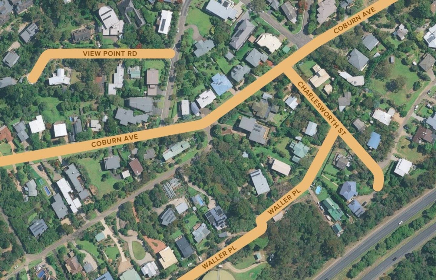
- From at least November 2024, residents of McCrae raised their concerns about the water to both the Shire and SEW. The complaints were numerous. The residents knew something was wrong, especially given the lack of rainfall in that period.
- As the chronology of complaints below illustrates, throughout November to the end of December 2024, the water was thought to be related to potential issues with stormwater drainage, road drainage or SEW’s water mains. The water issues were treated with varying degrees of priority by the Shire and SEW.
- During that period, no one knew the source of the water – not the residents, the Shire nor SEW. An answer to the problem eluded them for several weeks.
- A potential explanation for the water – a burst water main near the intersection of Bayview Road and Outlook Road – was discovered just before New Year’s Eve.
Escalation of complaints in the lead up to the 5 January 2025 landslide
Early to mid-November 2024, eight weeks before the landslide
- On multiple occasions throughout November 2024, a McCrae Resident who had recently moved into a property in McCrae heard “torrents of water rushing through the under[-]road drains on Coburn Ave[nue]”. She told the Board of Inquiry that the sound of rushing water persisted for around two weeks, and that she was “shocked [by] the amount of water (so loud [that] I could hear it through my ear buds)”.382
- At around the same time, Brett Cooper, the owner of 5 Waller Place, also began to notice issues with the road surface at the intersection of Charlesworth Street and Waller Place. He told the Board of Inquiry that he ordinarily drives through that intersection several times per day, and that, in early November 2024, he saw the road begin to rise and swell. Cracks started to appear in the road surface and water was leaking from them. As each day passed, the cracks grew wider and the volume of water leaking from them increased.383
Late November 2024, six weeks before the landslide
- On 24 November 2024, Philip Johnson reported to SEW via their Snap, Send and Solve application that water was surfacing in the middle of the road outside 3 Charlesworth Street. Worryingly, the impacted area had become “progressively larger” despite the fact that “it had been quite dry”.384 This is a photograph he took of the issue:
FIGURE 3.29: WATER SURFACING OUTSIDE 3 CHARLESWORTH STREET.385
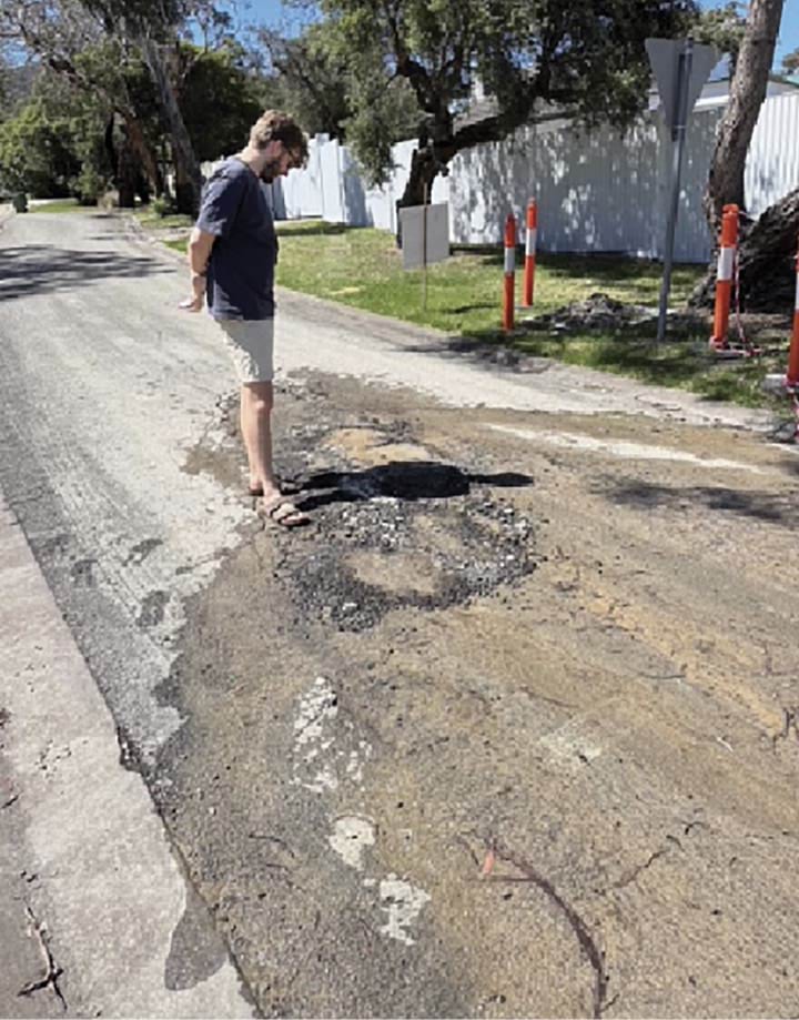
- SEW responded to Mr Johnson’s report on the same day, requesting further information on the basis that SEW had no assets in that location. Mr Johnson did not respond, but other residents subsequently contacted both SEW and the Shire to provide additional information.386
- On 28 November 2024, at around 2.46pm, a resident called SEW to report a water leak in the vicinity of 1 Charlesworth Street, near the intersection of Charlesworth Street and Waller Place. They reported that the water was flowing into the gutter at a rate of “approx [a] hose on half”.387
- Just over an hour later, the Shire was informed of the same issue. At around 4.06pm, the Shire submitted a road maintenance request to Fulton Hogan, a construction company contracted by the Shire, concerning the road surface outside of 3 Charlesworth Street, recording:
Customer reporting a sinkhole has appeared on the road in front of her house approx a dinner plate in diameter, reports it is leaking with water, please attend ASAP.388
- The request was given an urgent priority rating.389
- Fulton Hogan attended the site and erected traffic hazard signs and cones around the affected area, while waiting for representatives of SEW to arrive.390
- By 6.41pm, Service Stream personnel (on behalf of SEW) arrived on-site and found water seeping from the middle of the road outside of 3 Charlesworth Street. They recorded:
The road is very spongy. The council have filled in a small pothole. I tested the water a few times & got [electrical conductivity] readings of over 1350 which is well out of mains range. I sounded nearby service’s & picked up no sounds & the water main is in the n/strip. Looks to be a drainage issue from the very heavy downpour from last night. I told the council blokes of my findings & they have put bollards around the area & they are going to get a crew to come back in the morning.391 (errors in original)
- On 29 November 2024, SEW characterised the Charlesworth Street pothole that was inspected the day before as a “non-urgent fault” and assigned it a priority rating of 5. This rating meant that it had to be addressed within 24 hours.392
- At some point during that day, Fulton Hogan returned to repair the pothole with hot mix, emulsion and dust.393 The repair was short lived.
Early December 2024, five weeks before the landslide
- On 1 December 2024, at around midday, a resident called SEW to report water bubbling up through the road at the intersection of Charlesworth Street and Waller Place. A few hours later, by 3.58pm, Service Stream personnel arrived on-site and noted that this was the same issue raised days earlier. They noted that the Shire had “patched the road from where the water was seeping out”. They tested the water, observed that the electrical conductivity reading was “over 3700” and concluded that this was “a council issue”.394
- On 2 December 2024, SEW again allocated a priority rating of 5 to this issue.395
- On 4 December 2024, a Shire representative contacted SEW to report a “sinkhole” in the same location as was reported on 1 December 2024. The SEW representative advised the Shire of SEW’s previous findings and referred the issue back to the Shire’s Roads Corridor and Drainage team.396
Early to mid-December 2024, three to four weeks before the landslide
- In early to mid-December 2024, Mr Willigenburg observed the spoon drains on Penny Lane filling with water, and that the ground on either side of the drains was saturated and spongy.397 He described the sound of the water moving through those drains as ranging between a “whooshing sound” and a “low trickling” sound.398
- Water continued to emerge elsewhere within a 50 to 100 metre radius of the Charlesworth Street and Waller Place intersection. In the 10 days following 11 December 2024, Mr Cooper observed water leaking from the nature strip in front of 34 Coburn Avenue. The nature strip was so saturated that he thought someone had left a hose running.399 Similarly, he saw water leaking from the nature strip in front of 1 Waller Place. The nature strip was so saturated that a vehicle became bogged there in the lead up to Christmas. So significant was the water flow that it travelled across the road into a stormwater drain in front of 4 Waller Place.400
- In the same period, Mr Cooper heard a significant amount of water gushing through a large stormwater pipe that runs alongside his property on Waller Place. He described the flow of water as “unusually loud and uncharacteristic for that time period”. He told the Board of Inquiry he had never heard water flow through the stormwater pipe to that extent, when there had been no rain.401
- In the meantime, on 14 December 2024, a customer reported to the Shire that the leaks outside 3 Charlesworth Street had not abated. The customer said that while there was some evidence of work being done, sludgy water was still “oozing out of [the] roadway … [and] getting worse by the day”. The customer implored the Shire to act.402 The Shire categorised the request as a stormwater drainage concern and gave it an urgent priority rating.403
- Two days later, on 16 December 2024, the Shire noted that the “[r]elevant department” had inspected the site and deemed that all Shire assets were operating as intended, and that the issue could be related to a damaged SEW asset.404 It is unclear from the records which Shire department conducted the inspection.
- That same day, at around 1.45pm, SEW received a complaint that water was leaking out of the nature strip and trickling into the gutter near 4 Waller Place.405 Five minutes later, SEW received a report that water was leaking at 34 Coburn Avenue.406
- At 5.45pm, Mr Willigenburg reported to the Shire that the spoon drains at the end of Penny Lane were once again full even though there had been little rain. The report was categorised as a stormwater drainage concern and prioritised as urgent.407
- On 17 December 2024, a resident of 4 Waller Place reported to SEW that there was water bubbling up from the ground around 1 Charlesworth Street. SEW advised the resident that its representatives had already attended the site earlier that day. Acoustic leak detection and an electrical conductivity test of the water indicated that there was no leak from the nearby water main. SEW arranged for Service Stream to attend the site again to assess whether any further action was required.408
- On the same day, a resident sent a follow-up request to the Shire about the continuing water issues at the corner of Charlesworth Street and Waller Place. The resident explained the “road is still lifting and now water is rising and sitting just outside ... 3 Waller Place”. The issue was categorised as having medium priority.409
- The Shire’s Customer Service team contacted the Roads Corridor and Drainage team seeking an update on the request as it was “bouncing from SE[W] [to] us”.410 On an unknown date, the Shire contacted the customer providing an update regarding “proposed works” on Coburn Avenue.411 Additional details concerning those works are not set out in the Shire’s records.
- Three days later, on 20 December 2024, a resident reported to the Shire that were was “a large amount of groundwater streaming out of the road” at 1 Charlesworth Street. The resident stated that SEW had attended the site and confirmed that the water was not from a burst water main. They thought the issue was a danger to residents and the public as the ground could be unstable. The Shire categorised the report as a stormwater drainage concern and marked it as urgent.412
- A resident called SEW again about the leak outside 3 Charlesworth Street, which had been previously reported on 1 and 4 December 2024. SEW responded as follows:
Advised customer of all the notes from previous jobs and she insists that we need to go out. Saw the notes on Task 2 about Drainage department handling this. So, called the council and spoke with Steff. Steff passed me onto Jenna (Infrastructure Dep at council) and Jenna advised spoke to supervisor at SEW at 9.13am this morning (did not get his name) and was told we have been out here several times. Jenna advised Fulton and Hogan were out there this morning and said too much water to be stormwater. SEW Supervisor told her that we will go out on-site today to meet with drainage supervisor from the council.413
- Later that afternoon, the same resident contacted SEW to report that the hole on Charlesworth Street was getting worse. The resident wanted an update on what steps were being taken to address the issue.414
- The Shire’s Roads Corridor and Drainage team attended the site that day and placed bollards and tape up around the area where water was “streaming out of the road”.415 Fulton Hogan also noted that a “make safe for [the] pothole with water ingress [had been] installed”.416
- The Shire otherwise recorded that there were no Shire assets in the location and that SEW had been contacted to re-inspect its pipes.417
Mid to late December 2024, two weeks before the landslide
- On 21 December 2024, Fulton Hogan contacted SEW to report that the volume of pressurised water flowing near Charlesworth Street was leading them to believe that it was not stormwater. They had inspected all the stormwater assets in the area on the Shire’s behalf and found no faults. They also noted that the condition of the road was “getting bad”, so bad that a road closure might soon be necessary.418
- Later in the day, Service Stream personnel attended the site and saw water emerging from two locations. First, from the middle of the road opposite 3 Charlesworth Street. Second, from the nature strip in front of 1 Waller Place and travelling across the road to 4 Waller Place. The water was dirty.419
- Service Stream tested the water in both locations, and the results indicated that the water was “well above mains range”, with electrical conductivity readings between 440 and 540.420
- Water was also observed “pouring in a deep grated drain in the gutter” at 4 Waller Place, appearing to originate from the other side of the Mornington Peninsula Freeway. This prompted the Service Stream personnel to cross the freeway to conduct acoustic leak detection on valves and services along The Boulevard and Bayview Road. No signs of leakage were detected. They concluded that the running water may have been the result of a drainage issue but recommended that specialised leak detection personnel be engaged to confirm the source.421
- In the meantime, a resident of 3 Charlesworth Street reported to the Shire that there was “[b]ad water in middle of the narrow road, plastic bollards around leak making it difficult to pass. Been like this for weeks.” The Shire categorised the report as a road maintenance issue of medium priority.422
- On the same day, a local resident posted the following photograph and video of the Charlesworth Street pothole to the McCrae Village Community Group page on Facebook:
FIGURE 3.30: PHOTOGRAPH AND VIDEO FOOTAGE OF WATER ON CHARLESWORTH STREET.423
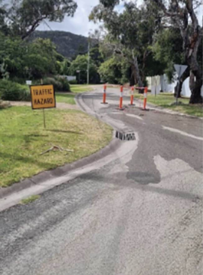
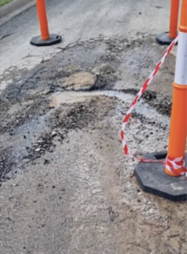
- The post stated “Charlesworth Street water leak. Just posting this to see how long it takes to get repaired. Water coming out of the road for about 3 weeks now, waiting for the massive washout”.424
- Two days later, on 23 December 2024, a resident of 4 Waller Place expressed concern to the Shire about the condition of the road along Charlesworth Street and Waller Place. A new sinkhole had appeared on Waller Place. The report was categorised as a road maintenance issue of medium priority.425
- The same morning, a resident of 1 Charlesworth Street telephoned SEW to request an update on the pothole on Charlesworth Street that had been reported almost a month earlier, on 28 November 2024. SEW recorded that the resident told them:
Red bollards and a traffic hazard sign have been placed around hole in roadway where water is flowing through - says many owners in the street frustrated, have called council who keep telling them it’s not their prob and to call SEW, rumour amongst locals in the street is that this is a natural spring - residents getting angry that bollards have been put up but water still flowing and a hazard, with no answers.426 (errors in original)
- This issue remained at a priority rating of 5.427
- At 4.52pm on 23 December 2024, the Shire recorded that the water leak at 3 Charlesworth Street was being “maintained by SEW”.428 The same note was recorded in respect of the leak at 4 Waller Place.429
- Notably, Shire records indicate that the 3 Charlesworth Street request was not resolved until 20 January 2025, at which time, the Shire’s Road Maintenance Request Summary simply noted that work had been “successfully completed”.430
Christmas Eve, 24 December 2024
- By Christmas Eve, about a month had passed since water issues near the corner of Charlesworth Street and Waller Place had been reported. Service Stream’s multiple investigations had not located the source of the water.431
- SEW escalated the issue to Jason Marsh, Leak Detection Technician from SEW, and a representative from Detection Services Pty Ltd (Detection Services). Detection Services, was and remains, contracted by SEW to provide leak detection services.432 They attended the site in the vicinity of 4 Waller Place to investigate.433
- It was a terrible day for leak detection, given the constant and heavy rain.434
- Upon arriving, Mr Marsh noticed that water was bubbling up from the road at about 10 litres per minute,435 the stormwater drain at 4 Waller Place was “raging”, and that there were extremely saturated nature strips.436 This was most concerning. The volume and forceful movement of water through the road and stormwater drain led Mr Marsh to suspect it was possibly emanating from a burst water main.437
- Mr Marsh and the Detection Services representative sounded all of SEW’s water main assets in the vicinity of 4 Waller Place – no leaks were detected.438 While they were conducting their investigations, they met Mr Cooper who allowed them to access a water main pit at the back of his property for acoustic leak detection.439 The water main was quiet – it was ruled out as the source of the water.440
- Mr Cooper subsequently directed Mr Marsh and the Detection Services representative to The Boulevard Reserve on the southern side of the Mornington Peninsula Freeway, knowing that both the water main and stormwater pipe travelled across the freeway.441
- Mr Marsh and the Detection Services representative proceeded there and sounded the valves and hydrants near Bayview Road. Again, no leak noises were detected.442 Mr Marsh did not otherwise observe any signs, such as wet ground, to indicate the presence of a potential leak.443
- At 6.37pm that evening, Mr Marsh sent an email to Charles Swain, Water Maintenance Manager at SEW, and others stating, “I believe that this may become a bigger problem”.444 Counsel Assisting asked Mr Marsh what he meant by “this”, he replied “I was ... concerned about the water raging” in the stormwater system.445
- Mr Marsh told his colleagues that he would return when the weather had improved to take water samples. He asked if an “operation tech” with personal knowledge of the area was available to assist him with its layout.446
- Later that evening, Hayden Phillips, Water Network and Leakage Technician at SEW, replied to Mr Marsh’s email. He stated that there had been no indication of a significant leak from trends at the Waller Place Pressure Reducing Valve/Pump station and Parkes Street tanks. He suggested that the water could be emanating from smaller leaks tracking downhill through stormwater drains.447
Christmas Day, 25 December 2024
- On Christmas Day, Mr Cooper walked over to The Boulevard Reserve to check his suspicions about the origin of the water. He walked towards a patch of land located behind The Boulevard Reserve at the intersection of Bayview Road and Outlook Road, where he knew there were two pits for the stormwater pipe. He was unable to locate the first pit due to overgrown vegetation. However, as he neared the second pit, he could hear running water. He did not find the pit, but he did notice that the ground was completely saturated, to the point that his shoes were sinking into it.448
- Mr Cooper then walked down to the beach via a set of stairs on View Point Road that led down to Margaret Street, where he knew there to be an outfall for the stormwater pipe. When he arrived, he saw that the volume of water coming from the outfall was washing a deep trench into that section of the beach. He told the Board of Inquiry:
I had previously seen similar trenches in that area form as a result of large volumes of water coming out of the outfall in winter, when there had been significant rain events or after a prolonged period of rain. However, I found it very unusual that this volume of water was coming from the outfall in December, in circumstances where there had been very limited rain in the preceding weeks.449
Late December 2024, one week before the landslide
- On 27 December 2024, Mr Marsh returned to Waller Place to conduct further leak detection investigations. He observed water was still raging through the stormwater drain at 4 Waller Place.450 He again crossed the Mornington Peninsula Freeway and sounded the valves and hydrant near Bayview Road but was unable to detect any leak.451 Little did he know that he was about 30 metres away from the site of a significant burst water main. In Mr Marsh’s words, he “regrettably” did not detect the burst that day.452 It would take another three days before the burst would be uncovered.
- On 29 December 2024, a resident reported to SEW that water was leaking from the nature strip near the corner of Coburn Avenue and Charlesworth Street. SEW recorded that the issues were likely to be linked to those on Waller Place.453
- Service Stream personnel attended the site the next day. The following observations were recorded:
Arrived on-site to find water pushing up from roadway opposite number 3 Charlesworth St tested water & reading was high 670 walked up hill sounded services & valves no noises walked up Waller Place & can hear water gushing in stormwater drain then SEW Jason Marsh on-site we lifted stormwater lid & saw water like a burst flowing down drain lowered bucket with rope got sample & reading was 160 possible burst up hill on 300mm MSCL near Bayview RD or under freeway & getting into stormwater drain sounded valve ID 362971 & it was screaming SEW leak detection & operations are chasing leak will be informed of where leak is.454 (emphasis added) (errors in original)
- The issue was given a priority rating of 5.455
Discovery of the burst water main – six days before the landslide
- On 30 December 2024, Mr Marsh returned to Waller Place for the third time in a week. This time, he was accompanied by a Service Stream supervisor.456 Still, they could not locate the leak.457
- Mr Marsh telephoned Gary Loudon within SEW’s Network Operations team, and asked for his view on the situation, noting that the Network Operations team typically has a better understanding of water sources and how water moves through SEW’s systems.458 Mr Marsh told the Board of Inquiry that, at this point, he was calling “anyone that would listen”.459
- Mr Loudon attended Waller Place at around 10.00am.460 He noticed water bubbling up from the road. However, like Mr Marsh, it was the amount of water running through the stormwater drain that caused Mr Loudon to consider there was a potential burst.461 Mr Loudon knew that the Parkes Street tanks supplied the zone in question and reviewed the tank outflow data to compare the differences between outflow in December 2023 and December 2024. He noted an increase in the flow rate.462
- In an email Mr Loudon sent to Mr Swain later that day, he recalled:
From there I suspected there may be a potential burst in the area based on the increase[d] flow rate and used the council drain overview on GTViewer to follow the flow of the water to the source.
Whilst doing so I sounded the valves on the water mains adjacent to the drain uphill towards the tanks. It was whilst locating and sounding the valves in heavy bushland on the other side of the Mornington Freeway opp[osite] Bayview Road that I firstly heard water flow and later discovered water flowing into the large storm water pit through a grate that crosses the Peninsula link over to Waller Place. Following that surface water from the pit … [I] located the burst and tested the water’s [electrical conductivity] confirming it was potable water.
Note that the burst is not something someone would have called in as it was away from any walking paths and in heavy unmaintained bushland.463 (emphasis added)
- The burst water main was located approximately 50 metres west of Outlook Road, between Bayview Road and the Mornington Peninsula Freeway.464
- At around 1.58pm on 30 December 2024, Service Stream personnel arrived on-site to find a burst 150 millimetre UPVC water main.465 A repair was not attempted due to difficulties the personnel faced in accessing the leak location with machinery, as well as staffing constraints.466
Repair of the burst water main – four to five days before the landslide
- At 9.08am on 31 December 2024, a Service Stream crew arrived at the site of the burst water main.467
- By 12.47pm, the crew had located the defective section of the water main and commenced pumping water out of it. The water main was 1.7 metres below the ground. They noted the area was “undermined” and “close to a couple of large trees”, one of which was hanging over the trench. They explained to Mr Loudon that the area was unsafe and that at least one of the trees would need to be removed to make it safe. They also suggested inserting a valve near Outlook Road to “isolate the main and program the repair”. Mr Loudon agreed with that proposal.468
- At around 3.50pm, SEW employees and Service Stream personnel attempted to locate the main, approximately 100 metres from the burst site, to insert the valve. They dug 2.5 metres into the ground but were unable to locate it.469
FIGURE 3.31: PHOTOGRAPHS OF BURST WATER MAIN SITE ON 31 DECEMBER 2024.470
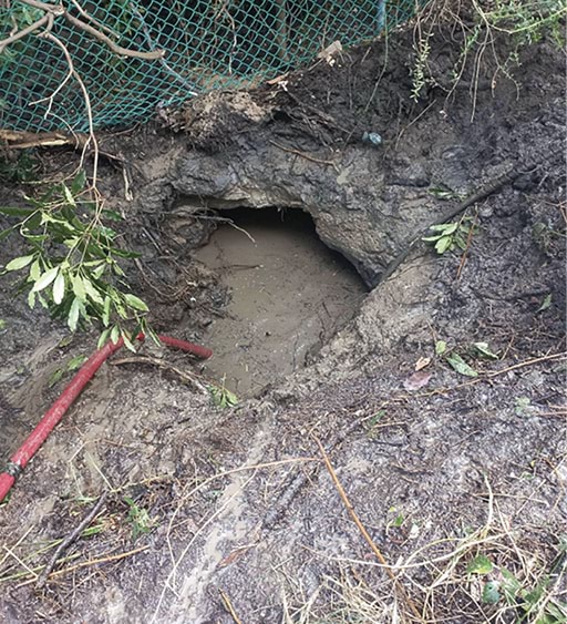
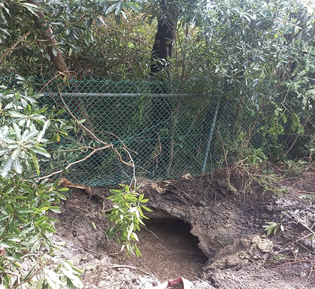
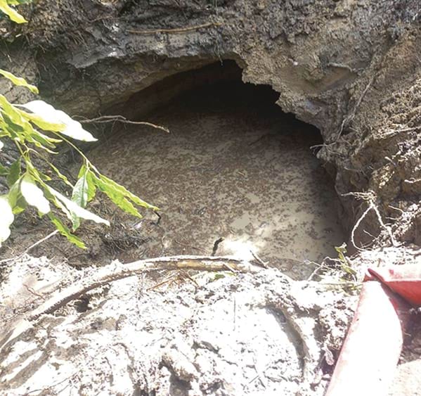
- In the meantime, a representative from the Shire had contacted SEW to report flooding at 1 Waller Place. The resident from that address had advised the Shire that the “house foundations and fence [were] under water”, the road was “crumbling” and three sink holes had appeared.471 A SEW representative contacted the Shire at around 4.26pm to advise that works were being undertaken to isolate a burst water main.472 He recorded:
Once water has been isolated, we can then re-inspect to see if water stops at other locations, ie, Cnr of Charl[es]worth Coburn & Wall[er]. Then if it turns out, that this is where the water from the burst was coming from. Then we’ll put in a temp repair on these road patches until a full re-instatement can take place.473 (errors in original)
- Service Stream resumed working on the site between 1.20am and 3.02am on 1 January 2025.474 During that period, it obtained approvals to cut down two unstable trees and remove cyclone fencing to make the site safe enough for the burst main to be repaired. Once the site was safe, the Service Stream personnel then excavated around the main, located the split on the 150 millimetre PVC water main, cut out the damaged section and replaced it with a new section of pipe.475
FIGURE 3.32: PHOTOGRAPH OF REPAIRED SECTION OF THE BURST WATER MAIN.476
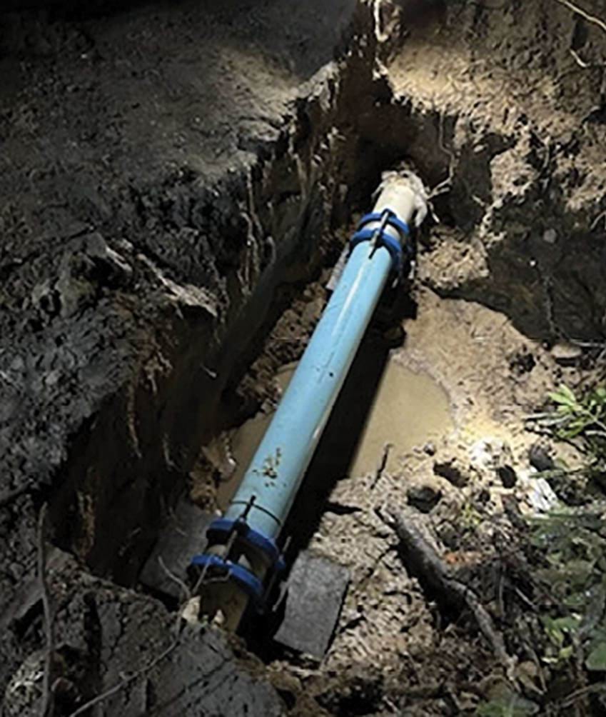
- At around 9.15am on 1 January 2025, Service Stream personnel inspected Charlesworth Street and Waller Place and observed that water was still coming out of the road opposite 3 Charlesworth Street and the nature strip along Waller Place.477 Water was also still running in the grated drain opposite 5 Waller Place.478
- That afternoon, at approximately 3.25pm, Service Stream personnel returned to inspect Charlesworth Street and Waller Place. The water running in the drain opposite 5 Waller Place had slowed but there was still water flowing outside 3 Charlesworth Street.479 Water was also observed pooling along the fence line of 1 Waller Place and flowing back toward the house. Water testing indicated the water was outside of “mains range”.480 The owner of 1 Waller Place was told they would need to speak with the Shire about the issue.481
- The next morning, at 11.29am, Fulton Hogan informed the Shire that the water issues on Charlesworth Street, Waller Place, and Coburn Avenue were under the management of SEW. They advised the Shire that they:
[L]iaised with SEW supervisor over the last few weeks to advocate on getting prompt action out here given the impact to both private property and MPS assets. SEW have identified a burst water main and shut water off 31.12.24, however there is still water flowing.
SEW have confirmed given the amount of water (flowing now for nearly 6 weeks) it is not an MPS storm water concern. Recent update as of 2.01.25 is that another leak detection team are heading down to further investigate. An update is also being provided as we speak to the SEW Customer team to be sure to advise residents that the issue is under the management of SEW.482
- Mr Cooper told the Board of Inquiry that throughout the first two weeks of January 2025, he observed that water leaking from the road and nature strips on Waller Place had begun to dry. Although water continued to leak at the intersection of Charlesworth Street and Waller Place, the volume appeared to be decreasing. He attributed this reduction to the repair of the burst water main.483
- The site of the burst water main is located approximately 450 metres south of 3 Penny Lane. The burst water main had leaked for an extensive period prior to its repair, releasing many millions of litres of water over that period.484
- Four days after the water main was repaired, on 5 January 2025, a landslide occurred above 3 Penny Lane. It was triggered by water.
3.6 The January 2025 landslides
The 5 January 2025 landslide
- Barely two years had passed since the November 2022 landslides when another landslide occurred, again, at the back of 10–12 View Point Road. This time, the landslide impacted 3 Penny Lane.
- At around 7.30pm on 5 January 2025, Mrs Moran heard a rumbling sound that she thought was the beginning of a thunderstorm. She had just returned to her house with her daughter, Isabella, after having dinner with Mr Moran and their other children. She stepped out onto the balcony of the second floor of the house to collect washing that had been left there to dry, when the rumbling sound got louder and the house began to vibrate.485 Within moments, Mrs Moran heard her daughter yell “mum”, closely followed by the sound of what she now knows to have been dirt and debris smashing into the rear of the house.486 She told the Board of Inquiry “there was a lot of banging, like bang and rumbling and the house was moving, you could feel it”.487
- When the movement stopped, Mrs Moran went to check on Isabella. They looked around and saw that the living room window was entirely obscured by a fallen tree and vegetation. To their left, the laundry door and cupboards had been pushed into the hallway, completely blocking access to part of the house.488
- Mrs Moran was in shock. She told the Board of Inquiry that her daughter had been standing in the part of the hallway that the laundry door and cupboards had protruded into, only seconds before.489 Counsel Assisting asked Mrs Moran if Isabella “would have been in trouble” had she not moved from the hallway.490 She would have been. Mrs Moran said, “it’s just lucky that [Isabella] walked back” from where she had initially been standing.491
FIGURE 3.33: PHOTOGRAPH TAKEN BY MR MORAN DEPICTING THE LAUNDRY DOOR AND CUPBOARDS ON THE SECOND FLOOR OF 3 PENNY LANE PROTRUDING INTO THE HALLWAY ON THE EVENING OF 5 JANUARY 2025.492
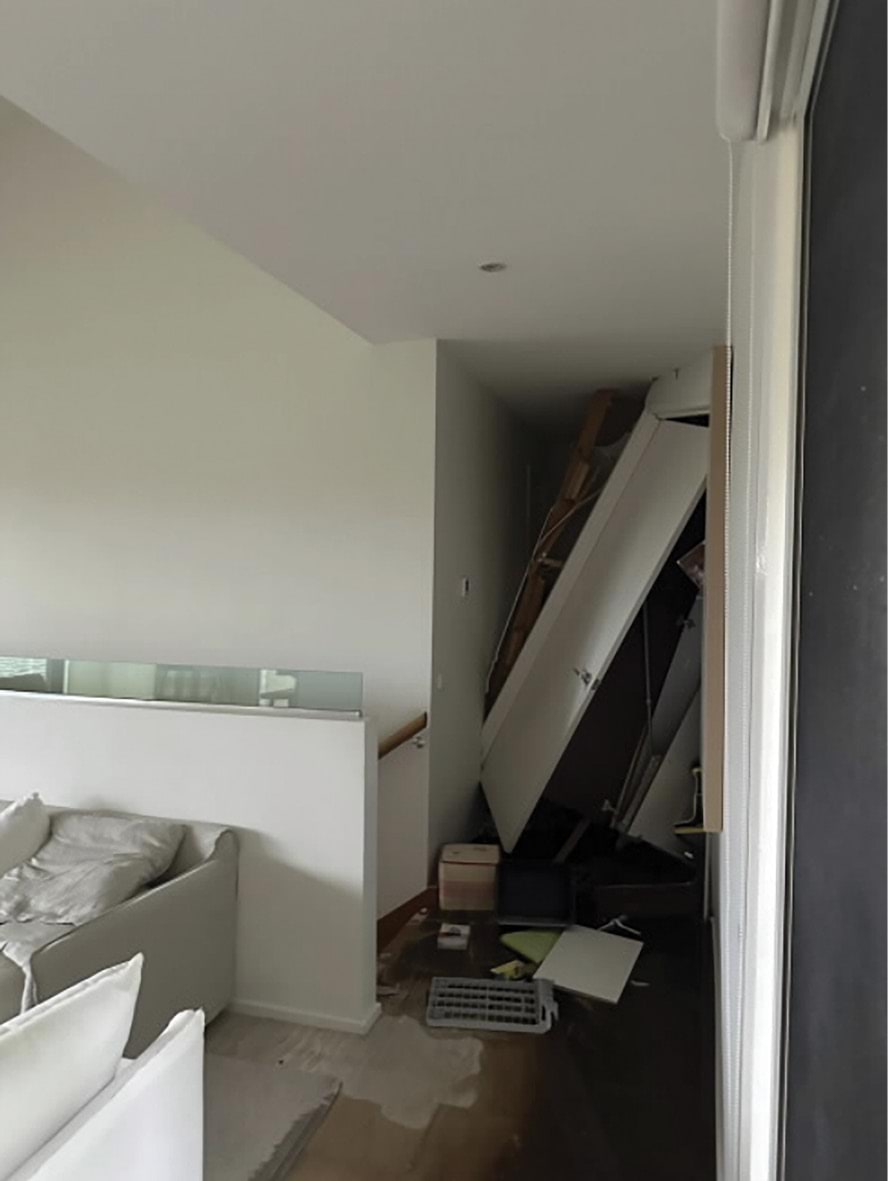
- What Mrs Moran and her daughter had experienced was a landslide that brought between 20–25 tonnes of debris crashing into their house.493 It had a sub-vertical headscarp of up to 1.5 metres high and had evacuated materials, down to natural granitic soils, to its base.494
- Mr Paul told the Board of Inquiry that:
The soil that detached from the escarpment in the 5 January 2025 landslide and then travelled towards the house at 3 Penny Lane indicated active landslide processes were occurring on the escarpment.495 (emphasis added)
- The landslide occurred on a different part of the escarpment at 10–12 View Point Road to the November 2022 landslides.496 The depletion zone of the upper part of the earlier landslides was to the west of the location of the landslide that occurred on 5 January 2025.497
- Unlike the earlier landslides, the 5 January 2025 landslide did not occur following heavy rain. Notwithstanding that, a significant portion of the headscarp was saturated and there was a measurable flow of water moving down the escarpment in the days that followed the landslide.498 In the immediate aftermath of the landslide, Mrs Moran saw water and mud on the ground near the laundry. She told Isabella, “we need to get out”, and they immediately left the house to contact emergency services.499
- Mrs Moran dialled 000 and told the operator “I think there has been a landslide at my house”.500 She was transferred to the VicSES, and, by 7.50pm, a VicSES unit was en route to the house.501
- After speaking with the VicSES, Mrs Moran and Isabella climbed the external stairs to the right hand side of the house to see what had occurred.502 Mrs Moran told the Board of Inquiry that it was very clear to her that land and vegetation had come down the escarpment, and that she could see water beginning to pool inside the house.503 Counsel Assisting asked Mrs Moran if she was concerned about the presence of water. She responded:
Yes. It was a substantial amount of water. So we walked back down the stairs. There was a little shed sort of there, and I thought maybe the mains power was there in that area, so I tried to get in there to turn the power off. That was my concern. But it wasn’t there. So I called triple O again.504
- At 7.57pm, the VicSES recorded a second phone call with Mrs Moran, during which she reported that water was “rushing into the premises” and “running into the middle level of the 3 stories”.505 Mrs Moran was unable to turn off the power to the house and wanted advice as to whether she needed to take any action before the VicSES arrived. The call was marked “critical”.506
- Mrs Moran then telephoned Mr Moran, who was driving back to Melbourne from McCrae. She told him there had been a landslide and that he needed to return.507 He immediately turned around to drive back to the house.508
Arrival of emergency services
- The first VicSES unit arrived at 8.05pm, and it was quickly determined that there had been a “considerable land slip from property up above”.509 VicSES responders turned off power to the house and then began moving furniture away from the water running through the house.510 They were also trying to determine whether the landslide had been caused by a burst pipe.511
- Mr Moran arrived at the house shortly after and had a conversation with Mark Daw, VicSES Unit Controller (Sorrento), and several conversations with other VicSES responders. Mr Moran understood from those conversations that there had been “some sort of landslide or slip towards the back of the house” and that it had been assumed the water flowing through the house was coming from a burst pipe in or around the laundry. The VicSES were making arrangements with the various service providers, including SEW, to try to shut off the water.512
- Mr Daw mentioned to Mr Moran that the owner of 10–12 View Point Road, Mr Borghesi, was open to speaking to him about what had happened.513 Mr Borghesi had learned of the landslide earlier that evening. He recorded in his diary that, between 6.30pm and 8.30pm, he observed: “mudslide and water flow north of veggie patch retaining wall and # 3 Penny Lane” which had “[taken] out # 3’s south laundry wall”.514
- At 8.20pm, Mr Daw telephoned the Shire’s Emergency Management Coordinator, Brett Fletcher, to inform the Shire about the landslide.515 Mr Fletcher was delegated the role of the Shire’s Municipal Emergency Management Officer at the time.516 He immediately contacted Dale Gilliatte, the Shire’s Manager of Community Safety, Health and Compliance, to relay what he had been told.517 The Board of Inquiry has not received any documents evidencing Mr Gilliatte’s response to that phone call. However, Mr Simon told the Board of Inquiry:
The VicSES, as the control agency, was primarily responsible for managing the response to the 5 January Landslide … [T]here were no displaced residents requiring temporary accommodation as a result of the 5 January 2025 Landslide. As a consequence, there was no activation of the response activities of the Shire’s Emergency Management team in response to the 5 January Landslide.518
- At around 9.09pm, Mr Daw made a second telephone call to Mr Fletcher and asked that the Shire’s MBS contact him and attend the landslide site. At 9.15pm, Mr Fletcher telephoned Mr Glover to relay that request. Mr Glover made his way to the landslide site.519
- By 9.20pm, the VicSES had also informed SEW of the situation and recorded that SEW representatives were on their way to the landslide site.520 SEW recorded in its Montage system:
SES advised leak large leak to rear of No. 10 and the meter wasn’t ticking over so said there is water running down from Viewpoint Road to the back of 10 which has caused a landslip to 3 Penny Lane. SES trying to find cause of leak and location of leak. Coming from the higher side of this address. They can hear water from the fireplug at no 10 in View point Road.521 (errors in original)
- At 9.36pm, SEW assigned the issue the highest priority rating of 1,522 which is typically reserved for safety-related tasks.523 SEW’s contractors were required to arrive on-site within one hour,524 and it appears they were in transit within that time.525
- At around 10.11pm, David Goldfinch, the Regional Commander of the VicSES, arrived at the landslide site.526 Mr Goldfinch spoke to Mr Moran and suggested that he contact his insurance provider as soon as possible.527 Mr Moran then contacted RACV Insurance.528
Arrival of Shire and SEW representatives
- VicSES’ records indicate that the first SEW representative arrived at the site at around 10.07pm. The SEW representative told the VicSES that they believed there was “a burst water main up top”, but they were unsure where it was located.529 SEW records indicate that Service Stream personnel conducted an “inspection” of the site at around 9.08pm to scope the works required and were actively working on-site by 11.25pm.530 The Board of Inquiry has not received any records clarifying the discrepancy in the timing or detailing the ‘inspection’ that was undertaken.
- The first Shire representatives, Mr Glover and James (Jimmy) Jones, Building Inspector, arrived at the site at around 11.30pm.531 Mr Glover told the Board of Inquiry that he spoke with Mr Daw, who told him that the VicSES had checked water meters in the area and found no signs of water loss. Mr Glover also recalled Mr Daw telling him that SEW had “informed the SES that there were no water leaks from the water main and water tests [had] been taken”.532
- At 12.33am, the VicSES recorded:
SORR S2 - COUNCIL INSPECTOR CAME OUT STATING THERE SHOULDNT BE ANY FURTHER LANDSLIPS OVERNIGHT - THEY WILL REATTEND AT 9AM - PLEASE LEAVE JOB OPEN AS WE WILL BE RETURNING TO AA AT APPROX 7AM.533
- Mr Moran told the Board of Inquiry that when he left the site late on 5 January 2025, the VicSES and SEW were still trying to locate the source of water running through the house.534 Whilst Mr Moran had no intention of staying in the house given the extent of the damage, he was not issued with an Emergency Order.535
- Mr and Mrs Borghesi had been given “permission” to remain in their house overnight.536
- From that night, the Morans’ property became a hub of activity. Representatives from the VicSES, the Shire, SEW, RACV, and geotechnical firms all converged on the landslide site.
- Amidst the activity in the nine days following the landslide, two truths became clear: there was water inexplicably flowing out of the escarpment above the Morans’ house and the threat of another landslide was growing as the water continued to flow.
The next day, 6 January 2025
- At around 7.00am the following morning, on 6 January 2025, VicSES responders returned to the site.537 They were joined shortly after by Mr Marsh from SEW,538 and noted that SEW was trying to confirm whether there were “any issues up the hill”.539 Mr Marsh inspected the landslide site from the rear of the Morans’ property, before speaking with Mr and Mrs Borghesi at their house and climbing down the embankment to take a water sample.540
- Later in the morning, Mr Marsh sent an email to Mr Swain and others stating that water was “running down the washed away embankment” and that the Borghesis were “having issues with retaining walls leaning, etc”.541 Mr Marsh confirmed that he had arranged for Detection Services to survey the area and that he would take the samples he had obtained that morning to ALS, a company that carries out water testing. In respect of the landslide, he commented:
Please note: its proximity to the ongoing issues at 4 Waller Pl does not present well.542
- Counsel Assisting asked Mr Marsh what he meant by that statement. Mr Marsh responded:
I was just – well, there was a – we found a large burst up the hill and there was water bubbling out of the road, and now there’s a landslide. It just doesn’t look good. That’s what I was trying to convey in that.543
- Counsel Assisting asked Mr Marsh whether, to his mind, there may have been a link between the burst water main, the water surfacing around Waller Place, and the landslide that had occurred on 5 January 2025. Mr Marsh replied:
I don’t think there was a [link]. That’s just – that’s my thoughts. But it doesn’t present well. It doesn’t look good, is what I was trying to say. I can’t see how that water that was going through the stormwater pit above could have affected down there. Because my take on it, [the water from the burst] was all going to the stormwater pit.544
- Mr Marsh told the Board of Inquiry that although he found some “minor” leaks in the vicinity of the landslide, he did not find “anything substantial anywhere”.545
- In the meantime, at 8.02am, Mr Glover contacted Renae Littlejohn, the Shire’s Director - Planning and Environment at the time, and Rory MacDonald, Manager - Development Services, stating:
We got home around 2am … We are heading to the site again today around lunch to see more in the daylight, especially the slip origin from 10–12 View Point Road. During the initial inspection last night, one could say the building works on-site are average.546
- Mr Glover gave them a photograph of the damage to the rear of the Morans’ property.547
FIGURE 3.34: PHOTOGRAPH OF THE REAR OF 3 PENNY LANE FOLLOWING THE 5 JANUARY 2025 LANDSLIDE.548
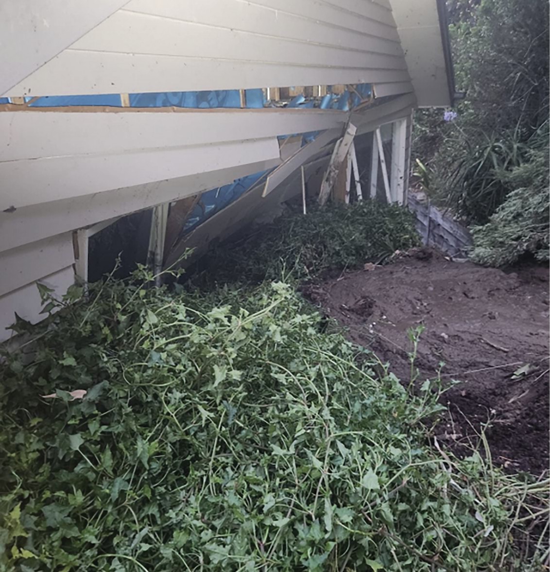
- Around the same time, Mr Glover contacted Mr Pope of PSM for assistance. Mr Glover told the Board of Inquiry that he was concerned about controlling the water flowing under the Morans’ property, and that he knew Mr Pope had experience dealing with the earlier landslides in 2022.549
- At 10.09am, Zelie Foley, Coordinator, Office of the MBS, sent Mr Glover and Mr Flores documents relating to the most recent building permit issued for 3 Penny Lane and noted that she was trying to track down the original permits for the property. Mr Glover forwarded Ms Foley’s email to Mr Pope.550
- During the morning, Mr Borghesi also contacted the Shire about the landslide. He told Mr Flores by text message:
The issue of seepage down [V]iew Point is clearly not our doing, and we would implore Council to take an active lead to investigate the cause of the seepage rather than issuing orders for others (us) to fix problems we are not causing.551
- Mr Borghesi contacted Maw Civil to inform them of the landslide and to arrange for a representative to attend his property to inspect the retaining wall.552 At 10.45am, a Maw Civil representative attended the property and confirmed he had no concerns about the integrity of the retaining wall “unless undermining occurs”.553
- At around midday, Mr Moran returned to the house. He told the Board of Inquiry that the sandbags the VicSES responders had installed were preventing water from entering the house, but that the flow of water had not ceased, or even decreased, from the previous night.554
- Mr Glover and Mr Jones arrived at the Morans’ property shortly after and carried out a further inspection.555 Mr Glover told the Board of Inquiry:
Following his inspection, Mr Jones said to me that he could see a large scour line with the presence of water under the house, running through the middle of underneath the dwelling. A scour line is a line created in the soil through the erosion and removal of soil caused by the movement of water. I recall that Mr Jones verbally stated there is scouring under the house. I did not see scouring or water on my side of the house. However, the presence and depth of the scouring indicated to me that water had been flowing under the Moran’s property for an extensive time prior to 6 January 2025.556
FIGURE 3.35: PHOTOGRAPH OF SCOUR LINES UNDERNEATH 3 PENNY LANE.557
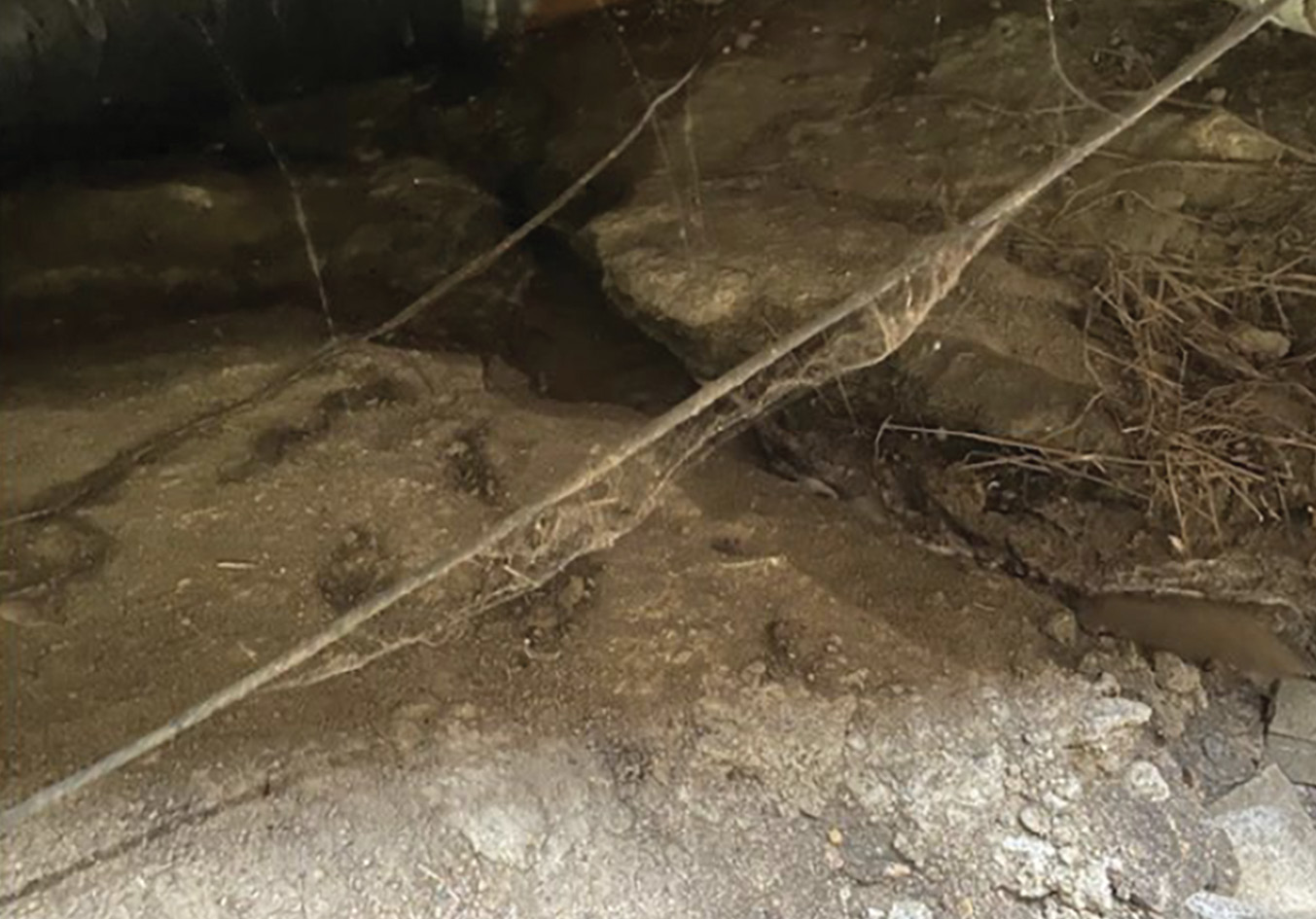
- At around 1.00pm, it was recorded in SEW’s Montage records that various tests had been carried out at and around 10–12 View Point Road, including:
- “checked FP at #10 View Point Rd no noise”;
- “Tested water running down SW [(stormwater)] pit is not in mains range 286SL”;
- “Checked the 25mm meter at #10 no noise is not ticking over”; and
- “Valve for view point id #362909 was buried located with yellow wand marked and painted. Shut valve no noise opened valve no noise”.558
- A SEW representative also inspected the Morans’ property and reported:
Water running down the stairs is clean and clear EC test is in mains range. Sounded garden tap good noise located b/valve was burried shut off and noise stopped. Flow down the stairs eventually stopped the water line inside the house has been damaged by the landslide. Took sample from the rear of the house from land slide EC test is not in mains range 1400SL plus. Residents advised me of a leak running from Charlesworth St drove up to find bollards in the middle of the road in two spots major pot holes. EC test is 600SL plus other pot hole is just before manhole id #430662 called Brendan out to inspect line all ok. Resident advises the leak has been running for 8-9months. Randell SEW briefed about job spoke with Brendan and W.Peters duty officer. Wally attended site advised he has been out to the area numerous times in regards to the leak advised a sample has been sent to the chemist via J.Marsh leak detection awaiting results refer to job #1295094/001 plus.559 (errors in original)
- At 1.02pm, the same SEW representative recorded:
I checked where leaks are on job no1295094/007 & the leaks have not changed. I then met up with R-Dickins & the SES. I spoke again with Randell & i told him the leaks up the road on the other job number is still the same & Jason Marsh from SEW leak detection is looking into this. Randell told me that he will get J-Marsh back in the morning. I told the people from the SES what is happening.560 (errors in original)
- By 2.00pm, Mr Pope had arrived at the Morans’ property and carried out an inspection. He then accompanied Mr Glover, Mr Jones and Mr Daw to 10–12 View Point Road to inspect the escarpment.561 Following those inspections, Mr Glover asked Mr Pope to prepare a preliminary assessment of the situation.562
- At around 2.00pm, the VicSES handed over control of the site to the Shire.563
- Mr Glover told the Board of Inquiry there was no “formal transfer of control” of the site from the VicSES to the Shire; the VicSES simply deactivated its role and function as the Incident Controller of the site.564 Mr Glover did not provide any further detail as to why the VicSES deactivated its services. He personally thought the VicSES should have remained as the Incident Controller after 6 January 2025.565
- At 3.51pm, the VicSES recorded that Mr Glover was “TAKING ONUS” of the landslide site, and by 5.30pm, Mr Daw told Mr Borghesi that control of the site was with the Shire.566 Mr Borghesi recorded the following view in his diary: “right people involved, council appearing to take responsibility”.567
- At some point in the afternoon, Mr and Mrs Willigenburg met Mr and Mrs Moran for the first time. Mr Willigenburg told the Morans that he had noticed the drains at the bottom of Penny Lane filling with water in December 2024 and had reported this to the Shire on 16 December 2024. He said that he considered the drains filling to be unusual in circumstances where there had been no rain.568 Mr Moran relayed that information to Mr Glover, but Mr Glover was not aware of Mr Willigenburg’s report.569
The second day after the landslide, 7 January 2025
- On the morning of 7 January 2025, Mark Finningham of Midcity Group, an assessor appointed by RACV, met Mr Moran at his house to conduct an inspection.570 Mr Finningham recorded in a document that he heard movement at the property and decided it was safer to leave. He reportedly advised Mr Moran not to re-enter the house until it was deemed safe to do so.571
- Mr Finningham prepared a preliminary report deeming the Morans’ property to be “extremely unsafe and unstable”.572 He stated: “Due to the amount of debris, I believe there is a chance that further movement could occur, and more damage to the property would be immediate.”573
- Mr Finningham also escalated the matter to David Jones, Construction Manager at Midcity, who requested that a Technical Assessor be appointed to manage the matter “due to the immediate risk of complete structural failure” at the property.574 Sue Scoble was appointed to that role by the RACV, and made arrangements to meet with Mr Moran at his house on 9 January 2025.575
- A note in the RACV’s internal system on 7 January 2025 stated that the landslide:
appears to be located below previously denied claim RAV224564034 [made by the Borghesis concerning the 15 November 2022 landslides], noting the unretained soil would have been stockpiled from the previous landslide, as no remediation works have been completed, also noting no weather event has happened on said date.576
- Whilst Mr Finningham was inspecting the Morans’ property, a representative from Maw Civil attended the Borghesis’ property.577
- Mr Borghesi recorded that Maw Civil had “no concerns” about the retaining wall on View Point Road but was concerned about the amount of water flowing down the escarpment. Mr Borghesi noted:
- The same day, Mr Glover prepared a Significant Incident Notification for Ms Littlejohn and Mr MacDonald regarding the landslide in which he notified them that:
- around 20–25 tonnes of material had been dislodged during the landslide, and there were “another 10-15 tonnes of material, a concern that will be let go at any time”;
- there was structural damage to the rear of the Morans’ property “including movement of piers in a concentrated area”. The rear external wall of the centre of the dwelling was “unsafe and unstable”, and an underfloor inspection of the house indicated that “the water problem has been an ongoing matter for some time”; and
- the water flow rate from the headscarp at 10–12 View Point Road was around 200 millilitres per second based on “a very rough water bottle test”. SEW had taken water samples for testing and although the results of those tests were pending, SEW had confirmed there were no leaks in the water mains.579
- The Significant Incident Notification stated that the Office of the MBS was undertaking water tracing and other investigations, and that PSM (Mr Pope) had been engaged to assist the MBS. It stated:
PSM is providing a preliminary report regarding the possibility of the dwelling (the Morans’ house at 3 Penny Lane) being dislodged from its piers from further impacts, causing the dwelling to collapse and affecting property along Point Nepean Road (607 and 605).580
- Separately, Ms Littlejohn sent an email to Mayor Anthony Marsh and the Shire’s Acting CEO, Bulent Oz, stating that the MBS had been dealing with the landslide since the VicSES handed over control of the site to the Shire the previous day. She stated that “appropriate action” was being taken to “manage the site”, but she did not elaborate on what that action entailed.581 While Mayor Marsh and Mr Oz both responded to Ms Littlejohn’s email the next day, they did not seek further information concerning the actions being taken to manage the site.582
- Mr Glover otherwise spent the morning of 7 January 2025 reviewing the Shire’s customer complaint system to identify any reports relating to Prospect Hill Road and/or View Point Road. He told the Board of Inquiry:
I ran this search to understand at a high level what (if any) reports had been made concerning water in the area because of the presence of water in the headscarp, as at that time South East Water had told me that there were no identified leaks.583
- Those searches revealed that several reports had been made in relation to the Shire’s stormwater drainage network in the vicinity of Prospect Hill Road and View Point Road between 1997 and 2023.584
- Mr Glover also exchanged correspondence with Mr Pope in respect of building permits for both 3 Penny Lane and 10–12 View Point Road. This appears to have been prompted by an email from Mr Pope at 10.02am, requesting structural drawings of the “Borghesi retaining wall” and any feature surveys associated with it. Mr Pope stated in that email: “It seems they placed a fair amount of fill onto the escarpment to build it. They also had to remove a bunch of trees to build that section of landscaping”.585
- That afternoon, Mr Glover sent Mr Pope and Mr Flores various permits and planning approvals for the Morans’ property, dating back to the 1970s.586 Mr Pope commented that it was “very interesting to see the 1987 complaint regarding seepage”.587 In the emails that followed, Mr Glover noted, “[t]he old septic trench was interesting in location??? The first land slip side. The contour line has changed a lot over time. Including the veg and the once live gum tree”.588 Mr Pope responded, “[l]ess than ideal location”.589
- At 3.50pm on 7 January 2025, Mr Flores confirmed, via email to Mr Pope and Mr Glover, that he had inspected the landslide site that day and had sent photographs and videos to Mr Pope. He told Mr Pope and Mr Glover that he and Mr Jones had placed plumber’s dye into the stormwater pits upstream of 10–12 View Point Road but could not see any traces of the dye in the area of the landslide. He also commented that “the amount of water flow has possibly increased at the base”.590
- Mr Flores told the Board of Inquiry that the water he observed caused him concern.591 Mr Flores explained that he had not considered whether measures should be taken to divert the water, nor did he raise those issues with anyone at the time, because the investigation was being led by Mr Glover. He noted he would generally seek advice from someone “suitably qualified” to advise on those matters, such as a geotechnical engineer.592
- Mr Borghesi recalled Mr Flores and Mr Jones carrying out dye testing on 7 January 2025. He had sent a text message to Mr Flores at around 1.15pm that afternoon, stating:
Hi Claude. The green dye is running in the new pipe on VPR [View Point Road] as expected, as the stormwater pipe is new. Suggest you put some dye further upstream, or consider some boreholes on our nature strip to identify the course of the water.593
- At 4.41pm, Mr Flores responded to Mr Borghesi’s text message to confirm the Shire was awaiting advice from Mr Pope and that he would pass on the borehole recommendation.594
- Mr Borghesi told the Board of Inquiry that he and Mr Flores had:
discussed the concept of drilling boreholes or what John Bolch described as spears in View Point Road to extract water before that water emanated from the scarp, because we were all terribly concerned that, if we weren’t capturing the water and redirecting it, this headscarp would continue to fail and lead to something disastrous.595
- When Counsel Assisting asked Mr Flores if anyone had raised with him the concept of inserting spear pumps to divert water, Mr Flores responded “Mr Borghesi may have raised that at some point in time”. When asked whether he would have passed that suggestion on to someone else, he stated:
I would have passed it on possibly to Mr Glover. I’d have to check my emails because it was during January, I was on leave, kids’ holidays, so there’s - there may have been a text or something like that from Mr Borghesi. I’m not too sure.596
- The Shire has confirmed it has not located correspondence from Mr Flores to anyone passing on Mr Borghesi’s suggestion.597 Irrespective of whether Mr Borghesi’s suggestion was passed on, the fact remains that it was not actioned by the Shire.
- At some point between 10.00am and 2.30pm, Mr Swain and Mr Marsh of SEW attended 10–12 View Point Road and saw water still trickling down the escarpment. Mr and Mrs Borghesi told them there had not previously been water flowing from that point on the escarpment.598 Mr Swain made notes in relation to the visit, recording:
We went across to the west side of the property where there is a stair pathway towards the bottom of the hill in between 14 and 10–12 [View Point Road]. He [Mr Borghesi] … said the area was previously very wet but is now dry. And he suspected it has something to do with the construction of the stormwater drain on the north side of the View Point rd. We walked up the alignment of the drain and he mentioned that there was previously a very poor condition curb and channel that experienced flow 24/7. He believed that prior to this being constructed, this water was infiltrating through cracks in the curb and channel and discharged out of the ground on the eastern side of no. 14.599
- Mr Swain and Mr Marsh walked further up onto Prospect Hill Road, accompanied by Mr Borghesi, and saw a significant flow of water inside a stormwater drain located on Prospect Hill Road. Mr Borghesi told them the water was from properties along Prospect Hill Road that had groundwater pumps. They later met with the owners of 5 Prospect Hill Road, who told them that the sump pump in their basement had started to pump more frequently around a month earlier.600 Mr Swain recorded that the “pump discharges [water] into the [k]erb and channel”, which in turn is connected to a “closed stormwater drain that connects to the drain in View Point Road”.601
- Mr Swain also noted that he had observed a significant wet area in front of 6 View Point Road, but that this had been surveyed multiple times by leak detection, and no leak had been found.602
- At 5.30pm on 7 January 2025, Mr Pope provided Mr Glover with his preliminary risk assessment and risk to life assessment in relation to the landslide.603 He stated that he had observed unstable zones near the headscarp in the order of three to six cubic metres, on the southwestern flank of the landslide. He also stated:
A preliminary risk assessment has been completed for volumes in the order of 5 to 10 m3. These volumes represent unstable volumes observed on-site and do not reflect long term volumes that are assessed for the life of the properties.604
- Mr Pope expressed the view that it was not necessary for the Willigenburgs to take any actions with respect to their rental property at 607–609 Point Nepean Road. However, while the causes of the landslide were being investigated, he advised that the Borghesis and the Morans should take certain steps to mitigate the risk of any further landslide activity at 10–12 View Point Road and 3 Penny Lane. Specifically, he recommended that:
- the Borghesis monitor the slope immediately behind the failure for any signs of change or deterioration, and cease watering the garden in the vicinity of the landslide. Mr Pope also recommended that the Borghesis place surficial cut off bunds with coir logs or sandbags behind the retaining wall to direct surface water away from the headscarp, and seek advice from their engaged geotechnical engineer to “make safe as best as is practical”;605 and
- the Morans monitor the slope immediately behind the house for signs of change and/or deterioration, and take steps to:
- remove the mud from between the house and the rear of the retaining wall. Mr Pope noted that the mud upslope of the retaining wall should not be disturbed, but recommended that the Morans proceed with caution in “areas of potentially unstable walls of the dwelling”. He suggested they seek further advice if the retaining wall had collapsed;
- divert surface water around the dwelling using hand cut off drains, coir logs or sand bags, and install a secondary cut off drain under the deck. This would involve digging by hand and installing weep holes in the northern most retaining wall; and
- install one or two ballasted shipping containers in the northern most section of lawn. He stated that further advice should be obtained to detail the design.606
- Mr Pope noted that each property owner should take the recommended steps with “the support of Geotechnical Engineers who are experienced in mitigation of landslide hazards”.607 Mr Pope included the following image showing his recommendations:
FIGURE 3.36: AERIAL PHOTOGRAPH ON WHICH MR POPE MARKED WHERE CERTAIN ACTIONS WERE TO BE TAKEN BY THE BORGHESIS AND THE MORANS.608
FIGURE 3.36
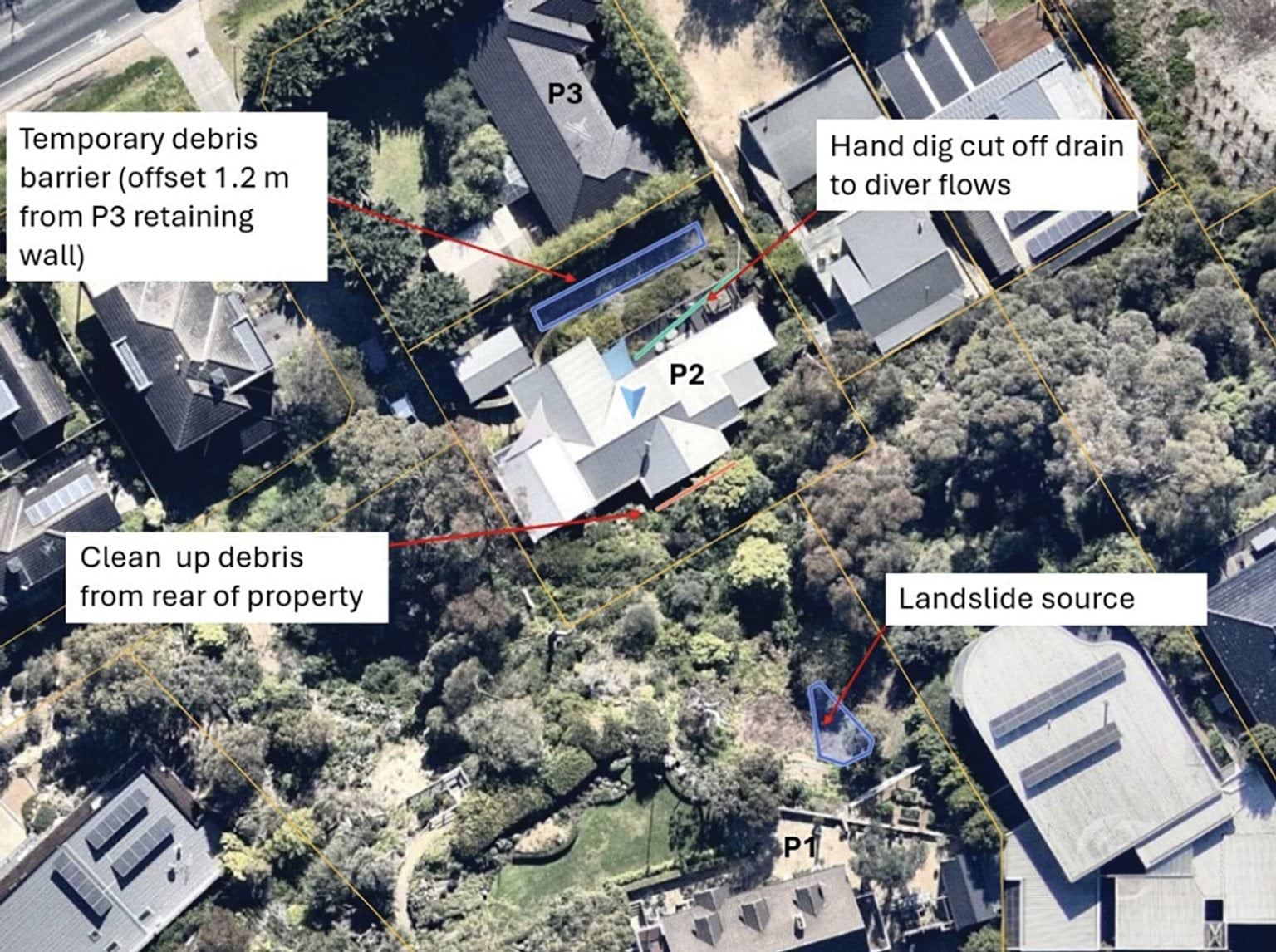
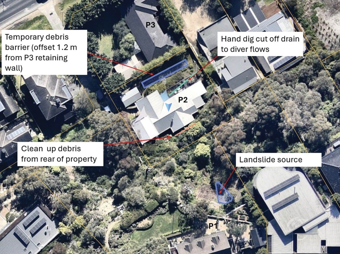
- Later that evening, Mr Glover forwarded Mr Pope’s preliminary risk assessment to Ms Littlejohn and Mr MacDonald, noting he would review it in more detail the following day, before approaching the Borghesis and the Morans. He wanted to understand “the bigger picture, including where the water [was] coming from”.609 Ms Littlejohn confirmed:
I’ve put it on the Mayor’s radar and will follow up with him in an email too in case it gets out there and political.610
- The Board of Inquiry does not have any evidence of a response by the Mayor.
- Mr Simon of the Shire told the Board of Inquiry:
I understand that following the advice in Mr Pope’s email dated 7 January 2025, Mr Glover or his delegates informed the owners of various surrounding properties, including the owners of 3 Penny Lane and 607 - 609 Point Nepean Road, of the need to vacate their properties. The Shire has not located any emergency orders issued by the MBS in respect of the 5 January 2025 Landslide.611
The third day after the landslide, 8 January 2025
- In the morning of 8 January 2025, Mr Glover sent a further email to Ms Littlejohn, Mr MacDonald and Mr Flores, copying several others. He adopted the action items that Mr Pope had formulated for 10–12 View Point Road and 3 Penny Lane (described above) and stated that he considered those actions to be reasonable to protect the life and safety of the surrounding property.612 He said he would discuss the action items with both affected parties.613
- Mr Glover went on to explain that the MBS was also required to issue “the necessary enforcement/s” on the Borghesis for having constructed a retaining wall exceeding 1 metre in height, without a building permit, and to notify the planning compliance area to investigate the works undertaken at the Borghesis’ property, including the placement of fill. Further, he would need to issue enforcement action on the Morans to undertake the preliminary works required to protect life at both their property and the Willigenburgs’ rental property at 607–609 Point Nepean Road.614
- He otherwise reported that the trace-dye testing undertaken on 7 January 2025 indicated that the water source was not the Shire’s drainage assets and that no further action was required in that regard.615
- The Shire has not located a response from Ms Littlejohn, Mr MacDonald, or Mr Flores to this email.616
- Mr Glover subsequently prepared an ‘Actions Items’ document, recording the information and action items set out in Mr Pope’s preliminary risk assessment, for provision to the Morans, the Borghesis and the Willigenburgs.617
- In the meantime, the Moran family had arrived at their property at around 9.30am. The Morans, with the assistance of some friends, spent the day removing some of their belongings from the house because they had been notified that their contents were not insured and water continued to enter the house.618 They had not received an Emergency Order prohibiting them from entering the house, nor were they aware of Mr Pope’s assessment that being at the house presented an unacceptable risk to life.
- On the same day, Mr Flores and Mr Jones were again on-site conducting trace-dye testing of the Shire’s stormwater drainage and road kerb collectors. Mr Glover explained that the purpose of the testing was to ascertain whether the Shire’s stormwater drainage had been compromised, as part of the efforts to locate the source of the water.619 Mr Flores and Mr Jones reported to Mr Glover that they had not seen any trace-dye flowing from the kerb collector at 2 View Point Road (facing Prospect Hill Road) to the stormwater pit on the corner of View Point Road and Prospect Hill Road.620
- At around lunchtime, Mrs Moran looked on the McCrae Village Community Group page on Facebook and saw several posts from residents made in December 2024 about a large pothole on Charlesworth Street that had been filling with water. Given the water issues at the Morans’ property, this piqued Mrs Moran’s interest and Mr Moran forwarded screenshots of the posts to Mr Glover.621
- Shortly thereafter, Mr Glover sent those screenshots to Mr Pope, stating “[m]aybe cause. Not sure on this street location as I need to look”.622 Minutes later, Mr Glover then sent an email to Mr Pope, Mr Flores and Mr Jones, providing the screenshots. Mr Glover also embedded in the email a map of McCrae, on which he appears to have drawn a black line showing the location of the Charlesworth Street pothole vis-a-vis the landslide. He stated, “[i]nteresting. Water leak from Charlesworth St. pre-xmas leave”.623
- In the early afternoon, Mr Flores responded to Mr Glover’s email without copying Mr Pope. He stated:
That’s great, Matt, we may be able to refer to SEW for rectification and liability. Could we get the water tested to see if its tap water as it was reasonably clear compared to the milky water coming from the spring.624
- Mr Glover replied suggesting that they test the water coming from the landslide area and the leak on Charlesworth Street. Mr Flores then sent an email to Peter O’Brien, Team Leader of Environmental Health at the Shire, explaining that the Shire was trying to establish the source of the water flowing from the escarpment. Mr Flores noted they had ruled out that the water was from a Shire drainage asset and that they “suspect[ed]” it could be from a leaking water source, such as the leak on Charlesworth Street. He requested that a water sample be collected and tested to determine if it was drinking water.625
- Later in the day, Mr Glover sent a further email to Mr Pope, suggesting that there could also be a “hydrant ground-ball leak”. He included a map with two hydrant sites highlighted and confirmed he would take tools to the site with him the following day to inspect it.626
- Mr Borghesi had continued to monitor the flow of water on the escarpment over the course of 8 January 2025 and sent Mr Flores a text message at 1.49pm that day, stating:
Claude, the water flow has just recently increased about 50%, from an estimated 10l/minute to 15l/minute. No further soil collapses.627
- Mr Borghesi told the Board of Inquiry that the water was “fluctuating a little bit. It would sometimes abate and then it would increase”.628
The fourth day after the landslide, 9 January 2025
- Four days on from the landslide and unexplained water was still running out of the unstable headscarp. No work was undertaken by anyone on or around the headscarp to reduce the risk of a further landslide.
- The Shire did not re-engage with the VicSES to seek an emergency response to the threat of a further landslide caused by water continuing to infiltrate the unstable headscarp. The Shire did not otherwise set up an emergency response.
- Instead, SEW and the Shire (through its MBS, Mr Glover) continued to separately investigate whether the water infiltrating the headscarp was emanating from their own respective assets. Mr Glover also continued to perform his separate MBS duties, namely suggesting to the Morans and the Borghesis that they act on Mr Pope’s recommendations to mitigate the risk of a further landslide (as described below).
The search for the water source continues
- At 7.42am, Mr Marsh sent an email to Mr Swain and others at SEW reporting that he had spent the previous two days checking stormwater drains and services around Waller Place and Bayview Road, including the WR174 water tank site, air valves and hydrants. He had also taken a sample from a stormwater pit located outside 6 Waller Place and delivered it to ALS for testing. He noted that Detection Services were on-site, surveying the zone “from Bayview Road up”.629
- At 8.41am, Mr Pope responded to Mr Glover’s emails of the previous day stating that he was “[f]ully supportive of running to ground any man-made sources of water”. He stated:
Note that in the 1960s when SEW drilled for the Dromana tunnel (through Arthurs Seat), there were several cases of groundwater encountered in the weathered granite at levels much higher than our Site. Furthermore, two of the boreholes on the southwestern side of the mountain (DT 9 and DT 10) struck groundwater at 20 to 25 m depth and both produced flows at the surface of the borehole. i.e. significant artesian pressure. These boreholes were drilled between Jetty Road and the Bay Views Golf course in similar geology and at elevations higher than our site (RL 70 to 85 m).
The SEW Map app shows where the trunk sewer runs. Yes, it’s a distance from the site, but it does give good insights into the groundwater regime of Arthurs Seat.630
- At around 9.00am, Ms Scoble of RACV met the Morans at their property, together with an engineer from Clear Engineering.631 Ms Scoble saw a “steady stream of water coming from the property” and noted that “water running down the hill” was visible from the rear of the property. She recorded:
no one seems to be able to confirm where this is coming from. [Mr Moran] advised that the council are saying it might be a natural spring as they can’t find any leaks.632
- Ms Scoble took this photograph of the running water:
FIGURE 3.37: PHOTOGRAPH TAKEN OF THE WATER FLOWING FROM 3 PENNY LANE DOWN PENNY LANE BY MS SCOBLE ON 9 JANUARY 2025.633
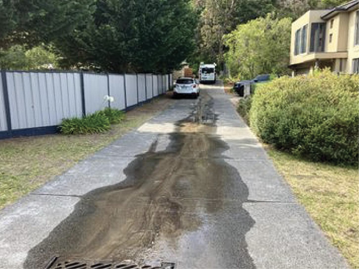
- Derek Rotter, Manager – Infrastructure Projects at the Shire, had also driven past the landslide site on his way to work and noticed water flowing down Penny Lane. He sent an email to Acting CEO Mr Oz, Ms Littlejohn, Mr MacDonald and others stating:
On inspecting the site, I noticed significant water still flowing out from the property, with silt content within the water. (This indicates the land has a significant high-risk of slipping again).
Noting no major rain events have taken place to generate this amount of water runoff, it then suggests there is a break in a domestic water line somewhere.634 (emphasis added)
- He included the following photograph of the flow of water and silt travelling out of the driveway of the Morans’ property and onto Penny Lane:
FIGURE 3.38: PHOTOGRAPH TAKEN BY MR ROTTER OF THE WATER FLOWING FROM THE DRIVEWAY OF 3 PENNY LANE DOWN PENNY LANE ON 9 JANUARY 2025.635
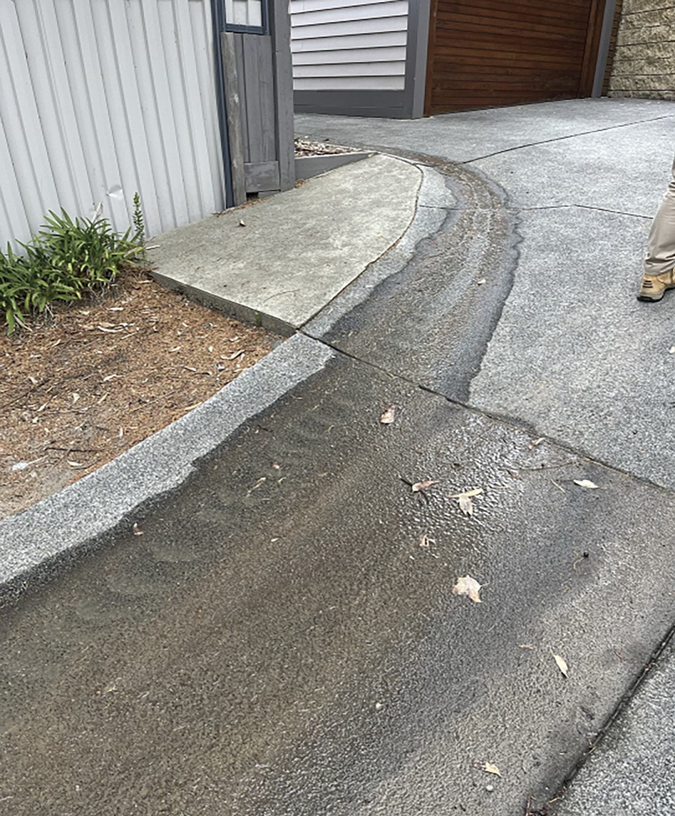
- Mr Rotter suggested that residents in the area be asked to turn off their water supplies one by one, to try to eliminate sources of water, and that this be overseen by the Shire “to reduce our risk and identify where the source is coming from”.636 Later that day, Mr Oz asked Ms Littlejohn if she could arrange this. Ms Littlejohn responded that Mr Glover and his team were monitoring the situation carefully and that she would take advice from them.637
Reponses to the unexplained water
- Notwithstanding Mr Rotter’s concerns that the significant water flow indicated that “the land has a significant high-risk of slipping again”, the Shire did not change its approach. None of the Shire’s responses to Mr Rotter’s email engaged with the question of whether the situation now warranted an emergency response.
- Instead, Mr Glover attended the Morans’ house and gave Mr Moran the Action Items list that he had prepared the day before.638 Mr Glover, Ms Scoble, and the Morans stood in the living room on the second floor to discuss the actions required.639 This was in circumstances where the Shire had Mr Pope’s opinion that being on the property presented an unacceptable risk to life.
- Mr Glover told the Board of Inquiry that he told the Morans the recommended actions were for the purpose of “mitigat[ing] the risk of a further landslide”.640 The Morans told the Board of Inquiry that they understood the Shire’s primary concerns to be dealing with the flow of water through their property and removing the buildup of debris from behind their property.641
- Mrs Moran recalled Mr Glover explaining that the weight of the dirt and rubble behind their home could become too heavy for their house to bear.642 She also told the Board of Inquiry:
Mr Glover told us that he was concerned that the amount of water still running from our property would place pressure on the front retaining wall and affect the house in front of ours.643
- Similarly, Mr Moran remembered Mr Glover saying words to the effect that he was concerned the dirt would have nowhere to go if there was another landslide.644 He told the Board of Inquiry that in any event, he and Mrs Moran “just didn’t have the expertise to fully understand exactly what they [the Shire] were trying to achieve … And Sue, the assessor, certainly took over”.645
- Following the meeting, Ms Scoble recorded that the Shire wanted the soil and debris to be removed from behind the Morans’ property within the week, and a water diversion system put in place. In addition, shipping containers and traffic bollards filled with water were to be installed on a 100-degree angle against the front retaining wall early the following week.646
- Over the course of the morning, Mr Borghesi also continued to update Mr Flores about the continued flow of water at the site. He sent a text message to him at 10.51am as follows:
Claude, the flow rate has abated to the original rate of ~10 l/minute. Council specifically asked us to report any changes or deterioration. It would be helpful if you acknowledge receipt of these updates.647
- Mr Borghesi did not receive a response to his text message. The Shire has informed the Board of Inquiry that Mr Flores went on annual leave on 9 January 2025, and did not return until 14 January 2025.648 It is apparent that Mr Borghesi was unaware that Mr Flores was on leave, and so continued to update Mr Flores as he had been asked to by the Shire.
- Shortly before lunch, Mr Glover met with the Borghesis at their house and provided them with a copy of the Action Items list.649 Mr Borghesi understood from that meeting that the Shire was focused on ensuring resident safety and identifying the source of the water flowing from the escarpment. He recorded in his diary that the “plan” was to take water samples, estimate flow rates, and check fire hydrants.650
- In relation to him giving the Action Items to the Morans and Borghesis, Mr Glover told the Board of Inquiry:
It was … the responsibility of the owners to take the relevant action(s) because the works concerned their properties. This was not a direction, but a strong suggestion by me. As both parties were working towards a solution and to Mr Pope’s recommendations, I considered that, should they not cooperate, I would issue a formal Building Notice directing them to undertake the recommended works. I advised both parties of my intent should cooperation not occur, including Ms Scoble.651
- Mr Glover did not explain why the Shire’s response was limited to directing residents to take actions, rather than also seeking an emergency response from the VicSES – even though water was continuing to infiltrate the unstable headscarp and there was the threat of a further landslide, which Mr Rotter of the Shire had assessed as “a significant high-risk”.652
- After giving the residents responsibility to take actions (including diverting surface water away from the headscarp), Mr Glover and Mr Jones then went about taking further water samples for chemical analysis.653
- Mr Glover spoke with the resident of 1 Waller Place, located on the corner of Charlesworth Street, who told him that residents had been reporting the water leak in that vicinity to the Shire and SEW from as early as September 2024 and throughout December 2024.654 Mr Glover said to Mr Jones at that point, “this could be the cause, to 10–12 View Point”.655 They continued to track the flow of water by walking the streets down Coburn Avenue. They “lost the water” at the intersection of Coburn Avenue and Prospect Hill Road.656
- Mr Glover told the Board of Inquiry that after seeing the leak in Charlesworth Street, he thought it may have been causing “the extent of water in the slope”. However, the Shire’s testing remained inconclusive: the trace-dye the Shire had used was not emerging in the stormwater drainage from around 2 View Point Road to the corner drainage pit. Accordingly, Mr Flores asked the Shire’s Environmental Health team to assist with arranging sample bottles of water to be tested.657
- After lunch, Mr Glover sent an email to Ms Littlejohn and Mr MacDonald to relay the steps he had taken that day.658
- None of the Shire’s trace-dye, water sampling tests or inspections had identified the cause of the water discharge on the escarpment, leading Mr Glover to comment that “the water source could just be a natural spring”. He noted that if that were the case, the State Government would need to be contacted.659 He told the Board of Inquiry that he was not certain there was a natural spring, and that he relied on his direct report and Director to communicate his update to the necessary parties.660
- Mr Glover otherwise confirmed that the Office of the MBS would continue to inspect the site conditions daily during the working week. He stated:
Work is commencing to reduce the hydrostatic loads on the premises, which will result in water being pumped via the surface along Penny Lane until the water source is known.
…
Over the next few days, the insurers and owner have commented on undertaking works as previously communicated and reviewed by PSM Engineers as a short-term solution.
Internally; Clrs, ELT, Engineering, Environmental Health have been notified. At this stage, based on the PSM initial finding, no residents along Point Nepean are at risk, provided the short-term works are undertaken.661 (emphasis added)
- In the early afternoon, Mr Borghesi contacted Dan Tolan, Geotechnical Engineer at CivilTest, to discuss the Action Items list. He was told to seek Maw Civil’s advice as to what works could be safely actioned to stabilise the headscarp. Mr Borghesi then contacted Maw Civil and a representative attended the property later in the afternoon.662
- Around this same time, Mr Borghesi observed that the water flow from the escarpment had increased. He was concerned the water flow was continuing to erode the headscarp and compromising the stability of a gum tree. He recorded in his diary: “small landslip at head of scarp and crack appearing south of gum tree”, and sent Mr Flores a text message stating, “Claude, a small amount of soil (0.5m3) collapse from near the gum tree, the tree is at risk”.663
FIGURE 3.39: PHOTOGRAPH TAKEN BY MR BORGHESI SHOWING THE COMPROMISED TREE ON 9 JANUARY 2025.664
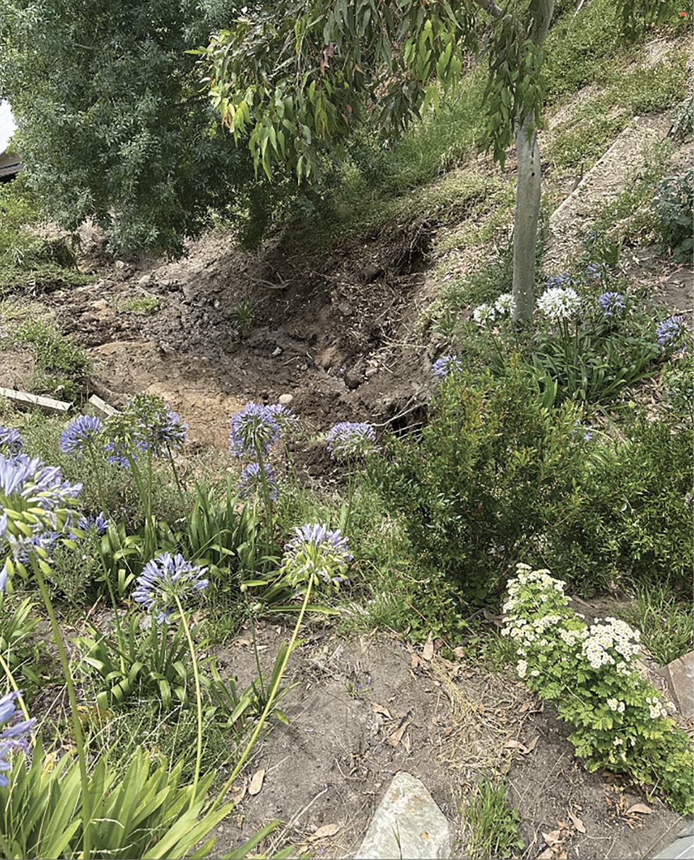
- Mr Borghesi also notified Mr Glover of these concerns at around 3.30pm. He made a further record in his diary regarding this communication, noting: “apparently they have ruled out leaking hydrants and did water testing – should have results back next week”.665
- By early evening, Ms Scoble had arranged for a builder to attend the Morans’ property the following day to carry out the water diversion works set out in the Action Items list, “under strict supervision due to site hazards”.666 She had also arranged for a plumber to attend the property to try to ascertain where the water was coming from, noting “the flow of water is constant, which is more than there would be if it was coming from a natural spring”.667 She recorded:
Whilst on-site CFT were under house and have advised approx. 4 stumps have been affected. I have also sent them a copy of the council recommendation for comment as they heard some of what they were recommending and reached out to me after leaving the property to express their concerns in particular around the shipping containers and the weight on the front lawn as this isn’t made to take the weight that there would be, and the concern is it would affect the retaining wall between [the Morans’ house] and the lower neighbour. I advised we had similar concerns, hence why we are holding off on this at this stage until I have further discussions early next week.668
The fifth day after the landslide, 10 January 2025
- Five days on and the unexplained water was continuing to flow from the headscarp (albeit at a reduced rate of 5 litres per minute),669 increasing the already significant risk of a further landslide.
- The Shire did not change its approach to the heightened threat.
- First thing in the morning, Mr Glover met Mr Moran at his house. They were joined by contractors, Mr Jones from Midcity and Ms Scoble, who wanted to ensure that all parties “were on the same page” as to what works were to be undertaken.670 Mr Glover told the contractors what the Shire was expecting in respect of the water diversion plan, namely, the removal of decking and the installation of a pipe underneath the house.671
- The plumbers who had been engaged by Ms Scoble the previous day also attended the property to investigate the source of the continuous flow of water.672 They told Ms Scoble that they had located a pipe underneath a retaining wall at 10–12 View Point Road, and they believed the water flowing down the escarpment to be emanating from that pipe. It is said that they gave photographs to Ms Scoble,673 but no such photographs have been produced to the Board of Inquiry.
- The contractors, Midcity, made this note of the discussions on-site:
A council officer is also on-site and advises David and Sue of his concerns and instructions on what works he wants completed, as he believes there is an immediate risk to the house directly below the insured property. The retaining wall at the front of the insured property is being compromised due to continual water runoff from the cliff at the back of the property[.]674 (emphasis added)
- Throughout the afternoon, the contractors installed pipes under the house to divert the water.675 The solution was short-lived. By the next day, it would fail.
- In the meantime, while the contractors worked, Mr Glover conducted a further inspection of road kerb collectors and stormwater pits, and carried out further trace-dye testing, to determine whether the Shire’s stormwater drainage had been compromised.676 Mr Glover told the Board of Inquiry:
I observed that the road curb collector at Prospect Hill Road was silted with debris…and the red dye did not flow via the stormwater drain to the corner pit of Prospect Hill and View Point Road. This made me consider there was a potential damaged pipe allowing water to flow subterraneously or within the trench void[.]677
- He then sent Mr Pope the following text message:
Just back on-site … No evidence of red [dye] … Discharge increased slightly and water is clearer
From 10–12 [View Point Road] at the head.678
- Around lunchtime, Mr Glover sent photographs of the landslide site to Mr Pope.679 The flow of water down the escarpment was clearly visible.
FIGURE 3.40: PHOTOGRAPH TAKEN BY MR GLOVER SHOWING THE FLOW OF WATER ON THE ESCARPMENT ON 10 JANUARY 2025.680
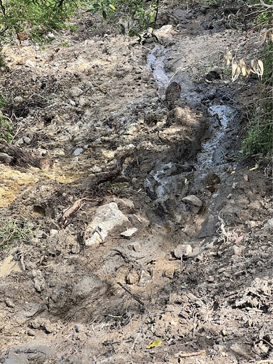
- In the afternoon, Mr Borghesi sent an email to Mr Glover, attaching a document prepared by Maw Civil outlining a proposed “methodology and stabilisation scope of works”.681 Maw Civil stated that while the proposed works involving the installation of rock bags would not resolve the issue, it was hopeful that the works would prevent the earth from further slippage.682
- Mr Borghesi asked Mr Glover to provide any comments on the proposal as the work was intended to commence the following week.683 Mr Tolan, from CivilTest, was to review the proposed scope of works concurrently.
- Mr Borghesi also asked the Shire to provide continued updates on the identification of the source of the water flow and actions being taken to redirect or manage the water flow on the Borghesis’ property.684
- Later that evening, Mr Borghesi made an emergency call to the Shire, the nature of which was recorded by the Shire as a “slide at the property”. Records indicate that the call was with Mr Glover.685 Mr Borghesi told the Board of Inquiry that he made a phone call to Mr Flores at around 7.35pm and to Mr Glover at around 9.00pm on 10 January 2025.686 He could not recall details of what was discussed.
The sixth day after the landslide, 11 January 2025
- The unexplained water was continuing to run six days after the landslide.
- Mr Moran visited his property on 11 January 2025 and observed that the flow of water had not decreased or altered since the landslide,687 and that there was water breaching the retaining wall at the front of his property.688
- He sent photographs to Ms Scoble.689 Ms Scoble sent a text message to Mr Jones of Midcity to advise him that the “make-safe around the front retaining wall to prevent runoff to the front neighbouring property” was no longer effective. She told him that water and silt were washing down the cliff face and back over the retaining wall, such that it required attention. She asked him to address the issue.690
- Ms Scoble sent a further text message to Mr Jones later in the day to follow up on her request, but she received no response.691
- In the meantime, Mr Borghesi noticed further movement on the escarpment. He told the Board of Inquiry:
Notably over the weekend 11 and 12 January just - we tried to contact council but there was no-one available over the weekend. They did have an after-hours call-in voicemail system that we spoke to someone and relayed our concerns that we were seeing further degradation of the hillside.692
- Counsel Assisting asked Mr Borghesi if it was fair to say that he was “actively concerned” there might be a further failure of the slope. Mr Borghesi replied, “Absolutely, categorically”.693 When asked if he considered the source of the water to be the most significant issue to be dealt with at that time, he stated:
No, not at all.
…
[What we] repeatedly communicated to council employees was we felt the source of the water at this point was completely irrelevant. What was relevant was water is coming out of the headscarp and likely to be identified and tracked in a relatively narrow pathway back up to View Point Road in the vicinity of the work where the dye was put into the borehole that led to the green dye coming out of the scarp. So our point was, ‘Don’t worry about where it’s coming from. What you need to do is intercept it before it emanates from the scarp because once gravity gets a hold of it, as was evidenced between 5 and 14 January, it will just continue to erode the scarp.’
And because water was continuing to flow, as I said, for many weeks after 14 January we felt it was imperative that council or South East Water undertake some urgent works to dig a trench or put spears in View Point Road to seek to intercept the water and, even if that were unsuccessful, it was critical that they do that rather than identify the source of the water.694
The seventh day after the landslide, 12 January 2025
- One week after the landslide, on 12 January 2025, John Bolch, a local resident and licensed and registered commercial plumber, observed a constant stream of water flowing along the west side of the Morans’ property, down Penny Lane and towards the spoon drain on Point Nepean Road. He described the water as being “bordered by a fine silty sand, which appeared to have been brought down the slope by the water”, and noted that he saw a significant amount of water flowing from underneath the Morans’ house and over the lower retaining wall in front of their house.695 He told the Board of Inquiry:
I proceeded to take a video of the water running down Penny Lane because it was a substantial flow. When I panned over the top of the gate and towards their retaining wall you could see a lot of silt, sand building up on the lower grass level of the retaining wall. As I moved around you could see where they’d put the pipe coming out from underneath the deck, but it had virtually stopped flowing. So obviously the sand and that had built up that much that it couldn’t flow out the relief point that they were trying to achieve.696
- Mr Bolch was surprised by the volume of water because it had been a “particularly dry summer”.697 He considered the presence of water to be related to the landslide on 5 January 2025, because he knew that landslides typically need a lot of moisture for the soil or other material to become heavy enough to slide.698
- Mr Bolch was curious to understand the source of the water and spent the afternoon driving around the local area with his wife.699 He saw water running down the kerbs along both sides of Charlesworth Street and saw that the road surface at the intersection of Coburn Avenue and Charlesworth Street was cracking and spongy with water. He was not able to locate the source of the water.700
- In the afternoon, at around 2.36pm, Ms Scoble sent an email to Mr Jones of Midcity, attaching the text messages she had sent him the previous day.701 She wanted to ensure he would arrange for someone to attend to deal with the water diversion at the Morans’ property, particularly given the wet weather. She stated:
I’m sending you an email as I’ve had no response to the text I sent you on Saturday and given the importance of this claim we need to make sure we are actioning this urgently.
[The Morans] are being very understanding at the moment but this could change especially if the council issue an order.702
- Mr Jones arranged a meeting at the site for the following morning.703
- Mr Borghesi also recorded in his diary that there had been rain and lightning and:
2nd retaining wall timber beam collapsed
Lost 2nd agapanthus – headscarp … stair pickets to south edge holding[.]704
- He took this photograph:
FIGURE 3.41: PHOTOGRAPH TAKEN BY MR BORGHESI OF THE RETAINING WALL FAILING ON 12 JANUARY 2025.705
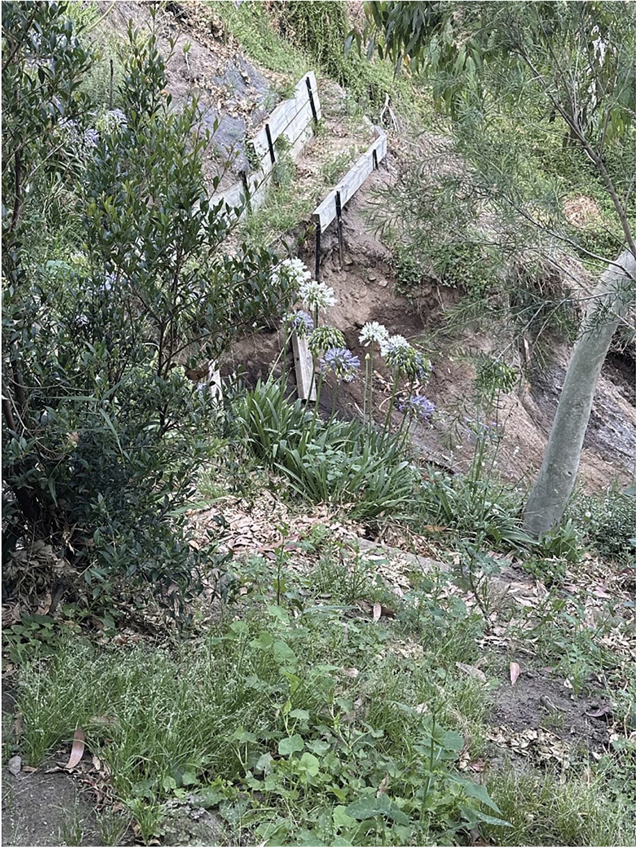
The eighth day after the landslide, 13 January 2025
- By the second week after the landslide, the water was still flowing and the headscarp was, unsurprisingly, even more unstable.
- In the morning of 13 January 2025, Mr Glover sent several photographs of the headscarp to Mr Pope, which appear to have been taken from 6 View Point Road. They exchanged the following text messages:
Mr Glover: Not good…
Mr Pope: Wedge in front is slowly failing
Mr Glover: I [was] told by the insurer the[re] is a water pipe under the retaining wall.
Mr Pope: For irrigation??
Mr Glover: I do not think so. It is a larger pipe I believe. RACV advised me and I am further investigating.706
- Again, the Shire did not re-engage with the VicSES to seek an emergency response to the imminent landslide.
- The Shire did not take the steps suggested by Mr Borghesi, namely, to dig a trench or put spears in View Point Road to try and intercept the water before it emanated from the headscarp, nor did SEW take those steps.
- The water continued to infiltrate the headscarp.
- At 9.50am, Mr Moran telephoned Ms Scoble to ask for an update on what was being done to repair the water diversion issue at his house. Ms Scoble confirmed that a builder would be attending that day. She noted she was otherwise still awaiting an engineer’s report and would update Mr Moran once she received it.707
- Shortly after, Mr Moran sent a text message to Mr Glover to enquire as to whether the rainfall the previous night had affected the water flow through his property. Mr Moran recalls receiving a telephone call from Mr Glover, during which they discussed the overnight rain and whether arrangements had been made for shipping containers to be brought onto his property.708
- About an hour later, Mrs Moran contacted Ms Scoble to tell her that Mr Glover had foreshadowed issuing a Building Order if work to remove the soil on their property was not undertaken. Ms Scoble recorded:
I advised that is fine he can issue an order but I need to know a cost as I am in the process of getting this she is concerned about the fact that if they have further slippage this will cause damage to the roof of the house as this is what has been suggested by Matt Glover[.]709 (errors in original)
- Ms Scoble telephoned Mr Glover to tell him that she was waiting on quotes for the removal of the soil and debris. She also told Mr Glover that the water leakage needed to be stopped first. She said that the longer it went on, the more likely further soil would “drop” which could “take out the props as well and cause the roof to collapse”. Ms Scoble noted that Mr Glover was surprised by that comment.710
- In the same conversation, Mr Glover told Ms Scoble that he understood from Mr Moran that the plumbers who had attended the site had located a cracked pipe. Mr Glover requested drawings to determine the location of the pipe, and Ms Scoble subsequently contacted Mr Jones of Midcity to ask for those drawings.711
- Mr Jones had, in the meantime, arrived at the Morans’ house with several tradesman and a civil contractor to review the failed water diversion. A secondary make-safe was completed, diverting water away from the lower house.712 The following observations were also made:
While on-site, it is discovered that the water flowing down the cliffside has increased significantly since previous attendances, likely due to rain over the weekend. It is recorded that there was 8mm of rain on Saturday and 9mm on Sunday in a short period of approximately three hours.713
- Mr Jones provided those updates to Ms Scoble during their conversation. She told Mr Jones that the Shire was “putting enormous pressure” on Mr Moran to have the soil and debris urgently removed from the rear of his property, and that she required a quote as soon as possible.714
- At around lunchtime, Ms Scoble told the Morans that she believed the water to be emanating from the damaged pipe underneath the retaining wall on 10–12 View Point Road. She said that if the water was coming from a natural spring, as had been suggested, the flow would be inconsistent, varying with the ebb and flow of the spring. She thought the flow of water at the Morans’ property was not behaving in that way; to her, it had not altered in volume or pace since the landslide.715
- Later that afternoon, Mr Glover contacted Ms Scoble to advise that he would be attending the Morans’ property the following day and would be “up on the hill”. Following a call from Mr Moran, Ms Scoble placed a further call to Mr Glover to discuss the use of shipping containers. Specifically, Ms Scoble asked Mr Glover how he proposed to have shipping containers taken up to the site. He responded that cranes would be used. Ms Scoble recorded, “I asked how given the access and he couldn’t answer me”.716
- Ms Scoble later sent to Mr Glover the following aerial shot of the Morans’ property and the rear of the Borghesis’ property:
FIGURE 3.42: AERIAL IMAGE OF 3 PENNY LANE AND 10–12 VIEW POINT ROAD WITH ANNOTATIONS SHOWING LOCATION OF THE BROKEN PIPE UNDERNEATH THE RETAINING WALL AT 10–12 VIEW POINT ROAD.717
FIGURE 3.42

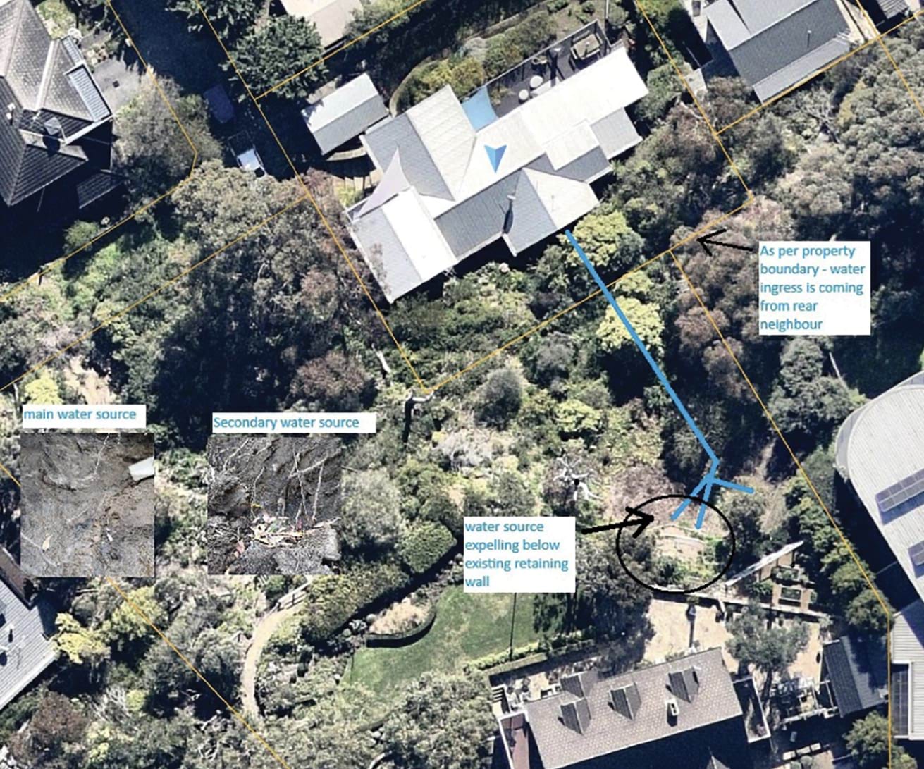
- She described it as “a map with the location of the pipe that is broken from our builder”. She otherwise noted that she would update Mr Glover on the proposed use of shipping containers once she had gathered more information “in the next couple of days”.718 Mr Glover responded, “I can see where the broken pipe is on the plan”.719 He forwarded the email to Mr Pope later that afternoon and asked for Mr Pope’s thoughts.720
- Mr Glover was also communicating with various people in relation to works on 10–12 View Point Road. He sent an email to Mr Tolan from CivilTest, Mr Borghesi and Mr Pope, asking Mr Tolan to liaise with Mr Pope in respect of the proposed use of rock bags.721
- In response, Mr Tolan sent an email to Mr Pope only, stating:
Our immediate works plan is to create a batter against the main scarp with porous rock bags. We will use around 30 bags (1.25t). Additionally the aggie in the retaining wall is going to be extended out such that it drains six metres or so downstream of the point where the groundwater is coming out. I’ve also told Gerry that the non-porous paved area should be sandbagged to prevent surface runoff (This is just the entrance to the stairs I believe, but I am reattending the site this week so I will make sure there are no potential areas where water will be able to drain to the scarp).722
- A few hours later, Mr Pope sent an email to Mr Tolan, copying Mr Glover, disagreeing with the proposed use of the rock bags.723 Mr Pope stated:
If the owner wants to meaningfully reduce risk, they should unload the active side of the retaining wall. i.e. remove planter boxes within influence of the slip and unload some of the back fill. This reduces the driving forces in the landslide immediately.724
- Mr Borghesi recorded in his diary the following:
930 Matt (MPSC) on-site – found voids under concrete retaining wall
Geotechs not aligned on emergency solution
Large tension cracks at base of ret[aining] wall (new and longer cracks).725
- Mr Glover provided an email update to David (Davey) Smith, Director Assets and Infrastructure at the Shire, and Tom Haines-Sutherland, Manager Infrastructure Services at the Shire, copying Ms Littlejohn and Mr MacDonald. He noted that water was still discharging from 10–12 View Point Road at around 15 litres per minute, and that the Office of the MBS had undertaken a preliminary assessment for leaks and flows, including kerb pit inspections, water sampling from the landslide site, using trace-dye, and checking surrounding water metres and ground ball hydrants.726 He stated:
The plan below indicates where the red trace [dye] was placed, and it stopped at 2 Prospect Hill and did not enter the [kerb] pit on the [corner] View Point / Prospect Hill.
Can you please investigate further? The trace [dye] appears to disappear between 2 Prospect Hill and the [kerb] pit. It also seems that the new pit’s construction has not been built to standard.727
- He included the following diagram:
FIGURE 3.43: DIAGRAM PREPARED BY MR GLOVER ON 10 JANUARY 2025.728
FIGURE 3.43

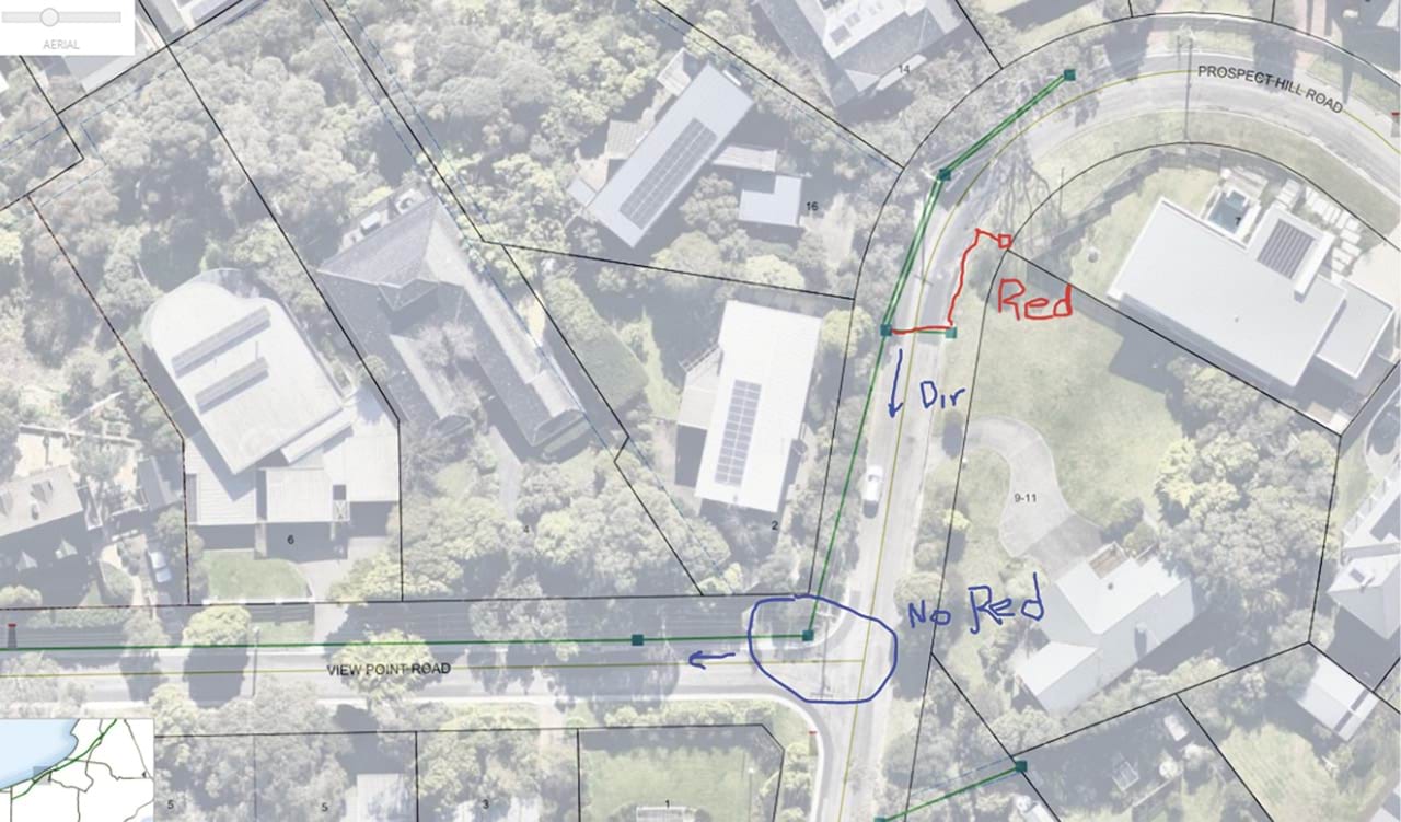
- Mr Glover told the Board of Inquiry that he asked Mr Smith and Mr Haines-Sutherland to investigate the flow of water as he felt he had exhausted the investigations available to him, and it appeared to him that a potential cause of the constant flow of water could be the “council’s drainage system failure”.729
The McCrae Landslide, 14 January 2025
- Nine days after the 5 January 2025 landslide, and with unexplained water still infiltrating the headscarp, the McCrae Landslide struck, destroying 3 Penny Lane.
- At around 8.45am on 14 January 2025, Mr Willigenburg heard a deep rumbling sound coming from the rear of his rental property. Within seconds, he heard a massive crash and Mrs Willigenburg yelling, “the house has come down”. Panicked, they ran out of the house and onto Point Nepean Road.730
- Mr Willigenburg told the Board of Inquiry:
As we came out of the house, I turned left to look towards the rear of the rental property and I immediately saw that the house at 3 Penny Lane had lurched forward into the backyard of the rental property. The house looked as though it had split in half and seemed to be hanging over the rear fence of the rental property. There was glass and timber everywhere. I was in complete shock and I do not recall Denise or me saying anything to one another in that moment.731
- Mr Willigenburg noticed a person lying near the front gate of the Morans’ property. He ran up to the person and realised it was Mr Glover.732 He told Counsel Assisting:
[Mr Glover] was in a terrible state. He was screaming and he had blood on his head. He had shards of glass sticking in his head. He was lying on his side. He was conscious, though. I can’t remember what I said to him at the time, but he was conscious.733
- Mr Glover had arrived at the Morans’ property earlier that morning to inspect the water diversion system that had been repaired the previous day.734 Mr Willigenburg understood from Mr Glover that he had jumped from the deck on the second floor of the Morans’ property when he heard the same loud rumble that Mr Willigenburg had heard.735
- Mr Borghesi had also heard the same sound. He had been sitting in his living room, typing an email to the Shire about further degradation of the escarpment, when he heard what he described as a “loud thunderstorm” that sounded like a “rumbling train”.736 He told the Board of Inquiry that he and Mrs Borghesi:
instantly ran out the backdoor, knowingly looking at each other that we knew what had happened, and then went to not the veggie patch area but…to the paved area, which we considered to be safe, and observed the back end of the landslip actually occurring, dust rising from down below. So we were outside within 15 seconds of the initial collapse.737
- Mrs Borghesi took several video recordings of the landslide in those initial moments. The videos clearly showed what Mr Borghesi described as “deeply saturated soil collapsing from underneath number 6 View Point Road” and “topsoil falling from behind the retaining wall”. He described the soil as “more liquified” than what flowed from the escarpment following the landslide that had occurred nine days earlier, noting it was “water just flowing out of the hillside”.738
- Mr Cooper, who was driving through McCrae that morning, turned onto Point Nepean Road and saw “a pile of rubble” with dust emanating from the area where the Morans’ property had stood. Mr Cooper’s mother rang him at the same time and told him she could see a fire. He told his mother, “that’s not a fire. A house has fallen down the hill”.739
FIGURE 3.44: AERIAL PHOTOGRAPH OF 3 PENNY LANE TAKEN FOR THE VICSES ON 14 JANUARY 2025.740
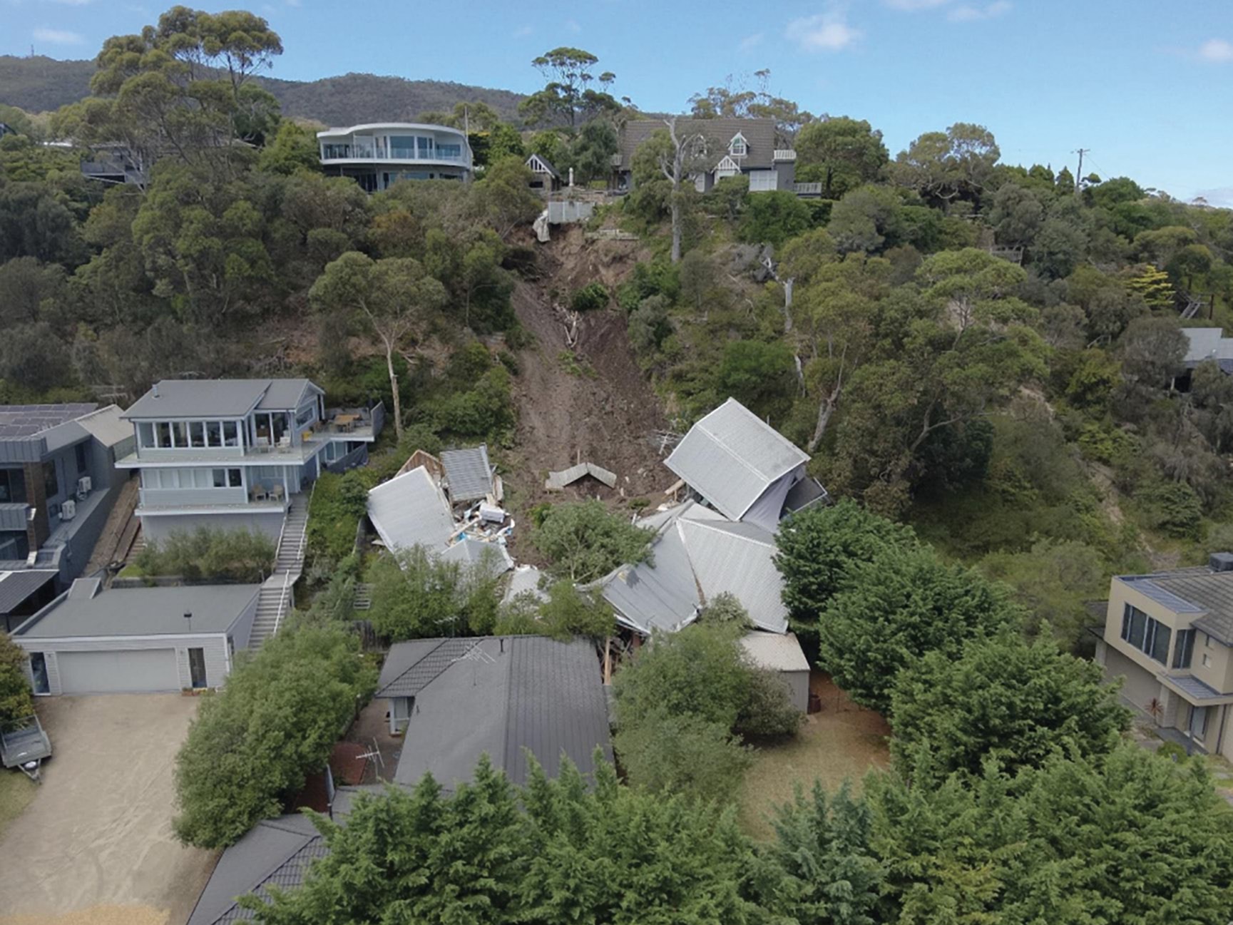
- Within moments of the landslide, people had begun to gather and local residents, Mike O’Neill and John D’Helin approached Mr Willigenburg and Mr Glover.741 A bystander called “000” and handed the phone to Mr Willigenburg who was closest to Mr Glover.742 Mr Willigenburg recalls the operator asking what had occurred and whether Mr Glover was conscious.743 As he responded to those questions, Mr O’Neill told him “Paul, you need to tell the d[i]spatcher the house is moving. We’ve got to get Matt away from here”. Mr Willigenburg told the Board of Inquiry:
So I told the d[i]spatcher that and they said, ‘Okay, as best you can, because he’s obviously seriously injured, drag him as far away as you can.’ And so we probably dragged him about four or five metres towards the front of Jon McLean’s property at 2 Penny Lane.744
FIGURE 3.45: PHOTOGRAPH OF 3 PENNY LANE FOLLOWING LANDSLIDE ON 14 JANUARY 2025.745
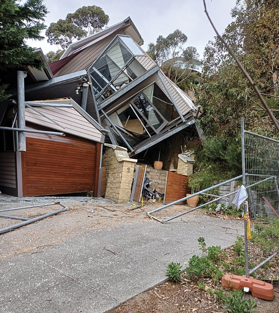
- The VicSES recorded its first notification of the incident at 8.48am. It had received a report that a whole house had rolled down a hill and that there was an injured man lying at the bottom of the hill. The VicSES did not know, at that point in time, whether there were any other persons inside the Morans’ house or who the injured person was.746 VicSES units were immediately dispatched to the scene.747
- The VicSES received several further notifications over the minutes that followed and recorded comments including:
- The first VicSES unit arrived on scene at 8.59am.749
- In the meantime, Maharlia Pakoti, Assistant Building Surveyor at the Shire, arrived at the scene. She had been due to meet Mr Glover at the Morans’ property to assist him with an inspection of it. Mr Glover told Ms Pakoti that he had been standing on the balcony when he heard a loud rumble and felt the house start to move. He had tried to jump onto the nearby retaining wall but missed the wall and landed in the driveway.750
- Ambulance Victoria and Shire representatives also attended the scene.751
- By 9.13am, Mr Daw of the VicSES, who had assumed the role of Incident Controller of the scene, reported that the Morans’ property had been “compromised by landslip and completely destructed”. He noted there were VicSES responders assessing the area above the landslide and evacuating people from it.752
- At around 9.15am, Mr Moran received a text message from a friend stating, “I heard there was a landslide on Penny Lane, hope that’s not your house”.753 Mr Moran, who had not received any notification of the landslide, responded to his friend’s message to explain that the landslide had occurred the previous week. His friend replied stating, “no, this morning”.754
- Mr Moran made a series of panicked telephone calls to try to find out what had occurred. He telephoned Mr Willigenburg, followed by Ms Scoble, and Mr Glover, but was unable to reach any of them. Mr Willigenburg returned his call. He told Mr Moran what had happened.755 The Morans then started driving to McCrae, listening to radio news reports about the landslide. They were both, understandably, in shock.756
- In the meantime, the VicSES had observed “lots of water coming down one of the main driveways”, and had agreed with Victoria Police to close Point Nepean Road, due to the “potential of house flipping further”.757 By 9.50am, it was determined that there would be an evacuation warning issued to residents within a 500 metre hexagon around Penny Lane and Point Nepean Road, and an exclusion zone was established shortly after.758
- Mr and Mrs Willigenburg had been permitted to enter their rental property for a few minutes, to collect any medication they required, but were told they needed to evacuate immediately after that.759
- At 10.00am, representatives from several agencies met and determined that the VicSES would continue to manage the incident.760 At 10.15am, the VicSES recorded: “source of underground water likely to be underground spring causing movement of soil”.761
- At around the same time, Mr Swain sent an email to Tim Lloyd, General Manager for Service Delivery at SEW, and other SEW personnel, stating:
Over the last 10 days we have been working with the customers and Morn Pen Council to investigate the source of water coming out of the ground at multiple locations that has caused a land slip at 10 Viewpoint Rd, McCrae … We have yet to conclude these investigations, as further leak detection is currently being undertaken further north, however at this stage our investigations are concluding that the water is not from the SEW Water Network.762
- Mr Swain noted that two leaks had been identified “across the highway” but explained that the overflowing water from those leaks had moved into the stormwater drain rather than into the ground, and that the leaks had since been repaired. He confirmed he would prepare a summary report of SEW’s activities and findings.763
- Mr and Mrs Moran arrived in McCrae at around 10.19am but were prevented from entering the area by Victoria Police officers who were monitoring the road closure that had been set up. They were later allowed into the restricted area.764
- Counsel Assisting asked Mr Moran what he saw when he and Mrs Moran entered the restricted area. Mr Moran responded:
It was - yes, it was horrible. I had concerns. I knew the assessors were having contractors there at different times and, with people coming and going, I had concerns there might have been some other people that they didn’t know were at the property. We pretty much cleared that and found out there wasn’t. And then we just - yes, it was just - yes, it was horrific.765
- Mrs Moran told the Board of Inquiry, “I don’t know how to describe it, it was shocking”.766 She had been concerned for the safety of the Willigenburgs and was asking where they were.767 She stated:
The SES were initially - didn’t - were confused, and it did send people into a bit of a panic because they didn’t know who Paul and Denise were. I then asked - that was the police, sorry. When I went to the SES, they knew who they were and they directed me - they said, ‘They’re over behind the bushes.’ By this stage there was a lot of media there, so they were sort of behind some bushes near some neighbouring properties. So I went to them.768
- Mrs Moran told Counsel Assisting that it was obvious there had been a second landslide. She explained:
contrary to a lot of reports, the property didn’t slide 50 metres down the hill. It was - the hill slid down and hit the property and split it in half. So you could see that there was a lot of land missing that had previously been there and that the property was - one half had gone one way and the other half had gone the other way.769
- Mr Bolch and Kevin Hutchings, son-in-law of a local resident and a former Managing Director of SEW, also arrived in McCrae by around 10.30am.770
- Mr Bolch had received a voicemail from a friend earlier that morning, to ask if he had been affected by the landslide.771 He had immediately telephoned his wife and they agreed to meet at Mr Bolch’s property. By the time Mr Bolch arrived, his wife and daughter had already been inside and were evacuated from it by the VicSES.772
- Mr Hutchings had received a telephone call from his brother-in-law earlier that morning, to advise him that there had been a landslide.773 Mr Hutchings had immediately set off for his mother-in-law’s house (6 View Point Road) and was eventually permitted to enter the restricted area.774 Mr Hutchings told the Board of Inquiry that as he waited in the restricted area, he overheard a bystander say words to the effect of “do you reckon it … has anything to do with the water up the road”.775
- At around 10.39am, Andrew Brick, Team Leader of the Shire’s Emergency Management team, held a brief team meeting, during which it was determined that the Shire’s two key responsibilities at that time were to contact affected residents and confirm they had somewhere to go, and to establish a relief hub for them.776 Mr Brick then travelled to the site and spent the morning liaising with Mr Daw, VicSES responders and Victoria Police, in relation to road closures, traffic control, and other logistical matters.777
- At around 11.23am, Mr Moran received a telephone call from a Shire representative, who notified him that his property was in the area impacted by the landslide and that a relief centre had been established for residents who required assistance. He told the Board of Inquiry “the person I spoke with did not know that I was one of the owners of the property that had collapsed”.778
- At 12.12pm, Mr Swain sent a further email to Mr Lloyd and others to confirm that SEW had shut down its water supply to View Point Road, and that “all the houses on the landslide side of the street [had] been evacuated”. He noted that Mr Marsh, “Ethan (Water Ops) and Bec Mcindoe (Customer liaison)” were on-site.779 He sent a further email to Mr Lloyd at 12.43pm, providing the following schematic of the water network he had prepared, together with notes of his observations from the site.780
FIGURE 3.46: SCHEMATIC OF THE WATER NETWORK IN THE MCCRAE AREA ANNOTATED BY MR SWAIN. 781
FIGURE 3.46

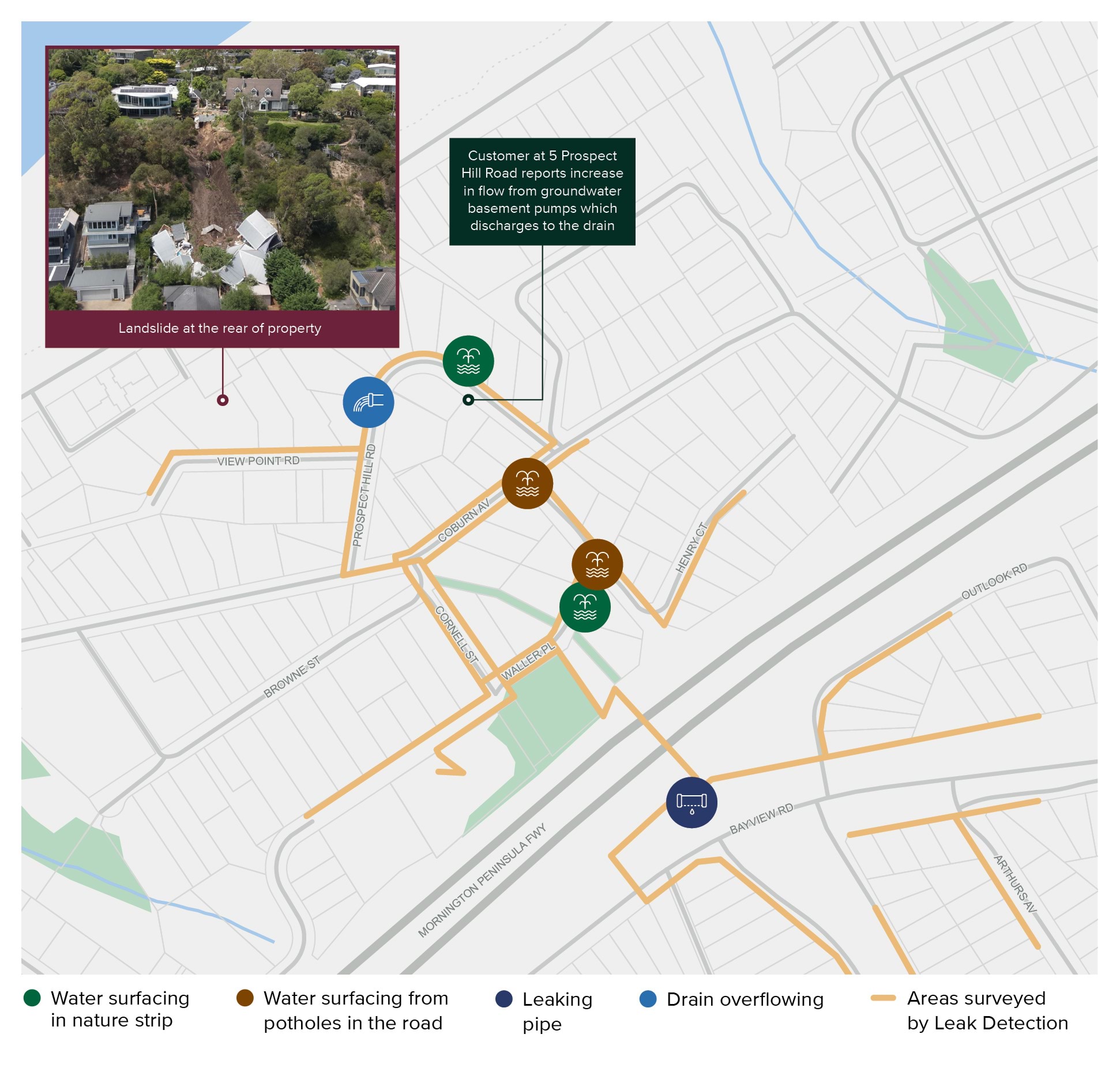
- Mr Swain stated:
The water main in Viewpoint Rd is AC [asbestos cement]. In terms of the sewer network, see GIS snapshot … I don’t believe that our sewers are impacted or have contributed in any way. I want to check the maintenance holes to the west of no. 10 when things quiet down. These are 25 metres deep and would be sensitive to any land movement.782
- Mr Lloyd responded to that email, stating “The burst info is interesting”.783 He told the Board of Inquiry that he understood the red symbols on the schematic to indicate burst pipes, and that in circumstances where there had been a landslide, water was emerging from the face of the landslide, and there was evidence of water surfacing, his genuine concern was “have we got an issue with one of our pipes in that vicinity”. He confirmed he had not yet connected the burst which had been repaired some two to three weeks earlier, with the landslide.784
- Mr Rotter and other Shire representatives arrived on-site at 2.26pm.785 At 3.48pm, Mr Rotter sent an email to Mr Smith and Mr Haines-Sutherland, copying Luke Jackson from the Shire’s Roads Corridor and Drainage team.786 He stated:
Following site inspection today with Luke Jackson and Nilanka investigating our drainage system. Luke will provide details of proposed works, at a high level we will undertake CCTV of the drainage system as first stage, along with cleaning of our drainage system – which did look very clear. The site is under control of MBS – Claudio, who will need to make determination tomorrow and issue building orders to the private residents.787
- At 4.12pm, the VicSES recorded that the “job” should remain open as there would be numerous crews attending the site over the next 24 to 48 hours.788 Mr Jackson also sent an email to Mr Smith, Mr Flores, Mr Rotter and Mr Haines-Sutherland to confirm that:
Roads & Drainage have engaged Fulton Hogan to be on-site tomorrow morning to perform CCTV to determine the condition of the drainage network.
We have also instructed them to clean some of the pits in the View Point & Prospect Hill Roads area, which show signs of some silt, leaf litter and refuse but nothing that appears to be impacting the efficiency of the network.
…
As an FYI, our contractor is performing investigative excavation works at Charlesworth St / Waller Place, in an attempt to determine the source of the water which is bubbling up and damaging the roads. This [i]s a last resort, as we have exhausted all possibility of defects from the relevant stakeholders with assets in the area.789
- Mr Jackson noted that Mr Rotter had strongly recommended a directive be given to residents in the area to cease all irrigation of their properties until the source of the water had been identified, and that SEW was continuing investigations into its assets in the area as well. He was hoping to receive a full report on SEW’s investigations in the coming days, including in respect of a burst water main they had identified and repaired “on the opposite side of the freeway”.790
- At 6.00pm, Jackson Evans, Road Rescue Capabilities Assessor at the VicSES, prepared a situation report, stating:
A known landslide occurred last week, resulting in the cordoning off of a holiday house and below houses, ensuring the surrounding residents were safe. After SES’s response, the scene was transitioned across to Council. On Tuesday, January 14th, at 8:48 a.m., Sorrento SES responded to an initial call of a rescue person structure collapse. An underground natural spring’s constant water further degraded the area’s foundations, resulting in a further landslide and the collapse of the house. At the time of the incident, a council Building Surveyor was attending and was injured.791
3.7 The effect of the November 2022 landslides and January 2025 landslides on the McCrae community
- The landslides have had a profound impact on the McCrae community.
- The landslides marked the sudden destruction of normality for those living in the vicinity of the landslide sites. They caused stress, fear and uncertainty for many residents and they continue to do so. They not only destroyed the house which once stood at 3 Penny Lane, but they also claimed the homes of multiple residents who were evacuated and have since been displaced.
- While the Board of Inquiry cannot inquire into actions taken since the McCrae Landslide on 14 January 2025,792 nor the related emergency response, relief and recovery activities,793 it is important to acknowledge the impact that the landslides have had on the community.
- The residents’ stories bring into sharp focus that the toll of the landslides extends well beyond property damage. The psychological and emotional toll for members of the McCrae community has been, and continues to be, immense.
Evacuations
The Emergency Orders
- The McCrae Landslide on 14 January 2025 led to Emergency Orders being issued to multiple residents, causing the temporary and, in some cases, ongoing displacement from their homes.
- On 17 January 2025, the Shire’s MBS issued Emergency Orders to 17 properties in the vicinity of the McCrae Landslide site,794 pursuant to s 102 of the Building Act. As a result, each affected resident was prohibited from entering their house and land.795
- The Emergency Orders stated:
The buildings and land have been identified as a potential risk to the life [and] safety of any occupant. This is due to the landslip that has occurred at the property known as 10–12 View Point Road, McCrae.796
- Residents were required to vacate their homes promptly, with little notice and in the hours approaching midnight.797 Residents, some of whom were vulnerable and elderly, had to find their own alternative accommodation.798
- At the time the Emergency Orders were issued, two properties were already, and remained, subject to Emergency Orders that were issued following the 15 November 2022 landslide.799 Residents of those properties were similarly prohibited from entering their house and land.800
- All told, in the aftermath of the McCrae Landslide, 19 properties fell within an area known as the exclusion zone established by the VicSES and the Shire.801
- By 14 February 2025, the Emergency Orders in respect of eight of the properties were lifted.802
- By 21 February 2025, the Emergency Orders in respect of another three properties were lifted.803
- The cancellation notices issued to the residents pursuant to ss 105B and 110 of the Building Act were brief. These decisions were communicated in terms such as “the directions within the [Emergency] Order have been completed and the Order is subsequently cancelled” and “this [Building Notice] is no longer warranted and is subsequently cancelled”.804 The residents did not know how it had been determined that it was safe for them to return to their homes.
- In the weeks following the McCrae Landslide, despite the establishment of the exclusion zone, the homes of multiple residents within that zone were ransacked by looters.805 This compounded the residents’ distress.
- One resident explained that there have been:
multiple burglaries and home invasions, the impact of which is still being felt. We have lost priceless heirlooms. For example, jewellery items passed down across many generations with countless stories and sentimental value attached to them, that simply cannot be replaced by any level of monetary value.806
- By early August 2025, the Emergency Orders in respect of another two properties were lifted.
- Today, six properties remain subject to Emergency Orders. Those affected residents have been unable to return to their homes, and they have been living with the uncertainty of not knowing if, and when, they will be able to return. The Board of Inquiry has heard that the hardship flowing from this uncertainty is significant and relentless.
FIGURE 3.47: MCCRAE LANDSLIDE: EVACUATION ORDER AREA AS AT 22 MAY 2025.807
3.47
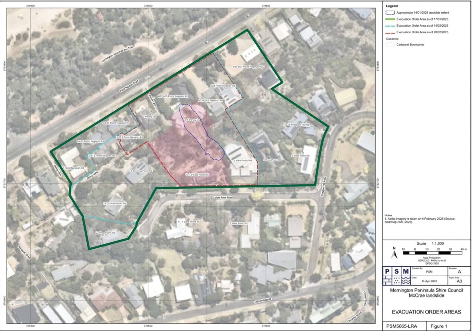
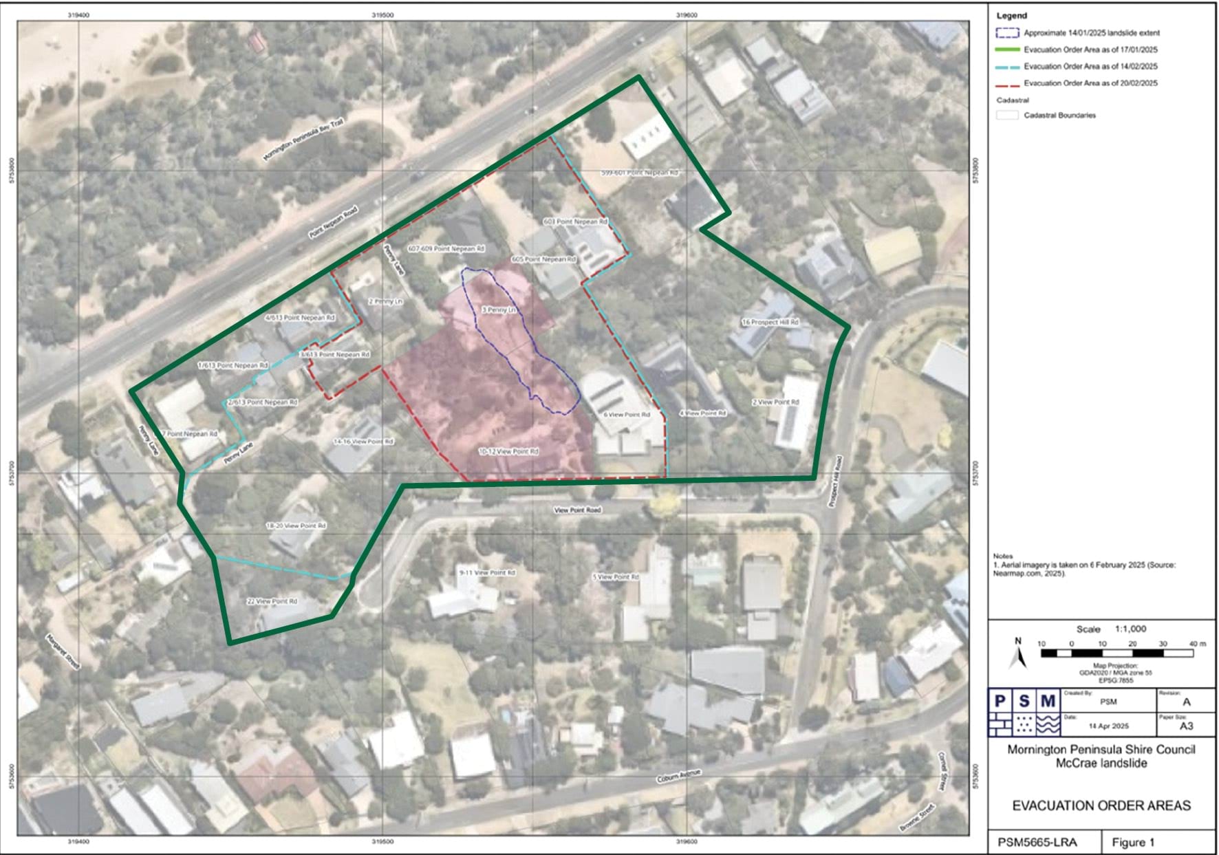
MERG
- In the weeks following the McCrae Landslide, the evacuated residents came together as a closeknit community to share information, express their concerns, and provide comfort to one another.808 United by the need to find answers, the residents formed a group known as the MERG.
- On 28 January 2025, MERG had its first group meeting at the McCrae Yacht Club.809
- Days later, on 31 January 2025, MERG met again.810 At that meeting, it became clear through the residents’ discussions that the task of obtaining answers about the cause of the McCrae Landslide was too immense for just one person. The residents collectively decided that particular individuals should be appointed to progress the interests of MERG, including to locate the source of the water flowing near the Morans’ property.811
- The formation of MERG is a powerful demonstration of community strength in the face of adversity. The work of MERG is both commendable and impressive. MERG has provided a cohesive voice for evacuated residents. MERG has also enabled resident-led investigations into the cause of the McCrae Landslide to be advanced.
- The Board of Inquiry has benefited greatly from the valuable information that MERG has shared.
The lived experiences of McCrae community members
- Many members of the McCrae community have generously and poignantly shared their experiences with the Board of Inquiry.
- The adverse impacts of the landslides on the community are undeniable. As one resident, who has been displaced from their home, told the Board of Inquiry:
The stress and anxiety of not returning to familiar surroundings, routine and community have not only affected my mental health but have also led to a decline in my physical health. The sense of security and routine that my home provided has been lost.812
- This sentiment is not unique. It has been echoed in the experiences shared by many other displaced residents. It is a profound reason why events like the McCrae Landslide must be prevented in the future.
- The following stories provide some insight into the impact of the landslides on certain members of the McCrae community. These stories illustrate the range of challenges faced by those who have homes in the immediate vicinity of the landslides. They do not represent the full breadth of difficulties faced by those affected by the landslides. The absence of others’ stories in no way diminishes their importance.
Kellie and Nick Moran – 3 Penny Lane, McCrae
- The McCrae Landslide destroyed Kellie and Nick Moran’s house.
- The home — once a testament to years of hard work and a place of happy memories — was reduced to rubble within moments. The landslide has not only robbed the Morans of their home, it has taken away their sense of safety and security.813 Mr Moran told the Board of Inquiry:
[W]e’re a pretty resilient family, but this has broken us. And my wife’s one of the strongest people you can come across, and she’s still not sleeping and she’s pretty broken by this.814
- The Morans purchased the house in May 2023.815 It was their pride and joy. It was purchased using funds from the sale of a business that Mr Moran had established at the age of 18 and operated for 29 years. The house was intended to be a holiday home for the Morans to enjoy with their three children and, potentially, to live in once they had retired.816
- Shortly after settlement, the Morans began to use the house regularly with their children. In the weeks leading up to 5 January 2025, the house was rarely vacant. The Morans and their children stayed there frequently, along with members of their extended family and friends.817 This period of enjoyment at their summer sanctuary was, however, abruptly cut short.
- Two landslides were to upend their home and their lives. The first landslide struck their home on 5 January 2025. Nine days later, the second landslide on 14 January 2025 demolished their home.
- It warrants repeating that at around 9.30am on the morning of 14 January 2025, Mr Moran received a phone call from his neighbour, Mr Willigenburg, who delivered the devastating news: “The whole thing’s come down”.818 The Morans’ house had slid down the hill and splintered in half.819
- Shocked, Mr Moran telephoned Mrs Moran to tell her what had happened.820 At around 10.30am, after a “horrible drive”,821 the Morans arrived to see rubble where their home once stood.
- In Mr Moran’s words:
it was horrific ... it’s just a fluke that it hasn’t taken out my whole family and we weren’t there that day.822
- The Moran family will not be able to return to their home or their land in the short term. The Moran family lives with emotional and financial stress to this day.823
Paul and Denise Willigenburg – 3/613 Point Nepean Road, McCrae
- The McCrae Landslide struck the rear of 607–609 Point Nepean Road, the rental property occupied by two retirees and pensioners, Paul and Denise Willigenburg.824
- The backyard of the rental property was, prior to the McCrae Landslide, directly in front of the house at 3 Penny Lane.825
- The McCrae Landslide was not the first time Mr and Mrs Willigenburg had suffered the consequences of a landslide. As described above, they were also impacted by the 15 November 2022 landslide, which destroyed the back fence of their home at 3/613 Point Nepean Road,826 located just a few doors down from the Morans’ house.
- Since the 15 November 2022 landslide, the Willigenburgs have been displaced from their home, apart from a brief period between 17 October 2023 and 23 February 2024.827 This period of displacement has been marked by stress, worry and frustration.828
- Ongoing delays in remediation works on the slope above their home have repeatedly forced the Willigenburgs to seek alternative accommodation.829 They managed to secure a rental property within metres of their home — only for that property, too, to suffer the misfortune of landslide damage.
- On 14 January 2025, debris from the McCrae Landslide damaged the retaining walls, house and the garage of the Willigenburgs’ rental property.830
- The Willigenburgs narrowly escaped injury by running out of the rental property as soon as they heard the deep rumbling sound that preceded the McCrae Landslide.831 Shortly after their escape, a VicSES responder told the Willigenburgs:
You need to get into the house, grab whatever medication, anything that you can grab, but you’re only going to get one minute to do it.832
- Mrs Willigenburg retrieved some medication and vacated the rental property as ordered. That was the last minute either of the Willigenburgs were to have in the rental property until mid-April 2025.833
- The Willigenburgs left with basically nothing; all their possessions were in the rental property. Mr Willigenburg told the Board of Inquiry:
So the Shire had provided us with some funds to buy some clothes and some medication and a few bits and pieces, which was good. But we needed a lot more than that. So, to be honest, you know, we spent a bit of our own money to start buying a few more things again and visited a few opportunity shops here and there to get a bit more.834
- In the weeks following the McCrae Landslide, both the Willigenburgs’ home and rental property were broken into. A laptop, watches and jewellery were taken, along with memorabilia that Mr Willigenburg had kept for many years and which held sentimental value to him.835
- It has now been more than two and a half years since the Willigenburgs were displaced from their home following the 15 November 2022 landslide. They have not been told when they will be able to return to their home or the rental property.836
- The remediation works required to render the Willigenburgs’ home safe for reoccupation remain to be done. The Willigenburgs sought an order from the Building Appeals Board that the Shire and/or the Borghesis cover the costs associated with such works.837 However, judgment in that proceeding has been delayed because of, amongst other matters, the McCrae Landslide.838
- The Willigenburgs continue to live with uncertainty. The stress they are feeling is understandably immense.
Gerry and Bronwyn Borghesi – 10–12 View Point Road, McCrae
- As described above, the McCrae Landslide occurred on the escarpment located within the property owned by Gerry and Bronwyn Borghesi.839
- Like the Willigenburgs, the McCrae Landslide was not the Borghesis’ first encounter with a landslide. The 14 and 15 November 2022 landslides also occurred on their property.840
- Since those landslides, the Shire has sought to compel the Borghesis to undertake stabilisation works to the landslide affected land.841 This led to the Borghesis commencing proceedings in the Building Appeals Board in May 2024 to challenge the validity of the Shire’s actions. Those proceedings were successful.
- On 30 April 2025, the Building Appeals Board determined, amongst other things, that the Shire’s MBS did not have the power to compel such works.842
- The Borghesis have also issued proceedings against the Shire in the Victorian Civil and Administrative Tribunal to recover their loss and damage arising from the November 2022 landslides. 843 Those proceedings are currently on foot.844
- As the consequences of the November 2022 landslides continued to unfold, the Borghesis experienced two further landslides on their property.
- The 5 January 2025 landslide occurred below the ground level of the Borghesis’ vegetable patch, located at the back of their property.845
- In the nine days that followed, the Borghesis lived in their home and watched “like hawks” as the land beneath their vegetable patch eroded due to the continuous flow of water from an unidentified source.846
- Mr Borghesi told the Board of Inquiry:
So we were watching that slow degradation [of the escarpment] on a daily basis. We were living in the house between 5 January and 14 January. We hadn’t been evacuated at that point. So naturally this is the only thing that matters in our lives. We’re watching it, you know, 12 to 16 hours a day, and watching that headscarp come up towards the retaining wall.847
- The Borghesis feared that another landslide was imminent. Their fears were soon realised.
- At around 3.00am on 14 January 2025, Mrs Borghesi was awake. As she had many nights since the landslide of 5 January, Mrs Borghesi looked at the large gum tree in the gully. She hoped that its roots were still stabilising the soil. They were.848 But the gum tree would not hold on for much longer.
- Around five hours later, when the McCrae Landslide occurred, Mr Borghesi was in his living room writing an email to the Shire about degradation on the slope. He heard a “loud thunderstorm noise”, which lasted for about 10 seconds but felt like two minutes.849
- The Borghesis instantly ran out the backdoor. They knew what had happened. They saw dust rising from below a paved area at the back of their property.850 The Morans’ house had been destroyed.851
- It warrants repeating that Mr Borghesi observed that:
there [was] deeply saturated soil collapsing from underneath number 6 View Point Road, with a consistency of what I would describe as tiramisu ... [there was] water, liquified soil ... collapsing from beneath the retaining wall[.]852
- On the day of the McCrae Landslide, the Borghesis were evacuated from their home. They did not return to their property until early August 2025, at which point it was deemed safe to reoccupy by the Shire’s MBS. Understandably, the Borghesis wish this had occurred much sooner.
Pugh family – 6 View Point Road, McCrae
- The McCrae Landslide also occurred on part of the escarpment on the neighbouring property at 6 View Point Road, owned by Pamela Pugh. It encroached, and nearly undermined, the patio of the house.853
- Mrs Pugh, a 90-year-old grandmother, and her late husband, Charles Pugh, purchased the land in around 2002.854 Mr Pugh built the home that stands there today.855
- In the months prior to the McCrae Landslide, the extended Pugh family had been preparing the home for sale.856 The family intended for the sale proceeds to fund Mrs Pugh’s transition to permanent aged care.857 The McCrae Landslide has put a halt to these plans, causing the Pugh family significant emotional distress.858
- Kevin Hutchings, Mrs Pugh’s son-in-law, told the Board of Inquiry that the McCrae Landslide was, and remains, a huge source of stress for the family.859 He explained:
[My] mother-in-law loves the [aged care home] she’s in. We would like her to stay there. But of course the financial burden is now an issue because we can’t sell the house. And we’re not sure when we will be able to get [the proceeds] because there’s no one giving us any remedies at all ... So we just don’t know where this is going to end up. But [my mother-in-law] won’t be able to afford to stay in that aged care. So it’s a concern for the whole family.860
- Thoughts of the McCrae Landslide were, and have been, all-consuming for the Pugh family.861 Mr Hutchings and his wife could not sleep at night in the week following the landslide.862 This prompted Mr Hutchings, a former Managing Director of SEW, to seek answers as to the source of the unexplained water flowing out of the escarpment at the landslide site and at various locations in McCrae.863
- On 21 January 2025, Mr Hutchings commenced his investigations.864 He and his wife drove to two locations higher up on the Arthurs Seat hillside to investigate the source of the water: a stormwater storage basin and a dam within Seawinds Gardens.865 On inspection, both were “bone dry”.866 Mr Hutchings concluded that neither the stormwater storage basin nor dam could account for the continuous flow of water observed on Charlesworth St.867
- The Hutchings’ investigations were not, however, wasted. On that day, Mr Hutchings learnt from a local resident that a water main had burst near Bayview Road and Outlook Road. Repairs of the burst water main had commenced on New Year’s Eve.868
- While inspecting the burst site, Mr Hutchings noticed that there was evidence of significant water flow previously occurring at that location. The vegetation had been stripped. There was scoring on the ground, indicating that water had travelled across the surface.869 Mr Hutchings was to discover the potential significance of this site in the weeks to follow.
- By the end of January 2025, MERG appointed Mr Hutchings along with Mr Bolch to find the source of the water seen emanating near 3 Penny Lane prior to and after the McCrae Landslide.870
- For several months, Mr Hutchings has worked independently and, at times with Mr Bolch, to investigate the unexpected flows of water in McCrae. Their work has been extensive. It has ranged from studying the layout of water infrastructure in the area, conducting multiple on-site physical inspections, to marshalling information concerning local residents’ observations in the lead up to, and following, the McCrae Landslide.871
- Based on the investigations, Mr Hutchings considered that the accumulation of water – which he believed may have been caused by the burst water main – could have played a central role in putting weight on the escarpment and providing lubricant near the Borghesis’ property, destabilising the ground behind the Morans’ house and triggering the landslides. He thought it was possible that the water had travelled through a combination of pipeline trench flow and significant ground saturation.872
- Mr Hutchings and Mr Bolch have shared their investigative work with the Shire and the Board of Inquiry.
- Today, the Pugh family remains excluded from their home at 6 View Point Road. They are concerned as to what the future holds.873
John and Vicki Bolch – 605 Point Nepean Road, McCrae
- The McCrae Landslide occurred next door to the house that was occupied by John and Vicki Bolch.
- The Bolch family took possession of the house around Easter of 2024 and had just moved in prior to Christmas of that year.874 Unfortunately, in Mr Bolch’s words, “no sooner did we get it than we were out”.875
- On the day of the McCrae Landslide, no one was at the Bolchs’ house.876 Mr Bolch, a licensed and registered commercial plumber, was meeting with one of his clients in Cranbourne.877
- At the end of the meeting, Mr Bolch listened to a voicemail from a friend asking whether the Bolchs’ house had been affected by the McCrae Landslide. Mr Bolch contacted his wife to share the shocking news, and they agreed to meet at the house.878
- Mrs Bolch and her daughter, Sasha, who were at a nearby campsite at Capel Sound, got on their push bikes and rode back to their house. Mr Bolch set out from Cranbourne.879 The three eventually met on the beach track running along Point Nepean Road.880
- Prior to Mr Bolch’s arrival, Mrs Bolch and Sasha had taken photos and videos of the landslide site.881 Upon seeing those videos, Mr Bolch told the Board of Inquiry that “the devastation [and] the destruction of [the Morans’ house] was ... a lot to consume”.882
- Mr Bolch observed in one of the videos that water was flowing down the escarpment from a location somewhere between the Borghesis’ house and the Morans’ house.883 The presence of water piqued Mr Bolch’s interest. Days earlier, he had observed a considerable amount of water flowing from under the Morans’ house, over the lower retaining wall at the front of the house and down Penny Lane.884
- On 15 January 2025, Mr Bolch decided to take a drive around the streets uphill of Penny Lane to look for the possible source of the unusual water he had observed around the Morans’ house.885 He observed a pothole at the intersection of Charlesworth Street and Coburn Avenue in a wet spongy area. The surrounding asphalt was visibly cracked from water damage.886 Mr Bolch also noticed that the nature strips around the intersection were sodden, so much so that water was leaking from the nature strips into the kerbs.887 It was “very boggy and wet”.888 Mr Bolch thought that things were not as they should be, especially since it had been a “very dry summer”.889
- Mr Bolch told the Board of Inquiry:
Asphalt’s enemy is water ... at this point I’m thinking ... there’s an issue along here with water flowing down the streets, and you’re trying to link – does this have something to do with the landslide because of the water coming down Penny Lane?890
- Mr Bolch has diligently set out to answer that question since 15 January 2025, drawing on his professional expertise. He has worked independently and, at times with Mr Hutchings, to investigate whether water may have been a contributing factor to causing the landslides.891 As mentioned above, the investigatory work undertaken by Mr Bolch and Mr Hutchings has been extensive.
- Based on his investigations, Mr Bolch believes that water saturation of the hillside near the Morans’ property was a significant contributing factor to causing the landslides.
- Mr Bolch told the Board of Inquiry that water leaking from the burst water main “most certainly” could travel into the sewer trench line.892 A trench line could basically become “the highway for the water to travel”.893 He explained:
The separation between those pipes [the water main and sewer pipe] is probably less than a metre, with a standard cover that you would use on the water main, and the sewer, I think the invert level was around 2.1 metres. So the [sewer] pipe would have been directly below the burst pipe. So if water was leaking at that point, even at a slow rate, it would have been going down into the easiest point of travel, which would have been the sewer trench and possibly the stormwater trench. But early on ... I believe it would be going down the sewer trench.894
- After conducting testing on water infrastructure near the burst site, Mr Bolch estimated that had the leak persisted for 60 days, through a 25 millimetre opening, as much as 84.4 million litres of water may have been released from the burst water main,895 the equivalent of about 34 Olympic-sized swimming pools’ worth of water.896
- Given that significant volume of water, and the lay of the land, Mr Bolch was concerned that it was “highly possible that the water has made its way from Point A to Point B”.897 Point A being the burst site and Point B being the Morans’ property.898
- Mr Bolch’s demonstrable commitment to determining the cause of the McCrae Landslide is underpinned by his belief that:
This is not just a technical or bureaucratic issue. It is deeply human, with real impacts on people’s homes, families and futures.899
- The Bolch family has not been allowed to occupy their home since 14 January 2025.900 They have only been allowed to access their house on two occasions. First, on 14 February 2025, to secure a sliding door that had been left open after the house had been ransacked. Second, on 28 February 2025, to retrieve some personal items and determine what had been stolen from them.901
- The stress and uncertainty continues for the Bolch family.
- 1 Exhibit CA-72, Landslide Risk Assessment for Evacuation Area prepared by PSM, 22 May 2025, [MSC.5047.0001.0001 at .0120].
- 2 Exhibit CA-72, Landslide Risk Assessment for Evacuation Area prepared by PSM, 22 May 2025, [MSC.5047.0001.0001 at .0120].
- 3 Exhibit CA-72, Landslide Risk Assessment for Evacuation Area prepared by PSM, 22 May 2025, [MSC.5047.0001.0001 at .0043].
- 4 Exhibit CA-72, Landslide Risk Assessment for Evacuation Area prepared by PSM, 22 May 2025, [MSC.5047.0001.0001 at .0040].
- 5 Exhibit CA-72, Landslide Risk Assessment for Evacuation Area prepared by PSM, 22 May 2025, [MSC.5047.0001.0001 at .0042].
- 6 Exhibit CA-72, Landslide Risk Assessment for Evacuation Area prepared by PSM, 22 May 2025, [MSC.5047.0001.0001 at .0041].
- 7 Exhibit CA-72, Landslide Risk Assessment for Evacuation Area prepared by PSM, 22 May 2025, [MSC.5047.0001.0001 at .0042].
- 8 Exhibit CA-72, Landslide Risk Assessment for Evacuation Area prepared by PSM, 22 May 2025, [MSC.5047.0001.0001 at .0132].
- 9 Mornington Peninsula C52 (PSA) [2003] PPV 115 at Section 4.2.
- 10 Mornington Peninsula C52 (PSA) [2003] PPV 115 at Section 4.2.
- 11 Lucy Callander, ‘Landslides Mornington Peninsula: Mt Martha, Anthony’s Nose, Flinders hit’, Herald Sun (online, 19 October 2020) <https://www.heraldsun.com.au/leader/south-east/landslides-mornington-peninsula-mt-martha-anthonys-nose-flinders-hit/news-story/14a73a4d122d5cf9b983afca6b899a79>.
- 12 Exhibit CA-72, Landslide Risk Assessment for Evacuation Area prepared by PSM, 22 May 2025, [MSC.5047.0001.0001 at .0045–.0046]; Public Submission of McCrae Resident, 12 May 2025, [SUB.0040.0001.0008].
- 13 Exhibit CA-72, Landslide Risk Assessment for Evacuation Area prepared by PSM, 22 May 2025, [MSC.5047.0001.0001 at .0059–.0060].
- 14 Exhibit CA-72, Landslide Risk Assessment for Evacuation Area prepared by PSM, 22 May 2025, [MSC.5047.0001.0001 at .0048–.0050].
- 15 Exhibit CA-72, Landslide Risk Assessment for Evacuation Area prepared by PSM, 22 May 2025, [MSC.5047.0001.0001 at .0061].
- 16 Mornington Peninsula C52 (PSA) [2003] PPV 115 at Section 2.1.
- 17 Mornington Peninsula C52 (PSA) [2003] PPV 115 at Section 2.3.
- 18 Mornington Peninsula C52 (PSA) [2003] PPV 115 at Section 2.3.
- 19 Mornington Peninsula C52 (PSA) [2003] PPV 115 at Section 4.2.
- 20 Mornington Peninsula C52 (PSA) [2003] PPV 115 at Section 4.2.
- 21 Mornington Peninsula C52 (PSA) [2003] PPV 115 at Section 4.1.
- 22 Mornington Peninsula C52 (PSA) [2003] PPV 115 at Section 4.1.
- 23 Mornington Peninsula C52 (PSA) [2003] PPV 115 at Section 2.3.
- 24 Mornington Peninsula C52 (PSA) [2003] PPV 115 at Section 3.4.
- 25 Mornington Peninsula C52 (PSA) [2003] PPV 115 at Section 4.2.
- 26 Mornington Peninsula C52 (PSA) [2003] PPV 115 at Section 4.2.
- 27 Mornington Peninsula C52 (PSA) [2003] PPV 115 at Section 4.2.
- 28 Mornington Peninsula C52 (PSA) [2003] PPV 115 at Section 4.2.
- 29 Mornington Peninsula C52 (PSA) [2003] PPV 115 at Section 4.2.
- 30 Mornington Peninsula C52 (PSA) [2003] PPV 115 at Section 4.2.
- 31 Mornington Peninsula C52 (PSA) [2003] PPV 115 at Section 4.2.
- 32 Mornington Peninsula C52 (PSA) [2003] PPV 115 at Section 4.2.
- 33 Mornington Peninsula C52 (PSA) [2003] PPV 115 at Section 4.2.
- 34 Mornington Peninsula C52 (PSA) [2003] PPV 115 at Section 7.
- 35 Mornington Peninsula C52 (PSA) [2003] PPV 115 at Section 7.
- 36 Mornington Peninsula C52 (PSA) [2003] PPV 115 at Section 7.
- 37 Mornington Peninsula C52 (PSA) [2003] PPV 115 at Section 8.
- 38 Exhibit CA-12, First Witness Statement of David Simon, 11 April 2025, Exhibit CA-12(8) [MSC.5014.0001.1302].
- 39 Exhibit CA-12, First Witness Statement of David Simon, 11 April 2025, Exhibit CA-12(8) [MSC.5014.0001.1302].
- 40 Exhibit CA-12, First Witness Statement of David Simon, 11 April 2025, Exhibit CA-12(29) [MSC.5002.0001.6966].
- 41 Exhibit CA-12, First Witness Statement of David Simon, 11 April 2025, 6 [16].
- 42 Exhibit CA-13, Second Witness Statement of David Simon, 17 April 2025, Exhibit CA-13(117) [MSC.5012.0001.0123 at .0127].
- 43 Exhibit CA-13, Second Witness Statement of David Simon, 17 April 2025, Exhibit CA-13(117) [MSC.5012.0001.0123 at .0127].
- 44 Exhibit CA-13, Second Witness Statement of David Simon, 17 April 2025, Exhibit CA-13(117) [MSC.5012.0001.0123 at .0128].
- 45 Exhibit CA-13, Second Witness Statement of David Simon, 17 April 2025, Exhibit CA-13(117) [MSC.5012.0001.0123 at .0134].
- 46 Exhibit CA-13, Second Witness Statement of David Simon, 17 April 2025, Exhibit CA-13(117) [MSC.5012.0001.0123 at .0140].
- 47 Exhibit CA-13, Second Witness Statement of David Simon, 17 April 2025, Exhibit CA-13(117) [MSC.5012.0001.0123 at .0140–.0144].
- 48 Exhibit CA-13, Second Witness Statement of David Simon, 17 April 2025, Exhibit CA-13(117) [MSC.5012.0001.0123 at .0140].
- 49 Exhibit CA-13, Second Witness Statement of David Simon, 17 April 2025, Exhibit CA-13(117) [MSC.5012.0001.0123 at .0142].
- 50 Mornington Peninsula Shire Council, Response to first set of potential adverse findings, 21 August 2025, [MSC.5094.0001.0020]. Email from Chloe Patching to Infrastructure Asset Notification at Mornington Peninsula Shire Council about completion of The Eyrie Gully Stabilisation Project, 10 November 2014, [MSC.5092.0001.0001].
- 51 Exhibit CA-13, Second Witness Statement of David Simon, 17 April 2025, 34–35 [62]–[63].
- 52 Exhibit CA-13, Second Witness Statement of David Simon, 17 April 2025, Exhibit CA-13(110) [MSC.5012.0001.4440 at .4442].
- 53 Exhibit CA-13, Second Witness Statement of David Simon, 17 April 2025, Exhibit CA-13(110) [MSC.5012.0001.4440 at .4442].
- 54 Exhibit CA-13, Second Witness Statement of David Simon, 17 April 2025, Exhibit CA-13(110) [MSC.5012.0001.4440 at .4475–.4477].
- 55 Exhibit CA-13, Second Witness Statement of David Simon, 17 April 2025, Exhibit CA-13(110) [MSC.5012.0001.4440 at .4455].
- 56 Exhibit CA-13, Second Witness Statement of David Simon, 17 April 2025, Exhibit CA-13(110) [MSC.5012.0001.4440 at .4454].
- 57 Exhibit CA-11, Witness Statement of Bulent Oz, 11 April 2025, 6–7 [29].
- 58 Exhibit CA-11, Witness Statement of Bulent Oz, 11 April 2025, 6–7 [29].
- 59 Exhibit CA-13, Second Witness Statement of David Simon, 17 April 2025, Exhibit CA-13(110) [MSC.5012.0001.4440 at .4458].
- 60 Exhibit CA-13, Second Witness Statement of David Simon, 17 April 2025, Exhibit CA-13(110) [MSC.5012.0001.4440 at .4458].
- 61 Public Hearing Transcript, David Simon, 9 May 2025, 218.
- 62 Exhibit CA-12, First Witness Statement of David Simon, 11 April 2025, 18 [43]; Exhibit CA-12, First Witness Statement of David Simon, 11 April 2025, Exhibit CA-12(62) [MSC.5014.0001.0076 at .0077].
- 63 Exhibit CA-12, First Witness Statement of David Simon, 11 April 2025, 18 [44]; Public Hearing Transcript, David Simon, 9 May 2025, 218.
- 64 Exhibit CA-12, First Witness Statement of David Simon, 11 April 2025, 18–19 [44].
- 65 Mornington Peninsula Planning Scheme, Schedules 4 and 5 to Clause 44.01 Erosion Management Overlay (as it stood prior to and after Amendment C279morn gazetted on 21 July 2021).
- 66 Exhibit CA-13, Second Witness Statement of David Simon, 17 April 2025, Exhibit CA-13(110) [MSC.5012.0001.4440 at .4442].
- 67 Exhibit CA-13, Second Witness Statement of David Simon, 17 April 2025, Exhibit CA-13(110) [MSC.5012.0001.4440 at .4442–.4443].
- 68 Exhibit CA-13, Second Witness Statement of David Simon, 17 April 2025, Exhibit CA-13(110) [MSC.5012.0001.4440 at .4462].
- 69 Exhibit CA-13, Second Witness Statement of David Simon, 17 April 2025, Exhibit CA-13(110) [MSC.5012.0001.4440 at .4462–.4463].
- 70 Exhibit CA-13, Second Witness Statement of David Simon, 17 April 2025, Exhibit CA-13(110) [MSC.5012.0001.4440 at .4514].
- 71 Exhibit CA-13, Second Witness Statement of David Simon, 17 April 2025, Exhibit CA-13(110) [MSC.5012.0001.4440 at .4515].
- 72 Exhibit CA-11, Witness Statement of Bulent Oz, 11 April 2025, Exhibit CA-11(3) [MSC.5014.0001.0010], Exhibit CA-11(4) [MSC.5014.0001.0068].
- 73 Exhibit CA-11, Witness Statement of Bulent Oz, 11 April 2025, 8 [42].
- 74 Exhibit CA-13, Second Witness Statement of David Simon, 17 April 2025, Exhibit CA-13(110) [MSC.5012.0001.4440 at .4532].
- 75 Exhibit CA-13, Second Witness Statement of David Simon, 17 April 2025, Exhibit CA-13(110) [MSC.5012.0001.4440 at .4533].
- 76 Exhibit CA-12, First Witness Statement of David Simon, 11 April 2025, 20 [52]–[53].
- 77 Exhibit CA-11, Witness Statement of Bulent Oz, 11 April 2025, 9 [43]; Exhibit CA-13, Second Witness Statement of David Simon, 17 April 2025, 35 [63].
- 78 Exhibit CA-11, Witness Statement of Bulent Oz, 11 April 2025, 9 [44].
- 79 Exhibit CA-11, Witness Statement of Bulent Oz, 11 April 2025, 9 [45].
- 80 Exhibit CA-11, Witness Statement of Bulent Oz, 11 April 2025, 9 [46].
- 81 Exhibit CA-11, Witness Statement of Bulent Oz, 11 April 2025, 9 [44].
- 82 Public Hearing Transcript, David Simon, 9 May 2025, 243.
- 83 Public Hearing Transcript, David Simon, 9 May 2025, 253.
- 84 Exhibit CA-12, First Witness Statement of David Simon, 11 April 2025, 19 [48]; Exhibit CA-12, First Witness Statement of David Simon, 11 April 2025, Exhibit CA-12(65) [MSC.5014.0001.0182].
- 85 Exhibit CA-12, First Witness Statement of David Simon, 11 April 2025 19 [48]; Exhibit CA-12, First Witness Statement of David Simon, 11 April 2025, Exhibit CA-12(65) [MSC.5014.0001.0182 at .0270].
- 86 Exhibit CA-12, First Witness Statement of David Simon, 11 April 2025 19 [48]; Exhibit CA-12, First Witness Statement of David Simon, 11 April 2025, Exhibit CA-12(65) [MSC.5014.0001.0182 at .0387].
- 87 Exhibit CA-12, First Witness Statement of David Simon, 11 April 2025, 19 [48]; Exhibit CA-12, First Witness Statement of David Simon, 11 April 2025, Exhibit CA-12(65) [MSC.5014.0001.0182 at .0387].
- 88 Exhibit CA-12, First Witness Statement of David Simon, 11 April 2025, 20 [52]–[53].
- 89 Exhibit CA-22, Witness Statement of Gerrard Raymond Borghesi, 14 May 2025, 1 [6]; Public Hearing Transcript, Gerrard Raymond Borghesi, 14 May 2025, 495–496.
- 90 Exhibit CA-22, Witness Statement of Gerrard Raymond Borghesi, 14 May 2025, 1 [6].
- 91 Exhibit CA-22, Witness Statement of Gerrard Raymond Borghesi, 14 May 2025, 1 [6].
- 92 Public Hearing Transcript, Gerrard Raymond Borghesi, 14 May 2025, 495.
- 93 Public Hearing Transcript, Gerrard Raymond Borghesi, 14 May 2025, 495–496.
- 94 Public Hearing Transcript, Gerrard Raymond Borghesi, 14 May 2025, 496.
- 95 Exhibit CA-22, Witness Statement of Gerrard Raymond Borghesi, 14 May 2025, 5 [29].
- 96 Exhibit CA-22, Witness Statement of Gerrard Raymond Borghesi, 14 May 2025, Exhibit GB-1 [RES.0001.0003.0001 at _0041].
- 97 Public Hearing Transcript, Gerrard Raymond Borghesi, 14 May 2025, 485–486.
- 98 Exhibit CA-22, Witness Statement of Gerrard Raymond Borghesi, 14 May 2025, 3 [16].
- 99 Exhibit CA-22, Witness Statement of Gerrard Raymond Borghesi, 14 May 2025, Exhibit GB-1 [RES.0001.0003.0001 at _0008–_0009].
- 100 Public Submission of Brett Manders, 30 April 2025, [SUB.0026.0001.0001].
- 101 Public Submission of McCrae Resident, 16 April 2025, [SUB.0016.0001.0001].
- 102 Public Submission of McCrae Resident, 29 April 2025, [SUB.0014.0002.0002].
- 103 Public Submission of McCrae Resident, 17 August 2025, [SUB.0014.0002.0001].
- 104 Public Submission of McCrae Resident, 29 April 2025, [SUB.0014.0002.0002].
- 105 Public Submission of McCrae Resident, 20 April 2025, [SUB.0006.0001.0002].
- 106 Public Submission of McCrae Resident, 20 April 2025, [SUB.0006.0001.0002].
- 107 Public Submissions of McCrae Resident, 10 July 2025, [SUB.0006.0002.0001], [SUB.0006.0002.0002], [SUB.0006.0002.0003].
- 108 Public Hearing Transcript, Julian Tully, 24 June 2025, 987–988.
- 109 Exhibit CA-41, Amended First Witness Statement of Julian Tully, 19 June 2025, 3 [18]; Exhibit CA-41, Amended First Witness Statement of Julian Tully, 24 June 2025, Exhibit 1 [SEW.0001.0001.4933 at _0001].
- 110 Exhibit CA-66, Fourth Witness Statement of David Smith, 28 July 2025, Exhibit CA-66(4) [MSC.5081.0001.0317].
- 111 Exhibit CA-66, Fourth Witness Statement of David Smith, 28 July 2025, Exhibit CA-66(6) [MSC.5081.0001.0215].
- 112 Exhibit CA-66, Fourth Witness Statement of David Smith, 28 July 2025, 5 [13]; Exhibit CA-66, Fourth Witness Statement of David Smith, 28 July 2025, Exhibit CA-66(3) [MSC.5081.0001.0313].
- 113 Exhibit CA-66, Fourth Witness Statement of David Smith, 28 July 2025, 6 [16].
- 114 Exhibit CA-66, Fourth Witness Statement of David Smith, 28 July 2025, 6 [16].
- 115 Exhibit CA-66, Fourth Witness Statement of David Smith, 28 July 2025, 6 [16]; Exhibit CA-66, Fourth Witness Statement of David Smith, 28 July 2025, Exhibit CA-66(10) [MSC.5081.0001.0026].
- 116 Exhibit CA-41, Amended First Witness Statement of Julian Tully, 19 June 2025, 4 [21].
- 117 Exhibit CA-41, Amended First Witness Statement of Julian Tully, 19 June 2025, Exhibit 4 [SEW.0001.0001.4937].
- 118 Exhibit CA-41, Amended First Witness Statement of Julian Tully, 19 June 2025, Exhibit 1 [SEW.0001.0001.4933].
- 119 Exhibit CA-25, Witness Statement of Lara Olsen, 16 May 2025, 5 [24(c)].
- 120 Exhibit CA-41, Amended First Witness Statement of Julian Tully, 19 June 2025, Exhibit 1 [SEW.0001.0001.4933].
- 121 Exhibit CA-41, Amended First Witness Statement of Julian Tully, 19 June 2025, Exhibit 1 [SEW.0001.0001.4933 at _0007–_0008].
- 122 Exhibit CA-41, Amended First Witness Statement of Julian Tully, 19 June 2025, Exhibit 1 [SEW.0001.0001.4933].
- 123 Exhibit CA-41, Amended First Witness Statement of Julian Tully, 19 June 2025, Exhibit 1 [SEW.0001.0001.4933].
- 124 Exhibit CA-41, Amended First Witness Statement of Julian Tully, 19 June 2025, Exhibit 1 [SEW.0001.0001.4933 at _0023–_0024].
- 125 Exhibit CA-41, Amended First Witness Statement of Julian Tully, 19 June 2025, Exhibit 1 [SEW.0001.0001.4933 at _0009, _0025].
- 126 Exhibit CA-41, Amended First Witness Statement of Julian Tully, 19 June 2025, Exhibit 1 [SEW.0001.0001.4933 at _0010].
- 127 Exhibit CA-41, Amended First Witness Statement of Julian Tully, 19 June 2025, 4 [19].
- 128 Exhibit CA-32, Witness Statement of Claudio Flores, 22 May 2025, Exhibit CA-32(7) [MSC.5000.0001.0292 at .0293].
- 129 Public Hearing Transcript, Paul Willigenburg, 14 May 2025, 444; Exhibit CA-21, Witness Statement of Paul Willigenburg, 14 May 2025, 2 [11].
- 130 Public Hearing Transcript, Paul Willigenburg, 14 May 2025, 444.
- 131 Exhibit CA-21, Witness Statement of Paul Willigenburg, 14 May 2025, 2 [12].
- 132 Exhibit CA-21, Witness Statement of Paul Willigenburg, 14 May 2025, 2 [12]–[13].
- 133 Exhibit CA-21, Witness Statement of Paul Willigenburg, 14 May 2025, 2 [14].
- 134 Exhibit CA-21, Witness Statement of Paul Willigenburg, 14 May 2025, 2 [15(a)].
- 135 Public Hearing Transcript, Paul Willigenburg, 14 May 2025, 445.
- 136 Public Hearing Transcript, Paul Willigenburg, 14 May 2025, 446; Exhibit CA-21, Witness Statement of Paul Willigenburg, 14 May 2025, Exhibit PW-2 [RES.0010.0001.0002].
- 137 Exhibit CA-21, Witness Statement of Paul Willigenburg, 14 May 2025, Exhibit PW-4 [RES.0010.0001.0004 at _0002].
- 138 Exhibit CA-32, Witness Statement of Claudio Flores, 22 May 2025, Exhibit CA-32(7) [MSC.5000.0001.0292 at _0002].
- 139 Public Submission of McCrae Resident, 30 April 2025, [SUB.0024.0001.0001].
- 140 Public Submission of McCrae Resident, 30 April 2025, [SUB.0024.0001.0003 at _0013].
- 141 Exhibit CA-6, Expert Opinion Report – Landslide Assessment about 10–12 View Point Road prepared by PSM, 11 June 2024, [MSC.5000.0001.0639 at .0643].
- 142 Exhibit CA-5, Landslide Risk Assessment about 10–12 View Point Road prepared by PSM, 3 November 2023, [MSC.5000.0001.1206 at .1215].
- 143 Exhibit CA-32, Witness Statement of Claudio Flores, 22 May 2025, Exhibit CA-32(7) [MSC.5000.0001.0292 at .0295].
- 144 Exhibit CA-22, Witness Statement of Gerrard Raymond Borghesi, 14 May 2025, Exhibit GB-1 [RES.0001.0003.0001 at _0017].
- 145 South East Water Montage Record, Task 1101563/001 – 3 Penny Lane, 15 November 2022, [SEW.0001.0001.0117 at _0001].
- 146 South East Water Montage Record, Task 1101563/001 – 3 Penny Lane, 15 November 2022, [SEW.0001.0001.0117 at _0001].
- 147 South East Water Montage Record, Task 1101563/001 – 3 Penny Lane, 15 November 2022, [SEW.0001.0001.0117 at _0001].
- 148 Exhibit CA-21, Witness Statement of Paul Willigenburg, 14 May 2025, 3 [15(c)].
- 149 Triple Zero Victoria, Chronology of Response to 2022 Landslide, 15 November 2022, [SES.0001.0002.0001 at .0003].
- 150 Triple Zero Victoria, Chronology of Response to 2022 Landslide, 15 November 2022, [SES.0001.0002.0001 at .0003].
- 151 Exhibit CA-21, Witness Statement of Paul Willigenburg, 14 May 2025, 3 [15(c)].
- 152 Triple Zero Victoria, Chronology of Response to 2022 Landslide, 15 November 2022, [SES.0001.0002.0001 at .0003]; South East Water Montage Record, Task 1101563/002 – 3 Penny Lane, 15 November 2022, [SEW.0001.0001.0117 at _0005].
- 153 South East Water Montage Record, Task 1101563/002 – 3 Penny Lane, 15 November 2022, [SEW.0001.0001.0117 at _0005].
- 154 South East Water Montage Record, Task 1101563/002 – 3 Penny Lane, 15 November 2022, [SEW.0001.0001.0117 at _0005].
- 155 South East Water Montage Record, Task 1101563/002 – 3 Penny Lane, 15 November 2022, [SEW.0001.0001.0117 at _0005].
- 156 South East Water Montage Record, Task 1101563/002 – 3 Penny Lane, 15 November 2022, [SEW.0001.0001.0117 at _0005].
- 157 South East Water Montage Record, Task 1101563/002 – 3 Penny Lane, 15 November 2022, [SEW.0001.0001.0117 at _0005, _0019].
- 158 South East Water Montage Record, Task 1101563/002 – 3 Penny Lane, 15 November 2022, [SEW.0001.0001.0117 at _0005, _0019].
- 159 Exhibit CA-22, Witness Statement of Gerrard Raymond Borghesi, 14 May 2025, Exhibit GB-1 [RES.0001.0003.0001 at _0014].
- 160 Exhibit CA-32, Witness Statement of Claudio Flores, 22 May 2025, Exhibit CA-32(7) [MSC.5000.0001.0292 at _0293].
- 161 Exhibit CA-22, Witness Statement of Gerrard Raymond Borghesi, 14 May 2025, Exhibit GB-1 [RES.0001.0003.0001 at _0014].
- 162 Exhibit CA-21, Witness Statement of Paul Willigenburg, 14 May 2025, Exhibit PW-3 [RES.0010.0001.0003].
- 163 Exhibit CA-21, Witness Statement of Paul Willigenburg, 14 May 2025, Exhibit PW-3 [RES.0010.0001.0003].
- 164 Public Hearing Transcript, Paul Willigenburg, 14 May 2025, 447; Exhibit CA-21, Witness Statement of Paul Willigenburg, 14 May 2025, 3 [17].
- 165 Exhibit CA-12, First Witness Statement of David Simon, 11 April 2025, Exhibit CA-12(81) [MSC.5003.0001.0030 at .0034].
- 166 Triple Zero Victoria, Chronology of Response to 2022 Landslide, 15 November 2022, [SES.0001.0002.0001 at .0003].
- 167 Exhibit CA-32, Witness Statement of Claudio Flores, 22 May 2025, Exhibit CA-32(7) [MSC.5000.0001.0292 at .0294].
- 168 Exhibit CA-32, Witness Statement of Claudio Flores, 22 May 2025, Exhibit CA-32(7) [MSC.5000.0001.0292 at .0294–.0297].
- 169 Exhibit CA-32, Witness Statement of Claudio Flores, 22 May 2025, Exhibit CA-32(7) [MSC.5000.0001.0292 at .0294–.0297].
- 170 Triple Zero Victoria, Chronology of Response to 2022 Landslide, 15 November 2022, [SES.0001.0002.0001 at .0003].
- 171 Triple Zero Victoria, Chronology of Response to 2022 Landslide, 15 November 2022, [SES.0001.0002.0001 at .0003].
- 172 Exhibit CA-12, First Witness Statement of David Simon, 11 April 2025, Exhibit CA-12(81) [MSC.5003.0001.0030 at .0033].
- 173 Exhibit CA-12, First Witness Statement of David Simon, 11 April 2025, Exhibit CA-12(81) [MSC.5003.0001.0030 at .0033].
- 174 Public Hearing Transcript, Gerrard Raymond Borghesi, 14 May 2025, 507–508.
- 175 Public Hearing Transcript, Gerrard Raymond Borghesi, 14 May 2025, 508.
- 176 Exhibit CA-32, Witness Statement of Claudio Flores, 22 May 2022, 5 [17].
- 177 Exhibit CA-21, Witness Statement of Paul Willigenburg, 14 May 2025, 5 [22].
- 178 Exhibit CA-21, Witness Statement of Paul Willigenburg, 14 May 2025, 4 [19]; Public Hearing Transcript, Paul Willigenburg, 14 May 2025, 448–449.
- 179 Exhibit CA-21, Witness Statement of Paul Willigenburg, 14 May 2025, 4 [19].
- 180 Exhibit CA-21, Witness Statement of Paul Willigenburg, 14 May 2025, 5 [21(b)].
- 181 Exhibit CA-21, Witness Statement of Paul Willigenburg, 14 May 2025, 5 [20(c)].
- 182 Exhibit CA-21, Witness Statement of Paul Willigenburg, 14 May 2025, 4 [20(a)].
- 183 Exhibit CA-21, Witness Statement of Paul Willigenburg, 14 May 2025, 4 [20(a)]; Public Hearing Transcript, Paul Willigenburg, 14 May 2025, 448–449.
- 184 Exhibit CA-21, Witness Statement of Paul Willigenburg, 14 May 2023, 5 [21(a)].
- 185 Exhibit CA-32, Witness Statement of Claudio Flores, 22 May 2025, 3 [9]; Exhibit CA-12, First Witness Statement of David Simon, 11 April 2025, Exhibit CA-12(81) [MSC.5003.0001.0030 at .0032], Exhibit CA-12(86) [MSC.5005.0003.0120].
- 186 Exhibit CA-12, First Witness Statement of David Simon, 11 April 2025, Exhibit CA-12(81) [MSC.5003.0001.0030 at .0032].
- 187 Exhibit CA-32, Witness Statement of Claudio Flores, 22 May 2025, 4 [11].
- 188 Email from Andrew Joseph to “undisclosed recipients” about meeting on 16 November 2022, 17 November 2022, [MSC.5005.0003.0764].
- 189 Email from Andrew Joseph to “undisclosed recipients” about meeting on 16 November 2022, 17 November 2022, [MSC.5005.0003.0764].
- 190 Email from Andrew Joseph to “undisclosed recipients” about meeting on 16 November 2022, 17 November 2022, [MSC.5005.0003.0764].
- 191 Exhibit CA-32, Witness Statement of Claudio Flores, 22 May 2025, 4 [13].
- 192 Exhibit CA-32, Witness Statement of Claudio Flores, 22 May 2025, 4 [14(a)].
- 193 Exhibit CA-32, Witness Statement of Claudio Flores, 22 May 2025, 4 [14(a)].
- 194 Exhibit CA-32, Witness Statement of Claudio Flores, 22 May 2025, 4 [14(b)].
- 195 Exhibit CA-32, Witness Statement of Claudio Flores, 22 May 2025, 5 [16].
- 196 Exhibit CA-32, Witness Statement of Claudio Flores, 22 May 2025, 5 [17]; Exhibit CA-32, Witness Statement of Claudio Flores, 22 May 2025, Exhibit CA-32(2) [MSC.5007.0003.0515], Exhibit CA-32(3) [MSC.5007.0003.0646], Exhibit CA-32(4) [MSC.5007.0003.0141].
- 197 Exhibit CA-32, Witness Statement of Claudio Flores, 22 May 2025, 5 [18].
- 198 Exhibit CA-32, Witness Statement of Claudio Flores, 22 May 2025, 5 [19]; Exhibit CA-32, Witness Statement of Claudio Flores, 22 May 2025, Exhibit CA-32(5) [MSC.5007.0003.0858].
- 199 Exhibit CA-32, Witness Statement of Claudio Flores, 22 May 2025, 5 [20].
- 200 Exhibit CA-32, Witness Statement of Claudio Flores, 22 May 2025, 5 [20].
- 201 Exhibit CA-21, Witness Statement of Paul Willigenburg, 14 May 2025, 6 [24].
- 202 Exhibit CA-32, Witness Statement of Claudio Flores, 22 May 2025, Exhibit CA-32(6) [MSC.5007.0003.0804].
- 203 Exhibit CA-32, Witness Statement of Claudio Flores, 22 May 2025, Exhibit CA-32(6) [MSC.5007.0003.0804].
- 204 Jinke Yu, CivilTest Pty Ltd, Expert Assessment – 10–12 View Point Road, McCrae, 5 December 2022, [MSC.5000.0001.1741].
- 205 Jinke Yu, CivilTest Pty Ltd, Expert Assessment – 10–12 View Point Road, McCrae, 5 December 2022, [MSC.5000.0001.1741 at .1741–.1745].
- 206 Exhibit CA-21, Witness Statement of Paul Willigenburg, 14 May 2025, 6 [27].
- 207 Public Hearing Transcript, Paul Willigenburg, 14 May 2025, 452.
- 208 Public Hearing Transcript, Paul Willigenburg, 14 May 2025, 452.
- 209 Jinke Yu, CivilTest Pty Ltd, Expert Assessment – 10–12 View Point Road, McCrae, 5 December 2022, [MSC.5000.0001.1741 at .1746].
- 210 Jinke Yu, CivilTest Pty Ltd, Expert Assessment – 10–12 View Point Road, McCrae, 5 December 2022, [MSC.5000.0001.1741 at .1746].
- 211 Jinke Yu, CivilTest Pty Ltd, Expert Assessment – 10–12 View Point Road, McCrae, 5 December 2022, [MSC.5000.0001.1741 at .1746].
- 212 Jinke Yu, CivilTest Pty Ltd, Expert Assessment – 10–12 View Point Road, McCrae, 5 December 2022, [MSC.5000.0001.1741 at .1746].
- 213 Jinke Yu, CivilTest Pty Ltd, Expert Assessment – 10–12 View Point Road, McCrae, 5 December 2022, [MSC.5000.0001.1741 at .1746].
- 214 Jinke Yu, CivilTest Pty Ltd, Expert Assessment – 10–12 View Point Road, McCrae, 5 December 2022, [MSC.5000.0001.1741 at .1746].
- 215 Jinke Yu, CivilTest Pty Ltd, Expert Assessment – 10–12 View Point Road, McCrae, 5 December 2022, [MSC.5000.0001.1741 at .1746].
- 216 Jinke Yu, CivilTest Pty Ltd, Expert Assessment – 10–12 View Point Road, McCrae, 5 December 2022, [MSC.5000.0001.1741 at .1747].
- 217 Jinke Yu, CivilTest Pty Ltd, Expert Assessment – 10–12 View Point Road, McCrae, 5 December 2022, [MSC.5000.0001.1741 at .1746].
- 218 Jinke Yu, CivilTest Pty Ltd, Expert Assessment – 10–12 View Point Road, McCrae, 5 December 2022, [MSC.5000.0001.1741 at .1747].
- 219 Jinke Yu, CivilTest Pty Ltd, Expert Assessment – 10–12 View Point Road, McCrae, 5 December 2022, [MSC.5000.0001.1741 at .1747].
- 220 Jinke Yu, CivilTest Pty Ltd, Expert Assessment – 10–12 View Point Road, McCrae, 5 December 2022, [MSC.5000.0001.1741 at .1748].
- 221 Jinke Yu, CivilTest Pty Ltd, Expert Assessment – 10–12 View Point Road, McCrae, 5 December 2022, [MSC.5000.0001.1741 at .1748].
- 222 Jinke Yu, CivilTest Pty Ltd, Expert Assessment – 10–12 View Point Road, McCrae, 5 December 2022, [MSC.5000.0001.1741 at .1748].
- 223 Jinke Yu, CivilTest Pty Ltd, Expert Assessment – 10–12 View Point Road, McCrae, 5 December 2022, [MSC.5000.0001.1741 at .1748].
- 224 Exhibit CA-32, Witness Statement of Claudio Flores, 22 May 2025, Exhibit CA-32(7) [MSC.5000.0001.0292].
- 225 Exhibit CA-32, Witness Statement of Claudio Flores, 22 May 2025, Exhibit CA-32(7) [MSC.5000.0001.0292 at .0297–.0299].
- 226 Exhibit CA-32, Witness Statement of Claudio Flores, 22 May 2025, Exhibit CA-32(7) [MSC.5000.0001.0292 at .0303].
- 227 Exhibit CA-32, Witness Statement of Claudio Flores, 22 May 2025, Exhibit CA-32(7) [MSC.5000.0001.0292 at .0293].
- 228 Exhibit CA-32, Witness Statement of Claudio Flores, 22 May 2025, Exhibit CA-32(7) [MSC.5000.0001.0292 at .0306–.0307].
- 229 Exhibit CA-32, Witness Statement of Claudio Flores, 22 May 2025, Exhibit CA-32(7) [MSC.5000.0001.0292 at .0293].
- 230 Exhibit CA-32, Witness Statement of Claudio Flores, 22 May 2025, Exhibit CA-32(7) [MSC.5000.0001.0292 at .0306].
- 231 Exhibit CA-21, Witness Statement of Paul Willigenburg, 14 May 2025, Exhibit PW-7 [RES.0010.0001.0007].
- 232 Maw Civil Marine Pty Ltd, McCrae Land Slip Methodology: Pre Xmas-Site Works, 15 December 2022, [MSC.5002.0001.0655].
- 233 Email from Gerrard Borghesi to Benjamin Essing and Claudio Flores about Maw Civil proposed work methodology, 15 December 2022, [MSC.5005.0004.9139].
- 234 Jinke Yu, CivilTest Pty Ltd, Expert Assessment – 10–12 View Point Road, McCrae, 16 December 2022, [MSC.5005.0004.9561].
- 235 Jinke Yu, CivilTest Pty Ltd, Expert Assessment – 10–12 View Point Road, McCrae, 16 December 2022, [MSC.5005.0004.9561].
- 236 Jinke Yu, CivilTest Pty Ltd, Expert Assessment – 10–12 View Point Road, McCrae, 16 December 2022, [MSC.5005.0004.9561 at .9561–.9562].
- 237 Jinke Yu, CivilTest Pty Ltd, Expert Assessment – 10–12 View Point Road, McCrae, 16 December 2022, [MSC.5005.0004.9561 at .9562].
- 238 Jinke Yu, CivilTest Pty Ltd, Expert Assessment – 10–12 View Point Road, McCrae, 16 December 2022, [MSC.5005.0004.9561 at .9562].
- 239 Email chain between Gerrard Borghesi, Benjamin Essing, Claudio Flores and Christopher Lyne et al about Maw Civil proposed work methodology, 16 December 2022 [MSC.5005.0004.9619 at .9620].
- 240 Email chain between Gerrard Borghesi, Benjamin Essing, Claudio Flores and Christopher Lyne et al about Maw Civil proposed work methodology, 16 December 2022 [MSC.5005.0004.9619 at .9620].
- 241 Exhibit CA-21, Witness Statement of Paul Willigenburg, 14 May 2025, 8 [38].
- 242 Exhibit CA-21, Witness Statement of Paul Willigenburg, 14 May 2025, Exhibit PW-8 [RES.0010.0001.0008].
- 243 Exhibit CA-21, Witness Statement of Paul Willigenburg, 14 May 2025, 8 [39].
- 244 Exhibit CA-21, Witness Statement of Paul Willigenburg, 14 May 2025, 8–9 [42]–[43]; Exhibit CA-21, Witness Statement of Paul Willigenburg, 14 May 2025, Exhibit PW-10 [RES.0010.0001.0010].
- 245 Exhibit CA-21, Witness Statement of Paul Willigenburg, 14 May 2025, 9 [45]; Exhibit CA-21, Witness Statement of Paul Willigenburg, 14 May 2025, Exhibit PW-11 [RES.0010.0001.0011].
- 246 Exhibit CA-21, Witness Statement of Paul Willigenburg, 14 May 2025, 9 [46]; Exhibit CA-21, Witness Statement of Paul Willigenburg, 14 May 2025, Exhibit PW-12 [RES.0010.0001.0012].
- 247 Public Hearing Transcript, Paul Willigenburg, 14 May 2025, 457.
- 248 Exhibit CA-21, Witness Statement of Paul Willigenburg, 14 May 2025, 9–10 [49].
- 249 Exhibit CA-21, Witness Statement of Paul Willigenburg, 14 May 2025, 10 [50].
- 250 Exhibit CA-21, Witness Statement of Paul Willigenburg, 14 May 2025, 11 [56].
- 251 Exhibit CA-21, Witness Statement of Paul Willigenburg, 14 May 2025, 11 [57]; Exhibit CA-21, Witness Statement of Paul Willigenburg, 14 May 2025, Exhibit PW-14 [RES.0010.0001.0014].
- 252 Exhibit CA-21, Witness Statement of Paul Willigenburg, 14 May 2025, Exhibit PW-14 [RES.0010.0001.0014 at _0002].
- 253 Exhibit CA-21, Witness Statement of Paul Willigenburg, 14 May 2025, 11 [59].
- 254 Exhibit CA-22, Witness Statement of Gerrard Raymond Borghesi, 14 May 2025, 4 [22].
- 255 Exhibit CA-21, Witness Statement of Paul Willigenburg, 14 May 2025, 11 [58]; Exhibit CA-21, Witness Statement of Paul Willigenburg, 14 May 2025, Exhibit PW-15 [RES.0010.0001.0017].
- 256 Exhibit CA-21, Witness Statement of Paul Willigenburg, 14 May 2025, 11 [58]; Exhibit CA-21, Witness Statement of Paul Willigenburg, 14 May 2025, Exhibit PW-15 [RES.0010.0001.0017].
- 257 Exhibit CA-21, Witness Statement of Paul Willigenburg, 14 May 2025, 12 [65]; Exhibit CA-21, Witness Statement of Paul Willigenburg, 14 May 2025, Exhibit PW-16 [RES.0010.0001.0018].
- 258 Exhibit CA-22, Witness Statement of Gerrard Raymond Borghesi, 14 May 2025, 2 [9(a)].
- 259 Exhibit CA-22, Witness Statement of Gerrard Raymond Borghesi, 14 May 2025, 2 [9(b)]; Public Hearing Transcript, Gerrard Raymond Borghesi, 14 May 2025, 484.
- 260 Exhibit CA-22, Witness Statement of Gerrard Raymond Borghesi, 14 May 2025, 2 [11]; Public Hearing Transcript, Gerrard Raymond Borghesi, 14 May 2025, 483–484.
- 261 Exhibit CA-22, Witness Statement of Gerrard Raymond Borghesi, 14 May 2025, Exhibit GB-1 [RES.0001.0003.0001 at _0006].
- 262 Exhibit CA-21, Witness Statement of Paul Willigenburg, 14 May 2025, 13 [66]; Exhibit CA-21, Witness Statement of Paul Willigenburg, 14 May 2025, Exhibit PW-17 [RES.0010.0001.0019].
- 263 Email from Kendrick Koa to Benjamin Essing about Logocon Report, 21 February 2023, [MSC.5005.0007.3284].
- 264 Robert Logozzo, Logocon, Structural Engineering Investigation Report, 16 February 2023, [MSC.5005.0007.3288 at .3290].
- 265 Robert Logozzo, Logocon, Structural Engineering Investigation Report, 16 February 2023, [MSC.5005.0007.3288 at .3294].
- 266 Robert Logozzo, Logocon, Structural Engineering Investigation Report, 16 February 2023, [MSC.5005.0007.3288 at .3294].
- 267 Robert Logozzo, Logocon, Structural Engineering Investigation Report, 16 February 2023, [MSC.5005.0007.3288 at .3294].
- 268 Exhibit CA-21, Witness Statement of Paul Willigenburg, 14 May 2025, 13 [71]; Exhibit CA-21, Witness Statement of Paul Willigenburg, 14 May 2025, Exhibit PW-18 [RES.0010.0001.0023].
- 269 Exhibit CA-21, Witness Statement of Paul Willigenburg, 14 May 2025, 13 [72]; Exhibit CA-21, Witness Statement of Paul Willigenburg, 14 May 2025, Exhibit PW-18 [RES.0010.0001.0023].
- 270 Public Submission of Dr Joseph Radcliffe, 8 May 2025, [SUB.0036.0001.0001].
- 271 Public Submission of Dr Joseph Radcliffe, 8 May 2025, [SUB.0036.0002.0001].
- 272 Exhibit CA-15, First Witness Statement of Kellie Anne Moran, 12 May 2025, 1 [3]; Exhibit CA-16, First Witness Statement of Nicholas James Moran, 12 May 2025, 2 [10].
- 273 Exhibit CA-15, First Witness Statement of Kellie Anne Moran, 12 May 2025, 1 [3]; Exhibit CA-16, First Witness Statement of Nicholas James Moran, 12 May 2025, 2 [11].
- 274 Exhibit CA-15, First Witness Statement of Kellie Anne Moran, 12 May 2025, 1 [4]; Exhibit CA-16, First Witness Statement of Nicholas James Moran, 12 May 2025, 2 [12].
- 275 Exhibit CA-15, First Witness Statement of Kellie Anne Moran, 12 May 2025, 1 [5]; Exhibit CA-16, First Witness Statement of Nicholas James Moran, 12 May 2025, 2 [13].
- 276 Exhibit CA-16 First Witness Statement of Nicholas James Moran, 12 May 2025, 2 [14].
- 277 Exhibit CA-16, First Witness Statement of Nicholas James Moran, 12 May 2025, 3 [15]; Exhibit CA-16 First Witness Statement of Nicholas James Moran, 12 May 2025, Exhibit NM-3 [RES.0009.0001.0009]; Exhibit CA-15, First Witness Statement of Kellie Anne Moran, 12 May 2025, 2 [7].
- 278 Exhibit CA-16, First Witness Statement of Nicholas James Moran, 12 May 2025, 3 [16].
- 279 Exhibit CA-16, First Witness Statement of Nicholas James Moran, 12 May 2025, 3 [17]; Exhibit CA-16 First Witness Statement of Nicholas James Moran, 12 May 2025, Exhibit NM-3 [RES.0009.0001.0009 at _0002].
- 280 Exhibit CA-16, First Witness Statement of Nicholas James Moran, 12 May 2025, 3–4 [19]; Exhibit CA-15, First Witness Statement of Kellie Anne Moran, 12 May 2025, 2 [8].
- 281 Email from Claudio Flores to Gerrard Borghesi about Building Order for 10–12 View Point Road, 28 March 2023, [MSC.5003.0001.0472].
- 282 Exhibit CA-32, Witness Statement of Claudio Flores, 22 May 2025, Exhibit CA-32(8) [MSC.5007.0003.0564].
- 283 Email from Claudio Flores to Gerrard Borghesi about Building Order for 10–12 View Point Road, 28 March 2023, [MSC.5003.0001.0472].
- 284 Exhibit CA-32, Witness Statement of Claudio Flores, 22 May 2025, Exhibit CA-32(8) [MSC.5007.0003.0564 at .0565].
- 285 Exhibit CA-32, Witness Statement of Claudio Flores, 22 May 2025, Exhibit CA-32(8) [MSC.5007.0003.0564 at .0565].
- 286 Email from Gerrard Borghesi to Claudio Flores about Landslide Stability Assessment prepared by CivilTest, 28 April 2023, [MSC.5005.0019.6708]; Daniel Tolan and William She, Civil Test Pty Ltd, Land Stability Assessment at 10–12 View Point Road, 24 March 2023, [MSC.5005.0019.6709].
- 287 Daniel Tolan and William She, Civil Test Pty Ltd, Land Stability Assessment at 10–12 View Point Road, 24 March 2023, [MSC.5005.0019.6709 at .6711].
- 288 Daniel Tolan and William She, Civil Test Pty Ltd, Land Stability Assessment at 10–12 View Point Road, 24 March 2023, [MSC.5005.0019.6709 at .6720].
- 289 Daniel Tolan and William She, Civil Test Pty Ltd, Land Stability Assessment at 10–12 View Point Road, 24 March 2023, [MSC.5005.0019.6709 at .6720].
- 290 Daniel Tolan and William She, Civil Test Pty Ltd, Land Stability Assessment at 10–12 View Point Road, 24 March 2023, [MSC.5005.0019.6709 at .6720].
- 291 Daniel Tolan and William She, Civil Test Pty Ltd, Land Stability Assessment at 10–12 View Point Road, 24 March 2023, [MSC.5005.0019.6709 at .6718].
- 292 Exhibit CA-60, Second Witness Statement of Melissa Burrage, 27 June 2025, 2 [7].
- 293 Email from Gerrard Borghesi to Claudio Flores about Landslide Stability Assessment undertaken by CivilTest, 28 April 2023, [MSC.5005.0019.6708].
- 294 Email from Gerrard Borghesi to Claudio Flores about Landslide Stability Assessment undertaken by CivilTest, 28 April 2023, [MSC.5005.0019.6708].
- 295 Email from Gerrard Borghesi to Claudio Flores about Landslide Stability Assessment undertaken by CivilTest, 28 April 2023, [MSC.5005.0019.6708].
- 296 Email from Claudio Flores to Gerrard Borghesi about Factor of Safety Rating, 9 May 2023, [MSC.5005.0019.6745].
- 297 Email from Claudio Flores to Gerrard Borghesi about Factor of Safety Rating, 9 May 2023, [MSC.5005.0019.6745].
- 298 Public Hearing Transcript, Gerrard Raymond Borghesi, 14 May 2025, 513.
- 299 Exhibit CA-22, Witness Statement of Gerrard Raymond Borghesi, 14 May 2025, Exhibit GB-1 [RES.0001.0003.0001 at _0010].
- 300 Public Hearing Transcript, Gerrard Raymond Borghesi, 14 May 2025, 515; Exhibit CA-22, Witness Statement of Gerrard Raymond Borghesi, 14 May 2025, Exhibit GB-1 [RES.0001.0003.0001 at _0019].
- 301 Exhibit CA-22, Witness Statement of Gerrard Raymond Borghesi, 14 May 2025, Exhibit GB-1 [RES.0001.0003.0001 at _0025].
- 302 Exhibit CA-32, Witness Statement of Claudio Flores, 22 May 2025, Exhibit CA-32(9) [MSC.5005.0011.4483].
- 303 Exhibit CA-32, Witness Statement of Claudio Flores, 22 May 2025, Exhibit CA-32(9) [MSC.5005.0011.4483].
- 304 Exhibit CA-22, Witness Statement of Gerrard Raymond Borghesi, 14 May 2025, 3 [18]; Public Hearing Transcript, Gerrard Raymond Borghesi, 15 May 2025, 520.
- 305 Email chain between Gerrard Borghesi, Claudio Flores and Davin Slade et al about Stantec’s peer review of the Land Stability Assessment undertaken by CivilTest, 18 July 2023, [MSC.5039.0001.0247]; Email chain between Gerrard Borghesi, Claudio Fores and Davin Slade et all about Stantec’s peer review of the Land Stability Assessment undertaken by Civil Test, 21 August 2023 [MSC.5039.0001.0255]; William She and Jinke Yu, Civil Test Pty Ltd, Land Stability Assessment at 10–12 View Point Road, 6 June 2023, [MSC.5000.0001.1131].
- 306 William She and Jinke Yu, Civil Test Pty Ltd, Land Stability Assessment at 10–12 View Point Road, 6 June 2023, [MSC.5000.0001.1131 at .1141–.1142].
- 307 William She and Jinke Yu, Civil Test Pty Ltd, Land Stability Assessment at 10–12 View Point Road, 6 June 2023, [MSC.5000.0001.1131 at .1143].
- 308 Rexicon Consulting Engineers, Proposed Land Stability Design for 10–12 & 14–16 View Point Road, 16 June 2023, [MSC.5003.0001.0805].
- 309 Exhibit CA-21, Witness Statement of Paul Willigenburg, 14 May 2025, 15 [83], 15 [85], 16 [88(b)], 16 [91].
- 310 Exhibit CA-21, Witness Statement of Paul Willigenburg, 14 May 2025, 16 [88(a)].
- 311 Exhibit CA-21, Witness Statement of Paul Willigenburg, 14 May 2025, 16 [89].
- 312 Exhibit CA-21, Witness Statement of Paul Willigenburg, 14 May 2025, 16 [86], 17 [92]; Exhibit CA-21, Witness Statement of Paul Willigenburg, 14 May 2025, Exhibit PW-21 [RES.0010.0001.0028], Exhibit PW-22 [RES.0010.0001.0029 at _0004].
- 313 Exhibit CA-12, First Witness Statement of David Simon, 11 April 2025, Exhibit CA-12(87) [MSC.5000.0001.0974].
- 314 William She and Jinke Yu, Civil Test Pty Ltd, Land Stability Assessment at 10–12 View Point Road, 2 August 2023, [MSC.5005.0030.2303].
- 315 Email chain between Gerrard Borghesi, Claudio Fores and David Slade et al about Stantec’s peer review of the Land Stability Assessment undertaken by Civil Test, 21 August 2023, [MSC.5039.0001.0255].
- 316 Exhibit CA-21, Witness Statement of Paul Willigenburg, 14 May 2025, 17 [93]; Exhibit CA-21, Witness Statement of Paul Willigenburg, 14 May 2025, Exhibit PW-22 [RES.0010.0001.0029 at .0003].
- 317 Public Hearing Transcript, Paul Willigenburg, 14 May 2025, 465–466.
- 318 Exhibit CA-21, Witness Statement of Paul Willigenburg, 14 May 2025, 17 [97]; Exhibit CA-21, Witness Statement of Paul Willigenburg, 14 May 2025, Exhibit PW-23 [RES.0010.0001.0038].
- 319 Public Hearing Transcript, Paul Willigenburg, 14 May 2025, 466.
- 320 Exhibit CA-21, Witness Statement of Paul Willigenburg, 14 May 2025, 17 [99].
- 321 Public Hearing Transcript, Paul Willigenburg, 14 May 2025, 466.
- 322 Email chain between Gerrard Borghesi, Bronwyn Borghesi and Claudio Flores about the Shire’s responsibility for remediation works following November 2022 landslides, 13 September 2023, [MSC.5005.0018.0340].
- 323 Email chain between Gerrard Borghesi, Bronwyn Borghesi and Claudio Flores about the Shire’s responsibility for remediation works following November 2022 landslides, 13 September 2023, [MSC.5005.0018.0340].
- 324 Email chain between Gerrard Borghesi, Bronwyn Borghesi and Claudio Flores about the Shire’s responsibility for remediation works following November 2022 landslides, 13 September 2023, [MSC.5005.0018.0340 at .0341].
- 325 Exhibit MPSC-1, Email from Gerrard Borghesi to Maw Civil about veggie patch retaining wall, 18 October 2023, [MSC.5039.0001.0259].
- 326 Exhibit MPSC-1, Email from Gerrard Borghesi to Maw Civil about veggie patch retaining wall, 18 October 2023, [MSC.5039.0001.0259].
- 327 Exhibit CA-21, Witness Statement of Paul Willigenburg, 14 May 2025, 18 [100]–[102]; Public Hearing Transcript, Paul Willigenburg, 14 May 2025, 467.
- 328 Exhibit CA-21, Witness Statement of Paul Willigenburg, 14 May 2025, 18 [102].
- 329 Exhibit CA-21, Witness Statement of Paul Willigenburg, 14 May 2025, 18 [104].
- 330 Exhibit CA-5, Landslide Risk Assessment regarding 10–12 View Point Road prepared by PSM, 3 November 2023, [MSC.5000.0001.1206].
- 331 Email From Gerrard Borghesi to Jane Gleeson and Simon Bulk about design of veggie patch retaining wall, 15 December 2023, [MSC.5039.0001.0265]; Drawing of design of veggie patch retaining wall, 15 December 2023, [MSC.5039.0001.0268].
- 332 Email From Gerrard Borghesi to Jane Gleeson and Simon Bulk about design of veggie patch retaining wall, 15 December 2023, [MSC.5039.0001.0265].
- 333 Exhibit CA-22, Witness Statement of Gerrard Raymond Borghesi, 14 May 2025, Exhibit GB-1 [RES.0001.0003.0001 at _0012].
- 334 Exhibit CA-22, Witness Statement of Gerrard Raymond Borghesi, 14 May 2025, Exhibit GB-1 [RES.0001.0003.0001 at _0019].
- 335 Exhibit CA-22, Witness Statement of Gerrard Raymond Borghesi, 14 May 2025, Exhibit GB-1 [RES.0001.0003.0001 at _0020].
- 336 Exhibit CA-22, Witness Statement of Gerrard Raymond Borghesi, 14 May 2025, 5 [29(f)]; Public Hearing Transcript, Gerrard Raymond Borghesi, 14 May 2025, 498; Public Hearing Transcript, Gerrard Raymond Borghesi, 15 May 2025, 538.
- 337 Exhibit CA-22, Witness Statement of Gerrard Raymond Borghesi, 14 May 2025, 5 [29(f)].
- 338 Public Hearing Transcript, Gerrard Raymond Borghesi, 15 May 2025, 539.
- 339 Public Hearing Transcript, Gerrard Raymond Borghesi, 15 May 2025, 540.
- 340 Exhibit CA-22, Witness Statement of Gerrard Raymond Borghesi, 14 May 2025, Exhibit GB-1 [RES.0001.0003.0001 at _0044].
- 341 Photograph of completed reinforcement wall at 10–12 View Point Road, [MSC.5039.0001.0315].
- 342 Public Hearing Transcript, Gerrard Raymond Borghesi, 14 May 2025, 499–500.
- 343 Public Hearing Transcript, Gerrard Raymond Borghesi, 14 May 2025, 499–500. A building permit is required for any retaining wall that is above one metre in height that is not otherwise part of or related to works already permitted: Building Regulations 2018 (Vic), sch 3, item 5.
- 344 Public Hearing Transcript, Gerrard Raymond Borghesi, 15 May 2025, 539.
- 345 Letter from Rotman & Morris Solicitors to Harwood Andrews about 10–12 View Point Road, 30 January 2024, [BAB.0001.0002.0020 at _0005].
- 346 Letter from Rotman & Morris Solicitors to Harwood Andrews about 10–12 View Point Road, 30 January 2024, [BAB.0001.0002.0020 at _0005].
- 347 Letter from Rotman & Morris Solicitors to Harwood Andrews about 10–12 View Point Road, 30 January 2024, [BAB.0001.0002.0020 at _0005–_0006].
- 348 Letter from Rotman & Morris Solicitors to Harwood Andrews about 10–12 View Point Road, 30 January 2024, [BAB.0001.0002.0020 at _0006].
- 349 Exhibit CA-21, Witness Statement of Paul Willigenburg, 14 May 2025, 19 [106].
- 350 Exhibit CA-21, Witness Statement of Paul Willigenburg, 14 May 2025, Exhibit PW-24 [RES.0010.0001.0039].
- 351 Exhibit CA-21, Witness Statement of Paul Willigenburg, 14 May 2025, 19 [107].
- 352 Exhibit CA-21, Witness Statement of Paul Willigenburg, 14 May 2025, 19 [107].
- 353 Exhibit CA-21, Witness Statement of Paul Willigenburg, 14 May 2025, 19 [107].
- 354 Exhibit CA-21, Witness Statement of Paul Willigenburg, 14 May 2025, 19 [111].
- 355 Exhibit CA-21, Witness Statement of Paul Willigenburg, 14 May 2025, 19 [110].
- 356 Exhibit CA-32, Witness Statement of Claudio Flores, 22 May 2025, 6–7 [25]; Exhibit CA-32, Witness Statement of Claudio Flores, 22 May 2025, Exhibit CA-32(11) [MSC.5002.0001.0898].
- 357 Exhibit CA-32, Witness Statement of Claudio Flores, 22 May 2025, 6 [25]; Exhibit CA-32, Witness Statement of Claudio Flores, 22 May 2025, Exhibit CA-32(11) [MSC.5002.0001.0898 at .0900].
- 358 Letter from Rotman & Morris Solicitors to Claudio Flores about Building Notice BN-002/24, 12 March 2024, [BAB.0001.0002.0020 at _0003].
- 359 Letter from Rotman & Morris Solicitors to Claudio Flores about Building Notice BN-002/24, 12 March 2024, [BAB.0001.0002.0020 at _0003].
- 360 Exhibit CA-21, Witness Statement of Paul Willigenburg, 14 May 2025, 20 [113]; Exhibit CA-12, First Witness Statement of David Simon, 11 April 2025, Exhibit CA-12(117) [MSC.5002.0001.7583].
- 361 Exhibit CA-32, Witness Statement of Claudio Flores, 22 May 2022, 7 [26]; Exhibit CA-32, Witness Statement of Claudio Flores, 22 May 2022, Exhibit CA-32(12) [MSC.5002.0001.1567].
- 362 Exhibit CA-32, Witness Statement of Claudio Flores, 22 May 2022, 7 [26]; Exhibit CA-32, Witness Statement of Claudio Flores, 22 May 2022, Exhibit CA-32(12) [MSC.5002.0001.1567].
- 363 Email from Daniel Darling-Filby to David Graj about the withdrawal of EO-152/22, 5 April 2024, [BAB.0001.0002.0018].
- 364 Exhibit CA-21, Witness Statement of Paul Willigenburg, 14 May 2025, 20 [115].
- 365 Exhibit CA-21, Witness Statement of Paul Willigenburg, 14 May 2025, 20 [116].
- 366 Exhibit CA-21, Witness Statement of Paul Willigenburg, 14 May 2025, 20 [116].
- 367 Exhibit CA-21, Witness Statement of Paul Willigenburg, 14 May 2025, 20 [117].
- 368 Appeal Application to the Building Appeals Board in respect of 10–12 View Point Rd, 3 May 2024, [BAB.0001.0002.0014]; Public Hearing Transcript, Gerrard Raymond Borghesi, 15 May 2025, 523.
- 369 Public Hearing Transcript, Gerrard Raymond Borghesi, 15 May 2025, 522.
- 370 Exhibit CA-22, Witness Statement of Gerrard Raymond Borghesi, 14 May 2025, 4 [25].
- 371 Exhibit CA-6, Expert Opinion Report: Landslide Assessment in relation to 10–12 View Point Road prepared by PSM, 11 June 2024, [MSC.5000.0001.0639].
- 372 Exhibit CA-6, Expert Opinion Report: Landslide Assessment in relation to 10–12 View Point Road prepared by PSM, 11 June 2024, [MSC.5000.0001.0639 at .0663].
- 373 Exhibit CA-6, Expert Opinion Report: Landslide Assessment in relation to 10–12 View Point Road prepared by PSM, 11 June 2024, [MSC.5000.0001.0639 at .0663].
- 374 Exhibit CA-32, Witness Statement of Claudio Flores, 22 May 2025, 6 [24(b)].
- 375 Exhibit CA-32, Witness Statement of Claudio Flores, 22 May 2025, 6 [24(b)].
- 376 Exhibit CA-6, Expert Opinion Report: Landslide Assessment in relation to 10–12 View Point Road prepared by PSM, 11 June 2024, [MSC.5000.0001.0639 at .0667].
- 377 Exhibit CA-12, First Witness Statement of David Simon, 11 April 2025, 19 [51].
- 378 Exhibit CA-12, First Witness Statement of David Simon, 11 April 2025, Exhibit CA-12(66) [MSC.5014.0001.0532 at .0648].
- 379 Exhibit CA-12, First Witness Statement of David Simon, 11 April 2025, Exhibit CA-12(66) [MSC.5014.0001.0532 at .0627].
- 380 Exhibit CA-12, First Witness Statement of David Simon, 11 April 2025, Exhibit CA-12(66) [MSC.5014.0001.0532 at .0664].
- 381 Nearmap, Image of McCrae Area (Web Page, July 2025) <https://apps.nearmap.com/maps/#/HtmyQ3yxQE6tLWdDNBPuoQ/@-38.3469521,144…;.
- 382 Public Submission of McCrae Resident, 5 May 2025, [SUB.0032.0001.0001].
- 383 Exhibit CA-17, Witness Statement of Brett Phillips Cooper, 12 May 2025, 1 [4]–[5]; Public Hearing Transcript, Brett Phillips Cooper, 12 May 2025, 328–329.
- 384 Public Submission of Philip Johnson, 30 April 2025, [SUB.0004.0010.0001].
- 385 Public Submission of Philip Johnson, 30 April 2025, [SUB.0004.0010.0001].
- 386 Public Submission of Philip Johnson, 30 April 2025, [SUB.0004.0010.0001].
- 387 Exhibit SEW-2, South East Water Montage Records, 1 November 2024–31 January 2025, [SEW.0001.0001.0085].
- 388 Exhibit CA-31, Second Witness of David Smith, 30 April 2025, Exhibit CA-31(1) [MSC.9000.0001.0017 at .0019], [MSC.5028.0001.0040].
- 389 Exhibit CA-31, Second Witness of David Smith, 30 April 2025, Exhibit CA-31(1) [MSC.9000.0001.0017 at .0019], [MSC.5028.0001.0040].
- 390 Exhibit CA-31, First Witness Statement of David Smith, 17 April 2025, Exhibit CA-31(4) [MSC.5016.0001.1915].
- 391 Exhibit SEW-2, South East Water Montage Records, 1 November 2024–31 January 2025, [SEW.0001.0001.0085].
- 392 Exhibit SEW-2, South East Water Montage Records, 1 November 2024–31 January 2025, [SEW.0001.0001.0085].
- 393 Exhibit CA-31, First Witness Statement of David Smith, 17 April 2025, Exhibit CA-31(13) [MSC.5018.0001.0021 at .0022].
- 394 Exhibit SEW-2, South East Water Montage Records, 1 November 2024–31 January 2025, [SEW.0001.0001.0085 at _0013].
- 395 Exhibit SEW-2, South East Water Montage Records, 1 November 2024–31 January 2025, [SEW.0001.0001.0085 at _0014].
- 396 Exhibit SEW-2, South East Water Montage Records, 1 November 2024–31 January 2025, [SEW.0001.0001.0085 at _0013].
- 397 Exhibit CA-21, Witness Statement of Paul Willigenburg, 14 May 2025, 20–21 [119].
- 398 Public Hearing Transcript, Paul Willigenburg, 14 May 2025, 469–470.
- 399 Exhibit CA-17, Witness Statement of Brett Phillips Cooper, 12 May 2025, 2 [8(a)]; Public Hearing Transcript, Brett Phillips Cooper, 12 May 2025, 332.
- 400 Exhibit CA-17, Witness Statement of Brett Phillips Cooper, 12 May 2025, 3 [8(b)]; Public Hearing Transcript, Brett Phillips Cooper, 12 May 2025, 330.
- 401 Exhibit CA-17, Witness Statement of Brett Phillips Cooper, 12 May 2025, 3 [9].
- 402 Exhibit CA-31, Second Witness Statement of David Smith, 30 April 2025, Exhibit CA-31(1) [MSC.9000.0001.0017 at .0020], [MSC.5028.0001.0041].
- 403 Exhibit CA-31, Second Witness Statement of David Smith, 30 April 2025, Exhibit CA-31(1) [MSC.9000.0001.0017 at .0020], [MSC.5028.0001.0041].
- 404 Exhibit CA-31, Second Witness Statement of David Smith, 30 April 2025, Exhibit CA-31(1) [MSC.9000.0001.0017 at .0020], [MSC.5028.0001.0041].
- 405 Exhibit SEW-2, South East Water Montage Records, 1 November 2024–31 January 2025, [SEW.0001.0001.0076].
- 406 South East Water, South East Water Montage Records, 1 November 2024–31 January 2025, [SEW.0001.0001.0094].
- 407 Exhibit CA-31, Second Witness Statement of David Smith, 30 April 2025, Exhibit CA-31(1) [MSC.9000.0001.0017 at .0020], [MSC.5028.0001.0042].
- 408 Exhibit SEW-2, South East Water Montage Records, 1 November 2024–31 January 2025, [SEW.0001.0001.0076].
- 409 Exhibit CA-31, Second Witness Statement of David Smith, 30 April 2025, Exhibit CA-31(1) [MSC.9000.0001.0017 at .0020], [MSC.5028.0001.0042].
- 410 Exhibit CA-31, Second Witness Statement of David Smith, 30 April 2025, Exhibit CA-31(1) [MSC.9000.0001.0017 at .0020], [MSC.5028.0001.0042].
- 411 Exhibit CA-31, Second Witness Statement of David Smith, 30 April 2025, Exhibit CA-31(1) [MSC.9000.0001.0017 at .0020].
- 412 Exhibit CA-31, Second Witness Statement of David Smith, 30 April 2025, Exhibit CA-31(1) [MSC.9000.0001.0017 at .0021], [MSC.5028.0001.0043].
- 413 Exhibit SEW-2, South East Water Montage Records, 1 November 2024–31 January 2025, [SEW.0001.0001.0085 at _0013].
- 414 Exhibit SEW-2, South East Water Montage Records, 1 November 2024–31 January 2025, [SEW.0001.0001.0085 at _0013].
- 415 Exhibit CA-31, First Witness Statement of David Smith, 17 April 2025, 9.
- 416 Exhibit CA-31, First Witness Statement of David Smith, 17 April 2025, Exhibit CA-31(13) [MSC.5018.0001.0021 at .0022].
- 417 Exhibit CA-31, Second Witness Statement of David Smith, 30 April 2025, Exhibit CA-31(1) [MSC.9000.0001.0017 at .0021], [MSC.5028.0001.0043].
- 418 Exhibit SEW-2, South East Water Montage Records, 1 November 2024–31 January 2025, [SEW.0001.0001.0076 at _0016].
- 419 Exhibit SEW-2, South East Water Montage Records, 1 November 2024–31 January 2025, [SEW.0001.0001.0076 at _0015].
- 420 Exhibit SEW-2, South East Water Montage Records, 1 November 2024–31 January 2025, [SEW.0001.0001.0076 at _0015].
- 421 Exhibit SEW-2, South East Water Montage Records, 1 November 2024–31 January 2025, [SEW.0001.0001.0076 at _0015].
- 422 Exhibit CA-31, Second Witness Statement of David Smith, 30 April 2025, Exhibit CA-31(1) [MSC.9000.0001.0017 at .0021], [MSC.5031.0001.5866].
- 423 Screenshot of Facebook Post on McCrae Village Community Group page, 21 December 2024, [MSC.5035.0001.0025].
- 424 Screenshot of Facebook Post on McCrae Village Community Group page, 21 December 2024, [MSC.5035.0001.0025].
- 425 Exhibit CA-31, Second Witness Statement of David Smith, 30 April 2025, Exhibit CA-31(1) [MSC.9000.0001.0017 at .0021], [MSC.5032.0001.0002].
- 426 Exhibit SEW-2, South East Water Montage Records, 1 November 2024–31 January 2025, [SEW.0001.0001.0085].
- 427 Exhibit SEW-2, South East Water Montage Records, 1 November 2024–31 January 2025, [SEW.0001.0001.0085 at _0002].
- 428 Exhibit CA-31, Second Witness Statement of David Smith, 30 April 2025, Exhibit CA-31(1) [MSC.9000.0001.0017 at .0021], [MSC.5031.0001.5866].
- 429 Exhibit CA-31, Second Witness Statement of David Smith, 30 April 2025, Exhibit CA-31(1) [MSC.9000.0001.0017 at .0021], [MSC.5032.0001.0002].
- 430 Exhibit CA-31, Second Witness Statement of David Smith, 30 April 2025, Exhibit CA-31(1) [MSC.9000.0001.0017 at .0019], [MSC.5028.0001.0040].
- 431 Public Hearing Transcript, Jason Marsh, 23 June 2025, 916.
- 432 Exhibit CA-25, Witness Statement of Lara Olsen, 16 May 2025, 4 [24(a)].
- 433 Exhibit CA-37, Witness Statement of Jason Marsh, 23 June 2025, Exhibit 1 [SEW.0001.0001.4923]; Exhibit SEW-2, South East Water Montage Records, 1 November 2024–31 January 2025 [SEW.0001.0001.0076 at _0037].
- 434 Exhibit CA-37, Witness Statement of Jason Marsh, 23 June 2025, Exhibit 2 [SEW.0001.0001.4921].
- 435 Public Hearing Transcript, Jason Marsh, 23 June 2025, 916.
- 436 Exhibit CA-37, Witness Statement of Jason Marsh, 23 June 2025, Exhibit 2 [SEW.0001.0001.4921].
- 437 Public Hearing Transcript, Jason Marsh, 23 June 2025, 916–918.
- 438 Exhibit CA-37, Witness Statement of Jason Marsh, 23 June 2025, 2 [10].
- 439 Exhibit CA-37, Witness Statement of Jason Marsh, 23 June 2025, 2 [10].
- 440 Exhibit CA-37, Witness Statement of Jason Marsh, 23 June 2025, 2 [10]; Public Hearing Transcript, Jason Marsh, 23 June 2025, 921.
- 441 Exhibit CA-17, Witness Statement of Brett Phillips Cooper, 12 May 2025, 5 [18]; Public Hearing Transcript, Brett Phillips Cooper, 12 May 2025, 338–339.
- 442 Exhibit CA-37, Witness Statement of Jason Marsh, 23 June 2025, Exhibit 1 [SEW.0001.0001.4923].
- 443 Public Hearing Transcript, Jason Marsh, 23 June 2025, 926.
- 444 Exhibit CA-37, Witness Statement of Jason Marsh, 23 June 2025, Exhibit 2 [SEW.0001.0001.4921].
- 445 Public Hearing Transcript, Jason Marsh, 23 June 2025, 926–927.
- 446 Exhibit CA-37, Witness Statement of Jason Marsh, 23 June 2025, Exhibit 2 [SEW.0001.0001.4921].
- 447 Email from Hayden Phillips to Jason Marsh et al about potential source of water observed near 4 Waller Place, 24 December 2024, [SEW.0001.0001.0967].
- 448 Exhibit CA-17, Witness Statement of Brett Phillips Cooper, 12 May 2025, 5–6 [20]–[21].
- 449 Exhibit CA-17, Witness Statement of Brett Phillips Cooper, 12 May 2025 6 [22].
- 450 Public Hearing Transcript, Jason Marsh, 23 June 2025, 928.
- 451 Exhibit CA-37, Witness Statement of Jason Marsh, 23 June 2025, 3 [15]–[16].
- 452 Public Hearing Transcript, Jason Marsh, 23 June 2025, 929.
- 453 Exhibit SEW-2, South East Water Montage Records, 1 November 2024–31 January 2025, [SEW.0001.0001.0088].
- 454 Exhibit SEW-2, South East Water Montage Records, 1 November 2024–31 January 2025, [SEW.0001.0001.0088].
- 455 Exhibit SEW-2, South East Water Montage Records, 1 November 2024–31 January 2025, [SEW.0001.0001.0088].
- 456 Public Hearing Transcript, Jason Marsh, 23 June 2025, 930.
- 457 Exhibit CA-37, Witness Statement of Jason Marsh, 23 June 2025, 4 [20].
- 458 Exhibit CA-37, Witness Statement of Jason Marsh, 23 June 2025, 1-2 [4]-[5].
- 459 Public Hearing Transcript, Jason Marsh, 23 June 2025, 930.
- 460 Exhibit CA-28, Email chain between Charles Swain, Gary Loudon and Declan McCreesh et al about burst in Bayview Road, 3 February 2025, [SEW.0001.0001.0036 at _0002].
- 461 Exhibit CA-28, Email chain between Charles Swain, Gary Loudon and Declan McCreesh et al about burst in Bayview Road, 3 February 2025, [SEW.0001.0001.0036 at _0002].
- 462 Exhibit CA-28, Email chain between Charles Swain, Gary Loudon and Declan McCreesh et al about burst in Bayview Road, 3 February 2025, [SEW.0001.0001.0036 at _0002].
- 463 Exhibit CA-28, Email chain between Charles Swain, Gary Loudon and Declan McCreesh et al about burst in Bayview Road, 3 February 2025, [SEW.0001.0001.0036 at _0003].
- 464 Exhibit CA-29, South East Water Submission to the Board of Inquiry into McCrae Landslide, April 2025, [SEW.0001.0001.0111 at _0008–_0009].
- 465 Exhibit SEW-2, South East Water Montage Records, 1 November 2024–31 January 2025, [SEW.0001.0001.0076 at _0075].
- 466 Exhibit CA-39, Email chain between Jason Marsh, Charles Swain, Gary Loudon et al about reported leak at 4 Waller Place, 30 December 2024, [SEW.0001.0001.0966].
- 467 Exhibit SEW-2, South East Water Montage Records, 1 November 2024–31 January 2025, [SEW.0001.0001.0076 at _0075].
- 468 Exhibit SEW-2, South East Water Montage Records, 1 November 2024–31 January 2025, [SEW.0001.0001.0076 at _0075].
- 469 Exhibit SEW-2, South East Water Montage Records, 1 November 2024–31 January 2025, [SEW.0001.0001.0076 at _0075].
- 470 Exhibit SEW-2, South East Water Montage Records, 1 November 2024–31 January 2025, [SEW.0001.0001.0076 at _0089, _0092, _0093].
- 471 Exhibit SEW-2, South East Water Montage Records, 1 November 2024–31 January 2025, [SEW.0001.0001.0076 at _0075].
- 472 Exhibit SEW-2, South East Water Montage Records, 1 November 2024–31 January 2025, [SEW.0001.0001.0076 at _0076].
- 473 Exhibit SEW-2, South East Water Montage Records, 1 November 2024–31 January 2025, [SEW.0001.0001.0076 at _0076].
- 474 Exhibit SEW-2, South East Water Montage Records, 1 November 2024–31 January 2025, [SEW.0001.0001.0076 at _0076].
- 475 Exhibit SEW-2, South East Water Montage Records, 1 November 2024–31 January 2025, [SEW.0001.0001.0076 at _0076].
- 476 Exhibit SEW-2, South East Water Montage Records, 1 November 2024–31 January 2025, [SEW.0001.0001.0076 at _0107].
- 477 Exhibit SEW-2, South East Water Montage Records, 1 November 2024–31 January 2025, [SEW.0001.0001.0076 at _0076].
- 478 Exhibit SEW-2, South East Water Montage Records, 1 November 2024–31 January 2025, [SEW.0001.0001.0076 at _0076].
- 479 Exhibit SEW-2, South East Water Montage Records, 1 November 2024–31 January 2025, [SEW.0001.0001.0076 at _0076–_0077].
- 480 Exhibit SEW-2, South East Water Montage Records, 1 November 2024–31 January 2025, [SEW.0001.0001.0076 at _0076–_0077].
- 481 Exhibit SEW-2, South East Water Montage Records, 1 November 2024–31 January 2025, [SEW.0001.0001.0076 at _0076–_0077].
- 482 Exhibit CA-31, Second Witness Statement of David Smith, 30 April 2025, Exhibit CA-31(1) [MSC.9000.0001.0017 at .0032].
- 483 Exhibit CA-17, Witness Statement of Brett Phillips Cooper, 12 May 2025, 7 [26].
- 484 Exhibit CA-67, McCrae Landslide Causation Report prepared by WSP, 21 July 2025, [DPA.0004.0001.0001 at _0011].
- 485 Exhibit CA-15, First Witness Statement of Kellie Anne Moran, 12 May 2025, 3 [13]-[14].
- 486 Exhibit CA-15, First Witness Statement of Kellie Anne Moran, 12 May 2025, 3 [14].
- 487 Public Hearing Transcript, Kellie Anne Moran, 12 May 2025, 266.
- 488 Exhibit CA-15, First Witness Statement of Kellie Anne Moran, 12 May 2025, 3 [15].
- 489 Exhibit CA-15, First Witness Statement of Kellie Anne Moran, 12 May 2025, 3 [14]–[15]; Public Hearing Transcript, Kellie Anne Moran, 12 May 2025, 267.
- 490 Public Hearing Transcript, Kellie Anne Moran, 12 May 2025, 267.
- 491 Public Hearing Transcript, Kellie Anne Moran, 12 May 2025, 267.
- 492 Exhibit CA-15, First Witness Statement of Kellie Anne Moran, 12 May 2025, Exhibit KM-2 [RES.0009.0001.0004].
- 493 Exhibit CA-13, Second Witness Statement of David Simon, 17 April 2025, 2 [5(a)], 46 [123]; Exhibit CA-13, Second Witness Statement of David Simon, 17 April 2025, Exhibit CA-13(121) [MSC.5003.0001.7156].
- 494 Exhibit CA-13, Second Witness Statement of David Simon, 17 April 2025, 46 [125]; Exhibit CA-13, Second Witness Statement of David Simon, 17 April 2025, Exhibit CA-13(122) [MSC.5003.0001.7180].
- 495 Exhibit CA-67, McCrae Landslide Causation Report prepared by WSP, 21 July 2025, [DPA.0004.0001.0001 at _0107].
- 496 Exhibit CA-13, Second Witness Statement of David Simon, 17 April 2025, 47 [128].
- 497 Exhibit CA-13, Second Witness Statement of David Simon, 17 April 2025, 47 [128].
- 498 Exhibit CA-13, Second Witness Statement of David Simon, 17 April 2025, Exhibit CA-13(122) [MSC.5003.0001.7180].
- 499 Exhibit CA-15, First Witness Statement of Kellie Anne Moran, 12 May 2025, 3 [15]; Public Hearing Transcript, Kellie Anne Moran, 12 May 2025, 267.
- 500 Exhibit CA-15, First Witness Statement of Kellie Anne Moran, 12 May 2025, 4 [17].
- 501 State Emergency Service, Emergency call log in relation to 3 Penny Lane, 5–6 January 2025, [SES.0001.0002.0009].
- 502 Exhibit CA-15, First Witness Statement of Kellie Anne Moran, 12 May 2025, 4 [19].
- 503 Public Hearing Transcript, Kellie Anne Moran, 12 May 2025, 269.
- 504 Public Hearing Transcript, Kellie Anne Moran, 12 May 2025, 270.
- 505 State Emergency Service, Emergency call log in relation to 3 Penny Lane, 5–6 January 2025, [SES.0001.0002.0009].
- 506 State Emergency Service, Emergency call log in relation to 3 Penny Lane, 5–6 January 2025, [SES.0001.0002.0009].
- 507 Exhibit CA-15, First Witness Statement of Kellie Anne Moran, 12 May 2025, 4 [21].
- 508 Public Hearing Transcript, Nicholas James Moran, 12 May 2025, 300.
- 509 State Emergency Service, Emergency call log in relation to 3 Penny Lane, 5–6 January 2025, [SES.0001.0002.0009].
- 510 Exhibit CA-15, First Witness Statement of Kellie Anne Moran, 12 May 2025, 4–5 [22], [24].
- 511 State Emergency Service, Emergency call log in relation to 3 Penny Lane, 5–6 January 2025, [SES.0001.0002.0009].
- 512 Exhibit CA-16, First Witness Statement of Nicholas James Moran, 12 May 2025, 5–6 [29(a)], [29(c)]; Public Hearing Transcript, Nicholas James Moran, 12 May 2025, 301.
- 513 Exhibit CA-16, First Witness Statement of Nicholas James Moran, 12 May 2025, 6 [29(d)].
- 514 Exhibit CA-22, Witness Statement of Gerrard Raymond Borghesi, 14 May 2025, Exhibit GB-1 [RES.0001.0003.0001 at _0033].
- 515 Exhibit CA-14, Third Witness Statement of David Simon, 7 May 2025, 3 [6(a)].
- 516 Exhibit CA-14, Third Witness Statement of David Simon, 7 May 2025, 3 [6(a)].
- 517 Exhibit CA-14, Third Witness Statement of David Simon, 7 May 2025, 3 [6(b)].
- 518 Exhibit CA-14, Third Witness Statement of David Simon, 7 May 2025, 3 [7].
- 519 Exhibit CA-14, Third Witness Statement of David Simon, 7 May 2025, 3 [6(c)-(d)], 4 [9(a)]; Exhibit CA-13, Second Witness Statement of David Simon, 17 April 2025, Exhibit CA-13(121) [MSC.5003.0001.7156].
- 520 State Emergency Service, Emergency call log in relation to 3 Penny Lane, 5–6 January 2025, [SES.0001.0002.0009]. Note: document refers to ‘Southwest Water’ in error.
- 521 South East Water, Task Summary of Planned Maintenance Repair at 3 Penny Lane, 5 January 2025, [SEW.0001.0001.0127 at _0002].
- 522 South East Water, Task Summary of Planned Maintenance Repair at 3 Penny Lane, 5 January 2025, [SEW.0001.0001.0127 at _0002].
- 523 Public Hearing Transcript, Tim Lloyd, 23 June 2025, 814.
- 524 Public Hearing Transcript, Tim Lloyd, 23 June 2025, 814.
- 525 South East Water, Task Summary of Planned Maintenance Repair at 3 Penny Lane, 5 January 2025, [SEW.0001.0001.0127 at _0003].
- 526 State Emergency Service, Emergency call log in relation to 3 Penny Lane, 5–6 January 2025, [SES.0001.0002.0009].
- 527 Exhibit CA-16, First Witness Statement of Nicholas James Moran, 12 May 2025, 6 [32].
- 528 Exhibit CA-16, First Witness Statement of Nicholas James Moran, 12 May 2025, 6–7 [33]; RACV file notes relating to claim of Nicholas Moran at 3 Penny Lane, 5 January 2025–4 March 2025, [IMA.0001.0001.0188].
- 529 State Emergency Service, Emergency call log in relation to 3 Penny Lane, 5–6 January 2025, [SES.0001.0002.0009].
- 530 South East Water, Task Summary of Planned Maintenance Repair at 3 Penny Lane, 5 January 2025, [SEW.0001.0001.0127]; Exhibit CA-50, Witness Statement of Declan McCreesh, 4 June 2025, 5 [24(c)-(d)].
- 531 Exhibit CA-14, Third Witness Statement of David Simon, 7 May 2025, 4 [9(b)]; Exhibit CA-61, First Witness Statement of Mathew Hopwood-Glover, 27 June 2025, 3 [6]; Exhibit CA-13, Second Witness Statement of David Simon, 17 April 2025, Exhibit CA-13(121) [MSC.5003.0001.7156]; State Emergency Service, Emergency call log in relation to 3 Penny Lane, 5–6 January 2025, [SES.0001.0002.0009].
- 532 Exhibit CA-61, First Witness Statement of Mathew Hopwood-Glover, 27 June 2025, 3 [6].
- 533 State Emergency Service, Emergency call log in relation to 3 Penny Lane, 5–6 January 2025, [SES.0001.0002.0009].
- 534 Exhibit CA-16, First Witness Statement of Nicholas James Moran, 12 May 2025, 7 [34]–[35].
- 535 Exhibit CA-16, First Witness Statement of Nicholas James Moran, 12 May 2025, 7 [34]–[35].
- 536 Exhibit CA-22, Witness Statement of Gerrard Raymond Borghesi, 14 May 2025, Exhibit GB-1 [RES.0001.0003.0001 at _0033].
- 537 State Emergency Service, Emergency call log in relation to 3 Penny Lane, 5–6 January 2025, [SES.0001.0002.0009].
- 538 Exhibit CA-38, Email from Jason Marsh to Charles Swain about inspection of landslide site and sampling, 6 January 2025, [SEW.0001.0001.0454].
- 539 State Emergency Service, Emergency call log in relation to 3 Penny Lane, 5–6 January 2025, [SES.0001.0002.0009].
- 540 Exhibit CA-38, Email from Jason Marsh to Charles Swain about inspection of landslide site and sampling, 6 January 2025, [SEW.0001.0001.0454].
- 541 Exhibit CA-38, Email from Jason Marsh to Charles Swain about inspection of landslide site and sampling, 6 January 2025, [SEW.0001.0001.0454].
- 542 Exhibit CA-38, Email from Jason Marsh to Charles Swain about inspection of landslide site and sampling, 6 January 2025, [SEW.0001.0001.0454].
- 543 Public Hearing Transcript, Jason Marsh, 23 June 2025, 936.
- 544 Public Hearing Transcript, Jason Marsh, 23 June 2025, 936.
- 545 Public Hearing Transcript, Jason Marsh, 23 June 2025, 937.
- 546 Email from Mathew Hopwood-Glover to Renae Littlejohn and Rory MacDonald about landslip impact at 10–12 View Point Road, 6 January 2025, [MSC.5005.0042.0892].
- 547 Email from Mathew Hopwood-Glover to Renae Littlejohn and Rory MacDonald about landslip impact at 10–12 View Point Road, 6 January 2025, [MSC.5005.0042.0892].
- 548 Email from Mathew Hopwood-Glover to Renae Littlejohn and Rory MacDonald about landslip impact at 10–12 View Point Road, 6 January 2025, [MSC.5005.0042.0892].
- 549 Exhibit CA-61, First Witness Statement of Mathew Hopwood-Glover, 27 June 2025, 3 [8].
- 550 Email chain between Dane Pope and the Mornington Peninsula Shire Council about permits for 3 Penny Lane and retaining wall at 10–12 View Point Road, 6–7 January 2025, [MSC.5003.0001.7175].
- 551 Exhibit CA-22, Witness Statement of Gerrard Raymond Borghesi, 14 May 2025, Exhibit GB-1 [RES.0001.0003.0001 at _0040].
- 552 Exhibit CA-22, Witness Statement of Gerrard Raymond Borghesi, 14 May 2025, Exhibit GB-1 [RES.0001.0003.0001 at _0032].
- 553 Exhibit CA-22, Witness Statement of Gerrard Raymond Borghesi, 14 May 2025, Exhibit GB-1 [RES.0001.0003.001 at _0032].
- 554 Exhibit CA-16, First Witness Statement of Nicholas James Moran, 12 May 2025, 8 [38].
- 555 State Emergency Service, Emergency call log in relation to 3 Penny Lane, 5–6 January 2025, [SES.0001.0002.0009]; Exhibit CA-61, First Witness Statement of Mathew Hopwood-Glover, 27 June 2025, 3 [7].
- 556 Exhibit CA-61, First Witness Statement of Mathew Hopwood-Glover, 27 June 2025, 3 [7].
- 557 Exhibit CA-13, Second Witness Statement of David Simon, 17 April 2025, Exhibit CA-13(235) [MSC.5016.0001.0863 at .0865].
- 558 South East Water, Task Summary of Planned Maintenance Repair at 3 Penny Lane, 5 January 2025, [SEW.0001.0001.0127].
- 559 South East Water, Task Summary of Planned Maintenance Repair at 3 Penny Lane, 5 January 2025, [SEW.0001.0001.0127].
- 560 South East Water, Task Summary of Planned Maintenance Repair at 3 Penny Lane, 5 January 2025, [SEW.0001.0001.0127].
- 561 Exhibit CA-61, First Witness Statement of Mathew Hopwood-Glover, 27 June 2025, 3 [8]; Exhibit CA-22, Witness Statement of Gerrard Raymond Borghesi, 14 May 2025, Exhibit GB-1 [RES.0001.0003.0001 at _0032].
- 562 Exhibit CA-61, First Witness Statement of Mathew Hopwood-Glover, 27 June 2025, 3 [8].
- 563 Exhibit CA-61, First Witness Statement of Mathew Hopwood-Glover, 27 June 2025, 3 [9].
- 564 Exhibit CA-63, Second Witness Statement of Mathew Hopwood-Glover, 17 July 2025, 2–3 [5].
- 565 Exhibit CA-64, Third Witness Statement of Mathew Hopwood-Glover, 23 July 2025, 15 [55(h)].
- 566 State Emergency Service, Emergency call log in relation to 3 Penny Lane, 5–6 January 2025, [SES.0001.0002.0009]; Exhibit CA-22, Witness Statement of Gerrard Raymond Borghesi, 14 May 2025, Exhibit GB-1 [RES.0001.0003.0001 at _0032].
- 567 Exhibit CA-22, Witness Statement of Gerrard Raymond Borghesi, 14 May 2025, Exhibit GB-1 [RES.0001.0003.0001 at _0032].
- 568 Exhibit CA-15, First Witness Statement of Kellie Anne Moran, 12 May 2025, 6 [32]; Exhibit CA-21, Witness Statement of Paul Willigenburg, 14 May 2025, 21 [122]–[123].
- 569 Exhibit CA-16, First Witness Statement of Nicholas James Moran, 12 May 2025, 8 [41].
- 570 Exhibit CA-16, First Witness Statement of Nicholas James Moran, 12 May 2025, 9 [42]–[43].
- 571 Midcity, Summary of works completed by Midcity at 3 Penny Lane, 5–14 January 2025, [IMA.0001.0001.0078].
- 572 Mark Finningham, Midcity, Expert Report regarding damage incurred at 3 Penny Lane, 7 January 2025, [IMA.0001.0001.0320].
- 573 Mark Finningham, Midcity, Expert Report regarding damage incurred at 3 Penny Lane, 7 January 2025, [IMA.0001.0001.0320].
- 574 Midcity, Summary of works completed by Midcity at 3 Penny Lane, 5–14 January 2025, [IMA.0001.0001.0078].
- 575 RACV file notes relating to claim of Nicholas Moran at 3 Penny Lane, 5 January 2025–4 March 2025, [IMA.0001.0001.0188].
- 576 RACV file notes relating to claim of Nicholas Moran at 3 Penny Lane, 5 January 2025–4 March 2025, [IMA.0001.0001.0188].
- 577 Exhibit CA-22, Witness Statement of Gerrard Raymond Borghesi, 14 May 2025, Exhibit GB-1 [RES.0001.0003.0001 at _0034].
- 578 Exhibit CA-22, Witness Statement of Gerrard Raymond Borghesi, 14 May 2025, Exhibit GB-1 [RES.0001.0003.0001 at _0034].
- 579 Exhibit CA-13, Second Witness Statement of David Simon, 17 April 2025, Exhibit CA-13(121) [MSC.5003.0001.7156].
- 580 Exhibit CA-13, Second Witness Statement of David Simon, 17 April 2025, Exhibit CA-13(121) [MSC.5003.0001.7156].
- 581 Exhibit CA-64, Third Witness Statement of Mathew Hopwood-Glover, 23 July 2025, Exhibit CA-64(3) [MSC.5005.0042.2288 at .2291–.2292].
- 582 Exhibit CA-64, Third Witness Statement of Mathew Hopwood-Glover, 23 July 2025, Exhibit CA-64(3) [MSC.5005.0042.2288 at .2291].
- 583 Exhibit CA-61, First Witness Statement of Mathew Hopwood-Glover, 27 June 2025, 3 [10].
- 584 Exhibit CA-61, First Witness Statement of Mathew Hopwood-Glover, 27 June 2025, 3 [11].
- 585 Email chain between Dane Pope and the Mornington Peninsula Shire Council about permits for 3 Penny Lane and retaining wall at 10–12 View Point Road, 6–7 January 2025, [MSC.5003.0001.7175].
- 586 Email chain between Dane Pope and the Mornington Peninsula Shire Council about permits for 3 Penny Lane and retaining wall at 10–12 View Point Road, 6–7 January 2025, [MSC.5003.0001.7175].
- 587 Email chain between Dane Pope and Mornington Peninsula Shire Council about permits for 3 Penny Lane and retaining wall at 10–12 View Point Road, 6–7 January 2025, [MSC.5003.0001.7175].
- 588 Email chain between Dane Pope and the Mornington Peninsula Shire Council about permits for 3 Penny Lane and retaining wall at 10–12 View Point Road, 6–7 January 2025, [MSC.5003.0001.7175].
- 589 Email chain between Dane Pope and the Mornington Peninsula Shire Council about permits for 3 Penny Lane and retaining wall at 10–12 View Point Road, 6–7 January 2025, [MSC.5003.0001.7175].
- 590 Public Hearing Transcript, Claudio Flores, 20 June 2025, 773–774; Email from Claudio Flores to Dane Pope and Mathew Hopwood-Glover about use of plumber’s dye in stormwater pits near 10–12 View Point Road, 7 January 2025, [MSC.5001.0001.1553].
- 591 Public Hearing Transcript, Claudio Flores, 20 June 2025, 774.
- 592 Public Hearing Transcript, Claudio Flores, 20 June 2025, 774.
- 593 Exhibit CA-22, Witness Statement of Gerrard Raymond Borghesi, 14 May 2025, Exhibit GB-1 [RES.0001.0003.0001 at _0040].
- 594 Exhibit CA-22, Witness Statement of Gerrard Raymond Borghesi, 14 May 2025, Exhibit GB-1 [RES.0001.0003.0001 at _0040].
- 595 Public Hearing Transcript, Gerrard Raymond Borghesi, 15 May 2025, 528–529.
- 596 Public Hearing Transcript, Claudio Flores, 20 June 2025, 774–775.
- 597 Mornington Peninsula Shire Council, Response to potential adverse observations, 25 August 2025, [MSC.5094.0001.0001].
- 598 Comments from Charles Swain of South East Water about site visit to 10–12 View Point Road, 7 January 2025, [SEW.0001.0001.0731].
- 599 Comments from Charles Swain of South East Water about site visit to 10–12 View Point Road, 7 January 2025, [SEW.0001.0001.0731].
- 600 Comments from Charles Swain of South East Water about site visit to 10–12 View Point Road, 7 January 2025, [SEW.0001.0001.0731].
- 601 Comments from Charles Swain of South East Water about site visit to 10–12 View Point Road, 7 January 2025, [SEW.0001.0001.0731].
- 602 Comments from Charles Swain of South East Water about site visit to 10–12 View Point Road, 7 January 2025, [SEW.0001.0001.0731].
- 603 Exhibit CA-14, Third Witness Statement of David Simon, 7 May 2025, Exhibit CA-14(2) [MSC.5003.0001.7180].
- 604 Exhibit CA-14, Third Witness Statement of David Simon, 7 May 2025, Exhibit CA-14(2) [MSC.5003.0001.7180].
- 605 Exhibit CA-14, Third Witness Statement of David Simon, 7 May 2025, Exhibit CA-14(2) [MSC.5003.0001.7180].
- 606 Exhibit CA-14, Third Witness Statement of David Simon, 7 May 2025, Exhibit CA-14(2) [MSC.5003.0001.7180].
- 607 Exhibit CA-14, Third Witness Statement of David Simon, 7 May 2025, Exhibit CA-14(2) [MSC.5003.0001.7180].
- 608 Exhibit CA-15, First Witness Statement of Kellie Anne Moran, 12 May 2025, Exhibit KM-3 [RES.0009.0001.0005 at _0003].
- 609 Exhibit CA-61, First Witness Statement of Mathew Hopwood-Glover, 27 June 2025, 4 [13]; Exhibit CA-61, First Witness Statement of Mathew Hopwood-Glover, 27 June 2025, Exhibit CA-61(5) [MSC.5005.0042.1513].
- 610 Exhibit CA-61, First Witness Statement of Mathew Hopwood-Glover, 27 June 2025, 4 [13]; Exhibit CA-61, First Witness Statement of Mathew Hopwood-Glover, 27 June 2025, Exhibit CA-61(5) [MSC.5005.0042.1513].
- 611 Exhibit CA-13, Second Witness Statement of David Simon, 17 April 2025, 54 [148].
- 612 Email from Mathew Hopwood-Glover to Renae Littlejohn, Rory MacDonald and Claudio Flores et al about mitigating the risk of further landslide activity, 8 January 2025, [MSC.5003.0001.7185].
- 613 Email from Mathew Hopwood-Glover to Renae Littlejohn, Rory MacDonald and Claudio Flores et al about mitigating the risk of further landslide activity, 8 January 2025, [MSC.5003.0001.7185].
- 614 Email from Mathew Hopwood Glover to Renae Littlejohn, Rory MacDonald and Claudio Flores et al about mitigating the risk of further landslide activity, 8 January 2025, [MSC.5003.0001.7185].
- 615 Email from Mathew Hopwood-Glover to Renae Littlejohn, Rory MacDonald and Claudio Flores et al about mitigating the risk of further landslide activity, 8 January 2025, [MSC.5003.0001.7185].
- 616 Mornington Peninsula Shire Council, Response to potential adverse observations, 25 August 2025, [MSC.5094.0001.0001].
- 617 Exhibit CA-15, First Witness Statement of Kellie Anne Moran, 12 May 2025, Exhibit KM-3 [RES.0009.0001.0005].
- 618 Exhibit CA-15, First Witness Statement of Kellie Anne Moran, 12 May 2025, 6 [33]; Exhibit CA-16, First Witness Statement of Nicholas James Moran, 12 May 2025, 9 [45].
- 619 Exhibit CA-61, First Witness Statement of Mathew Hopwood-Glover, 27 June 2025, 6 [23].
- 620 Exhibit CA-61, First Witness Statement of Mathew Hopwood-Glover, 27 June 2025, 6 [23].
- 621 Exhibit CA-15, First Witness Statement of Kellie Anne Moran, 12 May 2025, 6–7 [34]; Exhibit CA-16, First Witness Statement of Nicholas James Moran, 12 May 2025, 9 [46]; Exhibit CA-16, First Witness Statement of Nicholas James Moran, 12 May 2025, Exhibit NM-6 [RES.0009.0001.0012].
- 622 Text message chain between Mathew Hopwood-Glover and Dane Pope about site visit conducted at 10–12 View Point Road, 6–13 January 2025, [MSC.5031.0001.6040].
- 623 Email chain between Mathew Hopwood-Glover, Claudio Flores and Peter O’Brien about water leak at Charlesworth Street, 8 January 2025, [MSC.5003.0001.7213].
- 624 Email chain between Mathew Hopwood-Glover, Claudio Flores and Peter O’Brien about water leak at Charlesworth Street, 8 January 2025, [MSC.5003.0001.7213].
- 625 Email chain between Mathew Hopwood-Glover, Claudio Flores and Peter O’Brien about water leak at Charlesworth Street, 8 January 2025, [MSC.5003.0001.7213].
- 626 Exhibit CA-64, Third Witness Statement of Mathew Hopwood-Glover, 23 July 2025, Exhibit CA-64(19) [MSC.5003.0001.7216].
- 627 Exhibit CA-22, Witness Statement of Gerrard Raymond Borghesi, 14 May 2025, Exhibit GB-1 [RES.0001.0003.0001 at _0040].
- 628 Public Hearing Transcript, Gerrard Raymond Borghesi, 15 May 2025, 529.
- 629 Email from Jason Marsh to Charles Swain et al about monitoring of storm drains and sounding services around Waller Place and Bayview Road, 9 January 2025, [SEW.0001.0001.0438].
- 630 Exhibit CA-64, Third Witness Statement of Mathew Hopwood-Glover, 23 July 2025, Exhibit CA-64(19) [MSC.5003.0001.7216].
- 631 Exhibit CA-15, First Witness Statement of Kellie Anne Moran, 12 May 2025, 7 [38]; Exhibit CA-16, First Witness Statement of Nicholas James Moran, 12 May 2025, 10 [49]; RACV file notes relating to claim of Nicholas Moran at 3 Penny Lane, 5 January 2025–4 March 2025, [IMA.0001.0001.0188 at _0015]; Exhibit CA-82, Second Witness Statement of Nicholas James Moran, 1 [3] –[5]; Exhibit CA-83, Second Witness Statement of Kellie Anne Moran, 14 August 2025, 1 [3] –[5].
- 632 RACV, Property Assessment Report in respect of 3 Penny Lane, 9 January 2025, [IMA.0001.0001.0161 at _0001].
- 633 RACV, Property Assessment Report in respect of 3 Penny Lane, 9 January 2025, [IMA.0001.0001.0161 at _0051].
- 634 Exhibit CA-64, Third Witness Statement of Mathew Hopwood-Glover, 23 July 2025, Exhibit CA-64(3) [MSC.5005.0042.2288 at .2289–.2290].
- 635 Exhibit CA-64, Third Witness Statement of Mathew Hopwood-Glover, 23 July 2025, Exhibit CA-64(3) [MSC.5005.0042.2288 at .2290].
- 636 Exhibit CA-64, Third Witness Statement of Mathew Hopwood-Glover, 23 July 2025, Exhibit CA-64(3) [MSC.5005.0042.2288 at .2289–.2290].
- 637 Exhibit CA-64, Third Witness Statement of Mathew Hopwood-Glover, 23 July 2025, Exhibit CA-64(3) [MSC.5005.0042.2288 at .2288].
- 638 Exhibit CA-16, First Witness Statement of Nicholas James Moran, 12 May 2025, 10 [51]; Exhibit CA-15, First Witness Statement of Kellie Anne Moran, 12 May 2025, 7 [39]; Exhibit CA-15, First Witness Statement of Kellie Anne Moran, 12 May 2025, Exhibit KM-3 [RES.0009.0001.0005]; Exhibit CA-61, First Witness Statement of Mathew Hopwood-Glover, 27 June 2025, 4 [16]; RACV, Property Assessment Report in respect of 3 Penny Lane, 9 January 2025, [IMA.0001.0001.0161 at _0002].
- 639 Exhibit CA-15, First Witness Statement of Kellie Anne Moran, 12 May 2025, 7 [40].
- 640 Exhibit CA-61, First Witness Statement of Mathew Hopwood-Glover, 27 June 2025, 4 [16].
- 641 Exhibit CA-15, First Witness Statement of Kellie Anne Moran, 12 May 2025, 7–8 [41].
- 642 Exhibit CA-15, First Witness Statement of Kellie Anne Moran, 12 May 2025, 8 [41(b)].
- 643 Exhibit CA-15, First Witness Statement of Kellie Anne Moran, 12 May 2025, 8 [41(c)].
- 644 Exhibit CA-16, First Witness Statement of Nicholas James Moran, 12 May 2025, 10 [53(b)].
- 645 Public Hearing Transcript, Nicholas James Moran, 12 May 2025, 317.
- 646 RACV, Property Assessment Report in respect of 3 Penny Lane, 9 January 2025, [IMA.0001.0001.0161 at _0002].
- 647 Exhibit CA-22, Witness Statement of Gerrard Raymond Borghesi, 14 May 2025, Exhibit GB-1 [RES.0001.0003.0001 at _0040].
- 648 Mornington Peninsula Shire Council, Response to potential adverse observations, 25 August 2025, [MSC.5094.0001.0001].
- 649 Exhibit CA-61, First Witness Statement of Mathew Hopwood-Glover, 27 June 2025, 4 [15]–[16]; Public Hearing Transcript, Gerrard Raymond Borghesi, 14 May 2025, 529.
- 650 Exhibit CA-22, Witness Statement of Gerrard Raymond Borghesi, 14 May 2025, Exhibit GB-1 [RES.0001.0003.0001 at _0034].
- 651 Exhibit CA-61, First Witness Statement of Mathew Hopwood-Glover, 27 June 2025, 4 [16].
- 652 Exhibit CA-64, Third Witness Statement of Mathew Hopwood-Glover, 23 July 2025, Exhibit CA-64(3) [MSC.5005.0042.2288 at .2289 –.2290].
- 653 Exhibit CA-61, First Witness Statement of Mathew Hopwood-Glover, 27 June 2025, 7 [23(d)].
- 654 Exhibit CA-61, First Witness Statement of Mathew Hopwood-Glover, 27 June 2025, 7 [25].
- 655 Exhibit CA-61, First Witness Statement of Mathew Hopwood-Glover, 27 June 2025, 7 [25].
- 656 Exhibit CA-61, First Witness Statement of Mathew Hopwood-Glover, 27 June 2025, 7 [25].
- 657 Exhibit CA-61, First Witness Statement of Mathew Hopwood-Glover, 27 June 2025, 7 [25].
- 658 Exhibit CA-61, First Witness Statement of Mathew Hopwood-Glover, 27 June 2025, 7 [26].
- 659 Exhibit CA-64, Third Witness Statement of Mathew Hopwood-Glover, 23 July 2025, Exhibit CA-64(3) [MSC.5005.0042.2288 at .2288].
- 660 Exhibit CA-61, First Witness Statement of Mathew Hopwood-Glover, 27 June 2025, 7 [26].
- 661 Exhibit CA-64, Third Witness Statement of Mathew Hopwood-Glover, 23 July 2025, Exhibit CA-64(3) [MSC.5005.0042.2288 at .2288].
- 662 Exhibit CA-22, Witness Statement of Gerrard Raymond Borghesi, 14 May 2025, Exhibit GB-1 [RES.0001.0003.0001 at _0035].
- 663 Exhibit CA-22, Witness Statement of Gerrard Raymond Borghesi, 14 May 2025, Exhibit GB-1 [RES.0001.0003.0001 at _0035, _0040].
- 664 Photograph of compromised tree on escarpment beneath 10–12 View Point Road taken by Gerrard Borghesi on 9 January 2025, [RES.0001.0004.0174].
- 665 Exhibit CA-22, Witness Statement of Gerrard Raymond Borghesi, 14 May 2025, Exhibit GB-1 [RES.0001.0003.0001 at _0035].
- 666 Midcity, Summary of works completed by Midcity at 3 Penny Lane, 5–14 January 2025, [IMA.0001.0001.0078].
- 667 RACV, Property Assessment Report in respect of 3 Penny Lane, 9 January 2025, [IMA.0001.0001.0161 at _0002].
- 668 RACV, Property Assessment Report in respect of 3 Penny Lane, 9 January 2025, [IMA.0001.0001.0161 at _0003].
- 669 Exhibit CA-22, Witness Statement of Gerrard Raymond Borghesi, 14 May 2025, Exhibit GB-1 [RES.0001.0003.0001 at _0035].
- 670 RACV, Property Assessment Report in respect of 3 Penny Lane, 9 January 2025, [IMA.0001.0001.0161 at _0003].
- 671 Exhibit CA-61, First Witness Statement of Mathew Hopwood-Glover, 27 June 2025, 5 [18]; Exhibit CA-16, First Witness Statement of Nicholas James Moran, 12 May 2025, 12 [59].
- 672 RACV, Property Assessment Report in respect of 3 Penny Lane, 9 January 2025, [IMA.0001.0001.0161].
- 673 RACV, Property Assessment Report in respect of 3 Penny Lane, 9 January 2025, [IMA.0001.0001.0161 at _0003].
- 674 Midcity, Summary of works completed by Midcity at 3 Penny Lane, 5–14 January 2025, [IMA.0001.0001.0078].
- 675 Exhibit CA-61, First Witness Statement of Mathew Hopwood-Glover, 27 June 2025, 5 [18].
- 676 Exhibit CA-61, First Witness Statement of Mathew Hopwood-Glover, 27 June 2025, 6 [23(c)].
- 677 Exhibit CA-61, First Witness Statement of Mathew Hopwood-Glover, 27 June 2025, 7 [23(c)(ii)].
- 678 Text message chain between Mathew Hopwood-Glover and Dane Pope about site visit conducted at 10–12 View Point Road, 6–13 January 2025, [MSC.5031.0001.6040].
- 679 Email from Mathew Hopwood-Glover to Dane Pope about photos taken at 10–12 View Point Road, 10 January 2025, [MSC.5005.0042.2452].
- 680 Email from Mathew Hopwood-Glover to Dane Pope about photos taken at 10–12 View Point Road, 10 January 2025, [MSC.5005.0042.2452 at .2463].
- 681 Email from Gerrard Borghesi to Mornington Peninsula Shire Building Permits about methodology and stabilisation scope of works for 10–12 View Point Road, 10 January 2025, [MSC.5003.0001.7272].
- 682 Maw Civil Marine Pty Ltd, Expert Report on Methodology at 10–12 View Point Road, 13 January 2025, [MSC.5003.0001.7273].
- 683 Email from Gerrard Borghesi to Mornington Peninsula Shire Building Permits about methodology and stabilisation scope of works for 10–12 View Point Road, 10 January 2025, [MSC.5003.0001.7272].
- 684 Email from Gerrard Borghesi to Mornington Peninsula Shire Building Permits about methodology and stabilisation scope of works for 10–12 View Point Road, 10 January 2025, [MSC.5003.0001.7272].
- 685 Mornington Peninsula Shire Council, Daily Report Spreadsheet, 10–11 January 2025, [MSC.5005.0042.2542].
- 686 Mornington Peninsula Shire Council, Daily Report Spreadsheet, 10–11 January 2025, [MSC.5005.0042.2542].
- 687 Exhibit CA-16, First Witness Statement of Nicholas James Moran, 12 May 2025, 13 [66].
- 688 Exhibit CA-16, First Witness Statement of Nicholas James Moran, 12 May 2025, 12 [63].
- 689 Exhibit CA-16, First Witness Statement of Nicholas James Moran, 12 May 2025, Exhibit NM-10 [RES.0009.0001.0007].
- 690 Midcity, Summary of works completed by Midcity at 3 Penny Lane, 5–14 January 2025, [IMA.0001.0001.0078]; Text message from Sue Scoble to David Jones of Midcity about failed water diversion at 3 Penny Lane, 11 January 2025, [IMA.0001.0001.0138].
- 691 Text message from Sue Scoble to David Jones of Midcity about failed water diversion at 3 Penny Lane, 11 January 2025, [IMA.0001.0001.0139].
- 692 Public Hearing Transcript, Gerrard Raymond Borghesi, 15 May 2025, 529.
- 693 Public Hearing Transcript, Gerrard Raymond Borghesi, 15 May 2025, 529.
- 694 Public Hearing Transcript, Gerrard Raymond Borghesi, 15 May 2025, 536.
- 695 Exhibit CA-19, Witness Statement of John Nicholas Bolch, 14 May 2025, 4 [17].
- 696 Public Hearing Transcript, John Nicholas Bolch, 14 May 2025, 407.
- 697 Public Hearing Transcript, John Nicholas Bolch, 14 May 2025, 408.
- 698 Public Hearing Transcript, John Nicholas Bolch, 14 May 2025, 408–409.
- 699 Exhibit CA-19, Witness Statement of John Nicholas Bolch, 14 May 2025, 4 [18]–[19].
- 700 Exhibit CA-19, Witness Statement of John Nicholas Bolch, 14 May 2025, 4 [19]; Public Hearing Transcript, John Nicholas Bolch, 14 May 2025, 409.
- 701 Email chain between Sue Scoble and David Jones of Midcity Group about water diversion works at 3 Penny Lane, 9–12 January 2025, [IMA.0001.0001.0137].
- 702 Email chain between Sue Scoble and David Jones of Midcity about water diversion works at 3 Penny Lane, 9–12 January 2025, [IMA.0001.0001.0137].
- 703 Midcity, Summary of works completed by Midcity at 3 Penny Lane, 5–14 January 2025, [IMA.0001.0001.0078].
- 704 Exhibit CA-22, Witness Statement of Gerrard Raymond Borghesi, 14 May 2025, Exhibit GB-1 [RES.0001.0003.0001 at _0036].
- 705 Photograph of the retaining wall at 10–12 View Point Road failing taken by Gerrard Borghesi on 12 January 2025, [RES.0001.0004.0169].
- 706 Text message chain between Mathew Hopwood-Glover and Dane Pope about site visit conducted at 10–12 View Point Road, 6–13 January 2025, [MSC.5031.0001.6040].
- 707 RACV file notes relating to claim of Nicholas Moran at 3 Penny Lane, 5 January 2025–4 March 2025, [IMA.0001.0001.0188 at _0013].
- 708 Exhibit CA-16, First Witness Statement of Nicholas James Moran, 12 May 2025, 13 [67].
- 709 RACV file notes relating to claim of Nicholas Moran at 3 Penny Lane, 5 January 2025–4 March 2025, [IMA.0001.0001.0188 at _0013].
- 710 RACV file notes relating to claim of Nicholas Moran at 3 Penny Lane, 5 January 2025–4 March 2025, [IMA.0001.0001.0188 at _0013].
- 711 RACV file notes relating to claim of Nicholas Moran at 3 Penny Lane, 5 January 2025–4 March 2025, [IMA.0001.0001.0188 at _0013].
- 712 Midcity, Summary of works completed by Midcity at 3 Penny Lane, 5–14 January 2025, [IMA.0001.0001.0078].
- 713 Midcity, Summary of works completed by Midcity at 3 Penny Lane, 5–14 January 2025, [IMA.0001.0001.0078].
- 714 Midcity, Summary of works completed by Midcity at 3 Penny Lane, 5–14 January 2025, [IMA.0001.0001.0078].
- 715 Exhibit CA-16, First Witness Statement of Nicholas James Moran, 12 May 2025, 13 [68]; Exhibit CA-15, First Witness Statement of Kellie Anne Moran, 12 May 2025, 9 [45].
- 716 RACV file notes relating to claim of Nicholas Moran at 3 Penny Lane, 5 January 2025–4 March 2025, [IMA.0001.0001.0188 at _0013].
- 717 Photograph of 3 Penny Lane and 10–12 View Point Road with annotations showing location of broken pipe underneath retaining wall at 10–12 View Point Road, 13 January 2025, [IMA.0001.0001.0081].
- 718 Email chain between Mathew Hopwood-Glover and Sue Scoble about broken pipe at 3 Penny Lane, 13 January 2025, [IMA.0001.0001.0082].
- 719 Email chain between Mathew Hopwood-Glover and Sue Scoble about broken pipe at 3 Penny Lane, 13 January 2025, [IMA.0001.0001.0082].
- 720 Email chain between Mathew Hopwood-Glover and Dane Pope about broken pipe at 3 Penny Lane, 13 January 2025, [MSC.5005.0042.2868].
- 721 Exhibit CA-61, First Witness Statement of Mathew Hopwood-Glover, 27 June 2025, 6 [21]; Exhibit CA-61, First Witness Statement of Mathew Hopwood-Glover, 27 June 2025, Exhibit CA-61(7) [MSC.5003.0001.7277 at .7278].
- 722 Exhibit CA-61, First Witness Statement of Mathew Hopwood-Glover, 27 June 2025, Exhibit CA-61(7) [MSC.5003.0001.7277 at .7277].
- 723 Exhibit CA-61, First Witness Statement of Mathew Hopwood-Glover, 27 June 2025, 6 [21]; Exhibit CA-61, First Witness Statement of Mathew Hopwood-Glover, 27 June 2025, Exhibit CA-61(7) [MSC.5003.0001.7277 at .7277].
- 724 Exhibit CA-61, First Witness Statement of Mathew Hopwood-Glover, 27 June 2025, Exhibit CA-61(7) [MSC.5003.0001.7277 at .7277].
- 725 Exhibit CA-22, Witness Statement of Gerrard Raymond Borghesi, 14 May 2025, Exhibit GB-1 [RES.0001.0003.0001 at _0036].
- 726 Email from Mathew Hopwood-Glover to David Smith, Tom Haines-Sutherland, Renae Littlejohn and Rory MacDonald about OMBS preliminary assessment of leak, 13 January 2025, [MSC.5005.0042.2737].
- 727 Email from Mathew Hopwood-Glover to David Smith, Tom Haines-Sutherland, Renae Littlejohn and Rory MacDonald about OMBS preliminary assessment of leak, 13 January 2025, [MSC.5005.0042.2737].
- 728 Email from Mathew Hopwood-Glover to David Smith, Tom Haines-Sutherland, Renae Littlejohn and Rory MacDonald about OMBS preliminary assessment of leak, 13 January 2025, [MSC.5005.0042.2737 at .2738].
- 729 Exhibit CA-61, First Witness Statement of Mathew Hopwood-Glover, 27 June 2025, 7-8 [27].
- 730 Exhibit CA-21, Witness Statement of Paul Willigenburg, 14 May 2025, 22 [127]; Public Hearing Transcript, Paul Willigenburg, 14 May 2025, 472.
- 731 Exhibit CA-21, Witness Statement of Paul Willigenburg, 14 May 2025, 22 [128].
- 732 Exhibit CA-21, Witness Statement of Paul Willigenburg, 14 May 2025, 22 [129].
- 733 Public Hearing Transcript, Paul Willigenburg, 14 May 2025, 472–473.
- 734 Exhibit CA-61, First Witness Statement of Mathew Hopwood-Glover, 27 June 2025, 5 [18].
- 735 Public Hearing Transcript, Paul Willigenburg, 14 May 2025, 473.
- 736 Public Hearing Transcript, Gerrard Raymond Borghesi, 15 May 2025, 529–530.
- 737 Public Hearing Transcript, Gerrard Raymond Borghesi, 15 May 2025, 530.
- 738 Public Hearing Transcript, Gerrard Raymond Borghesi, 15 May 2025, 531–532; Exhibit CA-24, Video of soil falling down escarpment and 3 Penny Lane debris taken by Gerrard Borghesi on 14 January 2025, [RES.0001.0004.0194].
- 739 Exhibit CA-17, Witness Statement of Brett Phillips Cooper, 12 May 2025, 7 [27].
- 740 State Emergency Service, Situation Report on landslide at 3 Penny Lane, 14 January 2025, [SES.0001.0002.0071 at .0071].
- 741 Public Hearing Transcript, Paul Willigenburg, 14 May 2025, 473.
- 742 Exhibit CA-21, Witness Statement of Paul Willigenburg, 14 May 2025, 22 [130].
- 743 Public Hearing Transcript, Paul Willigenburg, 14 May 2025, 473.
- 744 Public Hearing Transcript, Paul Willigenburg, 14 May 2025, 473.
- 745 Photograph of 3 Penny Lane following 14 January 2025 landslide, [MSC.5058.0001.0259].
- 746 State Emergency Service, Emergency call log in relation to 3 Penny Lane and Point Nepean Road, 14–20 January 2025, [SES.0001.0002.0012].
- 747 State Emergency Service, Emergency call log in relation to 3 Penny Lane and Point Nepean Road, 14–20 January 2025, [SES.0001.0002.0012].
- 748 State Emergency Service, Emergency call log in relation to 3 Penny Lane and Point Nepean Road, 14–20 January 2025, [SES.0001.0002.0012 at .0013].
- 749 State Emergency Service, Emergency call log in relation to 3 Penny Lane and Point Nepean Road, 14–20 January 2025, [SES.0001.0002.0012 at .0016].
- 750 Exhibit CA-14, Third Witness Statement of David Simon, 7 May 2025, Exhibit CA-14(3) [MSC.5003.0001.7421].
- 751 Exhibit CA-14, Third Witness Statement of David Simon, 7 May 2025, Exhibit CA-14(3) [MSC.5003.0001.7421].
- 752 State Emergency Service, Emergency call log in relation to 3 Penny Lane and Point Nepean Road, 14–20 January 2025, [SES.0001.0002.0012 at .0017].
- 753 Exhibit CA-16, First Witness Statement of Nicholas James Moran, 12 May 2025, 13 [71].
- 754 Exhibit CA-16, First Witness Statement of Nicholas James Moran, 12 May 2025, 14 [71].
- 755 Exhibit CA-16, First Witness Statement of Nicholas James Moran, 12 May 2025, 14 [72].
- 756 Exhibit CA-16, First Witness Statement of Nicholas James Moran, 12 May 2025, 14 [73].
- 757 State Emergency Service, Emergency call log in relation to 3 Penny Lane and Point Nepean Road, 14–20 January 2025, [SES.0001.0002.0012 at .0018].
- 758 State Emergency Service, Emergency call log in relation to 3 Penny Lane and Point Nepean Road, 14–20 January 2025, [SES.0001.0002.0012 at .0019].
- 759 Exhibit CA-21, Witness Statement of Paul Willigenburg, 14 May 2025, 22–23 [132].
- 760 State Emergency Service, Emergency call log in relation to 3 Penny Lane and Point Nepean Road, 14–20 January 2025, [SES.0001.0002.0012 at .0019].
- 761 State Emergency Service, Emergency call log in relation to 3 Penny Lane and Point Nepean Road, 14–20 January 2025, [SES.0001.0002.0012 at .0020].
- 762 Exhibit CA-35, First Witness Statement of Tim Lloyd, 4 June 2025, Exhibit 4 [SEW.0001.0001.4907].
- 763 Exhibit CA-35, First Witness Statement of Tim Lloyd, 4 June 2025, Exhibit 4 [SEW.0001.0001.4907].
- 764 Exhibit CA-16, First Witness Statement of Nicholas James Moran, 12 May 2025, 14 [74]; Exhibit CA-15, First Witness Statement of Kellie Anne Moran, 12 May 2025, 9 [49]–[50].
- 765 Public Hearing Transcript, Nicholas James Moran, 12 May 2025, 324–325.
- 766 Public Hearing Transcript, Kellie Anne Moran, 12 May 2025, 285.
- 767 Exhibit CA-15, First Witness Statement of Kellie Anne Moran, 12 May 2025, 9 [51].
- 768 Public Hearing Transcript, Kellie Anne Moran, 12 May 2025, 286.
- 769 Public Hearing Transcript, Kellie Anne Moran, 12 May 2025, 286–287.
- 770 Exhibit CA-19, Witness Statement of John Nicholas Bolch, 14 May 2025, 4 [21]; Exhibit CA-18, Witness Statement of Kevin Barry Hutchings, 12 May 2025, 4 [22].
- 771 Exhibit CA-19, Witness Statement of John Nicholas Bolch, 14 May 2025, 4 [20].
- 772 Exhibit CA-19, Witness Statement of John Nicholas Bolch, 14 May 2025, 4–5 [21]–[23].
- 773 Exhibit CA-18, Witness Statement of Kevin Barry Hutchings, 12 May 2025, 4 [21].
- 774 Exhibit CA-18, Witness Statement of Kevin Barry Hutchings, 12 May 2025, 4 [22].
- 775 Exhibit CA-18, Witness Statement of Kevin Barry Hutchings, 12 May 2025, 4 [24].
- 776 Exhibit CA-14, Third Witness Statement of David Simon, 7 May 2025, Exhibit CA-14(4) [MSC.5019.0001.3389].
- 777 Exhibit CA-14, Third Witness Statement of David Simon, 7 May 2025, Exhibit CA-14(4) [MSC.5019.0001.3389].
- 778 Exhibit CA-16, First Witness Statement of Nicholas James Moran, 12 May 2025, 14 [75].
- 779 Exhibit CA-36, Email chain between Tim Lloyd, Charles Swain and Prerna Ramamurthy about water leaks in McCrae, 14 January 2025, [SEW.0001.0001.0518].
- 780 Exhibit CA-36, Email chain between Tim Lloyd, Charles Swain and Prerna Ramamurthy about water leaks in McCrae, 14 January 2025, [SEW.0001.0001.0518].
- 781 Exhibit CA-36, Schematic of the water network in the McCrae area annotated by Charles Swain, 14 January 2025, [SEW.0001.0001.0027].
- 782 Exhibit CA-36, Email chain between Tim Lloyd, Charles Swain and Prerna Ramamurthy about water leaks in McCrae, 14 January 2025, [SEW.0001.0001.0518].
- 783 Exhibit CA-36, Email chain between Tim Lloyd, Charles Swain and Prerna Ramamurthy about water leaks in McCrae, 14 January 2025, [SEW.0001.0001.0518].
- 784 Public Hearing Transcript, Tim Lloyd, Lloyd, 23 June 2025, 865–866.
- 785 State Emergency Service, Emergency call log in relation to 3 Penny Lane and Point Nepean Road, 14–20 January 2025, [SES.0001.0002.0012 at .0022].
- 786 Email from Derek Rotter to David Smith, Tom Haines-Sutherland and Luke Jackson about information on efforts to locate water source, 14 January 2025, [MSC.5005.0042.3308].
- 787 Email from Claudio Flores to Jack Divers and Rory MacDonald about information on efforts to locate water source, 14 January 2025, [MSC.5005.0042.3308 at .3309].
- 788 State Emergency Service, Emergency call log in relation to 3 Penny Lane and Point Nepean Road, 14–20 January 2025, [SES.0001.0002.0012 at .0023].
- 789 Email from Luke Jackson to David Smith, Claudio Flores, Derek Rotter and Tom Haines-Sutherland about information on efforts to locate water source, 14 January 2025, [MSC.5005.0042.3308 at .3308].
- 790 Email from Luke Jackson to David Smith, Claudio Flores, Derek Rotter and Tom Haines-Sutherland about information on efforts to locate water source, 14 January 2025, [MSC.5005.0042.3308 at .3308].
- 791 State Emergency Service, Situation Report on landslide at 3 Penny Lane, 14 January 2025, [SES.0001.0002.0071].
- 792 Terms of Reference, paragraph 3.4(j).
- 793 Terms of Reference, paragraph 3.4(l).
- 794 Exhibit CA-13, Second Witness Statement of David Simon, 17 April 2025, 50-51 [138].
- 795 Exhibit CA-13, Second Witness Statement of David Simon, 17 April 2025, 50–51 [138].
- 796 Exhibit CA-13, Second Witness Statement of David Simon, 17 April 2025, Exhibit CA-13(5) [MSC.5003.0002.3366].
- 797 Public Submission of Merryl and Bob Officer, 20 April 2025, [SUB.0005.0001.0002].
- 798 McCrae Community Session held on 9 April 2025.
- 799 Exhibit CA-13, Second Witness Statement of David Simon, 17 April 2025, 51 [140].
- 800 Exhibit CA-12, First Witness Statement of David Simon, 11 April 2025, Exhibit CA-12(111) [MSC.5002.0001.0883], Exhibit CA-12 (116) [MSC.5005.0027.0228].
- 801 Exhibit CA-13, Second Witness Statement of David Simon, 17 April 2025, 4 [9].
- 802 Exhibit CA-13, Second Witness Statement of David Simon, 17 April 2025, 85.
- 803 Exhibit CA-13, Second Witness Statement of David Simon, 17 April 2025, 85.
- 804 Exhibit CA-13, Second Witness Statement of David Simon, 17 April 2025, Exhibit CA-13(286) [MSC.5017.0001.0122].
- 805 Exhibit CA-19, Witness Statement of John Nicholas Bolch, 14 May 2025, 5 [24]; Exhibit CA-21, Witness Statement of Paul Willigenburg, 14 May 2025, 23 [134].
- 806 Public Submission of McCrae Resident, 1 May 2025, [SUB.0029.0001.0003].
- 807 Exhibit CA-72, McCrae Landslide Risk Assessment for Evacuation Area prepared by PSM, 22 May 2025, [MSC.5047.0001.0001 at .0091].
- 808 Exhibit CA-18, Witness Statement of Kevin Barry Hutchings, 12 May 2025, 10 [48]; Exhibit CA-19, Witness Statement of John Nicholas Bolch, 14 May 2025, 9 [42].
- 809 Exhibit CA-19, Witness Statement of John Nicholas Bolch, 14 May 2025, 9 [42].
- 810 Exhibit CA-19, Witness Statement of John Nicholas Bolch, 14 May 2025, 9 [43].
- 811 Exhibit CA-18, Witness Statement of Kevin Barry Hutchings, 12 May 2025, 10 [49].
- 812 Public Submission of McCrae Resident, 30 April 2025, [SUB.0024.0001.0001].
- 813 Letter from Nicholas and Kellie Moran to the Board of Inquiry, 28 April 2025.
- 814 Public Hearing Transcript, Nicholas James Moran, 12 May 2025, 325.
- 815 Exhibit CA-15, First Witness Statement of Kellie Anne Moran, 12 May 2025, 2 [9].
- 816 Exhibit CA-16, First Witness Statement of Nicholas James Moran, 12 May 2025, 1–2 [8].
- 817 Exhibit CA-15, First Witness Statement of Kellie Anne Moran, 12 May 2025, 2 [11].
- 818 Exhibit CA-16, First Witness Statement of Nicholas James Moran, 12 May 2025, 14 [72]; Public Hearing Transcript, Nicholas James Moran, 12 May 2025, 324.
- 819 Public Hearing Transcript, Kellie Anne Moran, 12 May 2025, 286–287.
- 820 Exhibit CA-16, First Witness Statement of Nicholas James Moran, 12 May 2025, 14 [73].
- 821 Public Hearing Transcript, Nicholas James Moran, 12 May 2025, 324.
- 822 Public Hearing Transcript, Nicholas James Moran, 12 May 2025, 325.
- 823 Letter from Nicholas and Kellie Moran to the Board of Inquiry, 28 April 2025.
- 824 Exhibit CA-72, McCrae Landslide Risk Assessment for Evacuation Area prepared by PSM, 22 May 2025, [MSC.5047.0001.0001 at .0058]; Exhibit CA-21, Witness Statement of Paul Willigenburg, 14 May 2025, 1 [3].
- 825 Exhibit CA-21, Witness Statement of Paul Willigenburg, 14 May 2025, 2 [9].
- 826 Exhibit CA-21, Witness Statement of Paul Willigenburg, 14 May 2025, 2 [15(a)]; Exhibit CA-21, Witness Statement of Paul Willigenburg, 14 May 2025, Exhibit PW-4 [RES.0010.0001.0004].
- 827 Exhibit CA-21, Witness Statement of Paul Willigenburg, 14 May 2025, 6 [24], 17 [99], 19 [110].
- 828 Exhibit CA-21, Witness Statement of Paul Willigenburg, 14 May 2025, 18 [104].
- 829 Exhibit CA-21, Witness Statement of Paul Willigenburg, 14 May 2025, 19 [110].
- 830 Exhibit CA-72, McCrae Landslide Risk Assessment for Evacuation Area prepared by PSM, 22 May 2025, [MSC.5047.0001.0001 at .0058].
- 831 Exhibit CA-21, Witness Statement of Paul Willigenburg, 14 May 2025, 22 [127].
- 832 Public Hearing Transcript, Paul Willigenburg, 14 May 2025, 474.
- 833 Public Hearing Transcript, Paul Willigenburg, 14 May 2025, 474.
- 834 Public Hearing Transcript, Paul Willigenburg, 14 May 2025, 474.
- 835 Exhibit CA-21, Witness Statement of Paul Willigenburg, 14 May 2025, 23 [134].
- 836 Exhibit CA-21, Witness Statement of Paul Willigenburg, 14 May 2025, 23 [135].
- 837 Exhibit CA-21, Witness Statement of Paul Willigenburg, 14 May 2025, 20 [117].
- 838 Exhibit CA-21, Witness Statement of Paul Willigenburg, 14 May 2025, 20 [118].
- 839 Exhibit CA-72, McCrae Landslide Risk Assessment for Evacuation Area prepared by PSM, 22 May 2025, [MSC.5047.0001.0001 at .0058].
- 840 Exhibit CA-22, Witness Statement of Gerrard Raymond Borghesi, 14 May 2025, 2 [9(c)]; Public Submission of Gerrard Raymond Borghesi, 23 February 2025, [RES.0001.0001.0004].
- 841 Exhibit CA-12, First Witness Statement of David Simon, 11 April 2025, Exhibit CA-12(90) [MSC.5002.0001.1567].
- 842 Borghesi v Municipal Building Surveyor for the Shire of Mornington Peninsula [2025] VBAB 60.
- 843 Exhibit CA-22, Witness Statement of Gerrard Raymond Borghesi, 14 May 2025, 4 [25].
- 844 Exhibit CA-22, Witness Statement of Gerrard Raymond Borghesi, 14 May 2025, 4 [25]; Public Hearing Transcript, Gerrard Raymond Borghesi, 15 May 2025, 523.
- 845 Exhibit CA-22, Witness Statement of Gerrard Raymond Borghesi, 14 May 2025, 6 [31].
- 846 Interview with Gerrard Raymond Borghesi and Bronwyn Borghesi, 11 April 2025.
- 847 Public Hearing Transcript, Gerrard Raymond Borghesi, 15 May 2025, 525.
- 848 Interview with Gerrard Raymond Borghesi and Bronwyn Borghesi, 11 April 2025.
- 849 Public Hearing Transcript, Gerrard Raymond Borghesi, 15 May 2025, 530.
- 850 Public Hearing Transcript, Gerrard Raymond Borghesi, 15 May 2025, 530.
- 851 Exhibit CA-24, Video of escarpment and dust emanating from 3 Penny Lane taken by Gerrard Borghesi on 14 January 2025, [RES.0001.0004.0142].
- 852 Public Hearing Transcript, Gerrard Raymond Borghesi, 15 May 2025, 531.
- 853 Exhibit CA-67, McCrae Landslide Causation Report prepared by WSP, 21 July 2025, [DPA.0004.0001.0001 at _0113].
- 854 Exhibit CA-18, Witness Statement of Kevin Barry Hutchings, 12 May 2025, 1 [1], 2 [8]; Public Hearing Transcript, Kevin Barry Hutchings, 12 May 2025, 359.
- 855 Exhibit CA-18, Witness Statement of Kevin Barry Hutchings, 12 May 2025, 2 [9]; Public Hearing Transcript, Kevin Barry Hutchings, 12 May 2025, 360.
- 856 Exhibit CA-18, Witness Statement of Kevin Barry Hutchings, 12 May 2025, 2–3 [11].
- 857 Public Hearing Transcript, Kevin Barry Hutchings, 12 May 2025, 361; Public Submission of McCrae Resident, 16 April 2025, [SUB.0016.0001.0001].
- 858 Public Submission of McCrae Resident, 16 April 2025, [SUB.0016.0001.0001].
- 859 Exhibit CA-18, Witness Statement of Kevin Barry Hutchings, 12 May 2025, 6 [34]; Public Hearing Transcript, Kevin Barry Hutchings, 12 May 2025, 375.
- 860 Public Hearing Transcript, Kevin Barry Hutchings, 12 May 2025, 375–376.
- 861 Exhibit CA-18, Witness Statement of Kevin Barry Hutchings, 12 May 2025, 6 [34]; Public Hearing Transcript, Kevin Barry Hutchings, 12 May 2025, 376.
- 862 Public Hearing Transcript, Kevin Barry Hutchings, 12 May 2025, 376.
- 863 Exhibit CA-18, Witness Statement of Kevin Barry Hutchings, 12 May 2025, 6–7 [34]; Public Hearing Transcript, Kevin Barry Hutchings, 12 May 2025, 376.
- 864 Exhibit CA-18, Witness Statement of Kevin Barry Hutchings, 12 May 2025, 7–8 [35]–[41].
- 865 Exhibit CA-18, Witness Statement of Kevin Barry Hutchings, 12 May 2025, 6–7 [34]–[36].
- 866 Public Hearing Transcript, Kevin Barry Hutchings, 12 May 2025, 378.
- 867 Exhibit CA-18, Witness Statement of Kevin Barry Hutchings, 12 May 2025, 7 [35]–[36].
- 868 Exhibit CA-18, Witness Statement of Kevin Barry Hutchings, 12 May 2025, 7 [37].
- 869 Exhibit CA-18, Witness Statement of Kevin Barry Hutchings, 12 May 2025, 8 [39].
- 870 Exhibit CA-18, Witness Statement of Kevin Barry Hutchings, 12 May 2025, 10 [49].
- 871 Exhibit CA-18, Witness Statement of Kevin Barry Hutchings, 12 May 2025, 10 [50].
- 872 Exhibit CA-18, Witness Statement of Kevin Barry Hutchings, 12 May 2025, 13–14 [64].
- 873 Public Submission of McCrae Resident, 16 April 2025, [SUB.0016.0001.0001].
- 874 Exhibit CA-19, Witness Statement of John Nicholas Bolch, 14 May 2025, 2 [7].
- 875 Interview with John Nicholas Bolch, 8 April 2025.
- 876 Exhibit CA-19, Witness Statement of John Nicholas Bolch, 14 May 2025, 4 [20].
- 877 Exhibit CA-19, Witness Statement of John Nicholas Bolch, 14 May 2025, 1 [4], 4 [20]; Public Hearing Transcript, John Nicholas Bolch, 14 May 2025, 409.
- 878 Exhibit CA-19, Witness Statement of John Nicholas Bolch, 14 May 2025, 4 [20]; Public Hearing Transcript, John Nicholas Bolch, 14 May 2025, 409–410.
- 879 Public Hearing Transcript, John Nicholas Bolch, 14 May 2025, 410.
- 880 Exhibit CA-19, Witness Statement of John Nicholas Bolch, 14 May 2025, 4–5 [21].
- 881 Exhibit CA-19, Witness Statement of John Nicholas Bolch, 14 May 2025, 5 [22].
- 882 Public Hearing Transcript, John Nicholas Bolch, 14 May 2025, 411.
- 883 Public Hearing Transcript, John Nicholas Bolch, 14 May 2025, 411–412.
- 884 Exhibit CA-19, Witness Statement of John Nicholas Bolch, 14 May 2025, 4 [17].
- 885 Exhibit CA-19, Witness Statement of John Nicholas Bolch, 14 May 2025, 6 [27].
- 886 Exhibit CA-19, Witness Statement of John Nicholas Bolch, 14 May 2025, 6 [28].
- 887 Exhibit CA-19, Witness Statement of John Nicholas Bolch, 14 May 2025, 6 [29].
- 888 Public Hearing Transcript, John Nicholas Bolch, 14 May 2025, 413.
- 889 Exhibit CA-19, Witness Statement of John Nicholas Bolch, 14 May 2025, 6 [30]; Public Hearing Transcript, John Nicholas Bolch, 14 May 2025, 414.
- 890 Public Hearing Transcript, John Nicholas Bolch, 14 May 2025, 413.
- 891 Exhibit CA-19, Witness Statement of John Nicholas Bolch, 14 May 2025, 5 [25].
- 892 Public Hearing Transcript, John Nicholas Bolch, 14 May 2025, 425.
- 893 Public Hearing Transcript, John Nicholas Bolch, 14 May 2025, 437.
- 894 Public Hearing Transcript, John Nicholas Bolch, 14 May 2025, 425.
- 895 Exhibit CA-19, Witness Statement of John Nicholas Bolch, 14 May 2025, 16 [72], 17 [74.2].
- 896 Exhibit CA-19, Witness Statement of John Nicholas Bolch, 14 May 2025, 17 [74.2].
- 897 Public Hearing Transcript, John Nicholas Bolch, 14 May 2025, 434.
- 898 Public Hearing Transcript, John Nicholas Bolch, 14 May 2025, 435.
- 899 Public Hearing Transcript, John Nicholas Bolch, 14 May 2025, 440.
- 900 Exhibit CA-19, Witness Statement of John Nicholas Bolch, 14 May 2025, 5 [24]; Public Hearing Transcript, John Nicholas Bolch, 14 May 2025, 412.
- 901 Exhibit CA-19, Witness Statement of John Nicholas Bolch, 14 May 2025, 5 [24].
Chapter 4
What caused the landslides?
4.1 Introduction
- A central task of the Board of Inquiry has been to inquire into, and report on, what caused the McCrae Landslide. In the course of undertaking that inquiry, however, it became apparent that understanding the cause of the McCrae Landslide required consideration of the causes of the November 2022 landslides and, in particular, the 5 January 2025 landslide, all of which predominantly occurred on the escarpment at 10–12 View Point Road. This Chapter therefore examines and identifies the causes of those landslides in turn.
- Shortly stated, the November 2022 landslides, 5 January 2025 landslide and McCrae Landslide share a common causal factor: water. The experts are unanimous in that opinion.
- What divides the experts is the source of that water. This is addressed in detail below.
- As will become apparent from the analysis that follows, there are complexities in determining the causes of landslides. The question does not typically lend itself to a straightforward answer. Landslides are caused by the interaction of multiple factors – some of which are natural, some of which are anthropogenic (that is, caused by human activity). Complexities reside in disentangling these causal factors and weighing their relative contributions. Notwithstanding these complexities, a simple point emerged from the evidence: excess water in an area susceptible to landslides is inherently dangerous.
4.2 The experts
- The Board of Inquiry was assisted in its task of determining the causes of the landslides by several expert witnesses.
- Expert evidence on the causes of the landslides was principally given by three geotechnical engineers specialising in landslides:
- Darren Paul of WSP, who was engaged by the Board of Inquiry;
- Dane Pope of PSM, who was engaged by the Shire; and
- David Hartley of SMEC, who was engaged by SEW.
- Mr Pope and Mr Paul gave opinions about the causes of the November 2022 landslides. All three experts gave opinions about the causes of the 5 January 2025 landslide and the McCrae Landslide.
- In the course of answering the question of what caused the 5 January 2025 landslide and the McCrae Landslide, it emerged that resolution of that question turned on two subsidiary questions. The first was whether water from another location could travel through the ground to the landslide site. The second was whether the chemical composition of the water emanating from the headscarp could identify its source. In seeking to answer those subsidiary questions, evidence was also provided by the following experts:
- a geochemist/geochemical modeller, Hong Vu of WSP; and
- four hydrogeologists: Stephen Makin of WSP, Hugo Bolton of SMEC, Christopher Jewell of CM Jewell & Associates (engaged by SEW), and Phillip Hitchcock of Australian Environmental Auditors Pty Ltd (engaged by the Shire).
- A list of all of the expert reports received by the Board of Inquiry in relation to the cause of the 5 January 2025 landslide and the McCrae Landslide is contained in Appendix E.
FIGURE 4.1: THE KEY EXPERTS
| Board of Inquiry | SEW | The Shire |
|---|---|---|
| Mr Darren Paul, Technical Director – Engineering Geology of WSP | Mr David Hartley, Senior Associate – Engineer of SMEC | Mr Dane Pope, Principal Geotechnical Engineer of PSM |
| Dr Hong Vu, Senior Associate Geochemist/Geochemical Modeller of WSP | Mr Hugo Bolton, Technical Principal – Hydrogeologist of SMEC | Mr Phillip Hitchcock, Principal Hydrogeologist of Australian Environment Auditors Pty Ltd |
| Mr Stephen Makin, Senior Hydrogeologist of WSP | Mr Christopher Jewell, Principal Hydrogeologist of CM Jewell & Associates |
- An expert conclave was held on questions of causation on 28 and 29 July 2025. It was attended by Mr Paul, Mr Makin (on 28 July 2025 only), Mr Pope, Mr Hitchcock, Mr Hartley and Mr Bolton. On 1 August 2025, a further expert conclave was held specifically concerning geochemistry. It was attended by Mr Paul, Mr Hitchcock, Mr Hartley, Mr Bolton, Dr Vu and Mr Jewell.
- The participants in the conclave concerning causation produced a joint report on 31 July 2025.1 The report included a table which recorded the comments of each of Mr Paul, Mr Pope, Mr Hitchcock and Mr Hartley about the factors that the experts agreed on and the factors in dispute. Similarly, the participants in the geochemistry conclave produced a joint report on 1 August 2025, containing a minute of the conclave.2
- Further details about the expert evidence process can be found in Appendix E.
4.3 Some basics in the causes of landslides, geology and hydrogeology
- It is not possible to understand and analyse the causes of landslides without first understanding some basic principles.
- The most convenient starting point is understanding the factors that contribute to causing landslides.
Factors that contribute to causing landslides
- The factors that contribute to causing landslides can be grouped into two broad categories: (1) preparatory factors; and (2) triggering factors.3
- Preparatory factors make the landscape susceptible or prone to landslides. Identifying and assessing preparatory factors can allow suitably trained professionals to identify where landslides might occur and what might happen if they do occur. An understanding of preparatory factors is key to the development of landslide susceptibility maps and associated planning controls such as an EMO.4
- The preparatory factors addressed in this Report are as follows and warrant brief explanation:
| Erosion of the escarpment | Erosion can change the height and angle of a slope. The steeper and higher a slope, the more susceptible it is to landslides. That is because the forces of gravity acting on steeper slopes are greater.5 |
| Anthropogenic changes | Anthropogenic changes are changes made to the landscape by humans, which can increase landslide susceptibility. Examples of anthropogenic changes include earthworks on a slope, development that obstructs or alters groundwater flow or changes the natural surface water flow paths, and the installation of water bearing services (sewers, water main and stormwater pipes).6 |
| Fill at the top or face of a slope | The placement of fill at the top of a slope or on the face of a slope can increase the stress applied to a slope, rendering it more susceptible to landslides.7 |
| Loss or removal of vegetation | The loss or removal of vegetation can weaken slope stability in several ways: less water is drawn up from the soil, more water is able to infiltrate the ground, and fewer roots remain to bind and reinforce the strength of the soil.8 |
| Piping through soils upslope | Piping refers to subsurface voids and channels within soil that can provide preferential pathways for water. These pathways can convey water to different parts of a slope, weakening the soil and thereby increasing its susceptibility to landslides.9 |
| Groundwater from a shallow aquifer | Water from a shallow aquifer – an underground water-bearing layer close to the surface – can elevate moisture levels, pre-saturate an escarpment, weaken the soil, and increase its susceptibility to landslides.10 |
| Stormwater leakage | Defects in a stormwater system can promote loss of water from the system causing water to infiltrate the ground, reducing its stability and increasing the risk of landslides.11 |
| Water from domestic water usage | Water from domestic usage, such as irrigation systems, can result in increased subsurface water flow and wetting of soils, which, again, can increase the risk of landslides.12 |
- Triggering factors are those that trigger landslides. They determine when a landslide might occur. Amongst other things, landslide risk mitigation might focus on reducing the potential for causal factors to trigger a landslide.13
- The triggering factors addressed in this Report are:
| Earthquake | Rainfall | Leaks from water bearing services |
| Erosion | Groundwater from aquifer | Domestic usage (irrigation) |
- Each of those triggering factors will be considered in greater detail below.
- In the joint causation report, the experts evaluated the relative contribution of each preparatory and triggering factor on a scale from insignificant to significant. They expressed their assessments by reference to a confidence scale ranging from very low to very high. The scales are captured in the following table:14
| Magnitude of Contribution | Level of Certainty | ||
|---|---|---|---|
| Significant | 80% - 100% | Very High | 80% - 100% |
| Major | 30% - <80% | High | 60% - <80% |
| Medium | 10% - <30% | Moderate | 40% - <60% |
| Minor | 1% - <10% | Low | 20% - <40% |
| Insignificant | 0 - <1% | Very Low | 0 - <%20 |
McCrae engineering geological model
- In order to understand the preparatory and triggering factors that may have contributed to causing the 5 January 2025 landslide and the McCrae Landslide, each geotechnical expert developed what is known as an “engineering geological model” for the McCrae escarpment and its surrounds.
- In broad terms, the purpose of the model is twofold: (1) to comprehensively identify the “geological units”, essentially soils and rocks at a site; and (2) to identify and describe how those units interact with one another within the ground.15 Critically, the model assists in answering the first subsidiary question identified above: whether water from another location could travel through the ground to the landslide site.
- The models developed by the geotechnical experts were largely consistent; any differences were at the margins.16 Four geological units were identified and analysed as part of the model for McCrae:
- fill;
- transported soils (colluvium and aeolian soils);
- residual granitic soils; and
- extremely weathered granite.17
- Each geological unit has distinct properties – this has two significant implications. First, those properties determine how permeable that geological unit is to water, which in turn influences the “linear velocity” – the rate at which water can move through that medium.18 Second, the geological unit’s properties also influence the chemical composition of water as it passes through that medium.19 As will be seen, both linear velocity and the changes in the chemical composition of water are important to understanding the causes of the 5 January 2025 landslide and the McCrae Landslide.
- Set out below is a table prepared by Mr Paul which summarises the properties of the four geological units:
FIGURE 4.2: GEOLOGICAL UNITS IDENTIFIED AND INCLUDED IN THE ENGINEERING GEOLOGICAL MODEL.20
| Unit | Description | Occurrence |
|---|---|---|
| Fill | Highly variable, typically silty sand to sand. Multiple generations of fill, in particular near the McCrae escarpment. Backfilling of service trenches. | Observed from surface across the site with variable thickness, typically less than 1.5 metres. Localised deep fill is expected behind retaining walls and within service trench backfill. |
| Transported Soils (Colluvium and Aeolian Soils) | Comprises colluvium (soils deposited through landslide processes) and aeolian (wind blown) sands. Clayey sand to sand with cobbles and gravel. Aeolian sands typically do not contain clays in notable proportions and the aeolian proportions are typically calcareous. | Aeolian sands are largely present at the base of the escarpment. May be observed in thin horizons or be absent at the top of the escarpment. Colluvium is observed as an apron around Arthurs Seat, with areas of increased thickness expected within both existing gullies and historic, now buried, gullies/channels. |
| Residual Granitic Soils | Clayey sand to sandy clay. Clays are typically very stiff to hard and sands are typically dense to very dense. | Underlies transported soils across the site originating from the weathering of the basement rock, the Dromana Granite. Observed to be of variable thickness, up to 9.5 metres thick. |
| Extremely Weathered Granite | Clayey sand to sandy clay with relic rock fabric observed. Clays are typically very stiff to hard and sands are typically dense to very dense. | Underlies residual soils across the site extents. |
- In building the model, the relative positions of the geological units are inferred. This enables approximate subsurface material cross-sectional profiles to be constructed for different geographical spans.
- Two cross sections of McCrae produced by WSP are of particular interest and are reproduced below. A regional one, extending from the foot of Arthurs Seat around The Boulevard to 3 Penny Lane and a local one, extending from approximately 23 Coburn Avenue to 3 Penny Lane. The cross sections show the relative positions of the residual granite (labelled “Granite: RS”), extremely weathered granite (labelled “Granite: XW or better”), transported soils (colluvium) and fill.
- The geotechnical experts produced effectively identical regional cross sections.21 However, the local cross sections gave rise to one area of dispute: the volume of fill on the slope above 3 Penny Lane.22 This dispute will be returned to later in this Chapter.
FIGURE 4.3: REGIONAL CROSS SECTION OF PSM’S CONCEPTUAL ENGINEERING GEOLOGICAL MODEL – THE BOULEVARD TO 3 PENNY LANE.23
FIGURE 4.3

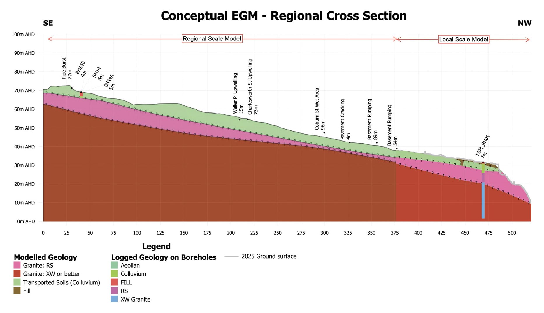
FIGURE 4.4: LOCAL CROSS SECTION OF PSM’S CONCEPTUAL ENGINEERING GEOLOGICAL MODEL – 23 COBURN AVENUE TO 3 PENNY LANE.24
FIGURE 4.4

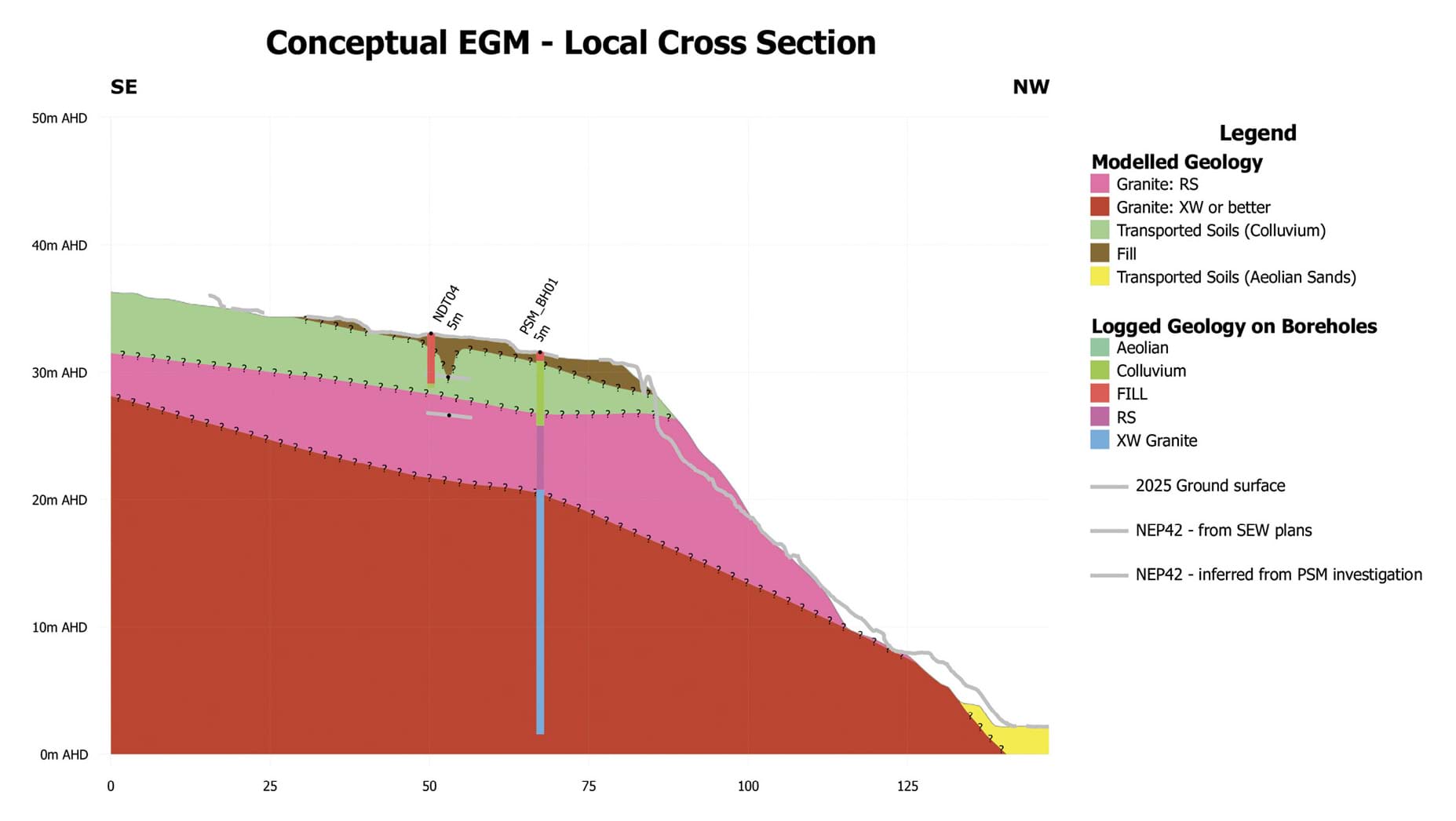
Water definitions and characteristics
- To properly address the second subsidiary question identified above – whether the chemical composition of water emanating from the headscarp can be used to identify its source – it is necessary to say something about groundwater and its characteristics.
- Generally speaking, the term “groundwater” can be used to describe any water that is held or travels underground.25
- Strictly speaking, however, groundwater has a particular meaning in hydrogeology, the scientific discipline concerning how water moves through subsurface pathways and interacts with the surrounding soil and rock.
- In its technical sense, groundwater refers to water that resides in an aquifer, being water-bearing layers beneath the ground surface. Aquifers vary in both their depth and their continuity of water supply. A permanent aquifer lies deeper underground and provides a constant supply of water, 26 whereas a shallow aquifer is closer to the surface and provides a more variable, often intermittent, supply.27
- “Regional groundwater” resides in the permanent aquifer for long periods. Its chemistry is therefore influenced by the aquifer material with which it comes in contact.28
- Contrastingly, “perched groundwater” is water in the shallow soils, which has infiltrated from the surface (typically from rainfall) or from a leaking water bearing service. Three points can be made about the characteristics of perched groundwater:
- The distinct locations of regional groundwater and perched groundwater in McCrae can be seen in the regional cross section prepared by SMEC (reproduced below). The regional groundwater is deeper underground, sitting just above the weathered granite “basement”. The perched groundwater is in the “perched water table” (or shallow aquifer) that sits closer to the surface.
FIGURE 4.5: INTERPRETATIVE HYDROGEOLOGICAL CROSS SECTION.32
FIGURE 4.5
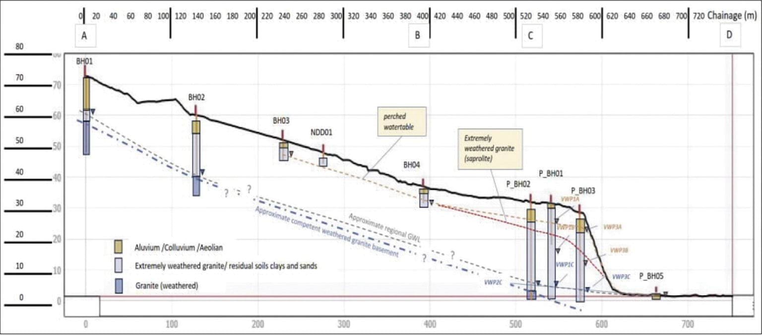
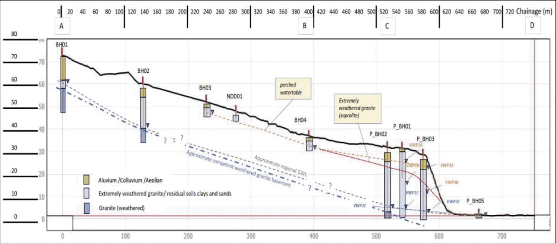
- Increases in the volume of regional groundwater and perched groundwater (that is, “recharge”) occur in different ways:
- as to regional groundwater recharge, water enters at a recharge point (for example, a rock outcrop or ground surface) and then migrates vertically to the water table level in the permanent aquifer;33 and
- as to perched groundwater recharge, water volume increases through:
- infiltration of rainfall; and/or
- leakage of water bearing service infrastructure in the area, including stormwater, mains supply and sewage.34
- Both regional groundwater and perched groundwater can discharge through the surface at exit or exfiltration points called “springs”.35
- Having laid the foundation with these basic principles, it is now appropriate to turn to considering the causes of the landslides, starting with the November 2022 landslides.
4.4 What caused the November 2022 landslides?
- The November 2022 landslides occurred on the escarpment at the north-west end of 10–12 View Point Road on 14 and 15 November 2022.36 The more destructive of the two landslides occurred on the morning of 15 November 2022. It brought down at least 20 tonnes of soil and debris to the base of the escarpment.37 Two properties at the toe of the slope were damaged: 2 Penny Lane and 3/613 Point Nepean Road.38
- Both Mr Pope and Mr Paul agree that water triggered the November 2022 landslides.39 The key question is, therefore, what was the source of the water?
- Before turning to that question, three points should be made at the outset:
- first, the experts did not view the November 2022 landslides as having a causal relationship with the McCrae Landslide;
- second, the Shire’s submission in relation to the cause of the landslides only briefly touches on the cause of the November 2022 landslides;40 and
- third, the Board of Inquiry has not sought to determine the causes of the November 2022 landslides as an independent chain of inquiry in and of itself – that is beyond its Terms of Reference. Rather, the causes of the November 2022 landslides have formed the backdrop against which some of the experts have analysed the causes of the 5 January 2025 landslide and the McCrae Landslide. To that extent, the Board of Inquiry has had regard to, and considers it appropriate to address, the causes of the November 2022 landslides.
What was the source of the water that triggered the November 2022 landslides?
- The experts considered four potential sources of water:
- rainfall;
- groundwater from a shallow aquifer;
- a burst water main near 23 Coburn Avenue; and
- domestic water usage.
- Little needs to be said about two of those sources – groundwater from a shallow aquifer and domestic water usage – beyond noting their relative insignificance. Mr Pope and Mr Paul agreed, with a high level of confidence, that groundwater from a shallow aquifer was an insignificant trigger for the November 2022 landslides.41 Mr Paul did not assess whether domestic water usage was a trigger, and Mr Pope considered its effect to be insignificant to minor with low confidence.42
- More does need to be said about rainfall and the burst water main near 23 Coburn Avenue as potential sources, each of which will now be addressed in turn.
The water was the result of rainfall
- A significant rain event occurred in McCrae the day before the 15 November 2022 landslide. Approximately 80 millimetres of rain was recorded at the Rosebud weather station, the closest rain gauge to McCrae, much of which fell within an eight hour period.43
- This was the fourth largest rain event on record.44 Mr Pope described the event as having a 1 in 100 year to 1 in 200 year probability of occurring within an eight hour window.45 Mr Paul described it as “anomalously high rainfall”.46
- The intense nature of the rainfall on 14 November 2022 is shown in the following graph:
FIGURE 4.6: DAILY RAINFALL TOTALS FOR THE PERIOD BETWEEN OCTOBER 2022 AND NOVEMBER 2022 FOR ROSEBUD (BUREAU OF METEOROLOGY) AND ARTHURS SEAT (MELBOURNE WATER).47
FIGURE 4.6
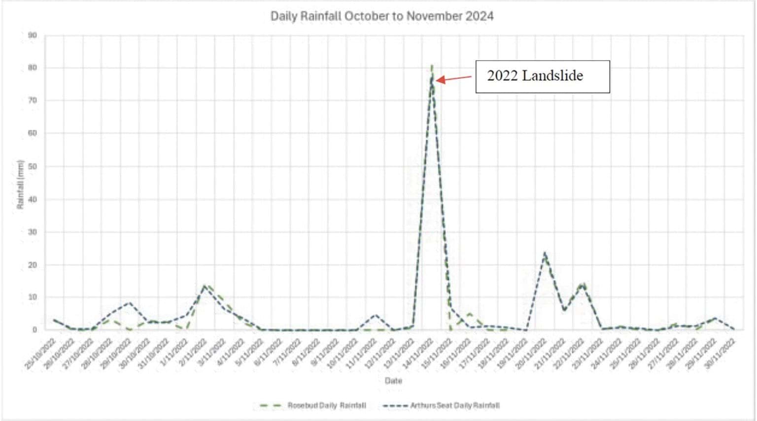
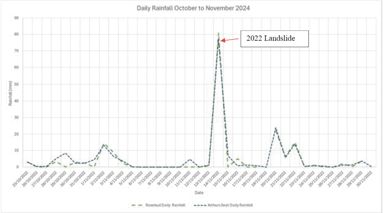
- It is no coincidence that the November 2022 landslides occurred shortly after this significant rain event. It is well-established that rainfall can trigger a landslide.
- Intense rainfall can cause water to infiltrate the ground and change the pressure between soil particles.48 If the space between soil particles (also referred to as pores) is filled with water, the increase in pressure exerted by the water can effectively “push” the soil particles apart.49 The increase in pore pressure can lead to a “tipping point at which soil strength is lost to the extent that a landslide is triggered”.50
- That tipping point was reached on the escarpment at 10–12 View Point Road.
- Mr Pope and Mr Paul gave evidence that the rainfall event was a major or significant triggering factor for the November 2022 landslides.51 The experts only differed in their level of confidence: Mr Pope expressed his opinion with high confidence,52 while Mr Paul expressed his opinion with moderate confidence.53
- Mr Pope stated:
[T]he Rain Event was a major contributor to the landslide. In my opinion the initial translational landslide [that occurred on 14 November 2022] and the subsequent debris flow [that occurred on 15 November 2022] is unlikely to have occurred had the Rain Event not occurred or had the Rain Event been of lower intensity.54
- Mr Paul stated:
The anomalously high rainfall on the day preceding [the] 15 November 2022 landslide gives cause to suspect rainfall as one of the sources of water that infiltrated into the ground and migrated to the escarpment causing the 2022 landslide, although the pathway along which water migrated is not certain.55
The Board of Inquiry accepts that water triggered the November 2022 landslides and that rainfall was a significant contributor to that volume of water. That much is obvious.
Finding
Water triggered the November 2022 landslides.
- What is less obvious is whether the rain alone or in combination with another water source – namely, the burst water main at 23 Coburn Avenue – triggered the landslides.
It cannot be determined whether some of the water originated from the burst near 23 Coburn Avenue
- At about 5.40am on 14 November 2022, a water main failed at the corner of Prospect Hill Road and Coburn Avenue,56 at approximately 23 Coburn Avenue.
- The asbestos cement pipe suffered two circumferential breaks along its length,57 allowing approximately 900,000 litres of water to be released prior to the main being turned off at 6.50pm.58 The water from the burst water main significantly compromised the road surface and nature strip. A large sinkhole appeared on Coburn Avenue to the great concern of multiple residents.59
- The failure occurred upslope of the site of the November 2022 landslides, as can be seen in the diagrams below.
FIGURE 4.7: LOCATION OF WATER MAIN BURST RELATIVE TO THE NOVEMBER 2022 LANDSLIDES.60
FIGURE 4.7
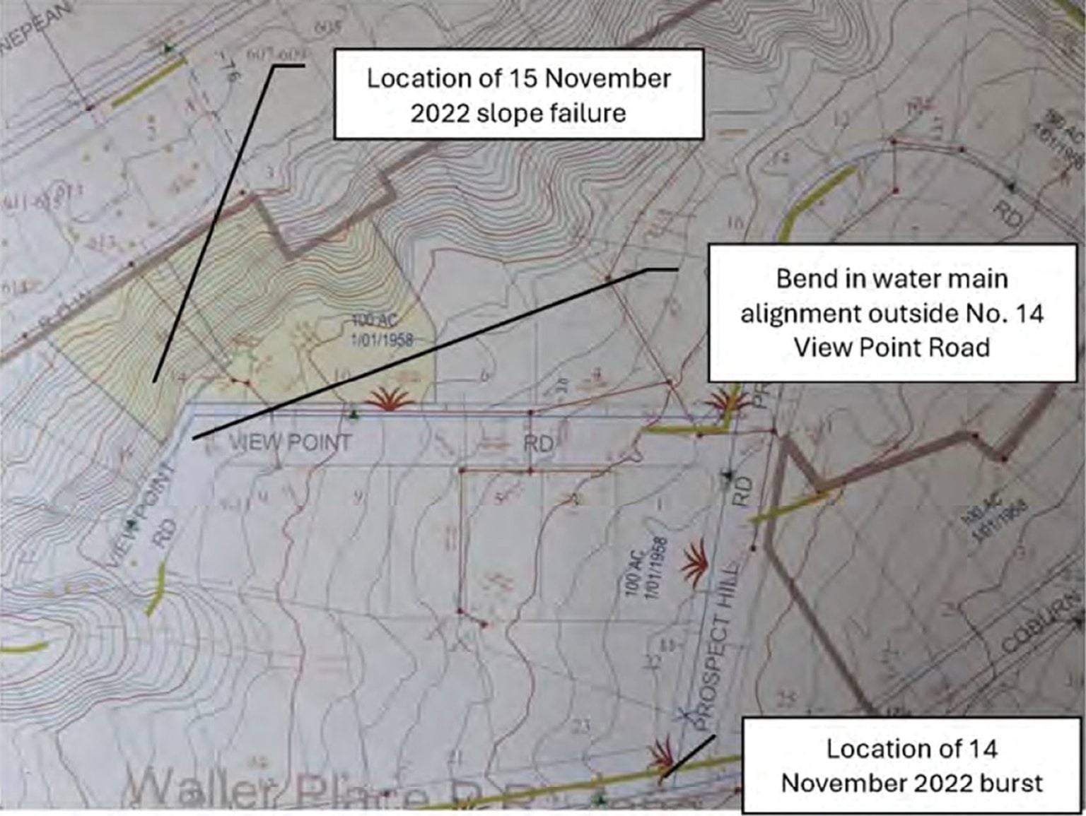
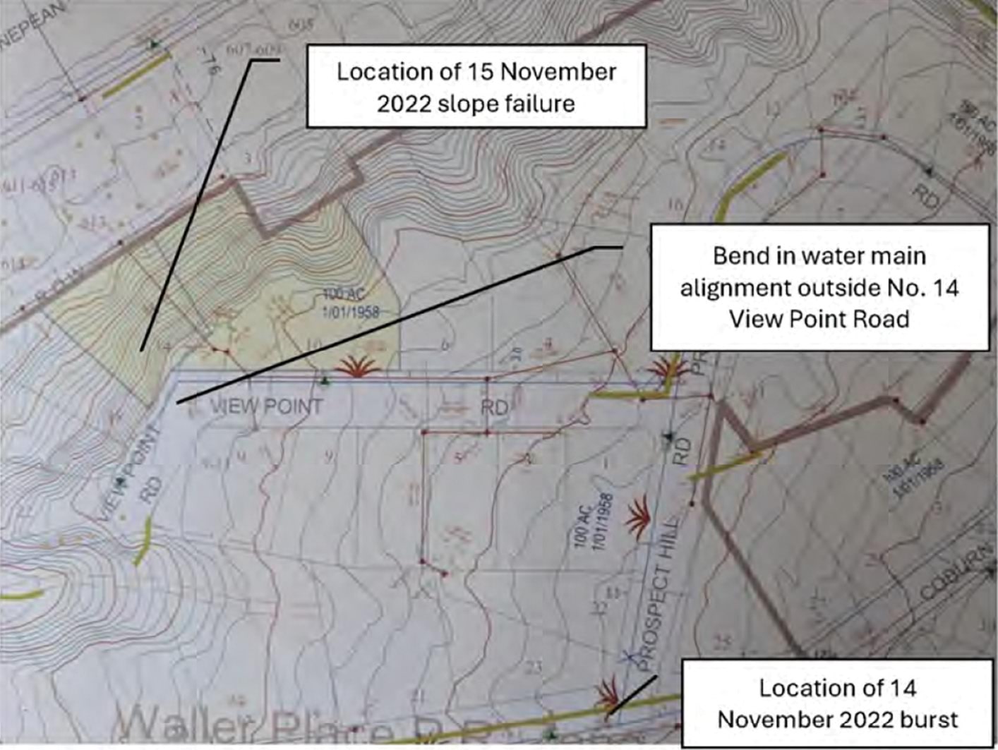
FIGURE 4.8: LOCATION OF WATER MAIN BURST AND OTHER OBSERVATIONS IN ITS VICINITY.61
FIGURE 4.8
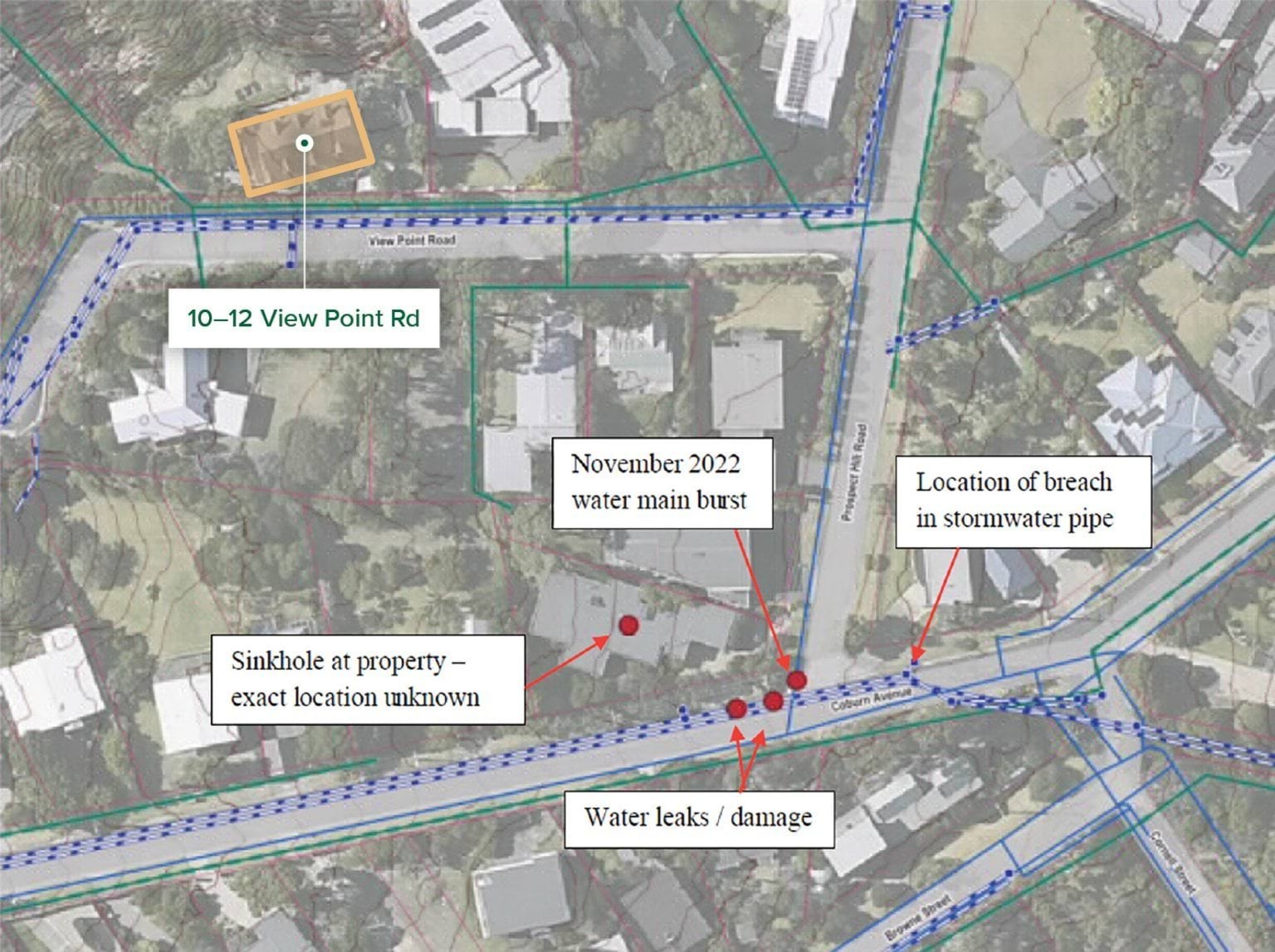
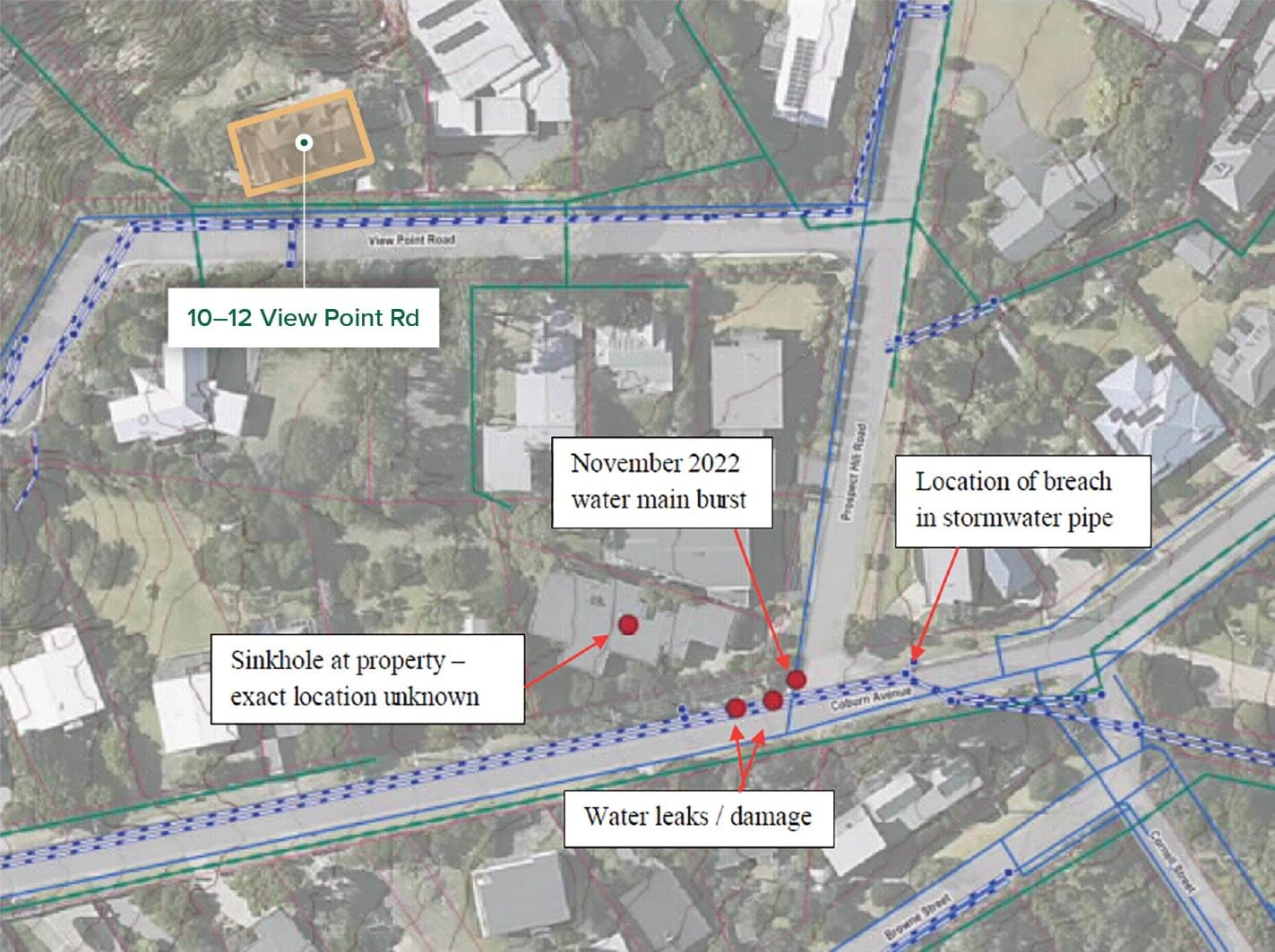
- The distance between the burst water main and the landslide site was greater than 120 metres.62 Could water from the burst have travelled downslope and triggered the landslides?
- Only Mr Paul gave an expert opinion on this issue. Mr Pope said he was unable to comment.63 Mr Paul expressed, with low confidence, the view that water from the burst water main was a medium contributor to the November 2022 landslides.64 He explained:
Some of this water [from the burst water main] exfiltrated at the road surface near the leak, and some must have infiltrated the ground because the point of water exfiltration at the ground surface was about 5 m away from the burst location and the sinkhole had opened in the private property at 23 Coburn Avenue.
Whilst the water main leakage ... may not have been the direct trigger of the landslide on [15 November 2022,] due to the insufficient evidence on which to base it, I am unable to provide an opinion on the proportion of water from the burst compared to the proportion from rainfall that might have contributed to the [landslide]. It is possible that the burst caused wetting of the ground and helped to form subsurface pathways, making the ground at the escarpment more susceptible to landslide upon the extreme rainfall event[.]65
- SEW did not adduce any contrary expert opinion in response to Mr Paul’s evidence. However, it submitted that the expert evidence does not permit a finding that the burst water main triggered the November 2022 landslides.66 SEW pointed to a temporal issue and the paucity of evidence.
- As to the temporal issue, SEW highlighted that the burst occurred at approximately 5.40am on 14 November 2022 and was fixed at around 6.45pm on the same day. SEW submitted that there was insufficient time for any infiltrated water from the burst to reach the landslide site by subterranean means, assuming that the landslide on 14 November 2022 occurred at around 6.30am.67
- The difficulty with this submission is that it hinges on the loud cracking noise that Mr Willigenburg heard at 6.30am on 14 November 2022 as being conclusive evidence of when the landslide occurred. That is open to doubt. There is no other evidence corroborating that the noise signalled the occurrence of the landslide. Mr Willigenburg himself gave evidence that, upon inspecting the back of his property after hearing the loud cracking noise, he did not observe anything unusual.68
- In any event, the repair of the burst water main on the evening of 14 November 2022 does not preclude the possibility that part of the 900,000 litres of escaped water flowed to the landslide site and contributed to causing the more significant landslide on 15 November 2022.
- The Board of Inquiry, therefore, does not accept that the temporal issue is determinative.
- As to the paucity of evidence, SEW submitted that there is no evidence of the:
- volume of water that entered the stormwater drain, save for some photographs taken on 14 November 2022 of water flowing downhill of Coburn Avenue, away from Prospect Hill Road, into a stormwater drain in the kerb;
- volume of water that infiltrated the ground;
- flow path of any subterranean water; and
- precise location of the leak.69
- In the course of cross-examination by SEW’s Counsel, Mr Paul acknowledged that in forming his opinion, he had not personally undertaken tests to identify the underground channels from Coburn Avenue to View Point Road.70 He acknowledged that the connectivity between the burst water main and the landslide site was a “main [area of] uncertainty”.71 He also said that he had not seen evidence of how much water went down the stormwater drain.72
- There is no direct evidence before the Board of Inquiry concerning the volume of water that diverted down Coburn Avenue and into the stormwater drain as opposed to the volume that travelled through a subsurface flow path towards the landslide site. That does not, however, eliminate the possibility that a proportion of the water may have infiltrated the escarpment at 10–12 View Point Road.
- There is some evidence that the water did not entirely flow into the stormwater drain and, in fact, progressed down Prospect Hill Road. For example, as outlined in Chapter 3, at 10.36am on 14 November 2022, a resident at 22 Prospect Hill Road (next door to 23 Coburn Avenue) reported that the street stormwater pit was blocked, and that water was overflowing and flooding their house.73
- Nevertheless, the point remains that the experts and the Board of Inquiry are in no position to conclude with any degree of certainty the proportion of water from the burst water main that flowed towards the landslide site. As Mr Paul said, properly, there are too many “unknowns” considering the current evidentiary base.74 A more wide-ranging and in-depth investigation would have been necessary in order for the Board of Inquiry to be satisfied of the relevant facts; however, that was outside the Terms of Reference.
- The Board of Inquiry, therefore, draws no conclusions as to the extent to which the burst water main near 23 Coburn Avenue may have contributed to triggering the November 2022 landslides.
What were the preparatory factors that may have contributed to causing the November 2022 landslides?
- It will be recalled that preparatory factors are those which make the landscape more susceptible to landslide, even before a triggering event – like the intense rainfall of 14 November 2022 – occurs.
- The experts addressed five preparatory factors in relation to the November 2022 landslides, each of which can be dealt with relatively briefly.
Erosion of the escarpment
- The site of the November 2022 landslides was located on the prominent escarpment at 10–12 View Point Road. The escarpment is approximately 25 metres high, with an overall slope angle of 35 degrees.75
- To contextualise the steepness of the slope, Mr Borghesi gave evidence that one could “scramble down the entire area of the 2022 landslide” but that it was still “quite a steep slope, so you would tend to traverse it rather than use it”.76
- Both Mr Pope and Mr Paul agreed, with very high confidence, that erosion of the escarpment was a major or significant preparatory factor for the November 2022 landslides.77
Mr Pope explained that erosion had led to “marginally stable slope conditions, for which landsliding may occur”. He added that in the upper zone of the slope, the soil slope angle exceeded the effective friction angle of the soils, rendering the slope susceptible to landslides upon a change in soil moisture.78
Finding
Erosion was a significant preparatory factor for the November 2022 landslides.
Subsurface voids/piping channels
- As outlined in Chapter 3, in May 2023, the Shire commenced a major stormwater drainage improvement project along View Point Road. During the excavation process, a “substantial void” was revealed directly upslope of the location of the November 2022 landslides.79
- It was common ground between the experts that a void existed. Ground penetrating radar testing conducted in December 2023 along View Point Road confirmed the existence of a void “approximately 550mm below ground surface and 450mm deep (1.0m below ground surface)”.80 The full extent of the void was unable to be mapped, but it minimally extended from the kerb line to the sewer line along 10–12 View Point Road.81 Mr Paul assumed the correctness of, and relied on, this evidence.82 Mr Pope agreed that the presence of the identified “void in a recently excavated stormwater trench is consistent with natural voids observed in the escarpment”.83
- What divided the experts was whether the void had acted as a preferential channel for water, leading to the saturation of the escarpment prior to the November 2022 landslides. On the one hand, CivilTest, geotechnical engineers engaged by the Borghesis in November 2022, concluded that the void had provided a pathway for water towards the headscarp area.84 It was also CivilTest’s opinion that the cracked kerbs along View Point Road allowed for water from the rain event to accumulate and build up below ground.85 Mr Paul and Mr Pope were not able to express a confident view about that matter. They expressed, with a low level of confidence (less than 40%), that the void was a significant (for Mr Paul) or minor (for Mr Pope) preparatory factor for the November 2022 landslides.86
- Both Mr Paul and Mr Pope were constrained by the evidence available. Mr Paul identified two key gaps in the evidence: he did not know to where the void led, nor did he know whether there were other voids in the area.87 It is, however, important to note that the effect of Mr Paul’s evidence is that the subsurface voids may have been a “significant” preparatory factor. It is also important to recognise that Mr Pope has only low confidence that the voids were a minor preparatory factor. As to his low level of confidence on the issue, Mr Pope said that the “orientation of the void is unknown”, but he expected it to be consistent with groundwater flow directions and perpendicular to the escarpment or parallel with the sewer trench.88 Moreover, he noted that he had not observed any direct evidence of “connectivity” between the void and the landslide site.89
- Without the benefit of a more comprehensive evidence base, the Board of Inquiry draws no conclusions as to whether subsurface voids were a preparatory factor for the November 2022 landslides. The Terms of Reference constrained a deeper inquiry into the issue.
Groundwater from a shallow aquifer
- The Board of Inquiry heard extensive evidence from the Borghesis about the continuous flow of “spring water” down the fractured and cracked northern kerb of View Point Road, and a general increase in the saturation of the hillside in the location of the November 2022 landslides. These observations were made from May 2014 and particularly in the period between December 2020 and May 2023.90
- The increased saturation was so significant that Mr Borghesi installed “agi drains” across the hillside pathway in July 2021 to redirect water, control erosion and make the pathway down to Penny Lane trafficable.91
- CivilTest opined that the Borghesis’ observations of natural seeps on the slope constituted “strong evidence of perched water forming at the materials interface due to the soil profile and topography of the area”.92 It concluded that “[p]erched water had built up at the material interface ... which led to a lack of friction and cohesion at the interface of [the] materials”.93
- Both Mr Pope and Mr Paul were less definitive in their opinions. Mr Pope expressed the view, with moderate confidence (40%-<60%), that groundwater from a shallow aquifer was a medium preparatory factor for the November 2022 landslides.94 He acknowledged that groundwater seepage provides a direct source of water which can contribute to increases in soil moisture content, and appeared to accept that the seeps were likely to be partly associated with natural springs further upslope.95 Mr Paul provided no opinion on this preparatory factor as he had “not seen evidence for a spring or natural conveyance of water to the location of the 2022 landslides”.96
In view of the above, the Board of Inquiry accepts that the site of the November 2022 landslides was saturated for some time prior to the landslides. However, in light of the state of the expert evidence and the limit in the Terms of Reference, it draws no conclusions as to the extent to which groundwater from a shallow aquifer was a preparatory factor for the November 2022 landslides.
Finding
The site of the November 2022 landslides was saturated for some time prior to the landslides.
Anthropogenic changes
- Several anthropogenic changes were identified in relation to the site of the November 2022 landslides. Namely, Mr Pope observed the presence of paths, retaining walls and stairs above the site, which he considered allowed “surface water from outside the Landslide area to concentrate and direct flow into the Landslide site”.97 He further observed that three subsurface “agi-drains” discharged water onto the slope above the site,98 providing an additional source of infiltration that reduced slope stability.
- In the result, Mr Pope expressed, with moderate confidence, that such anthropogenic changes made a medium contribution, whereas Mr Paul, with low confidence, considered their contribution to be minor.99
- Overall, anthropogenic changes were given brief treatment as a preparatory factor for the November 2022 landslides and were not explored in detail in the public hearings due to the limit in the Terms of Reference. The Board of Inquiry, therefore, draws no conclusions in relation to their contribution to the November 2022 landslides.
Loss or removal of vegetation
- Finally, the experts considered the extent to which removal of vegetation from the escarpment may have contributed to the November 2022 landslides.
- Initially, Mr Pope considered this factor to be significant. In a report he prepared for legal proceedings in June 2024 on the causes of the November 2022 landslides, he stated:
I note that trees have been removed in 2021 including a large mature gum and further vegetation has been removed by the Landslide[.] In my opinion tree removal is a significant conditional event that has occurred at the Site and suction will change in the escarpment slopes ... In my opinion the Landslide Area is well within the influence zone of removed trees.100
- During examination by Counsel Assisting, Mr Pope accepted that his conclusions concerning the extent of vegetation removal may have been expressed too conclusively, saying that the tree line had changed, but he was not able to say whether the trees had been heavily pruned or removed altogether.101
- Ultimately, Mr Pope expressed, with high confidence, that removal of vegetation had a medium to major contribution.102 He explained that his level of confidence was supported by his examination of aerial photographs as well as three-dimensional models of the subject area.103
- Mr Paul agreed that removal of vegetation had a medium contribution but expressed this opinion with very low confidence.104 He explained that his assessment was based on historical images and photographs, which made it “quite hard” for him to determine the extent of root removal.105 In his view, this was more relevant to assessing slope stability than the extent of visible canopy cover in a photograph.106
- Mr Pope disagreed. He stated that a tree’s capacity to draw water up from the soil is directly linked to the canopy size, making it unnecessary to identify details of the affected root systems to assess the impact on slope stability.107
- The Board of Inquiry is not able to resolve the conflict given that this factor was not extensively explored in evidence due to the limit in the Terms of Reference. The Board of Inquiry did not have, for example, evidence from a witness with sufficient expertise in water suction through vegetation. It draws no conclusions in relation to the contribution of loss of vegetation to the November 2022 landslides.
Conclusion on the November 2022 landslides
- Water – from an intense rainfall event or in combination with water from a burst water main – triggered the November 2022 landslides. It may also be that the subsurface voids, in combination with the poor drainage and cracked kerb in View Point Road, were significant preparatory factors, and that loss of vegetation also played a role.
- Beyond making these observations, it is neither appropriate, nor necessary, to draw conclusions about the causes of the November 2022 landslides given the limitations imposed by the Terms of Reference. The Board of Inquiry is conscious of the pressing need, after almost three years, for there to be a resolution between the Shire and affected residents in relation to these landslides. While the Terms of Reference constrained the Board of Inquiry, there is no need for the mediation process that has been recommended (Recommendation 1) to be similarly constrained.
- The November 2022 landslides form an important part of the backdrop to the 5 January 2025 landslide and the McCrae Landslide. It cannot be forgotten that all of those landslides predominantly occurred on the same property, albeit on different parts of the escarpment. Moreover, while the intense rainfall event was unique to the November 2022 landslides, water again played a significant role in triggering the 5 January 2025 landslide and the McCrae Landslide. It is to this central issue that the Report now turns.
4.5 What caused the 5 January 2025 landslide and the McCrae Landslide?
- An issue of central significance for the Board of Inquiry was the cause of the McCrae Landslide. On this question, the Board of Inquiry had the benefit of extensive expert geotechnical, hydrogeological and geochemical evidence.
- Although there is no doubt that the 5 January 2025 landslide and the McCrae Landslide were causatively related, the Board of Inquiry investigated the cause of each landslide independently. Critically, the Board of Inquiry did not proceed from the assumption that the McCrae Landslide was caused by the same factors as the 5 January 2025 landslide, or that the earlier landslide itself caused the later one.
- Even on that approach, it quickly emerged that the causes of the two landslides could not be disentangled. The landslides, to borrow Mr Paul’s language, “can be considered separate stages of the one landslide event”.108 Consequently, much of the analysis that follows applies to both landslides.
- With that in mind, the causal analysis for the 5 January 2025 landslide and the McCrae Landslide is as follows.
- On one point of significance there was unanimous agreement by the experts: the trigger for the landslides was excess water in the slope in the vicinity of 10–12 View Point Road.109 The origin of that water was disputed.
- All experts other than those engaged by SEW (being, Mr Paul, Dr Vu, Mr Makin, Mr Pope and Mr Hitchcock) considered that the water originated from a burst water main located near the corner of Bayview Road and Outlook Road. SEW’s expert, Mr Hartley (assisted by Mr Bolton and Mr Jewell), considered that the burst water main was not the source (and accordingly considered it to be a minor, or even insignificant, cause).
- Because water is accepted by all experts to be the trigger for the 5 January 2025 landslide and the McCrae Landslide, other common landslide triggers can be put to one side. Three potential water sources were identified:
- the burst water main;
- groundwater from an aquifer; and
- domestic irrigation.
- The preponderance of expert opinion was that the burst water main was the source of the excess water in the slope. All experts ruled out groundwater from an aquifer as a cause of any significance.110 SEW’s experts, Mr Hartley and Mr Bolton of SMEC were the only experts who considered domestic irrigation to be anything other than a minor cause.111
- It was important for the Board of Inquiry’s investigation to receive an opinion from SEW’s experts, which diverged from the views of all other experts. The provision of the contrary opinion served to rigorously test the prevailing expert consensus and has given the Board of Inquiry increased confidence in its conclusion that the burst water main was the source of the water.
The water originated from SEW’s burst water main
- As discussed in Chapter 3, SEW accepts that there was a long-running and substantial leak from the burst water main, which commenced around August 2024. In determining whether some of that water reached 6 and 10–12 View Point Road, the following issues arise for consideration:
- What was the volume of water lost from the burst water main?
- What were the available paths of travel for the burst water?
- Did water from the burst water main get to those flow paths?
- Do those flow paths convey water to the site of the January 2025 landslides?
- Do the observed conditions along each path support the flow of water along them?
- What volume of water travelled along each path?
- Did water from the burst water main make it to the slope?
- Each issue is considered in turn. The analysis is necessarily technical and detailed.
What was the volume of water lost from the burst water main?
- There is no doubt that a very significant volume of water escaped from the burst water main. SEW undertook various calculations to determine the likely extent of the leakage and, ultimately, engaged Professor van Zyl to opine on various matters connected with the burst.
- Relying on analysis prepared by Dr Jonathan Crook, Group Manager for Analytics and Performance of SEW, Professor van Zyl estimated that the leak commenced in around the start of August 2024 and ceased on 1 January 2025 when the burst was repaired, and that the total volume of water that escaped from the burst water main was 40.3 million litres.112
- Professor van Zyl estimated that the flow rate of the leak progressively increased over time, rising sharply throughout December 2024, and peaking at approximately 1.4 million litres per day in late December 2024. Professor van Zyl graphically represented this flow rate as follows:
FIGURE 4.9: PROFESSOR VAN ZYL’S FLOW RATE ANALYSIS.113
FIGURE 4.9
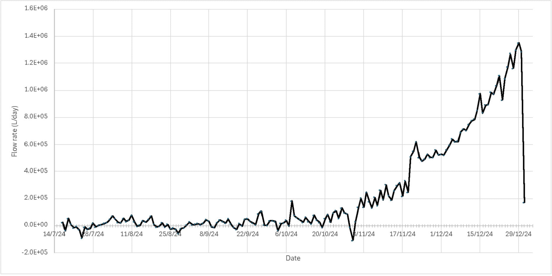
- Professor van Zyl modelled leakage volume per day between 11 August and 31 December 2024. On that model:
- from 11 August until sometime in mid-October, around 11,000 litres per day was lost;
- from mid-October, that loss increased to around 50,000 litres per day;
- by November, it had risen to 160,000 litres per day;
- by the end of November the volume reached 560,000 litres per day;
- by mid-December, about 1 million litres per day was escaping the pipe; and
- finally, by the end of December, the leakage had risen to approximately 1.4 million litres per day.
- The Board of Inquiry has assumed the correctness of Professor van Zyl’s conclusions as to the total water loss and maximum daily flows in its consideration of the cause of the January 2025 landslides.
- The next question is: where did that water go?
What were the available travel paths for the burst water?
- Three potential flow paths for the water were considered by the experts:
- through sewer and water mains trenches, including through the permeable embedment (or bedding) materials;
- through the stormwater system; and
- through the shallow aquifer in the colluvium.
- The plausibility of each flow path falls to be considered across two geographical segments:
- at the site of the burst water main; and
- between the burst water main and the escarpment at 10–12 View Point Road.
- Before turning to the hypothesised paths, something needs to be said about how water moves through different materials. This topic was addressed in several of the expert reports and during the course of the public hearings. The evidence in its critical respects can be summarised as follows:
- Ordinarily, water travels downward with gravity, following the path of least resistance.114
- Water on the ground surface, will either infiltrate that surface if it is permeable (e.g. soil), or otherwise flow over that surface following the path of least resistance downhill until it reaches a permeable surface.115
- “Permeability” is the ability of a material to absorb or transmit a given volume of water. “Hydraulic conductivity” is the rate at which water moves through a given material in metres per second. This can be used to compute the “linear velocity” of water using Darcy’s Law, which states that the discharge rate is proportional to the hydraulic gradient and the hydraulic conductivity.116
- Where the volume of water per minute infiltrating a given area of soil exceeds the amount of water that can pass through that area in the same minute, that water will pool on top of the soil and spread out across it.117
- When water infiltrates permeable materials, it will travel until it reaches a low permeability layer that limits its migration.118 If resistance to subsurface flow is too high for more water to be absorbed, water will be forced to the surface (exfiltration).119
- As water follows the path of least resistance, it will tend to travel through materials of relatively high permeability as the “preferential pathway”.120 The more granular the material, the more permeable (i.e., the greater “pore spacing”) it is and therefore the more likely to be a preferential pathway.121 Gravels are typically more granular than sands, which in turn are more granular than clays. This is why gravels are typically used for drainage.122 To give some more specific numbers for context, SMEC concluded here that the velocity of the embedment material in service trenches was approximately 10 minutes per metre travelled, whereas the natural soil (colluvium) velocity was 12 hours per metre travelled (two metres per day).123
- In order to understand whether water could have travelled the hypothesised paths to the landslide site, it is first necessary to start with the site of the burst. That is where water was immediately discharged and, therefore, the immediate surrounds of the water main are of relevance to the question of where water would have migrated. It is also necessary to provide a broad overview of the flow paths considered by the experts before descending into the detail.
Burst water main site
- The burst occurred in dense bushland located between Bayview Road and the Mornington Peninsula Freeway.
- The image below is an overhead photograph of the burst location, annotated to identify key features of relevance. In particular, it shows the position of the burst in relation to nearby mains water, stormwater and sewer infrastructure. The annotations show that the burst occurred several metres from a sewer trench and stormwater pipes, which run downslope under the Mornington Peninsula Freeway toward the escarpment on which the January 2025 landslides occurred.
FIGURE 4.10: OVERVIEW OF THE BURST SITE SHOWING THE APPROXIMATE LOCATION OF WATER SERVICES.124
FIGURE 4.10
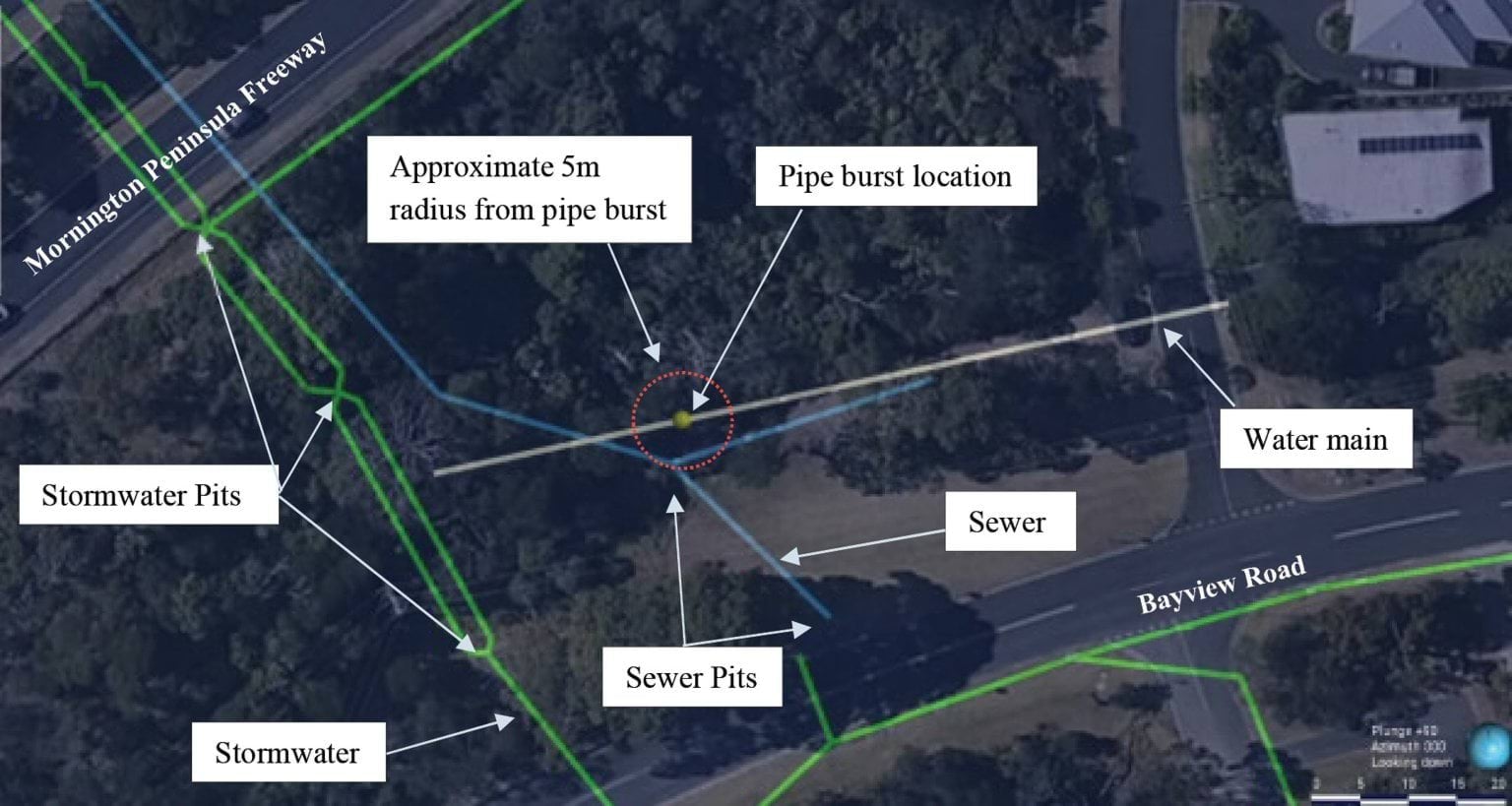
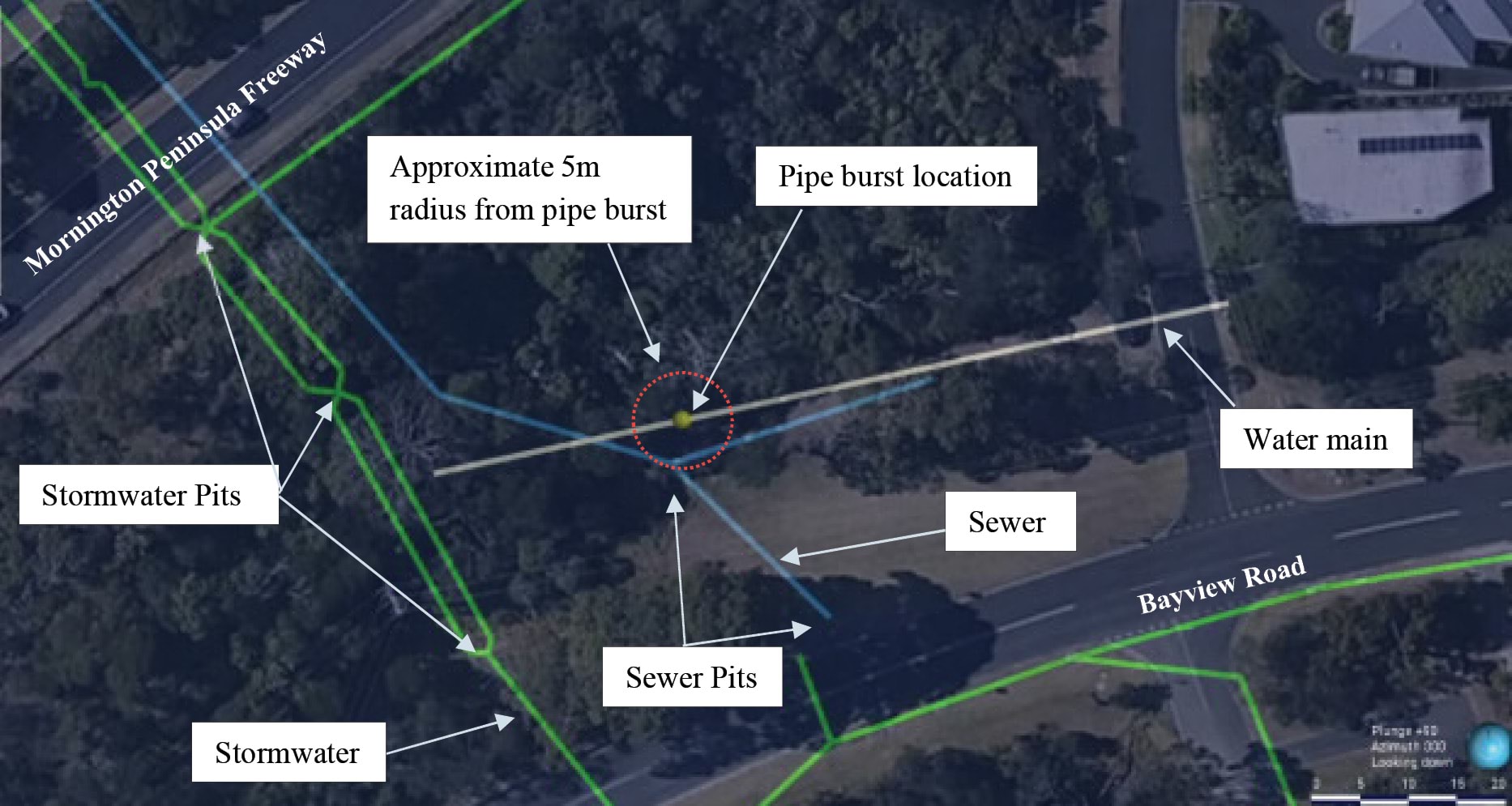
- The respective orientation of the burst location, sewer and stormwater trenches are shown in the image below, which is an isometric view of the burst site:
FIGURE 4.11: ISOMETRIC VIEW OF THE BURST SITE SHOWING THE APPROXIMATE LOCATION OF WATER SERVICES.125
FIGURE 4.11
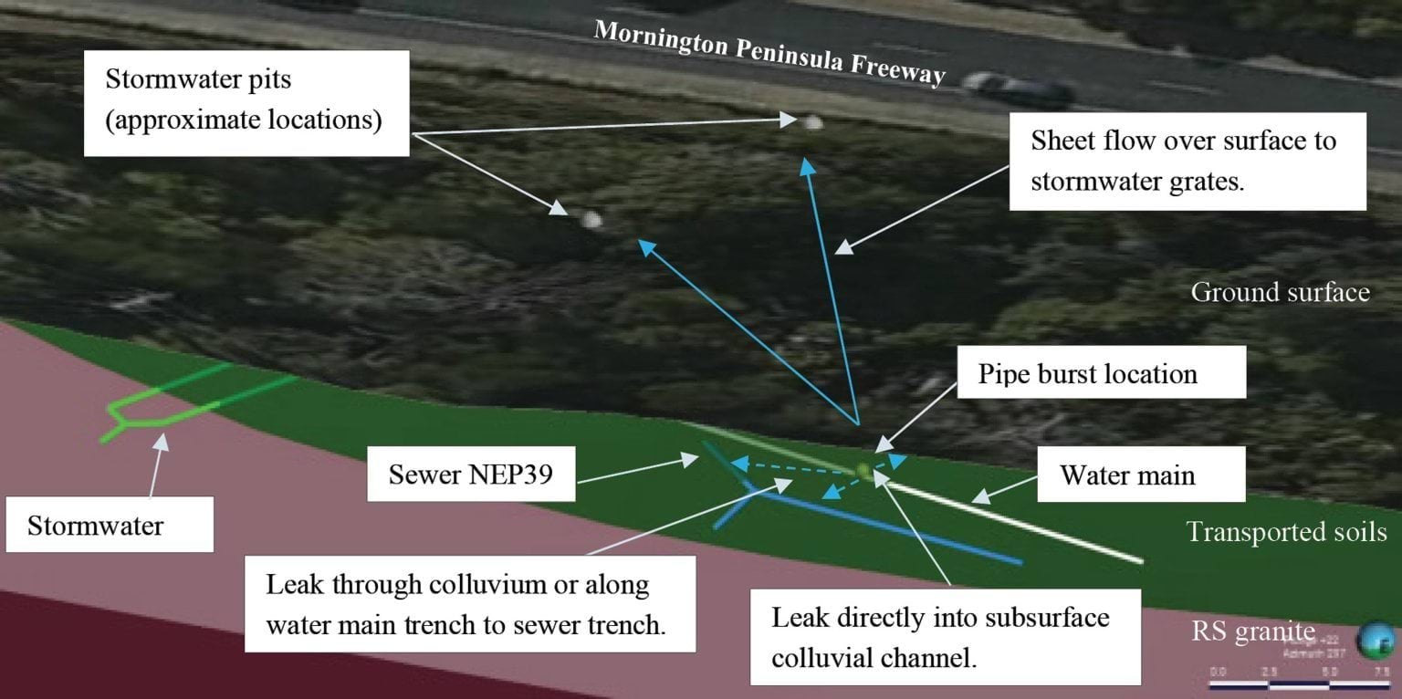
- The subsurface geological units in which the infrastructure is found are represented in different colours. The water main and sewer pipes are in the relatively permeable transported soils (green), which sit on top of residual granites (mauve). The implications of this for the extent and velocity of water flow will become apparent.
- Having identified the locational features of the burst site, it is then necessary to briefly return to the three potential flow paths, being through:
- sewer and water mains trenches, including through the permeable embedment or bedding materials;
- the stormwater system; and
- the shallow aquifer in the colluvium.
- There was substantial agreement between the experts both as to the existence of the flow paths, and the fact that water from the burst had travelled through them. SEW’s experts disagreed, however, with the other experts on where the water ultimately travelled.
- Mr Paul concluded that some of the water from the burst reached the site of the January 2025 landslides, travelling through soils, fill, trench backfill and possibly breaches in the stormwater systems.126
- He considered the burst water main was the only source capable of supplying the volume needed to trigger the landslides and to explain the post-landslide flows observed at the headscarp. He did not reach a firm view on which pathway or pathways the water followed, considering all three to be plausible.127
- Mr Pope independently reached the same conclusion as Mr Paul – that water from the burst water main triggered the 5 January 2025 landslide.128 As to how the water travelled to that location, Mr Hitchcock initially expressed the opinion that the colluvial channel flow path (shallow aquifer) was the most likely pathway by which water would have travelled.129 However, during the concurrent expert evidence hearing, he explained that after considering the other expert reports, which he had not seen before producing his report, he thought it was more likely that the water flowed through a combination of the colluvial channel and the stormwater and sewer bedding materials.130
- SEW’s expert, Mr Hartley, agreed with the presence of the flow paths from the burst water main, however, disagreed that water would have flowed through them to the site of the January 2025 landslides. Mr Hartley summarised his findings about flow paths as follows:
A proportion of mains water flowing overland from the Bayview Road leak would have permeated into the surrounding soil, flowing toward the escarpment as groundwater. The two paths likely taken by the leak water to travel downslope as groundwater comprise:
- Flow through the shallow soil aquifer only (i.e. through natural soil and fill soil, excluding embedment material) following groundwater flow paths; and
- Flow through the shallow soil aquifer, then into utility trenches filled with embedment material and then flowing downhill to the sea.
While these two flow paths are not mutually exclusive, and Bayview Road leak water would likely have taken both paths, we assess that the majority of the mains water derived from the leak (that didn’t enter the stormwater system) will have travelled downslope within existing service trenches. This is because the utility trenches – with relatively higher permeability than natural material – intercepts and absorbs the intercepted groundwater flowing through the shallow soil aquifer.131
- During the concurrent expert evidence hearing, Mr Hartley’s opinion about the sewer trenches flow path was clarified, as follows:
The idea that water flows through the sewerage trench down through - underneath the M11, Waller Place, Charlesworth, hits Coburn, is very much something that we think is a high likelihood and what we’ve been able to do - and it gets all geochemistry breadcrumby from thereon - is understand that there is a trend of water with similar characteristics that go down the sewerage down to Coburn Avenue, then get into the natural material and find themselves underneath the property in the agi-drain system of 7 Prospect Hill Road.132
- Despite agreeing about the existence of the flow paths, SEW’s experts, Mr Hartley and Mr Bolton, did not agree that water from the burst water main was the trigger for the 5 January 2025 landslide (or, for that matter, the McCrae Landslide).133 Mr Hartley and Mr Bolton stood apart from Mr Paul, Mr Pope and Mr Hitchcock in this respect.
- Having provided a broad overview of the available flow paths, it is necessary to consider more detailed evidence in respect of those flow paths.
- There is no escaping that the evidence concerning the flow paths is complex. It is therefore necessary to step through the analysis in stages. At the first stage, this Chapter examines the flow paths in the immediate vicinity of the burst water main. At the second stage, it examines the flow paths between the burst water main and the site of the January 2025 landslides.
Water infiltrating directly from the burst water main into embedment materials of the water main service trench and the nearby sewer trench
- Turning to the first stage, at its simplest, the water, on immediately escaping from the burst water main, had two possible directional paths: upward to the surface or downward into the ground. That proposition requires some unpacking.
- As can be seen from earlier diagrams of the burst site (Figures 4.10 and 4.11), close-by to the water main, is sewer main NEP39. That sewer main sits approximately 1.5 metres below and to the side of the water mains trench in which the burst main was located. The following cross-sectional diagram illustrates the point:
FIGURE 4.12: SUBTERRANEAN CROSS SECTION OF THE BURST SITE.134
FIGURE 4.12

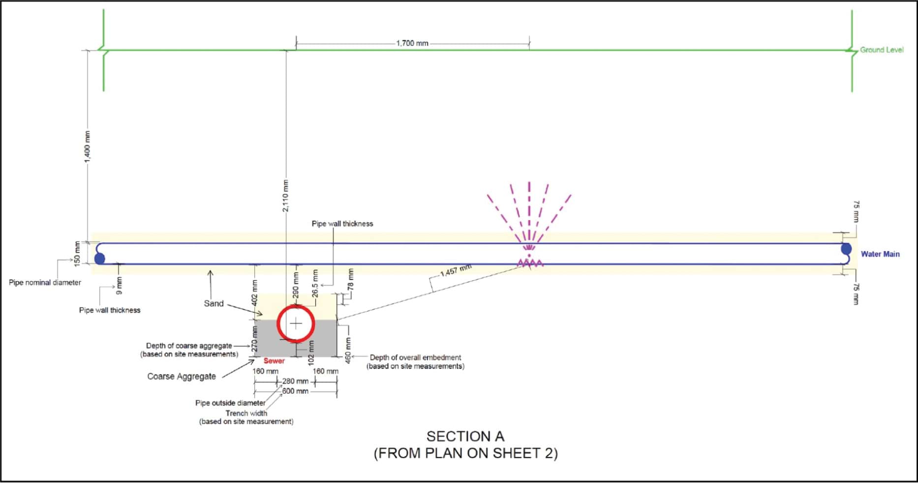
- Professor van Zyl provided an annotated version of the above diagram showing his opinion of the multiple flow paths from the burst:
FIGURE 4.13: ANNOTATED DIAGRAM ILLUSTRATING PROF VAN ZYL’S OPINION REGARDING FLOW PATHS NEAR THE BURST SITE.135
FIGURE 4.13

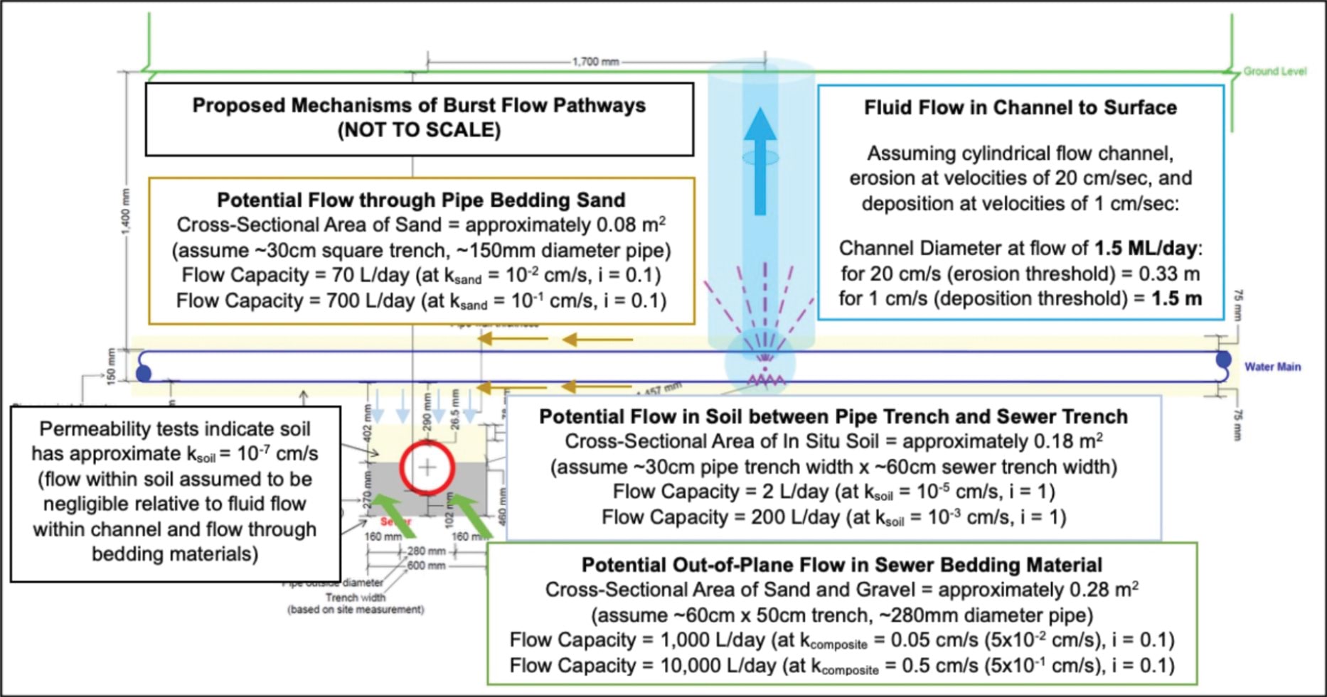
- As the diagram depicts, Professor van Zyl identified four flow pathways, one of which is vertical and three of which are lateral. As to the former, water from the burst could have travelled vertically upwards through a “Fluid Flow Channel” to the surface (Vertical Burst Channel). As to the latter, water from the burst could have travelled through the:
- bedding material of the water main, which was assumed to consist of sand;
- soil between the water main and sewer trench; or
- sewer bedding material, which was assumed to consist of gravel below the pipe and sand above the pipe.136
- Professor van Zyl’s opinion was that water from the burst main would have first infiltrated the water main’s sandy bedding material but, due to the relative impermeability of that material, it would also have begun to infiltrate the surrounding soils. From here, Professor van Zyl considered the water from the burst would have begun to form the Vertical Burst Channel, while, at the same time, continuing to spread through the soil and ultimately reaching the sewer service trench, which was comprised of sand and gravel. It is important to note the amount of water exiting from the burst pipe initially (i.e. in the first two months) was not enough to overcome the permeability of the mains and sewer service trenches.137 Once the volume of water was too great to be absorbed through these paths, the Vertical Burst Channel was formed and the water began to flow to the surface.138 As is explained below, the water that followed the Vertical Burst Channel to the surface is the source of the water for the recharge of the colluvial channel and stormwater flow paths to the site of the January 2025 landslides.
- On the question of how much water flowed through the bedding materials, Professor van Zyl provided “sample” calculations of the expected flow rates through the water main and sewer bedding materials. His estimate was a flow rate of 11,000 litres per day, of which 10,000 litres per day travelled through the sewer bedding material, and 1,000 litres per day travelled through the surrounding water main bedding material.139
- Professor van Zyl did not give oral evidence, nor did he participate in the expert conclaves. Rather, his report was sought by SEW and relied upon by Mr Hartley and Mr Bolton in forming their conclusions. Mr Hartley and Mr Bolton could not explain why Professor van Zyl referred to his calculations as a “sample”, nor did they attempt to verify the professor’s figures.140
- There were no alternative calculations for the flow rates Professor van Zyl calculated, however, Mr Pope considered Professor van Zyl’s figures to underestimate the likely permeability of the materials between the sewer and water main trenches.141 Mr Pope estimated that “relatively low heads (~0.5 m) flow through gravel bedding in sewer trenches may be in the order of 15 to 20 litres per minute or 21,600 to 28,800 litres per day”,142 roughly twice to three times Professor van Zyl’s 11,000 litres per day.
- Setting aside the concerns with the accuracy of Professor van Zyl’s estimate (without intending any criticism, given that he did not appear in person), the effect of his “sample” calculations – which may well be a conservative estimate – was that before the water from the burst water main reached the surface, at a minimum, approximately 11,000 litres per day would have been absorbed into the mains and sewer trenches from 11 August 2024.
- It will be recalled that the water main and its trench is situated in transported soils (colluvium).143 As to whether the water travelled through the colluvium – the soil between the water main and sewer trench – Professor van Zyl stated:
[S]eepage through the in-situ soil was assumed to be negligible relative to the flow capacities of the higher permeability bedding materials and the fluid flow channel developing between the pipe burst and ground surface (the assumption of relatively low seepage flow rates through the in-situ soil is supported by the measured permeability values).144
- In summary then, at least 11,000 litres per day (and possibly as high as 28,800 litres per day) of water from the burst water main was travelling directly from the burst into the surrounding water main bedding and nearby sewer main bedding. The balance reached the surface through the Vertical Burst Channel.
- What happened to the balance of the water that reached the surface via the Vertical Burst Channel?
Colluvium and stormwater flow paths
- As noted above, on Professor van Zyl’s analysis, the water from the burst main took about two months to reach the surface via the Vertical Burst Channel. Prior to this, the majority of the water was infiltrating the service trenches. That the water from the burst did not reach the surface until approximately 6 October 2024, was due to flow capacity for the service trench materials not being overwhelmed until that point.145
- What happened to the water once it reached the surface was considered by Tim Rhodes, Technical Principal of SMEC.146 He prepared a two-dimensional hydraulic model that simulated flows across the terrain between the burst location near Bayview Road and the nearby stormwater drains.147
- Mr Rhodes explained that as the volume of water reaching the surface increased, it began to fan out over the surface of the ground, flowing downhill toward the stormwater drain located about 30 metres from the burst site.148
- The extent of the surface water flow was estimated to be delineated by the extent of sandy materials deposited across the surface downslope of the burst site.149
- The diagram below illustrates the observed sand flow (delineated by the red lines) fanning out from the burst location towards the stormwater drain, and inferred to have been transported there by the surface water flow.150
Landslide Report
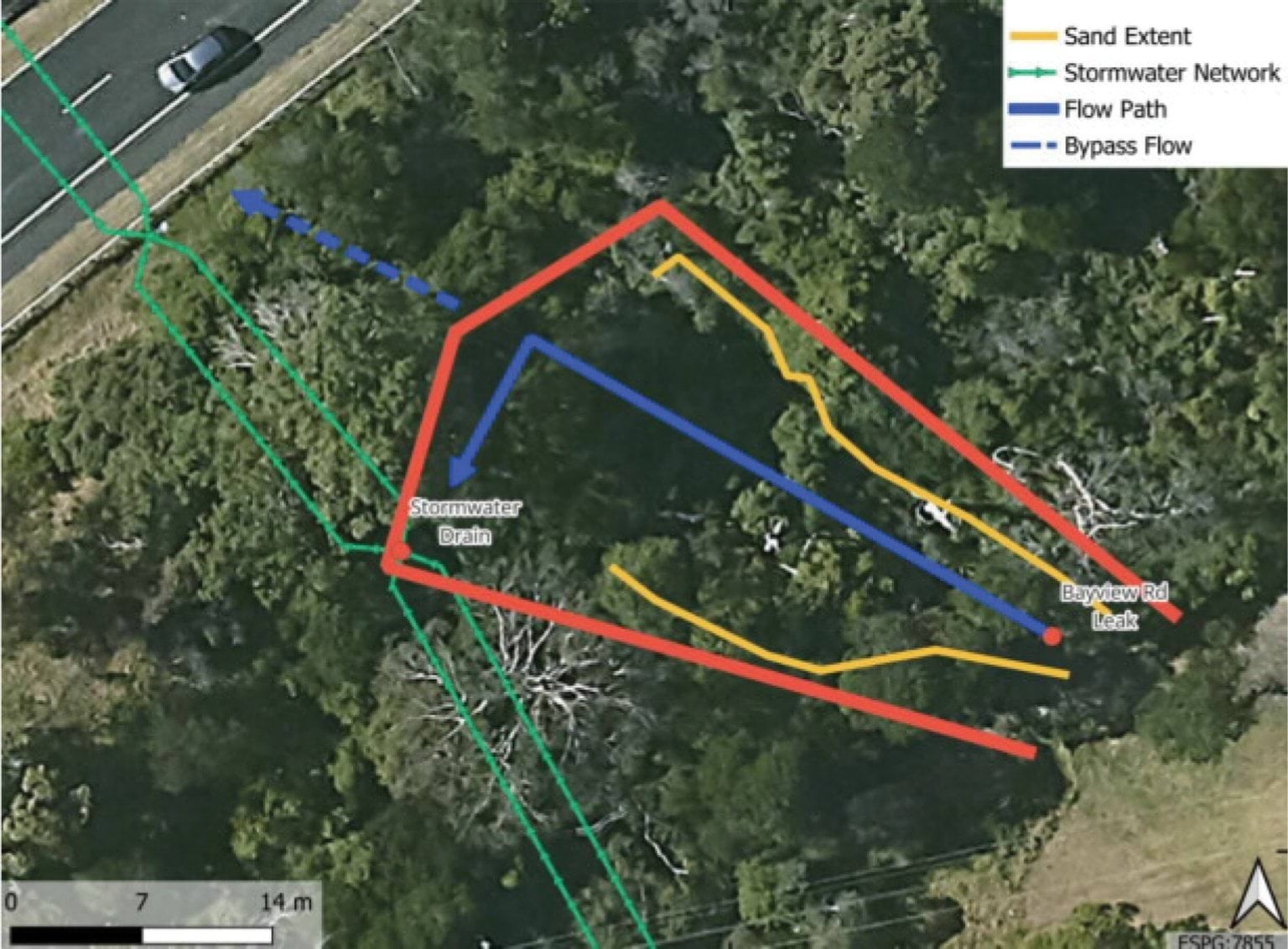
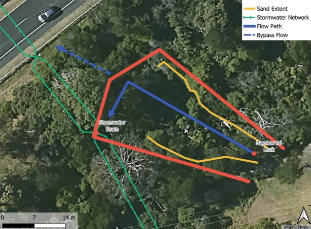
- Mr Rhodes estimated the surface area inundated by the surface flow to be around 400 square metres.151
- Once the water surfaced, it followed one of two pathways: a portion infiltrated (back) into the ground as it travelled downslope, while the residual made its way into the stormwater system via the stormwater drain.
- Mr Rhodes provided the Board of Inquiry with evidence of the proportion of water that infiltrated the ground. He estimated that by applying an infiltration rate (based on the surface permeability) of 50 millimetres per hour, at peak flow of 1.4 million litres per day, approximately five litres per second would have been reabsorbed into the ground in that area.152 Expressed as a daily rate, at peak flow, SMEC estimated that between 400,000 and 500,000 litres of water per day could infiltrate – that is effectively, be reabsorbed into – the ground between the burst water main and the stormwater pit.153 During the concurrent expert evidence, Mr Bolton accepted that this volume of water would follow the path of least resistance underground, being either through sewer bedding materials or colluvial channels.154
- It should be noted that neither SMEC nor Mr Rhodes performed any analysis of the progressive absorption rate as the burst rate increased towards the maximum volume.155 Put another way, the absorption rate was only calculated in respect of “the worst day” of the burst, that being 31 December 2024.156
- Notwithstanding that, the experts accepted that, as a general ratio, approximately one third of the surface water flow would be reabsorbed into the ground as it progressed towards the stormwater drains, with the balance entering the stormwater system.157
- Accordingly, returning to the immediate facts, once water began reaching the surface (at a burst volume of around 11,000 to 28,800 litres per day), approximately one third of the total volume that reached the surface was reabsorbed into the ground, while the balance travelled to the stormwater drain and into the stormwater system under the Mornington Peninsula Freeway.
Conclusion regarding the flow paths
- In summary then, the experts agreed that water from the burst water main could follow three pathways in its immediate vicinity:
- first, along channels in the nearby service trenches (mains and sewer);
- second, vertically to the surface once the flow rate exceeded the absorption capacity of the embedment material, with a portion of that surface water subsequently infiltrating (back) into the ground as it fanned out towards the stormwater drain; and
- third, into the stormwater system via the drain, such water comprised of the residual surface water not reabsorbed into the ground.
- Turning then to the next question: of the water that entered each of the flow paths, where did it go?
Potential flow paths between the Bayview Road burst site and January 2025 landslides site
- In this section, being the second stage of the analysis, the Report examines the flow paths between the burst water main and the site of the January 2025 landslides. Each of the three potential flow paths – service trenches, colluvial channels, and the stormwater system – are explained in turn, and the evidence of water flowing through them is considered.
- To aid the analysis, reference will be made to the graphical representations of the three flow paths from the burst water main to the site of the January 2025 landslides prepared by Mr Paul in his expert report.
The service trench flow path
- Expressed in a single sentence, the service trench flow path describes the flow of water from the burst site towards the site of the January 2025 landslides through the trenches of the water main and sewer networks – that is, through the permeable materials that are used to backfill trenches in which the pipes have been laid.
- The service trench flow path is depicted as follows by the yellow lines so far as it concerns the sewer trenches:
FIGURE 4.14: MR PAUL’S DEPICITION OF THE SERVICE TRENCH FLOW PATH.158
FIGURE 4.14
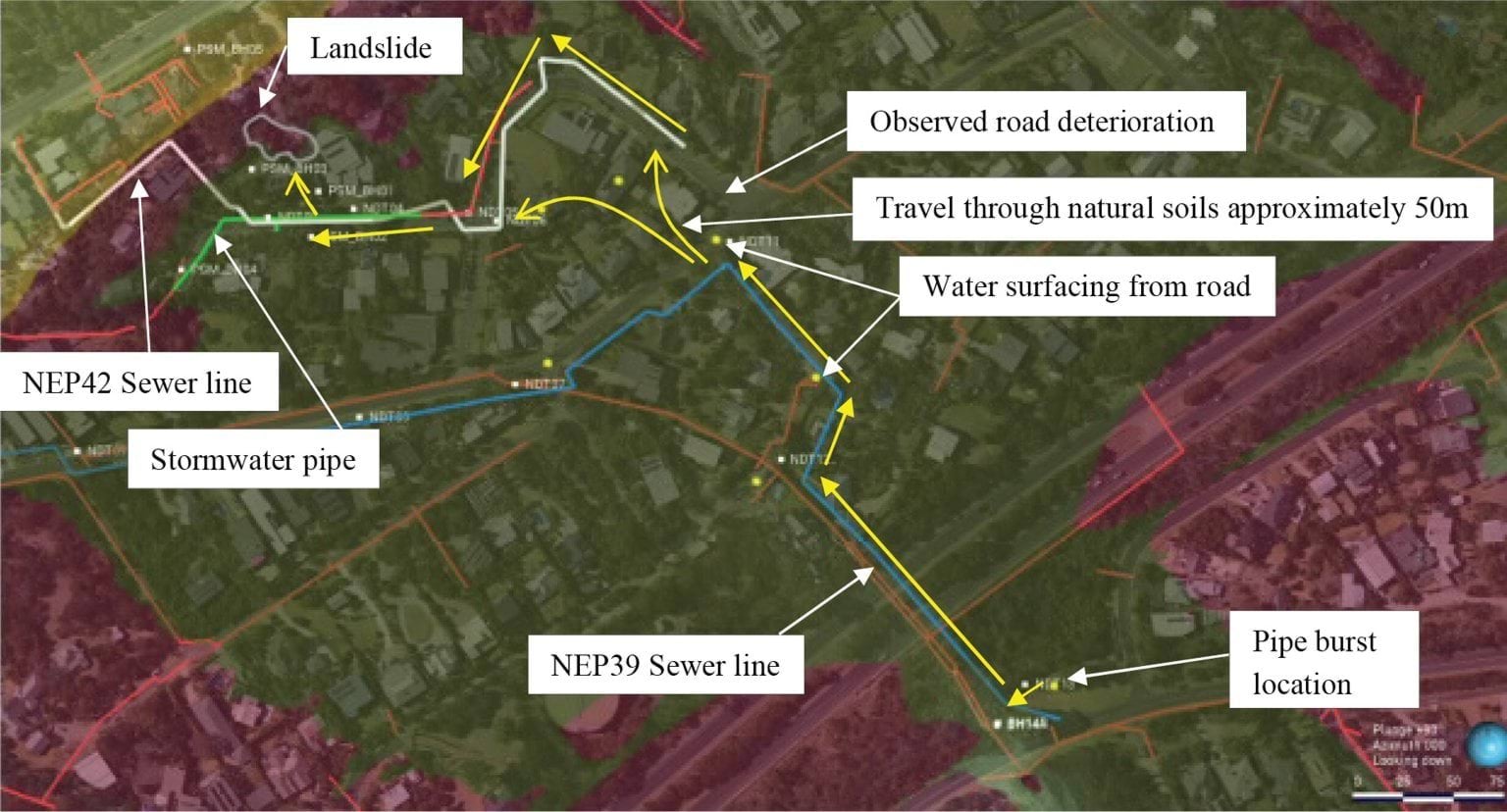
- As can be seen from the above, the sewer service trench flow path follows the blue NEP39 sewer line downhill under the Mornington Peninsula Freeway, to Waller Place, to Charlesworth Street, then down to Coburn Avenue. The service trench flow path then follows the sewer and water infrastructure downhill to the site of the January 2025 landslides.
- A simplified version of the sewer service trench flow path is depicted below. As overlayed in yellow over the SEW sewer map, the flow path follows the sewer main that runs under the Mornington Peninsula Freeway from Bayview Road, turns right at Waller Place, then runs down Charlesworth Street, before turning down Coburn Avenue:
FIGURE 4.15: SEWER NETWORK (INCLUDING DEPICTION OF POTENTIAL FLOW PATH).159
FIGURE 4.15
- As can be seen from the above, there is a constant run of sewer mains between the burst site and the corner of Charlesworth Street and Coburn Avenue (Coburn Avenue T-Intersection).
- A new branch of another sewer (between 31 and 31A Coburn Avenue, circled in blue (Coburn Avenue Branch) picks up across Coburn Avenue and then runs from under the homes directly opposite the Coburn Avenue T-Intersection downhill to View Point Road (blue arrow). The distance between the Coburn Avenue Branch and the sewer main that runs down Coburn Avenue is approximately 10 metres.160
- From the Coburn Avenue Branch, the sewer runs down to Prospect Hill Road, and then runs down View Point Road past numbers 6 and 10–12. Those properties are at the end of the blue arrow.
- The sewer main alone does not, however, show a complete picture of the subterranean connectivity between the burst site and View Point Road. Also present is the mains water network. Relevantly, that network runs in line with the length of Coburn Avenue, Prospect Hill Road and View Point Road. This can be observed in the following diagram:
FIGURE 4.16: WATER MAINS NETWORK.161
FIGURE 4.16

- All of that demonstrates that water mains run directly from the Coburn Avenue T-Intersection down to View Point Road.
- There is only a relatively small distance of unconnected mains between the Coburn Avenue T-Intersection (where the sewer main diverts) and the Coburn Avenue Branch (which also runs down View Point Road).
- Put another way, mains or sewer infrastructure effectively runs the entire way from the burst site to View Point Road, with one gap across Coburn Avenue for sewer only.
Could water have travelled from the sewer and mains infrastructure on View Point Road to the landslide site?
- Focussing then on the infrastructure on View Point Road, the following annotated map shows the water main, sewer and stormwater networks or systems in proximity to the top of the slope’s east gully.
FIGURE 4.17: WATER INFRASTRUCTURE IN THE VICINITY OF THE MCCRAE LANDSLIDE SITE.162
FIGURE 4.17
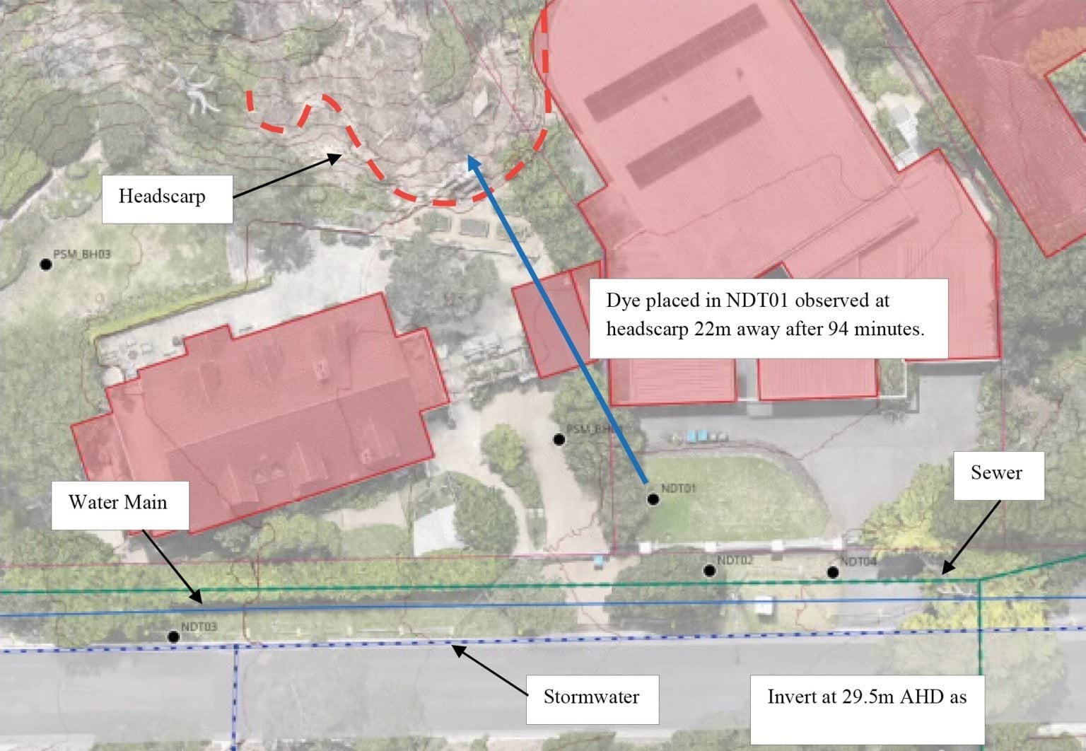
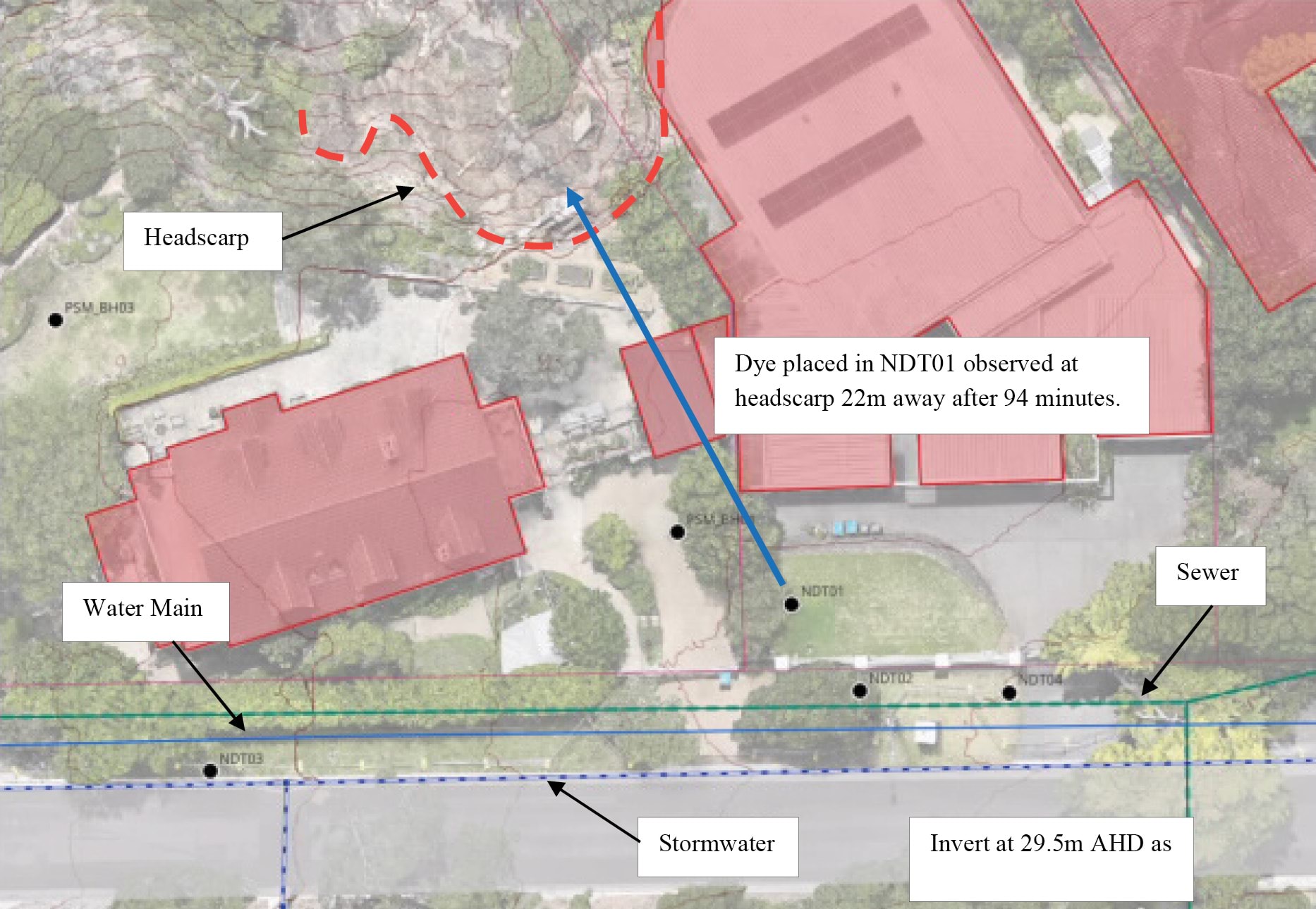
- As can be seen from the annotations, all three run down the northern side of View Point Road, with the sewer and stormwater systems being under the nature strip. It is approximately 25 to 30 metres from the sewer and water mains on View Point Road to the headscarp. It follows that the water that managed to reach the Coburn Avenue Branch would have had a direct path through the sewer embedment materials to within 25 to 30 metres of the landslide site.
- Bringing the above analysis of service trench connectivity together to analyse the extent of connectedness of the sewer and water mains running down View Point Road to the burst water main, it is apparent that:
- the burst occurred in a water main, with the adjacent sewer main located within 1.5 metres of the burst site;
- from there, both systems run directly to the Coburn Avenue T-Intersection (sewer main on the south-side, and water main crossing to the north);
- approximately 10 metres away, the sewer main picks up again at the Coburn Avenue Branch which runs down to View Point Road, and the water mains run around Prospect Hill Road and Coburn Avenue down to View Point Road; and
- there is approximately 25 to 30 metres from the View Point Road service trenches to the headscarp.
- In total, therefore, service trenches run for a significant proportion of the service trench flow path between the burst water main and 10–12 View Point Road.
Colluvium flow path (shallow aquifer)
- Turning then to the colluvium flow path, which describes the flow of water from the burst site towards the site of the January 2025 landslides through natural soils and the shallow aquifer.
- Mr Paul depicted that path as follows:
FIGURE 4.18: MR PAUL’S DEPICTION OF THE COLLUVIUM FLOW PATH.163
FIGURE 4.18
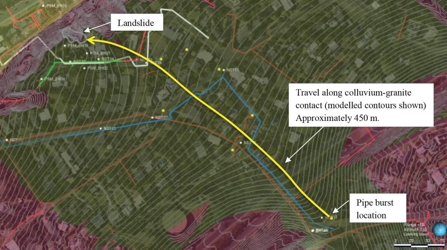
- As the regional cross section model extracted above shows,164 the weathered granite is overlayed by a layer of colluvium. This is also visible in Figure 8.19 from Mr Paul’s report reproduced earlier in this Chapter, as Figure 4.11, with the colluvium, which is coloured green and labelled, “Transported soils”.
- Mr Hartley explained the interaction of the colluvial layer with the shallow aquifer as follows:165
Prior to the landslide, the preferred path for groundwater was at or above the interface between the shallow aquifer and clay/bedrock until it reached the crest of the escarpment, where it permeated into the soil material covering the slope (colluvium). This colluvium forms a thin layer of soil over the underlying granite bedrock over a large area in which groundwater can permeate and disperse over an area of ground.
- The relative impermeability of the granite under the colluvium causes water that infiltrates from the surface to stop traveling vertically downward, and to instead start travelling downhill laterally along the boundary between the materials (in the “shallow aquifer”).166
- Within that colluvial layer, changes in topography create preferential pathways for water in the form of “paleochanels”. These are areas which are relatively lower than the surrounding colluvium, as depicted by Mr Pope in the following section diagram, with the section running across the slope looking downhill:
FIGURE 4.19: CROSS SECTION OF THE GULLY AT MARGARET STREET.167
FIGURE 4.19
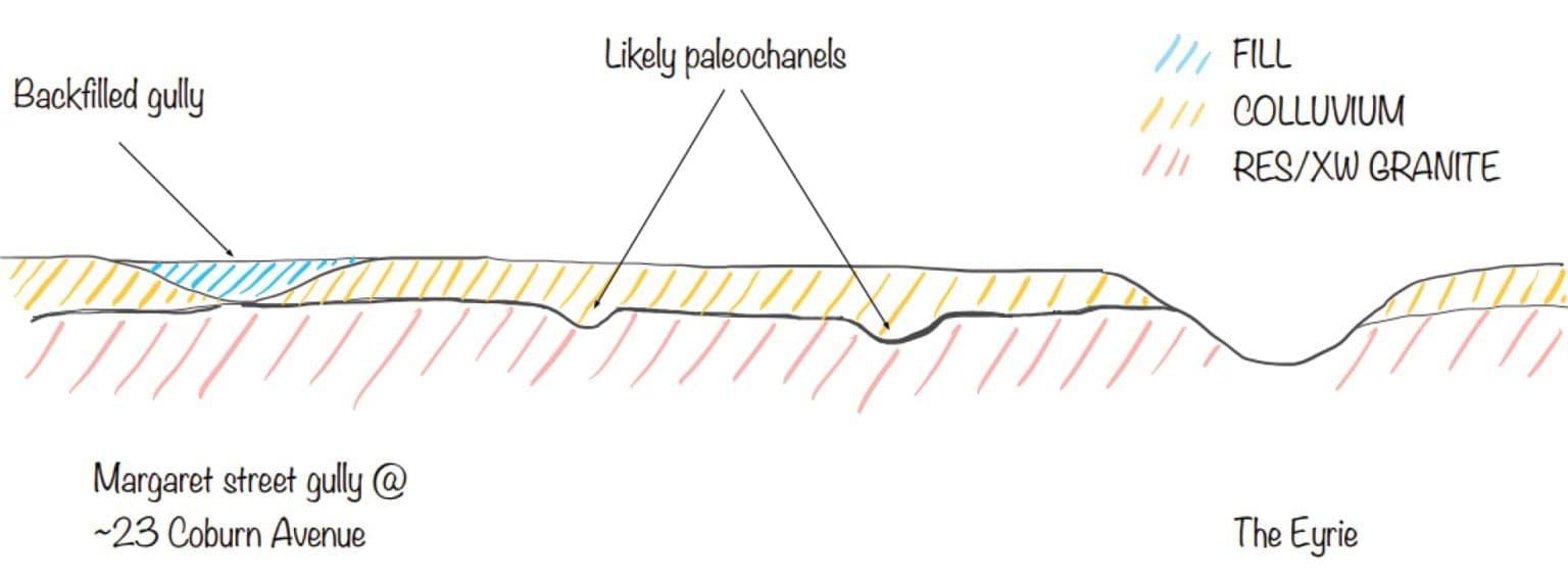
- Mr Pope’s interpretation of the natural channels that follow the topography from the Boulevard Reserve on Bayview Road down to the gully formerly running to the north of Coburn Avenue, are graphically represented at Inset 41 of his report (reproduced as Figure 4.20 below). The topographical lines on this figure show how there are natural low spots forming gullies. The left hand red dotted line is the Margaret Street Gully as labelled in Figure 4.19 above, and the right hand red dotted line is The Eyrie.
FIGURE 4.20: TOPOGRAPHICAL MAP OF THE MCCRAE AREA.168
FIGURE 4.20
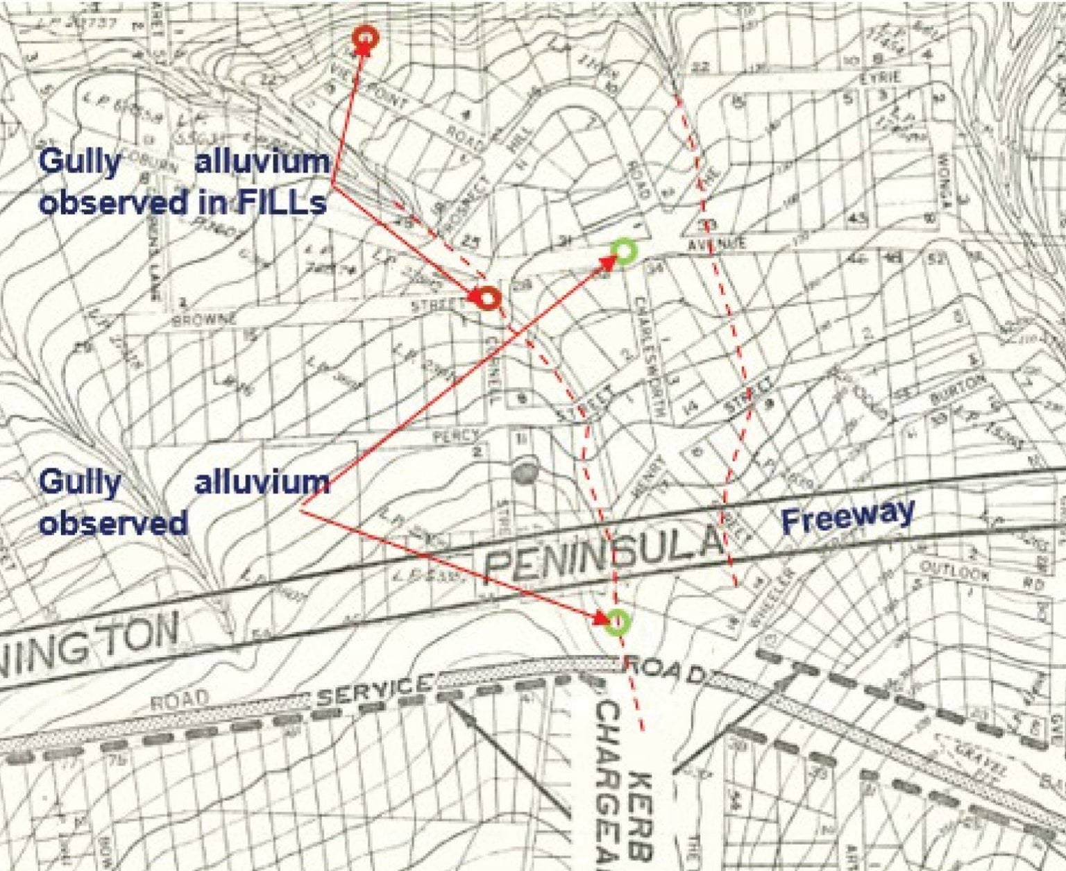
- There is significant evidence of colluvium and paleochannels at various locations between the headscarp and the burst site. Mr Pope explains that borehole log reports of the Dromana Sewer Tunnel indicate that “Ligniteous Clays and Silts” were buried by surficial soils at approximately 4.3 metres from surface level, which in his opinion is direct evidence of buried paleochannels.169 More recent borehole testing has shown similar results.170
- Photographs taken by Mr Pope identify the colluvium layer at the bottom of the eastern gully at 10–12 View Point Road.171 That water flowed from the colluvium layer after the 5 January 2025 landslide evidences connectivity of that site to the shallow aquifer.172
- Mr Pope concludes, based on the evidence, that there are buried paleochannels within the colluvial layer, which vary in width between 10 and 20 metres, and which are approximately one metre in depth.173 He estimates that it would take approximately 5.4 million litres of water to saturate those channels.174
Stormwater flow path
- Turning to the last potential flow path – the stormwater flow path – which describes the flow of water from the burst site towards the site of the January 2025 landslides via the stormwater system and any breaches or defects within it.
- Mr Paul depicted that path as follows:
FIGURE 4.21: MR PAUL’S DEPICTION OF THE STORMWATER FLOW PATH.175
FIGURE 4.21
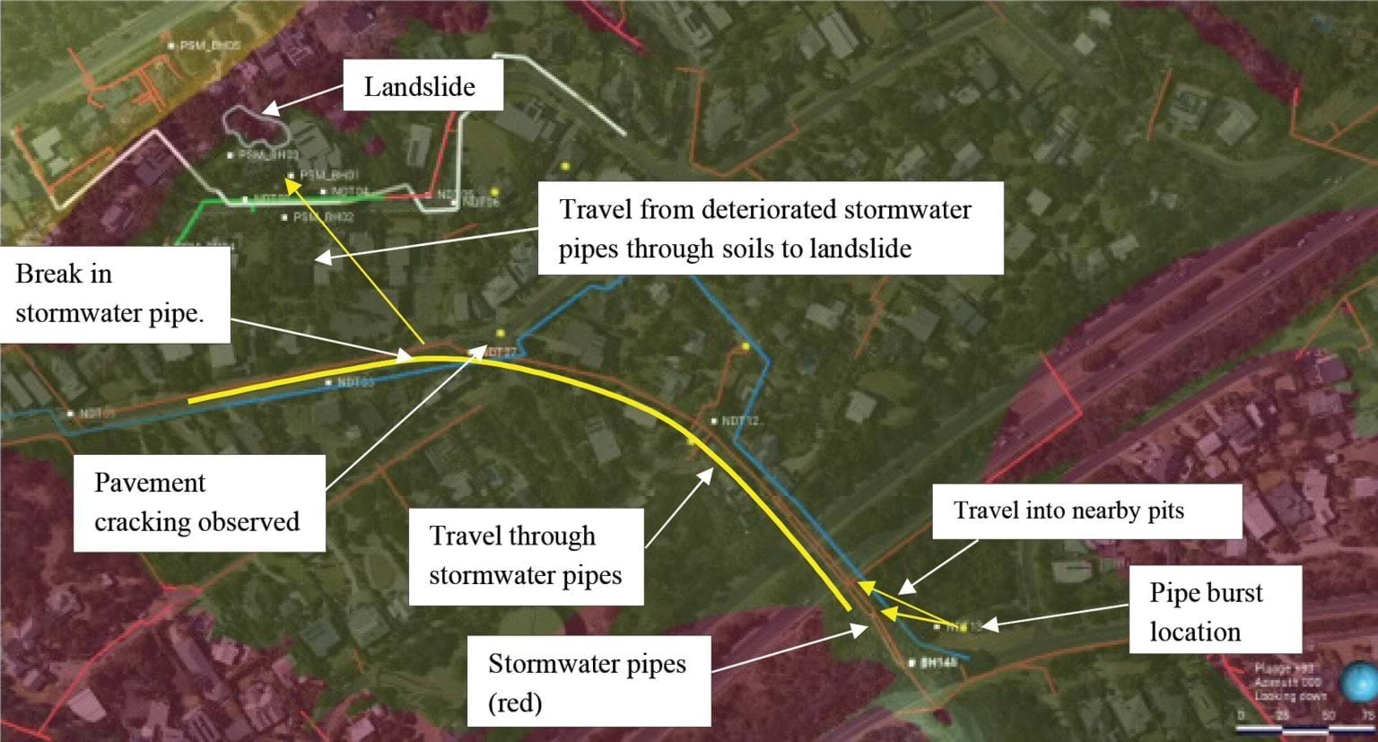
- The yellow line running from the burst water main to the left of the image is the 600 millimetre concrete stormwater pipe along which the burst water would have flowed after fanning around from the Vertical Burst Channel and running downslope into the stormwater drain. As can be seen, that pipe runs down to Coburn Avenue near the corner of Prospect Hill Road, then follows Coburn Avenue down toward the beach.
- Mr Paul hypothesised that water may have escaped through breaches or defects in the stormwater pipes, recharging the shallow aquifer and potentially reaching the landslide site.176
- There is evidence of breaches in the 600 millimetre stormwater pipe.177 Closed-circuit television cameras were fed through the stormwater pipe to inspect the condition of the pipe.178 Various defects were identified, ranging from holes to displaced joints through which soil and voids were visible.
- Mr Pope provided an annotated map showing the locations of these defects indicated by numbers one through to seven, a portion of which is extracted and annotated with arrows and comments below:
FIGURE 4.22: ANNOTATED MAP DEPICTING THE LOCATIONS OF VARIOUS STORMWATER DEFECTS.179
FIGURE 4.22
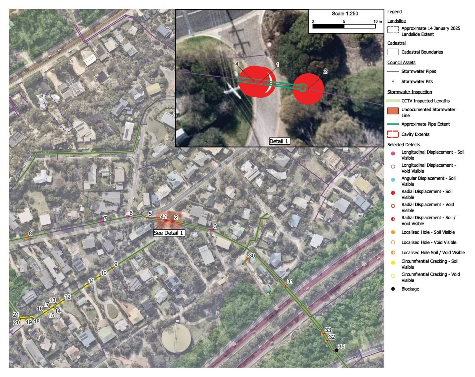
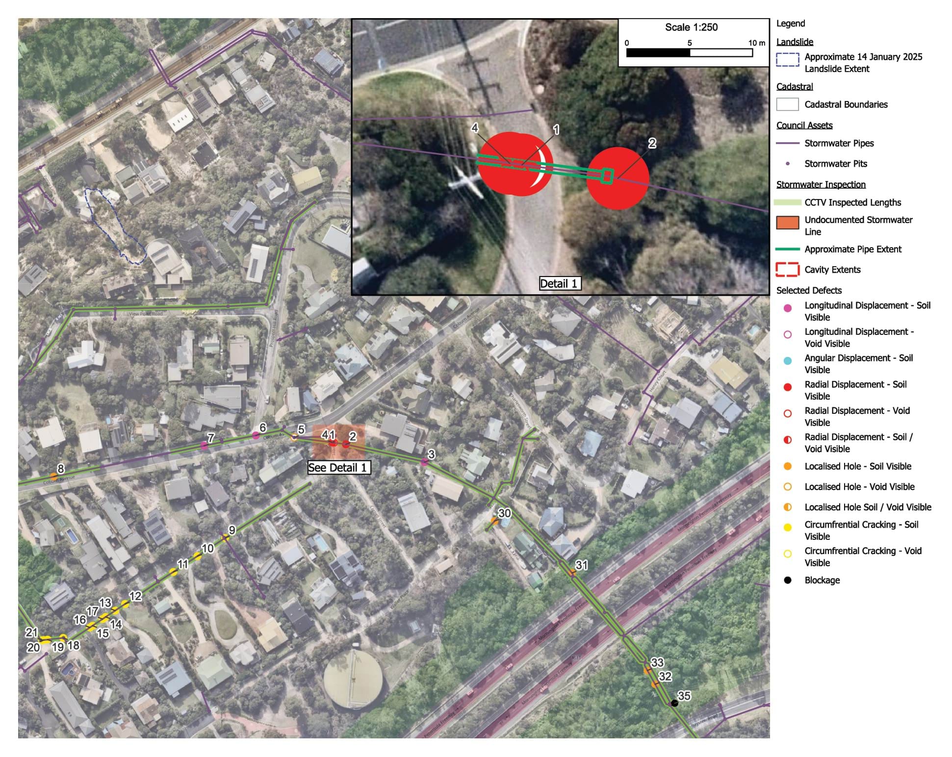
- The stormwater defects identified by Mr Pope are depicted by the numerals. Extracted below are the images of defect numbers 1 and 4 referred to at Figure 4.22, showing the extent of damage to the stormwater pipe located at Browne Street:
FIGURE 4.23: BREACHES IN THE STORMWATER PIPE LOCATED AT BROWNE STREET.180
FIGURE 4.23
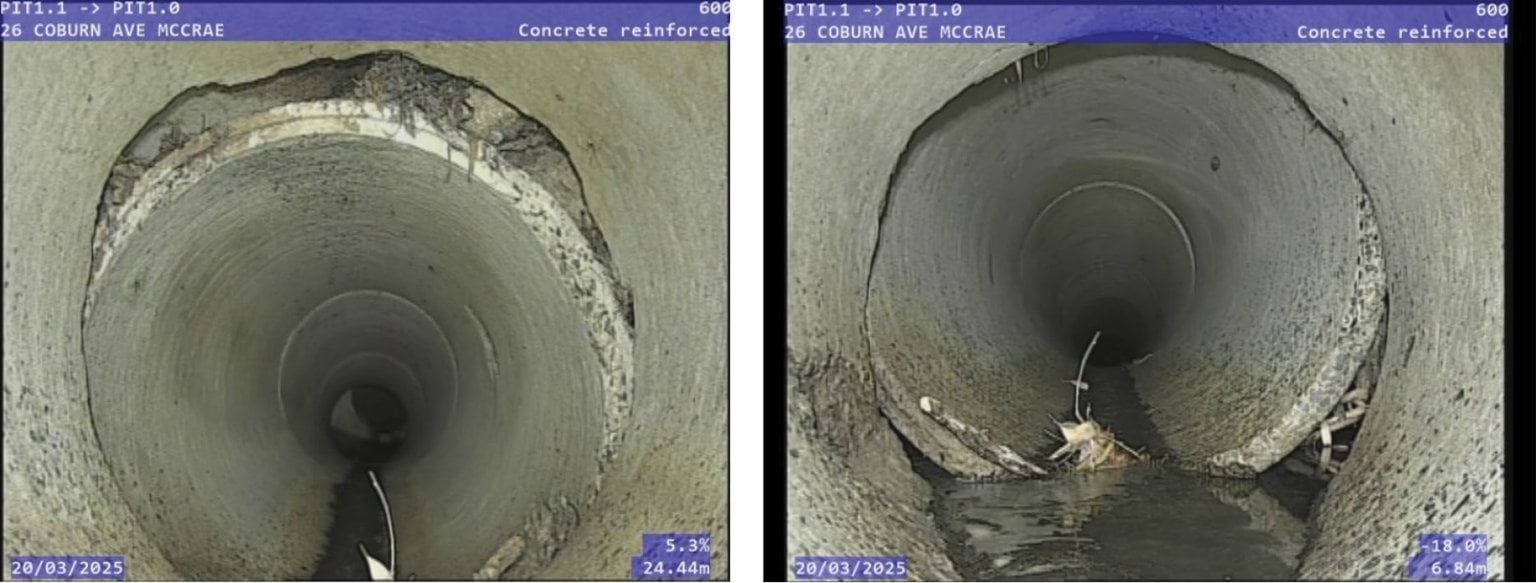
- The extent of the damage is significant. Plainly, water could, and did, exit the stormwater system through those cracks and holes in the stormwater pipe. Mr Pope estimated that the total leakage volume from the damage at the intersection of Browne Street and Coburn Avenue was in the order of 75 to 1,200 litres per day.181 In oral evidence, Mr Pope explained that he had not conducted a complete analysis of the entire stormwater channel, rather his focus was on two of the defects at the Browne Street corner.182 It follows that Mr Pope’s estimate is conservative and at least reasonably likely to underestimate the total water loss through the stormwater defects.
Where did water from the burst main, captured by the defective stormwater pipe, go?
- The experts were unable to give a definitive answer to that question. As can be seen from the annotations on the map of stormwater defects above in Figure 4.22, the majority of the defects are close to the location of the 23 Coburn Avenue burst considered in respect of the November 2022 landslides. As previously noted, Mr Paul was unable to give an opinion about the relative contribution of the 23 Coburn Avenue burst to the November 2022 landslides.183 Similarly, although the joint expert conclave report regarded the stormwater flow path to be plausible, none of Mr Paul, Mr Pope or Mr Hitchcock were able to give an opinion about whether water from the breaches in stormwater did in fact contribute to the water that triggered the January 2025 landslides.184
Did water flow through the service trench flow path, the colluvium flow path or the stormwater flow path to the site of the January 2025 landslides?
- Having described the three flow paths, it is now time to examine the evidence about the extent to which water travelled along those paths.
- There is substantial contemporaneous evidence of significant quantities of water having flowed along the three flow paths.
- The extensive evidence received by the Board of Inquiry of complaints from residents about excess water down Waller Place, Charlesworth Street, Coburn Avenue, Prospect Hill Road and View Point Road has already been set out in Part 3.5 of Chapter 3. Contemporaneous photographs and other documents put beyond doubt that excess water was present in an identifiable portion of the area between the burst water main and View Point Road, causing damage to roads and saturation of nature strips – particularly at the Coburn Avenue T-Intersection where the water would have crossed to the Coburn Avenue Branch.
- Both the timing and location of these observations is also important. Mr Pope provided an annotated map at Figure 5 of his report showing observations made by PSM staff from site-walks on various dates between 6 January and 16 June 2025.185 Similarly, a SEW staff member, who conducted a site visit on 7 January 2025, prepared a hand-annotated map of his observations, which also track the service trench flow path. The map is shown below.
FIGURE 4.24: ANNOTATED MAP DEPICTING AREAS SURVEYED BY LEAK DETECTION.186
FIGURE 4.24
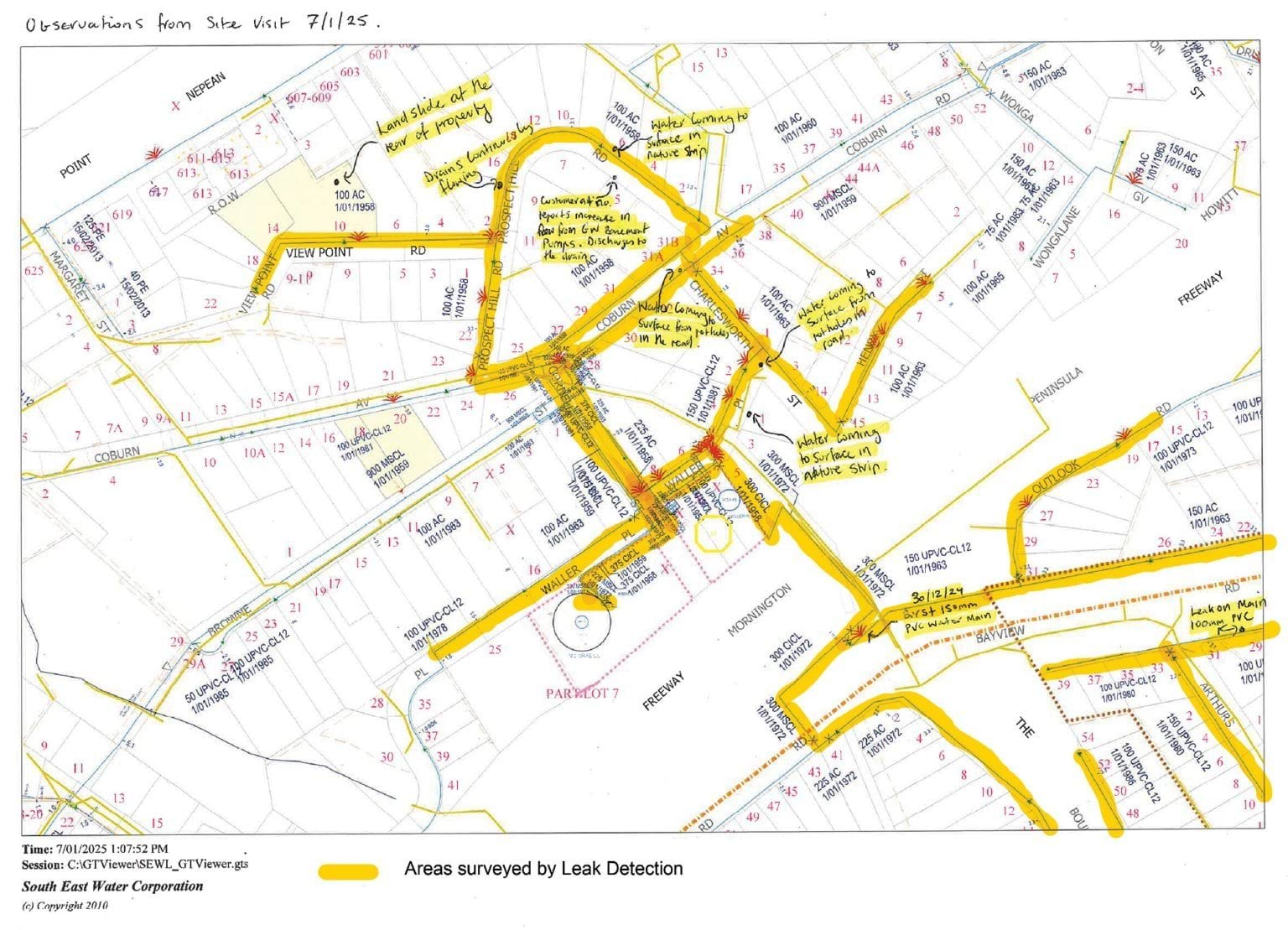
FIGURE 4.25
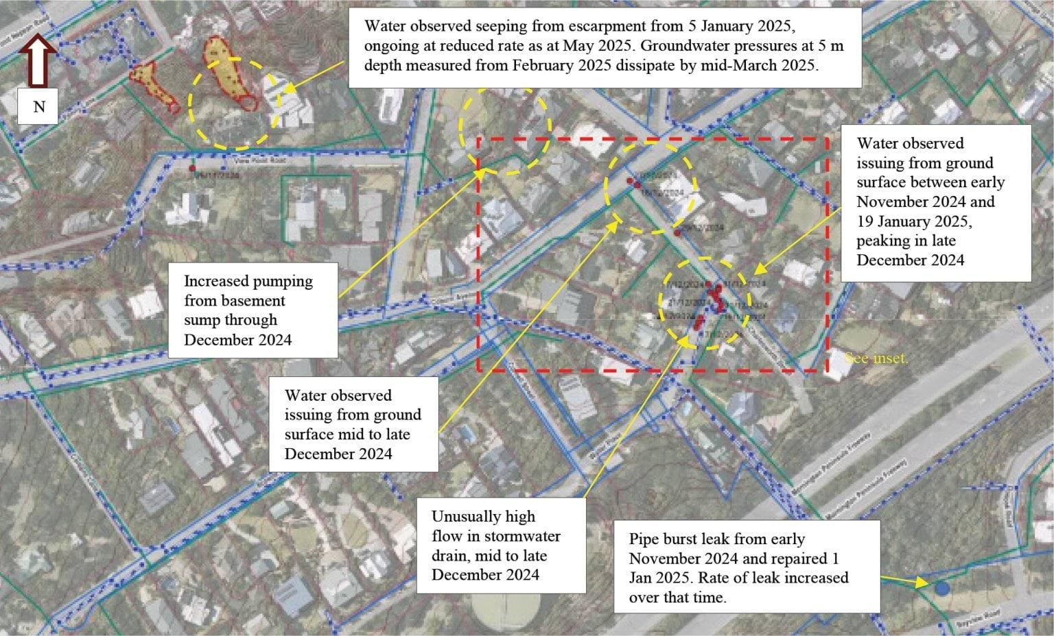
- Drawing from Mr Paul’s observations recorded in the Figure above, the following timeline becomes apparent:
- The first observation depicted in Figure 4.25 at the corner of Waller Place and Coburn Avenue was made at the top of the hill in around November 2024 (around the time the flow rate markedly increased).
- Water in the stormwater pipe running through Waller Place was observed flowing at an unusually high rate a few weeks later, from mid to late December 2024 (around the time the flow rate had increased further).
- The ground started upswelling at the Coburn Avenue T-Intersection at a similar time, also in mid-December 2024.
- By late December 2024, the water observed rising from the ground on the corner of Coburn Avenue and Waller Place peaked, when the flow rate from the burst water main was also peaking.
- On 5 January 2025, after the landslide, and also after the burst water main had been repaired, water was seen seeping from the escarpment in significant volumes.
- By 19 January 2025, water ceased surfacing at Waller Place and Coburn Avenue, however, down the hill, groundwater monitoring still showed groundwater which in turn dissipated by mid-March 2025.189
- Bringing the foregoing together, the observations of water surfacing downhill from the burst site chronologically match the progression of water from the burst water main, escalating in mid-October 2024, and then progressively receding after the burst water main was fixed on 1 January 2025.190
- Focusing on the landslide site itself, as has already been noted, on 6 January 2025, Mr Pope measured the flow rate from the escarpment as between 13,000 and 17,000 litres per day.191 Aside from domestic irrigation (which is considered below), there was no alternative explanation for the volume of water other than the burst water main.
- In any event, there is other evidence of hydraulic conductivity from the area around View Point Road to the escarpment. Figure 4.17 referred to earlier shows the results of a dye test conducted on 12 February 2025.192 Dye was placed by Mr Pope into a borehole labelled NDT01, located within the private sewer trench at 6 View Point Road.193 After 94 minutes, the dye appeared in the headscarp, demonstrating at least one connective path between the services infrastructure and the observed seepage in the colluvium at the headscarp.
Conclusion: water from the Bayview Road burst made it to the slope
- In summary, it is the opinion of both Mr Paul and Mr Pope that water from the burst water main did travel to the steep slope on which the 5 January 2025 landslide, and subsequently the McCrae Landslide, occurred.
- The above analysis demonstrates that:
- in excess of 40 million litres of water escaped from the burst water main;
- there were three flow paths for the escaped water;
- one of those paths (services trenches) covers a significant proportion of the distance from the burst to the escarpment; and
- water likely travelled along each of the three flow paths.
- It is the expert opinion of both Mr Paul and Mr Pope that those flow paths support a plausible hypothesis that water originating from the burst water main can account for the observations of water surfacing in McCrae throughout November and December 2024, and the water flowing from the headscarp at the site of the January 2025 landslides.
- SEW’s experts, Mr Hartley and Mr Bolton, disagreed. Though they agreed that water from SEW’s burst water main reached as far as 7 Prospect Hill Road,194 they did not consider it likely that water from the burst main contributed to the January 2025 landslides. They relied on four matters to support their view about the causal contribution of the burst water main to the landslides as insignificant to minor:
- first, most of the water would have flowed into the stormwater system;
- second, the velocities at which water would have travelled along the flow paths to the headscarp meant the water would not have reached the headscarp even by 5 January 2025;
- third, chemical testing of water from the headscarp indicated that it was not mains water; and
- fourth, given the small volume of water estimated to be required to cause the 5 January 2025 landslide, there are other plausible sources of water.195
- Each of those matters is now considered. As the only alternative source of water identified by Mr Hartley and Mr Bolton was domestic irrigation, it is convenient to defer consideration of that final matter until domestic irrigation is considered more generally.
The basis for SEW’s position that the burst water main did not cause the McCrae Landslide
Stormwater system
- As has already been identified, there were breaches in the Shire’s stormwater system through which water would inevitably have exited. The full extent of those breaches would only become apparent if a full video inspection was conducted of all relevant stormwater pipes. But it is beyond doubt that even on the more limited inspection undertaken, there were sizable ruptures in the pipes.
- While the exact volume of water that discharged through those breaches is unknown, it is probable that such outflows contributed to recharging the shallow aquifer.
- Whether water travelled through the shallow aquifer to the headscarp at 10–12 View Point Road is a different question. The Board of Inquiry has already considered the potential contribution of the 23 Coburn Avenue burst to the November 2022 landslides. The limitations identified there apply equally here and limit the confidence with which any conclusion about the contribution of stormwater leakages to the January 2025 landslides can be drawn.
- It is certainly possible that water from the burst that exited through breaches in the stormwater system recharged the shallow aquifer, reaching the headscarp. The Board of Inquiry does not accept Mr Hartley’s and Mr Bolton’s view that the fact that most of the water discharging from the burst main travelled through the stormwater systems establishes that none of that water entered the headscarp.
Velocity
- Mr Hartley and Mr Bolton also relied on water velocity as invalidating the hypothesis that water from the burst water main contributed to the January 2025 landslides. Mr Hartley and Mr Bolton’s opinion was that it would take 230 days for water travelling through the colluvium to reach the headscarp.196 That being so, as the burst began in August 2024, around 157 days prior to 5 January 2025, they did not consider that water from the burst could have reached the headscarp.197 This 230-day figure was explained to be based on a rough, but conservative, estimated average transmission speed of two metres per day.198
- Mr Hartley and Mr Bolton’s estimate rested on a large assumption: that water travelled exclusively through the colluvium,199 which stands or falls depending on its reasonableness.
- Mr Makin was the first expert to expose a flaw in the assumption. He used the same underlying equation as Mr Hartley and Mr Bolton,200 but provided alternative assumptions about the soil composition. His analysis demonstrated that, if the material consisted entirely of sand, the estimated travel time from Bayview Road to the headscarp would be 1465 days, whereas if the path was entirely consisted of gravel, the travel time would reduce to only 12 days.201 This analysis highlights how sensitive the velocity calculation is to assumptions about the soil composition.
- Next, Mr Hitchcock emphasised the inherent variability of assumptions about soil composition in his explanation during the public hearings.202 In his view, the 230-day figure was in “the same ballpark” as 150 days.203 That is, the inherent variability of soil types and the effect on velocity meant that any estimate was unlikely to be sufficiently precise to rule the burst water main in, or out, as a water source.
- Even assuming the accuracy of Mr Hartley and Mr Bolton’s assessment of the velocity of two metres per day through the colluvium, if the total non-trench flow travel distance from the burst water main to the landslide site is only about 40 metres, that part of the water’s journey to the headscarp would take about 20 days. This was in substance accepted by Mr Hartley in examination, where he stated:204
If you’re going through natural material – if you’re going through natural material, based on [Mr Bolton’s] site works and computations, no. If you’re going through … an entire manmade trenched pathway you’re going to get there earlier. And if you’re going through … the preferred line of going through the trenches, getting to Coburn Avenue, sitting there because the velocity goes to zip and going through the natural material underneath the houses, including number 5 Prospect Hill, getting into the agi-drains or the sewer trench situation of 7 Prospect Hill Road, and then going down there, you’re looking in the region of about 30 days. And so, yes, it could get there on the 5th, but if it’s going to get there on the 5th it’s going to get there beforehand.
- Relatedly, Mr Hartley accepted in oral evidence that the flow time from the sewer T-junction at the corner of Coburn Avenue and Charlesworth Street and the sewer between 31 and 31A Coburn Avenue (as explained earlier) would take approximately five days.205
- The fundamental flaw in SEW relying on the 230-day estimate to try to invalidate the hypothesis that water from the burst water main contributed to the January 2025 landslides is that it assumes water travelled exclusively through the shallow aquifer.206 If that assumption is falsified, that is, if water could have reached the headscarp through the shallow aquifer and the service trenches, then the estimate is unreliable.
- No expert considered a travel path of colluvium alone to be realistic. Mr Pope referred to the “blatant disconnect” between the 230-day estimate and the surface water observations in the community.207 The Board of Inquiry agrees with that obvious disconnect.
- SEW subsequently provided further information about velocity modelling. That material does not alter the above conclusions. All of the experts accept that water from the burst main made it to at least Prospect Hill Road, as reflected in saturated nature strips and water bubbling up through the roads.208 From there it had tens of metres more before it hit further sewer trenches taking it to the headscarp. Even with very low velocity, the water could have made it in time to trigger the 5 January 2025 landslide.
- The Board of Inquiry accepts the opinions of Mr Paul, Mr Makin, Mr Pope and Mr Hitchcock on this issue. SEW’s velocity argument is untenable – it artificially assumes that water would flow through one flow path to the exclusion of the others. Even if the Board of Inquiry were to assume, for the sake of analysis, that water travelled exclusively through colluvium, it still does not follow that the journey from the burst site to the headscarp would have taken 230 days. The colluvium consists of a heterogeneous mix of soils, which, in turn, introduces variability in flow velocity. Because the precise composition of the colluvium flow path is unknown, any estimate of velocity is inherently imprecise. Accordingly, the 230-day figure, even on Mr Hartley and Mr Bolton’s theory, is neither fixed nor reliable.
Water chemistry
- Next, SEW’s experts, Mr Hartley and Mr Bolton, relied on the chemical analysis of water samples taken both before and after the January 2025 landslides to support their view that water from the burst water main had not triggered the landslides.
- Water samples were taken from various locations, including the landslide site itself, upwelling within potholes on Charlesworth Street and surrounds, from stormwater drains, and from groundwater in boreholes. Annexure E to the SMEC report shows testing locations for the majority of those tests.209
- Of those samples, only two were taken of the water seeping from the escarpment in the days after the January 2025 landslides (Seepage Samples). The main questions in dispute between the hydrochemist and hydrogeologists were:
- whether the electrical conductivity and chloride of the Seepage Samples could have been achieved by a mixing of mains and groundwater; and
- whether the tested electrical conductivity and chloride levels was a consequence of the water’s path of travel through the geological structures between the burst water main and the headscarp.210
- In Mr Hartley and Mr Bolton’s view, the answers to those two questions are “no”. They opined that the electrical conductivity (or salinity) of the Seepage Samples taken between 6 January and late January 2025 were too high to be mains water.211 Moreover, they opined that the chemistry of the Seepage Samples did not indicate a dilution of mains water with groundwater from the shallow aquifer.212 It followed, in their view, that the water in the Seepage Samples had not originated from the burst water main.
- While Mr Hartley and Mr Bolton accepted that a portion of water from the burst site migrated toward 7 Prospect Hill Road via Waller Place, Charlesworth Street, and the intersection of Charlesworth Street and Coburn Avenue,213 they concluded that the water did not progress toward the escarpment on which the January 2025 landslides occurred.
- The reasoning underpinning that conclusion requires some explanation. It turned on an analysis of the chemical properties of water tested both before and after the burst water main was repaired from two potholes: the Waller Place/Charlesworth Street pothole and the Coburn Avenue/Charlesworth Street pothole. The short point is that both the salinity and chloride levels of water in those potholes jumped up after the burst water main was repaired.
- What was the significance of this jump? Mr Bolton thought it spoke to the extent to which the water travelled.
- Mr Bolton’s theory was that water from the burst entered the permeable embedment material and then travelled to the Waller Place/Charlesworth Street pothole site (Column A in the graphs below). Testing in December 2024 and early January 2025 showed that water in that pothole initially had a lower electrical conductivity level, which is more consistent with mains water.214 Then, after the burst main was repaired, “the [electrical conductivity] level jumps back up again”, which, on Mr Bolton’s theory, indicated that the mains water had stopped reaching that location and diluting the groundwater.215 Mr Bolton gave similar evidence in relation to the Coburn Avenue/Charlesworth Street pothole (Column B in the graphs below).216
- The water testing results for electrical conductivity and chloride levels for those potholes, as well as water collected at 7 Prospect Hill Road and the landslide site, are depicted in the graphs below:
FIGURE 4.26: GRAPHS DEPICTING THE ELECTRICAL CONDUCTIVITY AND CHLORIDE CONCENTRATION IN WATER SAMPLES.217
FIGURE 4.26
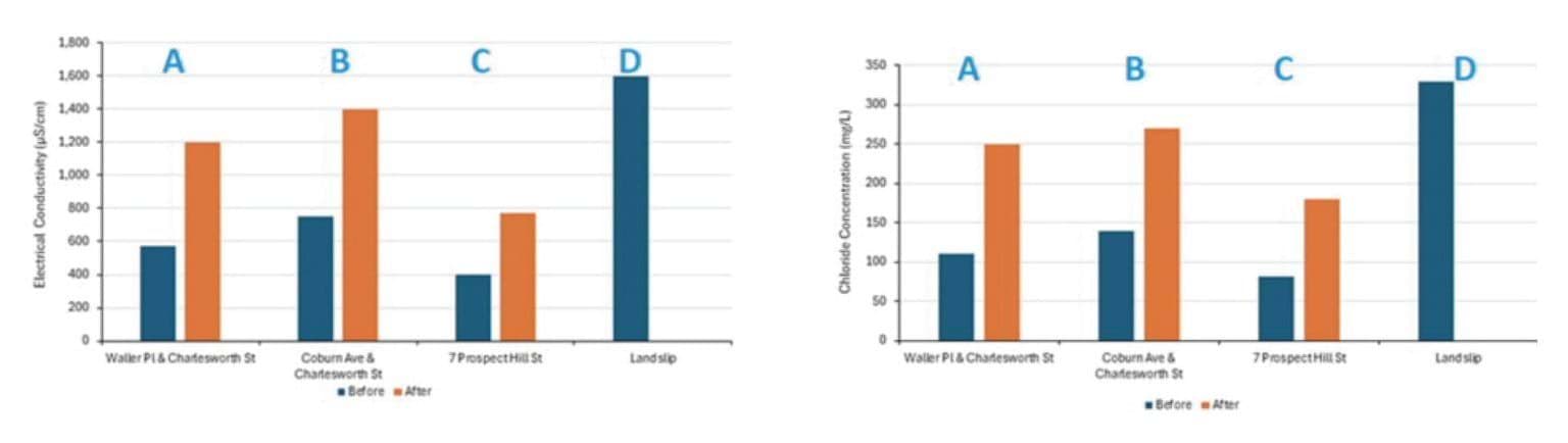
- The Board of Inquiry does not accept Mr Bolton’s theory. It draws unsteady distinctions. It considers only a limited selection of water samples. On closer examination, it does not withstand scrutiny.
- First, Mr Bolton’s theory attributes entirely opposite interpretations to similar electrical conductivity and chloride levels. On the one hand, his theory accepts that the water sampled on 16 January 2025 from the Waller Place/Charlesworth Street pothole – which had an electrical conductivity of 1200 MicroSiemens per centimetre and chloride concentration of 250 milligrams per litre – was connected to the burst water main. On the other hand, his theory rejects that the Seepage Sample taken on 6 January 2025 – which had an electrical conductivity of 1,600 MicroSiemens per centimetre and chloride concentration of 330 milligrams per litre – was connected to the burst water main.218 During examination, the tension between these interpretations was exposed. Mr Bolton accepted that the electrical conductivity and chloride figures were “similar” for those water samples.219 He conceded that based on those similar readings, it was open to conclude that the water seeping from the escarpment was also connected to the burst water main.220
- Second, Mr Bolton’s theory does not apply consistently across all the water samples taken. For example, water sampled on 22 January 2025 from the Coburn Avenue/Waller Place pothole had an electrical conductivity of 1000 MicroSiemens per centimetre, when, on the same day, water sampled uphill of that location at the “verge opposite 5 Waller Place” had an electrical conductivity of 600 MicroSiemens per centimetre.221 If Mr Bolton’s theory was correct, the electrical conductivity should have been higher uphill as that area had returned to groundwater levels of electrical conductivity and chloride following the repair of the water main. Mr Bolton could not explain this inconsistency – he accepted the results did not sit well with his theory.222
- It follows that even on his own evidence, Mr Bolton’s theory does not fit all of the data. Without a robust justification for the inclusion and exclusion of the other samples, the theory is also incomplete. It does not invalidate the hypothesis that water from the burst water main reached the headscarp.
- Third, there are plausible alternative explanations, beyond Mr Bolton’s theory, for the elevated levels of electrical conductivity and chloride in the water samples taken after the repair of the burst water main. An expert engaged by the Board of Inquiry, Dr Vu, explained that the higher electrical conductivity readings in those later samples could be a product of either the water spending a longer time travelling, and therefore dissolving more salts, or the water travelling through a different, less permeable, pathway on which it picked up more ions.223
- In view of the above, Mr Bolton’s theory does not preclude the possibility of water from the burst reaching the escarpment. Having rejected his theory, it is now necessary to consider the views of the other experts in relation to the Seepage Samples taken from the escarpment.
- Mr Hitchcock and Dr Vu considered that the Seepage Samples were potentially a combination of mains water and groundwater, and that there was a plausible flow path from the burst water main to the headscarp (i.e., that the chemical composition of the Seepage Samples did not rule out that they were partly derived from mains water).224
- Similarly, an expert engaged by SEW, Mr Jewell, concluded with a high degree of confidence that the water emanating from the headscarp after the 5 January 2025 landslide was comprised of a mixture of mains water and groundwater.225
- Under cross-examination, Mr Hartley accepted that his conclusion that the burst water main was not the source of water in the slope hinged on questions of velocity and water chemistry.226 As to velocity, the conclusion, as already explained, is founded on unrealistic assumptions. As to water chemistry, Mr Hartley appeared to concede that the likelihood that water from the burst was not present in the slope was “low”.227
- After the experts gave concurrent evidence at the hearings, SEW produced an expert report prepared by Mr Jewell dated 8 August 2025.228 Mr Jewell opined that it is “unlikely” that the water flow at the escarpment originated from the burst water main having regard to, among other things, the geochemical nature of the water.229 That is, while he accepts that mains water was seeping out of the headscarp, he does not accept the origin of that water to be the burst. Mr Hitchcock, Mr Pope and Mr Paul confirmed that Mr Jewell’s report did not cause them to change their opinions.230
- The Board of Inquiry does not accept that Mr Jewell’s revised analysis disproves that the Seepage Samples were derived substantially from water from the burst. His analysis is defective.
- Notably, in assessing the geochemical nature of the water, Mr Jewell used a chloride concentration for deep groundwater (480 milligrams per litre),231 which is not representative of the interface groundwater but that of deeper aquifer groundwater.232 This assumption is critical, as the imputed groundwater/mains water ratio depends directly on the assumed chloride level in groundwater. In this regard, the Shire stated:
Both Mr Hitchcock and Mr Paul opined that a more appropriate chloride concentration of groundwater for the water balance analysis is between 100 mg/L and 170 mg/L as observed in SMEC BH03 and BH04, being representative of interface groundwater. If this concentration is adopted (even assuming other aspects of Mr Jewell’s approach are sound), it has a material impact, [on the analysis]).233
Domestic irrigation as a source
- The first three bases relied on by Mr Hartley to found his opinion that the burst water main did not contribute to the January 2025 landslides have now been considered and dismissed as not invalidating that causal hypothesis. The final matter pointed to by Mr Hartley and Mr Bolton in support of their contention that the burst main was not the source was an alternative hypothesis that domestic irrigation was the or a source.
- This thesis hinged largely on a hypothesis that only 2,000 litres of water was required to enter the headscarp in order for a landslide to occur. That is, the volume of water required to trigger the 5 January 2025 landslide was so small that other sources of water could be plausible triggers.234 The only alternative source of water identified by Mr Hartley was domestic irrigation, and it was asserted that this was a possible source of the seepage flow visible after the 5 January 2025 landslide.235
- This theory depends upon two matters:
- whether the volume of water required to trigger the 5 January 2025 landslide is indeed only 2,000 litres; and
- whether it is plausible that domestic irrigation could explain a substantial part of the seepage seen after the 5 January 2025 landslide.
- Both matters can be dealt with in short order.
- The suggestion that only 2,000 litres of water was required to cause the 5 January 2025 landslide is untenable. The following matters are referred to:
- The video taken of the moment the McCrae Landslide occurred shows the soil pouring downhill as a liquid.236 Approximately 300 cubic metres was evacuated in this debris flow. Evidently a great amount more than 2,000 litres was contained in that soil.237 It is unexplained how such an amount of water could have built up to cause the McCrae Landslide debris flow while only 2,000 litres was apparently required to trigger the 5 January 2025 landslide only nine days prior.
- The area which suffered the landslides in 2025 did not fail during the significant 80 millimeter rain event in November 2022. If so little water could trigger the January 2025 landslides as is now asserted by SEW, the fact that the area did not fail after the historic rainfall in 2022 would need to be explained. No convincing explanation was given. As Mr Pope said, the 2,000 litre theory is not calibrated against historic slope performance.238 Mr Hartley accepted (1) that he had not undertaken analysis to compare how the slope could have withstood the rain in 2022 despite his estimated 2,000 litre trigger volume;239 and (2) that he did not take the 2022 rain event into account to test his model.240
- The flow rate of water measured seeping from the headscarp on 6 January 2025 by Mr Pope was between 13,000 and 17,000 litres per day.241 If the headscarp was so vulnerable to landslide from only 2,000 litres, it would have failed much earlier.
- The significant and continued flow rate from the headscarp post 5 January 2025 cannot possibly be accounted for by domestic irrigation alone.
- Mr Makin provided an analysis of the volume of water required to trigger the McCrae Landslide. He estimated that approximately 36,000 litres of water would be required to trigger the 300 cubic metres of material that evacuated during the McCrae Landslide.242 During examination by Counsel for SEW, Mr Hartley explained that his estimate of 2,000 to 2,300 litres to trigger the 5 January 2025 landslide was roughly equivalent to the figure given by Mr Makin, when the relative volumes of the landslides (20 cubic metres and 300 cubic metres) were taken into account.243 The Board of Inquiry does not accept Mr Hartley’s analysis.
- Mr Paul’s failure mechanism theory is that water infiltrated via the colluvium between 5 and 14 January 2025, saturating the surrounding soil and then further spreading outwards. It is not a matter of simply dividing the volume of soil that was displaced, but of understanding how increasing water flow through that soil from the colluvium progressively filled pores until failure. Mr Paul explained that the equivalent to this “would be like getting a bowl of flour and putting a thimble of water in it and expecting it to turn into batter”.244
- Ultimately, during cross-examination, Mr Hartley accepted that it was “fair” to describe this theory as “speculation about a possible alternative”.245 The Board of Inquiry does not accept the 2,000 litre thesis. At a minimum, it is contrary to the observed facts. Even accepting that it is theoretically possible domestic irrigation contributed to the observed water from the headscarp after 5 January 2025, this analysis still does not explain the source of the significant volume of water exiting for a lengthy period thereafter, nor what happened to the water that was accepted by SEW’s experts to have reached at least 7 Prospect Hill Road. Moreover, if so little water was required, and domestic irrigation was a plausible source, it would have been necessary to explain how the level of irrigation had varied over time so as to identify why the slope failed in 2025 and not before.
- SEW’s 2,000 litre theory is speculative and does not create any doubt that the January 2025 landslides were caused by the burst water main.
Conclusion – the burst water main caused the McCrae Landslide
- In summary, from early August 2024 to 1 January 2025, SEW’s burst water main caused approximately 40.3 million litres of water to be discharged. A large portion of that water was captured by the stormwater system, with the balance travelling downhill through colluvium and in service trenches. In a temporally staggered way, that water flowed downhill, breaking through roads, saturating kerbs, and causing sump pumps to run. All experts agreed that water from the burst water main reached at least Prospect Hill Road, within less than 100 metres of the landslide site.
- After the 5 January 2025 landslide, a significant volume of water continually flowed from the headscarp down the slope. This was also not disputed.
- The Shire submitted that the water main burst should be found to be the cause of the January 2025 landslides.246 SEW submitted “there is no empirical evidence that proves the Bayview Burst triggered the landslide.”247 Its submissions point to the various inferences drawn by the experts in forming their conclusions, the lack of certain geophysical tests undertaken, and the slight inconsistencies between other tests.248
- The Board of Inquiry considers there is simply no plausible hypothesis that explains the water progressing down the slope, the landslide, then the significant water continuing to flow from the headscarp other than the burst water main at Bayview Road. There were multiple available flow paths for the water to travel along. Neither water chemistry nor theories as to water velocity cast doubt on the ability of water to travel via one or more of those paths to reach the slope in sufficient time to saturate it before the 5 January 2025 landslide.
Water was the trigger of the 5 January 2025 landslide and the McCrae Landslide. The source of that water was the burst water main at Bayview Road.
Finding
Water from the burst water main owned by SEW caused the 5 January 2025 landslide and the McCrae Landslide.
Delays in detecting the burst water main
- The Shire’s submissions urge the Board of Inquiry to make a finding that SEW’s delay in locating the burst water main was itself a cause of the McCrae Landslide. They state (omitting footnotes):
Delay of South East Water in detecting the burst water main: If the Board accepts, as the Shire submits, that the Bayview Leak was the cause or trigger of the McCrae Landslide, it follows that SEW’s failure to detect the burst for (according to expert evidence) over 150 days, despite numerous reports made to SEW of upwelling from at least late November 2024, contributed to the McCrae Landslide. Had SEW adequately responded to the concerns of residents and detected the Bayview Leak earlier, less water would have been lost from it, and less water would have travelled to the landslide site.249
- While the Board of Inquiry has found that water from the burst water main was the cause of the trigger of the January 2025 landslides, it does not follow that the Board of Inquiry can make a finding about whether delay in identification of the burst was also causal. Such a finding would depend upon further evidence and analysis of counterfactuals. The evidence does not establish the critical threshold or timing at which intervention would have averted the landslides.
4.6 What were the preparatory factors that contributed to the 5 January 2025 landslide and the McCrae Landslide?
- The next area of focus is preparatory factors. There was some disagreement between the experts as to the contribution of preparatory factors, including erosion, the impact of fill on the escarpment, and the retaining walls in the east gully on 10–12 View Point Road, to the January 2025 landslides.
- Each of these preparatory factors is addressed in turn below.
Erosion of the escarpment
- All experts agreed, with a very high level of confidence, that erosion was a significant preparatory factor for the 5 January 2025 landslide.250 They did not consider erosion as a preparatory factor for the McCrae Landslide, but they did express views on its contribution as a cause of the McCrae Landslide.
- Mr Paul considered the contribution of erosion as a triggering factor for the McCrae Landslide to be minor.251 He considered the continued infiltration of water into the headscarp from the burst water main to be the significant trigger. While Mr Pope agreed that the water was a trigger, he also considered erosion caused by the 5 January 2025 landslide to have a significant contribution to the McCrae Landslide.252
- Mr Pope was of the view that the loss of material following the 5 January 2025 landslide destabilised the “slopes at the eastern extent of the gully where there was significant filling and no effective retaining wall”. He described this as “regression by landsliding”.253
- Mr Hartley considered:
[T]he removal of soil [consequent to] the 5 January 2025 [landslide] to be significant in destabilising the gully to the extent where the ravelling back of material between 5 January and 13 January, and [the McCrae Landslide on] 14 January were a direct consequence of the 5 January event.254
- There is no doubt that the continued infiltration of water from the burst water main was, at the very least, a major trigger of the McCrae Landslide. To the extent that it matters, the Board of Inquiry considers it probable that erosion caused by the 5 January 2025 landslide had some destabilising effect on the headscarp and aided the subsequent McCrae Landslide.
The impact of fill
- The experts disagreed about the effect of fill, in particular “old” fill, as a preparatory factor for the January 2025 landslides. Mr Pope described “old” fill as fill that was likely end dumped over the escarpment no later than the 1970s.255
- Mr Paul’s view, expressed with a moderate degree of confidence, was that old fill was a minor contributing factor to the instability of the escarpment, whereas Mr Pope considered, with high confidence, that it was a major contributing factor.256 Mr Hartley’s view was in between the two opinions. He considered old fill to be a medium contributing factor to the instability of the escarpment, and expressed that view with a moderate degree of confidence.257
Mr Paul’s assessment of fill
- On Mr Paul’s analysis of the data available to him, the presence of fill on the escarpment was of little to no consequence to the cause of the 5 January 2025 landslide and the McCrae Landslide.
- Mr Paul explained that:
- Normally, water flows through the colluvium and is discharged at a spring, along the escarpment.258 The finer soils above the colluvial channels are ordinarily dry, and their cohesion is a consequence of high soil suction, otherwise known as negative pore water pressure.259
- As a result of the burst water main, the increased volume of water travelling through the colluvium meant the natural ability for the water to emanate from the spring was overwhelmed.260 This forced the water to travel up into the finer soils, causing those soils to become saturated and ultimately, to slide.261
- Mr Paul considered that the escarpment included some fill, because fill was exposed in the headscarp following the landslides in January 2025. He could not dismiss the possibility that the displaced material was at least partially comprised of fill, but stated that he had not seen any physical evidence to indicate that a large volume of fill was placed on the escarpment. Rather, he noted that most of the exposed headscarp and side scarps were comprised of natural materials.262
- In any case, Mr Paul concluded that:
… because of progressive wetting of fine grained soils (fill or natural) the landslides of 5 January and 14 January 2025 would have occurred irrespective of whether the soils that became wet were natural or fill materials.263 (emphasis added)
Mr Pope’s assessment of fill
- Mr Pope disagreed with Mr Paul’s assessment of the volume of fill on the escarpment and the contribution of that fill as a preparatory factor for the McCrae Landslide. Based on his visual observations of the headscarp following the McCrae Landslide, he considered there to be a volume of fill at the top of the escarpment that was at least two metres deep.264 Mr Pope also considered borehole samples, LiDAR, and survey information to conclude that the gully where the McCrae Landslide occurred was asymmetrical prior to the McCrae Landslide.265 He stated:
Fundamentally the gully is out of balance when viewed in elevation cut parallel to the escarpment … i.e. it is not broadly symmetrical along the plunge of the gully line as most gullies along the escarpment are.266
- Mr Pope noted that the nearby gullies at The Eyrie, Coburn Creek, and the downstream section of Margaret Street, are not asymmetrical. Given the presence of fill at the top of the escarpment, and the unique profile of the gully where the McCrae Landslide occurred, he concluded that the explanation for the asymmetry of the gully was the presence of anthropogenic fill.267
- Mr Pope identified the LiDAR relied upon by Mr Paul was not as fulsome as the LiDAR and survey materials he had considered.268 The Board of Inquiry notes this could provide an explanation for the differences in the models generated by those experts with respect to the volume of fill on the escarpment.
- In any event, on the basis of Mr Pope’s analysis, he considered the presence of fill on the escarpment to be a “fundamental cause of the 2025 landslides”.269 He stated that:
[At] some stage in its life, [the escarpment] would be expected to fail in this manner once appropriate triggers occurred. In my opinion if the Old Fill was not placed into the gully, the 2025 Landslides [would] not [have] occur[ed].270 (emphasis added)
Mr Hartley’s assessment of fill
- Mr Hartley gave limited evidence about the presence of fill on the escarpment, though his views aligned most closely with Mr Pope’s.
- He explained that, ordinarily, he would expect water to exfiltrate from a spring in the centre of a gully, but that did not occur in the aftermath of the 5 January 2025 landslide. Rather, the water emanated to the side of the gully’s centre line. Like Mr Pope, Mr Hartley considered a plausible explanation for this to be the presence of fill on the escarpment.271 He made no further comments as to the impact of fill in respect of the McCrae Landslide.
Conclusion on whether fill was a preparatory factor for the McCrae Landslide
- Having regard to the varying views of the experts, it is apparent to the Board of Inquiry that the key matters of contention between them were the composition of the material that slid down the escarpment as a result of the January 2025 landslides, and to the extent that the material was compromised of fill, the volume of it.
- The Board of Inquiry makes no finding as to the volume of fill that may have been placed on the escarpment many decades ago. There is insufficient evidence about that matter for a finding to be made.
- The Board of Inquiry finds for the reasons given by Mr Paul, that irrespective of the volume of fill, the 5 January 2025 landslide and the McCrae Landslide would have occurred as a result of the water from the burst water main. It considers the significance of fill as a preparatory factor to the January 2025 landslides to be minor. It is possible that the unknown volume of fill contributed to the size of the McCrae Landslide but the evidence does not enable findings to be made about different counterfactual circumstances.
Retaining walls at 10–12 View Point Road
- As detailed in Chapter 3 of this Report, two retaining walls were erected on the Borghesis’ property between 2022 and 2024 in the east gully, above the site of the McCrae Landslide.
- The experts disagreed about the significance of the preparatory effect of the retaining walls. Mr Paul considered the retaining walls to be a minor (1% – <10%) contributing factor to both the 5 January 2025 landslide and the McCrae Landslide, and expressed his view with a medium degree of confidence. In contrast, Mr Pope considered the retaining walls to be a major (30% – <80%) contributing factor, with a high degree of confidence. Mr Hartley agreed with Mr Pope, that the retaining walls were a major contributing factor to the McCrae Landslide, with a high degree of confidence, and a medium contributing factor to the 5 January 2025 landslide, with a low degree of confidence.272
Mr Paul’s assessment of the retaining walls
- Mr Paul’s overall view of the contribution of the retaining walls to the 5 January 2025 landslide was that the surcharge load behind the retaining walls was significantly outweighed by the volume of water infiltrating the escarpment prior to the landslide. His view remained the same in respect of the McCrae Landslide.
- Turning first to the 5 January 2025 landslide, Mr Paul noted the location of the top of the zone of depletion was approximately two and a half metres below the base of the retaining wall. This was too far away from the zone of influence of the retaining wall (or the passive wedge), which indicated “the retaining wall could not have applied load to the soil that [was] displaced [by] the 5 January 2025 [landslide]”.273
- Further, Mr Paul observed that, instead of the soil that was being retained developing cracks or showing signs of subsistence, it was the soil in front of the retaining wall that developed cracks and showed signs of subsistence on 6 January 2025. He stated “the observed tension cracks indicate[d] soil moving away from the [toe of the] retaining wall and [were] an indicator that the 14 January 2025 landslide was developing at that time”.274 (emphasis added)
- Mr Paul concluded the retaining walls were a minor preparatory factor for the McCrae Landslide. He considered the failure of the retaining wall to be a part of the McCrae Landslide. This was on the basis that the infiltration of water into the escarpment from the burst water main which caused the landslide also undermined the retaining wall and caused it to fail.275 In contrast to Mr Pope’s view, Mr Paul did not consider the surcharge load of the soil retained by the wall to have contributed to the McCrae Landslide.276
- This Report now turns to Mr Pope’s analysis.
Mr Pope’s assessment of the retaining walls
- Mr Pope considered the retaining walls did place a surcharge load on the escarpment. He discussed this, and the consequent contribution of the retaining walls to the January 2025 landslides, having regard to elements of the design of the walls, and the use of the land retained by them.
- First, Mr Pope expressed the view that “it would be grossly unconservative to ignore the buried geometry at the retaining wall and the 40kPa surcharge especially where there is no pile socket”.277 He explained the retaining wall having been built on an incline plain, should have been piled into the granite because without that, it would not be able to overcome the driving forces of the active side of the retaining wall.278
- Second, Mr Pope identified that the retaining wall had not been tied back and did not extend across the entirety of the fill, pursuant to his model.279
- Further, in addition to these design issues, Mr Pope pointed to the loading of the area retained by the walls. He thought that, by virtue of the retaining walls’ construction, the effective slope angle of the escarpment had increased from 32 to 37 degrees.280 Together, the loading and the slope angle, had the effect of increasing the load on the active side of the retaining wall, without making any provision for any corresponding increase in the resisting forces on the passive side of the retaining wall.281
- In those circumstances, any increase in groundwater would have reduced “the effective stresses on the resisting side” of the retaining wall erected in 2024, such that the “resisting forces must also be reduced”.282 Mr Pope stated:
In my opinion, my facts on which I rely support that there have been multiple instances of increased loading associated with the [retaining wall] on multiple inclined plains immediately beneath and within influence of the [retaining wall] and with a decrease in sheer strength on the passive side of the wall due to the increase in groundwater levels.283
- In support of his view, Mr Pope referred to his observation of a significant crack beneath the retaining walls at 10–12 View Point Road on 6 January 2025. He opined that the crack was in line with the area where maximum fill had been placed behind the retaining wall, and that this placed pressure on the passive wedge causing it to crack.284 As opposed to Mr Paul, who considered the crack at the toe of the retaining wall to evidence the slope moving away from the wall, Mr Pope stated:
My view is that that’s the toe of the passive wedge failing. So it’s moved at the base of the wall. So the displacement is at the base of the wall. It’s well within the zone of influence of the wall. It’s literally under the wall.285 (emphasis added)
- Mr Pope concluded:
Analysis of the [retaining walls] and the loading on the passive wedge must consider the unfavorable influence of the inclined plains on the passive side of the [retaining wall]. I have not observed any facts or interpretation from either geotechnical expert regarding zone of influence of the [retaining wall] on a steep slope and with inclined plains immediately beneath the [retaining wall]. In my experience this is a common hazard associated with any amount of fill built over an escarpment or steep slope.286 (emphasis added)
- He expressed the view that “if the 2022 and 2024 [retaining walls] were never built it is possible that the 2025 Landslides [would] not [have] occur[ed]”.287 (emphasis added)
Mr Hartley’s assessment of the retaining walls
- Mr Hartley simply noted in the joint expert conclave report regarding causation, that the Borghesis’ observation of settlement of the soils behind the retaining wall erected in 2022 was indicative of the slope experiencing destabilising forces. This indicated a potential for the soil downslope to experience movement at that point in time. Importantly, Mr Hartley recognised that his opinion was based on “photos[,] witness statements[,] and analysis by others”.288
Conclusion on the contribution of the retaining walls to the McCrae Landslide
- The Shire submitted that the retaining walls were a major preparatory factor for the McCrae Landslide.289 The Board of Inquiry does not accept that submission.
- The Board of Inquiry considers the cracking at the base of the retaining wall observed by Mr Pope on 6 January 2025 is explained by Mr Paul’s conclusion that the slope was sliding due to significant water infiltration, rather than pressure from the retaining wall. The Board of Inquiry accepts Mr Paul’s opinion about the top of the zone of depletion being too far below the retaining wall for the wall to be a meaningful preparatory factor for the 5 January 2025 landslide.
Loss and removal of vegetation
- All experts recognised that loss of vegetation can be destabilising to an escarpment. This is because vegetation stabilises the surrounding soils via its root systems by providing a level of suction that reduces moisture in the soil.
- They also accepted that there had been some loss of vegetation on the east gully of the escarpment. The divergence in their opinions concerned whether the roots of any removed vegetation could have affected the suction of moisture from the colluvial channel through which water passed. Mr Paul was of the opinion that, given the depth of the colluvium, it could not. Mr Pope and Mr Hartley had a contrary view.
- Mr Paul considered the removal of vegetation to be a minor preparatory factor to the January 2025 landslides, but expressed that view with low confidence.290 He considered the loss of vegetation on the escarpment in the years prior to the January 2025 landslides made it more susceptible to landslide. However, given the depth of the colluvial channel, he did not think any of the roots removed would have penetrated down to that level so as to impact suction. He noted that, irrespective of the removal of vegetation, the soil had been infiltrated by water to the extent that it flowed down the escarpment.291
- Mr Pope, on the other hand, expressed with a very high degree of confidence, that the removal of vegetation was a medium preparatory factor for the January 2025 landslides.292 He acknowledged that it is well established that trees can influence suction, and as a consequence, groundwater levels. He observed the presence of root systems in the colluvium and fill, reflective of trees and vegetation that were previously removed from the escarpment and surmised that the “zone of influence from suction related to those trees must [have] extend[ed] to the soils immediately adjacent” to them.293 The inference is that the loss of suction power as a result of the removal of trees made the escarpment more susceptible to landslide.
- Mr Hartley formed different views in respect of the 5 January 2025 landslide and the McCrae Landslide. He considered the loss of vegetation to be a medium preparatory factor for the 5 January 2025 landslide and a minor preparatory factor for the McCrae Landslide. He expressed those views with a high degree of confidence.294 He noted the historic lushness of the gully and its surrounds, and the progressive removal of vegetation from it. He proffered that previously vegetated areas had either been replaced by “hardstanding [or] juvenile plants”.295 He concluded:
The impact of the change in vegetation character, is as relevant as structural work, and on balance, is probable to have a negative impact on: the ability of near surface materials to maintain strength with varying moisture content (such as elevated groundwater levels), [and] the ability of the vegetation to remove elevated moisture from the near surface.296
Conclusion on vegetation as a preparatory factor
- The Board of Inquiry accepts that the loss of vegetation on the escarpment over time probably increased its susceptibility to landslide. However, given the generalised nature of the evidence of vegetation removal and the absence of expert evidence about the effect of removal of specific types and volumes of vegetation on the escarpment, the Board of Inquiry is not able to determine the significance of the removal of vegetation as a preparatory factor for the January 2025 landslides.
Other sources of water
- The experts identified, during the conclave on causation, that there were three water sources which could each have been a preparatory factor for the January 2025 landslides. These were groundwater from an aquifer, stormwater leakage, and domestic water usage. All three relate to the pre-saturation of the east gully by ingress of water.
Groundwater from an aquifer
- The experts considered groundwater from an aquifer in two respects – first, the “moisture condition” and second, as a “pathway”. At a high level, these elements refer to the effect of groundwater on the baseline moisture level in soil (the “moisture condition”) and the existence of a pathway for water to reach the escarpment (the “pathway”).
- Mr Paul considered – with a high level of confidence – that the moisture condition was a medium preparatory factor to both the 5 January 2025 landslide and the McCrae Landslide, whilst the pathway was a significant contributing factor to both landslides.297 He explained:
There are natural flow paths with some water. Flow is intermittent. This could be a preparatory factor for landslide because it introduces some water into the soil and provides a flow path for the water.298
- Mr Pope did not proffer any view as to the contribution of groundwater from an aquifer because he considered this to be an “erosion control factor”.299 His comments on erosion are set out above. Mr Hitchcock, on the other hand, agreed with Mr Paul’s comments as to groundwater being a pathway, and considered the moisture condition to be a major preparatory factor to the January 2025 landslides. He expressed that view with a high degree of confidence.300
- In respect of both the 5 January 2025 landslide and the McCrae Landslide, Mr Hartley considered – with a high degree of confidence – that the moisture condition was a major preparatory factor, and the pathway was a significant contributing factor.301 He explained that shallow perched water tables exist in the McCrae area, and that these feed springs, some of which are on the escarpment in the vicinity of the McCrae Landslide site. He considered that:
- obstruction of those springs by debris or fill would increase groundwater pressure in the aquifer; and
- the increased groundwater pressure would have the effect of causing a larger area of the escarpment to become wet.302
Stormwater leakage
- Stormwater leakage as a preparatory factor refers to the infiltration of water into the surrounding soil, from defects in the stormwater system.303
- Mr Paul formed the view that stormwater leakage was a medium preparatory factor to the January 2025 landslides, but expressed that view with a low level of confidence.304 His reasoning was that:
Whilst stormwater breaches have been observed, at Browne Street and 23 Coburn, there is no information on how much water leaked from the stormwater during the Bayview Road leak event and no evidence of a flow path from the breaches down to the landslide.305
- Notwithstanding, he still considered stormwater leakage to be a plausible pathway for the water that reached the escarpment.306
- Whilst Mr Pope and Mr Hitchcock considered stormwater leakage to be a minor preparatory factor to the January 2025 landslides, they too had low confidence in their views.307 Mr Pope agreed with Mr Paul’s comments on stormwater leakage, whereas Mr Hitchcock said:
Leakage from stormwater infrastructure is a plausible source and some breaches have been documented but there is no information available about their magnitude. In addition, the flow in stormwater should be closely linked to rainfall events and rainfall precedent to the landslide was not considered to be more than normal.308
- Mr Hartley thought the contribution of stormwater leakage was a minor to medium preparatory factor to the January 2025 landslides.309 He noted that PSM had identified through on-site analysis, the condition and leak potential of the stormwater infrastructure in the McCrae area. He thought that due to the condition of the stormwater pipes, it was possible for leaks to contribute to the “charging of the shallow perched aquifer”.310 He commented that he had observed, during site visits, a steady stream of water flowing through the stormwater drains and pits. He considered this to be indicative of there being a “consistent source of perched groundwater”.311
Leakage from domestic water services
- The experts all had regard to leakage from domestic water services, being stormwater pipes, agricultural drains, sewerage systems, and mains water pipes located on private land, as a preparatory factor for the 5 January 2025 landslide and the McCrae Landslide.
- Mr Paul considered, with high confidence, that such leakage was a minor contributing factor to both landslides.312 He recognised there is a higher frequency of leaks in the vicinity of the McCrae Landslide, as compared to other parts of McCrae, and concluded that:
Leaking water from mains or domestic pipes could be a source of water that wets material at the escarpment, but is part of background flows and could not have caused the significant increase in water observed in Jan 2025.313
- Mr Pope expressed the same confidence rating as Mr Paul to domestic water usage being a minor preparatory factor to the January 2025 landslides.314 Mr Pope observed there was “very limited information available regarding how long these [domestic] water main leaks [were] occurring before they [were] identified and repaired”. He expected that, where dwellings are occupied, leaks would be identified quickly, because of the resultant pressure loss to those dwellings.315 Ultimately, Mr Pope concluded that it was not of any consequence that there were private leaks in the McCrae area. His concern was with leaks from services feeding broader areas, or leaks located in “difficult access terrain”. He drew a comparison here, to the Bayview Road Reserve, where the burst water main was located.316
- Conversely, Mr Hitchcock deemed the contribution of domestic leakage to the January 2025 landslides to be medium. In respect of the 5 January 2025 landslide, he expressed this view with a high degree of confidence, whereas for the McCrae Landslide, he expressed a moderate level of confidence.317 Leakage from domestic pipes was, in Mr Hitchcock’s opinion, known to occur regularly in the vicinity of the McCrae Landslide. Notwithstanding that Mr Hitchcock did not consider water from leaking domestic services to be a cause of a “sudden increase in soil moisture”.318
- Like Mr Hitchcock, Mr Hartley expressed, with a high degree of confidence, that domestic water leakage was a medium contributing factor to the 5 January 2025 landslide and the McCrae Landslide.319 He explained that he would expect water from leaks in the area surrounding the site of the landslides which was not directed into stormwater drainage, to enter groundwater systems, thereby “supplying a background source of elevation”.320
Conclusion on other sources of water as preparatory factors
- The Board of Inquiry considers that the three other sources of water are possible preparatory factors for the January 2025 landslides but that it is impossible, on the evidence, to determine the extent to which those sources may have contributed to moisture in the slope. The Board of Inquiry does find on the evidence, that other water sources were not material to the landslide events of 5 and 14 January 2025.
Chapter 4 Endnotes
- 1 Exhibit CA-74, Joint Report about causation prepared by expert conclave, 31 July 2025, [INQ.0009.0001.0001].
- 2 Exhibit CA-75, Joint Report about geochemistry prepared by expert conclave, 1 August 2025, [INQ.0010.0001.0001].
- 3 Exhibit CA-74, Joint Report about causation prepared by expert conclave, 31 July 2025, [INQ.0009.0001.0001 at _0001].
- 4 Exhibit CA-67, McCrae Landslide Causation Report prepared by WSP, 21 July 2025, [DPA.0004.0001.0001 at _0020].
- 5 Exhibit CA-67, McCrae Landslide Causation Report prepared by WSP, 21 July 2025, [DPA.0004.0001.0001 at _0025–_0026].
- 6 Exhibit CA-67, McCrae Landslide Causation Report prepared by WSP, 21 July 2025, [DPA.0004.0001.0001 at _0028].
- 7 Exhibit CA-67, McCrae Landslide Causation Report prepared by WSP, 21 July 2025, [DPA.0004.0001.0001 at _0028].
- 8 Exhibit CA-67, McCrae Landslide Causation Report prepared by WSP, 21 July 2025, [DPA.0004.0001.0001 at _0028].
- 9 Public Hearing Transcript, Darren Paul, 4 August 2025, 1096.
- 10 Public Hearing Transcript, Dane Pope, 4 August 2025, 1109–1111.
- 11 Exhibit CA-67, McCrae Landslide Causation Report prepared by WSP, 21 July 2025, [DPA.0004.0001.0001 at _0028]; Exhibit CA-71, McCrae Landslide Causation Report prepared by PSM, 21 July 2025 [MSC.5087.0001.0157 at .0191]; Public Hearing Transcript, Darren Paul and Dane Pope, 5 August 2025, 1264–1265.
- 12 Exhibit CA-74, Joint Report about causation prepared by expert conclave, 31 July 2025, [INQ.0009.0001.0001 at _0012].
- 13 Exhibit CA-67, McCrae Landslide Causation Report prepared by WSP, 21 July 2025, [DPA.0004.0001.0001 at _0020].
- 14 Exhibit CA-74, Joint Report about causation prepared by expert conclave, 31 July 2025, [INQ.0009.0001.0001 at _0002].
- 15 Exhibit CA-67, McCrae Landslide Causation Report prepared by WSP, 21 July 2025, [DPA.0004.0001.0001 at _0043]; Public Hearing Transcript, Darren Paul, 4 August 2025, 1139.
- 16 Public Hearing Transcript, Darren Paul, 4 August 2025, 1139–1140.
- 17 Exhibit CA-67, McCrae Landslide Causation Report prepared by WSP, 21 July 2025, [DPA.0004.0001.0001 at _0043].
- 18 Exhibit CA-67, McCrae Landslide Causation Report prepared by WSP, 21 July 2025, [DPA.0004.0001.0001 at _0094–_0095]; Public Hearing Transcript, Stephen Makin, 5 August 2025, 1253.
- 19 Exhibit CA-67, McCrae Landslide Causation Report prepared by WSP, 21 July 2025, [DPA.0004.0001.0001 at _0011–_0012]; Exhibit CA-70, Technical Memorandum about Geochemical Analysis of Groundwater Provenance prepared by SMEC, 25 July 2025, [SEW.0001.0002.4197]; Public Hearing Transcript, Christopher Jewell, 5 August 2025, 1304–1306.
- 20 Exhibit CA-67, McCrae Landslide Causation Report prepared by WSP, 21 July 2025, [DPA.0004.0001.0001 at _0043].
- 21 Public Hearing Transcript, Darren Paul, 4 August 2025, 1139; also Exhibit CA-67, McCrae Landslide Causation Report prepared by WSP, 21 July 2025, [DPA.0004.0001.0001 at _0147]; Exhibit CA-69, Revised Multidisciplinary Expert Supplementary Report about McCrae Landslide prepared by SMEC, 30 July 2025, [SME.0001.0001.0501 at _0054].
- 22 Exhibit CA-67, McCrae Landslide Causation Report prepared by WSP, 21 July 2025, [DPA.0004.0001.0001 at _0148]; Exhibit CA-71, McCrae Landslide Causation Report prepared by PSM, 21 July 2025 [MSC.5087.0001.0157 at .0210].
- 23 Exhibit CA-67, McCrae Landslide Causation Report prepared by WSP, 21 July 2025, [DPA.0004.0001.0001 at _0147].
- 24 Exhibit CA-67, McCrae Landslide Causation Report prepared by WSP, 21 July 2025, [DPA.0004.0001.0001 at _0148].
- 25 Exhibit CA-73, Expert Hydrogeological Report about the McCrae Landslide prepared by Australian Environmental Auditors, 21 July 2025, [MSC.5087.0001.0001 at .0011–.0012].
- 26 Public Hearing Transcript, Phillip Hitchcock, 5 August 2025, 1206–1207.
- 27 Public Hearing Transcript, Stephen Makin and Phillip Hitchcock, 5 August 2025, 1207.
- 28 Exhibit CA-73, Expert Hydrogeological Report about the McCrae Landslide prepared by Australian Environmental Auditors, 21 July 2025, [MSC.5087.0001.0001 at .0011–.0012].
- 29 Public Hearing Transcript, Stephen Makin and Phillip Hitchcock, 5 August 2025, 1206–1207.
- 30 Exhibit CA-73, Expert Hydrogeological Report about the McCrae Landslide prepared by Australian Environmental Auditors, 21 July 2025, [MSC.5087.0001.0001 at .0012].
- 31 Exhibit CA-73, Expert Hydrogeological Report about the McCrae Landslide prepared by Australian Environmental Auditors, 21 July 2025, [MSC.5087.0001.0001 at .0012].
- 32 Exhibit CA-69, Revised Multidisciplinary Expert Supplementary Report about McCrae Landslide prepared by SMEC, 30 July 2025, [SME.0001.0001.0501 at _0288].
- 33 Exhibit CA-73, Expert Hydrogeological Report about the McCrae Landslide prepared by Australian Environmental Auditors, 21 July 2025, [MSC.5087.0001.0001 at .0014].
- 34 Exhibit CA-73, Expert Hydrogeological Report about the McCrae Landslide prepared by Australian Environmental Auditors, 21 July 2025, [MSC.5087.0001.0001 at .0011]; Public Hearing Transcript, Dane Pope, 4 August 2025, 1112.
- 35 Exhibit CA-73, Expert Hydrogeological Report about the McCrae Landslide prepared by Australian Environmental Auditors, 21 July 2025, [MSC.5087.0001.0001 at .0020]; Public Hearing Transcript, Darren Paul, 4 August 2025, 1111.
- 36 Exhibit CA-32, Witness Statement of Claudio Flores, 22 May 2025, Exhibit CA-32(7) [MSC.5000.0001.0292 at .0293].
- 37 Exhibit CA-5, Landslide Risk Assessment about 10–12 View Point Road prepared by PSM, 3 November 2023, [MSC.5000.0001.1206 at .1215].
- 38 Public Hearing Transcript, Paul Willigenburg, 14 May 2025, 445; Exhibit CA-32, Witness Statement of Claudio Flores, 22 May 2025, Exhibit CA-32(7) [MSC.5000.0001.0292 at .0293].
- 39 Exhibit CA-74, Joint Report about causation prepared by expert conclave, 31 July 2025, [INQ.0009.0001.0001 at _0003].
- 40 Submission of the Mornington Peninsula Shire Council about the causes of the McCrae Landslide, 13 August 2025, [MSC.5095.0001.0001].
- 41 Exhibit CA-74, Joint Report about causation prepared by expert conclave, 31 July 2025, [INQ.0009.0001.0001 at _0003].
- 42 Exhibit CA-74, Joint Report about causation prepared by expert conclave, 31 July 2025, [INQ.0009.0001.0001 at _0003].
- 43 Exhibit CA-6, Expert Opinion Report – Landslide Assessment about 10–12 View Point Road prepared by PSM, 11 June 2024, [MSC.5000.0001.0639 at .0650].
- 44 Exhibit CA-6, Expert Opinion Report – Landslide Assessment about 10–12 View Point Road prepared by PSM, 11 June 2024, [MSC.5000.0001.0639 at .0650].
- 45 Exhibit CA-6, Expert Opinion Report – Landslide Assessment about 10–12 View Point Road prepared by PSM, 11 June 2024, [MSC.5000.0001.0639 at .0650].
- 46 Exhibit CA-67, McCrae Landslide Causation Report prepared by WSP, 21 July 2025, [DPA.0004.0001.0001 at _0071].
- 47 Exhibit CA-67, McCrae Landslide Causation Report prepared by WSP, 21 July 2025, [DPA.0004.0001.0001 at _0071].
- 48 Exhibit CA-67, McCrae Landslide Causation Report prepared by WSP, 21 July 2025, [DPA.0004.0001.0001 at _0029].
- 49 Exhibit CA-67, McCrae Landslide Causation Report prepared by WSP, 21 July 2025, [DPA.0004.0001.0001 at _0023].
- 50 Exhibit CA-67, McCrae Landslide Causation Report prepared by WSP, 21 July 2025, [DPA.0004.0001.0001 at _0029].
- 51 Exhibit CA-74, Joint Report about causation prepared by expert conclave, 31 July 2025, [INQ.0009.0001.0001 at _0003].
- 52 Public Hearing Transcript, Dane Pope, 4 August 2025, 1114.
- 53 Exhibit CA-67, McCrae Landslide Causation Report prepared by WSP, 21 July 2025, [DPA.0004.0001.0001 at _0074].
- 54 Exhibit CA-6, Expert Opinion Report – Landslide Assessment about 10–12 View Point Road prepared by PSM, 11 June 2024, [MSC.5000.0001.0639 at .0666].
- 55 Exhibit CA-67, McCrae Landslide Causation Report prepared by WSP, 21 July 2025, [DPA.0004.0001.0001 at _0071].
- 56 Public Hearing Transcript, Julian Tully, 24 June 2025, 987–988; Exhibit CA-41, Amended Witness Statement of Julian Tully, 19 June 2025, 3 [18]; Exhibit CA-41, Amended Witness Statement of Julian Tully, 24 June 2025, Exhibit 1 [SEW.0001.0001.4933].
- 57 Exhibit CA-41, Amended Witness Statement of Julian Tully, 19 June 2025, 4 [20]; Exhibit CA-41, Amended Witness Statement of Julian Tully, 24 June 2025, Exhibit 1 [SEW.0001.0001.4933 at _0001].
- 58 Exhibit CA-41, Amended Witness Statement of Julian Tully, 19 June 2025, 4 [19].
- 59 Exhibit CA-66, Fourth Witness Statement of David Smith, 28 July 2025, 5 [13]; Exhibit CA-66, Fourth Witness Statement of David Smith, 28 July 2025, Exhibit CA-66(3) [MSC.5081.0001.0313], Exhibit CA-66(4) [MSC.5081.0001.0317], Exhibit CA66(6) [MSC.5081.0001.0215].
- 60 Exhibit CA-27, Multidisciplinary Expert Report about McCrae Landslip Project prepared by SMEC, 5 May 2025, [SEW.0001.0001.0142 at _0049].
- 61 Exhibit CA-67, McCrae Landslide Causation Report prepared by WSP, 21 July 2025, [DPA.0004.0001.0001 at _0090]. For the avoidance of any doubt, the reference in the image to the breach in the stormwater pipe was not considered by the experts to be relevant to the source of the water that triggered the November 2022 landslides.
- 62 Public Hearing Transcript, Darren Paul, 4 August 2025, 1125.
- 63 Exhibit CA-74, Joint Report about causation prepared by expert conclave, 31 July 2025, [INQ.0009.0001.0001 at _0003].
- 64 Exhibit CA-67, McCrae Landslide Causation Report prepared by WSP, 21 July 2025, [DPA.0004.0001.0001 at _0013].
- 65 Exhibit CA-67, McCrae Landslide Causation Report prepared by WSP, 21 July 2025, [DPA.0004.0001.0001 at _0071].
- 66 Submission of South East Water about the causes of the McCrae Landslide, 29 July 2025, [SEW.0001.0002.4201 at _0002].
- 67 Submission of South East Water about the causes of the McCrae Landslide, 29 July 2025, [SEW.0001.0002.4201 at _0002]; Public Hearing Transcript, Darren Paul, 4 August 2025, 1122–1123.
- 68 Public Hearing Transcript, Paul Willigenburg, 14 May 2025, 444.
- 69 Submission of South East Water about the causes of the McCrae Landslide, 29 July 2025, [SEW.0001.0002.4201 at _0002].
- 70 Public Hearing Transcript, Darren Paul, 4 August 2025, 1126.
- 71 Public Hearing Transcript, Darren Paul, 4 August 2025, 1123.
- 72 Public Hearing Transcript, Darren Paul, 4 August 2025, 1125.
- 73 Exhibit CA-66, Fourth Witness Statement of David Smith, 28 July 2025, Exhibit CA-66(6) [MSC.5081.0001.0215].
- 74 Public Hearing Transcript, Darren Paul, 4 August 2025, 1125.
- 75 Exhibit CA-6, Expert Opinion Report – Landslide Assessment about 10–12 View Point Road prepared by PSM, 11 June 2024, [MSC.5000.0001.0639 at .0653].
- 76 Public Hearing Transcript, Gerrard Raymond Borghesi, 14 May 2025, 482.
- 77 Exhibit CA-74, Joint Report about causation prepared by expert conclave, 31 July 2025, [INQ.0009.0001.0001 at _0003].
- 78 Exhibit CA-6, Expert Opinion Report – Landslide Assessment about 10–12 View Point Road prepared by PSM, 11 June 2024, [MSC.5000.0001.0639 at .0660, .0664].
- 79 Exhibit CA-22, Witness Statement of Gerrard Raymond Borghesi, 14 May 2025, Exhibit GB-1 [RES.0001.0003.0001 at _0019].
- 80 Exhibit CA-22, Witness Statement of Gerrard Raymond Borghesi, 14 May 2025, Exhibit GB-1 [RES.0001.0003.0001 at _0019].
- 81 Exhibit CA-22, Witness Statement of Gerrard Raymond Borghesi, 14 May 2025, Exhibit GB-1 [RES.0001.0003.0001 at _0019].
- 82 Exhibit CA-67, McCrae Landslide Causation Report prepared by WSP, 21 July 2025, [DPA.0004.0001.0001 at _0090].
- 83 Exhibit CA-6, Expert Opinion Report – Landslide Assessment about 10–12 View Point Road prepared by PSM, 11 June 2024, [MSC.5000.0001.0639 at .0665].
- 84 Exhibit CA-22, Witness Statement of Gerrard Raymond Borghesi, 14 May 2025, Exhibit GB-1 [RES.0001.0003.0001 at _0020].
- 85 Exhibit CA-22, Witness Statement of Gerrard Raymond Borghesi, 14 May 2025, Exhibit GB-1 [RES.0001.0003.0001 at _0017].
- 86 Exhibit CA-74, Joint Report about causation prepared by expert conclave, 31 July 2025, [INQ.0009.0001.0001 at _0003].
- 87 Public Hearing Transcript, Darren Paul, 4 August 2025, 1098–1099.
- 88 Exhibit CA-6, Expert Opinion Report – Landslide Assessment about 10–12 View Point Road prepared by PSM, 11 June 2024, [MSC.5000.0001.0639 at .0665].
- 89 Exhibit CA-6, Expert Opinion Report – Landslide Assessment about 10–12 View Point Road prepared by PSM, 11 June 2024, [MSC.5000.0001.0639 at .0645].
- 90 Exhibit CA-22, Witness Statement of Gerrard Raymond Borghesi, 14 May 2025, 2 [9], 3 [15]; Public Transcript Hearing, Gerrard Raymond Borghesi, 14 May 2025, 483–488.
- 91 Exhibit CA-22, Witness Statement of Gerrard Raymond Borghesi, 14 May 2025, 3 [16].
- 92 Exhibit CA-22, Witness Statement of Gerrard Raymond Borghesi, 14 May 2025, Exhibit GB-1 [RES.0001.0003.0001 at _0015].
- 93 Exhibit CA-22, Witness Statement of Gerrard Raymond Borghesi, 14 May 2025, Exhibit GB-1 [RES.0001.0003.0001 at _0017].
- 94 Exhibit CA-74, Joint Report about causation prepared by expert conclave, 31 July 2025, [INQ.0009.0001.0001 at _0003].
- 95 Exhibit CA-6, Expert Opinion Report – Landslide Assessment about 10–12 View Point Road prepared by PSM, 11 June 2024, [MSC.5000.0001.0639 at .0664].
- 96 Public Hearing Transcript, Darren Paul. 4 August 2025, 1094.
- 97 Exhibit CA-6, Expert Opinion Report – Landslide Assessment about 10–12 View Point Road prepared by PSM, 11 June 2024, [MSC.5000.0001.0639 at .0665].
- 98 Exhibit CA-6, Expert Opinion Report – Landslide Assessment about 10–12 View Point Road prepared by PSM, 11 June 2024, [MSC.5000.0001.0639 at .0665].
- 99 Exhibit CA-74, Joint Report about causation prepared by expert conclave, 31 July 2025, [INQ.0009.0001.0001 at _0003].
- 100 Exhibit CA-6, Expert Opinion Report – Landslide Assessment about 10–12 View Point Road prepared by PSM, 11 June 2024, [MSC.5000.0001.0639 at .0660].
- 101 Public Hearing Transcript, Dane Pope, 8 May 2025, 136–140.
- 102 Exhibit CA-74, Joint Report about causation prepared by expert conclave, 31 July 2025, [INQ.0009.0001.0001 at _0003].
- 103 Public Hearing Transcript, Dane Pope, 4 August 2025, 1095.
- 104 Exhibit CA-74, Joint Report about causation prepared by expert conclave, 31 July 2025, [INQ.0009.0001.0001 at _0003].
- 105 Public Hearing Transcript, Darren Paul. 4 August 2025, 1094.
- 106 Public Hearing Transcript, Darren Paul. 4 August 2025, 1094–1095.
- 107 Public Hearing Transcript, Dane Pope, 4 August 2025, 1095.
- 108 Exhibit CA-67, McCrae Landslide Causation Report prepared by WSP, 21 July 2025, [DPA.0004.0001.0001 at _0016].
- 109 Public Hearing Transcript, Darren Paul and Dane Pope, 5 August 2025, 1205.
- 110 Exhibit CA-74, Joint Report about causation prepared by expert conclave, 31 July 2025, [INQ.0009.0001.0001 at _0004,_0011].
- 111 Exhibit CA-74, Joint Report about causation prepared by expert conclave, 31 July 2025, [INQ.0009.0001.0001 at _0004,_0012].
- 112 Exhibit CA-76, Flow Rate from Longitudinal Split in PVC pipe Report prepared by Dr Jakobus van Zyl and Dr Andrew Brown, 17 July 2025, [SEW.0001.0002.4191 at _0012].
- 113 Exhibit CA-76, Flow Rate from Longitudinal Split in PVC pipe Report prepared by Dr Jakobus van Zyl and Dr Andrew Brown, 17 July 2025, [SEW.0001.0002.4191 at _0012].
- 114 Exhibit CA-73, Expert Hydrogeological Report prepared by Australian Environmental Auditors, 21 July 2025, [MSC.5087.0001.0001 at .0013].
- 115 Exhibit CA-73, Expert Hydrogeological Report prepared by Australian Environmental Auditors, 21 July 2025, [MSC.5087.0001.0001 at .0013, .0034]; Public Hearing Transcript, Darren Paul, 7 May 2025, 46.
- 116 Exhibit CA-67, McCrae Landslide Causation Report prepared by WSP, 21 July 2025, [DPA.0004.0001.0001 at _0093].
- 117 Exhibit CA-67, McCrae Landslide Causation Report prepared by WSP, 21 July 2025, [DPA.0004.0001.0001 at _0093].
- 118 Exhibit CA-73, Expert Hydrogeological Report prepared by Australian Environmental Auditors, 21 July 2025, [MSC.5087.0001.0001 at .0013].
- 119 Exhibit CA-67, McCrae Landslide Causation Report prepared by WSP, 21 July 2025, [DPA.0004.0001.0001 at _0107].
- 120 Exhibit CA-73, Expert Hydrogeological Report prepared by Australian Environmental Auditors, 21 July 2025, [MSC.5087.0001.0001 at .0013].
- 121 Public Hearing Transcript, Darren Paul, 7 May 2025, 42.
- 122 Public Hearing Transcript, Darren Paul, 7 May 2025, 42.
- 123 Exhibit CA-68, Multidisciplinary Expert Supplementary Report prepared by SMEC, 21 July 2025, [SEW.0001.0002.4187 at _0010].
- 124 Exhibit CA-67, McCrae Landslide Causation Report prepared by WSP, 21 July 2025, [DPA.0004.0001.0001 at _0083].
- 125 Exhibit CA-67, McCrae Landslide Causation Report prepared by WSP, 21 July 2025, [DPA.0004.0001.0001 at _0084].
- 126 Exhibit CA-67, McCrae Landslide Causation Report prepared by WSP, 21 July 2025, [DPA.0004.0001.0001 at _0107].
- 127 Exhibit CA-74, Joint Report about causation prepared by expert conclave, 31 July 2025, [INQ.0009.0001.0001 at _0011–_0013].
- 128 Exhibit CA-74, Joint Report about causation prepared by expert conclave, 31 July 2025, [INQ.0009.0001.0001 at _0011].
- 129 Exhibit CA-74, Joint Report about causation prepared by expert conclave, 31 July 2025, [INQ.0009.0001.0001 at _0011].
- 130 Public Hearing Transcript, Philip Hitchcock, 5 August 2025, 1224–1225.
- 131 Exhibit CA-68, Multidisciplinary Expert Supplementary Report prepared by SMEC, 21 July 2025, [SEW.0001.0002.4187 at _0011].
- 132 Public Hearing Transcript, David Hartley, 5 August 2025, 1257.
- 133 Exhibit CA-74, Joint Report about causation prepared by expert conclave, 31 July 2025, [INQ.0009.0001.0001 at _0011–_0012].
- 134 Exhibit CA-76, Flow Rate from Longitudinal Split in PVC pipe Report prepared by Dr Jakobus van Zyl and Dr Andrew Brown, 17 July 2025, [SEW.0001.0002.4191 at _0026].
- 135 Exhibit CA-76, Flow Rate from Longitudinal Split in PVC pipe Report prepared by Dr Jakobus van Zyl and Dr Andrew Brown, 17 July 2025, [SEW.0001.0002.4191 at _0027].
- 136 Exhibit CA-76, Flow Rate from Longitudinal Split in PVC pipe Report prepared by Dr Jakobus van Zyl and Dr Andrew Brown, 17 July 2025, [SEW.0001.0002.4191 at _0022].
- 137 Exhibit CA-76, Flow Rate from Longitudinal Split in PVC pipe Report prepared by Dr Jakobus van Zyl and Dr Andrew Brown, 17 July 2025, [SEW.0001.0002.4191 at _0027, _0031].
- 138 Exhibit CA-76, Flow Rate from Longitudinal Split in PVC pipe Report prepared by Dr Jakobus van Zyl and Dr Andrew Brown, 17 July 2025, [SEW.0001.0002.4191 at _0027].
- 139 Exhibit CA-76, Flow Rate from Longitudinal Split in PVC pipe Report prepared by Dr Jakobus van Zyl and Dr Andrew Brown, 17 July 2025, [SEW.0001.0002.4191 at _0029].
- 140 Public Hearing Transcript, David Hartley and Hugo Bolton, 5 August 2025, 1230–1231.
- 141 Public Hearing Transcript, Dane Pope, 5 August 2025, 1233.
- 142 Exhibit CA-71, McCrae Landslide Causation Report prepared by PSM, 21 July 2025, [MSC.5087.0001.0157 at .0224].
- 143 Exhibit CA-67, McCrae Landslide Causation Report prepared by WSP, 21 July 2025, [DPA.0004.0001.0001 at _0084].
- 144 Exhibit CA-76, Flow Rate from Longitudinal Split in PVC pipe Report prepared by Dr Jakobus van Zyl and Dr Andrew Brown, 17 July 2025, [SEW.0001.0002.4191 at _0029].
- 145 Exhibit CA-76, Flow Rate from Longitudinal Split in PVC pipe Report prepared by Dr Jakobus van Zyl and Dr Andrew Brown, 17 July 2025, [SEW.0001.0002.4191 at _0031].
- 146 Exhibit CA-68, Multidisciplinary Expert Supplementary Report on McCrae Landslide prepared by SMEC, 21 July 2025, [SEW.0001.0002.4187 at _0338–_0352].
- 147 Exhibit CA-68, Multidisciplinary Expert Supplementary Report on McCrae Landslide prepared by SMEC, 21 July 2025, [SEW.0001.0002.4187 at _0345].
- 148 Exhibit CA-68, Multidisciplinary Expert Supplementary Report on McCrae Landslide prepared by SMEC, 21 July 2025, [SEW.0001.0002.4187 at _0345].
- 149 Exhibit CA-68, Multidisciplinary Expert Supplementary Report on McCrae Landslide prepared by SMEC, 21 July 2025, [SEW.0001.0002.4187 at _0345].
- 150 Exhibit CA-68, Multidisciplinary Expert Supplementary Report on McCrae Landslide prepared by SMEC, 21 July 2025, [SEW.0001.0002.4187 at _0061, _0345].
- 151 Exhibit CA-68, Multidisciplinary Expert Supplementary Report on McCrae Landslide prepared by SMEC, 21 July 2025, [SEW.0001.0002.4187 at _0349].
- 152 Exhibit CA-68, Multidisciplinary Expert Supplementary Report on McCrae Landslide prepared by SMEC, 21 July 2025, [SEW.0001.0002.4187 at _0062, _0349]; Public Hearing Transcript, David Hartley, 5 August 2025, 1237.
- 153 Exhibit CA-68, Multidisciplinary Expert Supplementary Report on McCrae Landslide prepared by SMEC, 21 July 2025, [SEW.0001.0002.4187 at _0062].
- 154 Public Hearing Transcript, David Hartley, 5 August 2025, 1247.
- 155 Public Hearing Transcript, David Hartley, Hugo Bolton, 5 August 2025, 1240–1242.
- 156 Public Hearing Transcript, David Hartley, 5 August 2025, 1242.
- 157 Public Hearing Transcript, Darren Paul, Stephen Makin, Philip Hitchcock, 5 August 2025, 1244–1245.
- 158 Exhibit CA-67, McCrae Landslide Causation Report prepared by WSP, 21 July 2025, [DPA.0004.0001.0001 at _0093].
- 159 Exhibit CA-68, Multidisciplinary Expert Supplementary Report on McCrae Landslide prepared by SMEC, 21 July 2025, [SEW.0001.0002.4187 at _0039].
- 160 Public Hearing Transcript, David Hartley, 5 August 2025, 1257–1258.
- 161 Exhibit CA-68, Multidisciplinary Expert Supplementary Report on McCrae Landslide prepared by SMEC, 21 July 2025, [SEW.0001.0002.4187 at _0040].
- 162 Exhibit CA-67, McCrae Landslide Causation Report prepared by WSP, 21 July 2025, [DPA.0004.0001.0001 at _ 0060].
- 163 Exhibit CA-67, McCrae Landslide Causation Report prepared by WSP, 21 July 2025, [DPA.0004.0001.0001 at _0091].
- 164 Exhibit CA-67, McCrae Landslide Causation Report prepared by WSP, 21 July 2025, [DPA.0004.0001.0001 at _0147].
- 165 Exhibit CA-68, Multidisciplinary Expert Supplementary Report on McCrae Landslide prepared by SMEC, 21 July 2025, [SEW.0001.0002.4187 at _0012].
- 166 Exhibit CA-73, Expert Hydrogeological Report prepared by Australian Environmental Auditors, 21 July 2025, [MSC.5087.0001.0001 at .0013, .0034].
- 167 Exhibit CA-71, McCrae Landslide Causation Report prepared by PSM, 21 July 2025, [MSC.5087.0001.0157 at .0205].
- 168 Exhibit CA-71, McCrae Landslide Causation Report prepared by PSM, 21 July 2025, [MSC.5087.0001.0157 at .0204].
- 169 Exhibit CA-71, McCrae Landslide Causation Report prepared by PSM, 21 July 2025, [MSC.5087.0001.0157 at .0203].
- 170 Exhibit CA-71, McCrae Landslide Causation Report prepared by PSM, 21 July 2025, [MSC.5087.0001.0157 at .0202].
- 171 Exhibit CA-71, McCrae Landslide Causation Report prepared by PSM, 21 July 2025, [MSC.5087.0001.0157 at .0442–.0443].
- 172 Exhibit CA-67, McCrae Landslide Causation Report prepared by WSP, 21 July 2025,[DPA.0004.0001.0001 at _0088].
- 173 Exhibit CA-71, McCrae Landslide Causation Report prepared by PSM, 21 July 2025, [MSC.5087.0001.0157 at .0225].
- 174 Exhibit CA-71, McCrae Landslide Causation Report prepared by PSM, 21 July 2025, [MSC.5087.0001.0157 at .0226].
- 175 Exhibit CA-67, McCrae Landslide Causation Report prepared by WSP, 21 July 2025, [DPA.0004.0001.0001 at _0092].
- 176 Exhibit CA-67, McCrae Landslide Causation Report prepared by WSP, 21 July 2025, [DPA.0004.0001.0001 at _0088].
- 177 Exhibit CA-71, McCrae Landslide Causation Report prepared by PSM, 21 July 2025, [MSC.5087.0001.0157 at .0418–.0422].
- 178 Exhibit CA-71, McCrae Landslide Causation Report prepared by PSM, 21 July 2025, [MSC.5087.0001.0157 at .0191].
- 179 Exhibit CA-71, McCrae Landslide Causation Report prepared by PSM, 21 July 2025, [MSC.5087.0001.0157 at .0247].
- 180 Exhibit CA-71, McCrae Landslide Causation Report prepared by PSM, 21 July 2025, [MSC.5087.0001.0157 at .0418–.0419].
- 181 Exhibit CA-71, McCrae Landslide Causation Report prepared by PSM, 21 July 2025, [MSC.5087.0001.0157 at .0223].
- 182 Public Hearing Transcript, Dane Pope, 5 August 2025, 1266–1267.
- 183 Exhibit CA-67, McCrae Landslide Causation Report prepared by WSP, 21 July 2025, [DPA.0004.0001.0001 at _0010].
- 184 Exhibit CA-74, Joint Report about causation prepared by expert conclave, 31 July 2025, [INQ.0009.0001.0001 at _0013–_0014].
- 185 Exhibit CA-71, McCrae Landslide Causation Report prepared by PSM, 21 July 2025, [MSC.5087.0001.0157 at .0246]. SMEC personnel also attended at various times from March 2025, though did not prepare a similar map. For their observations, see Exhibit CA-27, Multidisciplinary Expert Report on McCrae Landslip Project prepared by SMEC, 5 May 2025, [SEW.0001.0001.0142 at _0025].
- 186 Exhibit CA-36, Schematic of the water network in the McCrae area annotated by Charles Swain, 14 January 2025, [SEW.0001.0001.0027].
- 187 Exhibit CA-67, McCrae Landslide Causation Report prepared by WSP, 21 July 2025, [DPA.0004.0001.0001 at _0084–_0086].
- 188 Exhibit CA-67, McCrae Landslide Causation Report prepared by WSP, 21 July 2025, [DPA.0004.0001.0001 at _0087].
- 189 Exhibit CA-67, McCrae Landslide Causation Report prepared by WSP, 21 July 2025, [DPA.0004.0001.0001 at _0072].
- 190 Exhibit CA-67, McCrae Landslide Causation Report prepared by WSP, 21 July 2025, [DPA.0004.0001.0001 at _0087].
- 191 Exhibit CA-71, McCrae Landslide Causation Report prepared by PSM, 21 July 2025, [MSC.5087.0001.0157 at .0207].
- 192 Exhibit CA-71, McCrae Landslide Causation Report prepared by PSM, 21 July 2025, [MSC.5087.0001.0157 at .0196].
- 193 Exhibit CA-71, McCrae Landslide Causation Report prepared by PSM, 21 July 2025, [MSC.5087.0001.0157 at .0196].
- 194 Public Hearing Transcript, David Hartley, 5 August 2025, 1257.
- 195 Exhibit CA-74, Joint Report about causation prepared by expert conclave, 31 July 2025, [INQ.0009.0001.0001 at _0011–_0012].
- 196 Exhibit CA-68, Multidisciplinary Expert Supplementary Report on McCrae Landslide prepared by SMEC, 21 July 2025, [SEW.0001.0002.4187 at _0063].
- 197 Exhibit CA-68, Multidisciplinary Expert Supplementary Report on McCrae Landslide prepared by SMEC, 21 July 2025, [SEW.0001.0002.4187 at _0063].
- 198 Exhibit CA-68, Multidisciplinary Expert Supplementary Report on McCrae Landslide prepared by SMEC, 21 July 2025, [SEW.0001.0002.4187 at _0062]. No workings were initially provided for this figure, though ultimately it is not consequential.
- 199 Public Hearing Transcript, David Hartley, 5 August 2025, 1258; Exhibit CA-68, Multidisciplinary Expert Supplementary Report prepared by SMEC, 21 July 2025, [SEW.0001.0002.4187 at _0010].
- 200 Public Hearing Transcript, David Hartley and Stephen Makin, 5 August 2025, 1253.
- 201 Exhibit CA-67, McCrae Landslide Causation Report prepared by WSP, 21 July 2025, [DPA.0004.0001.0001 at _0095].
- 202 Public Hearing Transcript, Phillip Hitchcock, 5 August 2025, 1254–1255.
- 203 Public Hearing Transcript, Phillip Hitchcock, 5 August 2025, 1254–1255.
- 204 Public Hearing Transcript, David Hartley, 5 August 2025, 1288.
- 205 Public Hearing Transcript, David Hartley, 5 August 2025, 1258.
- 206 Public Hearing Transcript, David Hartley, 5 August 2025, 1251–1253.
- 207 Public Hearing Transcript, David Hartley, 5 August 2025, 1258–1259.
- 208 Exhibit CA-68, Multidisciplinary Expert Supplementary Report on McCrae Landslide prepared by SMEC, 21 July 2025, [SEW.0001.0002.4187 at _0272].
- 209 Exhibit CA-68, Multidisciplinary Expert Supplementary Report on McCrae Landslide prepared by SMEC, 21 July 2025 [SEW.0001.0002.4187 at _0252–_0254].
- 210 Exhibit CA-75, Joint report about geochemistry prepared by expert conclave, 1 August 2025 ,[INQ.0010.0001.0001]; Submission of Mornington Peninsula Shire Council about the causes of the McCrae Landslide, 13 August 2025, [MSC.5095.0001.0001 at .0007]; Submission of South East Water about the causes of the McCrae Landslide, 8 August 2025, [SEW.0001.0002.4201 at _0007–_0008]; Reply Submission of South East Water about the causes of the McCrae Landslide, 8 August 2025, [SEW.0001.0002.4202 at _0007–_0008].
- 211 Exhibit CA-27, Multidisciplinary Expert Report on McCrae Landslip Project prepared by SMEC, 5 May 2025, [SEW.0001.0001.0142 at _0075]; Public Hearing Transcript, Hugo Bolton and Chris Jewell, 5 August 2025, 1332–1333.
- 212 Exhibit CA-68, Multidisciplinary Expert Supplementary Report on McCrae Landslide prepared by SMEC, 21 July 2025 [SEW.0001.0002.4187 at _0272].
- 213 Exhibit CA-68, Multidisciplinary Expert Supplementary Report on McCrae Landslide prepared by SMEC, 21 July 2025, [SEW.0001.0002.4187 at _0272].
- 214 Public Hearing Transcript, Dr Hong Vu and Hugo Bolton, 5 August 2025, 1323; Exhibit CA-27, Multidisciplinary Expert Report on McCrae Landslip Project prepared by SMEC, 5 May 2025, [SEW.0001.0001.0142 at _0075].
- 215 Public Hearing Transcript, Dr Hong Vu and Hugo Bolton, 5 August 2025, 1323–1324; Exhibit CA-27, Multidisciplinary Expert Report on McCrae Landslip Project prepared by SMEC, 5 May 2025, [SEW.0001.0001.0142 at _0075].
- 216 Public Hearing Transcript, Dr Hong Vu and Hugo Bolton, 5 August 2025, 1329–1331.
- 217 Exhibit CA-68, Multidisciplinary Expert Supplementary Report on McCrae Landslide prepared by SMEC, 21 July 2025, [SEW.0001.0002.4187 at _0272].
- 218 Exhibit CA-68, Multidisciplinary Expert Supplementary Report on McCrae Landslide prepared by SMEC, 21 July 2025, [SEW.0001.0002.4187 at _0272].
- 219 Public Hearing Transcript, Hugo Bolton, 5 August 2025, 1340.
- 220 Public Hearing Transcript, Hugo Bolton, 5 August 2025, 1340–1341.
- 221 Exhibit CA-27, Multidisciplinary Expert Report on McCrae Landslip Project prepared by SMEC, 5 May 2025, [SEW.0001.0001.0142 at _0075]; Public Hearing Transcript, Hugo Bolton, 5 August 2025, 1332–1333.
- 222 Public Hearing Transcript, Hugo Bolton and Chris Jewell, 5 August 2025, 1333.
- 223 Public Hearing Transcript, Hugo Bolton and Dr Hong Vu, 5 August 2025, 1324.
- 224 Public Hearing Transcript, Philip Hitchcock, 5 August 2025, 1318.
- 225 Public Hearing Transcript, Christopher Jewell, 5 August 2025, 1333–1334.
- 226 Public Hearing Transcript, David Hartley, 5 August 2025, 1349–1350.
- 227 Public Hearing Transcript, David Hartley, 5 August 2025, 1350.
- 228 Exhibit CA-84, McCrae Landslide Geochemistry Report prepared by C.M. Jewell & Associates, 8 August 2025, [SEW.0001.0002.4199].
- 229 Exhibit CA-84, McCrae Landslide Geochemistry Report prepared by C.M. Jewell & Associates, 8 August 2025, [SEW.0001.0002.4199 at _0006].
- 230 Exhibit CA-85, Expert Hydrogeological Report Addendum on McCrae Landslide prepared by Australian Environmental Auditors,11 August 2025, [MSC.5088.0001.0001 at .0006]; Exhibit CA-89, Response to SMEC Submissions prepared by PSM, 13 August 2025, [MSC.5090.0001.0001 at .0006]; Exhibit CA-88, Assessment of additional information provided by South East Water between 21 July 2025 and 8 August 2025 prepared by WSP, 13 August 2025, [DPA.0006.0001.0001 at _0006].
- 231 Exhibit CA-85, Expert Hydrogeological Report Addendum on McCrae Landslide prepared by Australian Environmental Auditors, 11 August 2025, [MSC.5088.0001.0001 at .0004]; Exhibit CA-88, Assessment of additional information provided by South East Water between 21 July 2025 and 8 August 2025 prepared by WSP, 13 August 2025, [DPA.0006.0001.0001 at _0005].
- 232 Exhibit CA-85, Expert Hydrogeological Report Addendum on McCrae Landslide prepared by Australian Environmental Auditors, 11 August 2025, [MSC.5088.0001.0001 at .0004].
- 233 Submission of Mornington Peninsula Shire Council about the causes of the McCrae Landslide, 13 August 2025, [MSC.5095.0001.0001 at .0009].
- 234 Exhibit CA-74, Joint Report about causation prepared by expert conclave, 31 July 2025, [INQ.0009.0001.0001 at _0012].
- 235 Exhibit CA-68, Multidisciplinary Expert Supplementary Report on McCrae Landslide prepared by SMEC, 21 July 2025, [SEW.0001.0002.4187 at _0063–_0064]; Exhibit CA-74, Joint Report about causation prepared by expert conclave, 31 July 2025, [INQ.0009.0001.0001 at _0012–_0014].
- 236 Exhibit CA-24, Video recording of soil falling down escarpment and 3 Penny Lane debris taken by Gerrard Borghesi on 14 January 2025, [RES.0001.0004.0194]; Exhibit CA-24, Video recording of soil and mud flowing down the escarpment taken by Gerrard Borghesi on 14 January 2025, [RES.0001.0004.0195].
- 237 Public Hearing Transcript, Darren Paul and Dane Pope, 5 August 2025, 1295.
- 238 Public Hearing Transcript, Dane Pope, 5 August 2025, 1295.
- 239 Public Hearing Transcript, David Hartley, 5 August 2025, 1296–1299.
- 240 Public Hearing Transcript, David Hartley, 5 August 2025, 1296–1299.
- 241 Exhibit CA-71, McCrae Landslide Causation Report prepared by PSM, 21 July 2025, [MSC.5087.0001.0157 at .0207].
- 242 Exhibit CA-67, McCrae Landslide Causation Report prepared by WSP, 21 July 2025, [DPA.0004.0001.0001 at _0096].
- 243 Public Hearing Transcript, David Hartley, 5 August 2025, 1293.
- 244 Public Hearing Transcript, Darren Paul, 5 August 2025, 1295.
- 245 Public Hearing Transcript, David Hartley, 5 August 2025, 1347–1348.
- 246 Submission of the Mornington Peninsula Shire Council about the causes of the McCrae Landslide, 13 August 2025, [MSC.5095.0001.0001].
- 247 Submission of South East Water about the causes of the McCrae Landslide, 29 July 2025, [SEW.0001.0002.4201 at _0003].
- 248 Submission of South East Water about the causes of the McCrae Landslide, 29 July 2025, [SEW.0001.0002.4201 at _0004–_0006].
- 249 Submission of the Mornington Peninsula Shire Council about the causes of the McCrae Landslide, 13 August 2025, [MSC.5095.0001.0001 at .0011].
- 250 Exhibit CA-74, Joint Report arising from expert conclave in relation to causation, 31 July 2025, [INQ.0009.0001.0001 at _0004].
- 251 Exhibit CA-74, Joint Report arising from expert conclave in relation to causation, 31 July 2025, [INQ.0009.0001.0001 at _0005].
- 252 Exhibit CA-74, Joint Report arising from expert conclave in relation to causation, 31 July 2025, [INQ.0009.0001.0001 at _0005].
- 253 Exhibit CA-74, Joint Report arising from expert conclave in relation to causation, 31 July 2025, [INQ.0009.0001.0001 at _0012].
- 254 Exhibit CA-74, Joint Report arising from expert conclave in relation to causation, 31 July 2025, [INQ.0009.0001.0001 at _0012].
- 255 Exhibit CA-71, McCrae Landslide Causation Report prepared by PSM, 21 July 2025, [MSC.5087.0001.0157 at .0201].
- 256 Exhibit CA-74, Joint Report arising from expert conclave in relation to causation, 31 July 2025, [INQ.0009.0001.0001 at _0005].
- 257 Exhibit CA-74, Joint Report arising from expert conclave in relation to causation, 31 July 2025, [INQ.0009.0001.0001 at _0005].
- 258 Exhibit CA-74, Joint Report arising from expert conclave in relation to causation, 31 July 2025, [INQ.0009.0001.0001 at _0008].
- 259 Exhibit CA-74, Joint Report arising from expert conclave in relation to causation, 31 July 2025, [INQ.0009.0001.0001 at _0008–_0009].
- 260 Exhibit CA-74, Joint Report arising from expert conclave in relation to causation, 31 July 2025, [INQ.0009.0001.0001 at _0008].
- 261 Exhibit CA-74, Joint Report arising from expert conclave in relation to causation, 31 July 2025, [INQ.0009.0001.0001 at _0008].
- 262 Exhibit CA-74, Joint Report arising from expert conclave in relation to causation, 31 July 2025, [INQ.0009.0001.0001 at _0009].
- 263 Exhibit CA-74, Joint Report arising from expert conclave in relation to causation, 31 July 2025, [INQ.0009.0001.0001 at _0009].
- 264 Exhibit CA-74, Joint Report arising from expert conclave in relation to causation, 31 July 2025, [INQ.0009.0001.0001 at _0008].
- 265 Exhibit CA-74, Joint Report arising from expert conclave in relation to causation, 31 July 2025, [INQ.0009.0001.0001 at _0009].
- 266 Exhibit CA-74, Joint Report arising from expert conclave in relation to causation, 31 July 2025, [INQ.0009.0001.0001 at _0009].
- 267 Exhibit CA-74, Joint Report arising from expert conclave in relation to causation, 31 July 2025, [INQ.0009.0001.0001 at _0009].
- 268 Exhibit CA-74, Joint Report arising from expert conclave in relation to causation, 31 July 2025, [INQ.0009.0001.0001 at _0009].
- 269 Exhibit CA-71, McCrae Landslide Causation Report prepared by PSM, 21 July 2025, [MSC.5087.0001.0157 at .0234].
- 270 Exhibit CA-71, McCrae Landslide Causation Report prepared by PSM, 21 July 2025, [MSC.5087.0001.0157 at .0234].
- 271 Exhibit CA-74, Joint Report arising from expert conclave in relation to causation, 31 July 2025, [INQ.0009.0001.0001 at _0008].
- 272 Exhibit CA-74, Joint Report arising from expert conclave in relation to causation, 31 July 2025, [INQ.0009.0001.0001 at _0004–_0005].
- 273 Exhibit CA-74, Joint Report arising from expert conclave in relation to causation, 31 July 2025, [INQ.0009.0001.0001 at _0007].
- 274 Exhibit CA-74, Joint Report arising from expert conclave in relation to causation, 31 July 2025, [INQ.0009.0001.0001 at _0007].
- 275 Exhibit CA-74, Joint Report arising from expert conclave in relation to causation, 31 July 2025, [INQ.0009.0001.0001 at _0007].
- 276 Exhibit CA-74, Joint Report arising from expert conclave in relation to causation, 31 July 2025, [INQ.0009.0001.0001 at _0006].
- 277 Exhibit CA-74, Joint Report arising from expert conclave in relation to causation, 31 July 2025, [INQ.0009.0001.0001 at _0006].
- 278 Exhibit CA-74, Joint Report arising from expert conclave in relation to causation, 31 July 2025, [INQ.0009.0001.0001 at _0006–_0008].
- 279 Exhibit CA-71, McCrae Landslide Causation Report prepared by PSM, 21 July 2025, [MSC.5087.0001.0157 at .0234].
- 280 Exhibit CA-71, McCrae Landslide Causation Report prepared by PSM, 21 July 2025, [MSC.5087.0001.0157 at .0234]; Exhibit CA-74, Joint Report arising from expert conclave in relation to causation, 31 July 2025, [INQ.0009.0001.0001 at _0008].
- 281 Exhibit CA-74, Joint Report arising from expert conclave in relation to causation, 31 July 2025, [INQ.0009.0001.0001 at _0007–_0008].
- 282 Exhibit CA-74, Joint Report arising from expert conclave in relation to causation, 31 July 2025, [INQ.0009.0001.0001 at _0008].
- 283 Exhibit CA-74, Joint Report arising from expert conclave in relation to causation, 31 July 2025, [INQ.0009.0001.0001 at _0008].
- 284 Exhibit CA-74, Joint Report arising from expert conclave in relation to causation, 31 July 2025, [INQ.0009.0001.0001 at _0006].
- 285 Public Hearing Transcript, Dane Pope, 5 August 2025, 1189.
- 286 Exhibit CA-74, Joint Report arising from expert conclave in relation to causation, 31 July 2025, [INQ.0009.0001.0001 at _0008].
- 287 Exhibit CA-71, McCrae Landslide Causation Report prepared by PSM, 21 July 2025, [MSC.5087.0001.0157 at .0221].
- 288 Exhibit CA-74, Joint Report arising from expert conclave in relation to causation, 31 July 2025, [INQ.0009.0001.0001 at _0006].
- 289 Submission of the Mornington Peninsula Shire Council about the causes of the McCrae Landslide, 13 August 2025, [MSC.5095.0001.0001 at .0011].
- 290 Exhibit CA-74, Joint Report arising from expert conclave in relation to causation, 31 July 2025, [INQ.0009.0001.0001 at _0003–_0004].
- 291 Exhibit CA-74, Joint Report arising from expert conclave in relation to causation, 31 July 2025, [INQ.0009.0001.0001 at _0013–_0014].
- 292 Exhibit CA-74, Joint Report arising from expert conclave in relation to causation, 31 July 2025, [INQ.0009.0001.0001 at _0003–_0004].
- 293 Exhibit CA-74, Joint Report arising from expert conclave in relation to causation, 31 July 2025, [INQ.0009.0001.0001 at _0013–_0014].
- 294 Exhibit CA-74, Joint Report arising from expert conclave in relation to causation, 31 July 2025, [INQ.0009.0001.0001 at _0003–_0004].
- 295 Exhibit CA-74, Joint Report arising from expert conclave in relation to causation, 31 July 2025, [INQ.0009.0001.0001 at _0013–_0014].
- 296 Exhibit CA-74, Joint Report arising from expert conclave in relation to causation, 31 July 2025, [INQ.0009.0001.0001 at _0013–_0014].
- 297 Exhibit CA-74, Joint Report arising from expert conclave in relation to causation, 31 July 2025, [INQ.0009.0001.0001 at _0004–_0005].
- 298 Exhibit CA-74, Joint Report arising from expert conclave in relation to causation, 31 July 2025, [INQ.0009.0001.0001 at _00011, _0013].
- 299 Exhibit CA-74, Joint Report arising from expert conclave in relation to causation, 31 July 2025, [INQ.0009.0001.0001 at _0004–_0005, _00011, _013].
- 300 Exhibit CA-74, Joint Report arising from expert conclave in relation to causation, 31 July 2025, [INQ.0009.0001.0001 at _0004–_0005].
- 301 Exhibit CA-74, Joint Report arising from expert conclave in relation to causation, 31 July 2025, [INQ.0009.0001.0001 at _0004–_0005].
- 302 Exhibit CA-74, Joint Report arising from expert conclave in relation to causation, 31 July 2025, [INQ.0009.0001.0001 at _0011, _0013].
- 303 Exhibit CA-74, Joint Report arising from expert conclave in relation to causation, 31 July 2025, [INQ.0009.0001.0001 at _0011, _0013].
- 304 Exhibit CA-74, Joint Report arising from expert conclave in relation to causation, 31 July 2025, [INQ.0009.0001.0001 at _0004–_0005].
- 305 Exhibit CA-74, Joint Report arising from expert conclave in relation to causation, 31 July 2025, [INQ.0009.0001.0001 at _0011, _0013].
- 306 Exhibit CA-74, Joint Report arising from expert conclave in relation to causation, 31 July 2025, [INQ.0009.0001.0001 at _0011, _0013].
- 307 Exhibit CA-74, Joint Report arising from expert conclave in relation to causation, 31 July 2025, [INQ.0009.0001.0001 at _0004–_0005].
- 308 Exhibit CA-74, Joint Report arising from expert conclave in relation to causation, 31 July 2025, [INQ.0009.0001.0001 at _0013–_0014].
- 309 Exhibit CA-74, Joint Report arising from expert conclave in relation to causation, 31 July 2025, [INQ.0009.0001.0001 at _0004–_0005].
- 310 Exhibit CA-74, Joint Report arising from expert conclave in relation to causation, 31 July 2025, [INQ.0009.0001.0001 at _0013–_0014].
- 311 Exhibit CA-74, Joint Report arising from expert conclave in relation to causation, 31 July 2025, [INQ.0009.0001.0001 at _0013–_0014].
- 312 Exhibit CA-74, Joint Report arising from expert conclave in relation to causation, 31 July 2025, [INQ.0009.0001.0001 at _0004–_0005].
- 313 Exhibit CA-74, Joint Report arising from expert conclave in relation to causation, 31 July 2025, [INQ.0009.0001.0001 at _0012–_0014].
- 314 Exhibit CA-74, Joint Report arising from expert conclave in relation to causation, 31 July 2025, [INQ.0009.0001.0001 at _0004 – _0005].
- 315 Exhibit CA-74, Joint Report arising from expert conclave in relation to causation, 31 July 2025, [INQ.0009.0001.0001 at _0012 – _0014].
- 316 Exhibit CA-74, Joint Report arising from expert conclave in relation to causation, 31 July 2025, [INQ.0009.0001.0001 at _0012 – _0014].
- 317 Exhibit CA-74, Joint Report arising from expert conclave in relation to causation, 31 July 2025, [INQ.0009.0001.0001 at _0004 – _0005].
- 318 Exhibit CA-74, Joint Report arising from expert conclave in relation to causation, 31 July 2025, [INQ.0009.0001.0001 at _0012 – _0014].
- 319 Exhibit CA-74, Joint Report arising from expert conclave in relation to causation, 31 July 2025, [INQ.0009.0001.0001 at _0004 – _0005].
- 320 Exhibit CA-74, Joint Report arising from expert conclave in relation to causation, 31 July 2025, [INQ.0009.0001.0001 at _0012 – _0013].
Chapter 5
Mitigation measures
5.1 Introduction
- Having identified the cause of the McCrae Landslide, it is now time to consider the measures required to mitigate the risk of similar landslide events occurring along the escarpment at 6 and 10–12 View Point Road, and more broadly across McCrae.
- The Board of Inquiry has been assisted in relation to the first aspect by expert witnesses, Mr Paul and Mr Pope. They independently provided design concepts to the process of the Board of Inquiry at mitigation and/or remediation. The Board of Inquiry also had the benefit of a report from CivilTest, provided by Mr and Mrs Borghesi, and a report from AS James, provided by Mr and Mrs Willigenburg, in relation to the November 2022 landslides.
- In addition to considering steps that could be taken along the escarpment to mitigate further landslides, Mr Paul also considered infrastructure changes that could be implemented in McCrae more broadly to reduce the risk of landslides.
5.2 The escarpment at 6 and 10–12 View Point Road
The location of the landslides and the state of the escarpment
- It is convenient only to begin by briefly identifying the location of the landslides in 2022 and 2025. The November 2022 landslides occurred in the west gully of 10–12 View Point Road, while the 5 January 2025 landslide and the McCrae Landslide occurred in the east gully overlapping 6 and 10–12 View Point Road.
- This aerial photograph usefully depicts the location of the landslides:
FIGURE 5.1: IMAGE DEPICTING THE IMPACT OF THE LANDSLIDES AT 10–12 VIEW POINT ROAD.1
FIGURE 5.1

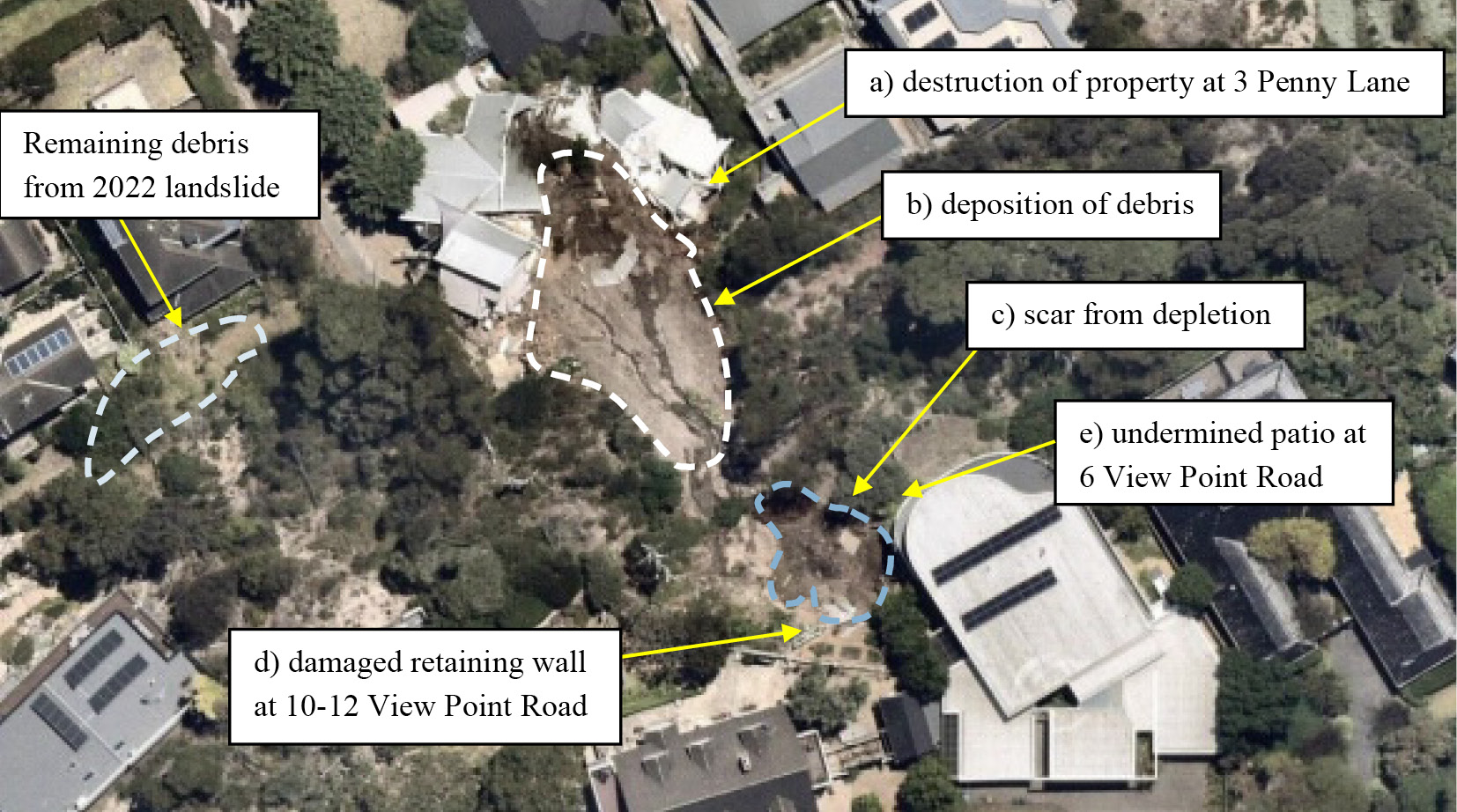
- The remaining debris from the November 2022 landslides can be observed to the rear of Mr and Mrs Willigenburg’s home at the toe of the escarpment. The debris flow from those landslides as depicted in the photograph, was confined to the west gully, and it ran across what was formerly the continuation of Penny Lane.
- The extent and location of the January 2025 landslides, as well as their impact on Mr and Mrs Moran’s home at 3 Penny Lane, are readily apparent in the photograph. Debris from the landslide is scattered throughout the building rubble. Approximately 300 cubic metres of soil was evacuated downhill.2 The home was propelled downward to the rear of 607-609 Point Nepean Road.
- Mr Paul and Mr Pope have considered the current condition of the landside site and separately developed design concepts to mitigate the risk of further landslides. A common element in both designs is the initial step of clearing debris from 3 Penny Lane before any work proceeds.3 Where the two concepts differ is in their approach to remediation. Mr Paul’s design is more sophisticated, as it seeks not only to mitigate the risk of future landslides but also to repair the damage to the escarpment caused by the landslides.
- The difference between mitigation and remediation should be briefly explained.
Mitigation and remediation
- Mr Paul and Mr Pope agree that mitigation works are aimed at placing the slope in a condition where the prospect of a further landslide is reduced to an acceptable level.4 The risk of another landslide can never be eliminated altogether, but mitigation works aim to make the prospect of such an event less likely. For example, Mr Paul and Mr Pope consider that their proposed designs, if implemented, would mean that a rainfall event of the kind that occurred in November 2022 would not result in either another landslide (Mr Pope) or the same level of destruction as was caused by the November 2022 landslide (Mr Paul).5
- Mr Paul explained that remediation works return the slope, as close as possible, to its pre-landslide condition.6 He explained that, unlike mitigation – which is entirely outcome driven – remediation takes into account the aesthetic character of the area and seeks to restore the landslide affected area to something approximating its prior condition.7
- While Mr Paul’s proposed concept was predominantly designed to mitigate future risk, he also incorporated remediation into the design.8 He explained in his evidence that had his design been concerned solely with mitigation, he would still have utilised the same primary element in the design: engineered rockfill.9
- In contrast, Mr Pope’s proposed concept is concerned solely with mitigation, while keeping the slope as close as possible to his view of its original landform.10 In this context, ‘original’ does not mean its condition before the landslides, but rather its natural geological formation before human intervention,11 in particular, before the placement of fill.12
- Turning now to the two proposed concept designs.
Mr Paul’s proposal
The design concept
- Mr Paul began his analysis by identifying a range of measures which, in some combination, could be implemented to reinstate the slope to its pre–McCrae Landslide form, and mitigate future risk to life and property from landslides. They comprised:
- the use of soil nails, potentially with shotcrete facing, to support the headscarp;13
- reinstatement of the material that detached from the landslide using “engineered fill”, namely rockfill;14
- reinstatement of the slope using a gabion wall or similar system like a crib wall;15
- the retroactive implementation of planning controls that would likely have been in place had an EMO been applied to the area;16
- the installation of debris flow barriers along the Penny Lane road reserve;17
- installation of groundwater extraction wells to facilitate ‘dewatering’ should that become necessary in the future;18
- the upgrading of aging vitreous clay sewer pipes and asbestos cement water mains in the McCrae area to prevent and reduce the likelihood of future leaks;19 and
- the use of impermeable backfill or trench stops to force water flowing along trench lines to the surface.20
- Mr Paul then prepared a design concept which sought to remediate the land and mitigate the risk of further landslides. He explained that the remediation objectives addressed in his design concept are:
a. reinstatement of the zone of depletion arising from the January 2025 landslides and the return of the landform as far as practical back to the state it was in prior to the landslides;
b. reinstatement of the zone of depletion with materials less susceptible to landslide and debris flow compared to those that detached in the January 2025 landslides;
c. provision for groundwater to drain freely from the landslide scarp and be directed to the municipal stormwater system; and
d. achievement of a similar level of risk to life and property to that prior to the January 2025 landslides.21
- He also explained that the two mitigation objectives addressed in the design concept are:
a. the reduction of the likelihood of further landslides to a level that is as low as reasonably practical; and
b. the reduction of the consequences from further landslides to a level that is as low as reasonably practical.22
- Mr Paul’s design concept is shown below:
FIGURE 5.2: WSP REMEDIATION DESIGN SHOWING ROCKFILL, PILED GROUND BEAM, AND GABION WALL.23
FIGURE 5.2

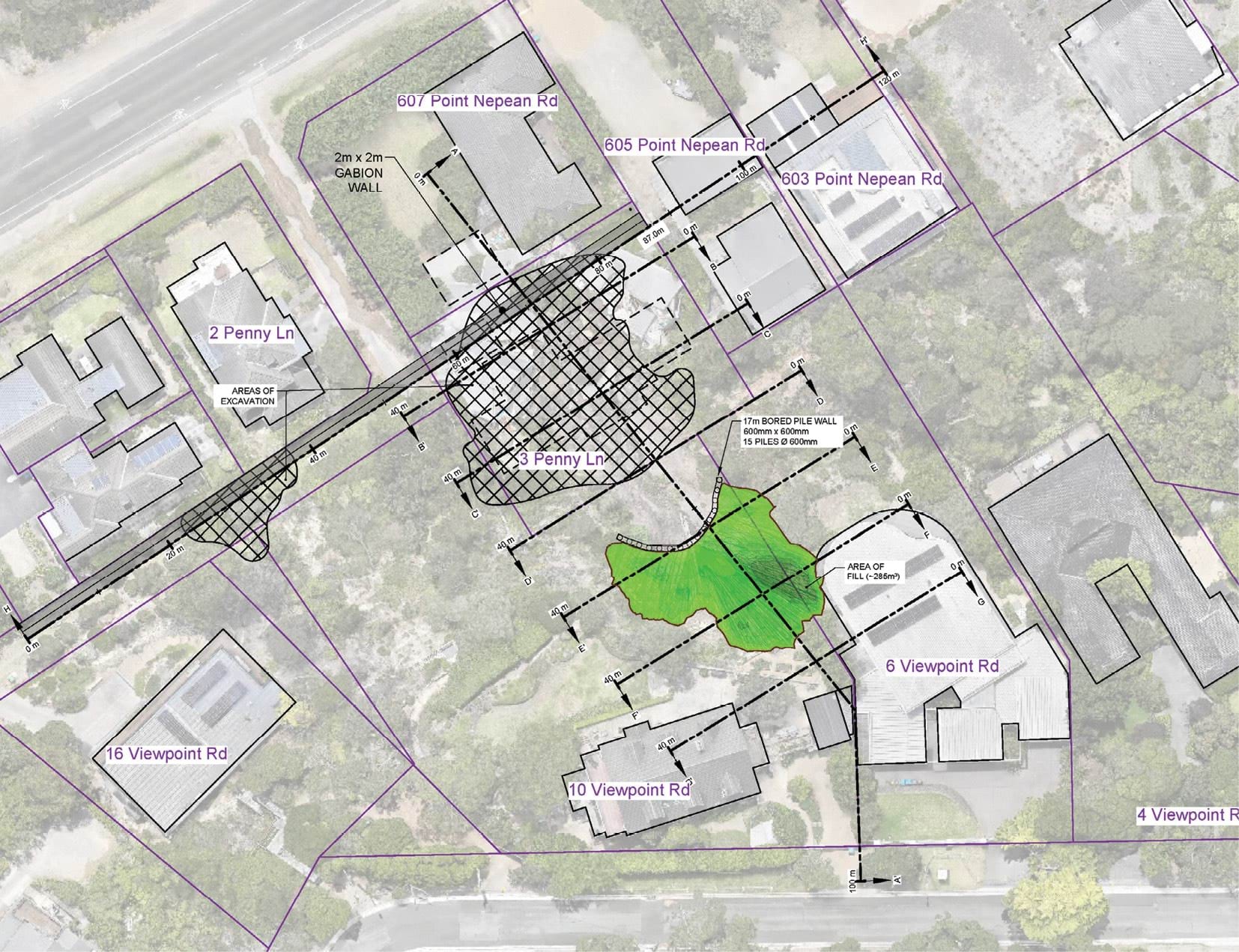
- This design concept includes several key features.
- With respect to the eastern gully (the location of the 2025 landslides), Mr Paul proposes:
- The use of engineered rockfill to in-fill the depleted parts of the slope to create a rockfill buttress. This appears in light green in the design image. The rockfill buttress would be comprised of angular, interlocking, high strength crushed quarried rock through which water can permeate.24 The rockfill could be reinforced using geogrid,25 a geosynthetic material used to reinforce soils and other granular materials. Mr Paul suggested the use of Dromana granite to match the appearance of the underlying natural rock.26 He said that, over time, vegetation would grow over the rockfill,27 and that, subject to appropriate engineering and design, provision could be made for the planting of trees.28 The engineered rockfill is intended to be installed from the bottom upwards until the light green area identified in the design image is covered.
- The installation of a piled ground beam at the base of the engineered rockfill.29 This is depicted at the base of the light green area in the design image. The piled ground beam is effectively a short retaining wall, of around 600 millimetres in height, that would be installed at the base of the rockfill to restrain the mass and prevent it from sliding down the slope.30
- As to the western gully (the location of the 2022 landslides), we understand that Mr Paul does not consider that any engineering work is presently necessary in respect of the hillside itself, because the area is returning to a more heavily vegetated state. Vegetation is a natural mitigation measure.31
- However, the design concept also includes the erection of a gabion wall in Penny Lane, which is intended to be a mitigation measure in respect of both the western and eastern gullies. As marked on the design image above, the gabion wall, a wall comprising cages or baskets made from steel wire and filled with stones rocks,32 would run across the southern edge of Penny Lane parallel to Point Nepean Road.33 The purpose of the gabion wall is to act as a barrier to absorb the impact of any further landslide that might occur.34
- As for View Point Road, Mr Paul’s concept provides for the installation of 34 groundwater wells down the length of the road.35 The wells would allow for the monitoring of groundwater levels behind the slope, and provide access to dewater the slope (by the insertion of pumps) in the event that groundwater levels were elevated.36
- The groundwater wells are numbered MW-1 to MW-34 in Mr Paul’s image below:
FIGURE 5.3: WSP GROUNDWATER EXTRACTION MONITORING WELLS.37
FIGURE 5.3
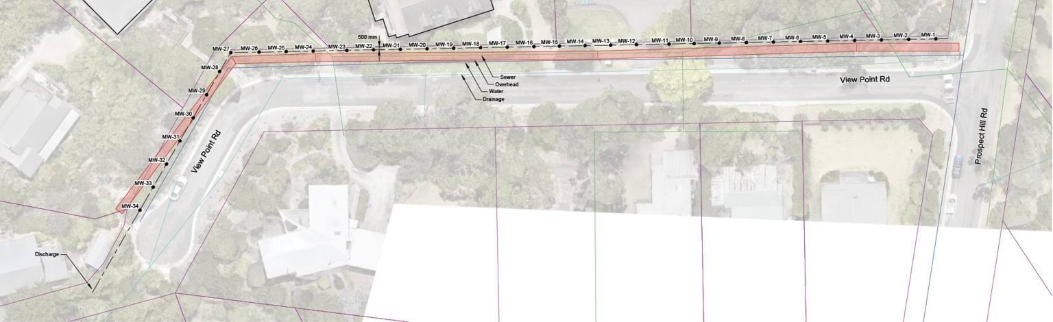
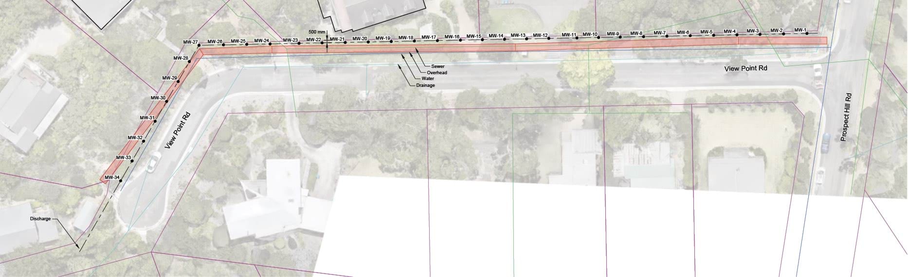
- As shown, the groundwater wells run from the intersection of Prospect Hill Road and View Point Road down the length of View Point Road on the northern side. The design does not provide for permanent pumps, but it does incorporate water monitoring devices and, therefore, power to the area would be required.38
Cost and timing
- As to the cost of Mr Paul’s design, Tim Whelan, Director of Major Projects and Engineering at Whelans Group, a firm specialising in the construction of civil infrastructure, was asked to estimate the overall construction cost, assuming full implementation of the design.
- Mr Whelan provided an estimate of $11.5 million exclusive of GST.39 This includes direct costs of approximately $745,000 for the construction of the gabion wall and direct costs of $1.2 million for the installation of the rockfill and construction of the associated pile wall.40
- Mr Paul has estimated the cost of the installation of the 34 groundwater wells down View Point Road to be $200,000 exclusive of GST.41
- These costings are necessarily indicative, only given the design is at a concept stage. Mr Paul considered it possible that the total cost would be less.42
- Mr Whelan also, helpfully, provided a construction program for the works, estimating the approximate time for each stage of construction.43 The estimated timeline is as follows:
- Removal of debris at 3 Penny Lane and two trees at 607–609 Point Nepean Road to allow access to the site – 30 days.44
- Once the site is accessible, construction of the gabion wall at the toe of the escarpment along Penny Lane – 25 days.45
- During the construction of the gabion wall, earthworks would begin in the area of the McCrae Landslide, to remove debris and to build a temporary access road. The access road would allow both the debris further uphill to be removed and enable the rockfill and geofabric separator to be installed. The piled wall and ground beam at the toe would also be constructed. This part of the project is estimated to take 108 days.46
- Works to remove left over debris and equipment, and the placement of hydromulch over the rockfill to allow for landscaping and revegetation – 23 days.47
- Mr Paul explained in his oral evidence to the Board of Inquiry that the overall construction schedule put together by Whelans “nominated a nine-month construction period”, but that, once procurement and the time to design were factored in, an additional three months would be added to the overall timeframe of the project.48 The effect of his evidence was that the works would take about 12 months from procurement.
Landslide Report Infographics
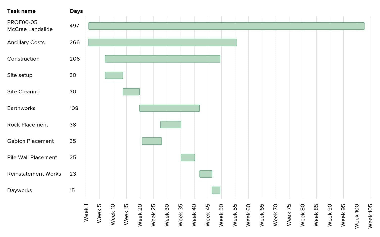
- After the hearing, Mr Paul, thoughtfully, wrote to the Board of Inquiry to explain that he considered that affected residents would be able to return to their homes before the completion of all works.49 His view is that:
- Based on the proposed program, the gabion wall would be completed about 21 weeks (four to five months) after the commencement of the project, and that once the gabion wall is in place, the houses at the toe of the slope could be re-occupied while the remaining works are undertaken.
- The houses at the top of the slope, 6 and 10 –12 View Point Road, could be re-occupied about seven weeks later once the rockfill has been installed.
- Mr Paul’s view in relation to the two houses at the top of the slope is now relevant only to 6 View Point Road as the Shire’s MBS has since removed the Emergency Order which restricted occupation of 10 –12 View Point Road.50 Mr and Mrs Borghesi have now returned to their home.
- Mr Paul also noted in his correspondence to the Board of Inquiry that the program proposed by Mr Whelan commenced with the removal of debris from 3 Penny Lane and Penny Lane more generally. Mr Paul stated that this work could commence earlier, pursuant to a separate contract, while design documentation is finalised for the works on the east and west gullies.51
- Such an approach would enable residents to return home sooner.
Mr Pope’s proposal
The design concept
- Turning now to Mr Pope’s proposed design, a key feature of his proposal is maintaining the west and east gullies in their post-landslide state, being a state that he considers to be more consistent with their landform pre-subdivision.52
- Mr Pope’s design for the west gully is, in substance, unchanged from his prior proposal examined by the Board of Inquiry in the first hearing block. That proposal, being the use of soil nails with netting, was prepared by Mr Pope following the 2022 landslides in the context of negotiations between the Shire and Mr and Mrs Borghesi about works required in response to those landslides.53
- Mr Pope also now proposes the use of soil nails and netting for the east gully. He proposes either a micro piled wall and capping beam (referred to as option 1),54 or a wall made of soil nails and shotcrete (referred to as option 2),55 at the boundary of 6 and 10–12 View Point Road. Mr Pope prefers option 2 because he considers that it is likely to be more constructable, less costly, safer to build, and that there are at least two contractors in the market available to undertake the work.56
- With respect to drainage at the site, Mr Pope’s concept provides for the installation of horizontal drains in the colluvium, in a bid to control groundwater and pore pressure.57
- Mr Pope’s design concepts are shown below. The image on the left side incorporates option 1 at the boundary of 6 and 10–12 View Point Road and the image to the right incorporates option 2 at the boundary.
FIGURE 5.4: COMPARE OF OPTION 1 AND OPTION 2 FOR THE EAST GULLY OF 6 AND 10–12 VIEW POINT ROAD.58
FIGURE 5.4
FIGURE 5.4

- More will be said about the features of Mr Pope’s preferred design concept shortly. It is important to first set out matters that informed his design and the preparatory works required before the soil nails, netting and the boundary wall can be installed.
- As to the matters that informed the design, Mr Pope had regard to development objectives that he considered typically apply to hillside work at residential properties, including the design objectives of the Shire and a design life of 50 years.59 It is important to note that he did not have regard to the design objectives of the land owners on whose land the works are to be undertaken.
- The design was also informed by a number of assumptions, specifically that:
- the design ought to allow for the construction of a new dwelling at 3 Penny Lane;
- the landform pre the McCrae Landslide was not to be reinstated;
- at a minimum, the design had to result in a Factor of Safety rating of 1.5;
- the design would be consistent with the most onerous of the Australian Standards and good first principles of engineering; and
- the works were to be owned and maintained by the property owners.60
- As to the preparatory works required before the soil nails and netting and the boundary wall can be installed, Mr Pope has identified three stages of works.61 Those stages are as follows:
- Landslide head initial works: this involves works at the top of the escarpment to remove materials which may become hazardous, such as parts of the existing retaining wall and plantar boxes located directly above the site of the McCrae Landslide. It also involves work to flatten and trim the headscarp to achieve a target angle of 35 degrees. Mr Pope explains that the rainwater tank at 6 View Point Road may need to be removed as part of the flattening of the area.62 The Board of Inquiry understands that the owners are exploring the removal of those tanks in any event, due to recent deterioration.
- Slope toe works: this involves demolition of the building debris on 3 Penny Lane and repair work at 607–609 Point Nepean Road.
- Mid-slope works: this last stage involves the removal of loose debris deposited down slope from the McCrae Landslide.63
- The second and third stages are self-explanatory. The first stage, the flattening of the headscarp, is best visualised in the following section drawings:
FIGURE 5.5: PSM LANDSLIDE INITIAL WORKS SECTION DRAWINGS.64
FIGURE 5.5
- As can be seen, the east gully is to be flattened, to the extent possible, to reduce the slope angle to 35 degrees. Mr Pope considers that the eastern edge of the east gully cannot be flattened to the same extent, as doing so would undermine the house foundations at 6 View Point Road.65 He proposes flattening that area to 65 degrees. The result of these flattening works would be to reduce the size of the level garden areas at both 6 and 10–12 View Point Road. It would also require the installation of a handrail along the boundary of 6 View Point Road to account for the steep slope along the top of the shotcrete retaining wall.66
- To assist the discussion that now follows about the features of design concept option 2, the image of the design is shown again below.
FIGURE 5.6: PSM DESIGN OPTION 2 FOR THE EAST GULLY OF 10–12 VIEW POINT ROAD.67
FIGURE 5.6

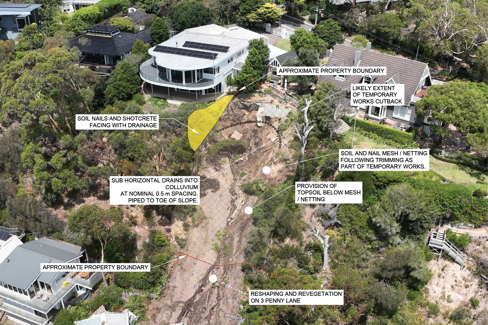
- The image shows the three distinct proposed engineered structures discussed earlier:
- The yellow area in the image represents the wall constructed of soil nails and shotcrete at the boundary of 6 and 10–12 View Point Road. Mr Pope explained that the soil nails would be nominally spaced every 1.5 square metres and they would be six metres long. The shotcrete is proposed to be 150 millimetres thick. This design does not permit trees to be planted near the wall, as they may adversely affect the structure.68
- The crescent of small black circles in the image represents the horizontal drains proposed to be installed along the base of the colluvium, 0.5 metres apart. The drains are to assist in draining water that travels to the east gully through the shallow aquifer. They are to be piped to the base of the slope to direct the water into a legal point of discharge.69
- The hatching in the image represents the stainless steel mesh held in place with fiberglass soil nails.70 This is to be placed across the face of the east gully, with soil nails of four to six metres in length spaced every two or three square metres.71 Low shrubs and other vegetation, though not trees, could be grown over the area.72
- The same type of concept is proposed for the west gully. It is shown below.
FIGURE 5.7: OBLIQUE VIEW OF SOIL NET DESIGN FOR WEST GULLY OF 10–12 VIEW POINT ROAD.73
FIGURE 5.7
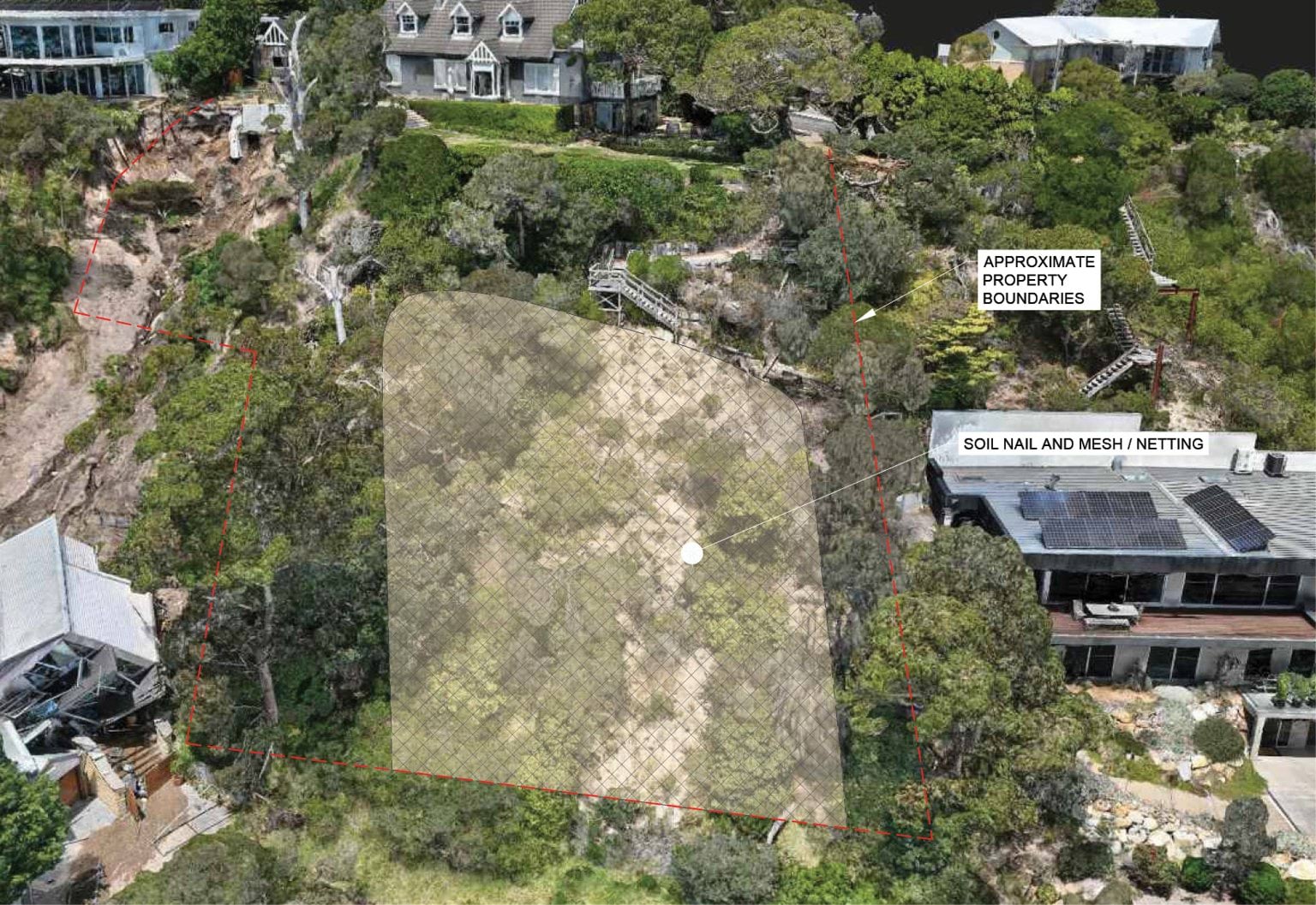
- The effect of Mr Pope’s concept is that a large part of the escarpment at 10–12 View Point Road would be covered with stainless steel mesh.
- It reflects a design approach commonly adopted for public road embankments.74
- A photograph of the soil nails and mesh design used on the Hamilton Highway is produced below:
FIGURE 5.8: COMPLETED SLOPE MITIGATION WORKS ALONG THE HAMILTON HIGHWAY USING SOIL NAILS AND MESH.75
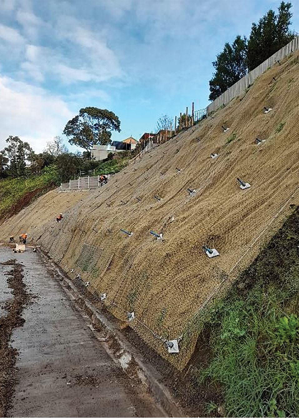
- This design approach requires ongoing maintenance. It would be necessary to clear materials that have built up behind the mesh about every five years, in addition to cleaning the slope drains.76 Any trees that start to grow would also need to be removed.77
Cost and timing
- While Mr Pope’s design will involve ongoing costs associated with the required maintenance, it is likely to be much less costly at the outset than Mr Paul’s proposal.
- Mr Pope’s concept has not been costed by a contractor. However, he gave an estimate of the total cost of the stainless-steel mesh and soil nails to be installed across the west and east gullies. His estimate was based on a rate of $1,300 per square metre,78 with a total area of approximately 1,000 square meters to be covered.79 He estimated a total cost of $1.3 million.80
- The installation of the stainless-steel mesh and soil nails is, of course, only one part of the project. There are also the costs of the three stages of preparatory work, the installation of the wall at the boundary and the installation of the horizontal drains.81
- The overall cost of Mr Pope’s concept will likely be considerably more than $1.3 million.
- As to the installation process, Mr Pope proposes that the works initially be undertaken by small-scale excavation using hand tools, with access to the slope obtained via abseiling.82 He recommended that the slope be monitored during the works,83 by, for example, a grid of tilt sensors.84
- Unlike Mr Paul’s proposal, the work is to be undertaken, at least initially, from the top of the slope downward. Mr Pope considered that method to be safer.85 Mr Paul considers that working from the base of the slope to the top can be performed with safety measures in place.86
Both designs adequately mitigate risk at the site of the landslides
- Having described both Mr Paul and Mr Pope’s concept designs, the next and most important matter to address is whether those concepts would adequately mitigate the risks in relation to further landslides at the site of the 2022 and 2025 landslide events.
Given the evidence of Mr Paul and Mr Pope, this matter can be dealt with very briefly. Their evidence was that both designs would adequately do so.87
Finding
The concept designs provided by geotechnical engineering experts, Darren Paul and Dane Pope, would adequately mitigate the risks in relation to further landslides at the site of the 2022 and 2025 events.
- Mr Paul explained that there are many considerations relevant to the selection of an appropriate concept.88 Both experts agreed that there is no one single correct answer as to what mitigation works should be undertaken.89
- Advice will also need to be sought as to whether any additional mitigation works are required on other parts of the escarpment at 6 and 10–12 View Point Road because Mr Paul and Mr Pope have focussed only on the locations of the 2022 and 2025 landslides.
- The ultimate selection of the concept is a matter to be resolved between the affected residents and those who are to be responsible for the cost of the works. The concept will, of course, require the consent of each affected landowner.90 Aesthetics, cost, future maintenance and timing are all matters that will need to be considered.
- The owners of 6 and 10–12 View Point Road have made it clear to the Board of Inquiry that they strongly prefer Mr Paul’s concept design over Mr Pope’s suggested mesh design.
- Following a public hearing at which the two concepts were examined, a written submission was made on behalf of the owner of 6 View Point Road. The submission explained that Mr Paul’s concept was preferred because it was a permanent, self-sustained remedy, that, once implemented, would require minimal to no future maintenance by the Shire or any other party. The submission also expressed concern that Mr Pope’s proposal of removing soil from the headscarp may undermine the foundations of the house.91
- Mr and Mrs Borghesi, the owners of 10–12 View Point Road, made a submission in which they:
- rejected Mr Pope’s design for the west gully;
- considered the escarpment should be returned as close as possible to its pre-landslide condition;
- supported Mr Paul’s proposal for the east gully, if trees which were present on the boundary between his property and 6 View Point Road are restored; and
- supported the construction of a gabion wall as proposed by Mr Paul.92
- While the selection of a design concept is ultimately a matter for others, some brief observations are made below about the competing concepts.
- First, while Mr Pope’s mesh and soil nail design is more cost effective, it is not in keeping with the surrounding area. The design will restrict the growth of trees and larger plants in an area surrounded by coastal vegetation. 93 Mr Paul’s design uses natural products and allows for the regrowth of vegetation.94
- Second, the use of soil nails could restrict the future use of properties around the escarpment, as future building works could require footings that intersect with the soil nails.95
- Third, Mr Pope’s design requires ongoing maintenance, entailing inspection of the nails and meshing, and tensioning, within two to five years of installation, in addition to further inspections every five years and the flushing of drains.96 Vegetation will also need to be maintained and trimmed where required.97 An agreement will need to be reached as to who will bear responsibility for the ongoing maintenance and associated costs.98
- Fourth, Mr Paul’s concept can be implemented from the bottom of the escarpment (with appropriate safety measures in place), reducing disruption to the owners of 6 and 10–12 View Point Road.99
- Fifth, while Mr Pope’s concept is aimed at restraining the slope, Mr Paul’s concept is aimed at reducing the risk of further landslides and preventing damage to houses at the toe of the escarpment. The gabion wall is to protect the houses at the toe of the slope. It would require the use of space within Penny Lane and may have visual impacts, particularly at the ground level. However, the structure is straightforward to construct and would involve only minimal ongoing maintenance.100 One complication is that the consent of the owners of 3 Penny Lane will be required if the wall is to be built into their boundary.
- Lastly, there are the different approaches to water management. Both proposals - horizontal drains in the east gully (Mr Pope) and groundwater wells along View Point Road (Mr Paul) – would require ongoing maintenance. Both proposals raise questions as to who would be responsible for the maintenance. SEW submitted to the Board of Inquiry that the primary water likely to be captured by groundwater wells is groundwater,101 which is itself, neither the responsibility of the Shire nor SEW.102
In light of the causation findings set out in Chapter 4, the complexity of the matters to be resolved in relation to the mitigation and remediation works, the number of parties with an interest in those matters, and the imperative of advancing the works with sufficient urgency to enable the return of displaced residents, the Board of Inquiry has given consideration to the establishment of an appropriate mechanism to facilitate the resolution of these issues. It makes the following recommendation.
Recommendation 1: Appointment of a mediator The Board of Inquiry recommends a Victorian Government Minister appoint an experienced mediator to engage in a structured process with the Shire, SEW, affected landowners and any other necessary parties, with a view to reaching agreement in relation to appropriate landslide mitigation and remediation works at and around the site of the McCrae Landslide. Recommendation 2: Participation in the mediation process The Board of Inquiry recommends the Shire and SEW appoint or engage a suitably experienced individual to lead and oversee their participation in the mediation process (Recommendation 1), with a view to bringing a fresh and pragmatic perspective to the issues.
5.3 Broader mitigation measures in McCrae
- The final matter for consideration concerns specific mitigation measures in McCrae.
- Little further needs to be said, as many of the recommendations set out in Chapter 8 already address this issue.
- Smart water meters are one mitigation measure now, pleasingly, being used in McCrae. By the time of the first hearing block, SEW had committed to replacing analogue meters in the McCrae area with smart (or “digital”) water meters.103 The roll out started in April 2025 and was scheduled to be completed in June 2025.104 The benefit of smart meters is that they enable household water usage to be monitored on a daily basis.105 They also provide an alert when usage is outside of the ordinary range, enabling SEW to make further inquiries to determine whether there is a water leak,106 and allowing for the quicker identification of bursts to mains in some situations.107
- The implementation of smart meters in landslide-prone areas such as McCrae is a prudent and practical measure. To the extent that the rollout in the McCrae area has not yet been completed, it should be completed as a matter of priority.
- Trench stops are another measure that may be useful in the McCrae area. They were raised by Mr Paul for consideration.108
- Trench stops are hydraulicly impervious barriers installed in trenches to prevent them becoming long conduits for water. They operate by creating an impervious barrier that forces water to accumulate in the trench, so that it either migrates through the walls of the trench (more slowly than it would through the bedding material), or it is pushed to the surface, where it is detected or diverted to stormwater via a kerb or stormwater pit.109 Examples of trench stops are shown below.
FIGURE 5.9: EXAMPLES OF TRENCH STOPS.110
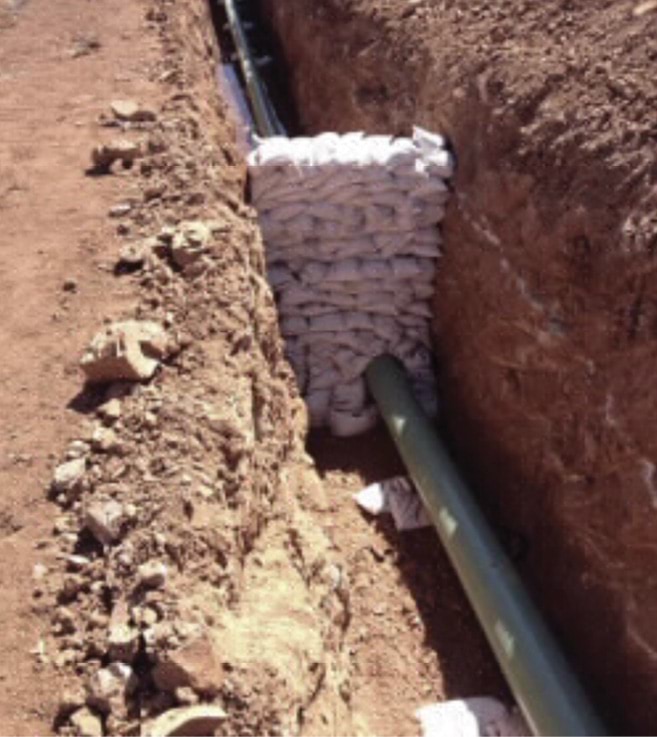
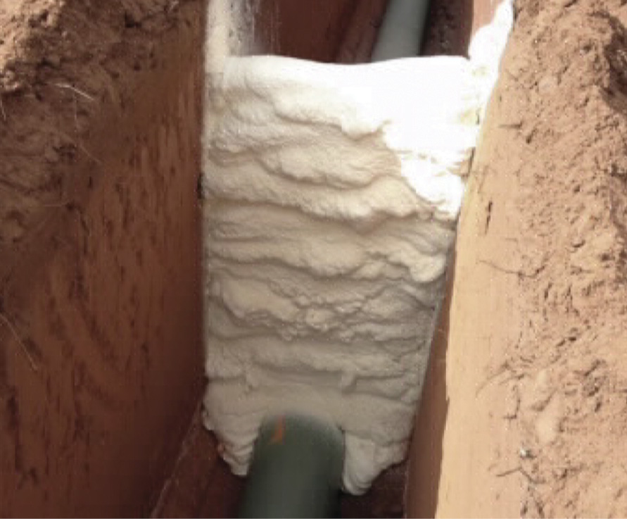
- SEW submitted to the Board of Inquiry that trench stops are unnecessary because “burst water generally flows to the surface in any event”.111 No supporting source was provided. Counsel for SEW questioned Mr Paul about the utility of trench stops. He was asked about the potential for trench stops to be “a nuisance to residents, [as the water diverted to the surface can cause] damage to roads, to gardens, soggy soil”.112 In response, Mr Paul stated:
Groundwater coming to the surface, damage to pavement and wet areas, yeah, that can mean inconvenience, but I’d say not as inconvenient as a landslide.113
- Mr Paul also explained that trench stops can be positioned so that any surface water runs into the stormwater system and not towards an area prone to landslides.114
- Mr Paul also raised for consideration the use of carrier pipes.
Carrier pipes are a sleeve that is placed around the water main such that, in the event of a rupture, water is captured by the carrier pipe and is then diverted through the carrier pipe to a pit.115 They also assist to protect the water main as they make the main more resistant to ground movements which are absorbed by the carrier pipe.116
Recommendation 3: Trench stops and carrier pipes The Board of Inquiry recommends the Shire and SEW obtain expert advice about the use of trench stops and carrier pipes in parts of McCrae to mitigate the risk of landslides, including the use of such measures in more remote locations where water leaks may be less readily detected. - Next, Mr Paul suggested that consideration be given to the replacement of aged vitreous clay sewer pipes and asbestos cement water mains.117
- This map indicates a zone in the McCrae area where there were an anomalous number of failures:
FIGURE 5.10: SOUTH EAST WATER PLAN SHOWING FREQUENCY OF WATER LEAKS WITHIN WATER MAINS IN THE MCCRAE AREA WITH ANNOTATIONS.118
FIGURE 5.10
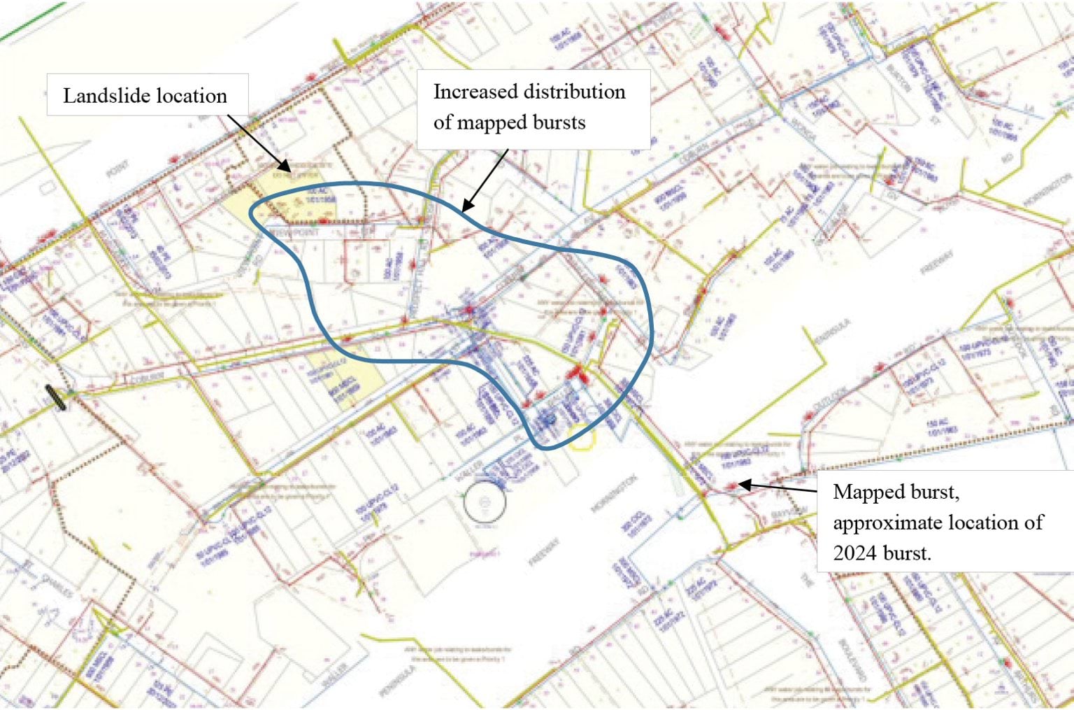
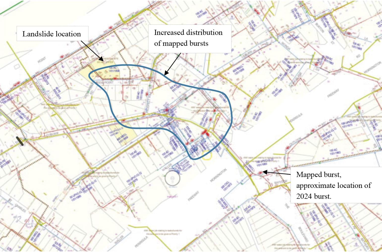
- Mr Paul considered that the asbestos pipes in the area outlined above were aging, brittle, and prone to cracking,119 and had a higher rate of leakage compared to other areas in McCrae.120
Finally, SEW has informed the Board of Inquiry that the burst water main that has been found by the Board of Inquiry to have caused the 5 January 2025 landslide and McCrae Landslide may have contained a manufacturing defect.121 SEW is presently examining whether this issue may affect other pipes in the area.122 Such investigations should proceed without delay.
Recommendation 4: Assessment of infrastructure The Board of Inquiry recommends the Shire and SEW thoroughly assess their water infrastructure in McCrae to identify any need for repair or replacement works to mitigate landslide risk. SEW should also adopt this measure in relation to its sewer system.
Chapter 5 Endnotes
- 1 Exhibit CA-87, McCrae Landslide Remediation and Mitigation Report prepared by WSP, 12 August 2025, [DPA.0005.0001.0001 at _0007].
- 2 Exhibit CA-67, McCrae Landslide Causation Report prepared by WSP, 21 July 2025, [DPA.0004.0001.0001 at _0016].
- 3 Exhibit CA-86, McCrae Landslide Mitigation Report prepared by PSM, 11 August 2025, [MSC.5088.0001.0007 at .0025–.0031]; Exhibit CA-87, McCrae Landslide Remediation and Mitigation Report prepared by WSP, 12 August 2025, [DPA.0005.0001.0001 at _0009, _0012].
- 4 Public Hearing Transcript, Darren Paul and Dane Pope, 18 August 2025, 1357–1358.
- 5 Public Hearing Transcript, Darren Paul and Dane Pope, 18 August 2025, 1355–1356.
- 6 Public Hearing Transcript, Darren Paul, 18 August 2025, 1357.
- 7 Public Hearing Transcript, Darren Paul, 18 August 2025, 1389.
- 8 Public Hearing Transcript, Darren Paul, 18 August 2025, 1390–1391.
- 9 Public Hearing Transcript, Darren Paul and Dane Pope, 18 August 2025, 1408.
- 10 Public Hearing Transcript, Dane Pope, 18 August 2025, 1358.
- 11 Public Hearing Transcript, Dane Pope, 18 August 2025, 1393.
- 12 Public Hearing Transcript, Dane Pope, 18 August 2025, 1373.
- 13 Exhibit CA-67, McCrae Landslide Causation Report prepared by WSP, 21 July 2025, [DPA.0004.0001.0001 at _0114].
- 14 Exhibit CA-67, McCrae Landslide Causation Report prepared by WSP, 21 July 2025, [DPA.0004.0001.0001 at _0114–_0116].
- 15 Exhibit CA-67, McCrae Landslide Causation Report prepared by WSP, 21 July 2025, [DPA.0004.0001.0001 at _0116].
- 16 Exhibit CA-67, McCrae Landslide Causation Report prepared by WSP, 21 July 2025, [DPA.0004.0001.0001 at _0117–_0118].
- 17 Exhibit CA-67, McCrae Landslide Causation Report prepared by WSP, 21 July 2025, [DPA.0004.0001.0001 at _0118–_0119].
- 18 Exhibit CA-67, McCrae Landslide Causation Report prepared by WSP, 21 July 2025, [DPA.0004.0001.0001 at _0119–_0120].
- 19 Exhibit CA-67, McCrae Landslide Causation Report prepared by WSP, 21 July 2025, [DPA.0004.0001.0001 at _0120–_0121].
- 20 Exhibit CA-67, McCrae Landslide Causation Report prepared by WSP, 21 July 2025, [DPA.0004.0001.0001 at _0120–_0121].
- 21 Exhibit CA-87, McCrae Landslide Remediation and Mitigation Report prepared by WSP, 12 August 2025, [DPA.0005.0001.0001 at _0008].
- 22 Exhibit CA-87, McCrae Landslide Remediation and Mitigation Report prepared by WSP, 12 August 2025, [DPA.0005.0001.0001 at _0008].
- 23 Exhibit CA-87, McCrae Landslide Remediation and Mitigation Report prepared by WSP, 12 August 2025, [DPA.0005.0001.0001 at _0019].
- 24 Exhibit CA-87, McCrae Landslide Remediation and Mitigation Report prepared by WSP, 12 August 2025, [DPA.0005.0001.0001 at _0009–_0010].
- 25 Exhibit CA-87, McCrae Landslide Remediation and Mitigation Report prepared by WSP, 12 August 2025, [DPA.0005.0001.0001 at _0010].
- 26 Exhibit CA-87, McCrae Landslide Remediation and Mitigation Report prepared by WSP, 12 August 2025, [DPA.0005.0001.0001 at _0009–_0010].
- 27 Exhibit CA-67, McCrae Landslide Causation Report prepared by WSP, 21 July 2025, [DPA.0004.0001.0001 at _0114–_0116].
- 28 Public Hearing Transcript, Darren Paul, 18 August 2025, 1365.
- 29 Exhibit CA-87, McCrae Landslide Remediation and Mitigation Report prepared by WSP, 12 August 2025, [DPA.0005.0001.0001 at _0009].
- 30 Exhibit CA-87, McCrae Landslide Remediation and Mitigation Report prepared by WSP, 12 August 2025, [DPA.0005.0001.0001 at _0009].
- 31 Public Hearing Transcript, Darren Paul, 18 August 2025, 1361.
- 32 Public Hearing Transcript, Darren Paul, 18 August 2025, 1361.
- 33 Exhibit CA-87, McCrae Landslide Remediation and Mitigation Report prepared by WSP, 12 August 2025, [DPA.0005.0001.0001 at _0011]; Public Hearing Transcript, Darren Paul, 18 August 2025, 1361.
- 34 Exhibit CA-87, McCrae Landslide Remediation and Mitigation Report prepared by WSP, 12 August 2025, [DPA.0005.0001.0001 at _0011].
- 35 Exhibit CA-87, McCrae Landslide Remediation and Mitigation Report prepared by WSP, 12 August 2025, [DPA.0005.0001.0001 at _0010 –_0011, _0023].
- 36 Exhibit CA-87, McCrae Landslide Remediation and Mitigation Report prepared by WSP, 12 August 2025, [DPA.0005.0001.0001 at _0010].
- 37 Exhibit CA-87, McCrae Landslide Remediation and Mitigation Report prepared by WSP, 12 August 2025, [DPA.0005.0001.0001 at _0023].
- 38 Public Hearing Transcript, Darren Paul, 18 August 2025, 1362–1363.
- 39 Exhibit CA-87, McCrae Landslide Remediation and Mitigation Report prepared by WSP, 12 August 2025, [DPA.0005.0001.0001 at _0013].
- 40 Exhibit CA-87, McCrae Landslide Remediation and Mitigation Report prepared by WSP, 12 August 2025, [DPA.0005.0001.0001 at _0013, _0029].
- 41 Exhibit CA-87, McCrae Landslide Remediation and Mitigation Report prepared by WSP, 12 August 2025, [DPA.0005.0001.0001 at _0013].
- 42 Public Hearing Transcript, Darren Paul, 18 August 2025, 1384.
- 43 Exhibit CA-87, McCrae Landslide Remediation and Mitigation Report prepared by WSP, 12 August 2025, [DPA.0005.0001.0001 at _0026].
- 44 Exhibit CA-87, McCrae Landslide Remediation and Mitigation Report prepared by WSP, 12 August 2025, [DPA.0005.0001.0001 at _0012, _0026, _0031].
- 45 Exhibit CA-87, McCrae Landslide Remediation and Mitigation Report prepared by WSP, 12 August 2025, [DPA.0005.0001.0001 at _0012, _0027, _0031].
- 46 Exhibit CA-87, McCrae Landslide Remediation and Mitigation Report prepared by WSP, 12 August 2025, [DPA.0005.0001.0001 at _0012, _0026 –_0027, _0031].
- 47 Exhibit CA-87, McCrae Landslide Remediation and Mitigation Report prepared by WSP, 12 August 2025, [DPA.0005.0001.0001 at _0012, _0027, _0031].
- 48 Public Hearing Transcript, Darren Paul, 18 August 2025, 1383.
- 49 Email from Darren Paul to Solicitors Assisting the Board of Inquiry about construction schedule, 18 August 2025, [DPA.0008.0001.0001].
- 50 Email from Mornington Peninsula Shire Council’s solicitors to Solicitors Assisting the Board of Inquiry about reoccupation of 10–12 View Point Road, 12 August 2025, [INQ.0015.0001.0001].
- 51 Email from Darren Paul to Solicitors Assisting the Board of Inquiry about construction schedule, 18 August 2025, [DPA.0008.0001.0001].
- 52 Public Hearing Transcript, Dane Pope, 18 August 2025, 1393.
- 53 Public Hearing Transcript, Dane Pope, 4 May 2025, 148–149, 151–153; Public Hearing Transcript, Dane Pope, 18 August 2025, 1368.
- 54 Exhibit CA-86, McCrae Landslide Mitigation Report prepared by PSM, 11 August 2025, [MSC.5088.0001.0007 at .0052–.0053].
- 55 Exhibit CA-86, McCrae Landslide Mitigation Report prepared by PSM, 11 August 2025, [MSC.5088.0001.0007 at .0054].
- 56 Exhibit CA-86, McCrae Landslide Mitigation Report prepared by PSM, 11 August 2025, [MSC.5088.0001.0007 at .0054].
- 57 Exhibit CA-86, McCrae Landslide Mitigation Report prepared by PSM, 11 August 2025, [MSC.5088.0001.0007 at .0053–.0054].
- 58 Exhibit CA-86, McCrae Landslide Mitigation Report prepared by PSM, 11 August 2025, [MSC.5088.0001.0007 at .0061–.0063].
- 59 Exhibit CA-86, McCrae Landslide Mitigation Report prepared by PSM, 11 August 2025, [MSC.5088.0001.0007 at .0047].
- 60 Exhibit CA-86, McCrae Landslide Mitigation Report prepared by PSM, 11 August 2025, [MSC.5088.0001.0007 at .0048].
- 61 Exhibit CA-86, McCrae Landslide Mitigation Report prepared by PSM, 11 August 2025, [MSC.5088.0001.0007 at .0034–.0035, .0037–.0038]. Note that, while not expressly referred to, the Board of Inquiry understands the mitigation works to be stage 4 of PSM’s temporary works advice.
- 62 Exhibit CA-86, McCrae Landslide Mitigation Report prepared by PSM, 11 August 2025, [MSC.5088.0001.0007 at .0035].
- 63 Exhibit CA-86, McCrae Landslide Mitigation Report prepared by PSM, 11 August 2025, [MSC.5088.0001.0007 at .0034–.0035].
- 64 Exhibit CA-86, McCrae Landslide Mitigation Report prepared by PSM, 11 August 2025, [MSC.5088.0001.0007 at .0041].
- 65 Exhibit CA-86, McCrae Landslide Mitigation Report prepared by PSM, 11 August 2025, [MSC.5088.0001.0007 at .0034].
- 66 Exhibit CA-90, Joint Report on remediation and mitigation prepared by expert conclave, 14 August 2025, [INQ.0012.0001.0001 at _0002].
- 67 Exhibit CA-86, McCrae Landslide Mitigation Report prepared by PSM, 11 August 2025, [MSC.5088.0001.0007 at .0063].
- 68 Exhibit CA-86, McCrae Landslide Mitigation Report prepared by PSM, 11 August 2025, [MSC.5088.0001.0007 at .0054].
- 69 Exhibit CA-90, Joint Report on remediation and mitigation prepared by expert conclave, 14 August 2025, [INQ.0012.0001.0001 at _0002].
- 70 Public Hearing Transcript, Dane Pope, 18 August 2025, 1372; Exhibit CA-86, McCrae Landslide Mitigation Report prepared by PSM, 11 August 2025, [MSC.5088.0001.0007 at .0053]; Exhibit CA-90, Joint Report on remediation and mitigation prepared by expert conclave, 14 August 2025, [INQ.0012.0001.0001].
- 71 Exhibit CA-86, McCrae Landslide Mitigation Report prepared by PSM, 11 August 2025, [MSC.5088.0001.0007 at .0053].
- 72 Public Hearing Transcript, Dane Pope, 18 August 2025, 1372; Exhibit CA-86, McCrae Landslide Mitigation Report prepared by PSM, 11 August 2025, [MSC.5088.0001.0007 at .0054].
- 73 Exhibit CA-86, McCrae Landslide Mitigation Report prepared by PSM, 11 August 2025, [MSC.5088.0001.0007 at .0059].
- 74 Public Hearing Transcript, Dane Pope, 8 May 2025, 151.
- 75 Exhibit CA-86, McCrae Landslide Mitigation Report prepared by PSM, 11 August 2025, [MSC.5088.0001.0007 at .0066].
- 76 Exhibit CA-90, Joint Report on remediation and mitigation prepared by expert conclave, 14 August 2025, [INQ.0012.0001.0001 at _0002].
- 77 Exhibit CA-90, Joint Report on remediation and mitigation prepared by expert conclave, 14 August 2025, [INQ.0012.0001.0001 at _0002].
- 78 Public Hearing Transcript, Dane Pope, 18 August 2025, 1385.
- 79 Exhibit CA-90, Joint Report on remediation and mitigation prepared by expert conclave, 14 August 2025, [INQ.0012.0001.0001].
- 80 Public Hearing Transcript, Dane Pope, 18 August 2025, 1385.
- 81 Public Hearing Transcript, Dane Pope, 18 August 2025, 1385.
- 82 Exhibit CA-86, McCrae Landslide Mitigation Report prepared by PSM, 11 August 2025, [MSC.5088.0001.0007 at .0035].
- 83 Exhibit CA-86, McCrae Landslide Mitigation Report prepared by PSM, 11 August 2025, [MSC.5088.0001.0007 at .0036].
- 84 Public Hearing Transcript, Dane Pope, 18 August 2025, 1380.
- 85 Public Hearing Transcript, Dane Pope, 18 August 2025, 1380.
- 86 Public Hearing Transcript, Darren Paul, 18 August 2025, 1380–1381.
- 87 Public Hearing Transcript, Darren Paul and Dane Pope, 18 August 2025, 1377–1378.
- 88 Public Hearing Transcript, Darren Paul, 18 August 2025, 1357.
- 89 Public Hearing Transcript, Darren Paul and Dane Pope, 18 August 2025, 1356–1357.
- 90 Public Hearing Transcript, Darren Paul and Dane Pope, 18 August 2025, 1358.
- 91 Public Submission of McCrae Resident, 19 August 2025, [RES.0011.0002.0001].
- 92 Public Submission of Gerrard and Bronwyn Borghesi, 19 August 2025, [RES.0001.0006.0004 at _0001–_0002].
- 93 Public Hearing Transcript, Dane Pope, 18 August 2025, 1372.
- 94 Public Hearing Transcript, Darren Paul, 18 August 2025, 1365.
- 95 Public Hearing Transcript, Darren Paul, 18 August 2025, 1389.
- 96 Public Hearing Transcript, Dane Pope, 18 August 2025, 1375–1376.
- 97 Public Hearing Transcript, Dane Pope, 18 August 2025, 1376.
- 98 Public Hearing Transcript, Darren Paul, 18 August 2025, 1378.
- 99 Email from Darren Paul to Solicitors Assisting the Board of Inquiry about construction schedule, 18 August 2025, [DPA.0008.0001.0001].
- 100 Public Hearing Transcript, Darren Paul, 18 August 2025, 1366.
- 101 Submission of South East Water about measures to reduce or prevent the risk of another landslide, 22 August 2025, [SEW.0001.0002.4205 at _0007].
- 102 Submission of Mornington Peninsula Shire Council about mitigation of further landslides, 22 August 2025, [MSC.5094.0001.0050 at .0052]; South East Water, Response to first set of potential adverse findings, 21 August 2025, [SEW.0001.0002.4203 at _0009].
- 103 Public Hearing Transcript, Lara Olsen, 16 May 2025, 565.
- 104 Public Hearing Transcript, Lara Olsen, 16 May 2025, 565.
- 105 Public Hearing Transcript, Andrew Forster-Knight, 24 June 2025, 1011.
- 106 Public Hearing Transcript, Lara Olsen, 16 May 2025, 567.
- 107 Public Hearing Transcript, Andrew Forster-Knight, 24 June 2025, 1012.
- 108 Exhibit CA-67, McCrae Landslide Causation Report prepared by WSP, 21 July 2025, [DPA.0004.0001.0001 at _0120]; Public Hearing Transcript, Darren Paul, 18 August 2025, 1366–1367.
- 109 Public Hearing Transcript, Darren Paul, 18 August 2025, 1399.
- 110 Exhibit CA-67, McCrae Landslide Causation Report prepared by WSP, 21 July 2025, [DPA.0004.0001.0001 at _0121].
- 111 Submission of South East Water about measures to reduce or prevent the risk of another landslide, 22 August 2025, [SEW.0001.0002.4205 at _0005].
- 112 Public Hearing Transcript, Darren Paul, 18 August 2025, 1398.
- 113 Public Hearing Transcript, Darren Paul, 18 August 2025, 1399.
- 114 Public Hearing Transcript, Darren Paul, 18 August 2025, 1399–1400.
- 115 Public Hearing Transcript, Darren Paul, 18 August 2025, 1403.
- 116 Public Hearing Transcript, Darren Paul, 18 August 2025, 1403.
- 117 Public Hearing Transcript, Darren Paul, 18 August 2025, 1367.
- 118 Exhibit CA-67, McCrae Landslide Causation Report prepared by WSP, 21 July 2025, [DPA.0004.0001.0001 at _0080].
- 119 Public Hearing Transcript, Darren Paul, 18 August 2025, 1394.
- 120 Exhibit CA-87, McCrae Landslide Remediation and Mitigation Report prepared by WSP, 12 August 2025, [DPA.0005.0001.0001 at _0011].
- 121 Yvonne Wu and John Scheirs, ExcelPlas Expert Report – Condition Monitoring of a PVC Pipe, 13 June 2025, [SEW.0001.0001.5467].
- 122 Exhibit CA-65, Second Witness Statement of Julian Tully, 2 July 2025, 4 –5 [22]–[23].
Chapter 6
Conduct of the Mornington Peninsula Shire Council and South East Water
6.1 Introduction
- Having found that the cause of the McCrae Landslide was water from the burst water main, it is now time to examine the conduct of the Shire and SEW in the lead up to the landslide.
- Their conduct is assessed across two dimensions:
- actions and decisions taken (or the absence thereof) to prevent or mitigate landslides in McCrae; and
- actions and decisions taken (or the absence thereof) that may have contributed to causing the McCrae Landslide.
- Three key observations emerge from that assessment:
- first, the Shire and SEW were not passive bystanders in the lead up to the McCrae Landslide. Both organisations took steps in an attempt to respond to the issues of water surfacing in McCrae and to locate the source of water flowing from the headscarp of the 5 January 2025 landslide;
- second, while each organisation invested resources and time in those efforts, they operated in siloes, missing valuable opportunities for collaboration and co-ordination; and
- third, their respective approaches demonstrate that neither fully appreciated the seriousness of the landslide risk in McCrae and, as a result, they did not respond with the urgency and appropriate lens that the situation demanded.
- The analysis that follows throws into sharp focus that, prior to the McCrae Landslide, neither the Shire nor SEW prioritised the management and mitigation of landslide risk in McCrae. That appears to be changing.
6.2 Mornington Peninsula Shire Council
- The Shire’s engagement with the Board of Inquiry was for the most part positive and constructive.
- The Shire now needs to adopt that same approach in rebuilding its relationship with the residents of McCrae and in assisting to provide practical and timely solutions for residents. This requires strong leadership and commitment from the Mayor, Councillors and the Chief Executive Officer. Unless this occurs, the Board of Inquiry fears that the residents who have already been displaced from their homes for far too long will remain displaced for many years to come. That is not a situation that the Shire should accept or tolerate within its community.
- The Shire states publicly that it is committed to the highest standards of performance, behaviour and service.1 The Shire has five core values which it says guide it in the delivery of exceptional community outcomes, being:
- integrity;
- openness;
- courage;
- respect; and
- excellence.
- These core values are said to set the framework for how the Shire works together to achieve outstanding outcomes for the community. They are said to guide the Shire in defining and communicating how it does things, how it makes decisions in the best interests of the community that it serves, and how Shire officers hold themselves accountable to the highest standards of performance and conduct.
- It is evident from the analysis that follows that the Shire has fallen short of its commitment to the highest standards of performance, behaviour and service, in relation to the events the subject of this Board of Inquiry. Residents have lost trust and confidence in the Shire. They are frustrated by the approach taken by the Shire to the 2022 and 2025 landslides.
The Mayor, Councillors and Chief Executive Officer must lead the Shire in learning from these shortcomings and in fulfilling the public commitment that it has given to its community.
Recommendation 5: Shire's McCrae Landslide Incident Group The Board of Inquiry recommends the Chief Executive Officer of the Shire review and improve the approach that has been and is being taken by the Shire’s McCrae Landslide Incident Group, with the assistance of a suitably experienced external independent consultant.
Inaction prior to the November 2022 landslides
- It is evident from the chronological outline of the evidence in Chapter 3 that, prior to the McCrae Landslide, the Shire did not fully comprehend the risk of landslides in McCrae which impacted the Shire’s approach to managing the risk and in preparing for landslide events.
The Shire could have, but did not, promptly commission work to classify the entire Mornington Peninsula into areas of high, medium and low landslide susceptibility after receiving geotechnical advice in March 2002
- The fact that the Shire did not fully comprehend the risk of landslides in McCrae can be observed from at least 2002.
- In March of that year, the Shire received an initial assessment by geotechnical experts of “landslide hazards” across the entire Mornington Peninsula.2 That assessment included preparation of the following parameter maps for inclusion in a geographical information system (GIS): a geological map, cadastre map and digital terrain model.
- The geotechnical experts recommended that those maps be combined with a field mapping exercise to enable the development of a map that classified the Shire into areas of high, medium and low susceptibility with regard to landslides.3
- The zoning of the Mornington Peninsula into areas of landslide susceptibility was said to serve several purposes, including:
- enabling prospective residents, developers and the Shire to assess the risks associated with building and developing in certain areas;
- assisting the Shire’s personnel to make more informed decisions on whether to approve a development or require further geotechnical investigation;
- allowing the Shire to assess the vulnerability of its own assets to landslides; and
- providing developers with information designed to promote responsible development.4
- Despite these clear benefits, the Shire did not commission Lane Piper to undertake the zoning until April 2007 – more than five years after the recommendation was made.
- The Shire has provided no explanation for the delay.
- It is acknowledged that between 2002 and 2007, significant advancements were made in GIS data and computer processing capabilities. These developments enabled computer-based analysis of landslide susceptibility, thereby reducing the need for engineers or geologists to spend time in the field.5 However, the Shire has not sought to justify its delay by reference to awaiting those technological advancements.
There is otherwise no evidence before the Board of Inquiry accounting for the Shire’s inaction for five years. That inaction is difficult to square with the fact that the Shire and its residents had, for decades, “experienced difficulties and expense as a result of slope stability issues throughout the [Mornington Peninsula area]” and were confronting increasingly serious consequences from slope instabilities.6
Finding
The Shire could have, but did not, promptly commission work to classify the entire Mornington Peninsula into areas of high, medium and low landslide susceptibility after receiving geotechnical advice in March 2002.
This was a missed opportunity to promptly identify and mitigate landslide risk.
The Shire could have, but did not, obtain appropriate landslide risk assessments prior to issuing planning permits for a residential development in 2003
- The fact the Shire did not fully comprehend the risk of landslides in McCrae can also be observed in 2003, when the Shire considered the application from the owners of 611–613 Point Nepean Road to develop that land by building multiple residential properties.
- As set out in Chapter 3, in response to the public exhibition of those applications, the Shire’s Planning Department was told by the Mornington Peninsula Ratepayers’ & Residents’ Association and by local community members that:
- This information from local people should have prompted the Shire’s Planning Department to request from the applicants information concerning the risk to the site from landslide. Instead, the Shire referred the applications to Planning Panels Victoria,11 where it supported the development.
- Despite the efforts of residents who attended the Planning Panel hearing to voice their concerns, and despite the Planning Panel not being able to make a finding on the risk of landslide, the Shire still did not act on the landslide concerns raised beyond simply checking for any relevant information in the Shire’s records.12
- The Shire ultimately issued planning permits allowing the subdivision and the construction of the residential properties at the toe of the escarpment at 611–613 Point Nepean Road.13 It did so without seeking to properly comprehend the landslide risk to those properties from the escarpment above.
- Two decades on and those properties (being 1–4/613 Point Nepean Road and 2 Penny Lane) were all impacted by the November 2022 landslides and the McCrae Landslide.
- Following the November 2022 landslides, the Willigenburgs in 3/613 Point Nepean Road were ordered out of their home by an Emergency Order.14 So were the owners of 1, 2 and 4/613 Point Nepean Road together with the owners of 2 Penny Lane.15
- Following the McCrae Landslide, the owners of 1–4/613 Point Nepean Road and the owners of 2 Penny Lane were ordered out of their homes again by Emergency Orders.16 The Willigenburgs and the residents of 2 Penny Lane had not been permitted back since the earlier landslides.17 They are still not back in their homes.
Had a risk assessment been undertaken two decades ago, it is not possible to know whether the planning permits would have been issued or whether they would have been issued subject to conditions such as a requirement that a gabion wall be built to protect the properties in the event of a landslide. What is certain, however, is that the planning permits would not be issued today based on PSM’s risk assessment provided to the Shire this year.18
Finding
The Shire could have, but did not, request from the applicants or itself obtain a landslide risk assessment prior to issuing planning permits for the subdivision and development of 611–613 Point Nepean Road, in circumstances where landslide risk was identified in public submissions as one of the issues bearing on the site’s suitability for development.
This was another missed opportunity to identify and mitigate landslide risk.
- In addition to not obtaining a risk assessment, the Shire also did not take steps in response to the following observation made by the Planning Panel:
[E]ffective management of stormwater drainage and other infiltration on the properties above the site would be likely to reduce any hazard that may exist and that such management is desirable regardless of the type or density of development that may occur on the subject land.19
There is a body of evidence, addressed in Chapter 3, that drainage above the site on View Point Road was sub-standard for many years following the construction of the properties. In addition, there is evidence of a history of excess water being observed at the toe of the escarpment in and around Penny Lane.20
Finding
The Shire could have, but did not, assess whether the stormwater drainage system above 611–613 Point Nepean Road was being effectively managed to mitigate landslide risk along the escarpment. For example, the Shire could have, but did not, obtain an expert opinion in relation to the condition and effectiveness of the stormwater system prior to issuing the planning permits for the subdivision and development of the subject site.
This was another missed opportunity to identify and mitigate landslide risk.
The Shire could have, but did not, promptly undertake works to stabilise the gully located between The Eyrie and Point Nepean Road
- Shortly after the site at 611–613 Point Nepean Road was developed, in September 2007, the Shire received geotechnical advice from Lane Piper that most of the slopes in the gully located between The Eyrie and Point Nepean Road were only marginally stable.21 That gully is approximately 200 metres away from 611–613 Point Nepean Road and 150 metres away from the site of the McCrae Landslide.
- Increased runoff in previous years had resulted in erosion of the gully bed and subsequent instability of the surrounding steep gully banks and the walking path. The instability was so great that it resulted in the collapse of a walking path and its subsequent closure.22
- Lane Piper recommended that works be undertaken to stabilise the gully.
- The works were not completed until 2014 – some seven years after the risk was identified. The stabilisation works included: installing underground drainage pipes, culverts and pits; earthworks and rock placement; and revegetation and landscaping.23
The Shire has provided no explanation as to why it took so long for the stabilisation works to be completed. The lapse of time suggests that the matter was not treated with urgency and indicates that the mitigation of landslide risk was not a high priority for the Shire.
Finding
The Shire could have, but did not, promptly undertake works to stabilise the gully located between The Eyrie and Point Nepean Road after receiving geotechnical advice in September 2007.
This was another missed opportunity to mitigate landslide risk.
The Shire could have, but did not, seek to update the EMO schedules in the Mornington Peninsula Planning Scheme after receiving the 2012 Cardno Report
- By February 2012, the Shire knew that geotechnical experts, Cardno, had classified the McCrae escarpment in the vicinity of 10–12 View Point Road, as well as other areas in the Mornington Peninsula, as exhibiting high landslide susceptibility.24 It bears repeating that the 2012 Cardno report stated: “[t]he cliffs at McCrae have been shown to be unstable in the past due to both natural and man-made causes”.25
- Yet, the Shire did not seek to extend its EMO schedules to those susceptible areas, despite its own acknowledgement that the EMO is the “primary and most effective control to prevent or mitigate landslides and erosion”.26 This omission is difficult to justify.
- The Shire’s inaction gives rise to several key questions:
- Why is the EMO important for protecting areas susceptible to landslides?
- Why did the Shire decide not to update the EMO schedules to include areas identified as being susceptible to landslides?
- What actions did the Shire take?
- Was the Shire’s response adequate?
- Each of these questions will be considered in turn.
Why is the EMO important in protecting areas susceptible to landslides?
- The EMO is part of the Victorian Planning Scheme.
- In general terms, the Victorian Planning Scheme is as follows. Each local government area has a unique planning scheme, which is prepared and approved under the Planning and Environment Act. That planning scheme regulates the use and development of land by, amongst other things, classifying land into zones and overlays. Every parcel of land falls within a zone – such as a residential, commercial or industrial zone. In addition to a zone, land with special characteristics may be subject to one or more overlays. Overlays set out additional requirements for subdivision, buildings and works, beyond those specified by the zone.27
- The EMO is applied to “protect areas prone to erosion, landslip, other land degradation or coastal processes by minimising land disturbance and inappropriate development”.28 In broad terms, if an EMO applies to land by a local EMO schedule, it ordinarily triggers the requirement for a planning permit to be obtained for building and works, including for types of development that are ordinarily exempt from planning permits under statewide controls in cl 62.02 of the Mornington Peninsula Planning Scheme.29
- The EMO, therefore, operates prospectively. Landslide risk is assessed in the context of assessing proposed use and development under the planning permit application. The EMO cannot be applied retrospectively to a use of land or development that was lawful before it came into operation.
- At the time the Shire received the 2012 Cardno Report, there were five EMO schedules in the Mornington Peninsula Planning Scheme (contained in cl 44.01, Schedules 1–5).30 The evidence of Mr Simon, current Acting Director Planning and Environment of the Shire, is that those EMO schedules came into existence “by evolution, not design”.31
- None of those EMO schedules applied, or currently apply, to the McCrae escarpment. Moreover, Mr Simon accepted that the Shire’s EMO schedules did not, and do not, cover all land that is within the red zone of high landslide susceptibility as reflected in the GIS generated using Cardno’s assessment.32
- To understand the practical effects of that omission, it is necessary to explain in greater detail how an EMO schedule within the Mornington Peninsula Planning Scheme works. It is sufficient to refer to EMO4 and EMO5 as they are the most prescriptive EMO schedules in the Mornington Peninsula Planning Scheme. Those EMO schedules were introduced in January 2011 and apply to land in the vicinity of Tanti Creek and Flinders township, northeast of McCrae.33
- The objectives of EMO4 and EMO5 are said to be “[t]o ensure land in areas susceptible to landslide is developed with proper regard to geotechnical hazard and risk assessment, including appropriate risk mitigation”.34
- The statement of risk in those EMO schedules is as follows:
Areas susceptible to landslide have been identified to occur along the coastline, creeks and steeper sloped inland parts of the Mornington Peninsula. Inappropriate use and development, including vegetation removal, can exacerbate the risks of landslide to life, property and environment associated with these areas. Problems may include restricted usability; structural stability, cracking and rising damp. Changes in drainage patterns or the water table could also contribute to further instability with associated risks to water quality and the protection of indigenous flora and fauna.35
- Under EMO4 and EMO5, a planning permit is required for all subdivisions and most building and other works, including the removal of vegetation.36 There are some exemptions to that requirement – for example, if there is no increase in building height, no ground disturbance and no change to stormwater runoff as a result of the proposed development.37
- Where a planning permit is required for the proposed building or works, the application must be accompanied by information concerning landslide risk to the satisfaction of the Shire. Notably, such information includes:
- a site-specific geotechnical hazard and risk assessment report prepared by a suitably qualified geotechnical engineer or engineering geologist with experience in landslide risk assessment;
- a quantitative risk assessment of the site in accordance with the AGS guidelines for loss of life and either a quantitative or qualitative risk assessment for property loss, where EMO5 applies to the land (alone or in combination with EMO4);
- a discussion and recommendation about whether the site is suitable for the proposed development, including whether or not conditions should be imposed in relation to a monitoring, inspection and maintenance regime conducted by a suitably qualified geotechnical engineer or engineering geologist who is experienced in slope stability assessments and other risk mitigation measures; and
- a peer review of the above reports by an independent and suitably qualified geotechnical engineer or engineering geologist.38
- The upshot is that, where EMO4 and EMO5 apply, proposed uses and developments undergo specific scrutiny for landslide risk. Decisions and actions on such use and developments can therefore be guided by considerations directly aimed at mitigating that risk.
- As the McCrae escarpment is not covered by EMO4 and EMO5 – indeed any EMO schedules – the Mornington Peninsula Planning Scheme provides no mechanism to require a planning permit application to be made for proposed use and developments on that land that specifically addresses landslide risk.
- Without an EMO, development in areas highly susceptible to landslide, for example, can proceed without proper and specific regard to how such development may exacerbate the landslide risks to life and property. Further, residents living in an area without an EMO are unlikely to maintain their properties in a way that reduces landslide risk or make themselves aware of how extreme weather can affect landslide conditions.39 Both consequences are demonstrably problematic.
- The Shire is not utilising its “primary and most effective control to prevent or mitigate landslides and erosion” in areas of high landslide susceptibility.40 This begs the obvious question: why?
Why did the Shire decide not to update the EMO schedules to include areas identified as being susceptible to landslides?
- It is unclear why the Shire did not promptly update the EMO schedules to at least include areas identified in the 2012 Cardno report as having high landslide susceptibility (shaded in red in the GIS).
- Mr Oz, Acting CEO of the Shire prior to 16 April 2025, had no specific knowledge as to why the Shire did not update its EMO schedules at the relevant time.41 Similarly, Katanya Barlow, the Shire’s Manager - Strategic & Infrastructure Planning, was not aware of any information that would indicate why the EMO was not applied by the Shire in or around 2012. She also was not aware of anything in the 2012 Cardno report which indicated that McCrae ought not to have had the EMO applied.42
- Mr Simon added that it would not simply have been a matter of extending EMO4 and EMO5 to the areas of high landslide susceptibility, primarily because those EMO schedules were premised on more location specific studies.43
- The question of whether to update the EMO schedules to reflect the 2012 Cardno report appears to have simply lain dormant for six years, until 2018. In the meantime, the Shire made use of the 2012 Cardno report through implementing an informal practice, which is outlined in the next section.
- In 2018, as noted in Chapter 3 of this Report, pursuant to s 12B of the Planning and Environment Act, the Shire reviewed provisions of the Mornington Peninsula Planning Scheme. Relevantly, the 2018 Review considered the then five EMO schedules which applied to ridgelines and escarpments throughout the Shire.44
- At the outset of the 2018 Review, it was acknowledged that “landslide susceptibility modelling has been completed [for the whole of the Mornington Peninsula] and now needs to be integrated into the scheme via review and amendment of the Erosion Management Overlay”.45
- The Shire’s review led to two relevant recommendations:
- Recommendation 210: Merge the application requirements of EMO3 into EMO1, delete the schedules for EMO2 and EMO3, and renumber mapping of EMO2 and EMO3 to EMO1.
- Recommendation 211: Complete the comprehensive review and update of the Shire’s landslip susceptibility data and modelling and update the ordinance and mapping of the Shire’s EMO schedules.46
- Mr Simon justified Recommendation 211 on the basis that the 2012 Cardno report had the following limitations,47 which Cardno itself accepted:
- it was primarily a desktop review that relied on existing literature, available data, reports and aerial photography. Very little fieldwork had been carried out by Cardno;
- it was not an assessment of landslide hazard or risk. Such assessments still had to be carried out on an individual site basis using intrusive investigations and site-specific field observations. Consequently, the report was not a substitute for such investigations and only served as a “guide as to the expected landslide susceptibility”; and
- the landslide susceptibility modelling was primarily based on the geology and slopes. Other important factors such as the depth of groundwater, the presence of perched water, vegetation and the depth to the rock were not considered in Cardno’s assessment.48
- Given those limitations, Cardno advised that it was “essential that findings of this assessment be followed up with an appropriately detailed geotechnical investigation on a site by site basis in order to appropriately assess each site”.49
- Mr Simon also gave evidence that Cardno’s mapping needs to be treated with a level of caution as areas of “red [high landslide susceptibility] don’t always necessarily align with the steepness of the land or, like, a cliff edge”. He thought this imprecision was a product of the underlying geological maps that Cardno used which can have a scale of 1:63,000, such that a miniscule millimetre movement on the map could translate to a difference of several metres in the real world.50
- The foregoing limitations explain why the 2012 Cardno report was not the most reliable dataset for updating the Shire’s EMO schedules in 2018. They highlighted the need to implement Recommendation 211 before making any such updates – a step the Shire then did not take. Why?
- Mr Simon did not have firsthand knowledge in relation to why Recommendation 211 was not implemented. However, he understands that there may have been other priorities for the Shire at the relevant time. For example, there were various recommendations regarding a neighbourhood character study and heritage review that were already underway, and which were prioritised by the Shire ahead of Recommendation 211. He said that this was ordinary practice in the Shire: existing amendments are prioritised ahead of any new recommendations, as any amendments need to be seen through to completion due to the pressure on Shire resources.51
- While the Shire did not take steps to update its EMO schedules after receiving the 2012 Cardno report, it is not the case that it did nothing with the landslide susceptibility modelling. The next question is, therefore, what did the Shire do instead to prevent and manage the risk of landslides?
What actions did the Shire take?
- At some point after receiving the 2012 Cardno report but prior to 2019, the Shire adopted a practice of imposing additional planning requirements on properties that were mapped by Cardno as falling within the high landslide susceptibility areas.52
- That practice was set out in Chapter 3 of this Report but should be repeated here. Those additional requirements were, and currently are, as follows:
- first, any planning permit applications for the development of land clearly in high landslide susceptibility (red) areas must be accompanied by a peer reviewed geotechnical report which complies with the AGS Guidelines 2007;53
- second, prior to the commencement of any works for the development, a Form B Structural/Civil/Geotechnical Engineering Declaration must be completed in compliance with the AGS Guidelines 2007 by both a registered structural or civil engineer (endorsed by the Victorian Business Licensing Authority) and a specialist geotechnical engineer or a specialist engineering geologist as defined by the AGS;54 and
- finally, upon completion of the works, but prior to occupation of the site, a Final Geotechnical Certificate must be completed by a specialist geotechnical engineer or a specialist engineering geologist as defined by the AGS.55
- Mr Simon accepted that this practice was not formally documented until March 2025 by the Shire’s Development Engineering team.56 Prior to this, the practice was said to be guided by a series of internal documents and on-the-job training.57
- The formally documented process essentially guides a statutory planner within the Shire as to when a planning permit application should be referred to the Development Engineering team. The formalised process applies to proposed developments that are to occur in or near areas subject to EMO2 to EMO5.58 A separate process is followed for developments in areas in or near EMO1, which was not explored in evidence.
- The Shire’s formalised process can be depicted as follows:
FIGURE 6.1: FLOWCHART DEPICTING THE SHIRE’S INFORMAL PROCESS FOR ASSESSING PLANNING PERMIT APPLICATIONS FOR LANDSLIDE RISK.
- If an application is referred to the Development Engineering team, the engineer assesses the proposal and provides recommendations as to site-specific conditions.60 Those conditions might include:
- before any works associated with the development start, a geotechnical investigation of the property is to be undertaken in accordance with the AGS Guidelines 2007 by a geotechnical consultant with expertise in slope stability, and a copy of the geotechnical report lodged with the Shire;
- before any works associated with the development start, a peer review of the slope stability investigation report must be undertaken by an independent geotechnical consultant with expertise in slope stability, and a copy of the peer review report lodged with the Shire;
- prior to occupation of the development, a Form F Geotechnical Declaration Final Structural / Civil Certificate, along with “as constructed” documents in accordance with the AGS Guidelines 2007 must be completed by a structural engineer registered as a Civil or Structural Endorsed Building Engineer with the Victorian Business Licensing Authority, and copies lodged with the Shire;
- all retaining walls must be designed by a qualified structural engineer in accordance with the recommendations of the geotechnical report; and
- all stormwater and subsoil drainage must be directed to a legal point of discharge in accordance with the recommendations of the geotechnical report and to the satisfaction of the Shire.61
- The Shire’s Statutory Planning team retains ultimate authority over the conditions to be imposed. However, according to Mr Simon, in the “vast majority of instances”, the Statutory Planning team follows a recommendation from the Development Engineering team to obtain a geotechnical report and have it peer reviewed before making any determination on the planning permit application.62
- Stepping back, the Shire’s process can be viewed as a proxy for having the EMO in place over areas of high landslide susceptibility. But is that proxy adequate?
Was the Shire’s response adequate?
- There are several reasons why the Shire’s process is not an adequate substitute for having an EMO in place:
- first, the Shire’s process for assessing landslide risk is triggered only when a planning permit application is submitted. The Shire’s process itself cannot compel a planning permit application in areas of high landslide susceptibility. Viewed in this way, the Shire’s process is reactive rather than proactive. By contrast, where an EMO applies, it requires a planning permit application to be made before any subdivision or other specified types of proposed developments are undertaken;
- second, adherence to the Shire’s process, unlike adherence to the requirements of EMO schedules, is not mandated by law. Mr Oz accepted that the additional requirements imposed by the Shire are not required by any legislation or regulation.63 Mr Simon accepted that EMO schedules, by contrast, are mandatory and have statutory force, and do not turn on the discretionary request of a statutory planner; 64
- third, and relatedly, without statutory force, the Shire’s process is vulnerable to being frustrated by applicants resisting requests for geotechnical reports or quantitative landslide risk assessments. Mr Simon accepted that such assessments lie at the higher end of the scale in terms of burden and cost, making resistance a more likely response.65 In the face of objections, and absent another source of authority to compel production,66 the Shire may be left without any landslide risk assessments at all; and
- fourth, the Shire’s process is not visible to the public at large. Until an application is lodged and assessed, there is no clear indication of which areas in the Mornington Peninsula are classified as having high landslide susceptibility, nor of what landslide risk assessments are required before proposed works can begin in those areas. Conversely, the scope and requirements of an EMO schedule are readily and openly available online – both to owners and to third parties with an interest in identifying landslide prone areas.
- Having regard to those limitations, the Shire could have updated or taken steps to update its EMO schedules after receiving the 2012 Cardno report. The informal process it adopted may have been adequate as a short-term solution, but it should not have been the solution.
- In oral evidence, Mr Simon suggested that the absence of an EMO schedule may be attenuated by the presence of another overlay which might trigger the need for a planning permit application for the proposed development. It was said that in considering that application, the planner might have regard to erosion risk and by extension landslide risk.67 That is an impoverished version of a control to prevent or mitigate landslides. It is no substitute for an EMO schedule. The Shire can do better.
At the time of the November 2022 landslides, more than a decade had passed since the 2012 Cardno report was issued. By any measure, it was unsatisfactory that the Shire had not even commenced updating its EMO schedules to incorporate areas identified as having high landslide susceptibility. Such areas included the McCrae escarpment on which the November 2022 landslides occurred.
Finding
The Shire could have, but did not, update the EMO schedules in the Mornington Peninsula Planning Scheme after receiving the 2012 Cardno report to incorporate areas identified as having high landslide susceptibility.
This was another missed opportunity to mitigate landslide risk.
The Shire could have, but did not, upgrade the stormwater drainage system on View Point Road prior to the November 2022 landslides
- It is uncontroversial that, prior to May 2023, the kerbs on View Point Road were in very poor condition due to stormwater drainage issues. Indeed, the Shire knew this for several years.
- In November 2017, DM Roads, a contractor of the Shire, surveyed the kerb and channel along the stretch of road from Prospect Hill Road to the end of View Point Road.68
- More than a year later, in 2019, the Shire used the survey data as the basis for a desktop condition assessment. The 2019 assessment identified the kerb and channel on View Point Road as needing renewal within the following five years.69
- David Smith, Director - Assets and Infrastructure of the Shire, gave evidence that the “condition of the kerb and channel [on View Point Road] was in very poor condition, which flagged that it needed to be renewed”.70
- In amplification, he explained:
During the 2019 assessment of the View Point Road kerb and channel, it was also identified that the existing drainage infrastructure in the area did not provide a continuous flow through a connected stormwater network. This was because the underground piped drainage systems from upstream terminated adjacent to 4 View Point Road, and stormwater was surcharged to the surface and directed to flow along the kerb and channel and into the next section of the underground drainage network adjacent to 22 View Point Road. It was observed that water was pooling in the kerb and channel along View Point Road, causing the growth of algae and accelerated deterioration of the kerb and channel.71
- The renewal of the kerb and channel was proposed for delivery in the 2020–2021 financial year. This did not occur. Mr Smith understood that the project was delayed as a result of adjusting scheduling to meet annual budgets and as a result of the effects of the COVID-19 pandemic. However, he acknowledged that he does not have a complete understanding of why the project was not completed in 2021 as he was not directly involved at the time.72
- In May 2023, approximately six months after the November 2022 landslides at 10–12 View Point Road, the renewal works on the kerb and channel on View Point Road commenced.73
- Counsel Assisting asked Mr Smith whether the lag between the identification of the need for renewal in 2019 and commencement of the works was typical. Mr Smith replied “Yes, I’d certainly say it’s not unusual”.74 He stated:
[W]e generally need to be able to adjust the program because we do try and align our kerb and channel renewal program with our resurfacing program, so when you resurface a road, because it’s very poor practice to go and resurface a road and then come back the next year and dig out all the edges and put [a] new kerb and channel down. So quite often we do have to sort of adjust and tweak the program as we go to really make sure we get the best value for [the] community and the outcome.75
- It is undeniable that the Shire must balance competing considerations when determining the timing of a renewal project. However, in circumstances where the kerb and channel were in “very poor condition” immediately adjacent to a steep escarpment – one that the Shire knew had high susceptibility to landslides – it is reasonable to query why the project was not approached with greater urgency.
- Mr Smith initially seemed not to understand the need for a quicker response. He said:
If the water’s not causing – like, it’s not actually – like, it’s only a small amount of water flowing down a kerb and channel it certainly is wearing down a kerb and channel quicker. It’s not great from an aesthetic and visual point of view.76
- Mr Smith, however, later accepted that the Shire’s system and maintenance program should account for the risk of water continually seeping through cracks in the kerb and channel, thereby saturating an area highly susceptible to landslides. He said: “I think that would make sense ... yes, if there’s evidence that something is a problem or a challenge or an issue we should absolutely be addressing it, yes”.77
The stormwater drainage issues on View Point Road cannot be swept aside as merely being “not great from an aesthetic and visual point of view”. Plainly, constant seepage of water through cracks in the kerb and channel into a steep escarpment carries risk – it can render the affected landscape more susceptible to landslides. That risk should have been addressed in a timely manner.
Finding
The Shire could have, but did not, upgrade the stormwater drainage system on View Point Road prior to the November 2022 landslides on 10–12 View Point Road.
This was another missed opportunity to mitigate landslide risk.
Inaction between the November 2022 landslides and the 5 January 2025 landslide
The Shire could have, but did not, update the EMO schedules in the Mornington Peninsula Planning Scheme following the November 2022 landslides
- Following the November 2022 landslides, the Shire did not consider extending EMO4 and EMO5 – whether on an interim or emergency basis – to the areas identified in the 2012 Cardno Report as having high landslide susceptibility. It likewise did not consider applying those EMO schedules to 10–12 View Point Road and neighbouring properties, nor did it seek the Minister for Planning’s authorisation to do so.78
- Mr Simon stated that the Shire did not consider taking such steps because:
the Shire considered its existing practice was adequate to guard against further landslide risk in that area. Further, the Shire was taking advice from experts and following that advice in relation to the steps to be taken in relation to the properties involved in the 15 November 2022 landslide.79
- Mr Simon also said that, since the November 2022 landslides were likely triggered by water, applying an EMO schedule to 10–12 View Point Road and neighbouring properties would have involved “applying the wrong tool to cure the wrong problem”.80 Relatedly, he said that, even if an EMO schedule had been in place over those areas, “then the chances are the landslide still would have happened”.81
- It may be accepted that the presence of an EMO may not have prevented the November 2022 landslides. However, it does not naturally follow that the Shire should not have applied an EMO schedule to 10–12 View Point Road and neighbouring properties following those landslides.
- The essential facts are simple:
- in 2012, Cardno characterised the escarpment at 10–12 View Point Road and neighboring properties as having high landslide susceptibility;
- about 10 years later, on 14 and 15 November 2022, landslides occurred at 10–12 View Point Road which caused damage to two properties at 2 Penny Lane and 3/613 Point Nepean Road;
- on 15 November 2022, the Shire issued Emergency Orders to prohibit occupation of those properties on the basis that there were “immediate safety concerns relating to landslip impact to building/s” and soil stabilisation measures were required;82 and
- on 28 November 2022, the Shire issued an Emergency Order on Mr and Mrs Borghesi to engage a geotechnical engineer to undertake an assessment of 10–12 View Point Road and provide recommendations to undertake make safe works to stabilise the land.83 Mr Flores, then a Senior Building Surveyor at the Shire, gave evidence that this direction was aimed at preventing a further landslide in the area of the November 2022 landslides.84
- Plainly, the Shire knew that the area in the vicinity of 10–12 View Point Road was susceptible to landslides. By its own admission, the EMO is the best planning tool the Shire has to prevent or mitigate landslides.85 It follows that the Shire should have, minimally, considered whether to apply the EMO to that area after the November 2022 landslides.
- The following year, in 2023, the Strategic Planning team at the Shire conducted a subsequent review of the Mornington Peninsula Planning Scheme.86 Amongst other items, the following was noted as a key area of work that remained outstanding from the 2018 Review: “Strengthening the mitigation of landslip risk through the review of susceptibility data and modelling and associated application of the Erosion Management Overlay”.87
The point was reiterated later in the review report:88
Issue Status Recommendation Landslip susceptibility and outdated Erosion Management Overlay mapping Strategic work is required to undertake a comprehensive review and update of the Shire’s inland landslip susceptibility data and modelling. Following this review, an update of the ordinance and mapping of the Environmental Management Overlays will likely be required. This work is yet to be funded, resourced and programmed. Complete the comprehensive review and update of the Shire’s landslip susceptibility data and modelling and update the ordinance and mapping of the Environmental Management Overlays. - Counsel Assisting asked Mr Simon whether the Strategic Planning team, as part of the 2023 Review, gave any consideration to the November 2022 landslides. He did not know. Mr Simon was also asked if the Strategic Planning team considered whether to seek an interim or emergency extension to the EMO to cover all the high landslide susceptibility area identified in the 2012 Cardno Report. He also did not know.89
- The 2023 Review identified that the implementation of Recommendations 210 and 211 of the 2018 Review had not yet started. It assigned Recommendation 211 a priority rating of “Medium”, notwithstanding that five years had elapsed since the recommendation was first made and that landslides had occurred just the year before.90
- Again, Mr Simon was unable to explain why Recommendation 211 was not implemented by the Shire following the 2023 Review. He was only able to point to the Shire’s limited resources and other competing priorities.91
- It may be accepted that the Shire operates within resource and budget constraints. It may also be accepted that imposing the EMO is a multi-phased process that takes considerable time and State Government approval. However, doing nothing to review and update landslide susceptibility data – despite being on notice for over a decade of the risk, and having direct knowledge of a destructive landslide impacting multiple residents – was unacceptable. This inaction fell well short of the Shire’s own current stated commitment “to the highest standards of performance, behaviour and service”.92
The Shire accepts, on reflection, that it could have fully implemented Recommendation 211 more expeditiously. The Board of Inquiry was informed by the Shire that it is presently actively procuring updated modelling and ordinance mapping in accordance with that recommendation.93 However, the Board of Inquiry was also recently informed by letter dated 2 September 2025 that the Shire has not yet engaged a geotechnical engineer to update the landslide susceptibility data and that it expects that the engineer may take almost two years to complete the assessment.94 No explanation was provided by the Shire for not yet having engaged a geotechnical engineer.
Finding
The Shire could have, but did not, make an application to the Minister for Planning to update the EMO schedules in the Mornington Peninsula Planning Scheme following the November 2022 landslides to incorporate areas identified as having high landslide susceptibility.
This was another missed opportunity to mitigate landslide risk.
Finding
The Shire is not utilising its “primary and most effective control to prevent or mitigate landslide and erosion” in areas of high landslide susceptibility being the EMO.
Recommendation 6: EMO The Board of Inquiry recommends the Shire progress the work that is currently underway to amend the existing EMO schedules, or add a new schedule, to the Mornington Peninsula Planning Scheme, which has the effect of applying an EMO to at least those areas of the Shire that are highly susceptible to landslides. The Shire should take advice from a geotechnical engineer as to the appropriate scope of the schedule(s).
The Shire could have, but did not, assess landslide risk in McCrae with a view to formulating a plan to mitigate the risk of further landslides following the November 2022 landslides
- It is natural to query what the Shire did following the November 2022 landslides to mitigate landslide risk in McCrae. Cardno’s assessment of the escarpment having high susceptibility to landslide had proven real. Properties had been damaged and multiple residents had been displaced.
- In view of this, did the Shire, for example, undertake or commission risk assessments to determine the likelihood and severity of further landslides in McCrae?
- The short answer to that question is “no”. As Mr Simon explained, while landslide risk assessments were obtained in respect of properties in the immediate vicinity of 10–12 View Point Road, the Shire did not obtain any wider risk assessments to determine the likelihood and severity of landslides in McCrae.95
- The Shire submitted to the Board of Inquiry that it was under no obligation to do so. It said that its actions after the November 2022 landslides were appropriate and reasonable in the context of the advice received from geotechnical experts relating to the cause of the landslides and magnitude of any further landslide and cohered with the Shire’s statutory responsibilities.96
- It bears repeating the actions the Shire, through the office of the Municipal Building Surveyor (MBS), took following the November 2022 landslides, namely it:
- sought geotechnical advice on the causes of those landslides;97
- issued Emergency Orders for the evacuation of affected properties;98
- liaised with the owners of 10–12 View Point Road, the Borghesis, to develop a plan for stabilisation works to be undertaken by them;99 and
- issued Emergency Orders and Building Orders directing the carrying out of stabilisation works at 10–12 View Point Road.100
- It can readily be observed that the first steps were not principally directed to understanding the risk of or preventing the occurrence of further landslides in McCrae. As Mr Flores properly accepted, the second step could not itself prevent the occurrence of a further landslide; it was a step he took in an attempt to protect the owners and occupiers of those properties.101
- The last two steps were directed to understanding the risk of or preventing the occurrence of a further landslide on the Borghesis’ property but, as it has recently been determined, the Shire did not have the jurisdiction to issue those orders.102
- The Shire further submitted that any responsibility to obtain risk assessments to determine the likelihood and severity of further landslides in McCrae must be worked out through the State Emergency Management Plan (SEMP). It emphasised that the VicSES – not the Shire – is the “control agency” for a landslide event under the SEMP, and it is the VicSES that maintains the State Landslide Hazard Plan.103
- True it is that the VicSES is the control agency for landslides in the “response” phase under the SEMP – that is, the agency “primarily responsible for managing the response to an emergency” and for “establishing the management arrangements for an integrated response to the emergency”.104 However, that says nothing about what the Shire can or cannot do to contribute to the mitigation of landslides.
- There was, and is, nothing in the SEMP that precluded the Shire from taking steps to gain a better understanding of landslide risk in McCrae with a view to mitigating such risk. Indeed, the SEMP states “[e]ven when not required by law, departments, agencies, businesses and the community are key actors to take actions to mitigate and reduce risk to emergency shocks and stresses”.105
- Following the November 2022 landslides, the Shire could have, for example, worked with the Mornington Peninsula Municipal Emergency Management Planning Committee to assess landslide risk in McCrae. As explained in greater detail in Chapter 8 of the Report, that committee is chaired by a representative of the Shire and comprises representatives from various agencies such as Victoria Police, the VicSES and the Department of Transport and Planning.106 The committee serves several functions, including to identify and evaluate risks that could impact the municipality and to implement measures to reduce the likelihood of them materialising.107
- It is noted that the ‘role statement’ for councils on the Emergency Management Victoria website expressly states that a council’s mitigation activities include working with the Municipal and/or Regional Emergency Management Planning Committee to: identify and assess hazards/risks; implement/coordinate specific risk treatments for identified risks; and provide community awareness and information.108
- Had the Shire engaged with the Mornington Peninsula Municipal Emergency Management Planning Committee following the November 2022 landslides, this may have led to the development of a mitigation plan that entailed:
- a review of the adequacy of the Shire’s informal practice of imposing additional planning requirements on properties falling within the high landslide susceptibility areas mapped by Cardno;
- a review of the Shire’s policies and procedures for maintaining stormwater infrastructure in those susceptible areas to account for landslide risk;
- implementing policies and procedures for responding to reports of water leaks or excess water in those susceptible areas; and
- informing relevant Shire staff, SEW and residents about the susceptible areas so they could take appropriate mitigation steps.
- The Shire appeared to defend the absence of such a mitigation plan in submissions to the Board of Inquiry on the basis that, even if one had been in place, it would not have prevented the 5 January 2025 landslide or the McCrae Landslide from occurring.109 Even if that is so, it cannot be said that such a plan would have been bereft of utility.
- In fact, today, the Shire is currently working towards improving its systems and processes, including by:
- planning a strategic assessment of landslide risk patterns across the full escarpment area, involving a systematic evaluation of geological conditions, historical landslide frequency, building characteristics, and the adequacy of Shire infrastructure in the vicinity of the escarpment;110
- amending the existing EMO schedules to apply to those areas of the Shire falling within the high landslide susceptibility areas mapped by Cardno;111
- reviewing its existing stormwater infrastructure to identify potential seepage points, as well as updating its Asset Management Strategy and Stormwater Asset Management Plan, and incorporating more specific information relating to landslide susceptibility and risk into those documents and the planning of the maintenance and renewal of stormwater assets in general;112
- planning improved data collection and notification processes so that the Shire can identify more readily when multiple customer requests/complaints are made to the Shire (or identified by its contractors) in the same or similar areas;113 and
- engaging in conversations with SEW about improved processes for the notification of water main bursts.114
- Further, the Shire acknowledges that the community and other statutory agencies/authorities could benefit from the sharing of information held by the Shire about landslide susceptibility across the municipality so that they can take steps to mitigate against the risk of landslide.115 The Board of Inquiry agrees.
- The symmetry between what the Board of Inquiry has identified as the mitigation steps that could have been taken following the November 2022 landslides and what the Shire is currently doing following the 5 January 2025 landslide and the McCrae Landslide is striking.
- There is nothing before the Board of Inquiry to justify why these initiatives could not have been prioritised and implemented before a landslide in the order of 300 cubic metres destroyed the Morans’ house.
As formally recommended later in this Chapter, the Shire should promptly progress these initiatives.
Finding
The Shire could have, but did not, assess landslide risk in McCrae with a view to formulating a plan to mitigate the risk of further landslides following the November 2022 landslides.
This was another missed opportunity to identify and mitigate landslide risk.
The Shire could have, but did not, prepare a comprehensive plan for responding to another landslide event following the November 2022 landslides
- Another question that arises is whether the Shire prepared a comprehensive plan for responding to another landslide event following the November 2022 landslides.116
- According to the Shire, it did have a plan. Namely, a municipal-level plan for various kinds of emergencies, being the Municipal Emergency Management Plan (MEMP). The MEMP was prepared and reviewed by the Municipal Emergency Management Planning Committee.117
- In simple terms, the MEMP contains provisions that provide for the mitigation of, response to, and recovery from emergencies in the Mornington Peninsula municipality.118
- The problem with the MEMP, however, is that it did not, and does not, identify landslide as a standalone risk. Instead, the MEMP assumes that a landslide is a secondary event that occurs following a significant weather event, such as intense rainfall or an earthquake.119 But as the McCrae Landslide has demonstrated, it is not invariably the case that a landslide is a secondary event.
- The MEMP by its own terms exposes that it is not a comprehensive plan for responding to another landslide event.
- The Shire implicitly recognised as much as, in late 2021, it developed a flow chart setting out the process it would follow upon being notified of a landslide. This flow chart was subsequently updated in 2023.120 In summary, the response process reflected in the flow chart involves notification procedures, safety assessments, stakeholder engagement, geotechnical investigation, and project management steps for remediation.121
- While the flow chart appears to be elaborate on its face, with multiple layers and processes, there are notable omissions. For example, the response process makes no provision for how the Shire should engage with water entities such as SEW where a landslide appears to be triggered by water. It also lacks protocols for the timely sharing of information in circumstances where the cause of a landslide is unclear and warrants immediate investigation. Most critically, the process makes no provision for urgent stabilisation or other mitigation works to be undertaken where there is a risk of a further landslide.
- This gap leaves the Shire without a structured means of responding to a landslide event decisively, thereby increasing the risk that a relatively minor landslide will escalate into a more destructive landslide.
- Had a dynamic and coordinated response process been in place, incorporating the features identified above, the Shire’s approach in the aftermath of the 5 January 2025 landslide could have been different – it could have been better. Adherence to such a process would likely have encouraged more effective co-ordination between the Shire and SEW. While it may not have prevented the McCrae Landslide, it could certainly have reduced inefficiencies, avoided unnecessary diversion of resources, and minimised information asymmetries.
- It bears repeating that the Board of Inquiry is acutely aware that the Shire is not designated as the relevant “control agency” for landslides in the “response” phase under the SEMP – that responsibility rests with the VicSES. Nothing in the foregoing analysis is intended to superimpose obligations on the Shire contrary to the SEMP. However, this does not diminish the need for the Shire to have its own response process. The absence of a formal obligation in the SEMP does not absolve the Shire from ensuring that it can respond in a timely, coordinated and informed manner when a landslide occurs. In fact, over the nine days that followed the 5 January 2025 landslide, the Shire’s MBS was looking for the source of the water and taking other steps to try to mitigate the risk of a further landslide. However, in the absence of the Shire having a proper process or plan, the response was ad hoc and limited.
Having regard to the history of landslides and ongoing landslide susceptibility in its municipality, the Shire needs a comprehensive and thoughtfully designed plan for responding to landslide events.
Finding
The Shire could have, but did not, prepare a comprehensive plan for responding to another landslide event following the November 2022 landslides.
This was another missed opportunity to mitigate landslide risk.
Recommendation 7: Process for responding to landslide incidents The Board of Inquiry recommends the Shire review and improve its processes for responding to landslide incidents with a view to including, amongst other things:
a. protocols for timely information sharing with relevant entities, agencies and individuals; and
b. mechanisms for urgent steps to be taken to mitigate the risk of a subsequent landslide, such as contacting the VicSES when there is a threat of a subsequent landslide, and using equipment on Shire or private land (with permission) to try to divert hazardous water flow.
The Shire could have, but did not, take effective measures to address the water that was surfacing on Charlesworth Street, Coburn Avenue and Waller Place
- Water upwelled on the streets uphill of Penny Lane from at least November 2024. As outlined in Chapter 3, the water bubbled up through the roads, damaged bitumen, created potholes and flowed down the streets.
- Residents of McCrae raised their concerns with the Shire. The complaints were numerous.
- The Shire attended in response to those complaints. It did so relatively quickly. But the actions taken by the Shire to address the water issues were neither effective nor optimal.
- The Shire disagrees. It maintains its response was “more than adequate, and very responsive”. It submits that it should not be blamed for the “colossal failure of SEW” and that its responsibilities begin and end at stormwater infrastructure (and even there, those responsibilities are only to a limited degree, with stormwater assets being managed by several different agencies other than the Shire, including VicRoads, Melbourne Water and private persons).122
- Obviously, no blame can be assigned to the Shire for the burst water main. However, it remains the case that the Shire’s responses to the water issues throughout November and December 2024 were not “more than adequate”.
- By way of illustration, on 20 December 2024, the Shire’s Roads Corridor and Drainage team attended Charlesworth Street and placed bollards and tape up around the area where water was “streaming out of the road”.123 Fulton Hogan also noted that a “make safe for [the] pothole with water ingress [had been] installed”.124 There is no evidence before the Board of Inquiry that suggests such make safe works involved more than erecting bollards and tape.
- On any view, those actions were not “more than adequate” – indeed far from it.
- A survey of the chronology in Chapter 3 shows that the water issues were addressed through largely superficial measures. Hazard signs were erected, bollards and tape were put up, and, on occasion, potholes were (temporarily) repaired. Nothing was done to address the subsurface flow of water, notwithstanding that water had been flowing out of the ground for weeks and it was evident to one local resident that a “massive washout” was imminent.125
- It was not until on or about 16 January 2025, after the McCrae Landslide, that the Shire instructed Fulton Hogan to undertake works at the intersection of Waller Place and Charlesworth Street. Mr Smith gave evidence that the works were “required due to saturation causing potholes on Charlesworth Street that were unable to be repaired from the surface ... it is my belief that the [works] involved excavating the road base and laying Agi pipes to collect water and drain the pavement into the adjacent drainage pit”.126
- Mr Cooper was present when those works were undertaken. The first thing he said to one of the Shire representatives was “[i]t took a house falling down the hill for you to address these water issues”.127 He told the Board of Inquiry that his comment was prompted by the following sentiment:
[I]t just felt like we had been walking around in circles for weeks and weeks, handballing whose fault and problem this was, and no one wanted to dig a hole in the ground and look or do anything until something bad had happened.
[The Shire and SEW] would talk amongst themselves about who’s owning the water now, and if it ... entered the stormwater pipe it was the council’s, if it was a spring, it’s like no one seemed to know.128
- Mr Cooper thought the unwillingness to take responsibility for the water issues was “the biggest stumbling block to the whole affair”.129
- The Board of Inquiry agrees.
- It appears that the Shire did not take any serious measures throughout November and December 2024 to address the water issues – such as trying to divert the water into the stormwater system – for a multitude of reasons, chief among them that it did not consider the surfacing water to be its responsibility. Added to that, the Shire did not fully appreciate how the water issues had a bearing on landslide risk.
- Had the Shire fully appreciated that risk, the approach to addressing the water issues would likely have been different. It is reasonable to expect that the Shire would have promptly shared with SEW that the water was surfacing in an area adjacent to a zone of high landslide susceptibility. Similarly, it is reasonable to expect that the Shire would have demanded that SEW treat the issues with urgency given the heightened risk of excess water in such an area. It is also reasonable to expect that the Shire itself would have treated the matter more seriously by, for example, diverting the subsurface water into the stormwater system much earlier.
It is difficult to imagine that the Shire, properly informed about landslide risk, would have been satisfied with the installation of bollards and tape as the predominant solution to the water issues. Such measures were inadequate at the time and they are inadequate moving forward. The Shire can do better and it should do better.
Finding
The Shire could have, but did not, take effective measures to address the water that was surfacing on Charlesworth Street, Coburn Avenue and Waller Place. It did not, for example, seek to divert the subsurface water flow into the stormwater system prior to the 5 January 2025 landslide.
This was another missed opportunity to mitigate landslide risk.
Recommendation 8: Process for responding to water incidents The Board of Inquiry recommends the Shire review and improve its processes for responding to incidents of water upwelling in and around areas highly susceptible to landslides.
Inaction between 5 and 14 January 2025
- The 5 January 2025 landslide occurred on a Sunday evening. The McCrae Landslide occurred nine days later, on a Wednesday morning. Those nine days were pivotal.
- During that period, unexplained water flowed out of the unstable headscarp of the site of the 5 January 2025 landslide. The water did not stop. It did not consistently abate. It signalled a further landslide.
- What was done by the Shire during that critical period?
- It is acknowledged that the Shire took multiple steps to respond to the 5 January 2025 landslide. Indeed, Shire representatives were on the scene approximately four hours after the landslide occurred to inspect the site.130 In the days that followed, the steps they took included:
- promptly seeking geotechnical advice from Mr Pope of PSM with a view to, amongst other things, controlling the water flowing under the Morans’ house;131
- inspecting the escarpment at 10–12 View Point Road daily during the working week;132
- examining the building works that had been carried out at 10–12 View Point Road, as well as considering building permits and historical subdivision documents issued for the property;133
- reviewing the Shire’s customer complaint system to identify any reports concerning water in the vicinity of Prospect Hill Road and View Point Road;134
- investigating the source of the water infiltrating the headscarp, including:
- conducting dye testing in the Shire’s stormwater assets from Prospect Hill Road to View Point Road to determine whether the water running out of the escarpment had originated from those assets;
- inspecting water meters of properties near 10–12 View Point Road;
- inspecting hydrant groundballs for leaks;
- undertaking water sampling and testing of surface water from the landslide site and uphill streets;135
- preparing an ‘Actions Items’ document to provide to the Morans, Borghesis and Willigenburgs, setting out steps for the former two families to, amongst other things, divert surface water away from the headscarp and 3 Penny Lane;136
- overseeing the installation of the water diversion plan at the Morans’ house, namely the installation of a pipe under the house to divert the water under the Morans’ deck to reduce the hydrostatic load;137 and
- liaising with the Morans’ insurer about whether ballasted shipping containers could be brought on-site and installed in the northern most section of the lawn, to act as a temporary debris barrier in the event of a further landslide.138
- In view of the above, the Shire was actively involved – specifically through the MBS, Mr Glover, and the Office of the MBS – in responding to the 5 January 2025 landslide. It is accepted that the response was, to use Mr Glover’s words, “both labour and time intensive”.139 However, due to an absence of executive leadership and emergency preparation, the Shire did not take the more critical steps.
- There are three key actions the Shire did not take in the period between 5 and 14 January 2025:
- it did not appropriately resource its response;
- it did not escalate or change its response to the developing emergency as water continued to infiltrate the unstable headscarp; and
- it did not take steps, together with SEW, to try to intercept the subsurface water flow upslope of the landslide site and to direct it away from the site.
- Each of those inactions will be considered in detail below.
- While it is not possible to know whether the taking of such steps would have prevented or reduced the magnitude of the McCrae Landslide, it is evident that such steps could have been taken and that they might have changed the ultimate outcome.
The Shire did not appropriately resource its response to the 5 January 2025 landslide
- For the avoidance of doubt, the term “response” in this section is again used in its ordinary sense. It is not intended to bear the particular meaning it has under the SEMP.
- The chronology of events following the 5 January 2025 landslide, outlined in Chapter 3, exposes two striking features of the Shire’s approach to resourcing its response to that landslide:
- first, the response was led principally by the MBS and the Office of the MBS – namely, Mr Glover, Mr Flores and Mr Jones – in consultation with Mr Pope; and
- second, and relatedly, the Shire’s executive leadership were not actively involved in managing the risks of a further landslide.
- The Shire’s approach was unduly limited. The response demanded more than reliance on the MBS, whose functions are circumscribed by the Building Act and the Building Regulations 2018 (Vic) (Building Regulations). The response required enhanced monitoring and active oversight by the Shire’s executive leaders, including the Acting CEO. The Mayor should have also requested regular detailed updates.
- To appreciate why the response required more than just the involvement of the Office of the MBS, it is necessary to address the following questions:
- What are the functions of the MBS and the Office of the MBS?
- Why did the Shire allow the Office of the MBS to effectively lead the response to the 5 January 2025 landslide?
- What steps did the Shire’s executive leadership take to respond to the risk of a further landslide following the 5 January 2025 landslide?
- The answers to those questions are set out in turn.
What are the functions of the MBS and the Office of the MBS?
- Shortly stated, the functions of the MBS and the Office of the MBS revolve around building compliance, including issuing building permits, inspecting building work, issuing occupancy permits, and enforcing safety and building standards.
- The MBS is a statutory position established under the Building Act and Building Regulations, which, together, regulate building works and standards in Victoria. Every local government must appoint an MBS to administer Parts 3, 4, 5, 7 and 8 of the Building Act and Building Regulations within its municipal district.
- Relevantly, between 5 and 14 January 2025, Mr Glover was the Shire’s MBS.140 His functions as MBS included:
- responding to building-related emergencies, dangerous buildings and dangerous land, including issuing emergency orders;
- investigating suspected non-compliance with the Building Act and Building Regulations, including exercising powers of entry, seizure and testing, and to request documents; and
- enforcing compliance with the Building Act and Building Regulations, including through issuing building notices and orders, and infringement notices.141
- The Office of the MBS is comprised of employees at the Shire who assist the MBS in carrying out their functions under the Building Act or Building Regulations.142 In broad terms, it is responsible for ensuring buildings and places of entertainment in the Shire are safe for people to use. In doing so, the Office of the MBS is particularly focused on compliance of building works, the safe conduct of public events, and responding to emergency events involving buildings, such as fires, floods or landslides.143
- The powers of the MBS and Office of the MBS to respond to landslides are, therefore, limited – and even more limited when it comes to preventing or mitigating landslides.
- Mr Glover explained the limitations as follows:
[T]he Office of the MBS and the MBS did not have powers to prevent or mitigate landslides unless a building or structure was impacted, and even then, the powers were limited to directing work to be carried out in respect of the damaged building or structure.144
- Mr Glover went on to say the MBS’s role is “only related to building/structural damage under the Building Act”. He also said that the Building Appeals Board decision in relation to 10–12 View Point Road dated 30 April 2025 “demonstrates the significant limits” of the MBS’s powers.145 In that decision, the Building Appeals Board decided, amongst other things, that the MBS can issue Building Notices and Emergency Orders to an owner of land in respect of land on which building work is being or is proposed to be carried out, but not in respect of land simpliciter.146
- Accepting the correctness of Mr Glover’s evidence, and the decision of the Building Appeals Board, it is a short step then to conclude that the Office of the MBS was ill-suited to serve as the Shire’s leading response body to the 5 January 2025 landslide.
- So, how was it that the Shire’s MBS (Mr Glover), Senior Building Surveyor (Mr Flores) and a Building Inspector (Mr Jones) came to be the Shire’s key actors in the response effort?
Why did the Shire allow the Office of the MBS to effectively lead the response to the 5 January 2025 landslide?
- The first matter to note is that, on 5 January 2025, the VicSES, as the control agency under the SEMP, was primarily responsible for managing the response to the landslide.147
- Mr Simon gave evidence that the Shire’s Emergency Management team was not activated in response to the landslide. He pointed to two factors. First, the VicSES did not, on 5 January 2025 or subsequently, ask the Shire to supply physical equipment and assets needed to undertake emergency management activities. Second, there were no displaced residents requiring temporary accommodation at that time.148
- Mr Brick, Team Leader of the Shire’s Emergency Management team, corroborated Mr Simon’s evidence. He said that, for the reasons given by Mr Simon, the Shire’s recovery responsibility was limited to the tasks of the MBS.149
- On 5 January 2025, the Shire acted on the instruction of the VicSES and deployed the MBS – namely Mr Glover and Mr Jones – to the landslide site.150 Mr Glover said that the Office of the MBS was there that night to “provide a response and professional support to VicSES under the Building Act … for building safety”.151
- The second matter to note is that, on 6 January 2025, the VicSES determined that it was no longer needed to lead and manage the response to the landslide and it deactivated its services as Incident Controller.152
- Mr Glover recounted that on 6 January 2025, he met with the VicSES officers on-site who told him that there was nothing else the VicSES needed to do and that the site now fell under the Building Act.153
- Thereafter, the Shire did not decide that Mr Glover was the appropriate person to have responsibility for the site. Rather, Mr Glover’s functions as the Shire’s MBS were activated by the incident because the Morans’ house was impacted by the landslide and an assessment and determination regarding the occupancy of that damaged residential building was required of him.154
- No other person within the Shire, other than the MBS or a delegate of the MBS, had (or has) the power under the Building Act (or other statute) to conduct that assessment. However, as the chronology outlined in Chapter 3 makes clear, Mr Glover and his team assumed responsibilities well beyond conducting that assessment in the days following the landslide. In effect, those individuals became the drivers of the response, taking on tasks that included investigating the source of the unexplained water.
- Ultimately, the MBS and the Office of the MBS, assumed the lead in responding to the 5 January 2025 landslide not by deliberate choice, but through circumstance and the inaction of the Shire’s other divisions.
What steps did the Shire’s executive leadership take to respond to the risks following the 5 January 2025 landslide?
- Having identified the MBS and the Office of the MBS as the Shire’s key personnel involved in responding to the 5 January 2025 landslide, the next question is: to what extent was the Shire’s executive leadership involved in the response?
- The answer is short: very little.
- The extent to which the Shire’s executive leadership was involved in the response can be summarised as follows. Some of it was outlined in Chapter 3 but should be repeated here.
- On 6 January 2025, Mr Glover first reported the landslide to two senior individuals to whom he reported within the Shire’s organisational structure: Mr MacDonald, Manager – Development Services, and, Ms Littlejohn, Director - Planning and Environment.155
- On 7 January 2025, he told Ms Littlejohn and Mr MacDonald, amongst other things, that the VicSES had handed over the site to the MBS, water was flowing from the headscarp at a rate of around 200 millilitres per second (equivalent to 12 litres per minute) and Mr Pope was going to provide a preliminary report regarding the possibility of the Morans’ house collapsing and affecting property along Point Nepean Road. He also told them that the Office of the MBS was conducting ongoing investigations in connection with the unexplained water at the landslide site, including undertaking water tracing.156
- Ms Littlejohn sent a brief update email to the Mayor and the Shire’s Acting CEO, Mr Oz:
This is a FYI regarding a landslide for 3 Penny Lane McCrae.
The team, led by our MBS, have been dealing with this situation after the SES handed the site over yesterday.
The affected premises has sustained structural damage to the rear and appropriate action is currently being taken to manage the site.
I will keep you in the loop as things evolve.157
- On the same day, after being forwarded Mr Pope’s preliminary risk assessment by Mr Glover, Ms Littlejohn confirmed that she had put the landslide on the Mayor’s “radar” and would follow up with him “in case it gets out there and political”.158
- On 8 January 2025, Mr Glover provided another update to Ms Littlejohn and Mr MacDonald. He assessed Mr Pope’s recommended action items for the Borghesis and Morans as “reasonable to protect the life and safety of the surrounding property”. He reported that the trace dye exercise indicated that the water at the landslide site was not coming from the Shire’s drainage assets. He left it to Ms Littlejohn to brief the Mayor and the Shire’s leadership about the situation and proposed actions.159
- Shortly after, both the Mayor and Acting CEO briefly responded to the email Ms Littlejohn had sent the previous day. The Mayor stated:
I know there was a legal matter on a similar issue (landslip damage to property in McCrae).
Do we know of any potential legal implications/liability here?160
- Mr Oz copied in Mr Rotter, Manager - Infrastructure Projects at the Shire, to ask whether he had “any ideas on implications for us?”. Mr Rotter replied, stating that his team, Infrastructure Projects, had not been involved in this “new landslip”. He understood that the situation was being managed by the Office of the MBS. He deferred to Ms Littlejohn to provide further information.161
- On 9 January 2025, Mr Rotter drove past the landslide site. He sent an email to Mr Oz, Ms Littlejohn, Mr MacDonald and others stating that there was a significant volume of water flowing, indicating that the “land has a significant high-risk of slipping again”.162
- Notwithstanding this alarming information, Mr Oz simply asked if Mr Rotter and Ms Littlejohn could take care of the situation or suggest an “alternative approach”. Ms Littlejohn replied that Mr Glover’s team was monitoring the situation “carefully so we can take advice from him as the need arises”.163
- Later in the day, Mr Glover sent another update email to Ms Littlejohn and Mr MacDonald advising that work was commencing on-site to reduce the hydrostatic loads on the Morans’ property, which would involve “water being pumped via the surface along Penny Lane until the water source is known”. He explained that the investigations to date, including dye trace testing and water sampling, provided no evidence of the cause of the water discharging at 10–12 View Point Road.164
- On 13 January 2025, the day before the McCrae Landslide, Mr Glover copied Ms Littlejohn and Mr MacDonald into an email update, noting that water was still discharging at around 15 litres per minute from the escarpment.165
- Beyond this brief email correspondence, it does not appear that the Shire’s executive leadership took any substantive role in responding to the landslide. There is no evidence of them doing anything to manage the risk of a further landslide. They deferred to Mr Glover and his team.
- The Shire’s leaders, including the Mayor and Acting CEO, appear to have trusted that enough was being done through the MBS and Office of the MBS to manage the situation. No other resources from the Shire were deployed despite Mr Rotter warning that there was a “significant high-risk” of a further landslide.166 The Shire’s executive leadership adopted a passive approach, leaving the Shire’s response to the landslide inadequately resourced. That was unsatisfactory. The situation needed to be carefully and actively managed by a team of people with different experience and skills, including experience in emergency management. The impacted residents needed the Shire’s executive leadership to be engaged and committed “to the highest standards of performance, behaviour and service”.167
Five days after Mr Rotter’s prescient warning, the McCrae Landslide occurred.
Finding
Following the 5 January 2025 landslide, the Shire did not appropriately resource its response to the landslide. The response was principally led by the MBS and Office of the MBS, in consultation with Dane Pope of PSM. Given the seriousness of the situation, the Shire’s executive leadership should have exercised oversight and provided guidance. The Mayor should also, at the very least, have required regular, detailed updates.
The Shire did not appropriately escalate its response to the developing emergency as water continued to infiltrate the unstable headscarp
- It is difficult to reconcile the Shire’s response to the 5 January 2025 landslide with the evidence that water was continuously infiltrating the headscarp of the landslide and destabilising it.
- The unexplained water started flowing out of the escarpment as soon as the landslide occurred. Mrs Moran and her daughter watched it pool inside their house,168 and for nine days it did not stop:
- Day 1 (the day after the landslide): water continued flowing with no sign of easing.169
- Day 2: water was observed flowing from the headscarp at about 12 litres per minute,170 causing concern to Mr Flores.171
- Day 3: the flow increased to about 15 litres per minute, as observed by Mr Borghesi, who reported this to Mr Flores.172
- Day 4: water was seen running from the Morans’ property and down Penny Lane.173
- Day 5: the water had carved a defined pathway down the escarpment.174
- Day 6: despite the installation of a diversion system under the Morans’ deck the previous day, the water breached their front retaining wall.175
- Day 7: water was flowing constantly along the west side of the Morans’ property, down Penny Lane and towards the spoon drain on Point Nepean Road.176
- Day 8: the volume of water increased further, likely exacerbated by weekend rainfall.177
- Day 9: the flow persisted, and the McCrae Landslide occurred.
- It should have been very clear to the Shire as the days marched on, and water continued to flow out of the escarpment, that another emergency was unfolding. Indeed, several people identified the threat of another landslide.
- On 7 January 2025, it was clear to the assessor who was appointed by RACV to inspect the Morans’ property. He reported that the house was “extremely unsafe and unstable” and that “there is a chance that further movement could occur, and more damage to the property would be immediate”.178
- On 9 January 2025, it was certainly clear to Mr Rotter who thought there was a significant risk of a further landslide after seeing the volume of water flowing from the Morans’ property.
- It was equally clear to the Borghesis, who had the clearest vantage point of the headscarp, and who were “absolutely, categorically” concerned that there might be a further landslide.179
- On 9 January 2025, Mr Borghesi told Mr Glover that the flow of water had increased, a small landslip had occurred at the head of the scarp and cracks were appearing south of a gum tree.180 He also sent Mr Flores a text stating, “Claude, a small amount of soil (0.5m3) collapse from near the gum tree, the tree is at risk”.181
- Over the weekend of 11 and 12 January 2025, Mr Borghesi contacted the Shire again to convey his concerns about the further degradation of the headscarp.182
- On 13 January 2025, the day before the McCrae Landslide, Mr Glover exchanged text messages, including photos, with Mr Pope about the condition of the headscarp. He said that things were “[n]ot good”. Mr Pope acknowledged that the wedge in front was “slowly failing”.183
- Faced with the threat of a further landslide, the Shire did not seek to re-engage with the VicSES to activate an emergency response.
- Mr Brick stated that, to the extent the SEMP applied, the MBS undertook his responsibilities in accordance with Table 17 of the SEMP. Specifically, Mr Glover conducted a survey and made a determination regarding the occupancy of damaged residential buildings (when safe to do so).184 That may be accepted.
- There was, however, nothing in the SEMP to prevent the Shire from contacting the VicSES to seek an emergency response to the imminent occurrence of a landslide, which threatened to endanger the safety of residents and to destroy or damage property. That is the very definition of an emergency.185 But the Shire did not act.
- The Shire should have escalated – or at the very least considered escalating – the developing threat of a further landslide to the VicSES before 14 January 2025, but it did not. Again, while it is not possible to know whether such action would have prevented the McCrae Landslide, there is at least a possibility it would have done so or would have lessened the consequences of the McCrae Landslide. The VicSES may have, for example, sought to urgently remove soil from the headscarp using a long arm excavator, sought to intercept the continued water flow to the headscarp and/or placed barriers at the bottom of the escarpment to stop debris flow from impacting properties.186
The reason the Shire did not consider seeking assistance from the VicSES seems to stem from the inadequate resourcing of the Shire’s response to the landslide, with no one knowledgeable and experienced in emergency management involved. Mr Glover was following the advice received from geotechnical engineer Mr Pope on 7 January 2025 that “some of the Property owners should take steps to mitigate the risk of further landslide activity while cause/repairs are investigated further, and insurers respond”.187 He gave the owners action items provided by Mr Pope, but, in the absence of any appropriate leadership from the Shire, he did not consider whether more could and should have be done urgently.
Finding
Following the 5 January 2025 landslide, the Shire did not appropriately escalate its response to the developing emergency as water continued to infiltrate the unstable headscarp. It did not, for example, re-engage with the VicSES to seek an emergency response to the threat of a further landslide.
The Shire could have, but did not, take steps, together with SEW, to try to intercept the subsurface water flow upslope of the site and to direct it away from the landslide site
- During those critical eight full days between the 5 January 2025 landslide and the McCrae Landslide, no one uncovered the source of the water infiltrating the headscarp.
- Multiple theories were posited. Mr Glover initially thought the water was coming from a natural spring,188 and later thought it may have been caused by a potential failure in the Shire’s drainage system.189 The Morans’ insurer thought the water was coming out of a pipe.190 SEW thought the water may have been leaking from its assets in the vicinity of the landslide and accordingly surveyed the area.191
- In the face of this uncertainty, Mr Glover and his team were, therefore, keenly focused on locating the source of the water. They inspected various infrastructure, namely surrounding water meters, hydrant groundballs, road kerb collectors and stormwater pits. They conducted dye trace testing in stormwater lines from Prospect Hill Road and View Point Road. They tested water that had surfaced at the landslide site and neighbouring streets. Despite their best efforts, their investigations did not lead them to the source of the water.192
- During those eight days between the 5 January 2025 landslide and the day of the McCrae Landslide, both the Shire and SEW were preoccupied with locating the water’s source. But was that the best use of their time and resources?
- Mr Borghesi resoundingly answered “no”. In Mr and Mrs Borghesi’s view, the source of the water was “completely irrelevant”. What was relevant was that water was flowing subsurface and coming out of the headscarp. It needed to be intercepted before it triggered another landslide.193
- Mr Borghesi explained:
[O]ur point was, ‘Don’t worry about where it’s coming from. What you need to do is intercept it before it emanates from the scarp because once gravity gets a hold of it … it will just continue to erode the scarp.’
[W]e felt it was imperative that [the Shire] or South East Water undertake some urgent works to dig a trench or put spears in View Point Road to seek to intercept the water and, even if that were unsuccessful, it was critical that they do that rather than identify the source of the water.194
- Similarly, in Mr Paul’s expert opinion, there were measures that could have been implemented quickly after the 5 January 2025 landslide to reduce, or prevent a further increase in, pore water pressure at the site. These included:
- drilling boreholes or auger holes on View Point Road and between View Point Road and the escarpment, and inserting sump pumps to extract water;
- inserting dewatering spears (steel rods) to intersect subsurface water and pump it out of the ground; or
- excavating a trench – on View Point Road, for example – to intercept groundwater and enable its removal by pumping.195
- None of those measures were taken by the Shire and SEW, individually or collectively, to intercept the subsurface water flow, presumably because they did not know who was responsible for causing it. Not knowing was not a reason not to act.
- In circumstances where neither the Shire nor SEW could be sure that the water flowing out of the escarpment was not from their assets, they could have worked together to try to intercept the subsurface water flow upslope of the site on View Point Road, and to direct it away from the landslide site.
- While stopping the water at its source may have been seen as the ideal solution, the pursuit of that ideal should not have come at the expense of trying to prevent an imminent landslide. The water infiltrating the headscarp was plainly an acute problem, and it needed to be addressed as a priority and above ascertaining fault.
- Mr Borghesi repeatedly told the Shire this.196 The Shire should have listened and actively considered taking such a step. Had the Shire implemented a planned response to the 5 January 2025 landslide and assembled an appropriate team, then they may have done so.
- The Shire did attempt to divert the water running under the Morans’ house.197 However, redirecting the surface water onto the driveway and down Penny Lane was not aimed at addressing the infiltration at the headscarp by subsurface water, nor at preventing that water from destabilising the soil above the Morans’ property and causing it to slide downhill.
The Shire should have grasped the enormity of the threat posed by the subsurface water continually infiltrating the headscarp day after day. The warning signs were unmistakable.
Finding
In the period between the 5 January 2025 landslide and the McCrae Landslide, the Shire and SEW could have, but did not, take steps to try to intercept the subsurface water flow upslope of the site and to direct it away from the landslide site.
This was another missed opportunity to mitigate landslide risk.
Finding
In all the circumstances, the Shire did not fully comprehend the risk of landslides in McCrae which impacted the Shire’s approach to managing the risk and preparing for landslide events.
Recommendation 9: Landslide risk assessment and mitigation project The Board of Inquiry recommends the Shire progress the work that is planned or currently underway to assess and mitigate landslide risk in McCrae, including undertaking a strategic assessment of landslide risk patterns across the full escarpment area and updating its asset management strategies and processes to account for landslide risk.
To the extent not already incorporated, the project should include:
a. obtaining external expert advice about any necessary modifications to the Shire’s stormwater system in McCrae;
b. obtaining external expert advice about the presence and management of excess water around 6 and 10–12 View Point Road and Penny Lane, McCrae; and
c. consideration of the additional mitigation matters identified in section 9.3 of the PSM Landslide Risk Assessment dated 28 May 2025.
6.3 South East Water
- SEW’s engagement with the Board of Inquiry was, at times, troubling.
- On the first day of public hearings, the Board of Inquiry clearly set its expectations:
This inquiry is not an opportunity for grandstanding. It is not a place for litigation type strategy. It is a place for finding answers in the public interest.198
- As the work of the Board of Inquiry progressed, however, there were indications that SEW may have been preoccupied with protecting itself rather than discovering the answers. SEW formed a preliminary view in January 2025 that the McCrae Landslide was caused by no fault of its own. SEW appeared to adhere to that view unwaveringly. Put another way, SEW did not appear to approach the Board of Inquiry with a desire to understand whether the burst water main might have triggered the McCrae Landslide.
- It is unnecessary to identify each of the matters that led to the Board of Inquiry feeling troubled. The minutes of the McCrae Strategy Group – a group of senior staff assembled to respond to the McCrae Landslide – were the most concerning. The minutes of a meeting on 28 February 2025 record this remark or discussion: “How do we maintain the confidence of government? – that goes towards no admissions”.199 Those minutes also record this comment: “Be careful of info provided to customers, because then B of I [Board of Inquiry] might question us under oath”.200 The minutes of a meeting on 27 March 2025 record a discussion about the approach to the Board of Inquiry: “We need to decide on our strategic position of how we respond to the inquiry”.201 The minutes of a meeting on 7 April 2025 record that, in the context of a discussion about responding to a Notice to Produce issued by the Board of Inquiry, one executive leader said “should we be cleaning up our internal notes etc before next notice to produce”.202
- The Board of Inquiry has considered SEW’s written response to the Board of Inquiry’s concerns. While concerns subsist, no adverse finding is made against SEW in circumstances where the Board of Inquiry does not have written or oral evidence from each of the relevant representatives explaining the relevant parts of the meeting minutes and the other conduct.
This does not mean that these concerns should go unexamined within SEW. They should be fully explored by SEW’s new Managing Director. Lack of insight and accountability in any organisation can lead to delayed and poor outcomes. The residents of McCrae need quick and responsible action.
Recommendation 10: SEW's McCrae Strategy Group The Board of Inquiry recommends the new Managing Director of SEW review and improve the approach that has been and is being taken by SEW's McCrae Strategy Group, with the assistance of a suitably experienced external independent consultant. - Turning now to SEW’s operational environment, before SEW can determine what could and should be done differently, it is necessary to look back, to see where it fell short in the lead up to the McCrae Landslide.
Limitations prior to the 5 January 2025 landslide
SEW was limited in its ability to detect the burst water main near the corner of Bayview Road and Outlook Road expeditiously
- The burst water main was not located by SEW expeditiously.
- It was located on 30 December 2024.203 That is, nearly five months after it first started leaking,204 two months after residents first noticed water rushing along and surfacing on streets uphill of Penny Lane,205 and six days before the 5 January 2025 landslide.
- It is acknowledged that SEW – primarily through its contractor, Service Stream – attended Waller Place, Charlesworth Street and Coburn Avenue multiple times in response to complaints of water upwelling on those streets throughout November and December 2024. Various leak detection activities were undertaken, but to no avail.
- It is also acknowledged that the burst was not an ordinary one, not least because of its size and location in obscured bushland.
- There was, as SEW submitted, a confluence of factors that complicated the detection of the burst. Key factors included the burst occurring during warmer months of higher water usage in a suburb known for natural springs, in a PVC pipe less suited to acoustic leak detection, and a significant distance from the locations at which water noticeably surfaced.206
- Mr Lloyd, General Manager for Service Delivery of SEW, said:
It’s probably fair to say that leaks of this complexity are rare: they’re not unique, but they are rare. I suspect the majority of people ... in their career or short career may only see one or two that are this complex.207
- Still, the delay in locating the burst water main was, in all the circumstances, as unsatisfactory as it was damaging. The delay resulted in approximately 40.3 million litres of water – the equivalent of about 16 Olympic sized swimming pools – escaping from the burst water main.208 The delay may have contributed to a highly destructive landslide.
Counsel Assisting squarely asked Ms Lara Olsen, then Managing Director of SEW, whether she thought it was unacceptable that it took SEW up to eight weeks to identify the source of the leak after residents had reported the water issues uphill of Penny Lane. She was asked this question several times. She eventually conceded the point:
- Her first answer was: “It’s certainly not what we would want to happen, so that’s why we’re relooking at [our standard practice for leak detection]”.209
- Her second answer was: “It was our practice at the time and we’re relooking at it, and, yes, I am sorry that it took us so long”.210
- Her third answer was: “I certainly wish it was better”.211
- In her final answer she accepted the obvious: “It was our practice at the time, but, no, I don’t think it’s okay that it took so long” (emphasis added) to identify and stop the leak.212
Finding
SEW did not locate the burst water main near the corner of Bayview Road and Outlook Road expeditiously.
- Ms Olsen was asked why she thought it took so long to locate the burst water main. She replied:
I think partly because we were using our standard practices that had worked previously. When I read through the [Montage] records about what’s happened you can see that there’s a conclusion made using those practices or through discussions where our team members conclude that it’s not our asset, that it’s groundwater or something else.213
- She also pointed to other factors that prevented the burst water main from being detected earlier. Namely, it was located at an asset on the edge of densely vegetated bushland between Bayview Road and the Mornington Peninsula Freeway and restricted from public access by a chain mesh fence.214
- The most telling point that emerged from Ms Olsen’s evidence was her frank acknowledgement that SEW’s standard practices were inadequate at the time, such that SEW “absolutely missed the Bayview Road Leak”.215 She told the Board of Inquiry:
[Our practices] were adequate within the sense that we’d used them previously to [identify] leaks … but they weren’t in terms of this type of situation where the leak itself is a distance from where any water is surfacing and where ... it’s hard to find.216
- Ms Olsen ultimately said:
I wish we were faster. I accept that it’s a lot of water. I accept that we would have liked to have found it earlier. And so I accept it took too long for us to find it. But we did our standard practices at the time.217 (emphasis added)
- The question that naturally presents itself is: why were SEW’s standard leak detection practices at the time inadequate to detect the burst water main in a timely manner?
- There are four notable features of SEW’s practices that potentially delayed it in locating the burst water main:
- first, it did not have systems and processes capable of promptly detecting the large volume of water that was escaping from the burst water main;
- second, its reactive processes and procedures for detecting leaks were ill-defined, inadequately documented and not adapted for areas susceptible to landslides;
- third, its on-site electrical conductivity testing did not account for the possibility that mains water may have travelled through the ground and undergone changes in its chemical composition; and
- fourth, it did not have systems and processes capable of identifying the potential relationship between clusters of customer complaints.
- Each of those features will be considered in detail below.
SEW did not have systems and processes capable of detecting, in a timely manner, the large volume of water that was being lost as a result of the burst water main
- It might be expected that SEW, as a water corporation, would possess two important capabilities. The first is that it would know – or at least be able to readily determine – the volume of water flowing through its water mains at any given location. The second, and closely related, is that it would know – or be able to readily determine – when abnormally high volumes were flowing, suggesting the existence of a burst or leak in a water main. Yet, surprisingly, it did not have the latter capability.
- The extent of SEW’s detection and monitoring systems requires closer examination.
- SEW did, and continues to, operate a system of various alarms that may be triggered based on pre-set thresholds, signalling a change in the performance of its water network. The changes may relate to a multitude of metrics, including water pressure, water flow, chlorine levels, turbidity and reservoir levels.218 Such alarms were, and are, monitored by SEW’s centralised control centre known as the Network Operational Control Centre.219 When an alarm is triggered, a response may be generated if, in the judgement of the responding operator, one is deemed necessary.220
- Counsel Assisting asked Mr Forster-Knight, General Manager - Digital and Transformation of SEW, which alarms could be particularly useful in the context of leak detection. He explained:
So in leak detection, [alarms in relation to] flow can be useful. I’ll say “can”, because it depends on the configuration of the zone and how complex it is, and it’s not a – none of it is a silver bullet. Unless you understand the complexity of that zone, other things could be happening, and because we don’t have digital meters to balance against a network flowmeter, we can’t absolutely say there’s a leak. But, yes, they can be - it can be useful for inferring something is happening potentially abnormally[.]221 (emphasis added)
- Mr Forster-Knight accepted that an alarm may trigger a body of work to investigate or follow up on whether there might be a leak in SEW’s network. However, an alarm alone was, in his words, “far from” being able to pinpoint the exact location of a potential leak or burst.222
- In December 2024, two relevant alarms were triggered in McCrae, one on 11 December 2024 and the other on 16 December 2024.223 SEW submitted that those “fleeting” flow alarms triggered on one flow meter were consistent with increased water consumption during the summer months in McCrae. It further submitted that the flow rate of the burst water main on 11 December 2024 was in the order of half of the peak flow rate on 31 December 2024 so was relatively unremarkable.224 That peak flow rate was approximately 1.4 million litres per day.225
- Even if SEW’s submission is accepted at its highest – that the two alarms justifiably did not trigger any follow up by SEW – it remains unexplained why no further alarms were triggered, nor attendant inquiries made, as the leakage flow rate escalated to 1.4 million litres per day. The point need not be laboured, save to say that SEW is reviewing the calibration of alarms and will set sufficiently sensitive thresholds to drive leakage investigations particularly in areas of landslide risk.226
- As SEW properly admitted, SEW’s alarm system was not, at the relevant time, capable of detecting with precision and in real-time the potential existence of a leak or burst by reference to abnormally high water flow, not even in Ms Olsen’s assessment “one of [SEW’s] biggest bursts”.227
- The Board of Inquiry is otherwise not aware of any other system or process used by SEW that could have detected, in a timely manner, the large volume of water that was being lost as a result of the burst water main.
- Indeed, determining the volume of water lost has proven to be complex.
- During the first public hearing, four months after the McCrae Landslide, Counsel Assisting asked Ms Olsen whether SEW could readily arrive at a view about the volume of water lost from the burst water main. The answer was no. She explained:
[SEW has] been trying to estimate what that volume of that burst is because we can’t say for certain what that volume is.228
- Ms Olsen further explained:
So we don’t have telemetry [i.e. remote measuring devices] that would tell us exactly what the [volume] is. So it’s trying to look at the water in versus water out, and then looking over a number of years to take out other seasonal factors, et cetera, and then a range [of water loss] is come up with. That’s partly because we also don’t and can’t know the exact date that [the leak] started.229
- The water lost from the burst water main – about 40.3 million litres – was ultimately estimated through a series of multifaceted calculations, which involved assumptions concerning, amongst other things, the size of the initial split length on the burst water main, mass balance of flow meters in the area and adjustments to compensate for typical water consumption patterns.230
- These complexities only underscored the limitations of SEW’s monitoring and detection capabilities for leaks or bursts by reference to volumes of water flow. SEW itself acknowledged that the flow balancing algorithms required to do real-time flow balancing to detect leaks is something which it, and other water corporations, is aspiring to build.231
Overall, had SEW’s systems and processes been more technologically advanced and sensitive to the large volume of water loss from the burst water main, there is a real possibility that the burst could have been detected earlier. The Board of Inquiry expresses no stronger conclusion.
Finding
At the relevant time, SEW did not have systems and processes capable of detecting, in a timely manner, the large volume of water that was being lost as a result of the burst water main.
Recommendation 11: Calibration of SEW alarms The Board of Inquiry recommends SEW progress its work on calibrating its alarms in areas susceptible to landslides to drive effective and timely leak investigations. Recommendation 12: Real-time flow balancing The Board of Inquiry recommends SEW progress its work on developing flow balancing algorithms required for real-time flow balancing, with the objective of enhancing its ability to detect potential water leaks in a timely manner, especially in areas susceptible to landslides.
SEW’s reactive processes and procedures for detecting leaks were ill-defined, inadequately documented and not adapted for areas susceptible to landslides
- In its submissions, SEW emphasised that “[t]he failure to detect [the] leak was not from want of trying”.232 That may be so. But that does not cure the fact that SEW’s reactive processes for detecting leaks were ill-defined, inadequately documented and insufficiently adapted for areas susceptible to landslides. To appreciate why that is the case, it is necessary to begin by setting out SEW’s leak detection practices.
- SEW used, and still uses, three methods for detecting leaks across its network:
- reactive leak detection, which is triggered when potential leaks or other potential asset failures are reported by customers, or members of the public, or identified by SEW’s field staff;233
- proactive leak detection, which involves scheduled inspections of SEW’s water network to identify leaks which cannot be identified by network monitoring and are generally not visible to the public (and, therefore, typically unreported);234 and
- remote network monitoring techniques, which involves the use of telemetry and digital meter sensors. Telemetry refers to the remote collection and transmission of data from sensors and monitoring devices located throughout SEW’s water network to and from SEW’s Network Operational Control Centre.235 Digital meters measure the volume of water used by customers on domestic properties and can help identify a private property leak.236
- To locate the burst water main, SEW relied on the first of the three methods described above: reactive leak detection. The following analysis is therefore focused on that method.
- Broadly speaking, SEW’s reactive leak detection practices can be categorised into two distinct phases:
- basic leak detection, which is exclusively conducted by SEW’s maintenance contractors, namely Service Stream and Downer, as the first step in investigating the source of a leak;237 and
- specialised leak detection, which is conducted by Detection Services or specialist leak detection technicians from SEW, in the event that the maintenance contractor is unable to determine the source of the leak.238
- Mr Lloyd explained those approaches to leak detection.
- As to basic leak detection, he said that it:
involves examining the surrounding area, tracking the source of any visible water, checking valves and other fittings and examining domestic meters, lifting pit lids of other utilities and attempting to follow any water sources to their origin. The maintenance contractors also use basic acoustic detection equipment (probes and ‘listening sticks’) to test fittings for sounds indicating the possible presence of a leak.
[The maintenance contractors] test the [visible] water using an electrical conductivity or total dissolved solids pen (an electronic device with a probe / sensor at the end) and, where available, chlorine reagent test kits.239
- Electrical conductivity testing of water warrants some explanation. Simply stated, electrical conductivity measures how well water (or any other material) can conduct an electrical current. The higher the concentration of salts (or dissolved ions) in the water, the greater the electrical conductivity of the water.240 Drinking (or potable) water should contain low levels of salts and exhibit relatively low electrical conductivity.241 The electrical conductivity of SEW’s mains water is 83 MicroSiemens per centimetre on average,242 and ranges between 50 MicroSiemens per centimetre and 200 MicroSiemens per centimetre.243 As is evident from the chronology outlined in Chapter 3, electrical conductivity readings outside that range are typically interpreted as indicating that the water has not originated from SEW’s water mains. This is flawed reasoning, to which this Report will return.
- Next, as to specialised leak detection, Mr Lloyd explained that it involves more advanced equipment. He explained:
Specialised leak detection technicians walk the alignment of the water main and service pipes and use a range of more sophisticated equipment ... to test all available fittings along the alignment to locate noise. Technicians might also use [a correlator device] to pin-point the leak or, if required, ‘lift and shift’ acoustic devices such as the Enigma or Von-Roll Sensor, which can be used in sequence and for longer duration i.e. overnight when there is less background noise.244
- Neither basic leak detection nor specialised leak detection processes were clearly or comprehensively documented by SEW. As Mr Lloyd acknowledged:
SEW previously did not have a formal document that outlined the range of field and laboratory testing for the chemical composition of water and how those results could be interpreted.245
- SEW relied on two matters to justify that state of affairs. First, SEW explained that each step of the basic leak detection process that SEW expected its maintenance contractors to follow were not set out in its contracts with them because it had engaged them on the basis of their experience.246 Second, SEW’s specialised leak detection technicians receive on-the-job training under the supervision of a more experienced colleague for a six-month period, including in relation to acoustic leak detection and electrical conductivity testing.247
- As to the latter, Mr Marsh – a retired leak detection technician at SEW who, it will be recalled, was involved in leak detection activities both in the lead up to and aftermath of the 5 January 2025 landslide – gave evidence that he had not been trained in accordance with any standard leak detection manual or guideline published by SEW.248 He insisted that it is “very hard to write up a procedure”,249 and said:
Leak detection is not a science. Rather, there may be a bunch of clues you have to interpret. So leak detection is not easily taught.250
- That may be so but it is not a reason for not clearly and comprehensively documenting processes.
- A process that relies on experience or the interpretation of multiple “clues” does not cease to be a process. The fact that judgement, pattern recognition, deductive reasoning, or intuition based on experience is involved in reactive leak detection does not mean that the process cannot, or should not, be well-defined and documented. Documentation serves important functions, including to provide structure to the process and to reduce errors and variability in performance.
- SEW submitted that had its processes and procedures been further documented, it would have made no difference – what SEW’s maintenance contractors and employees did on the ground at the relevant time in McCrae would have remained unchanged.251 That might be true, but that does not deny the benefits of documentation including ensuring transparency, repeatability and reliability of the process.
- Indeed, Mr Lloyd told the Board of Inquiry:
One of the key learnings from the McCrae Landslide has been the need to ensure that leak detection procedures are clearly documented for the benefit of SEW’s staff and contractors, including the procedure for undertaking [electrical conductivity] tests. To date the reactive leak detection tasks have primarily been undertaken on the basis of ‘on the job’ training.
[SEW] is in the process of drafting a procedure for investigating unknown sources of water and an accompanying work instruction to outline steps for leak detection for the benefit of both SEW employees and SEW’s maintenance contractors. This willbecome a minimum standard / expectation for our future leakage detection and maintenance contracts.252
Mr Lloyd was right to identify that key learning and it is proper that SEW has taken steps in view of it.
Finding
At the relevant time, SEW’s reactive processes and procedures for detecting leaks were illdefined and inadequately documented.
Recommendation 13: Documentation of leak detection processes and procedures The Board of Inquiry recommends SEW clearly document its leak detection processes and procedures to:
a. outline training requirements to ensure employees and contractors apply procedures consistently;
b. set out the systematic steps that employees and contractors must take when investigating unknown sources of water;
c. provide guidance on the interpretation of field test results;
d. require employees and contractors, in more complex cases, to assess whether the unknown water may be originating from a SEW asset located uphill or at a more distant location;
e. set out roles, responsibilities, and escalation pathways for decision-making; and
f. include provisions for periodic review and updating of the processes and procedures to account for any lessons learnt, new technology, or changes in risk profile.
- It remains to say something about SEW’s reactive leak detection practices not being adapted for landslide prone areas.
- The short point is that they were not specifically tailored to address the particular risks associated with landslide prone areas.
- Counsel Assisting asked Mr Lloyd whether he was aware of SEW’s Faults and Emergency team, which assigns priority ratings to reported issues potentially involving SEW’s assets, having regard to whether the location of the report lies within an area that is historically susceptible to landslides or subject to an EMO. He replied, “No, that wouldn’t be part of the decision-making process”.253 Mr Lloyd was also asked whether the team gave any consideration to whether the reported issue was in the vicinity of an escarpment or a hill. He replied, “No, I don’t believe they do”.254
- This goes some way to explaining why SEW consistently assigned a priority rating of 5 – a rating assigned to non-urgent faults – to the water issues reported throughout November and December 2024 on Waller Place, Charlesworth Street and Coburn Avenue, even as they multiplied (as outlined in Chapter 3).
- Mr Lloyd acknowledged that SEW, together with a range of other organisations, is still in the process of coming to terms with landslide risks. He explained:
[T]he water industry bases a lot of its risk assessment and planning on the water sector resilience plans, and we also do work with the community emergency risk assessment process, which is a process between ourselves, other agencies, Mornington Peninsula Shire and the SES. To date, none of those consider landslide as a potential risk.
... landslide is probably - is something that many of our organisations that collaborate on these things are really starting to learn more about.255
- SEW submitted that, prior to 5 January 2025, it had no knowledge that McCrae was an area of high landslide susceptibility.
- SEW highlighted that no EMO was in place and landslides were not identified in the State or Regional plans or the MEMP as a significant risk nor identified on Emergency Management Victoria’s list of top threats.256 That is true. However, the factors on which SEW relies do not change the fact that its leak detection practices did not have regard to landslide risk.
- SEW submitted that had it known at the relevant time what it now knows, it would have taken a different approach.257 Indeed, since the McCrae Landslide, it has taken a different approach.
- Christopher Smith, Network Performance Integrated Planning Manager of SEW, gave evidence that SEW has improved its approach to managing landslide risk through a range of initiatives. Two developments are of particular significance.
- First, prior to 2025, SEW’s asset management framework did not expressly address landslide susceptibility. That position has since changed. From April 2025, SEW’s Strategic Asset Management Plan expressly recognises landslides both as a factor in assessing whether SEW’s assets could exacerbate landslide risk, and in determining whether those assets may themselves be rendered vulnerable by a landslide.258
- Second, SEW is in the process of incorporating all relevant EMO schedules within its service area into its GIS to enable the mapping of areas potentially susceptible to landslides. This information will guide SEW’s approach to asset management and risk control measures, including decisions regarding asset renewal in those areas.259 It should not, however, be the only information that SEW relies upon to identify areas susceptible to landslide because, as is the case on the Mornington Peninsula, EMO schedules do not always capture all such areas.
- Again, while it is not possible to know whether such practices that are more attune to landslide risk would have prevented the McCrae Landslide, there is at least a real possibility that SEW would have treated the reported water issues in November and December 2024 with greater urgency. This may have expedited the discovery of the burst water main.
SEW’s recent initiatives are pleasing. They represent a necessary and important step toward giving proper regard to the risks posed by excess water in areas susceptible to landslides.
Finding
At the relevant time, SEW’s reactive leak detection practices were not specifically tailored to address the particular risks associated with landslide prone areas.
Recommendation 14: Adapting leak detection practices and processes The Board of Inquiry recommends SEW review its leak detection practices and processes to ensure they are appropriately adapted to address the heightened risk of excess water accumulating or surfacing in areas susceptible to landslides.
SEW’s on-site electrical conductivity testing did not account for the possibility that mains water may have travelled through the ground and undergone changes in its chemical composition
- As has already been said, SEW’s contractors, Service Stream, and its employees attended Waller Place, Charlesworth Street and Coburn Avenue on multiple occasions to respond to complaints of water upwelling on those streets, including through potholes, throughout November and December 2024. On each of those occasions, the water was dismissed as not originating from one of SEW’s assets. Why?
- SEW submitted that this was not a product of overreliance on electrical conductivity testing of water to determine whether or not water surfacing on Waller Place, Charlesworth Street and Coburn Avenue was from its assets. It further submitted that electrical conductivity testing formed part of a “package of tools including visual observation, acoustic leak detection, and information from residents”.260
- In a similar vein, Mr Lloyd said:
To be clear, water testing alone is not a deciding factor as to whether the source is or is not from a SEW asset. There would generally be other clues to suggest whether the water was from SEW assets, for example, sounds on fittings, or perhaps other evidence like poor pressure. It is a combination of things that build up a picture.261
- A survey of SEW’s Montage records reveals that SEW’s contractors and employees did use a range of tools to try to identify the source of the surfacing water. However, the survey also reveals that the interpretation of electrical conductivity testing results was flawed. The overwhelming practice was that any reading outside the range of 50 MicroSiemens per centimetre to 200 MicroSiemens per centimetre was treated as strongly or conclusively indicating that the water had not originated from SEW’s water mains. That was wrong.
- SEW itself now recognises:
[i]f water has travelled through soil before it surfaces, it may absorb any salts present on its journey. Consideration of this must be taken in reaching a conclusion that a leak is not from the water network or private plumbing when looking only at EC levels.262
- But such consideration was not demonstrated in the leak detection activities undertaken throughout November and December 2024.
- A few examples make the point sufficiently:
- on 28 November 2024, a contractor recorded “I tested the water a few times & got readings of over 1350 which is well out of mains range. I sounded nearby services & picked up no sounds & the water main is in the n/strip. Looks to be a drainage issue";263
- on 1 December 2024, a contractor recorded “I tested the water a few times [at Waller Place] & the reading is over 3700. This is a council issue”;264
- on 16 December 2024, a contractor recorded “water sitting [in front yard ] tested at 225 ... raining on-site no indication of sew asset leak storm water” (errors in original);265 and
- on 17 December 2024, a contractor recorded “on-site [at Waller Place] tested water in gutter 352 storm water”.266
- Nowhere in those examples is there any evidence that the contractor considered the possibility that the elevated electrical conductivity reading was caused by SEW’s mains water travelling through the ground from a different location. Instead, once a reading beyond 200 MicroSiemens per centimetre was obtained, the contractor appears to have invariably concluded that the source of the water was stormwater.
- Counsel Assisting asked Ms Olsen whether an electrical conductivity reading of 225 MicroSiemens per centimetre obtained on 16 December 2024 would at least be a cause of concern given its proximity to the upper bound of the electrical conductivity of SEW’s mains water. She replied “Yes, I agree so; yes”.267 She was right to make that acknowledgement.
- In its submissions, SEW said that the laboratory results from the potholes showed that the samples were not within the typical range of drinking water, a finding reinforced by the on-site electrical conductivity tests.268 Of course that was the case. It is no revelation. The photographs of the potholes alone – showing murky water in the potholes – made it clear that the water bore no resemblance to drinking water.
- SEW’s submission ultimately misses the point.
- Even though SEW’s contractors and employees used information obtained through visual observations, acoustic testing and discussions with local residents, in addition to the electrical conductivity testing, it is still the case that no one appeared to seriously entertain the possibility that the electrical conductivity reading was misleading and did not in fact establish that the water was stormwater.
- As it has turned out, Mr Bolton, a hydrogeologist of SMEC (engaged by SEW), accepted that water from the burst water main had made its way to Waller Place, along Charlesworth Street and to the intersection of Charlesworth Street and Coburn Avenue.269 And that was so even though the electrical conductivity reading of the upwelled water within the pothole at the corner of Waller Place and Charlesworth Street was 670 MicroSiemens per centimetre, well above SEW’s mains range of 50 MicroSiemens per centimetre to 200 MicroSiemens per centimetre.270
Had the interpretation of the electrical conductivity testing been more nuanced at the relevant time – that is, in November and December 2024 – SEW might not have so readily and repeatedly dismissed the possibility that the water had originated from one of its assets. It might have moved swiftly to trace the source of the water across the Mornington Peninsula Freeway. SEW’s failure to recognise the unreliability of the electrical conductivity testing may have contributed to the delay in the detection of the burst water main.
Finding
SEW’s on-site electrical conductivity testing did not account for the possibility that mains water may have travelled through the ground and undergone changes in its chemical composition.
Recommendation 15: Interpreting on-site electrical conductivity readings The Board of Inquiry recommends SEW ensure that on-site electrical conductivity readings outside mains water range are not taken as conclusive evidence that leaking water has not originated from its assets. Appropriate processes and procedures should be developed to account for the possibility that the water may have travelled through the ground and changed in its chemical composition.
SEW did not have systems and processes capable of identifying the potential relationship between clusters of customer complaints throughout November and December 2024
- The multiple complaints of water surfacing on Waller Place, Charlesworth Street and Coburn Avenue throughout November and December 2024 have been laid bare in Chapter 3.
- A question arises as to whether SEW had systems and processes in place to escalate the leak detection investigation in such circumstances. The answer is: no.
- Counsel Assisting asked Mr Lloyd whether he thought the frequency of reports in an area should bear on the priority to be assigned to a reported issue. He replied:
At the moment, it’s not … [I]t’s certainly one of the things that we are looking to do, is to try and identify if we have a cluster of calls.
... leaks tend to get reported in over a series of days. So being able to – our current systems don’t draw that correlation. I know one of my colleagues is looking at developing a mechanism to be able to analyse a particular geography and a series of calls to determine if – to create a – you know, if there is a pattern to understand if there’s a pattern.271
- Relatedly, Mr Lloyd was asked whether, in circumstances where there had been a number of issues within relatively close proximity, SEW would likely revise the priority rating assigned to reported issues. He said he did not know.272
- Mr Forster-Knight is the colleague to whom Mr Lloyd referred. Consistent with Mr Lloyd’s evidence, Mr Forster-Knight said that SEW’s systems are “built in isolation” so are unable to recognise clusters of complaints or recognise correlations between multiple complaints. He also accepted that SEW’s contractors and employees do not have an easy means of determining potential interrelationships between multiple customer complaints.273
- Mr Forster-Knight explained that SEW was in the process of developing software that would extract data from various systems to facilitate cluster detection. He was unable to say when the software would go live but hoped it would occur in the coming months.274
- Notwithstanding this clear evidence, in its submissions, SEW resisted the proposition that it does not have systems and processes capable of identifying the potential relationship between clusters of customer complaints. It submitted:
[T]he water events in adjacent streets in McCrae were captured in SEW’s Montage system. For example, the task story of Montage record 1298016... specifically mentions Montage record 1295094[,] which demonstrates that there was no lack of awareness of the various customer complaints at the time. As a result, leak detection activities were being undertaken in the ‘cluster’ of Prospect Hill Road, Coburn Av, Charlesworth St, View Point Road and surrounds.275
- Leaving aside that SEW’s submission conflicts with the evidence of its own employees, there are at least two difficulties with its submission.
- First, the example given does no more than demonstrate that, on 29 December 2024, one of SEW’s customer contact representatives recognised that there were also reported water issues at 4 Waller Place. This does not demonstrate that SEW had a system or process to identify potential links between complaints, such as recognising that multiple water issues might stem from a single major burst.
- Second, the fact that leak detection activities were undertaken in streets in close proximity says nothing about whether SEW was able to identify potential links between a cluster of complaints.
- SEW further submitted that having the ability to identify the potential relationship between clusters of customer complaints in McCrae does not necessarily mean the leak would have been easier to identify given the “rare confluence of factors” that complicated its detection.276
- That is open to doubt.
- Counsel Assisting put to Mr Lloyd that it would have been useful if SEW’s systems were able to ascertain the fact that there had been a number of unresolved callouts in a particular area so that someone within SEW could look at the whole suite of information to determine whether or not there was a potential underlying problem. Mr Lloyd accepted the utility of that capability, saying: “And I think this is why we’re actually looking at this particular opportunity now to identify when there has been a cluster of those complaints. That is directly one of the reasons why we’re looking at it”.277
- Mr Lloyd also accepted that the Montage system is currently limited to being a record of things that have occurred. Consequently, SEW is trying to harness that information to “come up with a means to identify when we get a series of those clusters together”.278
- Significantly, when asked whether he thought the burst water main ought to have been detected sooner, Mr Lloyd replied:
[W]ithout a doubt, we would have wanted it to have been found far quicker, without a shadow of a doubt. Nobody wants to have a leak that runs that long.
But I can put myself in [the position of those who undertook leak detection activities], and based on the tools they’ve got, the information they’ve got, I can see how it led to those conclusions. It’s only when you eventually piece together that wider source of information that it draws out to you what was actually happening on the other side of the freeway.279 (emphasis added)
- There are evident advantages, as Mr Lloyd rightly recognised, in identifying clusters of customer complaints within close proximity. One important advantage is that it facilitates the early detection of systemic or recurring issues that may not be evident when complaints are considered in isolation.
- Where multiple customers report similar concerns in close proximity, this may signify that the complaints share a common cause. That was certainly the case in McCrae.
In the absence of systems and processes capable of identifying the potential relationship between the cluster of customer complaints throughout November and December 2024, SEW was unable to identify expeditiously the possibility that the issues may have stemmed from the same underlying cause. This too may have contributed to the delay in detecting the burst water main.
Finding
SEW did not have systems and processes capable of identifying the potential relationship between clusters of customer complaints throughout November and December 2024.
Recommendation 16: Identifying clusters of complaints The Board of Inquiry recommends SEW progress its work to develop systems and processes capable of identifying the potential relationship between clusters of complaints in relation to potential water leaks, particularly in areas that are susceptible to landslides.
Inaction between 5 and 14 January 2025
- The burst water main was discovered on 30 December 2024. It was repaired in the early hours of New Year’s Day. Four days later, the 5 January 2025 landslide occurred.
- What was done by SEW following that landslide?
- In the period between 5 January 2025 and the McCrae Landslide, it is acknowledged that SEW took multiple steps which included:
- attending the site within hours of the landslide to conduct an inspection, and informing the VicSES that there was potentially “a burst water main up top” but they were unsure where it was located;280
- inspecting the landslide site and taking a water sample from “the embankment” for laboratory testing after observing, on 6 January 2025, that water was “running down the washed away embankment” and that the Borghesis were “having issues with retaining walls leaning, etc”;281
- instructing Detection Services, its specialist leak detection provider, to survey the area for leaks;282
- conducting leak detection activities at and around 10–12 View Point Road, including electrical conductivity testing and sounding nearby fittings with acoustic leak detection devices;283
- liaising with the VicSES about its leak detection investigations on 6 January 2025;284 and
- sending Mr Swain (Water Maintenance Manager) and Mr Marsh (Leak Detection Technician) to survey streets uphill of the landslide site for potential sources of water, including Prospect Hill Road, Waller Place and Bayview Road.285
- SEW’s leak detection investigations in the days following the 5 January 2025 landslide covered significant territory, as demonstrated in the schematic prepared by Mr Swain:
FIGURE 6.2: SCHEMATIC OF THE WATER NETWORK IN THE MCCRAE AREA ANNOTATED BY MR SWAIN.286
FIGURE 6.2

- It is obvious that in the period between 5 and 14 January 2025, SEW was actively looking for the source of water that was seen emanating from the headscarp. No criticism can be levelled against SEW for trying in that respect. But should they have done more?
- With the benefit of hindsight, reasonable minds could differ as to what approach SEW could or should have taken after the 5 January 2025 landslide. It would not be possible to interrogate all the courses of action available to SEW during those critical eight days between the landslides. However, three questions present themselves as deserving further consideration:
- Should SEW have conducted further tests and investigations to determine whether the water flowing out of the 5 January 2025 landslide site may have originated from the burst water main?
- Should SEW have informed the Shire’s MBS, and/or other appropriate representatives of the Shire, in the days between the 5 January 2025 landslide and the McCrae Landslide, about the burst water main?
- Should SEW have taken steps, together with the Shire, to try to intercept the subsurface water flow upslope of the site and to direct it away from the landslide site?
- The third question can be addressed in relatively short order. It will be dealt with first.
- SEW submitted that it could not have been expected to take steps, together with the Shire, to intercept the subsurface water flow upslope of the site. It relied on two matters. First, it submitted that, in the period between 5 and 14 January 2025, it held the reasonable view that the water had not originated from a water main given that the electrical conductivity of the water sample taken at the headscarp on 6 January 2025 was 1600 MicroSiemens per centimetre, the area was well-known for natural springs, and the burst water main was located 465 metres uphill from the headscarp. Second, it submitted that there is a ‘regulatory gap’ as no organisation is tasked with the responsibility for managing the negative consequences of groundwater, including diverting it.287
- SEW’s submission seems to begin with the premise that SEW categorically knew that the water flowing out of the escarpment was not mains water but groundwater. Such an absolute position is difficult to reconcile with the ongoing investigations conducted by SEW to locate the source of the water, even in the aftermath of the McCrae Landslide.
- The following email sent by Mr Swain to Mr Lloyd on 14 January 2025 demonstrates that final conclusions about the source and nature of the water had not yet been reached:
Over the last 10 days [that is, since the 5 January 2025 landslide] we have been working with the customers and Morn Pen Council to investigate the source of water coming out of the ground at multiple locations that has caused a land slip at 10 Viewpoint Rd, McCrae. This included leak detection of the whole area, review of pressure and flow data from trends at the zone pump station and water quality sampling of 3 of the points where water has been surfacing. We have yet to conclude these investigations, as further leak detection is currently being undertaken further north, however at this stage our investigations are concluding that the water is not from the SEW Water Network.
We did identify 2 leaks across the highway which have now been repaired but these were overflowing into the stormwater drain and not going into the ground. Once our investigations have been concluded I will be preparing a summary report of our activities and findings.288 (emphasis added)
- Again, as explained above, in circumstances where neither SEW nor the Shire could be sure that the water flowing out of the escarpment was not from their assets, they could have worked together between 5 and 14 January 2025 to try to intercept the subsurface water flow upslope of the site on View Point Road, and to direct it away from the landslide site.
- Suffice to say that had the Shire developed and implemented a comprehensive landslide response plan, it is reasonable to expect that there would have been some engagement with SEW about such an option in order to mitigate the risk of a further landslide in circumstances where neither SEW nor the Shire could be sure that the water was not coming from their assets.
- Turning now to the first and second questions. The answers to those questions depend on the state of SEW’s knowledge concerning the burst water main in the period between 5 and 14 January 2025.
- SEW submitted that during that period it did not draw a clear connection between the water flowing out of the headscarp and the burst water main which had been repaired on New Year’s Day. At that stage, SEW had no knowledge of the volume and duration of the leak.289
- What does the evidence suggest?
- It is uncontroversial that by 5 January 2025, SEW knew three things: large volumes of water had been surfacing on the streets of McCrae since November 2024; a burst water main had been located and repaired in the lead up to and on New Year’s Day; and water was flowing from the headscarp of the landslide at 10–12 View Point Road.
- Recognising each of those facts individually is one thing, but fully appreciating their interrelationship is quite another.
- Mr Marsh gave evidence that, on 6 January 2025, he did not consider that there was a link between the burst water main, the water surfacing around Waller Place and the 5 January 2025 landslide. However, he recognised that the sequence of factors did not “look good”, such that there might be a “misconception” that the landslide had been triggered by the burst water main.290
- Mr Lloyd gave evidence that, on the day of the McCrae Landslide, he had not drawn a potential link between the burst water main and the McCrae Landslide. He explained that the burst water main was “too far” away from the landslide site, both geographically and temporally. He recounted his state of mind on 14 January 2025 as follows:
The fact water was still surfacing weeks after the Burst Water Main was fixed caused me to believe the two issues [the burst water main and the cause of the McCrae Landslide] were unrelated and the focus for me and my team was on the ongoing water surfacing at various locations near the McCrae Landslide site.291
- Mr Lloyd also said:
I’m not correlating the two together at this point ... my focus was on the here and now and the fact that there was water emerging at that time.292
- He emphasised that his “genuine concern” was whether SEW had an issue in one of its pipes in the vicinity of the landslide site.293
- The contemporaneous documentary evidence does not contradict that oral evidence.
- The state of the evidence, therefore, supports a finding that, in the intervening period between the landslides, SEW did not know or strongly suspect that the burst water main was the source of the water emanating from the headscarp.
- In view of that state of knowledge, and in the absence of a Shire-led plan to respond to landslides, it is understandable why SEW did not, in the days between the 5 January 2025 landslide and the McCrae Landslide, take the following steps:
- conduct further tests and investigations to determine whether water flowing out of the 5 January 2025 landslide site may have originated from the burst water main; and
- inform the Shire’s MBS, who was leading the Shire’s response to the 5 January 2025 landslide, about the burst water main.With the benefit of hindsight, and especially with the benefit of the expert evidence, it would be easy enough to say that SEW should have taken such steps. But that would be to ignore the reality that SEW, at the relevant time, did not fully grasp the significance of the burst water main. Nor was SEW privy to the concerns of Mr Glover, Mr Rotter and Mr Pope that there was a growing risk of another landslide over the days that followed the 5 January 2025 landslide.
- Had the Shire developed and implemented a comprehensive landslide response plan, it is reasonable to expect that the level of co-ordination and information sharing between SEW and the Shire, as well as the VicSES, during those critical eight days between the landslides would have been markedly improved. While it cannot be said with certainty that such measures would have prevented the McCrae Landslide, there was a missed opportunity to lessen the likelihood of it occurring.
Chapter 6 Endnotes
- 1 Mornington Peninsula Shire Council, ‘Our Organisational Values’, About Our Organisation (Web Page) https://www.mornpen.vic.gov.au/About-Us/About-Our-Organisation/Our-Organisational-Values.
- 2 Exhibit CA-13, Second Witness Statement of David Simon, 17 April 2025, Exhibit CA-13(110) [MSC.5012.0001.4440 at .4452].
- 3 Exhibit CA-13, Second Witness Statement of David Simon, 17 April 2025, Exhibit CA-13(110) [MSC.5012.0001.4440 at .4452].
- 4 Exhibit CA-13, Second Witness Statement of David Simon, 17 April 2025, Exhibit CA-13(110) [MSC.5012.0001.4440 at .4454].
- 5 Exhibit CA-13, Second Witness Statement of David Simon, 17 April 2025, Exhibit CA-13(110) [MSC.5012.0001.4440 at .4452].
- 6 Exhibit CA-13, Second Witness Statement of David Simon, 17 April 2025, Exhibit CA-13(110) [MSC.5012.0001.4440 at .4453].
- 7 Mornington Peninsula C52 (PSA) [2003] PPV 115 at Section 4.2.
- 8 Mornington Peninsula C52 (PSA) [2003] PPV 115 at Section 4.1.
- 9 Mornington Peninsula C52 (PSA) [2003] PPV 115 at Section 4.1.
- 10 Mornington Peninsula C52 (PSA) [2003] PPV 115 at Section 4.2.
- 11 Mornington Peninsula C52 (PSA) [2003] PPV 115 at Section 2.3.
- 12 Mornington Peninsula C52 (PSA) [2003] PPV 115 at Section 4.2.
- 13 Exhibit CA-12, First Witness Statement of David Simon, 11 April 2025, Exhibit CA-12(8) [MSC.5014.0001.1302].
- 14 Exhibit CA-21, Witness Statement of Paul Willigenburg, 14 May 2025, Exhibit PW-3 [RES.0010.0001.0003].
- 15 Exhibit CA-12, First Witness Statement of David Simon, 11 April 2025, Exhibit CA-12(81) [MSC.5003.0001.0030 at .0034].
- 16 Exhibit CA-13, Second Witness Statement of David Simon, 17 April 2025, 50–51 [138].
- 17 Exhibit CA-13, Second Witness Statement of David Simon, 17 April 2025, 51 [140].
- 18 Exhibit CA-77, Revised McCrae Landslide Risk Assessment for Evacuation Area prepared by PSM, 28 May 2025, [MSC.5056.0001.0003].
- 19 Mornington Peninsula C52 (PSA) [2003] PPV 115 at Section 4.2.
- 20 Public Submission of Dr Joseph Radcliffe, 8 May 2025, [SUB.0036.0001.0001].
- 21 Exhibit CA-13, Second Witness Statement of David Simon, 17 April 2025, Exhibit CA-13(117) [MSC.5012.0001.0123 at .0140].
- 22 Exhibit CA-13, Second Witness Statement of David Simon, 17 April 2025, Exhibit CA-13(117) [MSC.5012.0001.0123 at .0127].
- 23 Email from Chloe Patching to Infrastructure Asset Notification at Mornington Peninsula Shire Council about completion of The Eyrie Gully Stabilisation Project, 10 November 2014, [MSC.5092.0001.0001].
- 24 Exhibit CA-11, Witness Statement of Bulent Oz, 11 April 2025, Exhibit CA-11(3) [MSC.5014.0001.0010], Exhibit CA-11(4) [MSC.5014.0001.0068].
- 25 Exhibit CA-13, Second Witness Statement of David Simon, 17 April 2025, Exhibit CA-13(110) [MSC.5012.0001.4440 at .4514].
- 26 Exhibit CA-11, Witness Statement of Bulent Oz, 11 April 2025, 6–7 [29]; Public Hearing Transcript, Bulent Oz, 8 May 2025, 188–189.
- 27 Department of Transport and Planning, Using Victoria’s Planning System (Guide, March 2024) https://www.planning.vic.gov.au/__data/assets/pdf_file/0033/629349/Using-Victorias-Planning-System-March-2024.pdf.
- 28 Exhibit CA-1(2), Mornington Peninsula Planning Scheme (in force prior to 5 January 2025), [INQ.0003.0001.0001 at _0755].
- 29 Exhibit CA-1(2), Mornington Peninsula Planning Scheme (in force prior to 5 January 2025), [INQ.0003.0001.0001 at _0755–_0769, _1210]; Exhibit CA-11, Witness Statement of Bulent Oz, 11 April 2025, 6–7 [29].
- 30 Exhibit CA-1(2), Mornington Peninsula Planning Scheme (in force prior to 5 January 2025), [INQ.0003.0001.0001 at _0755–_0769].
- 31 Public Hearing Transcript, David Simon, 9 May 2025, 229.
- 32 Exhibit CA-12, First Witness Statement of David Simon, 11 April 2025, 19 [47].
- 33 Exhibit CA-12, First Witness Statement of David Simon, 11 April 2025, 18–19 [44].
- 34 Exhibit CA-1(2), Mornington Peninsula Planning Scheme (in force prior to 5 January 2025), [INQ.0003.0001.0001 at _0764, _0767].
- 35 Exhibit CA-1(2), Mornington Peninsula Planning Scheme (in force prior to 5 January 2025), [INQ.0003.0001.0001 at _0764].
- 36 Exhibit CA-1(2), Mornington Peninsula Planning Scheme (in force prior to 5 January 2025), [INQ.0003.0001.0001 at _0755, _0764, _0767].
- 37 Exhibit CA-1(2), Mornington Peninsula Planning Scheme (in force prior to 5 January 2025), [INQ.0003.0001.0001 at _0764, _0767].
- 38 Exhibit CA-1(2), Mornington Peninsula Planning Scheme (in force prior to 5 January 2025), [INQ.0003.0001.0001 at _0764–_0765, _0767–_0768].
- 39 Yarra Ranges Council, ‘Erosion Management Overlay Mapping Review (Planning Scheme Amendment C225)’, Amendment C225 Erosion Management Overlay Mapping Review (Fact Sheet, August 2025) <https://www.yarraranges.vic.gov.au/Our-services/Planning-building-and-development/Planning/Amendments-to-the-planning-scheme/Amendment-C225-Erosion-Management-Overlay-Mapping-Review>.
- 40 Exhibit CA-11, Witness Statement of Bulent Oz, 11 April 2025, 6–7 [29]; Public Hearing Transcript, Bulent Oz, 8 May 2025, 188–189.
- 41 Public Hearing Transcript, Bulent Oz, 8 May 2025, 201.
- 42 Public Hearing Transcript, Katanya Barlow, 20 June 2025, 791.
- 43 Public Hearing Transcript, David Simon, 9 May 2025, 232.
- 44 Exhibit CA-12, First Witness Statement of David Simon, 11 April 2025, Exhibit CA-12(65) [MSC.5014.0001.0182 at .0386].
- 45 Exhibit CA-12, First Witness Statement of David Simon, 11 April 2025, Exhibit CA-12(65) [MSC.5014.0001.0182 at .0205].
- 46 Exhibit CA-12, First Witness Statement of David Simon, 11 April 2025 19 [48]–[49]; Exhibit CA-12, First Witness Statement of David Simon, 11 April 2025, Exhibit CA-12(65) [MSC.5014.0001.0182 at .0387].
- 47 Exhibit CA-13, Second Witness Statement of David Simon, 17 April 2025, 37 [76].
- 48 Exhibit CA-13, Second Witness Statement of David Simon, 17 April 2025, Exhibit CA-13(110) [MSC.5012.0001.4440 at .4531–.4532].
- 49 Exhibit CA-13, Second Witness Statement of David Simon, 17 April 2025, Exhibit CA-13(110) [MSC.5012.0001.4440 at .4532].
- 50 Public Hearing Transcript, David Simon, 9 May 2025, 237.
- 51 Exhibit CA-13, Second Witness Statement of David Simon, 17 April 2025, 37 [77].
- 52 Exhibit CA-11, Witness Statement of Bulent Oz, 11 April 2025, 9 [43]; Exhibit CA-13, Second Witness Statement of David Simon, 17 April 2025, 35 [63].
- 53 Exhibit CA-11, Witness Statement of Bulent Oz, 11 April 2025, 9 [44].
- 54 Exhibit CA-11, Witness Statement of Bulent Oz, 11 April 2025, 9 [45].
- 55 Exhibit CA-11, Witness Statement of Bulent Oz, 11 April 2025, 9 [46].
- 56 Public Hearing Transcript, David Simon, 9 May 2025, 244.
- 57 Public Hearing Transcript, David Simon, 9 May 2025, 243.
- 58 Exhibit CA-13, Second Witness Statement of David Simon, 17 April 2025, Exhibit CA-13(111) [MSC.5005.0044.5961].
- 59 Adapted from Exhibit CA-13, Second Witness Statement of David Simon, 17 April 2025, Exhibit CA-13(66), [MSC.5005.0044.5961 at .5964].
- 60 Exhibit CA-13, Second Witness Statement of David Simon, 17 April 2025, Exhibit CA-13(111) [MSC.5005.0044.5961 at .5963].
- 61 Exhibit CA-13, Second Witness Statement of David Simon, 17 April 2025, Exhibit CA-13(111) [MSC.5005.0044.5961 at .5965].
- 62 Exhibit CA-13, Second Witness Statement of David Simon, 17 April 2025, 35–36 [67].
- 63 Exhibit CA-11, Witness Statement of Bulent Oz, 11 April 2025, 9 [44].
- 64 Public Hearing Transcript, David Simon, 9 May 2025, 253.
- 65 Public Hearing Transcript, David Simon, 9 May 2025, 229.
- 66 Public Hearing Transcript, David Simon, 9 May 2025, 224–226.
- 67 Public Hearing Transcript, David Simon, 9 May 2025, 225–226.
- 68 Exhibit CA-31, Third Witness Statement of David Smith, 11 June 2025, 9 [39].
- 69 Exhibit CA-31, Third Witness Statement of David Smith, 11 June 2025, 9 [39].
- 70 Public Hearing Transcript, David Smith, 20 June 2025, 704.
- 71 Exhibit CA-31, Third Witness Statement of David Smith, 11 June 2025, 10 [40].
- 72 Exhibit CA-31, Third Witness Statement of David Smith, 11 June 2025, 10 [42].
- 73 Exhibit CA-31, Third Witness Statement of David Smith, 11 June 2025, 10 [43].
- 74 Public Hearing Transcript, David Smith, 20 June 2025, 719.
- 75 Public Hearing Transcript, David Smith, 20 June 2025, 719–720.
- 76 Public Hearing Transcript, David Smith, 20 June 2025, 721.
- 77 Public Hearing Transcript, David Smith, 20 June 2025, 722.
- 78 Exhibit CA-80, Fifth Witness Statement of David Simon, 11 June 2025, 2–3 [1]–[2].
- 79 Exhibit CA-79, Fourth Witness Statement of David Simon, 11 June 2025, 4 [11].
- 80 Public Hearing Transcript, David Simon, 9 May 2025, 255.
- 81 Public Hearing Transcript, David Simon, 9 May 2025, 255.
- 82 Exhibit CA-12, First Witness Statement of David Simon, 11 April 2025, Exhibit CA-12(96) [MSC.5007.0003.0088], Exhibit CA-12(92) [MSC.5007.0003.0815].
- 83 Exhibit CA-32, Witness Statement of Claudio Flores, 22 May 2025, Exhibit CA-32(6) [MSC.5007.0003.0804].
- 84 Exhibit CA-32, Witness Statement of Claudio Flores, 22 May 2025, 5 [21].
- 85 Exhibit CA-11, Witness Statement of Bulent Oz, 11 April 2025, 6 [29].
- 86 Exhibit CA-12, First Witness Statement of David Simon, 11 April 2025, 19 [51]; Exhibit CA-12, First Witness Statement of David Simon, 11 April 2025, Exhibit CA-12(66) [MSC.5014.0001.0532 at .0545].
- 87 Exhibit CA-12, First Witness Statement of David Simon, 11 April 2025, Exhibit CA-12(66) [MSC.5014.0001.0532 at .0541].
- 88 Exhibit CA-12, First Witness Statement of David Simon, 11 April 2025, Exhibit CA-12(66) [MSC.5014.0001.0532 at .0627].
- 89 Public Hearing Transcript, David Simon, 9 May 2025, 240–241.
- 90 Exhibit CA-12, First Witness Statement of David Simon, 11 April 2025, Exhibit CA-12(66) [MSC.5014.0001.0532 at .0664].
- 91 Exhibit CA-13, Second Witness Statement of David Simon, 17 April 2025, 38 [79].
- 92 Mornington Peninsula Shire, ‘Our Organisational Values’, About Our Organisation (Web Page) https://www.mornpen.vic.gov.au/About-Us/About-Our-Organisation/Our-Organisational-Values.
- 93 Mornington Peninsula Shire Council, Response to first set of potential adverse findings, 21 August 2025, [MSC.5094.0001.0020].
- 94 Letter from Mornington Peninsula Shire Council's solicitors to Solicitors Assisting the Board of Inquiry about requests for further information from July 2025, 2 September 2025, [INQ.0014.0001.0001 at _0002].
- 95 Exhibit CA-13, Second Witness Statement of David Simon, 17 April 2025, 44 [114]–[117].
- 96 Mornington Peninsula Shire Council, Response to second set of potential adverse findings, 25 August 2025, [MSC.5094.0001.0029].
- 97 Public Hearing Transcript, Claudio Flores, 20 June 2025, 752–756, 758.
- 98 Exhibit CA-32, Witness Statement of Claudio Flores, 22 May 2025, 3 [7(a)].
- 99 Exhibit CA-32, Witness Statement of Claudio Flores, 22 May 2025, 3 [7(b)].
- 100 Exhibit CA-32, Witness Statement of Claudio Flores, 22 May 2025, 3 [7(c)].
- 101 Exhibit CA-32, Witness Statement of Claudio Flores, 22 May 2025, 3 [7(a)].
- 102 Borghesi v Municipal Building Surveyor for the Shire of Mornington Peninsula [2025] VBAB 60.
- 103 Mornington Peninsula Shire Council, Response to second set of potential adverse findings, 25 August 2025, [MSC.5094.0001.0029].
- 104 Exhibit CA-11, Witness Statement of Bulent Oz, 11 April 2025, Exhibit CA-11(9) [MSC.5007.0001.1278 at _1328].
- 105 Exhibit CA-11, Witness Statement of Bulent Oz, 11 April 2025, Exhibit CA-11(9) [MSC.5007.0001.1278 at _1291].
- 106 Exhibit CA-11, Witness Statement of Bulent Oz, 11 April 2025, 10 [49], [51].
- 107 Exhibit CA-11, Witness Statement of Bulent Oz, 11 April 2025, Exhibit CA-11(6) [MSC.5006.0001.1021 at .1027].
- 108 Emergency Management Victoria, ‘Role statement – Councils’, Councils (Web Page, 29 November 2024) <https://www.emv.vic.gov.au/responsibilities/state-emergency-management-plan-semp/roles-and-responsibilities/role-statements/role-statement-councils>.
- 109 Mornington Peninsula Shire Council, Response to second set of potential adverse findings, 25 August 2025, [MSC.5094.0001.0029].
- 110 Exhibit CA-55, Witness Statement of Mark Stoermer, 13 June 2025, 5 [11]–[12].
- 111 Public Hearing Transcript, Katanya Barlow, 20 June 2025, 792–798; Exhibit CA-55, Witness Statement of Mark Stoermer, 13 June 2025, 8–9 [19(b)].
- 112 Public Hearing Transcript, David Smith, 20 June 2025, 701–702, 711, 713–715.
- 113 Public Hearing Transcript, David Smith, 20 June 2025, 734–736.
- 114 Public Hearing Transcript, David Smith, 20 June 2025, 729–730.
- 115 Mornington Peninsula Shire Council, Response to second set of potential adverse findings, 25 August 2025, [MSC.5094.0001.0029].
- 116 For the avoidance of doubt, the term “response” in this section is used in its ordinary sense. It is not intended to bear the particular meaning it has under the SEMP, unless otherwise indicated.
- 117 Mornington Peninsula Shire Council, Response to second set of potential adverse findings, 25 August 2025, [MSC.5094.0001.0029].
- 118 Exhibit CA-11, Witness Statement of Bulent Oz, 11 April 2025, 10 [52].
- 119 Exhibit CA-11, Witness Statement of Bulent Oz, 11 April 2025, 11 [58].
- 120 Exhibit CA-11, Witness Statement of Bulent Oz, 11 April 2025, 15–16 [82]–[87].
- 121 Exhibit CA-11, Witness Statement of Bulent Oz, 11 April 2025, Exhibit CA-11(14) [MSC.5004.0001.0059].
- 122 Mornington Peninsula Shire Council, Response to second set of potential adverse findings, 25 August 2025, [MSC.5094.0001.0029] referring to Exhibit CA-31, Second Witness Statement of David Smith, 30 April 2025, 2–3 [4]–[7].
- 123 Exhibit CA-31, First Witness Statement of David Smith, 17 April 2025, 9.
- 124 Exhibit CA-31, First Witness Statement of David Smith, 17 April 2025, Exhibit CA-31(13) [MSC.5018.0001.0021 at .0022].
- 125 Exhibit SEW-2, South East Water Montage Records, 1 November 2024–31 January 2025, [SEW.0001.0001.0085]; Screenshot of Facebook Post on McCrae Village Community Group page, 21 December 2024, [MSC.5035.0001.0025].
- 126 Exhibit CA-31, Second Witness Statement of David Smith, 30 April 2025, 13 [44].
- 127 Exhibit CA-17, Witness Statement of Brett Phillip Cooper, 12 May 2025, 8 [29(b)].
- 128 Public Hearing Transcript, Brett Phillip Cooper, 12 May 2025, 347.
- 129 Public Hearing Transcript, Brett Phillip Cooper, 12 May 2025, 347.
- 130 Exhibit CA-61, First Witness Statement of Mathew Hopwood-Glover, 27 June 2025, 3 [6].
- 131 Exhibit CA-61, First Witness Statement of Mathew Hopwood-Glover, 27 June 2025, 3 [8].
- 132 Exhibit CA-22, Witness Statement of Gerrard Raymond Borghesi, 14 May 2025, Exhibit GB-1 [RES.0001.0003.0001 at _0032–_0036]; Public Hearing Transcript, Claudio Flores, 20 June 2025, 773–774; Exhibit CA-64, Third Witness Statement of Mathew Hopwood-Glover, 23 July 2025, Exhibit CA-64(3) [MSC.5005.0042.2288 at .2288].
- 133 Exhibit CA-64, Third Witness Statement of Mathew Hopwood-Glover, 23 July 2025, 8–9 [27].
- 134 Exhibit CA-61, First Witness Statement of Mathew Hopwood-Glover, 27 June 2025, 3 [10].
- 135 Public Hearing Transcript, Claudio Flores, 20 June 2025, 773–774; Email from Claudio Flores to Dane Pope and Mathew Hopwood-Glover about use of plumber’s dye in stormwater pits near 10–12 View Point Road, 7 January 2025, [MSC.5001.0001.1553]; Exhibit CA-61, First Witness Statement of Mathew Hopwood-Glover, 27 June 2025, 6–7 [23].
- 136 Exhibit CA-64, Third Witness Statement of Mathew Hopwood-Glover, 23 July 2025, 12–13 [42]; Exhibit CA-15, First Witness Statement of Kellie Anne Moran, 12 May 2025, Exhibit KM-3 [RES.0009.0001.0005].
- 137 Exhibit CA-61, First Witness Statement of Mathew Hopwood-Glover, 27 June 2025, 5 [18]; Exhibit CA-16, First Witness Statement of Nicholas James Moran, 12 May 2025, 12 [59].
- 138 RACV file notes relating to claim of Nicholas Moran at 3 Penny Lane, 5 January 2025–4 March 2025, [IMA.0001.0001.0188 at _0013].
- 139 Exhibit CA-64, Third Witness Statement of Mathew Hopwood-Glover, 23 July 2025, 14 [52].
- 140 Exhibit CA-64, Third Witness Statement of Mathew Hopwood-Glover, 23 July 2025, 2 [5].
- 141 Exhibit CA-64, Third Witness Statement of Mathew Hopwood-Glover, 23 July 2025, 3 [6].
- 142 Exhibit CA-54, Witness Statement of David Kotsiakos, 13 June 2025, 5 [12].
- 143 Exhibit CA-54, Witness Statement of David Kotsiakos, 13 June 2025, 5 [13].
- 144 Exhibit CA-64, Third Witness Statement of Mathew Hopwood-Glover, 23 July 2025, 14 [51].
- 145 Exhibit CA-64, Third Witness Statement of Mathew Hopwood-Glover, 23 July 2025, 15 [55(h)].
- 146 Borghesi v Municipal Building Surveyor for the Shire of Mornington Peninsula [2025] VBAB 60.
- 147 Exhibit CA-14, Third Witness Statement of David Simon, 7 May 2025, 3 [7].
- 148 Exhibit CA-14, Third Witness Statement of David Simon, 7 May 2025, 3 [7].
- 149 Exhibit CA-62, Witness Statement of Andrew Brick, 16 July 2025, 6 [22].
- 150 Exhibit CA-14, Third Witness Statement of David Simon, 7 May 2025, 4 [8].
- 151 Exhibit CA-63, Second Witness Statement of Mathew Hopwood-Glover, 17 July 2025, 2 [5].
- 152 Exhibit CA-63, Second Witness Statement of Mathew Hopwood-Glover, 17 July 2025, 2–3 [5]; Exhibit CA11, Witness Statement of Bulent Oz, 11 April 2025, Exhibit CA-11(9) [MSC.5007.0001.1278 at .1338].
- 153 Exhibit CA-63, Second Witness Statement of Mathew Hopwood-Glover, 17 July 2025, 3 [6(b)].
- 154 Exhibit CA-63, Second Witness Statement of Mathew Hopwood-Glover, 17 July 2025, 3–4 [7].
- 155 Email from Mathew Hopwood-Glover to Renae Littlejohn and Rory MacDonald about landslip impact at 10–12 View Point Road, 6 January 2025, [MSC.5005.0042.0892].
- 156 Exhibit CA-13, Second Witness Statement of David Simon, 17 April 2025, Exhibit CA-13(121) [MSC.5003.0001.7156].
- 157 Exhibit CA-64, Third Witness Statement of Mathew Hopwood-Glover, 23 July 2025, Exhibit CA-64(3) [MSC.5005.0042.2288 at .2291–.2292].
- 158 Exhibit CA-13, Second Witness Statement of David Simon, 17 April 2025, Exhibit CA-13(1) [MSC.5005.0042.1513].
- 159 Email from Mathew Hopwood-Glover to Renae Littlejohn, Rory MacDonald and Claudio Flores et al about mitigating the risk of further landslide activity, 8 January 2025, [MSC.5003.0001.7185].
- 160 Exhibit CA-64, Third Witness Statement of Mathew Hopwood-Glover, 23 July 2025, Exhibit CA-64(3) [MSC.5005.0042.2288 at .2291].
- 161 Exhibit CA-64, Third Witness Statement of Mathew Hopwood-Glover, 23 July 2025, Exhibit CA-64(3) [MSC.5005.0042.2288 at .2291].
- 162 Exhibit CA-64, Third Witness Statement of Mathew Hopwood-Glover, 23 July 2025, Exhibit CA-64(3) [MSC.5005.0042.2288 at .2289].
- 163 Exhibit CA-64, Third Witness Statement of Mathew Hopwood-Glover, 23 July 2025, Exhibit CA-64(3) [MSC.5005.0042.2288 at .2288–.2290].
- 164 Exhibit CA-64, Third Witness Statement of Mathew Hopwood-Glover, 23 July 2025, Exhibit CA-64(3) [MSC.5005.0042.2288 at .2288].
- 165 Email from Mathew Hopwood-Glover to David Smith, Tom Haines-Sutherland, Renae Littlejohn and Rory MacDonald about OMBS preliminary assessment of leak, 13 January 2025, [MSC.5005.0042.2737].
- 166 Exhibit CA-64, Third Witness Statement of Mathew Hopwood-Glover, 23 July 2025, Exhibit CA-64(3) [MSC.5005.0042.2288 at .2289].
- 167 Mornington Peninsula Shire, ‘Our Organisational Values’, About Our Organisation (Web Page) https://www.mornpen.vic.gov.au/About-Us/About-Our-Organisation/Our-Organisational-Values.
- 168 Public Hearing Transcript, Kellie Anne Moran, 12 May 2025, 269.
- 169 Exhibit CA-16, First Witness Statement of Nicholas James Moran, 12 May 2025, 8 [38].
- 170 Exhibit CA-13, Second Witness Statement of David Simon, 17 April 2025, Exhibit CA-13(121) [MSC.5003.0001.7156].
- 171 Public Hearing Transcript, Claudio Flores, 20 June 2025, 774.
- 172 Exhibit CA-22, Witness Statement of Gerrard Raymond Borghesi, 14 May 2025, Exhibit GB-1 [RES.0001.0003.0001 at _0040].
- 173 Exhibit CA-64, Third Witness Statement of Mathew Hopwood-Glover, 23 July 2025, Exhibit CA-64(3) [MSC.5005.0042.2288 at .2289-.2290].
- 174 Email from Mathew Hopwood-Glover to Dane Pope attaching photos taken at 10–12 View Point Road, 10 January 2025, [MSC.5005.0042.2452 at .2463].
- 175 Exhibit CA-16, First Witness Statement of Nicholas James Moran, 12 May 2025, 12 [63].
- 176 Exhibit CA-19, Witness Statement of John Nicholas Bolch, 14 May 2025, 4 [17].
- 177 Midcity, Summary of works completed by Midcity at 3 Penny Lane, 5–14 January 2025, [IMA.0001.0001.0078 at _0001].
- 178 Mark Finningham, Midcity, Expert Report about damage incurred at 3 Penny Lane, 7 January 2025, [IMA.0001.0001.0320 at _0001].
- 179 Public Hearing Transcript, Gerrard Raymond Borghesi, 15 May 2025, 529.
- 180 Exhibit CA-22, Witness Statement of Gerrard Raymond Borghesi, 14 May 2025, Exhibit GB-1 [RES.0001.0003.0001 at _0035].
- 181 Exhibit CA-22, Witness Statement of Gerrard Raymond Borghesi, 14 May 2025, Exhibit GB-1 [RES.0001.0003.0001 at _0040].
- 182 Public Hearing Transcript, Gerrard Raymond Borghesi, 15 May 2025, 529.
- 183 Text message chain between Mathew Hopwood-Glover and Dane Pope regarding site visit conducted at 10–12 View Point Road, 6–13 January 2025, [MSC.5031.0001.6040].
- 184 Exhibit CA-62, Witness Statement of Andrew Brick, 16 July 2025, 4–5 [14].
- 185 Emergency Management Act 2013 (Vic) s 3; Victoria State Emergency Service, State Landslide Hazard Plan (Version 1, September 2018) 10.
- 186 Exhibit CA-67, McCrae Landslide Causation Report prepared by WSP, 21 July 2025, [DPA.0004.0001.0001 at _0108–_0112.
- 187 Exhibit CA-61, First Witness Statement of Mathew Hopwood-Glover, 27 June 2025, 3-4 [12]; Exhibit CA-61, First Witness Statement of Mathew Hopwood Glover, 27 June 2025, Exhibit CA-61(1) [MSC.5003.0001.7180].
- 188 Exhibit CA-16, First Witness Statement of Nicholas James Moran, 12 May 2025, 8 [39].
- 189 Exhibit CA-61, First Witness Statement of Mathew Hopwood-Glover, 27 June 2025, 7–8 [27].
- 190 Public Hearing Transcript, Nicholas James Moran, 12 May 2025, 321.
- 191 Exhibit CA-38, Email from Jason Marsh to Charles Swain about inspection of landslide site and sampling, 6 January 2025, [SEW.0001.0001.0454].
- 192 Exhibit CA-61, First Witness Statement of Mathew Hopwood-Glover, 27 June 2025, 6–7 [23], 7–8 [27].
- 193 Public Hearing Transcript, Gerrard Raymond Borghesi, 15 May 2025, 536.
- 194 Public Hearing Transcript, Gerrard Raymond Borghesi, 15 May 2025, 536.
- 195 Exhibit CA-67, McCrae Landslide Causation Report prepared by WSP, 21 July 2025, [DPA.0004.0001.0001 at _0111–_0112].
- 196 Public Hearing Transcript, Gerrard Raymond Borghesi, 15 May 2025, 536.
- 197 Exhibit CA-61, First Witness Statement of Mathew Hopwood-Glover, 27 June 2025, 2 [4]–[5].
- 198 Public Hearing Transcript, Chairperson, 7 May 2025, 4.
- 199 Minutes of McCrae Strategy Group, 28 February 2025, [SEW.0001.0001.2493].
- 200 Minutes of McCrae Strategy Group, 28 February 2025, [SEW.0001.0001.2493].
- 201 Minutes of McCrae Strategy Group, 27 March 2025 [SEW.0001.0001.2503 at _0002].
- 202 Minutes of McCrae Strategy Group, 7 April 2025, [SEW.0001.0001.2577].
- 203 Exhibit CA-28, Email chain between Charles Swain, Declan McCreesh and Gary Loudon et al about burst in Bayview Road, 3 February 2025, [SEW.0001.0001.0036 at _0002].
- 204 Exhibit CA-76, Report about Flow Rate from a Longitudinal Split in PVC Pipe prepared by Dr Jakobus E van Zyl and Dr Andrew Brown, 17 July 2025, [SEW.0001.0002.4191 at _0011–_0012].
- 205 Public Submission of McCrae Resident, 4 May 2025, [SUB.0032.0001.0001]; Exhibit CA-17, Witness Statement of Brett Phillips Cooper, 12 May 2025, 1 [4]–[5]; Public Hearing Transcript, Brett Phillips Cooper, 12 May 2025, 328–329.
- 206 South East Water, Response to first set of potential adverse findings, 21 August 2025, [SEW.0001.0002.4203].
- 207 Public Hearing Transcript, Tim Lloyd, 23 June 2025, 849.
- 208 Exhibit CA-76, Report about Flow Rate from a Longitudinal Split in PVC Pipe prepared by Dr Jakobus E van Zyl and Dr Andrew Brown, 17 July 2025, [SEW.0001.0002.4191 at _0012].
- 209 Public Hearing Transcript, Lara Olsen, 16 May 2025, 588.
- 210 Public Hearing Transcript, Lara Olsen, 16 May 2025, 589.
- 211 Public Hearing Transcript, Lara Olsen, 16 May 2025, 589.
- 212 Public Hearing Transcript, Lara Olsen, 16 May 2025, 589–590.
- 213 Public Hearing Transcript, Lara Olsen, 16 May 2025, 590.
- 214 Exhibit CA-25, Witness Statement of Lara Olsen, 16 May 2025, 8 [41].
- 215 Public Hearing Transcript, Lara Olsen, 16 May 2025, 593.
- 216 Public Hearing Transcript, Lara Olsen, 16 May 2025, 596.
- 217 Public Hearing Transcript, Lara Olsen, 16 May 2025, 670.
- 218 Public Hearing Transcript, Andrew Forster-Knight, 24 June 2025, 1033.
- 219 Exhibit CA-25, Witness Statement of Lara Olsen, 16 May 2025, 3 [15]; Exhibit CA-35, Second Witness Statement of Tim Lloyd, 10 June 2025, 8 [46].
- 220 Public Hearing Transcript, Andrew Forster-Knight, 24 June 2025, 1013.
- 221 Public Hearing Transcript, Andrew Forster-Knight, 24 June 2025, 1033.
- 222 Public Hearing Transcript, Andrew Forster-Knight, 24 June 2025, 1033.
- 223 Public Hearing Transcript, Lara Olsen, 16 May 2025, 592.
- 224 South East Water, Response to first set of potential adverse findings, 21 August 2025, [SEW.0001.0002.4203].
- 225 Exhibit CA-76, Report about Flow Rate from a Longitudinal Split in PVC Pipe prepared by Dr Jakobus E van Zyl and Dr Andrew Brown, 17 July 2025, [SEW.0001.0002.4191 at _0032].
- 226 Exhibit CA-42, Witness Statement of Andrew Forster-Knight, 24 June 2025, 8 [42].
- 227 Public Hearing Transcript, Lara Olsen, 16 May 2025, 626.
- 228 Public Hearing Transcript, Lara Olsen, 16 May 2025, 569.
- 229 Public Hearing Transcript, Lara Olsen, 16 May 2025, 616.
- 230 Exhibit CA-76, Report about Flow Rate from a Longitudinal Split in PVC Pipe prepared by Dr Jakobus E van Zyl and Dr Andrew Brown, 17 July 2025, [SEW.0001.0002.4191].
- 231 South East Water, Response to first set of potential adverse findings, 21 August 2025, [SEW.0001.0002.4203].
- 232 South East Water, Response to first set of potential adverse findings, 21 August 2025, [SEW.0001.0002.4203].
- 233 Exhibit CA-35, Second Witness Statement of Tim Lloyd, 10 June 2025, 2 [6]–[7].
- 234 Exhibit CA-35, Second Witness Statement of Tim Lloyd, 10 June 2025, 6 [36].
- 235 Exhibit CA-35, Second Witness Statement of Tim Lloyd, 10 June 2025, 8 [46].
- 236 Exhibit CA-35, Second Witness Statement of Tim Lloyd, 10 June 2025, 8–9 [52]–[54].
- 237 Exhibit CA-35, Second Witness Statement of Tim Lloyd, 10 June 2025, 3 [13]–[15].
- 238 Exhibit CA-35, Second Witness Statement of Tim Lloyd, 10 June 2025, 4 [18]–[19].
- 239 Exhibit CA-35, Second Witness Statement of Tim Lloyd, 10 June 2025, 4–5 [23]–[24].
- 240 Public Hearing Transcript, Darren Paul, 7 May 2025, 94.
- 241 Exhibit CA-35, First Witness Statement of Tim Lloyd, 4 June 2025, Exhibit 2, [SEW.0001.0001.4896].
- 242 Public Hearing Transcript, Lara Olsen, 15 May 2025, 580.
- 243 Exhibit CA-9, South East Water Submission to the Board of Inquiry into the McCrae Landslide, April 2025, [SEW.0001.0001.0111 at _0006].
- 244 Exhibit CA-35, Second Witness Statement of Tim Lloyd, 10 June 2025, 5 [27].
- 245 Exhibit CA-35, First Witness Statement of Tim Lloyd, 4 June 2025, 4 [19].
- 246 Exhibit CA-35, Second Witness Statement of Tim Lloyd, 10 June 2025, 4 [22].
- 247 Exhibit CA-35, Second Witness Statement of Tim Lloyd, 10 June 2025, 6 [30].
- 248 Public Hearing Transcript, Jason Marsh, 23 June 2025, 909.
- 249 Public Hearing Transcript, Jason Marsh, 23 June 2025, 909.
- 250 Exhibit CA-37, Witness Statement of Jason Marsh, 4 June 2025, 2 [5].
- 251 South East Water, Response to first set of potential adverse findings, 21 August 2025, [SEW.0001.0002.4203].
- 252 Exhibit CA-35, Second Witness Statement of Tim Lloyd, 10 June 2025, 7 [44].
- 253 Public Hearing Transcript, Tim Lloyd, 23 June 2025, 813.
- 254 Public Hearing Transcript, Tim Lloyd, 23 June 2025, 823.
- 255 Public Hearing Transcript, Tim Lloyd, 23 June 2025, 826.
- 256 South East Water, Response to first set of potential adverse findings, 21 August 2025, [SEW.0001.0002.4203].
- 257 South East Water, Response to first set of potential adverse findings, 21 August 2025, [SEW.0001.0002.4203].
- 258 Exhibit CA-51, Witness Statement of Christopher Smith, 6 June 2025, 3 [13].
- 259 Exhibit CA-51, Witness Statement of Christopher Smith, 6 June 2025, 3–4 [18]–[20].
- 260 South East Water, Response to first set of potential adverse findings, 21 August 2025, [SEW.0001.0002.4203].
- 261 Exhibit CA-35, Second Witness Statement of Tim Lloyd, 10 June 2025, 3 [16].
- 262 Exhibit CA-35, Second Witness Statement of Tim Lloyd, 10 June 2025, Exhibit 2 [SEW.0001.0001.4896 at _0002].
- 263 Exhibit SEW-2, South East Water Montage Records, 1 November 2024–31 January 2025, [SEW.0001.0001.0085].
- 264 Exhibit SEW-2, South East Water Montage Records, 1 November 2024–31 January 2025, [SEW.0001.0001.0085 at _0013].
- 265 Exhibit SEW-2, South East Water Montage Records, 1 November 2024–31 January 2025, [SEW.0001.0001.0076].
- 266 Exhibit SEW-2, South East Water Montage Records, 1 November 2024–31 January 2025, [SEW.0001.0001.0076 at _0010].
- 267 Public Hearing Transcript, Lara Olsen, 16 May 2025, 593.
- 268 South East Water, Response to first set of potential adverse findings, 21 August 2025, [SEW.0001.0002.4203].
- 269 Exhibit CA-69, Revised Multidisciplinary Expert Supplementary Report about McCrae Landslide prepared by SMEC, 30 July 2025, [SME.0001.0001.0501 at _0297].
- 270 Exhibit CA-27, Multidisciplinary Expert Report about McCrae Landslide Project prepared by SMEC, 5 May 2025, [SEW.0001.0001.0142 at _0075].
- 271 Public Hearing Transcript, Tim Lloyd, 23 June 2025, 846–867.
- 272 Public Hearing Transcript, Tim Lloyd, 23 June 2025, 813.
- 273 Public Hearing Transcript, Andrew Forster-Knight, 24 June 2025, 1037.
- 274 Public Hearing Transcript, Andrew Forster-Knight, 24 June 2025, 1038.
- 275 South East Water, Response to first set of potential adverse findings, 21 August 2025, [SEW.0001.0002.4203].
- 276 South East Water, Response to first set of potential adverse findings, 21 August 2025, [SEW.0001.0002.4203].
- 277 Public Hearing Transcript, Tim Lloyd, 23 June 2025, 851.
- 278 Public Hearing Transcript, Tim Lloyd, 23 June 2025, 851.
- 279 Public Hearing Transcript, Tim Lloyd, 23 June 2025, 851–852.
- 280 State Emergency Service, Emergency call log in relation to 3 Penny Lane, 5–6 January 2025, [SES.0001.0002.0009 at _0011]; South East Water, Task Summary of Planned Maintenance Repair at 3 Penny Lane, 5 January 2025, [SEW.0001.0001.0127].
- 281 Exhibit CA-38, Email from Jason Marsh to Charles Swain about inspection of landslide site and sampling, 6 January 2025, [SEW.0001.0001.0454].
- 282 Exhibit CA-38, Email from Jason Marsh to Charles Swain about inspection of landslide site and sampling, 6 January 2025, [SEW.0001.0001.0454].
- 283 South East Water, Task Summary of Planned Maintenance Repair at 3 Penny Lane, 5 January 2025, [SEW.0001.0001.0127].
- 284 South East Water, Task Summary of Planned Maintenance Repair at 3 Penny Lane, 5 January 2025, [SEW.0001.0001.0127].
- 285 Comments from Charles Swain of South East Water about site visit to 10–12 View Point Road, 7 January 2025, [SEW.0001.0001.0731]; Email from Jason Marsh to Charles Swain et al about monitoring of storm drains and sounding services around Waller Place and Bayview Road, 9 January 2025, [SEW.0001.0001.0438].
- 286 Exhibit CA-36, Schematic of the water network in the McCrae area annotated by Charles Swain, 14 January 2025, [SEW.0001.0001.0027].
- 287 South East Water, Response to first set of potential adverse findings, 21 August 2025, [SEW.0001.0002.4203].
- 288 Exhibit CA-35, First Witness Statement of Tim Lloyd, 4 June 2025, Exhibit 4 [SEW.0001.0001.4907].
- 289 South East Water, Response to first set of potential adverse findings, 21 August 2025, [SEW.0001.0002.4203].
- 290 Public Hearing Transcript, Jason Marsh, 23 June 2025, 936.
- 291 Exhibit CA-35, First Witness Statement of Tim Lloyd, 4 June 2025, 6 [26].
- 292 Public Hearing Transcript, Tim Lloyd, 23 June 2025, 866.
- 293 Public Hearing Transcript, Tim Lloyd, 23 June 2025, 866.